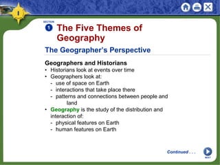
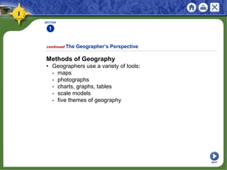
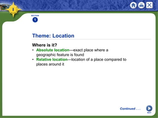
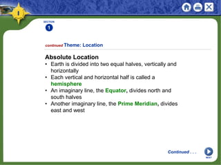
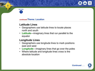
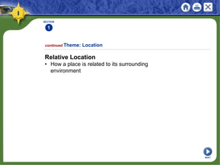
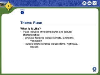
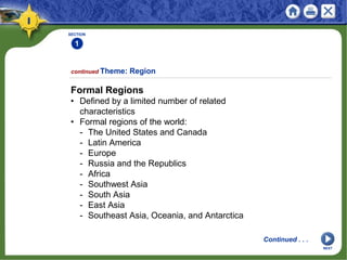
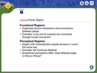
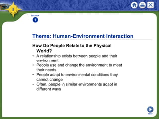
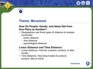
SlideShare a Scribd company logo
1 of 25
Physical Geography
Looking at the Earth
Geography involves the study of places: their
locations, their characteristics, and how humans
use and move around them.
NEXT
SECTION 1 The Five Themes of Geography
SECTION 2 The Geographer’s Tools
Physical Geography
Looking at the Earth
NEXT
Section 1
The Five Themes of
Geography
• Geographers view the world in terms of the
use of space.
• Geographers study the world by looking at
location, place, region, movement, and
human-environment interaction.
NEXT
The Geographer’s Perspective
Geographers and Historians
• Historians look at events over time
• Geographers look at:
- use of space on Earth
- interactions that take place there
- patterns and connections between people and
land
• Geography is the study of the distribution and
interaction of:
- physical features on Earth
- human features on Earth
SECTION
1
Continued . . .
The Five Themes of
Geography
NEXT
SECTION
1
Methods of Geography
• Geographers use a variety of tools:
- maps
- photographs
- charts, graphs, tables
- scale models
- five themes of geography
continued The Geographer’s Perspective
NEXT
Theme: Location
Where is it?
• Absolute location—exact place where a
geographic feature is found
• Relative location—location of a place compared to
places around it
SECTION
1
Continued . . .
NEXT
SECTION
1
Absolute Location
• Earth is divided into two equal halves, vertically and
horizontally
• Each vertical and horizontal half is called a
hemisphere
• An imaginary line, the Equator, divides north and
south halves
• Another imaginary line, the Prime Meridian, divides
east and west
continued Theme: Location
Continued . . .
NEXT
SECTION
1
Latitude Lines
• Geographers use latitude lines to locate places
north and south
• Latitude—imaginary lines that run parallel to the
equator
continued Theme: Location
Continued . . .
Longitude Lines
• Geographers use longitude lines to mark positions
east and west
• Longitude—imaginary lines that go over the poles
• Where latitude and longitude lines cross is the
absolute location
NEXT
SECTION
1
Relative Location
• How a place is related to its surrounding
environment
continued Theme: Location
NEXT
Theme: Place
What is it Like?
• Place includes physical features and cultural
characteristics:
- physical features include climate, landforms,
vegetation
- cultural characteristics include dams, highways,
houses
SECTION
1
NEXT
Theme: Region
How are Places Similar or Different?
• A region is an area united by similar characteristics
• Unifying characteristics—physical, political,
economic, cultural
• Three types of regions:
- formal
- functional
- perceptual
SECTION
1
Continued . . .
NEXT
SECTION
1
Formal Regions
• Defined by a limited number of related
characteristics
• Formal regions of the world:
- The United States and Canada
- Latin America
- Europe
- Russia and the Republics
- Africa
- Southwest Asia
- South Asia
- East Asia
- Southeast Asia, Oceania, and Antarctica
continued Theme: Region
Continued . . .
NEXT
SECTION
1
Functional Regions
• Organized around interactions and connections
between places
• Example: a city and its suburbs are connected
through human movement
continued Theme: Region
Perceptual Regions
• Region with characteristics people perceive in much
the same way
• Example: the American Midwest
• Sometimes perceptions differ: Does Midwest begin
in Ohio or Illinois?
NEXT
Theme: Human-Environment Interaction
How Do People Relate to the Physical
World?
• A relationship exists between people and their
environment
• People use and change the environment to meet
their needs
• People adapt to environmental conditions they
cannot change
• Often, people in similar environments adapt in
different ways
SECTION
1
NEXT
Theme: Movement
How Do People, Goods, and Ideas Get from
One Place to Another?
• Geographers use three types of distance to analyze
movement:
- linear distance
- time distance
- psychological distance
SECTION
1
Linear Distance and Time Distance
• Linear distance—how far a person, product, or idea
travels
• Time distance—how long it takes for person,
product, idea to travel
Continued . . .
NEXT
SECTION
1
Psychological Distance
• Refers to the way people perceive distance
• Example: unfamiliar places may seem farther away
than familiar ones
continued Theme: Movement
NEXT
Section 2
The Geographer’s Tools
• Geographers use two- and three-dimensional
tools to learn about the earth.
• Geographers use computer-assisted
technology to study the use of the earth’s
surface.
NEXT
Maps and Globes
Visualizing Earth
• Oldest known map: Babylonian clay tablet, circa
500 B.C.
• Maps show locations of places, landforms, bodies
of water
The Geographer’s Tools
SECTION
2
Continued . . .
NEXT
SECTION
2
Two or Three Dimensions
• Globe—a three-dimensional representation (a
sphere) of Earth
• Map—a two-dimensional graphic representation of
Earth’s surface
• Cartographer (mapmaker) tries to accurately
reflect earth’s surface
• Map projection—way of showing Earth’s curved
surface on a flat map
continued Maps and Globes
Continued . . .
NEXT
SECTION
2
Types of Maps
• Three types of maps: general reference,
thematic, navigational
• A topographic map is one kind of general
reference map
• Topographic map—shows natural and man-made
features of earth
• Thematic map—shows specific data such as
climate, population density
• A navigation map is used by sailors, pilots
continued Maps and Globes
NEXT
The Science of Mapmaking
Surveying
• Surveyors observe, measure, record what they see
in a specific area
• Remote sensing, gathering geographic data from a
distance, includes:
- aerial photography
- satellite imaging
The Geographer’s Tool
SECTION
2
Continued . . .
NEXT
SECTION
2
Satellites
• Best known satellites are Landsat and GOES
• Landsat is a series of satellites; can scan entire
planet in 16 days
• Geostationary Operational Environment Satellite
(GOES):
- orbits in sync with Earth’s rotation
- gathers images of atmospheric conditions
continued The Science of Mapmaking
Continued . . .
NEXT
SECTION
2
Geographic Information Systems
• Geographic Information Systems (GIS) is a
digital geographic database
• Combines and displays information from many
sources
continued The Science of Mapmaking
Global Positioning System (GPS)
• Uses series of 24 Navstar satellites to beam
information to Earth
• Hand-held GPS receivers on Earth display exact
position
• GPS used by explorers, sailors, drivers; also used
to track animals
NEXT
This is the end of the chapter presentation of
lecture notes. Click the HOME or EXIT button.
Print Slide Show
1. On the File menu, select Print
2. In the pop-up menu, select Microsoft PowerPoint
If the dialog box does not include this pop-up, continue
to step 4
3. In the Print what box, choose the presentation format
you want to print: slides, notes, handouts, or outline
4. Click the Print button to print the PowerPoint
presentation
CONTINUE

More Related Content

What's hot (20)

Maps, Landforms, And Climate
Maps, Landforms, And ClimateMaps, Landforms, And Climate
Maps, Landforms, And Climate
 
The 5 Themes of Geography
The 5 Themes of GeographyThe 5 Themes of Geography
The 5 Themes of Geography
 
Chapter 2
Chapter 2Chapter 2
Chapter 2
 
Chapter 15
Chapter 15Chapter 15
Chapter 15
 
Chapter 13
Chapter 13Chapter 13
Chapter 13
 
2-1 The Earth
2-1 The Earth2-1 The Earth
2-1 The Earth
 
chapter 8
chapter 8chapter 8
chapter 8
 
Chapter 14
Chapter 14Chapter 14
Chapter 14
 
Ch.2 planet earth
Ch.2  planet earthCh.2  planet earth
Ch.2 planet earth
 
Chapter 10
Chapter 10Chapter 10
Chapter 10
 
Chapter 18
Chapter 18Chapter 18
Chapter 18
 
Political Geography
Political GeographyPolitical Geography
Political Geography
 
Chapter 17
Chapter 17Chapter 17
Chapter 17
 
Chapter 21
Chapter 21Chapter 21
Chapter 21
 
01 Chap 1 Introduction To Geography (Jan 08)
01   Chap 1   Introduction To Geography (Jan 08)01   Chap 1   Introduction To Geography (Jan 08)
01 Chap 1 Introduction To Geography (Jan 08)
 
Chapter 26
Chapter 26Chapter 26
Chapter 26
 
AP Human Geography: Unit 4: Political Geography - Part 1: Territoriality and ...
AP Human Geography: Unit 4: Political Geography - Part 1: Territoriality and ...AP Human Geography: Unit 4: Political Geography - Part 1: Territoriality and ...
AP Human Geography: Unit 4: Political Geography - Part 1: Territoriality and ...
 
5.1 - North American Landforms and Resources
5.1 - North American Landforms and Resources5.1 - North American Landforms and Resources
5.1 - North American Landforms and Resources
 
Ch.3 climate, enviroment, and resources
Ch.3  climate, enviroment, and resourcesCh.3  climate, enviroment, and resources
Ch.3 climate, enviroment, and resources
 
Ch.1 geographer's world
Ch.1  geographer's worldCh.1  geographer's world
Ch.1 geographer's world
 

Similar to Chapter 1

Chapter 1 P.ppt
Chapter 1 P.pptChapter 1 P.ppt
Chapter 1 P.pptRoy Ebio
 
01 - The Study of Geography
01 - The Study of Geography01 - The Study of Geography
01 - The Study of GeographyPaul English
 
The 5 theme of Geography for your academy
The 5 theme of Geography for your academyThe 5 theme of Geography for your academy
The 5 theme of Geography for your academyKaium Chowdhury
 
7th Grade Social Studies Chapter 1 notes Using Geography Skills
7th Grade Social Studies Chapter 1 notes Using Geography Skills7th Grade Social Studies Chapter 1 notes Using Geography Skills
7th Grade Social Studies Chapter 1 notes Using Geography Skillsjedwards032
 
Introduction_to_Earth_Science_PPT.ppt
Introduction_to_Earth_Science_PPT.pptIntroduction_to_Earth_Science_PPT.ppt
Introduction_to_Earth_Science_PPT.pptAnalynLampa1
 
Geo: Unit 1, Chapter 1 Powerpoint
Geo: Unit 1, Chapter 1 PowerpointGeo: Unit 1, Chapter 1 Powerpoint
Geo: Unit 1, Chapter 1 PowerpointMr. Philen
 
Types of maps, long, lat, satellites, time zones
Types of maps, long, lat, satellites, time zonesTypes of maps, long, lat, satellites, time zones
Types of maps, long, lat, satellites, time zonesBantay's Earth Science!
 
Notes on different terms of Geography
Notes on different terms of GeographyNotes on different terms of Geography
Notes on different terms of Geographyaprilrousseau
 
Intro & 5 themes
Intro & 5 themesIntro & 5 themes
Intro & 5 themeskmcastillo
 
A Geographer’s World
A Geographer’s WorldA Geographer’s World
A Geographer’s Worldkevinkacel
 
The 5 themes of geography
The 5 themes of geographyThe 5 themes of geography
The 5 themes of geographyAaron Carn
 
Presentation 3 5 themes of geography & 4 components of a map for w. history
Presentation 3   5 themes of geography & 4 components of a map for w. historyPresentation 3   5 themes of geography & 4 components of a map for w. history
Presentation 3 5 themes of geography & 4 components of a map for w. historykristguy
 
palnet.pptx
palnet.pptxpalnet.pptx
palnet.pptxmijknewz
 
World geography intro powerpoint
World geography  intro powerpointWorld geography  intro powerpoint
World geography intro powerpointconfused1913
 
TSST-Earth-space.ppt
TSST-Earth-space.pptTSST-Earth-space.ppt
TSST-Earth-space.pptAnishRawat10
 

Similar to Chapter 1 (20)

Chapter 1 P.ppt
Chapter 1 P.pptChapter 1 P.ppt
Chapter 1 P.ppt
 
Topic 6 power point
Topic 6 power pointTopic 6 power point
Topic 6 power point
 
01 - The Study of Geography
01 - The Study of Geography01 - The Study of Geography
01 - The Study of Geography
 
The 5 theme of Geography for your academy
The 5 theme of Geography for your academyThe 5 theme of Geography for your academy
The 5 theme of Geography for your academy
 
7th Grade Social Studies Chapter 1 notes Using Geography Skills
7th Grade Social Studies Chapter 1 notes Using Geography Skills7th Grade Social Studies Chapter 1 notes Using Geography Skills
7th Grade Social Studies Chapter 1 notes Using Geography Skills
 
Introduction_to_Earth_Science_PPT.ppt
Introduction_to_Earth_Science_PPT.pptIntroduction_to_Earth_Science_PPT.ppt
Introduction_to_Earth_Science_PPT.ppt
 
4 3-regional & national geography
4 3-regional & national geography4 3-regional & national geography
4 3-regional & national geography
 
Geo: Unit 1, Chapter 1 Powerpoint
Geo: Unit 1, Chapter 1 PowerpointGeo: Unit 1, Chapter 1 Powerpoint
Geo: Unit 1, Chapter 1 Powerpoint
 
Types of maps, long, lat, satellites, time zones
Types of maps, long, lat, satellites, time zonesTypes of maps, long, lat, satellites, time zones
Types of maps, long, lat, satellites, time zones
 
Notes on different terms of Geography
Notes on different terms of GeographyNotes on different terms of Geography
Notes on different terms of Geography
 
Intro & 5 themes
Intro & 5 themesIntro & 5 themes
Intro & 5 themes
 
hm.ppt
hm.ppthm.ppt
hm.ppt
 
A Geographer’s World
A Geographer’s WorldA Geographer’s World
A Geographer’s World
 
The 5 themes of geography
The 5 themes of geographyThe 5 themes of geography
The 5 themes of geography
 
Presentation 3 5 themes of geography & 4 components of a map for w. history
Presentation 3   5 themes of geography & 4 components of a map for w. historyPresentation 3   5 themes of geography & 4 components of a map for w. history
Presentation 3 5 themes of geography & 4 components of a map for w. history
 
palnet.pptx
palnet.pptxpalnet.pptx
palnet.pptx
 
1 introduction to world geography
1  introduction to world geography1  introduction to world geography
1 introduction to world geography
 
2.0MapsGlobes.pptx
2.0MapsGlobes.pptx2.0MapsGlobes.pptx
2.0MapsGlobes.pptx
 
World geography intro powerpoint
World geography  intro powerpointWorld geography  intro powerpoint
World geography intro powerpoint
 
TSST-Earth-space.ppt
TSST-Earth-space.pptTSST-Earth-space.ppt
TSST-Earth-space.ppt
 

More from Ekart's World Geography (14)

Chapter 32
Chapter 32Chapter 32
Chapter 32
 
Chapter 31
Chapter 31Chapter 31
Chapter 31
 
Chapter 30
Chapter 30Chapter 30
Chapter 30
 
Chapter 29
Chapter 29Chapter 29
Chapter 29
 
Chapter 23
Chapter 23Chapter 23
Chapter 23
 
Chapter 22
Chapter 22Chapter 22
Chapter 22
 
Chapter 20
Chapter 20Chapter 20
Chapter 20
 
Chapter 19
Chapter 19Chapter 19
Chapter 19
 
Chapter 16
Chapter 16Chapter 16
Chapter 16
 
Chapter 11
Chapter 11Chapter 11
Chapter 11
 
Chapter 27
Chapter 27Chapter 27
Chapter 27
 
Chapter 4
Chapter 4Chapter 4
Chapter 4
 
Wg ch04
Wg ch04Wg ch04
Wg ch04
 
Wg ch04
Wg ch04Wg ch04
Wg ch04
 

Recently uploaded

DevoxxFR 2024 Reproducible Builds with Apache Maven
DevoxxFR 2024 Reproducible Builds with Apache MavenDevoxxFR 2024 Reproducible Builds with Apache Maven
DevoxxFR 2024 Reproducible Builds with Apache MavenHervé Boutemy
 
Training state-of-the-art general text embedding
Training state-of-the-art general text embeddingTraining state-of-the-art general text embedding
Training state-of-the-art general text embeddingZilliz
 
Vector Databases 101 - An introduction to the world of Vector Databases
Vector Databases 101 - An introduction to the world of Vector DatabasesVector Databases 101 - An introduction to the world of Vector Databases
Vector Databases 101 - An introduction to the world of Vector DatabasesZilliz
 
Ensuring Technical Readiness For Copilot in Microsoft 365
Ensuring Technical Readiness For Copilot in Microsoft 365Ensuring Technical Readiness For Copilot in Microsoft 365
Ensuring Technical Readiness For Copilot in Microsoft 3652toLead Limited
 
"LLMs for Python Engineers: Advanced Data Analysis and Semantic Kernel",Oleks...
"LLMs for Python Engineers: Advanced Data Analysis and Semantic Kernel",Oleks..."LLMs for Python Engineers: Advanced Data Analysis and Semantic Kernel",Oleks...
"LLMs for Python Engineers: Advanced Data Analysis and Semantic Kernel",Oleks...Fwdays
 
Beyond Boundaries: Leveraging No-Code Solutions for Industry Innovation
Beyond Boundaries: Leveraging No-Code Solutions for Industry InnovationBeyond Boundaries: Leveraging No-Code Solutions for Industry Innovation
Beyond Boundaries: Leveraging No-Code Solutions for Industry InnovationSafe Software
 
"Subclassing and Composition – A Pythonic Tour of Trade-Offs", Hynek Schlawack
"Subclassing and Composition – A Pythonic Tour of Trade-Offs", Hynek Schlawack"Subclassing and Composition – A Pythonic Tour of Trade-Offs", Hynek Schlawack
"Subclassing and Composition – A Pythonic Tour of Trade-Offs", Hynek SchlawackFwdays
 
Are Multi-Cloud and Serverless Good or Bad?
Are Multi-Cloud and Serverless Good or Bad?Are Multi-Cloud and Serverless Good or Bad?
Are Multi-Cloud and Serverless Good or Bad?Mattias Andersson
 
"Federated learning: out of reach no matter how close",Oleksandr Lapshyn
"Federated learning: out of reach no matter how close",Oleksandr Lapshyn"Federated learning: out of reach no matter how close",Oleksandr Lapshyn
"Federated learning: out of reach no matter how close",Oleksandr LapshynFwdays
 
Scanning the Internet for External Cloud Exposures via SSL Certs
Scanning the Internet for External Cloud Exposures via SSL CertsScanning the Internet for External Cloud Exposures via SSL Certs
Scanning the Internet for External Cloud Exposures via SSL CertsRizwan Syed
 
What's New in Teams Calling, Meetings and Devices March 2024
What's New in Teams Calling, Meetings and Devices March 2024What's New in Teams Calling, Meetings and Devices March 2024
What's New in Teams Calling, Meetings and Devices March 2024Stephanie Beckett
 
Dev Dives: Streamline document processing with UiPath Studio Web
Dev Dives: Streamline document processing with UiPath Studio WebDev Dives: Streamline document processing with UiPath Studio Web
Dev Dives: Streamline document processing with UiPath Studio WebUiPathCommunity
 
Anypoint Exchange: It’s Not Just a Repo!
Anypoint Exchange: It’s Not Just a Repo!Anypoint Exchange: It’s Not Just a Repo!
Anypoint Exchange: It’s Not Just a Repo!Manik S Magar
 
Artificial intelligence in cctv survelliance.pptx
Artificial intelligence in cctv survelliance.pptxArtificial intelligence in cctv survelliance.pptx
Artificial intelligence in cctv survelliance.pptxhariprasad279825
 
Leverage Zilliz Serverless - Up to 50X Saving for Your Vector Storage Cost
Leverage Zilliz Serverless - Up to 50X Saving for Your Vector Storage CostLeverage Zilliz Serverless - Up to 50X Saving for Your Vector Storage Cost
Leverage Zilliz Serverless - Up to 50X Saving for Your Vector Storage CostZilliz
 
SIP trunking in Janus @ Kamailio World 2024
SIP trunking in Janus @ Kamailio World 2024SIP trunking in Janus @ Kamailio World 2024
SIP trunking in Janus @ Kamailio World 2024Lorenzo Miniero
 
My Hashitalk Indonesia April 2024 Presentation
My Hashitalk Indonesia April 2024 PresentationMy Hashitalk Indonesia April 2024 Presentation
My Hashitalk Indonesia April 2024 PresentationRidwan Fadjar
 
Unraveling Multimodality with Large Language Models.pdf
Unraveling Multimodality with Large Language Models.pdfUnraveling Multimodality with Large Language Models.pdf
Unraveling Multimodality with Large Language Models.pdfAlex Barbosa Coqueiro
 
New from BookNet Canada for 2024: BNC CataList - Tech Forum 2024
New from BookNet Canada for 2024: BNC CataList - Tech Forum 2024New from BookNet Canada for 2024: BNC CataList - Tech Forum 2024
New from BookNet Canada for 2024: BNC CataList - Tech Forum 2024BookNet Canada
 

Recently uploaded (20)

DevoxxFR 2024 Reproducible Builds with Apache Maven
DevoxxFR 2024 Reproducible Builds with Apache MavenDevoxxFR 2024 Reproducible Builds with Apache Maven
DevoxxFR 2024 Reproducible Builds with Apache Maven
 
Training state-of-the-art general text embedding
Training state-of-the-art general text embeddingTraining state-of-the-art general text embedding
Training state-of-the-art general text embedding
 
Vector Databases 101 - An introduction to the world of Vector Databases
Vector Databases 101 - An introduction to the world of Vector DatabasesVector Databases 101 - An introduction to the world of Vector Databases
Vector Databases 101 - An introduction to the world of Vector Databases
 
Ensuring Technical Readiness For Copilot in Microsoft 365
Ensuring Technical Readiness For Copilot in Microsoft 365Ensuring Technical Readiness For Copilot in Microsoft 365
Ensuring Technical Readiness For Copilot in Microsoft 365
 
"LLMs for Python Engineers: Advanced Data Analysis and Semantic Kernel",Oleks...
"LLMs for Python Engineers: Advanced Data Analysis and Semantic Kernel",Oleks..."LLMs for Python Engineers: Advanced Data Analysis and Semantic Kernel",Oleks...
"LLMs for Python Engineers: Advanced Data Analysis and Semantic Kernel",Oleks...
 
Beyond Boundaries: Leveraging No-Code Solutions for Industry Innovation
Beyond Boundaries: Leveraging No-Code Solutions for Industry InnovationBeyond Boundaries: Leveraging No-Code Solutions for Industry Innovation
Beyond Boundaries: Leveraging No-Code Solutions for Industry Innovation
 
"Subclassing and Composition – A Pythonic Tour of Trade-Offs", Hynek Schlawack
"Subclassing and Composition – A Pythonic Tour of Trade-Offs", Hynek Schlawack"Subclassing and Composition – A Pythonic Tour of Trade-Offs", Hynek Schlawack
"Subclassing and Composition – A Pythonic Tour of Trade-Offs", Hynek Schlawack
 
Are Multi-Cloud and Serverless Good or Bad?
Are Multi-Cloud and Serverless Good or Bad?Are Multi-Cloud and Serverless Good or Bad?
Are Multi-Cloud and Serverless Good or Bad?
 
"Federated learning: out of reach no matter how close",Oleksandr Lapshyn
"Federated learning: out of reach no matter how close",Oleksandr Lapshyn"Federated learning: out of reach no matter how close",Oleksandr Lapshyn
"Federated learning: out of reach no matter how close",Oleksandr Lapshyn
 
Scanning the Internet for External Cloud Exposures via SSL Certs
Scanning the Internet for External Cloud Exposures via SSL CertsScanning the Internet for External Cloud Exposures via SSL Certs
Scanning the Internet for External Cloud Exposures via SSL Certs
 
DMCC Future of Trade Web3 - Special Edition
DMCC Future of Trade Web3 - Special EditionDMCC Future of Trade Web3 - Special Edition
DMCC Future of Trade Web3 - Special Edition
 
What's New in Teams Calling, Meetings and Devices March 2024
What's New in Teams Calling, Meetings and Devices March 2024What's New in Teams Calling, Meetings and Devices March 2024
What's New in Teams Calling, Meetings and Devices March 2024
 
Dev Dives: Streamline document processing with UiPath Studio Web
Dev Dives: Streamline document processing with UiPath Studio WebDev Dives: Streamline document processing with UiPath Studio Web
Dev Dives: Streamline document processing with UiPath Studio Web
 
Anypoint Exchange: It’s Not Just a Repo!
Anypoint Exchange: It’s Not Just a Repo!Anypoint Exchange: It’s Not Just a Repo!
Anypoint Exchange: It’s Not Just a Repo!
 
Artificial intelligence in cctv survelliance.pptx
Artificial intelligence in cctv survelliance.pptxArtificial intelligence in cctv survelliance.pptx
Artificial intelligence in cctv survelliance.pptx
 
Leverage Zilliz Serverless - Up to 50X Saving for Your Vector Storage Cost
Leverage Zilliz Serverless - Up to 50X Saving for Your Vector Storage CostLeverage Zilliz Serverless - Up to 50X Saving for Your Vector Storage Cost
Leverage Zilliz Serverless - Up to 50X Saving for Your Vector Storage Cost
 
SIP trunking in Janus @ Kamailio World 2024
SIP trunking in Janus @ Kamailio World 2024SIP trunking in Janus @ Kamailio World 2024
SIP trunking in Janus @ Kamailio World 2024
 
My Hashitalk Indonesia April 2024 Presentation
My Hashitalk Indonesia April 2024 PresentationMy Hashitalk Indonesia April 2024 Presentation
My Hashitalk Indonesia April 2024 Presentation
 
Unraveling Multimodality with Large Language Models.pdf
Unraveling Multimodality with Large Language Models.pdfUnraveling Multimodality with Large Language Models.pdf
Unraveling Multimodality with Large Language Models.pdf
 
New from BookNet Canada for 2024: BNC CataList - Tech Forum 2024
New from BookNet Canada for 2024: BNC CataList - Tech Forum 2024New from BookNet Canada for 2024: BNC CataList - Tech Forum 2024
New from BookNet Canada for 2024: BNC CataList - Tech Forum 2024
 

Chapter 1

  • 1. Physical Geography Looking at the Earth Geography involves the study of places: their locations, their characteristics, and how humans use and move around them. NEXT
  • 2. SECTION 1 The Five Themes of Geography SECTION 2 The Geographer’s Tools Physical Geography Looking at the Earth NEXT
  • 3. Section 1 The Five Themes of Geography • Geographers view the world in terms of the use of space. • Geographers study the world by looking at location, place, region, movement, and human-environment interaction. NEXT
  • 4. The Geographer’s Perspective Geographers and Historians • Historians look at events over time • Geographers look at: - use of space on Earth - interactions that take place there - patterns and connections between people and land • Geography is the study of the distribution and interaction of: - physical features on Earth - human features on Earth SECTION 1 Continued . . . The Five Themes of Geography NEXT
  • 5. SECTION 1 Methods of Geography • Geographers use a variety of tools: - maps - photographs - charts, graphs, tables - scale models - five themes of geography continued The Geographer’s Perspective NEXT
  • 6. Theme: Location Where is it? • Absolute location—exact place where a geographic feature is found • Relative location—location of a place compared to places around it SECTION 1 Continued . . . NEXT
  • 7. SECTION 1 Absolute Location • Earth is divided into two equal halves, vertically and horizontally • Each vertical and horizontal half is called a hemisphere • An imaginary line, the Equator, divides north and south halves • Another imaginary line, the Prime Meridian, divides east and west continued Theme: Location Continued . . . NEXT
  • 8. SECTION 1 Latitude Lines • Geographers use latitude lines to locate places north and south • Latitude—imaginary lines that run parallel to the equator continued Theme: Location Continued . . . Longitude Lines • Geographers use longitude lines to mark positions east and west • Longitude—imaginary lines that go over the poles • Where latitude and longitude lines cross is the absolute location NEXT
  • 9. SECTION 1 Relative Location • How a place is related to its surrounding environment continued Theme: Location NEXT
  • 10. Theme: Place What is it Like? • Place includes physical features and cultural characteristics: - physical features include climate, landforms, vegetation - cultural characteristics include dams, highways, houses SECTION 1 NEXT
  • 11. Theme: Region How are Places Similar or Different? • A region is an area united by similar characteristics • Unifying characteristics—physical, political, economic, cultural • Three types of regions: - formal - functional - perceptual SECTION 1 Continued . . . NEXT
  • 12. SECTION 1 Formal Regions • Defined by a limited number of related characteristics • Formal regions of the world: - The United States and Canada - Latin America - Europe - Russia and the Republics - Africa - Southwest Asia - South Asia - East Asia - Southeast Asia, Oceania, and Antarctica continued Theme: Region Continued . . . NEXT
  • 13. SECTION 1 Functional Regions • Organized around interactions and connections between places • Example: a city and its suburbs are connected through human movement continued Theme: Region Perceptual Regions • Region with characteristics people perceive in much the same way • Example: the American Midwest • Sometimes perceptions differ: Does Midwest begin in Ohio or Illinois? NEXT
  • 14. Theme: Human-Environment Interaction How Do People Relate to the Physical World? • A relationship exists between people and their environment • People use and change the environment to meet their needs • People adapt to environmental conditions they cannot change • Often, people in similar environments adapt in different ways SECTION 1 NEXT
  • 15. Theme: Movement How Do People, Goods, and Ideas Get from One Place to Another? • Geographers use three types of distance to analyze movement: - linear distance - time distance - psychological distance SECTION 1 Linear Distance and Time Distance • Linear distance—how far a person, product, or idea travels • Time distance—how long it takes for person, product, idea to travel Continued . . . NEXT
  • 16. SECTION 1 Psychological Distance • Refers to the way people perceive distance • Example: unfamiliar places may seem farther away than familiar ones continued Theme: Movement NEXT
  • 17. Section 2 The Geographer’s Tools • Geographers use two- and three-dimensional tools to learn about the earth. • Geographers use computer-assisted technology to study the use of the earth’s surface. NEXT
  • 18. Maps and Globes Visualizing Earth • Oldest known map: Babylonian clay tablet, circa 500 B.C. • Maps show locations of places, landforms, bodies of water The Geographer’s Tools SECTION 2 Continued . . . NEXT
  • 19. SECTION 2 Two or Three Dimensions • Globe—a three-dimensional representation (a sphere) of Earth • Map—a two-dimensional graphic representation of Earth’s surface • Cartographer (mapmaker) tries to accurately reflect earth’s surface • Map projection—way of showing Earth’s curved surface on a flat map continued Maps and Globes Continued . . . NEXT
  • 20. SECTION 2 Types of Maps • Three types of maps: general reference, thematic, navigational • A topographic map is one kind of general reference map • Topographic map—shows natural and man-made features of earth • Thematic map—shows specific data such as climate, population density • A navigation map is used by sailors, pilots continued Maps and Globes NEXT
  • 21. The Science of Mapmaking Surveying • Surveyors observe, measure, record what they see in a specific area • Remote sensing, gathering geographic data from a distance, includes: - aerial photography - satellite imaging The Geographer’s Tool SECTION 2 Continued . . . NEXT
  • 22. SECTION 2 Satellites • Best known satellites are Landsat and GOES • Landsat is a series of satellites; can scan entire planet in 16 days • Geostationary Operational Environment Satellite (GOES): - orbits in sync with Earth’s rotation - gathers images of atmospheric conditions continued The Science of Mapmaking Continued . . . NEXT
  • 23. SECTION 2 Geographic Information Systems • Geographic Information Systems (GIS) is a digital geographic database • Combines and displays information from many sources continued The Science of Mapmaking Global Positioning System (GPS) • Uses series of 24 Navstar satellites to beam information to Earth • Hand-held GPS receivers on Earth display exact position • GPS used by explorers, sailors, drivers; also used to track animals NEXT
  • 24. This is the end of the chapter presentation of lecture notes. Click the HOME or EXIT button.
  • 25. Print Slide Show 1. On the File menu, select Print 2. In the pop-up menu, select Microsoft PowerPoint If the dialog box does not include this pop-up, continue to step 4 3. In the Print what box, choose the presentation format you want to print: slides, notes, handouts, or outline 4. Click the Print button to print the PowerPoint presentation CONTINUE