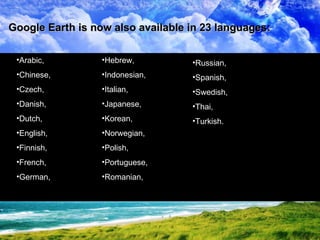
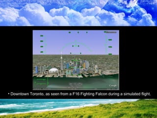
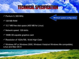
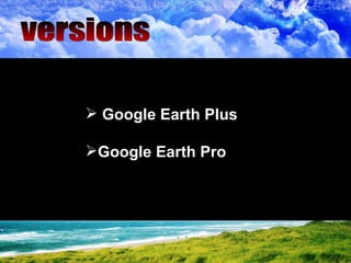
Google Earth is a virtual globe program that displays satellite images of Earth allowing users to view locations from above. It supports 3D models and GIS data. Users can search locations, enter coordinates, view places in 23 languages. Features include Street View, a flight simulator, and sky viewing mode to see stars. It requires basic system specifications and is available in free, Plus, and Pro versions with different export and data options.