Modified Resource Google Presentation
•
1 like•453 views

This is a presentation I did in class on Google Earth. The animation had to be deleted in order to make space for the PowerPoint

Recommended
Recommended
More Related Content
What's hot
What's hot (20)
Viewers also liked
Viewers also liked (20)
Similar to Modified Resource Google Presentation
Similar to Modified Resource Google Presentation (20)
Recently uploaded
Recently uploaded (20)
Modified Resource Google Presentation
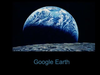
- 1. Google Earth
- 2. The Wide Open World The Earth is a big place. Techniques in mapping such a large astronomical body have evolved tremendously with in the past 500 years alone.
- 3. The Wide Open World From the era of Abraham Ortelius to Gerard Mercator to modern electronic data formats, geographical resources have evolved from being tools of foreign conquest to tools used to advance economic entrepreneurship as well as scholastic achievement. - Cassell and Hiremath
- 6. Google earth is a 3D G.I.S. virtual globe program that uses a combination of satellite, panoramic, and aerial imaging resulting in a detail surface map of the earth.
- 10. Use/Features The Google earth interface is set up much in the same vein as a internet search engine. Choice, 2009
- 11. Use/Features Except in the Google earth, individuals are searching the known global geographical landscape.
- 12. Use/Features Google earth several layers of integration including : Earth Mode Sky mode Street View
- 13. Earth Mode “ Google earth maps the Earth by using the superimposition of images obtained from satellite imagery and aerial photography ” Wikipedia, 2009
- 14. Sky Mode Sky mode uses the archive images compiled between a partnership of the Space Telescope Science Institute (STScI) and the science operations center for the Hubble Space Telescope to display a map of the known universe. Wikipedia, July 2009
- 15. Street Mode “ Google Street Mode provides 360° panoramic street-level views and allows users to view parts of selected cities and their surrounding metropolitan areas at ground level.” Wikipedia, July 2009
- 19. …………… . The End?
- 20. Works Cited Google. "Google.com," http://www.google.com/. Google earth. "Google earth," http://earth.google.com/ Wikipedia. " Google earth," http://en.wikipedia.org/wiki/Google_Earth, (accessed July 6, 2009). Google earth. "Age and clarity of imagery," http://sites.google.com/site/earthhowdoi/Home/ageandclarityofimagery . (accesed July 6, 2009). Stachacz, J.. "Google Earth." Choice, " January 1, 2009, http://libdata.lib.ua.edu:2048/login?url=http://proquest.umi.com/pqdlink?did=1626638251&Fmt=3&clientId=31537&RQT=309&VName=PQD. (accessed July 6, 2009).
- 21. Chicken For Aliens Advertisement