SlideShare a Scribd company logo
1. WHAT IS GIS?
2. WHICH APPLICATION OFGIS?
3. WHAT IS GEOREFERENCING?
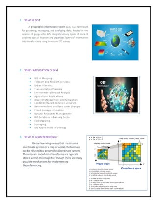
A geographic information system (GIS) is a framework
for gathering, managing, and analyzing data. Rooted in the
science of geography, GIS integrates many types of data. It
analyzes spatial location and organizes layers of information
into visualizations using maps and 3D scenes.
 GIS in Mapping
 Telecom and Network services
 Urban Planning
 Transportation Planning
 Environmental Impact Analysis
 Agricultural Applications
 Disaster Management and Mitigation
 Landslide Hazard Zonation using GIS
 Determine land use/land cover changes
 Flood damage estimation
 Natural Resources Management
 GIS Solutions in Banking Sector
 Soil Mapping
 Surveying
 GIS Applications in Geology
Georeferencingmeansthatthe internal
coordinate systemof amap or aerial photoimage
can be relatedtoa geographiccoordinate system.
The relevantcoordinate transformsare typically
storedwithinthe image file,thoughthere are many
possible mechanismsforimplementing
Georeferencing.
4. WHICH COMPONENTSOFGIS?
5. WHAT IS LAYERSTACK?
6. WHAT IS TOPOLOGY?
7. WHAT IS DATA ATTRIBUTE?
Attribute data is defined as information used to create control charts. This data can be used to create
many different chart systems, includingpercent charts, charts show casing the number of affected units,
count-per-unit charts, demerit charts, and quality score charts.
Working GIs integrates five key
components: hardware,software,data,people,
and methods.Hardware is the computer on which a GIS
operates. Today, GIS software runs on a wide range
of hardware types,from centralized computer servers to
desktop computers used in stand-alone or networked
configurations.
Layer stacking is a process for combining multiple images
into a single image. In order to do that the images should
have the same extent (number of rows and number of
columns), which means you will need to resample other
bands which have different spatial resolution to the target
resolution.
Topology is the mathematical study of the properties
that are preserved through deformations, twisting and
stretching of object. Tearing, However is not allowed. A
circle is topologically Equivalent to an Ellipse and a
sphere is Equivalent to ellipsoid. There are 5 types of
topology ----
 Mesh
 Star
 Bus
 Ring
 hybrid
8. HOW TO CRATE SHAPEFILFIN ARCMAP?
9. HOW TO SET COORDINATESYSTEMIN ARCMAP?
A shape fileis an Esri vector data storage
format for storing the location, shape, and
attributes of geographic features. It is stored as a
set of related files and contains one feature
class.
In geometry, a coordinate system is a system that
uses one or more numbers, or coordinates, to
uniquely determine the position of the points or
other geometric elements on a manifold such as
Euclidean space.
EX: INDIA Coordinate system 42 – 47◦N Degree

More Related Content

What's hot

Surfer software
Surfer softwareSurfer software
Surfer software
Aqib Ahmed
 
Lecture+12+topology+2013 (3)
Lecture+12+topology+2013 (3)Lecture+12+topology+2013 (3)
Lecture+12+topology+2013 (3)Mei Chi Lo
 
Introduction to Maps
Introduction to MapsIntroduction to Maps
Introduction to Maps
Malla Reddy University
 
Georeferencing
GeoreferencingGeoreferencing
Georeferencing
Reham Maher El-Safarini
 
Geographical information system unit 2
Geographical information  system unit 2Geographical information  system unit 2
Geographical information system unit 2
WE-IT TUTORIALS
 
Geographical information system unit 4
Geographical information  system unit 4Geographical information  system unit 4
Geographical information system unit 4
WE-IT TUTORIALS
 
Functions of GIS
Functions of GISFunctions of GIS
Functions of GIS
Fayaz Ahamed A P
 
ePOM - Intro to Ocean Data Science - Raster and Vector Data Formats
ePOM - Intro to Ocean Data Science - Raster and Vector Data FormatsePOM - Intro to Ocean Data Science - Raster and Vector Data Formats
ePOM - Intro to Ocean Data Science - Raster and Vector Data Formats
Giuseppe Masetti
 
TIN IN GIS
TIN IN GISTIN IN GIS
TIN IN GIS
Rohit Kumar
 
Create Fishnet_XTools
Create Fishnet_XToolsCreate Fishnet_XTools
Create Fishnet_XTools
Atiqa khan
 
5 spatial data editing
5 spatial data editing5 spatial data editing
5 spatial data editing
anita bodke
 
Raster data analysis
Raster data analysisRaster data analysis
Raster data analysis
Abdul Raziq
 
Geographic Information System unit 5
Geographic Information System   unit 5Geographic Information System   unit 5
Geographic Information System unit 5
sridevi5983
 
Module for principles and application of precision agriculture
Module for principles and application of precision agricultureModule for principles and application of precision agriculture
Module for principles and application of precision agricultureJAWI Herbs Centre
 
introduction to GIS
introduction to GIS introduction to GIS
introduction to GIS
niazali15CRP92
 
Spatial analysis and modeling
Spatial analysis and modelingSpatial analysis and modeling
Spatial analysis and modelingTolasa_F
 
Data input techniques - GIS
Data input techniques - GISData input techniques - GIS
Data input techniques - GIS
Vignesh LS
 
Geographical information system unit 5
Geographical information  system unit 5Geographical information  system unit 5
Geographical information system unit 5
WE-IT TUTORIALS
 
Data input and transformation
Data input and transformationData input and transformation
Data input and transformation
Mohsin Siddique
 

What's hot (20)

Surfer software
Surfer softwareSurfer software
Surfer software
 
Lecture+12+topology+2013 (3)
Lecture+12+topology+2013 (3)Lecture+12+topology+2013 (3)
Lecture+12+topology+2013 (3)
 
Introduction to Maps
Introduction to MapsIntroduction to Maps
Introduction to Maps
 
Georeferencing
GeoreferencingGeoreferencing
Georeferencing
 
Geographical information system unit 2
Geographical information  system unit 2Geographical information  system unit 2
Geographical information system unit 2
 
Geographical information system unit 4
Geographical information  system unit 4Geographical information  system unit 4
Geographical information system unit 4
 
application of gis
application of gisapplication of gis
application of gis
 
Functions of GIS
Functions of GISFunctions of GIS
Functions of GIS
 
ePOM - Intro to Ocean Data Science - Raster and Vector Data Formats
ePOM - Intro to Ocean Data Science - Raster and Vector Data FormatsePOM - Intro to Ocean Data Science - Raster and Vector Data Formats
ePOM - Intro to Ocean Data Science - Raster and Vector Data Formats
 
TIN IN GIS
TIN IN GISTIN IN GIS
TIN IN GIS
 
Create Fishnet_XTools
Create Fishnet_XToolsCreate Fishnet_XTools
Create Fishnet_XTools
 
5 spatial data editing
5 spatial data editing5 spatial data editing
5 spatial data editing
 
Raster data analysis
Raster data analysisRaster data analysis
Raster data analysis
 
Geographic Information System unit 5
Geographic Information System   unit 5Geographic Information System   unit 5
Geographic Information System unit 5
 
Module for principles and application of precision agriculture
Module for principles and application of precision agricultureModule for principles and application of precision agriculture
Module for principles and application of precision agriculture
 
introduction to GIS
introduction to GIS introduction to GIS
introduction to GIS
 
Spatial analysis and modeling
Spatial analysis and modelingSpatial analysis and modeling
Spatial analysis and modeling
 
Data input techniques - GIS
Data input techniques - GISData input techniques - GIS
Data input techniques - GIS
 
Geographical information system unit 5
Geographical information  system unit 5Geographical information  system unit 5
Geographical information system unit 5
 
Data input and transformation
Data input and transformationData input and transformation
Data input and transformation
 

Similar to Geographical information system

Terminology and Basic Questions About GIS
Terminology and Basic Questions About GISTerminology and Basic Questions About GIS
Terminology and Basic Questions About GISMrinmoy Majumder
 
introduction to geographical information system
introduction to geographical information systemintroduction to geographical information system
introduction to geographical information system
DrVenkateswarluGogan1
 
How to empower community by using GIS lecture 1
How to empower community by using GIS lecture 1How to empower community by using GIS lecture 1
How to empower community by using GIS lecture 1wang yaohui
 
Introduction to GIS
Introduction to GISIntroduction to GIS
Introduction to GIS
KU Leuven
 
2-200305220204.pdf
2-200305220204.pdf2-200305220204.pdf
2-200305220204.pdf
IIT Bombay
 
Intro to GIS and Remote Sensing
Intro to GIS and Remote SensingIntro to GIS and Remote Sensing
Intro to GIS and Remote Sensing
John Reiser
 
Geographic Information System for Bachelor in Agriculture Engineering
Geographic Information System for Bachelor in Agriculture EngineeringGeographic Information System for Bachelor in Agriculture Engineering
Geographic Information System for Bachelor in Agriculture Engineering
Dinesh Bishwakarma
 
TYBSC IT PGIS Unit I Chapter I- Introduction to Geographic Information Systems
TYBSC IT PGIS Unit I  Chapter I- Introduction to Geographic Information SystemsTYBSC IT PGIS Unit I  Chapter I- Introduction to Geographic Information Systems
TYBSC IT PGIS Unit I Chapter I- Introduction to Geographic Information Systems
Arti Parab Academics
 
Raster data and Vector data
Raster data and Vector dataRaster data and Vector data
Raster data and Vector data
Reham Maher El-Safarini
 
GIS.INTRODUCTION TO GIS PACKAGES &GEOGRAPHIIC ANALYSIS
GIS.INTRODUCTION TO GIS PACKAGES &GEOGRAPHIIC ANALYSISGIS.INTRODUCTION TO GIS PACKAGES &GEOGRAPHIIC ANALYSIS
GIS.INTRODUCTION TO GIS PACKAGES &GEOGRAPHIIC ANALYSIS
TessaRaju
 
Gis
GisGis
Principles of GIS unit 1
Principles of GIS unit 1Principles of GIS unit 1
Principles of GIS unit 1
SanjanaKhemka1
 
Introduction and Application of GIS
Introduction and Application of GISIntroduction and Application of GIS
Introduction and Application of GIS
Satish Taji
 
Introduction to GIS systems
Introduction to GIS systemsIntroduction to GIS systems
Introduction to GIS systemsVivek Srivastava
 
Geographic information system
Geographic information systemGeographic information system
Geographic information system
Kamrul Islam Karim
 
Gis fandamentals -1
Gis fandamentals -1Gis fandamentals -1
Gis fandamentals -1
RJRANJEET1
 
Introduction To Geographical Information System (GIS)
Introduction To Geographical Information System (GIS) Introduction To Geographical Information System (GIS)
Introduction To Geographical Information System (GIS)
Ajay Singh Lodhi
 
Geographical Information System By Zewde Alemayehu Tilahun.pptx
Geographical Information System By Zewde Alemayehu Tilahun.pptxGeographical Information System By Zewde Alemayehu Tilahun.pptx
Geographical Information System By Zewde Alemayehu Tilahun.pptx
zewde alemayehu
 
Geographical information system by zewde alemayehu tilahun
Geographical information system by zewde alemayehu tilahunGeographical information system by zewde alemayehu tilahun
Geographical information system by zewde alemayehu tilahun
zewde alemayehu
 
Geographic information system
Geographic information systemGeographic information system
Geographic information system
OssamaElShanawany
 

Similar to Geographical information system (20)

Terminology and Basic Questions About GIS
Terminology and Basic Questions About GISTerminology and Basic Questions About GIS
Terminology and Basic Questions About GIS
 
introduction to geographical information system
introduction to geographical information systemintroduction to geographical information system
introduction to geographical information system
 
How to empower community by using GIS lecture 1
How to empower community by using GIS lecture 1How to empower community by using GIS lecture 1
How to empower community by using GIS lecture 1
 
Introduction to GIS
Introduction to GISIntroduction to GIS
Introduction to GIS
 
2-200305220204.pdf
2-200305220204.pdf2-200305220204.pdf
2-200305220204.pdf
 
Intro to GIS and Remote Sensing
Intro to GIS and Remote SensingIntro to GIS and Remote Sensing
Intro to GIS and Remote Sensing
 
Geographic Information System for Bachelor in Agriculture Engineering
Geographic Information System for Bachelor in Agriculture EngineeringGeographic Information System for Bachelor in Agriculture Engineering
Geographic Information System for Bachelor in Agriculture Engineering
 
TYBSC IT PGIS Unit I Chapter I- Introduction to Geographic Information Systems
TYBSC IT PGIS Unit I  Chapter I- Introduction to Geographic Information SystemsTYBSC IT PGIS Unit I  Chapter I- Introduction to Geographic Information Systems
TYBSC IT PGIS Unit I Chapter I- Introduction to Geographic Information Systems
 
Raster data and Vector data
Raster data and Vector dataRaster data and Vector data
Raster data and Vector data
 
GIS.INTRODUCTION TO GIS PACKAGES &GEOGRAPHIIC ANALYSIS
GIS.INTRODUCTION TO GIS PACKAGES &GEOGRAPHIIC ANALYSISGIS.INTRODUCTION TO GIS PACKAGES &GEOGRAPHIIC ANALYSIS
GIS.INTRODUCTION TO GIS PACKAGES &GEOGRAPHIIC ANALYSIS
 
Gis
GisGis
Gis
 
Principles of GIS unit 1
Principles of GIS unit 1Principles of GIS unit 1
Principles of GIS unit 1
 
Introduction and Application of GIS
Introduction and Application of GISIntroduction and Application of GIS
Introduction and Application of GIS
 
Introduction to GIS systems
Introduction to GIS systemsIntroduction to GIS systems
Introduction to GIS systems
 
Geographic information system
Geographic information systemGeographic information system
Geographic information system
 
Gis fandamentals -1
Gis fandamentals -1Gis fandamentals -1
Gis fandamentals -1
 
Introduction To Geographical Information System (GIS)
Introduction To Geographical Information System (GIS) Introduction To Geographical Information System (GIS)
Introduction To Geographical Information System (GIS)
 
Geographical Information System By Zewde Alemayehu Tilahun.pptx
Geographical Information System By Zewde Alemayehu Tilahun.pptxGeographical Information System By Zewde Alemayehu Tilahun.pptx
Geographical Information System By Zewde Alemayehu Tilahun.pptx
 
Geographical information system by zewde alemayehu tilahun
Geographical information system by zewde alemayehu tilahunGeographical information system by zewde alemayehu tilahun
Geographical information system by zewde alemayehu tilahun
 
Geographic information system
Geographic information systemGeographic information system
Geographic information system
 

Recently uploaded

CACJapan - GROUP Presentation 1- Wk 4.pdf
CACJapan - GROUP Presentation 1- Wk 4.pdfCACJapan - GROUP Presentation 1- Wk 4.pdf
CACJapan - GROUP Presentation 1- Wk 4.pdf
camakaiclarkmusic
 
A Strategic Approach: GenAI in Education
A Strategic Approach: GenAI in EducationA Strategic Approach: GenAI in Education
A Strategic Approach: GenAI in Education
Peter Windle
 
Advantages and Disadvantages of CMS from an SEO Perspective
Advantages and Disadvantages of CMS from an SEO PerspectiveAdvantages and Disadvantages of CMS from an SEO Perspective
Advantages and Disadvantages of CMS from an SEO Perspective
Krisztián Száraz
 
1.4 modern child centered education - mahatma gandhi-2.pptx
1.4 modern child centered education - mahatma gandhi-2.pptx1.4 modern child centered education - mahatma gandhi-2.pptx
1.4 modern child centered education - mahatma gandhi-2.pptx
JosvitaDsouza2
 
June 3, 2024 Anti-Semitism Letter Sent to MIT President Kornbluth and MIT Cor...
June 3, 2024 Anti-Semitism Letter Sent to MIT President Kornbluth and MIT Cor...June 3, 2024 Anti-Semitism Letter Sent to MIT President Kornbluth and MIT Cor...
June 3, 2024 Anti-Semitism Letter Sent to MIT President Kornbluth and MIT Cor...
Levi Shapiro
 
Thesis Statement for students diagnonsed withADHD.ppt
Thesis Statement for students diagnonsed withADHD.pptThesis Statement for students diagnonsed withADHD.ppt
Thesis Statement for students diagnonsed withADHD.ppt
EverAndrsGuerraGuerr
 
Natural birth techniques - Mrs.Akanksha Trivedi Rama University
Natural birth techniques - Mrs.Akanksha Trivedi Rama UniversityNatural birth techniques - Mrs.Akanksha Trivedi Rama University
Natural birth techniques - Mrs.Akanksha Trivedi Rama University
Akanksha trivedi rama nursing college kanpur.
 
The basics of sentences session 5pptx.pptx
The basics of sentences session 5pptx.pptxThe basics of sentences session 5pptx.pptx
The basics of sentences session 5pptx.pptx
heathfieldcps1
 
The Diamonds of 2023-2024 in the IGRA collection
The Diamonds of 2023-2024 in the IGRA collectionThe Diamonds of 2023-2024 in the IGRA collection
The Diamonds of 2023-2024 in the IGRA collection
Israel Genealogy Research Association
 
BÀI TẬP BỔ TRỢ TIẾNG ANH GLOBAL SUCCESS LỚP 3 - CẢ NĂM (CÓ FILE NGHE VÀ ĐÁP Á...
BÀI TẬP BỔ TRỢ TIẾNG ANH GLOBAL SUCCESS LỚP 3 - CẢ NĂM (CÓ FILE NGHE VÀ ĐÁP Á...BÀI TẬP BỔ TRỢ TIẾNG ANH GLOBAL SUCCESS LỚP 3 - CẢ NĂM (CÓ FILE NGHE VÀ ĐÁP Á...
BÀI TẬP BỔ TRỢ TIẾNG ANH GLOBAL SUCCESS LỚP 3 - CẢ NĂM (CÓ FILE NGHE VÀ ĐÁP Á...
Nguyen Thanh Tu Collection
 
S1-Introduction-Biopesticides in ICM.pptx
S1-Introduction-Biopesticides in ICM.pptxS1-Introduction-Biopesticides in ICM.pptx
S1-Introduction-Biopesticides in ICM.pptx
tarandeep35
 
The Accursed House by Émile Gaboriau.pptx
The Accursed House by Émile Gaboriau.pptxThe Accursed House by Émile Gaboriau.pptx
The Accursed House by Émile Gaboriau.pptx
DhatriParmar
 
"Protectable subject matters, Protection in biotechnology, Protection of othe...
"Protectable subject matters, Protection in biotechnology, Protection of othe..."Protectable subject matters, Protection in biotechnology, Protection of othe...
"Protectable subject matters, Protection in biotechnology, Protection of othe...
SACHIN R KONDAGURI
 
Multithreading_in_C++ - std::thread, race condition
Multithreading_in_C++ - std::thread, race conditionMultithreading_in_C++ - std::thread, race condition
Multithreading_in_C++ - std::thread, race condition
Mohammed Sikander
 
Acetabularia Information For Class 9 .docx
Acetabularia Information For Class 9  .docxAcetabularia Information For Class 9  .docx
Acetabularia Information For Class 9 .docx
vaibhavrinwa19
 
TESDA TM1 REVIEWER FOR NATIONAL ASSESSMENT WRITTEN AND ORAL QUESTIONS WITH A...
TESDA TM1 REVIEWER  FOR NATIONAL ASSESSMENT WRITTEN AND ORAL QUESTIONS WITH A...TESDA TM1 REVIEWER  FOR NATIONAL ASSESSMENT WRITTEN AND ORAL QUESTIONS WITH A...
TESDA TM1 REVIEWER FOR NATIONAL ASSESSMENT WRITTEN AND ORAL QUESTIONS WITH A...
EugeneSaldivar
 
MASS MEDIA STUDIES-835-CLASS XI Resource Material.pdf
MASS MEDIA STUDIES-835-CLASS XI Resource Material.pdfMASS MEDIA STUDIES-835-CLASS XI Resource Material.pdf
MASS MEDIA STUDIES-835-CLASS XI Resource Material.pdf
goswamiyash170123
 
How to Make a Field invisible in Odoo 17
How to Make a Field invisible in Odoo 17How to Make a Field invisible in Odoo 17
How to Make a Field invisible in Odoo 17
Celine George
 
Chapter 4 - Islamic Financial Institutions in Malaysia.pptx
Chapter 4 - Islamic Financial Institutions in Malaysia.pptxChapter 4 - Islamic Financial Institutions in Malaysia.pptx
Chapter 4 - Islamic Financial Institutions in Malaysia.pptx
Mohd Adib Abd Muin, Senior Lecturer at Universiti Utara Malaysia
 
Pride Month Slides 2024 David Douglas School District
Pride Month Slides 2024 David Douglas School DistrictPride Month Slides 2024 David Douglas School District
Pride Month Slides 2024 David Douglas School District
David Douglas School District
 

Recently uploaded (20)

CACJapan - GROUP Presentation 1- Wk 4.pdf
CACJapan - GROUP Presentation 1- Wk 4.pdfCACJapan - GROUP Presentation 1- Wk 4.pdf
CACJapan - GROUP Presentation 1- Wk 4.pdf
 
A Strategic Approach: GenAI in Education
A Strategic Approach: GenAI in EducationA Strategic Approach: GenAI in Education
A Strategic Approach: GenAI in Education
 
Advantages and Disadvantages of CMS from an SEO Perspective
Advantages and Disadvantages of CMS from an SEO PerspectiveAdvantages and Disadvantages of CMS from an SEO Perspective
Advantages and Disadvantages of CMS from an SEO Perspective
 
1.4 modern child centered education - mahatma gandhi-2.pptx
1.4 modern child centered education - mahatma gandhi-2.pptx1.4 modern child centered education - mahatma gandhi-2.pptx
1.4 modern child centered education - mahatma gandhi-2.pptx
 
June 3, 2024 Anti-Semitism Letter Sent to MIT President Kornbluth and MIT Cor...
June 3, 2024 Anti-Semitism Letter Sent to MIT President Kornbluth and MIT Cor...June 3, 2024 Anti-Semitism Letter Sent to MIT President Kornbluth and MIT Cor...
June 3, 2024 Anti-Semitism Letter Sent to MIT President Kornbluth and MIT Cor...
 
Thesis Statement for students diagnonsed withADHD.ppt
Thesis Statement for students diagnonsed withADHD.pptThesis Statement for students diagnonsed withADHD.ppt
Thesis Statement for students diagnonsed withADHD.ppt
 
Natural birth techniques - Mrs.Akanksha Trivedi Rama University
Natural birth techniques - Mrs.Akanksha Trivedi Rama UniversityNatural birth techniques - Mrs.Akanksha Trivedi Rama University
Natural birth techniques - Mrs.Akanksha Trivedi Rama University
 
The basics of sentences session 5pptx.pptx
The basics of sentences session 5pptx.pptxThe basics of sentences session 5pptx.pptx
The basics of sentences session 5pptx.pptx
 
The Diamonds of 2023-2024 in the IGRA collection
The Diamonds of 2023-2024 in the IGRA collectionThe Diamonds of 2023-2024 in the IGRA collection
The Diamonds of 2023-2024 in the IGRA collection
 
BÀI TẬP BỔ TRỢ TIẾNG ANH GLOBAL SUCCESS LỚP 3 - CẢ NĂM (CÓ FILE NGHE VÀ ĐÁP Á...
BÀI TẬP BỔ TRỢ TIẾNG ANH GLOBAL SUCCESS LỚP 3 - CẢ NĂM (CÓ FILE NGHE VÀ ĐÁP Á...BÀI TẬP BỔ TRỢ TIẾNG ANH GLOBAL SUCCESS LỚP 3 - CẢ NĂM (CÓ FILE NGHE VÀ ĐÁP Á...
BÀI TẬP BỔ TRỢ TIẾNG ANH GLOBAL SUCCESS LỚP 3 - CẢ NĂM (CÓ FILE NGHE VÀ ĐÁP Á...
 
S1-Introduction-Biopesticides in ICM.pptx
S1-Introduction-Biopesticides in ICM.pptxS1-Introduction-Biopesticides in ICM.pptx
S1-Introduction-Biopesticides in ICM.pptx
 
The Accursed House by Émile Gaboriau.pptx
The Accursed House by Émile Gaboriau.pptxThe Accursed House by Émile Gaboriau.pptx
The Accursed House by Émile Gaboriau.pptx
 
"Protectable subject matters, Protection in biotechnology, Protection of othe...
"Protectable subject matters, Protection in biotechnology, Protection of othe..."Protectable subject matters, Protection in biotechnology, Protection of othe...
"Protectable subject matters, Protection in biotechnology, Protection of othe...
 
Multithreading_in_C++ - std::thread, race condition
Multithreading_in_C++ - std::thread, race conditionMultithreading_in_C++ - std::thread, race condition
Multithreading_in_C++ - std::thread, race condition
 
Acetabularia Information For Class 9 .docx
Acetabularia Information For Class 9  .docxAcetabularia Information For Class 9  .docx
Acetabularia Information For Class 9 .docx
 
TESDA TM1 REVIEWER FOR NATIONAL ASSESSMENT WRITTEN AND ORAL QUESTIONS WITH A...
TESDA TM1 REVIEWER  FOR NATIONAL ASSESSMENT WRITTEN AND ORAL QUESTIONS WITH A...TESDA TM1 REVIEWER  FOR NATIONAL ASSESSMENT WRITTEN AND ORAL QUESTIONS WITH A...
TESDA TM1 REVIEWER FOR NATIONAL ASSESSMENT WRITTEN AND ORAL QUESTIONS WITH A...
 
MASS MEDIA STUDIES-835-CLASS XI Resource Material.pdf
MASS MEDIA STUDIES-835-CLASS XI Resource Material.pdfMASS MEDIA STUDIES-835-CLASS XI Resource Material.pdf
MASS MEDIA STUDIES-835-CLASS XI Resource Material.pdf
 
How to Make a Field invisible in Odoo 17
How to Make a Field invisible in Odoo 17How to Make a Field invisible in Odoo 17
How to Make a Field invisible in Odoo 17
 
Chapter 4 - Islamic Financial Institutions in Malaysia.pptx
Chapter 4 - Islamic Financial Institutions in Malaysia.pptxChapter 4 - Islamic Financial Institutions in Malaysia.pptx
Chapter 4 - Islamic Financial Institutions in Malaysia.pptx
 
Pride Month Slides 2024 David Douglas School District
Pride Month Slides 2024 David Douglas School DistrictPride Month Slides 2024 David Douglas School District
Pride Month Slides 2024 David Douglas School District
 

Geographical information system

  • 1. 1. WHAT IS GIS? 2. WHICH APPLICATION OFGIS? 3. WHAT IS GEOREFERENCING? A geographic information system (GIS) is a framework for gathering, managing, and analyzing data. Rooted in the science of geography, GIS integrates many types of data. It analyzes spatial location and organizes layers of information into visualizations using maps and 3D scenes.  GIS in Mapping  Telecom and Network services  Urban Planning  Transportation Planning  Environmental Impact Analysis  Agricultural Applications  Disaster Management and Mitigation  Landslide Hazard Zonation using GIS  Determine land use/land cover changes  Flood damage estimation  Natural Resources Management  GIS Solutions in Banking Sector  Soil Mapping  Surveying  GIS Applications in Geology Georeferencingmeansthatthe internal coordinate systemof amap or aerial photoimage can be relatedtoa geographiccoordinate system. The relevantcoordinate transformsare typically storedwithinthe image file,thoughthere are many possible mechanismsforimplementing Georeferencing.
  • 2. 4. WHICH COMPONENTSOFGIS? 5. WHAT IS LAYERSTACK? 6. WHAT IS TOPOLOGY? 7. WHAT IS DATA ATTRIBUTE? Attribute data is defined as information used to create control charts. This data can be used to create many different chart systems, includingpercent charts, charts show casing the number of affected units, count-per-unit charts, demerit charts, and quality score charts. Working GIs integrates five key components: hardware,software,data,people, and methods.Hardware is the computer on which a GIS operates. Today, GIS software runs on a wide range of hardware types,from centralized computer servers to desktop computers used in stand-alone or networked configurations. Layer stacking is a process for combining multiple images into a single image. In order to do that the images should have the same extent (number of rows and number of columns), which means you will need to resample other bands which have different spatial resolution to the target resolution. Topology is the mathematical study of the properties that are preserved through deformations, twisting and stretching of object. Tearing, However is not allowed. A circle is topologically Equivalent to an Ellipse and a sphere is Equivalent to ellipsoid. There are 5 types of topology ----  Mesh  Star  Bus  Ring  hybrid
  • 3. 8. HOW TO CRATE SHAPEFILFIN ARCMAP? 9. HOW TO SET COORDINATESYSTEMIN ARCMAP? A shape fileis an Esri vector data storage format for storing the location, shape, and attributes of geographic features. It is stored as a set of related files and contains one feature class. In geometry, a coordinate system is a system that uses one or more numbers, or coordinates, to uniquely determine the position of the points or other geometric elements on a manifold such as Euclidean space. EX: INDIA Coordinate system 42 – 47◦N Degree