Download to read offline


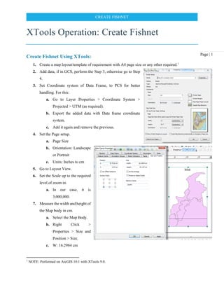
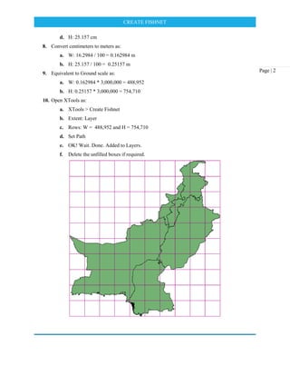

1. The document provides instructions for creating a fishnet grid in ArcGIS using the XTools extension. It involves setting up a map layout, measuring the map extent, converting to real-world units, and using those measurements to specify the number of rows and columns when generating the fishnet grid in XTools. 2. Key steps include setting the coordinate system, measuring the map width and height in centimeters, converting cm to meters based on the map scale, and entering the width and height in meters for the number of rows and columns in XTools. 3. The fishnet grid is then generated in XTools and added to the map layers.