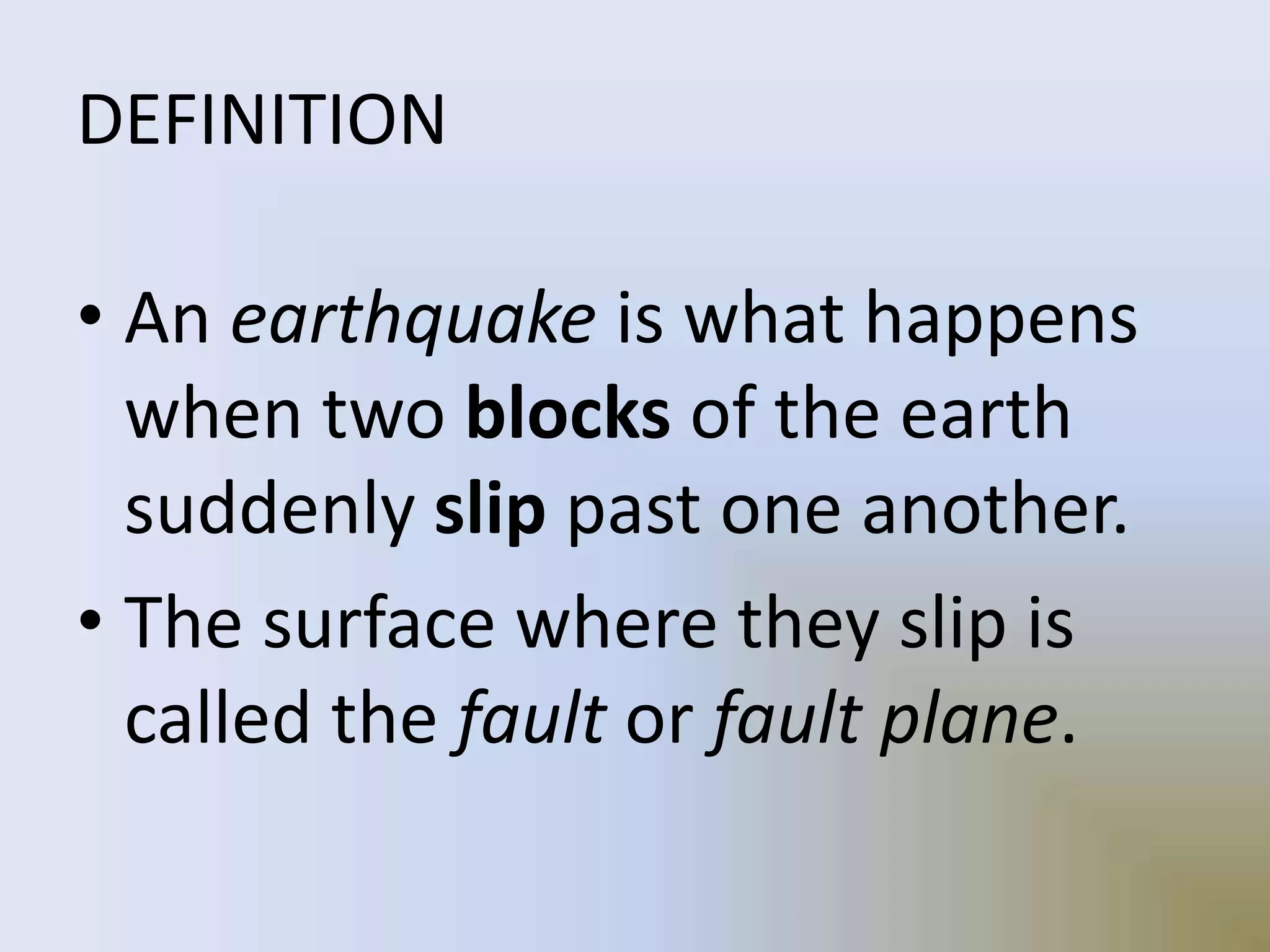
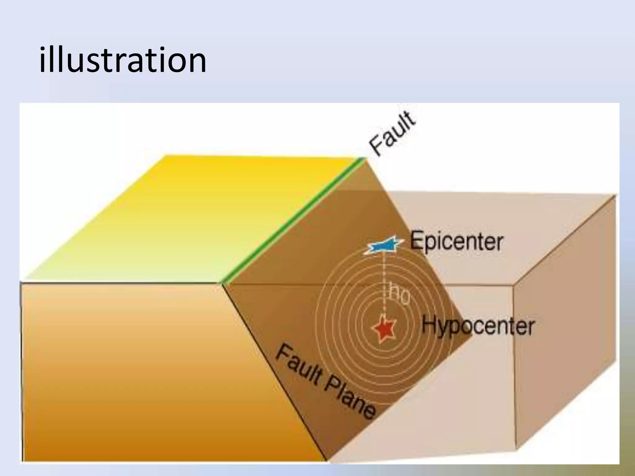
2. On Tuesday, January 17th 1995, at 5.46
a.m. (local time), an earthquake of
magnitude 7.2 on the Richter Scale struck
the Kobe region of south-central Japan. This
region is the second most populated and
industrialized area after Tokyo, with a total
population of about 10 million people. The
ground shook for only about 20 seconds but
in that short time, over 5,000 people died,
over 300,000 people became homeless and
damage worth an estimated ÂŁ100 billion
was caused to roads, houses, factories and
infrastructure (gas, electric, water,
sewerage, phone cables, etc).
4. DEFINITION
⢠An earthquake is what happens
when two blocks of the earth
suddenly slip past one another.
⢠The surface where they slip is
called the fault or fault plane.
5. DEFINITION
⢠The location below the earthâs
surface where the earthquake
starts is called the hypocenter,
and the location directly above it
on the surface of the earth is
called the epicenter.
8. ⢠Sometimes an earthquake has foreshocks.
These are smaller earthquakes that happen in
the same place as the larger earthquake that
follows.
⢠Scientists canât tell that an earthquake is a
foreshock until the larger earthquake
happens.
9. ⢠The largest, main earthquake is called the
mainshock.
⢠Mainshocks always have aftershocks that
follow. These are smaller earthquakes that
occur afterwards in the same place as the
mainshock.
⢠Depending on the size of the mainshock,
aftershocks can continue for weeks, months,
and even years after the mainshock!
10. ⢠Christchurch earthquakes of 2010â11, also
called Canterbury earthquakes, series of
tremors that occurred within and near the
city of Christchurch, N.Z., and the Canterbury
Plains region from early September 2010 to
late February 2011. The severest of those
events were the earthquake (magnitude
from 7.0 to 7.1) that struck on Sept. 4, 2010,
and the large, destructive aftershock
(magnitude 6.3) that occurred on Feb. 22,
2011.
20. ⢠While the edges of faults are stuck
together, and the rest of the block is
moving, the energy that would normally
cause the blocks to slide past one
another is being stored up.
⢠When the force of the moving blocks
finally overcomes the friction of the
jagged edges of the fault and it unsticks,
all that stored up energy is released.
21. ⢠The energy radiates outward from the
fault in all directions in the form of
seismic waves like ripples on a pond.
⢠The seismic waves shake the earth as
they move through it, and when the
waves reach the earthâs surface, they
shake the ground and anything on it,
like our houses and us!
22. How are earthquakes recorded?
⢠Earthquakes are recorded by instruments called
seismographs.
⢠The recording they make is called a seismogram.
⢠video
23. How are earthquakes recorded?
⢠The seismograph has a base that sets firmly in
the ground, and a heavy weight that hangs free.
⢠When an earthquake causes the ground to shake,
the base of the seismograph shakes too, but the
hanging weight does not.
⢠Instead the spring or string that it is hanging from
absorbs all the movement. The difference in
position between the shaking part of the
seismograph and the motionless part is what is
recorded.
24. How do scientists measure the size of
earthquakes?
⢠The size of an earthquake depends on the size of the fault and
the amount of slip on the fault, but thatâs not something
scientists can simply measure with a measuring tape since
faults are many kilometers deep beneath the earthâs surface.
⢠So how do they measure an earthquake? They use the
seismogram recordings made on the seismographs at the
surface of the earth to determine how large the earthquake
was.
⢠A short wiggly line that doesnât wiggle very much means a
small earthquake, and a long wiggly line that wiggles a lot
means a large earthquake. The length of the wiggle depends
on the size of the fault, and the size of the wiggle depends on
the amount of slip.
25. Below is the seismogram from the Christchurch, New Zealand,
earthquake, as recorded by the seismograph at South Karori, New
Zealand, and retrieved using GEE.
26.
27. The size of the earthquake is called its
magnitude. There is one magnitude
for each earthquake. Scientists also
talk about the intensity of shaking
from an earthquake, and this varies
depending on where you are during
the earthquake.
29. Magnitude and Intensity
measure different characteristics
of earthquakes. Magnitude
measures the energy released at
the source of the earthquake.
Magnitude is determined from
measurements on seismographs.
30. Intensity measures the
strength of shaking produced
by the earthquake at a certain
location. Intensity is
determined from effects on
people, human structures,
and the natural environment.
32. ⢠Seismograms come in handy for locating
earthquakes too, and being able to see the P
wave and the S wave is important.
⢠You learned how P & S waves each shake the
ground in different ways as they travel
through it.
⢠P waves are also faster than S waves, and this
fact is what allows us to tell where an
earthquake was.
33. ⢠Limitation:
However, they canât tell in what direction
from the seismograph the earthquake was,
only how far away it was.
If they draw a circle on a map around the
station where the radius of the circle is the
determined distance to the earthquake, they
know the earthquake lies somewhere on the
circle.
34. ⢠Scientists then use a method called
triangulation to determine exactly where the
earthquake was.
⢠It is called triangulation because a triangle has
three sides, and it takes three seismographs
to locate an earthquake. If you draw a circle
on a map around three different
seismographs where the radius of each is the
distance from that station to the earthquake,
the intersection of those three circles is the
epicenter!