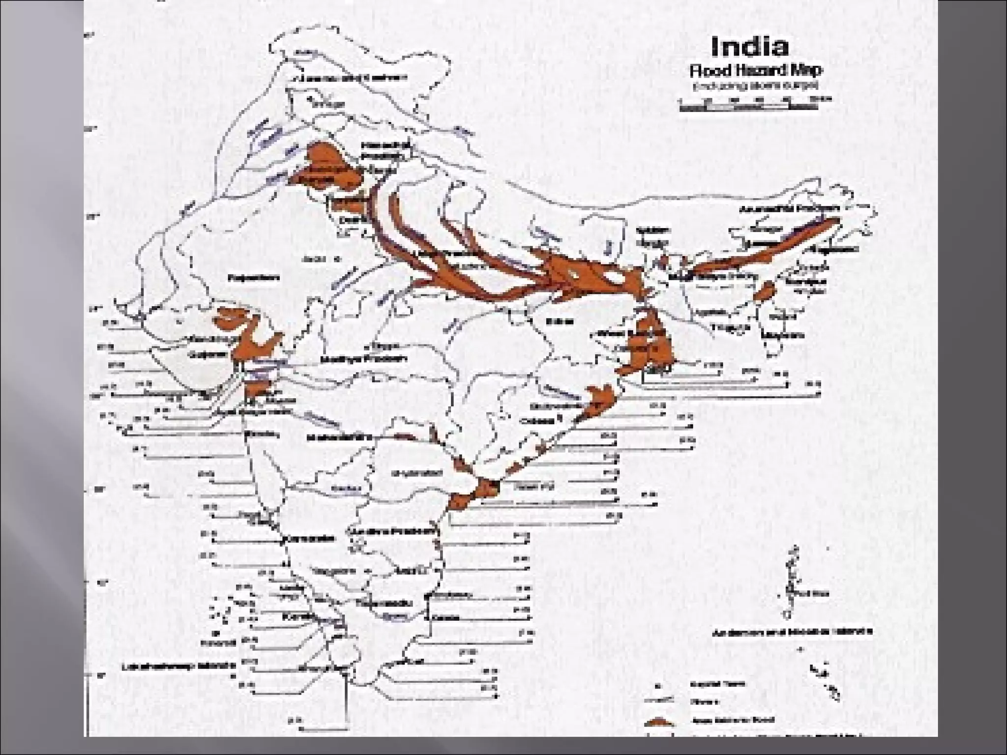
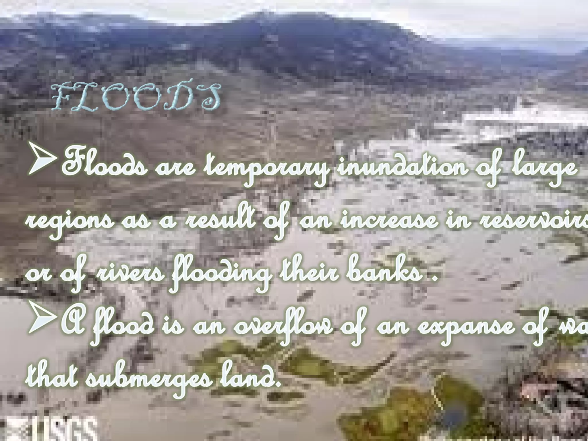
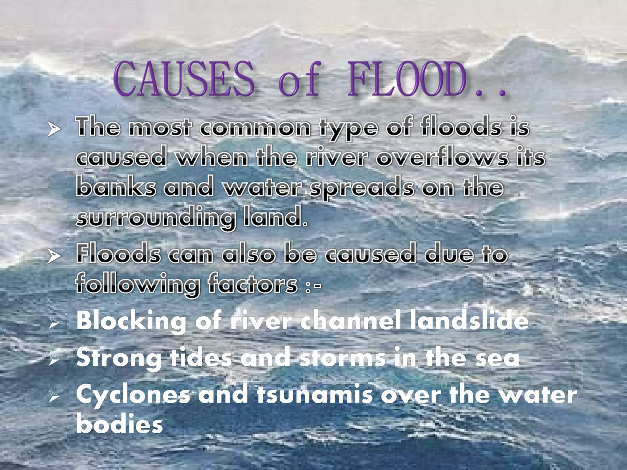
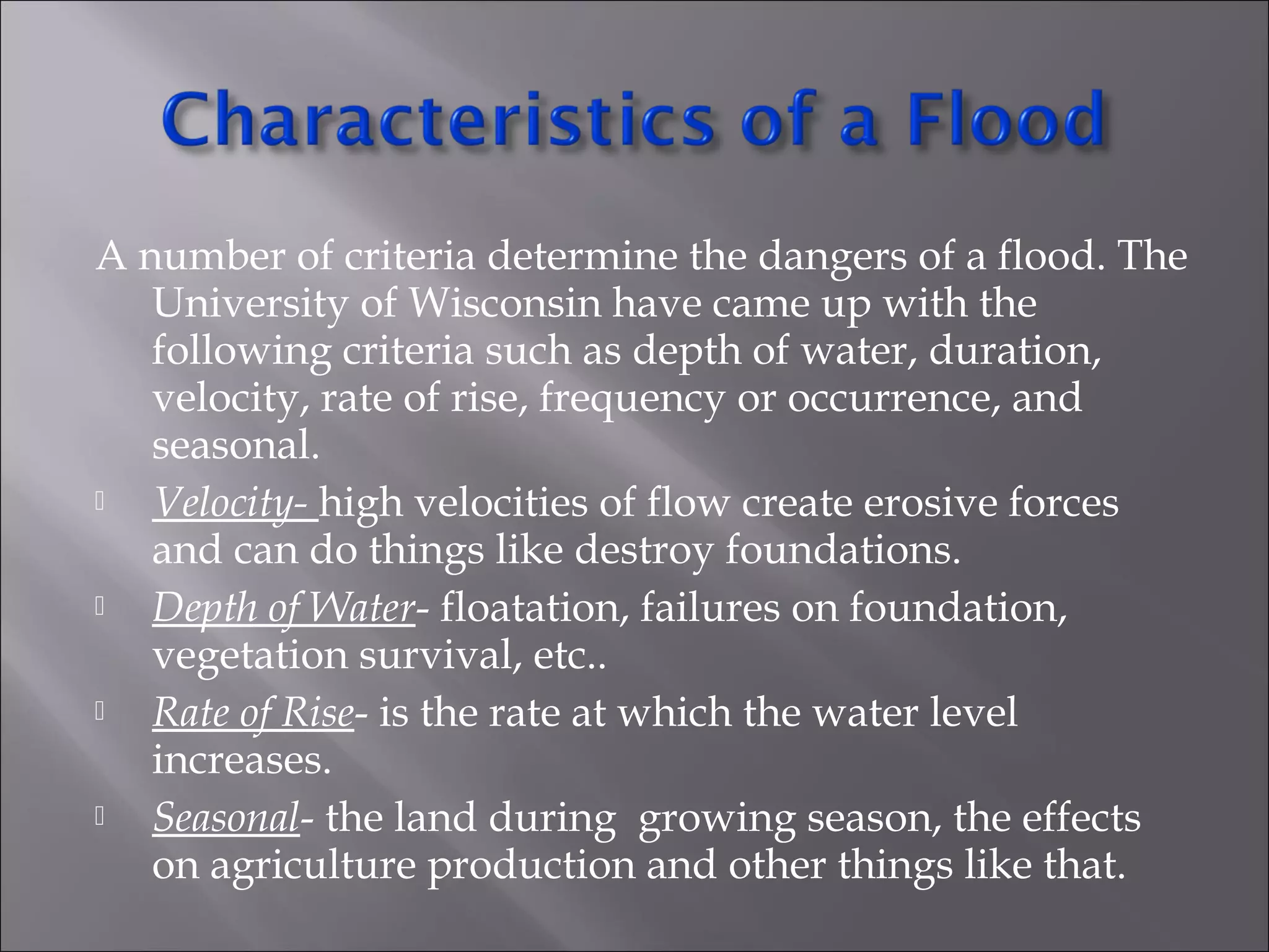
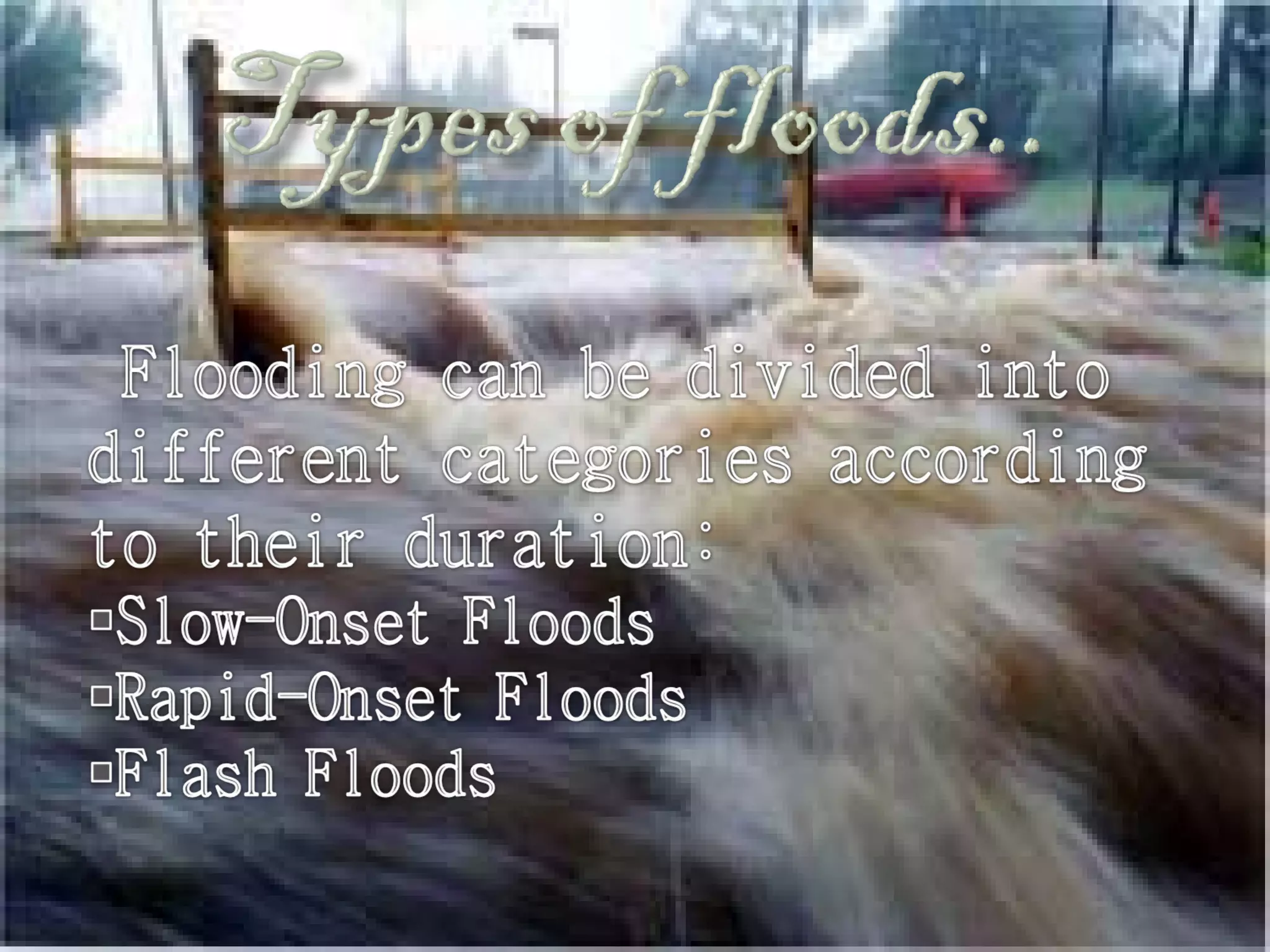
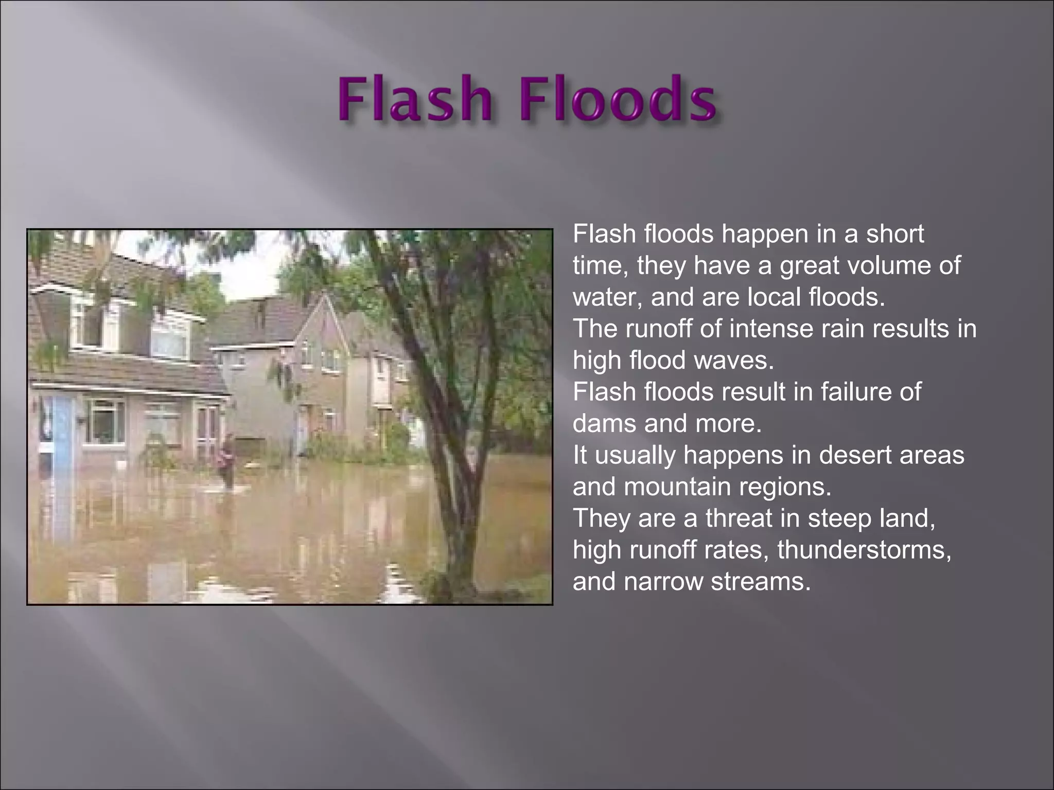
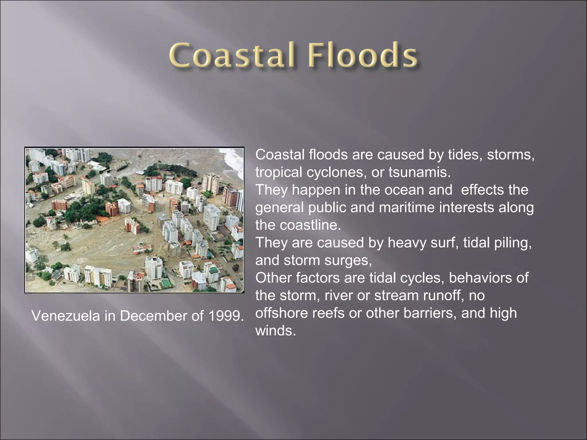
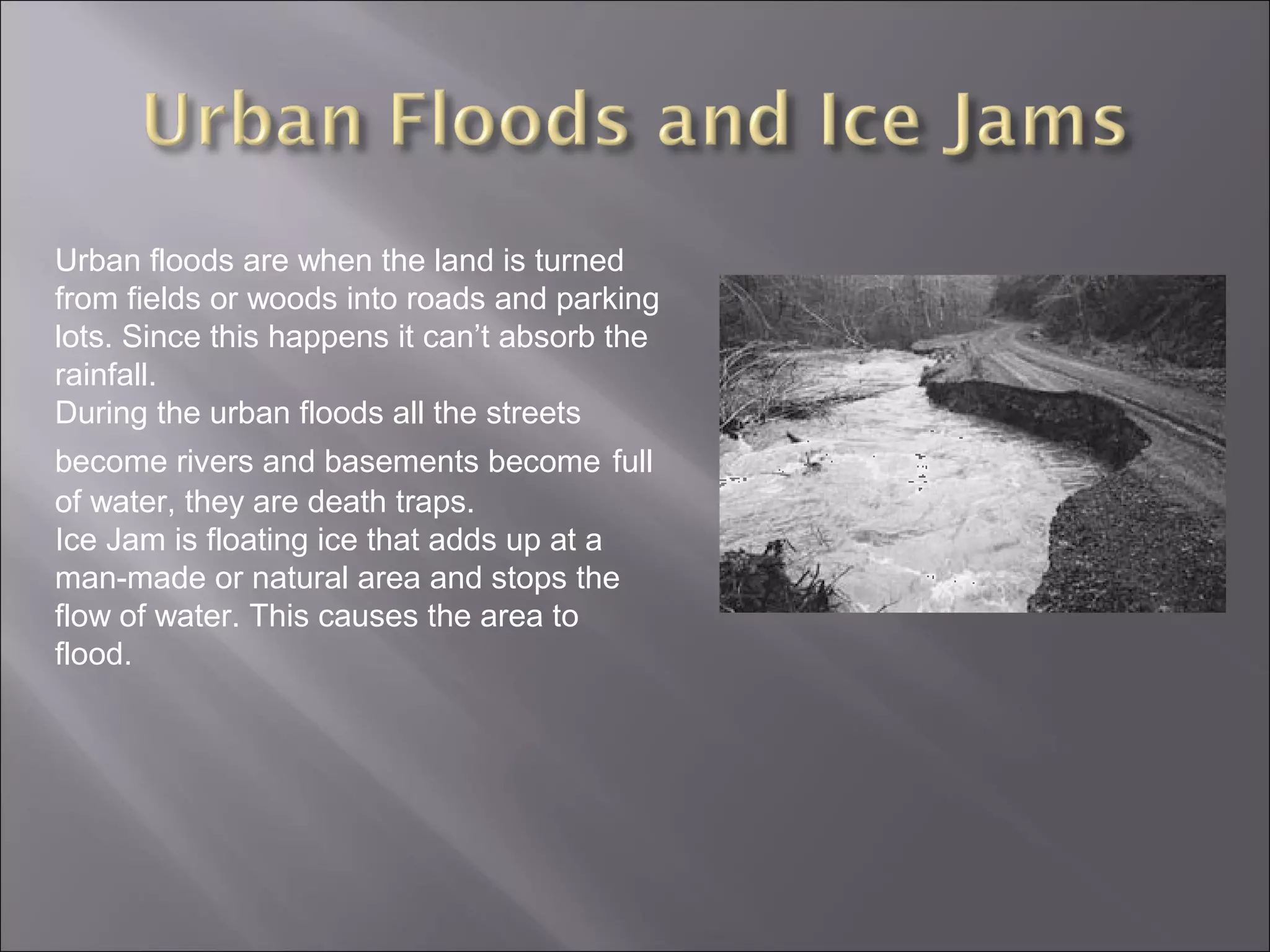
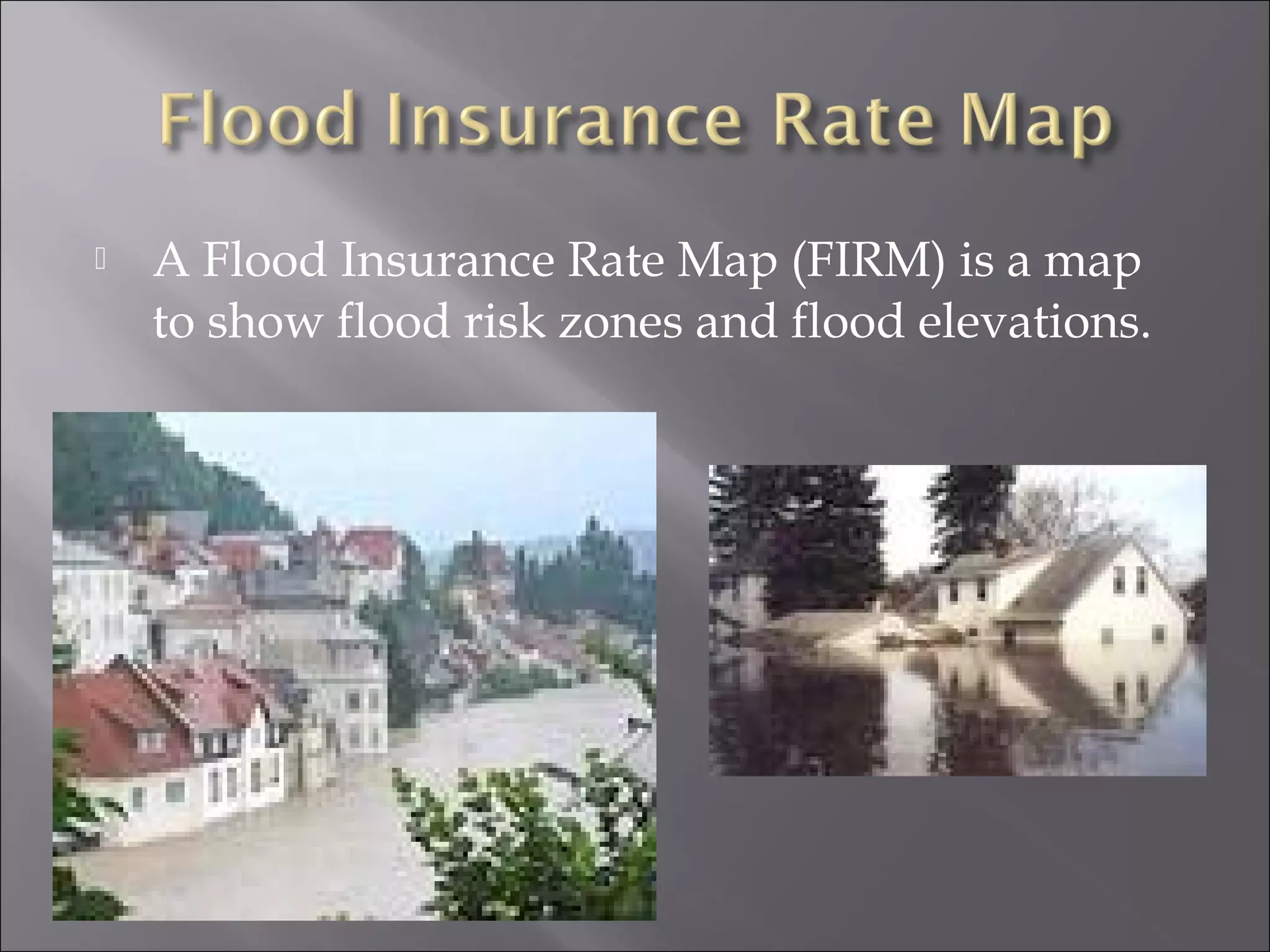
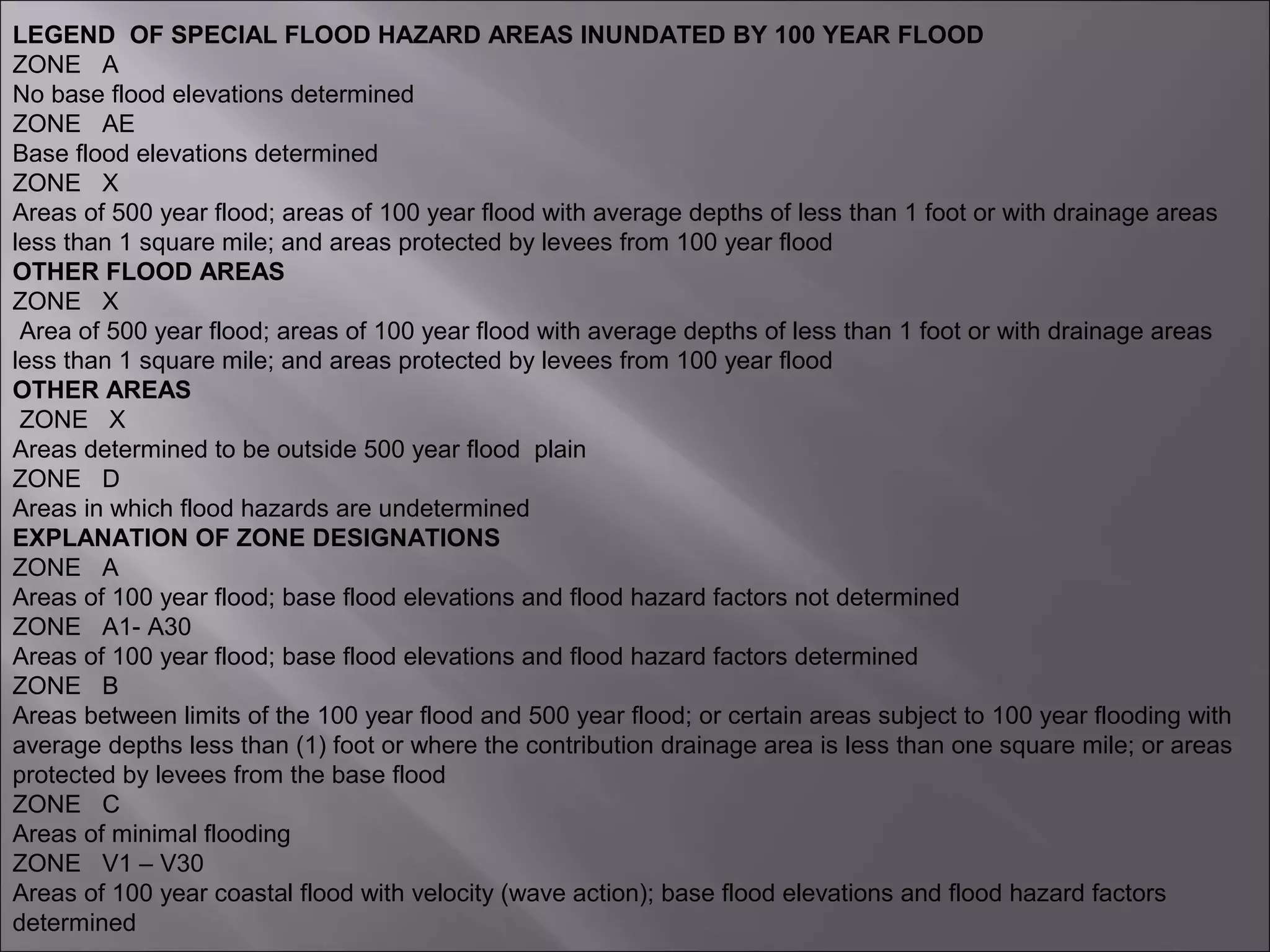
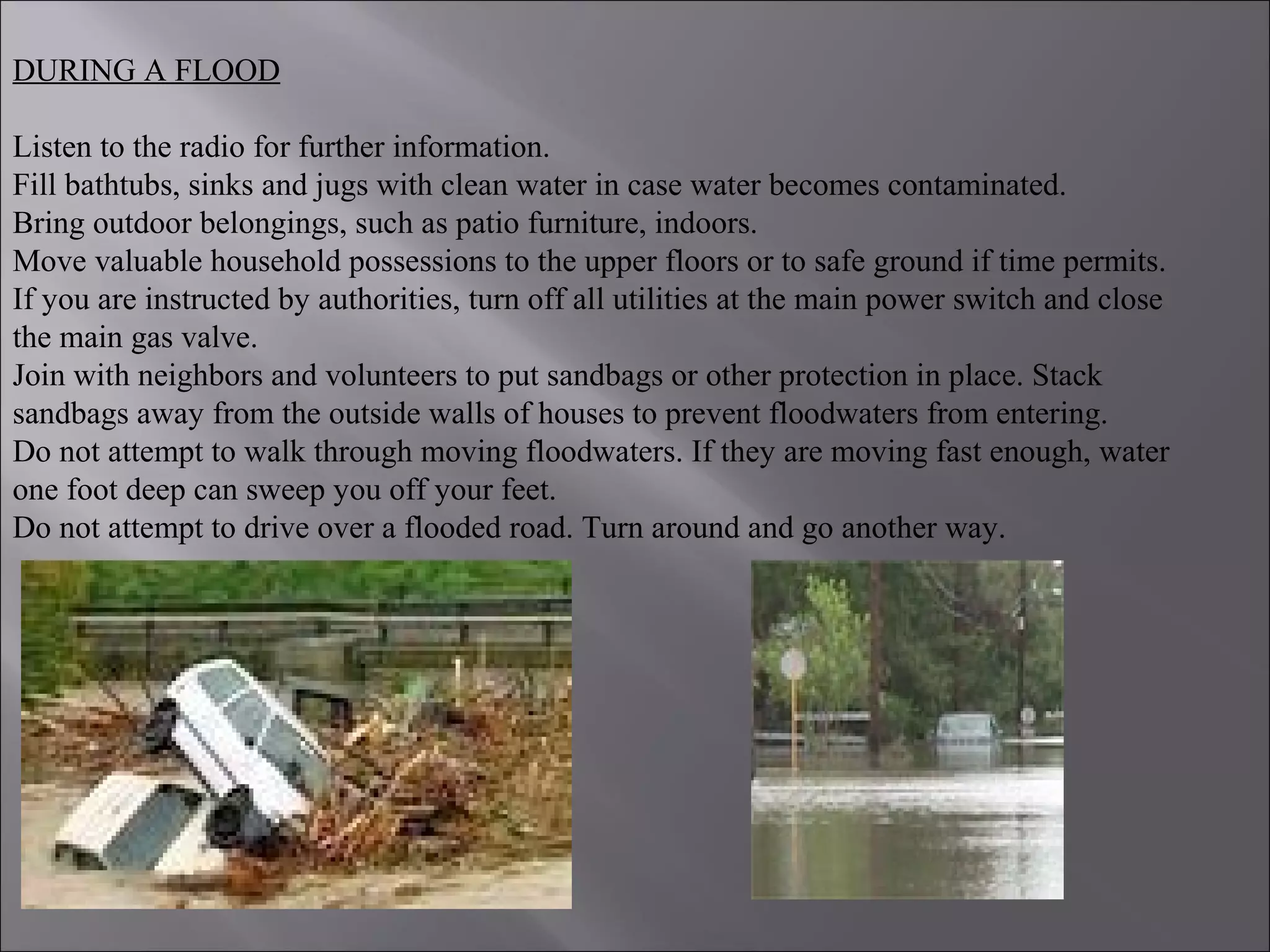
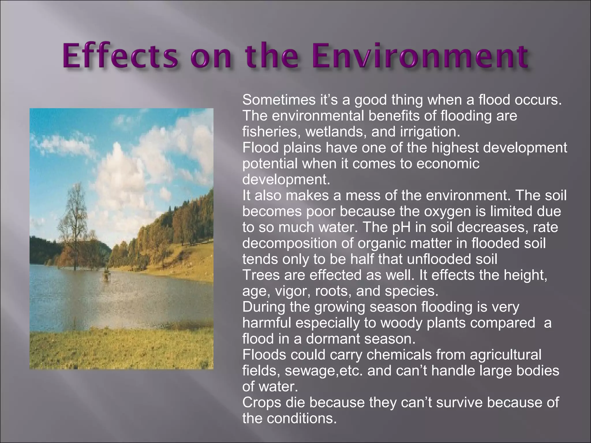
FLOODS
PRESENTED BY:
SURABHI VASUDEV
B110556EE
Climate change is likely to be perceived
through experience of extreme weather
events
Therefore, response to climate change will
perhaps happen through adaptation to
climate hazards
Important to characterize the institutional
mechanisms and structures in place for
responding to natural (and climate-related)
disasters
Scale of Disaster
Is Dependent on :
1)Lead Time Available.
2)Intensity of Hazard.
3)Duration.
4)Spatial Extent.
5)Density of Population & Assets.
6)Time of Occurrence.
7)Vulnerabilities existing in the Elements
at Risk.
Hazard X Vulnerability = Disaster
People
Livestock
Rural Housing Stock
Houses Vulnerable
Crops, Trees , Telephone, Electric poles
Boats, Looms, Working Implements
Personal Property
Electricity, Water and Food Supplies
Infrastructure Support
ELEMENTS AT RISK
Mortality due to natural hazards
1990 - 2000
Reduce (Avoid, if possible) the
potential losses from hazards.
Assure prompt and appropriate
assistance to victims when necessary.
Achieve rapid and durable recovery.
AIMS OF DISASTER MANAGEMENT
• People : Individuals, House -Holds, Volunteers
• Gram Panchayat : Sarpanch, Panchayati
Secretary, Panchayati Members
• Village Elders : Caste/Community/Religious
Leaders, Teachers, Doctors, Engineers,
Retired Army & Police Personnel
• Govt. Deptl. Officers : Agriculture, Medical,
Engineers (Housing, Roads & Buildings,
Irrigation) Revenue Department, Public
Health, Police etc. NGOs
RolePlayers inDisasters
The shore or land by or surrounding a body of
water erodes and this erosion causes waves
currents that result in a flood.
Flood disasters have been increased because of
the expansion of settlements and growth in
floodplains.
Floods could be slow or fast but usually occur
over a matter of days.
After the water eventually goes down or dries up.
On coastal floods, low tides and high tides
makes a change in heights.
Flooding is the most worldwide natural disaster. It
occurs in every country and wherever there is
rainfall or coastal hazards.
They are most likely to happen in tropical areas and
tsunamis.
Most common floods happen around the world’s
largest/greatest rivers.
Believe it or not, smaller rivers could cause more
damage even though people don’t pay as much
attention to them.
Most Flooding occurs during the beginning of spring.
A number of criteria determine the dangers of a flood. The
University of Wisconsin have came up with the
following criteria such as depth of water, duration,
velocity, rate of rise, frequency or occurrence, and
seasonal.
 Velocity- high velocities of flow create erosive forces
and can do things like destroy foundations.
 Depth of Water- floatation, failures on foundation,
vegetation survival, etc..
 Rate of Rise- is the rate at which the water level
increases.
 Seasonal- the land during growing season, the effects
on agriculture production and other things like that.
 Coastal Floods
 Arroyos Floods
 River Floods
 Urban Floods
Flash floods happen in a short
time, they have a great volume of
water, and are local floods.
The runoff of intense rain results in
high flood waves.
Flash floods result in failure of
dams and more.
It usually happens in desert areas
and mountain regions.
They are a threat in steep land,
high runoff rates, thunderstorms,
and narrow streams.
Riverine floods are caused
by melting of snow and
precipitation over large
areas. They take place in
rivers. Floods in large rivers
take hours to days.
The ground conditions
effects the runoff.
Venezuela in December of 1999.
Coastal floods are caused by tides, storms,
tropical cyclones, or tsunamis.
They happen in the ocean and effects the
general public and maritime interests along
the coastline.
They are caused by heavy surf, tidal piling,
and storm surges,
Other factors are tidal cycles, behaviors of
the storm, river or stream runoff, no
offshore reefs or other barriers, and high
winds.
Urban floods are when the land is turned
from fields or woods into roads and parking
lots. Since this happens it can’t absorb the
rainfall.
During the urban floods all the streets
become rivers and basements become full
of water, they are death traps.
Ice Jam is floating ice that adds up at a
man-made or natural area and stops the
flow of water. This causes the area to
flood.
Lakeshore floods affect the general public
as well as some areas of the Great Lakes.
These floods extend from the beaches to
rivers that flow into lakes. The extent of the
flooding is dependant on surrounding the
shore terrain. The causes of these
lakeshore floods are seiches in the Great
Lakes.
The Webster dictionary’s definition of
Seiches is:
The flow of periodically changing direction
of the surface of a landlocked body of
water (like a lake) that varies from a few
minutes to several hours.
The Red River flood crest emptied into
Lake Winnipeg on May 8th, 1997. This
ended the largest flood in Red River Valley
ever recorded
The red river valley occurred in 1997 in
Minnesota. That winter eight harsh
blizzards hit Red River Valley. When
the snow started to melt the river
started to rise.
The flood preparation was made for a
49 foot flood crest. The flood was
actually 54.33 feet on April 22, 1997.
Areas that were in immediate danger
was evacuated on April 18th, people
were evacuated from entire cities on
the 19th.
On the 24th the government officials
started to let people back in dry areas.
Most of the clean-up was done by the
end of 1997 but they were still building
houses, basements, and other
buildings in 2000.
In Mozambique on March 3rd, 2000 an
awful flood had destroyed three villages.
Around 1 million people needed shelter,
food, and medical care.
Thousands of people remained on roofs
and rat-infested trees.
Rescuers had saved 12,000 people from
flood waters after starving for a week.
15,000 remained in Save River Valley,
stranded and nowhere to go.
The government has estimated 1 million
people have been displaced by floods
since the beginning of February 2000.
Bangladesh is a country with
many rivers. Flooding in this
area is common and necessary
so it could fertilize from
deposits of fresh alluvium.
Fresh alluvium is soil that is
deposited by moving water.
In the fall of 1974 flooding was
extended over one half of the
country and stayed this way
for over a month.
At least 1,200 people had died in
the floods and 27,500 died
from diseases and starvation.
425,000 houses were
destroyed and destroyed
agriculture. The cost of
damages were 325.9 million in
U.S.
36 million were effected by this
huge flood.
 This horrific storm dumped around 100 millimeters of rain
trough the Atlantic on Monday March 3rd, 2003.
 It was caused by melting snow, rain, high tides, and freezing
rain which caused streams and rivers to clog and trees to break.
 Thousands of people have had to bail out of their homes.
 The overall damage for provincial roads and bridges is
estimated to be 10 million dollars.
 Nova Scotia’s Transportation Department said 47 bridges have
been destroyed or damaged by flooding. Two hundred roads
have been damaged in the province as well. Major culverts were
ruined and oil tanks ripped from homes.
 Emergency tenders are being sent out to get repair work started
as soon as possible.
 Unfortunately a seniors couple died when that car got swept
away from a flooded road of Lahave River.
 This flood was one of the worst floods Nova Scotia has had in
years.
This is where the latest floods have occurred in the world. It was taken by NASA
satellite.
Precautions to Take
To remain safe from floods you need to know
when and how to deal with them.
Lives could be saved by having more warnings
of floods for places in threat.
There are things used for antiflood protection
and it makes your house, yard and much more,
safe and protected when a flood arrives. They
can be used over and over again.
Equipment
This is a Door Flood Barrier. Its used to fit
and seal your door.
This is a free standing door barrier. The
difference with this one is you can still have
use of the door as well.
Modular Flood Barrier is the highest level
of protection . Its installed to protect your
whole property from high bodies of water
during a flood.
 A Flood Insurance Rate Map (FIRM) is a map
to show flood risk zones and flood elevations.
LEGEND OF SPECIAL FLOOD HAZARD AREAS INUNDATED BY 100 YEAR FLOOD
ZONE A
No base flood elevations determined
ZONE AE
Base flood elevations determined
ZONE X
Areas of 500 year flood; areas of 100 year flood with average depths of less than 1 foot or with drainage areas
less than 1 square mile; and areas protected by levees from 100 year flood
OTHER FLOOD AREAS
ZONE X
Area of 500 year flood; areas of 100 year flood with average depths of less than 1 foot or with drainage areas
less than 1 square mile; and areas protected by levees from 100 year flood
OTHER AREAS
ZONE X
Areas determined to be outside 500 year flood plain
ZONE D
Areas in which flood hazards are undetermined
EXPLANATION OF ZONE DESIGNATIONS
ZONE A
Areas of 100 year flood; base flood elevations and flood hazard factors not determined
ZONE A1- A30
Areas of 100 year flood; base flood elevations and flood hazard factors determined
ZONE B
Areas between limits of the 100 year flood and 500 year flood; or certain areas subject to 100 year flooding with
average depths less than (1) foot or where the contribution drainage area is less than one square mile; or areas
protected by levees from the base flood
ZONE C
Areas of minimal flooding
ZONE V1 – V30
Areas of 100 year coastal flood with velocity (wave action); base flood elevations and flood hazard factors
determined
A Flood Hazard Boundary Map(FHBM) is for an area
and outlines the special flood areas but doesn’t include
and elevation information. It shows flood insurance
risk zones. Its for 100-500 year flood areas.
DURING A FLOOD
Listen to the radio for further information.
Fill bathtubs, sinks and jugs with clean water in case water becomes contaminated.
Bring outdoor belongings, such as patio furniture, indoors.
Move valuable household possessions to the upper floors or to safe ground if time permits.
If you are instructed by authorities, turn off all utilities at the main power switch and close
the main gas valve.
Join with neighbors and volunteers to put sandbags or other protection in place. Stack
sandbags away from the outside walls of houses to prevent floodwaters from entering.
Do not attempt to walk through moving floodwaters. If they are moving fast enough, water
one foot deep can sweep you off your feet.
Do not attempt to drive over a flooded road. Turn around and go another way.
 .
 Deep Snow can melt into a lot of
water. It usually floods because
of rain or rapid warm
temperatures.
 Frozen ground won’t absorb as
much water, the rain and/ or
snow causes flooding on frozen
ground.
 Full reservoirs- Reservoirs are
very big and are man-made to
hold water for drinking or
irrigation. It won’t absorb
anymore water f full and it
causes it to overflow.
 High River or Stream Levels-
melting flows into a full river and
overflows on banks.
Sometimes it’s a good thing when a flood occurs.
The environmental benefits of flooding are
fisheries, wetlands, and irrigation.
Flood plains have one of the highest development
potential when it comes to economic
development.
It also makes a mess of the environment. The soil
becomes poor because the oxygen is limited due
to so much water. The pH in soil decreases, rate
decomposition of organic matter in flooded soil
tends only to be half that unflooded soil
Trees are effected as well. It effects the height,
age, vigor, roots, and species.
During the growing season flooding is very
harmful especially to woody plants compared a
flood in a dormant season.
Floods could carry chemicals from agricultural
fields, sewage,etc. and can’t handle large bodies
of water.
Crops die because they can’t survive because of
the conditions.
There is an organization called World
Meteorological Organization. It promotes flood
management and water resources
management. They have successfully guided
and promoted international development of
meteorology and hydrology. They give
forecasts and warnings.
The government’s responsibility of fixing things
during a flood are for example :damaged
roads, buildings, telephones, and electricity.
 Floods take a heavy toll of life and
property ,so necessary
precautions should be taken.
 Floods are great fury of nature
and humans can take precautions
against it but can not control it.
http://www.fema.gov/hazards/floods
www.und.nodak.edu/dept/library/Collections/og1351.html
http://wmo.ch/apfm
http://www.antiflood.com
www.canada.com/news/story.asp?id=275CB01A-CDDC-47AOO-93/D5274D7244
www.ssl.sabah.gov.my/clh/environment/flood/flood_effects.html
www.na.fs.fed.us/spfo/pubs/n_resource/flood/toler.htm
www.hydrology.com
http://dmc.engr.wisc.edu/courses/hazards/BB02-06.html
novascotia.cbc.ca/regional/servlet/View?filenames=ns_floodcost20030402
www.usatoday.com/weather/wfldfac.htm#three
http://ks.water.usgs.gov/kansas/pubs/fact-sheet/fs.023-000.html
www.hollandsentinel.com/stories/030400/new_slow.html
www.property-appraiser.lee.fl.us/GISDepartment/FIRM1.htm
www.savethechildren.org/press/pr_bangladesh.html
www.personal.psu.edu/users/a/l/alal64/projects/geog121/project5/firm_example.htm
www.nws.noaa.gov/om/brochures/ffbro.htm
Disaster management of floods..

Disaster management of floods..

  • 1.
  • 2.
    Climate change islikely to be perceived through experience of extreme weather events Therefore, response to climate change will perhaps happen through adaptation to climate hazards Important to characterize the institutional mechanisms and structures in place for responding to natural (and climate-related) disasters
  • 3.
    Scale of Disaster IsDependent on : 1)Lead Time Available. 2)Intensity of Hazard. 3)Duration. 4)Spatial Extent. 5)Density of Population & Assets. 6)Time of Occurrence. 7)Vulnerabilities existing in the Elements at Risk. Hazard X Vulnerability = Disaster
  • 4.
    People Livestock Rural Housing Stock HousesVulnerable Crops, Trees , Telephone, Electric poles Boats, Looms, Working Implements Personal Property Electricity, Water and Food Supplies Infrastructure Support ELEMENTS AT RISK
  • 5.
    Mortality due tonatural hazards 1990 - 2000
  • 6.
    Reduce (Avoid, ifpossible) the potential losses from hazards. Assure prompt and appropriate assistance to victims when necessary. Achieve rapid and durable recovery. AIMS OF DISASTER MANAGEMENT
  • 7.
    • People :Individuals, House -Holds, Volunteers • Gram Panchayat : Sarpanch, Panchayati Secretary, Panchayati Members • Village Elders : Caste/Community/Religious Leaders, Teachers, Doctors, Engineers, Retired Army & Police Personnel • Govt. Deptl. Officers : Agriculture, Medical, Engineers (Housing, Roads & Buildings, Irrigation) Revenue Department, Public Health, Police etc. NGOs RolePlayers inDisasters
  • 10.
    The shore orland by or surrounding a body of water erodes and this erosion causes waves currents that result in a flood. Flood disasters have been increased because of the expansion of settlements and growth in floodplains. Floods could be slow or fast but usually occur over a matter of days. After the water eventually goes down or dries up. On coastal floods, low tides and high tides makes a change in heights.
  • 12.
    Flooding is themost worldwide natural disaster. It occurs in every country and wherever there is rainfall or coastal hazards. They are most likely to happen in tropical areas and tsunamis. Most common floods happen around the world’s largest/greatest rivers. Believe it or not, smaller rivers could cause more damage even though people don’t pay as much attention to them. Most Flooding occurs during the beginning of spring.
  • 13.
    A number ofcriteria determine the dangers of a flood. The University of Wisconsin have came up with the following criteria such as depth of water, duration, velocity, rate of rise, frequency or occurrence, and seasonal.  Velocity- high velocities of flow create erosive forces and can do things like destroy foundations.  Depth of Water- floatation, failures on foundation, vegetation survival, etc..  Rate of Rise- is the rate at which the water level increases.  Seasonal- the land during growing season, the effects on agriculture production and other things like that.
  • 15.
     Coastal Floods Arroyos Floods  River Floods  Urban Floods
  • 16.
    Flash floods happenin a short time, they have a great volume of water, and are local floods. The runoff of intense rain results in high flood waves. Flash floods result in failure of dams and more. It usually happens in desert areas and mountain regions. They are a threat in steep land, high runoff rates, thunderstorms, and narrow streams.
  • 17.
    Riverine floods arecaused by melting of snow and precipitation over large areas. They take place in rivers. Floods in large rivers take hours to days. The ground conditions effects the runoff.
  • 18.
    Venezuela in Decemberof 1999. Coastal floods are caused by tides, storms, tropical cyclones, or tsunamis. They happen in the ocean and effects the general public and maritime interests along the coastline. They are caused by heavy surf, tidal piling, and storm surges, Other factors are tidal cycles, behaviors of the storm, river or stream runoff, no offshore reefs or other barriers, and high winds.
  • 19.
    Urban floods arewhen the land is turned from fields or woods into roads and parking lots. Since this happens it can’t absorb the rainfall. During the urban floods all the streets become rivers and basements become full of water, they are death traps. Ice Jam is floating ice that adds up at a man-made or natural area and stops the flow of water. This causes the area to flood.
  • 20.
    Lakeshore floods affectthe general public as well as some areas of the Great Lakes. These floods extend from the beaches to rivers that flow into lakes. The extent of the flooding is dependant on surrounding the shore terrain. The causes of these lakeshore floods are seiches in the Great Lakes. The Webster dictionary’s definition of Seiches is: The flow of periodically changing direction of the surface of a landlocked body of water (like a lake) that varies from a few minutes to several hours.
  • 21.
    The Red Riverflood crest emptied into Lake Winnipeg on May 8th, 1997. This ended the largest flood in Red River Valley ever recorded The red river valley occurred in 1997 in Minnesota. That winter eight harsh blizzards hit Red River Valley. When the snow started to melt the river started to rise. The flood preparation was made for a 49 foot flood crest. The flood was actually 54.33 feet on April 22, 1997. Areas that were in immediate danger was evacuated on April 18th, people were evacuated from entire cities on the 19th. On the 24th the government officials started to let people back in dry areas. Most of the clean-up was done by the end of 1997 but they were still building houses, basements, and other buildings in 2000.
  • 22.
    In Mozambique onMarch 3rd, 2000 an awful flood had destroyed three villages. Around 1 million people needed shelter, food, and medical care. Thousands of people remained on roofs and rat-infested trees. Rescuers had saved 12,000 people from flood waters after starving for a week. 15,000 remained in Save River Valley, stranded and nowhere to go. The government has estimated 1 million people have been displaced by floods since the beginning of February 2000.
  • 23.
    Bangladesh is acountry with many rivers. Flooding in this area is common and necessary so it could fertilize from deposits of fresh alluvium. Fresh alluvium is soil that is deposited by moving water. In the fall of 1974 flooding was extended over one half of the country and stayed this way for over a month. At least 1,200 people had died in the floods and 27,500 died from diseases and starvation. 425,000 houses were destroyed and destroyed agriculture. The cost of damages were 325.9 million in U.S. 36 million were effected by this huge flood.
  • 24.
     This horrificstorm dumped around 100 millimeters of rain trough the Atlantic on Monday March 3rd, 2003.  It was caused by melting snow, rain, high tides, and freezing rain which caused streams and rivers to clog and trees to break.  Thousands of people have had to bail out of their homes.  The overall damage for provincial roads and bridges is estimated to be 10 million dollars.  Nova Scotia’s Transportation Department said 47 bridges have been destroyed or damaged by flooding. Two hundred roads have been damaged in the province as well. Major culverts were ruined and oil tanks ripped from homes.  Emergency tenders are being sent out to get repair work started as soon as possible.  Unfortunately a seniors couple died when that car got swept away from a flooded road of Lahave River.  This flood was one of the worst floods Nova Scotia has had in years.
  • 26.
    This is wherethe latest floods have occurred in the world. It was taken by NASA satellite.
  • 27.
    Precautions to Take Toremain safe from floods you need to know when and how to deal with them. Lives could be saved by having more warnings of floods for places in threat. There are things used for antiflood protection and it makes your house, yard and much more, safe and protected when a flood arrives. They can be used over and over again.
  • 28.
    Equipment This is aDoor Flood Barrier. Its used to fit and seal your door. This is a free standing door barrier. The difference with this one is you can still have use of the door as well. Modular Flood Barrier is the highest level of protection . Its installed to protect your whole property from high bodies of water during a flood.
  • 29.
     A FloodInsurance Rate Map (FIRM) is a map to show flood risk zones and flood elevations.
  • 31.
    LEGEND OF SPECIALFLOOD HAZARD AREAS INUNDATED BY 100 YEAR FLOOD ZONE A No base flood elevations determined ZONE AE Base flood elevations determined ZONE X Areas of 500 year flood; areas of 100 year flood with average depths of less than 1 foot or with drainage areas less than 1 square mile; and areas protected by levees from 100 year flood OTHER FLOOD AREAS ZONE X Area of 500 year flood; areas of 100 year flood with average depths of less than 1 foot or with drainage areas less than 1 square mile; and areas protected by levees from 100 year flood OTHER AREAS ZONE X Areas determined to be outside 500 year flood plain ZONE D Areas in which flood hazards are undetermined EXPLANATION OF ZONE DESIGNATIONS ZONE A Areas of 100 year flood; base flood elevations and flood hazard factors not determined ZONE A1- A30 Areas of 100 year flood; base flood elevations and flood hazard factors determined ZONE B Areas between limits of the 100 year flood and 500 year flood; or certain areas subject to 100 year flooding with average depths less than (1) foot or where the contribution drainage area is less than one square mile; or areas protected by levees from the base flood ZONE C Areas of minimal flooding ZONE V1 – V30 Areas of 100 year coastal flood with velocity (wave action); base flood elevations and flood hazard factors determined
  • 32.
    A Flood HazardBoundary Map(FHBM) is for an area and outlines the special flood areas but doesn’t include and elevation information. It shows flood insurance risk zones. Its for 100-500 year flood areas.
  • 33.
    DURING A FLOOD Listento the radio for further information. Fill bathtubs, sinks and jugs with clean water in case water becomes contaminated. Bring outdoor belongings, such as patio furniture, indoors. Move valuable household possessions to the upper floors or to safe ground if time permits. If you are instructed by authorities, turn off all utilities at the main power switch and close the main gas valve. Join with neighbors and volunteers to put sandbags or other protection in place. Stack sandbags away from the outside walls of houses to prevent floodwaters from entering. Do not attempt to walk through moving floodwaters. If they are moving fast enough, water one foot deep can sweep you off your feet. Do not attempt to drive over a flooded road. Turn around and go another way.
  • 35.
  • 36.
     Deep Snowcan melt into a lot of water. It usually floods because of rain or rapid warm temperatures.  Frozen ground won’t absorb as much water, the rain and/ or snow causes flooding on frozen ground.  Full reservoirs- Reservoirs are very big and are man-made to hold water for drinking or irrigation. It won’t absorb anymore water f full and it causes it to overflow.  High River or Stream Levels- melting flows into a full river and overflows on banks.
  • 37.
    Sometimes it’s agood thing when a flood occurs. The environmental benefits of flooding are fisheries, wetlands, and irrigation. Flood plains have one of the highest development potential when it comes to economic development. It also makes a mess of the environment. The soil becomes poor because the oxygen is limited due to so much water. The pH in soil decreases, rate decomposition of organic matter in flooded soil tends only to be half that unflooded soil Trees are effected as well. It effects the height, age, vigor, roots, and species. During the growing season flooding is very harmful especially to woody plants compared a flood in a dormant season. Floods could carry chemicals from agricultural fields, sewage,etc. and can’t handle large bodies of water. Crops die because they can’t survive because of the conditions.
  • 40.
    There is anorganization called World Meteorological Organization. It promotes flood management and water resources management. They have successfully guided and promoted international development of meteorology and hydrology. They give forecasts and warnings. The government’s responsibility of fixing things during a flood are for example :damaged roads, buildings, telephones, and electricity.
  • 41.
     Floods takea heavy toll of life and property ,so necessary precautions should be taken.  Floods are great fury of nature and humans can take precautions against it but can not control it.
  • 42.
    http://www.fema.gov/hazards/floods www.und.nodak.edu/dept/library/Collections/og1351.html http://wmo.ch/apfm http://www.antiflood.com www.canada.com/news/story.asp?id=275CB01A-CDDC-47AOO-93/D5274D7244 www.ssl.sabah.gov.my/clh/environment/flood/flood_effects.html www.na.fs.fed.us/spfo/pubs/n_resource/flood/toler.htm www.hydrology.com http://dmc.engr.wisc.edu/courses/hazards/BB02-06.html novascotia.cbc.ca/regional/servlet/View?filenames=ns_floodcost20030402 www.usatoday.com/weather/wfldfac.htm#three http://ks.water.usgs.gov/kansas/pubs/fact-sheet/fs.023-000.html www.hollandsentinel.com/stories/030400/new_slow.html www.property-appraiser.lee.fl.us/GISDepartment/FIRM1.htm www.savethechildren.org/press/pr_bangladesh.html www.personal.psu.edu/users/a/l/alal64/projects/geog121/project5/firm_example.htm www.nws.noaa.gov/om/brochures/ffbro.htm