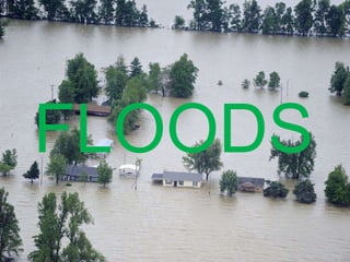
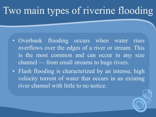
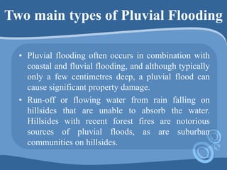
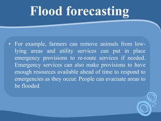
FLOODS
FLOODS
• A flood is an overflow of water that
submerges land that is usually dry. Flood as
a temporary covering by water of land which
is usually not covered by water. Floods are
an area of study of the discipline hydrology
and are of significant concern in agriculture,
civil engineering and public health.
FLOODS
• Flooding may occur as an overflow of water from
water bodies, such as a river, lake, or ocean, in
which the water overtops, resulting in some of that
water escaping its usual boundaries, or it may
occur due to an accumulation of rainwater on
saturated ground in an area flood. While the size
of a lake or other body of water will vary with
seasonal changes in precipitation and snow melt,
these changes in size are unlikely to be considered
significant unless they flood property or drown
domestic animals.
Types of Floods
• Coastal flood
• A coastal flood, as the name suggests, occurs
in areas that lie on the coast of a sea, ocean,
or other large body of open water. In this
type of flood, water overwhelms low-lying
land and often causes devastating loss of life
and property.
COASTAL FLOOD
• Coastal flooding is categorized in three levels:
• Minor: A slight amount of beach erosion will
occur but no major damage is expected.
• Moderate: A fair amount of beach erosion will
occur as well as damage to some homes and
businesses.
• Major: Large-scale beach erosion will occur,
numerous roads will be flooded, and many
structures will be damaged. Citizens should
review safety precautions and prepare to evacuate
if necessary.
FLUVIAL FLOODS
• Fluvial or riverine flooding, occurs when
excessive rainfall over an extended period of
time causes a river to exceed its capacity. It can
also be caused by heavy snow melt and ice
jams. The damage from a river flood can be
widespread as the overflow affects smaller
rivers downstream, often causing dams and
dikes to break and swamp nearby areas.
Two main types of riverine flooding
• Overbank flooding occurs when water rises
overflows over the edges of a river or stream. This
is the most common and can occur in any size
channel — from small streams to huge rivers.
• Flash flooding is characterized by an intense, high
velocity torrent of water that occurs in an existing
river channel with little to no notice.
Pluvial (Surface Flood)
• A pluvial or surface water flood, is caused when
heavy rainfall creates a flood event independent of
an overflowing water body. One of the most
common misconceptions about flood risk is that
one must be located near a body of water to be at
risk. Pluvial flooding debunks - it can happen in
any urban area & even higher elevation areas that
lie above coastal and river floodplains.
Two main types of Pluvial Flooding
• Pluvial flooding often occurs in combination with
coastal and fluvial flooding, and although typically
only a few centimetres deep, a pluvial flood can
cause significant property damage.
• Run-off or flowing water from rain falling on
hillsides that are unable to absorb the water.
Hillsides with recent forest fires are notorious
sources of pluvial floods, as are suburban
communities on hillsides.
Catastrophic floods due to errors
• Catastrophic riverine flooding is usually associated
with major infrastructure failures such as the
collapse of a dam, but they may also be caused by
drainage channel modification from a landslide,
earthquake.
Causes of flooding
• Rains
• River overflow
• Strong winds in coastal areas
• Dam breaking
• Ice and snow-melts
• Heavy siltation of the river bed reduces the water
carrying capacity of the rivers/stream.
• Blockage in the drains lead to flooding of the area.
Effects of flooding
• Environment
• Economic
• People and animals
Areas are more likely liable to floods
Human Adjustments –
Mitigation measures to
reduce the risk of
Flooding
Before the floods
 Know about your local relief centres and evacuation
routes.
 Keep emergency numbers and important information
handy
 Fold and roll up anything onto higher ground including
chemicals and medicines.
 Make sure everything that is of importance is secured
 Plant trees and shrubs and keep a lot of vegetation in
your compound .
During the floods
Flash floods occur in a short duration of time.
As soon as they start, be quick, keep safe and
ensure that children and elderly are safe by
leaving the house to a higher ground.
Turn off all electrical appliance, gas, heating
and the like if there is a bit of time.
Try to keep away from flood water as it may
contain chemicals or other hazardous materials.
After the floods
 Make sure you have permission from emergency
officers to get back inside your house.
 Keep all power and electrical appliance off until the
house is cleaned up properly and an electrical
personnel has confirmed that it is OK to put them on.
 Make sure you have photographs, or a record of all the
damage, as it may be needed for insurance claims.
 Wear appropriate gear (mask and gloves) before
cleaning begins.
Methods of flood prevention
• Humans cannot stop the rains from falling or
stop flowing surface water from bursting its
banks. These are natural events, but we can do
something to prevent them from having great
impact. Here are a few.
• In some places, retaining walls levees, lakes,
dams, reservoirs or retention ponds have been
constructed to hold extra water during times of
flooding.
Methods of flood prevention
• Vegetation
• Town planning
• Sea / Coastal Defence Walls
• Education
• Vegetation
Flood forecasting
• Anticipating floods before they occur allows for
precautions to be taken and people to be warned.
so that they can be prepared in advance for
flooding conditions. For example, farmers can
remove animals from low-lying areas and utility
services can put in place emergency provisions to
re-route services if needed. Emergency services
can also make provisions to have enough resources
available ahead of time to respond to emergencies
as they occur.
Flood forecasting
• For example, farmers can remove animals from low-
lying areas and utility services can put in place
emergency provisions to re-route services if needed.
Emergency services can also make provisions to have
enough resources available ahead of time to respond to
emergencies as they occur. People can evacuate areas to
be flooded
Distribution of floods
• On a global scale, river floodplains and coastal
areas are the most susceptible to flooding.
Bangladesh is the most flood prone area in the
world. This country is a low lying riverine
country located between the foothills of the
Himalayas and the Bay of Bengal. It is
vulnerable due to a long monsoon season which
causes heavy rainfall.
Floods in India
• The peculiar nature of India’s climate,
dominated by monsoons, causes situations
where drought and floods may affect
different pockets at the same time of year.
The main reasons for floods in India are:
• 1. Heavy concentrated rainfall
• 2. Cyclone and strong winds, and
• 3. Inadequate drainage
Flood prone zones in India
• 1 = flood-prone areas;
• 2 = major rainstorm zones after Dhar and
Nandargi (1995);
• 3 = percentage of annual rainfall contributed
by southwest monsoon;
• 4 = major hydro-geomorphic zones
Flood prone zones in India
• Among the severely affected areas of the country
are the Brahmaputra valleys, north Bihar (Kosi
River and north Gangetic plain) and lower West
Bengal. Apart from these, floods affect large areas
in the following belts:
 The lower courses of rivers in the north Indian
plains which get silted and change their courses.
Such situations are in the states of Punjab,
Haryana, Himachal Pradesh, Delhi, Rajasthan,
Uttar Pradesh, Bihar and West Bengal
Flood prone zones in India
 Inadequate drainage in parts of Haryana and
Punjab is the main cause of inundation. The
tributaries of the Indus – the Jhelum, Sutlej, Beas,
Ravi and Chenab – cause floods in Jammu and
Kashmir, Punjab, Haryana, western Uttar Pradesh
and Himachal Pradesh.
 Certain areas in central India and the peninsula get
flooded by the Narmada, Tapti, Chambal,
Godavari, Krishna, Cauveri and Pennar.
Flood prone zones in India
Large tracts (area of land) along the east
coast get flooded due to cyclonic storms.
The total area affected by floods in
India is between 7.5 million hectares and 10
million hectares. Eastern Uttar Pradesh and
northern Bihar are the worst affected regions
of the country.

Exogenous disasters floods

  • 1.
  • 2.
    FLOODS • A floodis an overflow of water that submerges land that is usually dry. Flood as a temporary covering by water of land which is usually not covered by water. Floods are an area of study of the discipline hydrology and are of significant concern in agriculture, civil engineering and public health.
  • 3.
    FLOODS • Flooding mayoccur as an overflow of water from water bodies, such as a river, lake, or ocean, in which the water overtops, resulting in some of that water escaping its usual boundaries, or it may occur due to an accumulation of rainwater on saturated ground in an area flood. While the size of a lake or other body of water will vary with seasonal changes in precipitation and snow melt, these changes in size are unlikely to be considered significant unless they flood property or drown domestic animals.
  • 4.
    Types of Floods •Coastal flood • A coastal flood, as the name suggests, occurs in areas that lie on the coast of a sea, ocean, or other large body of open water. In this type of flood, water overwhelms low-lying land and often causes devastating loss of life and property.
  • 7.
    COASTAL FLOOD • Coastalflooding is categorized in three levels: • Minor: A slight amount of beach erosion will occur but no major damage is expected. • Moderate: A fair amount of beach erosion will occur as well as damage to some homes and businesses. • Major: Large-scale beach erosion will occur, numerous roads will be flooded, and many structures will be damaged. Citizens should review safety precautions and prepare to evacuate if necessary.
  • 8.
    FLUVIAL FLOODS • Fluvialor riverine flooding, occurs when excessive rainfall over an extended period of time causes a river to exceed its capacity. It can also be caused by heavy snow melt and ice jams. The damage from a river flood can be widespread as the overflow affects smaller rivers downstream, often causing dams and dikes to break and swamp nearby areas.
  • 10.
    Two main typesof riverine flooding • Overbank flooding occurs when water rises overflows over the edges of a river or stream. This is the most common and can occur in any size channel — from small streams to huge rivers. • Flash flooding is characterized by an intense, high velocity torrent of water that occurs in an existing river channel with little to no notice.
  • 11.
    Pluvial (Surface Flood) •A pluvial or surface water flood, is caused when heavy rainfall creates a flood event independent of an overflowing water body. One of the most common misconceptions about flood risk is that one must be located near a body of water to be at risk. Pluvial flooding debunks - it can happen in any urban area & even higher elevation areas that lie above coastal and river floodplains.
  • 13.
    Two main typesof Pluvial Flooding • Pluvial flooding often occurs in combination with coastal and fluvial flooding, and although typically only a few centimetres deep, a pluvial flood can cause significant property damage. • Run-off or flowing water from rain falling on hillsides that are unable to absorb the water. Hillsides with recent forest fires are notorious sources of pluvial floods, as are suburban communities on hillsides.
  • 14.
    Catastrophic floods dueto errors • Catastrophic riverine flooding is usually associated with major infrastructure failures such as the collapse of a dam, but they may also be caused by drainage channel modification from a landslide, earthquake.
  • 16.
    Causes of flooding •Rains • River overflow • Strong winds in coastal areas • Dam breaking • Ice and snow-melts • Heavy siltation of the river bed reduces the water carrying capacity of the rivers/stream. • Blockage in the drains lead to flooding of the area.
  • 17.
    Effects of flooding •Environment • Economic • People and animals
  • 18.
    Areas are morelikely liable to floods
  • 19.
    Human Adjustments – Mitigationmeasures to reduce the risk of Flooding
  • 20.
    Before the floods Know about your local relief centres and evacuation routes.  Keep emergency numbers and important information handy  Fold and roll up anything onto higher ground including chemicals and medicines.  Make sure everything that is of importance is secured  Plant trees and shrubs and keep a lot of vegetation in your compound .
  • 21.
    During the floods Flashfloods occur in a short duration of time. As soon as they start, be quick, keep safe and ensure that children and elderly are safe by leaving the house to a higher ground. Turn off all electrical appliance, gas, heating and the like if there is a bit of time. Try to keep away from flood water as it may contain chemicals or other hazardous materials.
  • 22.
    After the floods Make sure you have permission from emergency officers to get back inside your house.  Keep all power and electrical appliance off until the house is cleaned up properly and an electrical personnel has confirmed that it is OK to put them on.  Make sure you have photographs, or a record of all the damage, as it may be needed for insurance claims.  Wear appropriate gear (mask and gloves) before cleaning begins.
  • 23.
    Methods of floodprevention • Humans cannot stop the rains from falling or stop flowing surface water from bursting its banks. These are natural events, but we can do something to prevent them from having great impact. Here are a few. • In some places, retaining walls levees, lakes, dams, reservoirs or retention ponds have been constructed to hold extra water during times of flooding.
  • 24.
    Methods of floodprevention • Vegetation • Town planning • Sea / Coastal Defence Walls • Education • Vegetation
  • 25.
    Flood forecasting • Anticipatingfloods before they occur allows for precautions to be taken and people to be warned. so that they can be prepared in advance for flooding conditions. For example, farmers can remove animals from low-lying areas and utility services can put in place emergency provisions to re-route services if needed. Emergency services can also make provisions to have enough resources available ahead of time to respond to emergencies as they occur.
  • 26.
    Flood forecasting • Forexample, farmers can remove animals from low- lying areas and utility services can put in place emergency provisions to re-route services if needed. Emergency services can also make provisions to have enough resources available ahead of time to respond to emergencies as they occur. People can evacuate areas to be flooded
  • 27.
    Distribution of floods •On a global scale, river floodplains and coastal areas are the most susceptible to flooding. Bangladesh is the most flood prone area in the world. This country is a low lying riverine country located between the foothills of the Himalayas and the Bay of Bengal. It is vulnerable due to a long monsoon season which causes heavy rainfall.
  • 29.
    Floods in India •The peculiar nature of India’s climate, dominated by monsoons, causes situations where drought and floods may affect different pockets at the same time of year. The main reasons for floods in India are: • 1. Heavy concentrated rainfall • 2. Cyclone and strong winds, and • 3. Inadequate drainage
  • 32.
    Flood prone zonesin India • 1 = flood-prone areas; • 2 = major rainstorm zones after Dhar and Nandargi (1995); • 3 = percentage of annual rainfall contributed by southwest monsoon; • 4 = major hydro-geomorphic zones
  • 33.
    Flood prone zonesin India • Among the severely affected areas of the country are the Brahmaputra valleys, north Bihar (Kosi River and north Gangetic plain) and lower West Bengal. Apart from these, floods affect large areas in the following belts:  The lower courses of rivers in the north Indian plains which get silted and change their courses. Such situations are in the states of Punjab, Haryana, Himachal Pradesh, Delhi, Rajasthan, Uttar Pradesh, Bihar and West Bengal
  • 34.
    Flood prone zonesin India  Inadequate drainage in parts of Haryana and Punjab is the main cause of inundation. The tributaries of the Indus – the Jhelum, Sutlej, Beas, Ravi and Chenab – cause floods in Jammu and Kashmir, Punjab, Haryana, western Uttar Pradesh and Himachal Pradesh.  Certain areas in central India and the peninsula get flooded by the Narmada, Tapti, Chambal, Godavari, Krishna, Cauveri and Pennar.
  • 35.
    Flood prone zonesin India Large tracts (area of land) along the east coast get flooded due to cyclonic storms. The total area affected by floods in India is between 7.5 million hectares and 10 million hectares. Eastern Uttar Pradesh and northern Bihar are the worst affected regions of the country.