The United States Integrated Ocean Observing System (IOOS®) is a user-driven, coordinated network of people, organizations, and technology that generate and disseminate continuous data about our coastal waters, Great Lakes, and oceans supported by strong research and development activities. IOOS enables decision making every day and fosters advances in science and technology. US IOOS is the United States’ contribution to the Global Ocean Observing System which is part of the ocean contribution to the Global Earth Observation Systems of Systems (GEOSS).
A five-year National Science Foundation-funded Research Coordination Network (RCN), the “OceanObs” RCN, is currently in its third year. The RCN, through a series of working groups continues to focus on key issues in ocean observations. Two outcomes are highlighted in this presentation. Recommendations for improvements in the joint use of in situ and remote sensing were developed by one of the RCN’s working groups; an exemplar use case considered observation of coastal waters. An RCN supported working group examined the maturity of sensors for ocean biology observations. This presentation reviews the outcomes of these working groups.
Outputs and recommendations from the Atlantic Sea-basin Checkpoint WorkshopEMODnet
Mickaël Vasquez, EMODnet Atlantic Checkpoint and marine mapping scientist at Ifremer, presents the main outputs and recommendations from the Atlantic Sea-basin Checkpoint Workshop held on the 14th of February 2017, in Brussels during the EMODnet stakeholder conference.
Drs. Witold Krajewski and Ricardo Mantilla have developed graphical user interfaces for a comprehensive model evaluation that allows for testing model performance in new regions. They have developed methodologies for rapid model implementation and parameterization, the extension of the domain of rainfall product, and techniques for
data assimilation to insure high-quality food forecasts.
Landslide Early Warning System - Wyatt Bartlett and John Nihiwmmb
John Nihi and I conducted research on soil samples to predict how the stability of the slopes from which they were drawn would be affected by saturation during rainfall events. We won a first place prize at the 2015 Indigenous Knowledge in Engineering (IKE) Symposium.
Increasing Access to MODIS data through Web services and visualization tools CIMMYT
Remote sensing –Beyond images
Mexico 14-15 December 2013
The workshop was organized by CIMMYT Global Conservation Agriculture Program (GCAP) and funded by the Bill & Melinda Gates Foundation (BMGF), the Mexican Secretariat of Agriculture, Livestock, Rural Development, Fisheries and Food (SAGARPA), the International Maize and Wheat Improvement Center (CIMMYT), CGIAR Research Program on Maize, the Cereal System Initiative for South Asia (CSISA) and the Sustainable Modernization of the Traditional Agriculture (MasAgro)
Outputs and recommendations from the Mediterranean Sea-basin Checkpoint WorkshopEMODnet
Nadia Pinardi, EMODnet Mediterranean Sea Checkpoint and associate tenure professor of Oceanography at Bologna University, presents the main outputs and recommendations from the Mediterranean Sea-basin Checkpoint Workshop held on the 14th of February 2017, in Brussels during the EMODnet stakeholder conference.
C6.03: User engagement within the ocean-colour climate change initiative - Sh...Blue Planet Symposium
Ocean colour is the only marine Essential Climate Variable amenable to remote sensing that targets a biological field. Phytoplankton abundance, which can be indexed as Chlorophyll (Chl-a) concentration (and derived from ocean-colour data), is a key factor in the ocean carbon cycle and hence important in all discussions dealing with the pathways of carbon in the Earth System. The user community, both ecosystem modellers and remote-sensing scientists, were polled through an on-line questionnaire as well as at small targeted meetings during Phase 1 of the Ocean Colour Climate Change Initiative project; followed up at the start of Phase 2 by a review of the feedback received after the public product release. The consultation details are available in a User Requirements document, with a key point being that the Global Climate Observing System identified requirements may be considered a minimum in the sense that the user community is interested in additional ocean-colour derived products for climate research; including primary production and phytoplankton functional types in addition to Chl-a concentration.
The main product (i.e. Chl-a), received a variety of spatial and temporal resolution requirements depending on the user type (remote sensing scientists or modellers) and on the areas of research within those categories (global scale versus operational). Accordingly, spatial resolution requirements ranged from 1 km or less for the remote sensing scientists to 1 degree for modellers. Temporal requirements ranged from 1 day to monthly for both groups. In addition, all users identified the importance of having uncertainty or error characteristics associated with each product as well as products with sufficient stability over the long term e.g. 1-2% trends on Chl-a concentration over 10 years was desirable.
In addition, a number of products (with their requirements characteristics) were mentioned to extend the spatial extent and scope of climate studies e.g. inherent optical properties so that algorithms could be extended to optically-complex coastal (i.e. Case-2) waters, or, failing that, algorithms that would at least identify the boundaries of Case-2 waters. Also, since phytoplankton absorption characteristics are used in many primary-production algorithms it would also be desirable to retrieve and provide the spectral phytoplankton absorption values.
International Underwater Explorations presents an integrated visualization system for hydrographic and oceanographic data for use as a dual use decision support system that can be applied to naval mission planning, alternative energy site selection, and harbor and coastal emergency response.
This presentation was given at the Catchment Management Network meeting on February 24th 2017. The Catchment Management Network consists of the EPA, all of Ireland's Local Authorities, and other public bodies involved in looking after Ireland's catchments, sub-catchments and water bodies. For more information about this work see www.catchments.ie
DSD-INT 2016 Regional groundwater flow systems in the Kenya Rift Valley - Mur...Deltares
Presentation by Patrick Murunga Wakhungu (University of Twente) at the iMOD International User Day, during Delft Software Days 2016. Tuesday 1 November 2016, Delft.
ACEF: Australian Coastal Ecosystems FacilityTERN Australia
The presentation provides an overview of services offered by ACEF. The presentation was part of the Workshop on Approaches to Terrestrial Ecosystem Data Management : from collection to synthesis and beyond which was held on 9th of March 2016 in University of Queensland.
Pydro & HydrOffice: Open Tools for Ocean MappersGiuseppe Masetti
Workshop given by Damian Manda (NOAA Office of Coast Survey) and Giuseppe Masetti (UNH Center for Coastal and Ocean Mapping/NOAA-UNH Joint Hydrographic Center) on March 18, 2019 at the US Hydro Conference in Biloxi, MS, USA.
With natural resource conservation being such a hot topic, it is important to be able to inform and educate the public about invasive species dispersion and impacts. To assist with such efforts, the Vilas County Mapping Department has teamed with the Invasive Species Coordinator to help create effective teaching and reference materials that can be updated in a timely manner using GPS and other techniques. Examples of procedures and products will be showcased, as well as other invasive species issues and initiatives which illustrate departmental cooperation and creative funding.
A Geospatial Inventory and Preliminary Valuation of Human Uses of Rhode Islan...riseagrant
A Geospatial Inventory and Preliminary Valuation of Human Uses of Rhode Island Coastal Ponds presented at the May 19th, 2014 Shellfish Management Plan Stakeholder meeting.
DSD-INT 2017 - Delft3D - Water Quality and Ecological Modeling Symposium - Fr...Deltares
Presentation by Nicky Villars, Deltares, The Netherlands, at the Delft3D - User Days (Day 3: Water quality and ecology), during Delft Software Days - Edition 2017. Wednesday, 1 November 2017, Delft.
http://destinations.flysaa.com/ | Looking to book flight tickets to Mozambique? Keep an eye out on flight prices for direct flights to this exciting and colourful destination. Take a look at what’s in store in vibrant Maputo.
Outputs and recommendations from the Baltic Sea-basin Checkpoint WorkshopEMODnet
Jun She, EMODnet Baltic Sea Checkpoint and senior researcher at the Danish Metereological Institute, presents the main outputs and recommendations from the Baltic Sea-basin Checkpoint Workshop held on the 14th of February 2017, in Brussels during the EMODnet stakeholder conference.
Catchment Data & Evidence Forum 28/09/18 - Lightning TalksCaBASupport
The CaBA Catchment Data & Evidence Forum brought together around 60 data and evidence professionals from the CaBA community to share knowledge, identify opportunities and discuss future development of the data and evidence sharing landscape, in the light of the government's 25 year plan for the environment.
This slide pack contains all of the 5 minute 'lightning talks' given by attendees.
C1.01: GOOS: an essential collaborative system enabling societal benefit - Jo...Blue Planet Symposium
A sustained ocean observing system forms a basis, along with capacity development, enabling societal benefit from ocean information. The Global Ocean Observing System (GOOS) is driven by societal requirements, including:
- adapting to and mitigating climate variability and change
- preparing for ocean-related hazards and supporting development of the ocean economy, and
- monitoring and promoting stewardship of ocean health.
GOOS is a key contributor to the GEO Blue Planet task. We are a collaborative programme, connecting a community and organizations working on many aspects of a Framework for Ocean Observations: identifying requirements focused on Essential Ocean Variables, coordinating observing networks and monitoring progress towards targets, and connecting to data and information generation activities that create scientific and societal value.
At the global level, these processes are led by three GOOS Panels focused on physics, biogeochemistry, and biology. The panels evaluate the readiness of the observing system, promoting strategic investment by identifying what is essential, and encouraging the development of new capabilities. They work closely with the ocean observing community. A Strategic Mapping is helping to identify how elements integrate into the system. GOOS development projects are evaluating and where necessary will improve and change parts of the sustained ocean observing system.
The combined satellite and in situ observing networks contributing to GOOS have strengthened in recent years.
At the regional level, GOOS Regional Alliances individually focus on local priorities and requirements. Collectively, they work to develop institutional and human capacity to make and benefit from sustained ocean observations.
GOOS both supports and relies on many partners, including other contributors to the GEO Blue Planet, in seeking to sustain present observations, while integrating new essential ocean observations into a sustained observing system.
Climate Data Sharing for Urban Resilience - OGC Testbed 11George Percivall
OGC Testbed 11:
Delivering on our commitment to the Climate Data Initiative
In December 2014 the US White House Office of Science and Technology (OSTP) released a Policy Fact Sheet titled "Harnessing Climate Data to Boost Ecosystem & Water Resilience." The Fact Sheet includes OGC’s commitment to increase open access to climate change information using open standards. Testbed 11 results are now available delivering on that commitment.
The results of this major interoperability testbed contribute to development and refinement of international standards that are critical for the communication and integration of geospatial information. http://www.opengeospatial.org/projects/initiatives/testbed11
• Nine sponsors provided requirements and funding for Testbed 11.
• Thirty organizations participated in Testbed 11 by contributing prototypes, engineering
reports and participating in a scenario driven demonstration of the technical advances Technical results of Testbed 11 relevant to the Climate Data Initiative include:
• Analysis and prediction based on open climate data accessed using open standards
• Making predictive models more accessible with OGC Web Processing Service (WPS)
• Verifying model predictions using mobile operations, in-situ gauges and social media.
Climate adaptation, resilience and security planning based on technology from OGC Testbed 11:
• Estimating geographic extend of coastal inundation in dynamic weather conditions
• Assessing social unrest with displaced population due to climate change
• Integrating spatial and non-spatial models of human geography and resilience
• Predictive models and verifications to support planning and response phases
C1.04: GOOS Biology and Ecosystems Panel - In a complex space can we fit a si...Blue Planet Symposium
There is no single model that describes how marine biodiversity and ecosystems are fairing or predict how they will change in the future under increasing anthropogenic pressures. Thus there is no unique set of Essential Ocean Variables (EOVs) for biological components of the ecosystem that will satisfy the scientific understanding needed to support and monitor management actions. Yet there is a need to come to international agreement on a set of variables that can be developed globally to support advanced and advancing countries and international conventions in understanding and managing the marine environment. The DPSIR framework is a commonly accepted framework used to identify the information needs to understand and manage human impacts on the environment and provides one high level model that can guide the process to identify EOVs. It is a complex space with many existing initiatives that we need to integrate with and build on. In this talk we are seeking input and feedback on our early progress in filling in this framework:
D what are the societal questions, sectoral trends, national and international obligations and that Drive the need to monitor marine biodiversity and ecosystem health
P what are the human Pressures affecting the environment that are or will impact marine biodiversity and ecosystem health
S what are the existing initiatives that could be built on to measure the State of the marine environment
I what are the priority Impacts on the marine environment that need to be monitored and how well do existing initiatives address those needs – what are the key gaps
R which monitoring information is most likely to be used to help society Respond to identified impacts
Similar to C1.06: US IOOS: Eyes on the Ocean - Zdenka Willis (20)
C5.04: GO-SHIP: A component of the sustained ocean observing system - Bernade...Blue Planet Symposium
The Global Ocean Ship-based Hydrographic Investigations Program (GO-SHIP) brings together scientists with interests in physical oceanography, the carbon cycle, marine biogeochemistry and ecosystems, and other users and collectors of ocean interior data, and coordinates a network of globally sustained hydrographic sections as part of the global ocean/climate observing system including physical oceanography, the carbon cycle, marine biogeochemistry and ecosystems.
GO-SHIP provides approximately decadal resolution of the changes in inventories of heat, freshwater, carbon, oxygen, nutrients and transient tracers, covering the ocean basins from coast to coast and full depth (top to bottom), with global measurements of the highest required accuracy to detect these changes. The GO-SHIP principal scientific objectives are: (1) understanding and documenting the large-scale ocean water property distributions, their changes, and drivers of those changes, and (2) addressing questions of how a future ocean that will increase in dissolved inorganic carbon, become more acidic and more stratified, and experience changes in circulation and ventilation processes due to global warming and altered water cycle.
C7.03: Second International Indian Ocean Expedition (IIOE-2) - emerging scien...Blue Planet Symposium
The International Indian Ocean Expedition (IIOE) of 1959-65 left an important oceanographic legacy. Five decades on, both IOC and SCOR, together with IOGOOS, SIBER and others, are stimulating a modern phase of co-ordinated international research and applications for the Indian Ocean, namely, IIOE-2: 2016-2020. The planned research, guided by science priorities developed through a SCOR science plan development committee, is ambitious and broad and focusses on six themes. These are human impacts on the Indian Ocean; boundary current dynamics and upwelling; monsoon variability and ecosystem response; circulation, climate variability and change; extreme events and associated ecosystem responses and impacts; and discovery of unique physical, geological, biogeochemical and ecological features of the Indian Ocean. The IIOE-2 will forge new international scientific research programs with far-reaching benefits for, and beyond, the Indian Ocean. It will provide a rich framework of data, process understanding and input to oceanographic, climate, bio-geochemical and ecosystem modelling through open ocean science but will have strong links to continental shelf and coastal systems and coupled climatic phenomena affecting society. The transfer of knowledge, capacity building and tangible outputs for societal application and benefit are key pursuits. Since 2011, in support of the IIOE-2, there have been several internationally supported reference group meetings and national planning efforts. The IOC Assembly of 147 Member States is formally considering science and complementary plans for IIOE-2, as well as governance and timeframes for implementation through an IOC-constituted IIOE-2 Interim Planning Committee (Group of Experts). This presentation will report on the status of planning for IIOE-2, including the evolving frameworks for significant matters such as the science, data/information management, capacity building, and also the developing governance framework.
C7.01: Current activities of the International Ocean Colour Coordinating Grou...Blue Planet Symposium
The International Ocean Colour Coordinating Group (IOCCG) was established in 1996 with the aim of developing consensus and synthesis on a global scale in the subject area of satellite ocean colour radiometry (OCR). It operates as an Affiliated Program of the Scientific Committee on Oceanic Research (SCOR) and comprises a rotating committee of representatives from each of the major international space agencies that provide ocean colour data, as well as representatives from the scientific community that use ocean colour data for research and applications. Space agencies contribute financially to the IOCCG and carry out the decisions endorsed by the group, while the scientific members address current research issues and make recommendations. Currently, IOCCG works towards ensuring Continuity and Consistency of the Ocean Colour Data Stream in the framework of the CEOS Ocean Colour virtual constellation. Within the OCR-VC framework, the International Network for Sensor Inter-comparison and Uncertainty Assessment for Ocean Color Radiometry (INSITU-OCR) initiative aims at integrating and rationalizing inter-agency efforts on satellite sensor inter-comparisons and uncertainty assessment for remote sensing products, with particular emphasis on requirements addressing the generation of ocean colour Essential Climate Variables (ECV) as proposed by the Global Climate Observing System (GCOS). Since 2013, IOCCG organises a bi-annual International Ocean Colour Science Meeting, where the global OCR community can gather and exchange with peers and space agency representatives. In parallel to these new initiatives, the IOCCG has a continuing capacity building and training activity, and continues to increase its record of monographs, based on the work of its working groups (currently 5 WG are active).
Estuaries, long recognized for their local importance, form collectively an important global ecosystem, sensitive to both climate change and local pressures. This has been recognized by a 2013 U.S. workshop, which issued a set of recommendations directed at building worldwide capacity and collaborations to address estuaries as a global ecosystem. The workshop recognized that modern observation and modeling technology is poised to play a key role in advancing the scientific understanding of estuaries, and identified the need to map the resulting understanding of individual estuaries into a common global framework. An international partnership has since emerged, driven by the increasingly recognized need to advance estuarine observation, modeling, science and science translation worldwide. Anchoring the partnership is a belief that there are important commonalities across estuaries that, if explored, will prove synergistic and transformation towards understanding and sustainable management of all estuaries. On behalf of this emerging international partnership, we describe here steps that are being taken to develop Our Global Estuary. Integral to these efforts are: (a) the organization of regular international workshops, to build a common vision and global capacity and collaborative networks—the first of these workshops planned for Chennai, India; (b) the creation of a pilot project, Our Virtual Global Estuary, where a common modeling and analysis framework, supported by and supporting local observations, will be progressively put in place for estuaries across the world—with an initial set identified in Brazil, China, Portugal, Spain, and United States, and additional estuaries under consideration; and (b) exploration of synergies with global organizations (such as the Partnership for Ocean Global Observations) and global-scale programs and initiatives (such as Blue Planet), to further contextualize the role of estuaries in the earth’s sustainability.
C5.08A: A multi-decadal, coastal sea surface temperature product for Australa...Blue Planet Symposium
There is an increasing requirement within the Australasian region for accurate sea surface temperatures within a few kilometres of coasts, for high-resolution weather and ocean prediction, environmental monitoring, fisheries and biological research. Although there are a multitude of gridded sea surface temperature (SST) products available, derived from interpolating remotely sensed observations, few can resolve surface features of spatial scales less than 20 km, making them unsuitable for many coastal applications. Multi-decadal, gridded SST products of approximately 4 km resolution that do not involve data interpolation, and therefore resolve ocean features up to 4 km from coasts (eg. NOAA Pathfinder), do not provide uncertainty estimates for each SST value.
As part of the Integrated Marine Observing System (IMOS), the Bureau of Meteorology in collaboration with CSIRO Oceans and Atmosphere Flagship produces a range of 2 km resolution, gridded SST products, derived using direct broadcast, infra-red data from NOAA polar-orbiting satellites (http://imos.org.au/sstproducts.html). All products follow the latest Group for High Resolution SST (GHRSST: www.ghrsst.org) file formats, including error estimates for each SST value, and are available in real-time and delayed mode back to 1992. They form a unique 22 year data set that supplies quality-assured SST values to within 2 km of coasts. The products cover Australia, Papua New Guinea, Indonesia, New Zealand and much of the south-west Pacific and Antarctica.
The presentation will describe the new IMOS-GHRSST data sets, including current applications, and present results of validation against in-situ observations. Plans for including data from new satellites (e.g. METOP-B, GCOM-W1, Himawari-8) will be discussed.
C5.07: Blue Carbon: Current status of Australian estimates and future model p...Blue Planet Symposium
Blue carbon is becoming widely recognised as a critical component of all national carbon accounting schemes. Australia has invested heavily in collating existing estimates of blue carbon stocks and is currently targeting important yet poorly represented habitats around its extensive coastline. Much of this effort is linked with the CSIRO-funded Coastal Carbon Cluster. This 3-year program has developed and validated many approaches to blue carbon estimation and is now able to showcase best-practice methods. The activities of the Cluster have been used as a model for international efforts to develop global estimates, as well as national blue carbon inventories via the International Blue Carbon Scientific Working Group. Finally, static estimates of carbon can only describe the current carbon stock at a specific location; models can extrapolate these relationships into unsampled regions, as well as estimate carbon stock into the future given changes to climate as well as alterations to the geochemistry/hydrodynamics of a specific habitat.
C5.02: The Global Ocean Acidification Observing Network: data for decisions -...Blue Planet Symposium
Ocean acidification describes the changes in seawater chemistry that result from the uptake of anthropogenic carbon dioxide by the ocean. The changes this century are predicted to have profound impacts on marine ecosystems with potential flow-on effects to economic and environmental services the ecosystems provide, including fisheries and aquaculture, coastal protection, and tourism. The Global Ocean Acidification - Observing Network (GOA-ON) has been developed in response to the widespread concern of the impacts of ocean acidification. The network is an internationally coordinated effort, combining ‘bottom up’ collaboration by the research community with ‘top down’ encouragement and support from a range of international bodies and organisations, including the Intergovernmental Oceanographic Commission (UNESCO-IOC), the International Atomic Energy Agency (IAEA), and the Global Ocean Observing System (GOOS). The aim is to provide chemical and biological data from local to global scales that can be used to improve understanding of ocean acidification conditions and ecosystem responses, and to provide uniformly collected and quality-controlled data to assist policy making through research products and model-based projections of ecosystem responses. Capability development is a key aspect of the network. The status and future plans of the GOA-ON initiative will be described – providing the opportunity for additional involvement in its implementation.
C5.01: Ocean acidification and seawater carbon chemistry of the Great Barrier...Blue Planet Symposium
Ocean acidification is considered a major threat to the health and sustainability of tropical reef ecosystems. Observations of carbonate chemistry have been made over a range of scales from reefs to ocean hydrographic sections in the Southwest Pacific and Great Barrier Reef (GBR) in order to establish baseline conditions for tracking ocean acidification change. A major component of the research has been monthly sampling of shelf waters along the entire length of the GBR using a ship of opportunity, RTM Wakmatha. The observations provide measures of the vital signs of the reef health and growing conditions. The results show that seawater carbonate chemistry is strongly influenced by the flow of Coral Sea waters onto the GBR shelf, with localised modification of the water chemistry by calcification/dissolution and production/respiration in the many reefs and coastal regions of the GBR. The shelf-offshore changes are similar in size to ocean acidification changes predicted over the next few decades due to ocean CO2 uptake. The changes in carbonate chemistry indicate that many reefs of the GBR may already be exposed to marginal growing conditions with respect to seawater carbonate chemistry. However, the results are also consistent with a net calcification signal for the GBR, with no evidence of large-scale net dissolution that may occur under ocean acidification. The research is a basis for developing an integrated modelling and sustained observational approach for 1) determining how the GBR is responding to ocean acidification and other stresses (e.g. tipping from conditions of net growth to net loss of reef), 2) diagnosing the complex feedback mechanisms on the GBR that alter water chemistry and influence the resilience of reefs to ocean acidification, and 3) delivering tools and evidence for informed decision making on responses to ocean acidification.
C5.05: Fit for Purpose Marine Observations - Boris Kelly-GerreynBlue Planet Symposium
As with most providers of ocean observations, the Bureau delivers data to a vast array of end users. For the Bureau, these data contribute both to national concerns (security, safety, well-being and economic prosperity) and to international programs. For example, sea level monitoring is provided to support South Pacific island nations as part of an international aid program and as a contribution to the Global Sea Level Observing System (GLOSS).
One of the major challenges that the ocean observing community faces is the ability to provide data which is measurably fit for purpose. Building on recent innovative work at the UK Meteorological Office, and in partnership with other international organisations, the Bureau has started to address this challenge by developing efficient modelling tools to assist with observing network design. The focus of this work is on quantifying the impact of observation systems when they are assimilated in numerical weather prediction systems. This activity is part of a pioneering effort to improve how we bring observations to users and in doing so provide step-change benefits to the international ocean observing community.
This presentation will cover these observing and modelling activities and their potential impact on the Australian and international community
C5.03: Ocean observations by the Global Change Observation Mission (GCOM) - K...Blue Planet Symposium
As a contribution to the climate variability monitoring, the Japan Aerospace Exploration Agency (JAXA) initiated the Global Change Observation Mission (GCOM). GCOM is a concept comprised of two polar-orbiting satellite series, spread over three generations to achieve long-term and consistent data records. The two satellite series are GCOM-W (Water) and GCOM-C (Climate). JAXA is implementing the first generation of the series. The GCOM-W satellite was launched on May 18, 2012 (Japan Standard Time) and started the continuous observation by the Advanced Microwave Scanning Radiometer-2 (AMSR2) from the A-Train orbit. The instrument has been showing stable performance and accumulating its data records. AMSR2 is capable of observing various oceanic and atmospheric geophysical parameters, including sea surface temperature (SST), sea surface wind speed, water vapor, cloud liquid water, precipitation, and sea ice. Particularly, nearly all-weather SST measurement by utilizing the characteristics of microwave observation is playing an important role in capturing dynamic changes of ocean phenomena, together with the time-proven infrared observations. The GCOM-C satellite is now under development and scheduled for launch in Japanese fiscal year 2016 to provide the continuous observations related to carbon cycle and radiation budget. The satellite will be equipped with the Second-generation Global Imager (SGLI) with some unique features including enhanced spatial resolution (250 m) for most of the visible channels, ultraviolet channels (380 nm), and polarization/multidirectional measurement capabilities. These features will provide the better understanding of the coastal phenomena through the detailed and accurate observations of coastal ocean colors and SST.
C5.06: Argo: Recent Insights and Future Evolution - Susan WijffelsBlue Planet Symposium
Since reaching global coverage in 2006, the Argo array of profiling floats has been delivering high-quality temperature and salinity profiles from depths of around 2000m to the surface every 10 days (www.argo.net). When synthesized, these data show that the Earth’s warming has continued unabated at 0.4-0.6 Wm-2 despite a ‘hiatus’ in surface air temperature rise. Argo’s depth reach reveals that short-term vertical displacement of heat accounts for this surface ‘hiatus’, characterized by compensating subsurface warming above ~700m. Below 700m a steady warming is detected down to 2000m. Over the period for which Argo coverage is global (2006 to present), most of the extra heat is accumulating in the Southern Hemisphere extratropical ocean. Argo drift phase data are also revealing striking structures in the mid-depth circulation field. We will describe the current status of Argo and its challenges. We will also outline progress towards evolving the design of the Argo array and piloting extensions to cover existing gaps (marginal seas, deep and ice-covered oceans) and new parameters such as bio-chemical and optical measurements.
Declining water quality on the Great Barrier Reef (GBR) has been linked to a long-term decline of coral cover within the GBR World Heritage area. GBR reefs are naturally exposed to river runoff carrying nutrient and suspended sediment loads, but historical and current land-use practices have enhanced the delivery of terrestrially derived material in to the marine environment. Regional water quality improvement plans are a mechanism to improve coastal water quality, through actions in the source catchments targeted at reducing sediment and nutrient delivery into streams, rivers and ultimately the marine receiving waters.
Hydrodynamic models currently being applied to the GBR as part of the eReefs project provide a valuable tool for identifying, quantifying and communicating the spatial impact of discharges from various rivers into the GBR lagoon. Using hindcast simulations of historic wet seasons, river-tagged passive tracers were released from major rivers discharging into the GBR to provide a quantitative identification of high or extended exposure of spatial regions to river plumes. Simulated river exposures were coupled with estimated river nutrient loads to inform a spatial risk analysis of reef exposure to terrestrially derived pollutants. This modelling provided a quantitative basis for prioritizing catchments for management attention, and has informed the refinement of regional water quality improvement plans.
C4.05: An Interannual to Decadal Local Sea Level Forecasting System - Hans-Pe...Blue Planet Symposium
Societal and environmental effects of sea level rise are among the major impacts of climate change. Rapid local sea level (LSL) changes exceeding by far those experienced over the last 6,000 years can not be excluded, not even for the next few decades. Such changes pose an unparalleled threat to humanity. In case of an onset of rapid LSL rise, "early warnings" are needed to mitigate the impact of such a low-probability, high-impact event. We are developing a demonstrator for interannual LSL forecasts, which is implemented as a semi-operational system model using as far as possible on existing model components. LSL is the output of many Earth system processes acting on global to local spatial scale, and including mass relocation and exchange between ice sheets, glaciers, land water storage, and oceans; deformation of the solid Earth and gravity-field changes caused by the mass relocation; changes in ocean heat storage and ocean currents; changes in atmospheric circulation; tectonic processes; and natural and anthropogenic local coastal subsidence. Modules of the system model include global models; regional models for steric effects; local models for vertical land motion; and physical models to convert global processes into local effects. Initially, some of the modules are weakly coupled and based on input from complex models (both internal and external), while other modules are networked locally. The modular nature of the system allows improvements of individual modules, thus enabling rapid integration of advances within modules. Assimilation of observations on global to local scales provide additional constrains. The system model ensures global consistency for key Earth system parameters, such as mass and momentum conservation. Although many scientific issues need to be addressed before reliable forecasting is achieved, it is important to start forecasting as soon as possible to further assess the forecasting capabilities.
C4.07: Using models to help shape sustainable coasts - Beth FultonBlue Planet Symposium
Australia sees itself as the coastal nation and the world is following suite, with more than three quarters to the global population projected to live within coastal zones by mid century. As the point where land and sea meet coasts represent a rich diversity of environment types, livelihoods, opportunities and conflicting objectives. Models a one means of navigating through the situation, bringing together information in a consistent framework and helping people visualise what alternative futures may contain. The diversity of modelling tools available has grown in sophistication over the last 30 years, growing to encompass consideration of ecosystem and human dimensions of the coastal zone. Drawing on examples from Australia and around the world this discussion will show that while there is plenty of scope for future development, modelling approaches have matured to a point that they provide a tailorable toolbox of approaches that can get beyond impact modelling to address the socioecological and operational challenges involved in finding pragmatic sustainable options for coastal zone development and management.
C4.06: Towards continental-scale operational ocean and coastal monitoring usi...Blue Planet Symposium
Regionally tuned algorithms that deliver remotely sensed marine water quality products from the MODIS/Aqua sensor have been developed and validated for the Great Barrier Reef (GBR). Through the eReefs partnership, these algorithms are being transferred from the research domain and being deployed operationally via the national meteorological agency. Furthermore they are being adapted to work with two other ocean colour satellite instruments, SeaWiFS and VIIRS/NPP to enable extension of the monitoring time series, both historically and into the future. The production infrastructure to manage contemporary data flows from the VIIRS sensor is similarly being extended. In parallel, the validated remote sensing products are being integrated into a hydrodynamic and bio-geochemical regional ocean model through data assimilation to provide a holistic suite of monitoring products for the GBR.
This work is being undertaken with the goal of expanding the monitoring to more of Australia's marine jurisdiction. While the remote sensing algorithms themselves are parameterised for the atmospheric and optical characteristics of the GBR region, they are inherently flexible and are progressively being applied and tested in other locations where suitable in situ data are available. The data processing system for the GBR already is nested within the national data production operated by the Integrated Marine Observing System.
C4.03: International Coastal Atlas Network (ICAN) – Global Expertise in Coast...Blue Planet Symposium
The IODE International Coastal Atlas Network (ICAN) project is a community of practice of organizations with a mission to share experiences and to find common solutions to Coastal Web Atlas (CWA) development. With more than 60 member organizations around the globe, ICAN can harness expertise across a wide range of specialties that include spatial data management, web map services, networking, coastal management, ocean remote sensing, and coastal policy. A major goal of ICAN is to help build a functioning digital atlas of the worldwide coast based on the principle of shared distributed information and global-level operational interoperability. ICAN promotes and encourages an increase in coastal and marine data sharing among policy makers and resource managers through the strategic use of CWAs. Participants seek to play a leadership role in forging international collaborations of value to the participating nations and organizations, thereby optimizing regional governance in coastal zone management. Since 2013 ICAN members have collaborated and shared ideas with the GEOSS in support of the goals of the Coastal Zone Community of Practice.. To foster this and other like-minded global projects, ICAN provides training and software for CWA implementation and serves as host for informed discussion. Among its achievements are a handbook on coastal informatics and CWA development, an interoperability portal, training guides on best practices, and numerous workshops.
C4.02: Development of an Integrated Global Water Quality Monitoring and Forec...Blue Planet Symposium
Surface waters are generally viewed as a hydrologic continuum, flowing from inland water sources through estuaries to the open oceans. The GEO Working Group on Earth Observations of Inland and Near-Coastal Waters (WA-01-C4) has organised the Water Quality Summit in Geneva 20-22nd April 2015 with the aim of charting the future of earth observation and in situ measurements based global water quality monitoring and forecasting systems. The relationship to GEO Blue Planet lies in the coastal zone.
There is a crucial need for timely, accurate, and widespread assessment and monitoring and forecasting of inland and near-coastal water quality. However, existing measurement and forecasting capabilities have significant logistical, technical, and economic challenges and constraints, impacting both developed and developing nations. This summit was endorsed by GEO as a part of the water quality task (WA-01-C4) and the GEOSS Water Strategy with the mission to deliver, on a routine and sustained basis, timely, consistent, accurate and fit-for -purpose water quality data products and information to support water resource management and decision making in coastal and inland waters. The Summit goal is to define specific requirements of the water quality system components and develop a plan to implement integrated global end-to-end water quality monitoring and forecasting service. We present the results of this meeting: Development of a strategic implementation and a phased action plan including baseline and threshold service build-outs, with both a short-term and a long-term plan for a global-scale water quality monitoring and forecasting service. Some feedback will be given on the CEOS–GEOSS Water Strategy Implementation plan as well as other international related activities.
C4.04: Design of a GEO Coastal Ocean Pilot Project for the Caribbean Region -...Blue Planet Symposium
The Group on Earth Observations (GEO) Oceans and Society Coastal Ocean Pilot Project for the Caribbean Region is a response to the need for a Pilot Project to demonstrate the added value of an end-to-end System of Systems for Ecosystem-Based Approaches for monitoring and managing the coastal zone (GEO 2012 – 2015 Work Plan, SB-01-C4-02 [1]).
The Pilot Project design will be based on principles established by the Group on Earth Observations “Oceans and Society: Blue Planet [2]” task and developed in collaboration with the Global Ocean Observing System (GOOS) Regional Alliance (GRA) for the Caribbean, IOCARIBE-GOOS [3]. It will incorporate concepts and recommendations from GOOS Pub. 193, Requirements for Global Implementation of the Strategic Plan for Coastal GOOS [4], and will be tailored to provide meaningful and sustainable value for Caribbean Region marine ecosystems and the populations they impact. The Design document will be developed in increasingly detailed stages, with distribution, review, and comment at each stage, leading to a final Design Plan, at which time we will seek approval to move ahead with GEO support for implementation planning and financing.
C3.04: Assessing the impact of observations on ocean forecasts and reanalyses...Blue Planet Symposium
Under GODAE OceanView the operational ocean modelling community has developed a suite of global ocean forecast, reanalysis and analysis systems. Each system has a critical dependence on ocean observations – routinely assimilating observations of in-situ temperature and salinity, and satellite sea-level anomaly and sea surface temperature. Under GODAE OceanView (GOV), the Observing System Evaluation Task Team (https://www.godae-oceanview.org/science/task-teams/observing-system-evaluation-tt-oseval-tt/) regularly coordinates analyses from the GOV community to demonstration the value and impact of ocean observations on different global and regional data-assimilating forecast and reanalysis systems. Highlights of the latest suite of demonstrations will be presented here. Results show that Argo data are critically important – the most critical for seasonal prediction, and as critical as satellite altimetry for eddy-resolving applications. Most systems show that TAO data are as important as Argo in the tropical Pacific, and that XBT data have an impact that is comparable to other data types in the vicinity of XBT transects. It is clear that no currently available data type is redundant. On the contrary, the components of the global ocean observing system complement each other remarkably well, providing sufficient information to monitor and forecast the global ocean.
C3.06: Early Warning of Inundation in the Marshall Islands - Nover JuriaBlue Planet Symposium
The Republic of the Marshall Islands has been experiencing coastal inundation events, primarily during spring tides, that have caused serious problems for the population and their environment. Marshall Islands is a low lying atoll in the Pacific that is on average only two metres above sea level. We have identified several factors that contribute to coastal inundation in Marshall Islands based on research done in collaboration with the Weather Forecast Offices in Guam and Honolulu, and the Australian Bureau of Meteorology. We found that the combination of the swell waves coming from the northern Pacific at the time of a spring tide can cause inundations. These swell waves are formed both in the northern hemisphere extra-tropical storm belt, and by northeasterly trade winds. The highest astronomical tides in the Marshall Islands occur between December and March.
Due to concern about the impacts from recent events, inundation is one of the climate risks that the Weather Service Office in Marshall Islands is monitoring as a priority in collaboration with the National Disaster Committee. The first inundation event that caused serious problems for the people in the Marshall Islands occurred on March 3, 2014, followed by an inundation event on December 20 of the same year. These events caused erosion, flooding, damage to homes, and other problems to the environment upon which people depend. The most recent inundation event occurred on January 19, 2015. The most severe impacts occur on the main islands of Majuro and Kwajalein.
The Weather Service Office, in cooperation with the Weather Forecast Offices in Guam and Honolulu and the Australian Bureau of Meteorology, is working closely to monitor waves during spring tides to provide early warning in order to reduce the risks and impacts of these wave events. Different models are used to predict the swell waves and the winds that combine together to cause inundations. Nearby offshore swell waves, with a significant wave height of at least 4 metres, are likely to cause inundation when they coincide with spring tides between December and March.
WRI’s brand new “Food Service Playbook for Promoting Sustainable Food Choices” gives food service operators the very latest strategies for creating dining environments that empower consumers to choose sustainable, plant-rich dishes. This research builds off our first guide for food service, now with industry experience and insights from nearly 350 academic trials.
Natural farming @ Dr. Siddhartha S. Jena.pptxsidjena70
A brief about organic farming/ Natural farming/ Zero budget natural farming/ Subash Palekar Natural farming which keeps us and environment safe and healthy. Next gen Agricultural practices of chemical free farming.
Artificial Reefs by Kuddle Life Foundation - May 2024punit537210
Situated in Pondicherry, India, Kuddle Life Foundation is a charitable, non-profit and non-governmental organization (NGO) dedicated to improving the living standards of coastal communities and simultaneously placing a strong emphasis on the protection of marine ecosystems.
One of the key areas we work in is Artificial Reefs. This presentation captures our journey so far and our learnings. We hope you get as excited about marine conservation and artificial reefs as we are.
Please visit our website: https://kuddlelife.org
Our Instagram channel:
@kuddlelifefoundation
Our Linkedin Page:
https://www.linkedin.com/company/kuddlelifefoundation/
and write to us if you have any questions:
info@kuddlelife.org
Characterization and the Kinetics of drying at the drying oven and with micro...Open Access Research Paper
The objective of this work is to contribute to valorization de Nephelium lappaceum by the characterization of kinetics of drying of seeds of Nephelium lappaceum. The seeds were dehydrated until a constant mass respectively in a drying oven and a microwawe oven. The temperatures and the powers of drying are respectively: 50, 60 and 70°C and 140, 280 and 420 W. The results show that the curves of drying of seeds of Nephelium lappaceum do not present a phase of constant kinetics. The coefficients of diffusion vary between 2.09.10-8 to 2.98. 10-8m-2/s in the interval of 50°C at 70°C and between 4.83×10-07 at 9.04×10-07 m-8/s for the powers going of 140 W with 420 W the relation between Arrhenius and a value of energy of activation of 16.49 kJ. mol-1 expressed the effect of the temperature on effective diffusivity.
"Understanding the Carbon Cycle: Processes, Human Impacts, and Strategies for...MMariSelvam4
The carbon cycle is a critical component of Earth's environmental system, governing the movement and transformation of carbon through various reservoirs, including the atmosphere, oceans, soil, and living organisms. This complex cycle involves several key processes such as photosynthesis, respiration, decomposition, and carbon sequestration, each contributing to the regulation of carbon levels on the planet.
Human activities, particularly fossil fuel combustion and deforestation, have significantly altered the natural carbon cycle, leading to increased atmospheric carbon dioxide concentrations and driving climate change. Understanding the intricacies of the carbon cycle is essential for assessing the impacts of these changes and developing effective mitigation strategies.
By studying the carbon cycle, scientists can identify carbon sources and sinks, measure carbon fluxes, and predict future trends. This knowledge is crucial for crafting policies aimed at reducing carbon emissions, enhancing carbon storage, and promoting sustainable practices. The carbon cycle's interplay with climate systems, ecosystems, and human activities underscores its importance in maintaining a stable and healthy planet.
In-depth exploration of the carbon cycle reveals the delicate balance required to sustain life and the urgent need to address anthropogenic influences. Through research, education, and policy, we can work towards restoring equilibrium in the carbon cycle and ensuring a sustainable future for generations to come.
DRAFT NRW Recreation Strategy - People and Nature thriving together
C1.06: US IOOS: Eyes on the Ocean - Zdenka Willis
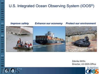
1. U.S. Integrated Ocean Observing System (IOOS®)
Z
Improve safety Enhance our economy Protect our environment
Zdenka Willis
Director, US IOOS Office
2. 85
6
11
2
4
10
3
7
9
1
U.S. IOOS®: Program Overview
Partnership effort that leverages dispersed national investments to deliver ocean,
coastal and Great Lakes data relevant to decision-makers
12
Coastal Component
– 17 Federal agencies
– 13 regional partners
Global Component
– US contribution to GOOS
2
5. IOOS - National Backbone
607: Buoys, Water Level Gauges,
Coastal and Estuary stations
PORTS®Satellites
Stream Gauges
Water Quality Research Infrastructure
5
6. IOOS – Regional Component
449: Buoys, Water Level Gauges,
Coastal and Estuary stations
High Frequency Radar
Waves
Tagging
6
8. US IOOS Program Office: DMAC Focus
Technical solutions
Imagecourtesysteve-dale.net
Building community
Implementation across the
enterprise
ImagecourtesyproactiveIT
Technical solutions
8
PeopleProcessTechnology
13. Northeast Coastal Acidification Network
(NECAN)
• Leadership by IOOS- NERACOOS
• Nexus of scientists, federal and
state agencies, and industry
partners
• Coordinates regional observing
and research to identify and
communicate critical
vulnerabilities to OA
- 16 Webinars; State of the Science
Workshop
13
14. OpenOcean
Workgroup
NOAA US
Fishery Data
3D Ocean
Observations
+
Physical Models
Regional
Habitat
Projections
To Inform Existing Single Species
Stock Assessment Models
(Catchability/Availability)
Catchability = availability * detectability
Science, Management, and
Industry Partnership
15. Biological and Physical Data Integration
Emerging capability: Beta version of emerging marine mammal health mapping tool
15
17. A third-party testbed for evaluating technologies
PH Sensors (2013/2014) – 7
DO Sensors II (2014/2015) – 10
Nutrient Sensor Challenge (2015/2016)
A forum for capacity and consensus building
An information clearinghouse for environmental technologies
ACT Services
Alliance for Coastal Technologies
17
18. US IOOS Coastal & Ocean Modeling Testbed
• Venue to facilitate testing and transitions into operations.
• Improving ties to different NOAA and partner Agency
modeling efforts.
• 5 projects; Hypoxia in Gulf of Mexico and Chesapeake Bay,
Inundation in PR/USVI, West Coast Operational Forecast
System, CI tools for comparing models/data
18
20. Marine Biodiversity
• 3 MBON projects: showing how
marine and coastal data can be
integrated into the system
• This U.S. regional contribution to
GEO BON
• Four geographic areas:
– the Florida Keys
– Monterey Bay
– Santa Barbara Channel Islands
– U.S. Chukchi Sea
• http://www.ioos.noaa.gov/biodive
rsity/welcome.html
20
Credit: MBARI
21. Enables decision making
Fosters Advances in Science and Technology
www.noaa.ioos.gov
https://www.facebook.com/usioosgov
@usioosgov
US IOOS at Work
21