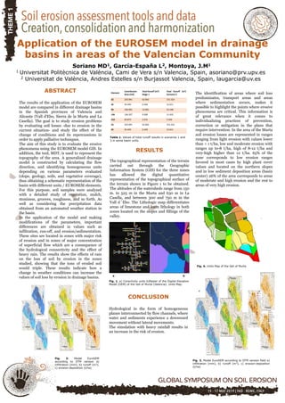
Application of the EUROSEM model in drainage basins in areas of the Valencian Community (Spain)
•
0 likes•116 views

The EUROSEM model was applied to three drainage basins in Valencia, Spain to study erosion problems and evaluate soil losses under current and changed conditions. Topography was represented using GIS and a digital elevation model. The basins were divided into homogeneous elements based on slope, geology, soils, and vegetation. Model results showed infiltration, runoff, and erosion/sedimentation values. Applying the model with heavy rain scenarios showed increased erosion risk and soil loss tripling, demonstrating how weather changes can worsen erosion in drainage basins.
Recommended

Recommended
More Related Content
What's hot
What's hot (10)
Similar to Application of the EUROSEM model in drainage basins in areas of the Valencian Community (Spain)
Similar to Application of the EUROSEM model in drainage basins in areas of the Valencian Community (Spain) (20)
More from ExternalEvents
More from ExternalEvents (20)
Recently uploaded
Recently uploaded (20)
Application of the EUROSEM model in drainage basins in areas of the Valencian Community (Spain)
- 1. Application of the EUROSEM model in drainage basins in areas of the Valencian Community Soriano MD1, García-España L2, Montoya, J.M1 1 Universitat Politècnica de València, Cami de Vera s/n Valencia, Spain, asoriano@prv.upv.es 2 Universitat de València, Andres Estelles s/n Burjassot Valencia, Spain, laugarcia@uv.es RESULTS The topographical representation of the terrain carried out through the Geographic Information System (GIS) for the three zones has allowed the digital quantitative representation of the topographical surface of the terrain shown in Figure 1 to be obtained. The altitudes of the watersheds range from 150 m. to 525 m in the Murta and 630 m in La Casella, and between 300 and 750 m in the Vall d´Ebo. The Lithologic map differentiates areas of limestone and loam lithology in both zones located on the slopes and fillings of the valley. Element Contribution Area (m2) Total Runoff (m3) Stage 1 Total Runoff (m3) Scenario 3 32 225.991 62.003 151.523 45 45.493 6.340 12.611 94 146.901 12.001 23.198 136 126.327 9.300 11.432 152 62.873 2.215 3.456 32 225.991 62.003 151.523 45 45.493 6.340 12.611 Table 1. Values of total runoff results in scenarios 1 and 3 in some basin units. The identification of areas where soil loss predominates, transport areas and areas where sedimentation occurs, makes it possible to highlight the points where erosive phenomena are critical. This information is of great relevance when it comes to individualizing practices of prevention, correction or mitigation in the plans that require intervention. In the area of the Murta soil erosion losses are represented in ranges ranging from light erosion with values lower than < 1 t/ha, low and moderate erosion with ranges up to-8 t/ha, high of 8-12 t/ha and very-high higher than 12 t/ha. 65% of the zone corresponds to low erosion ranges favored in most cases by high plant cover values and located on the northern slopes and in low sediment deposition areas (basin center) 26% of the area corresponds to areas of moderate and high erosion and the rest to areas of very high erosion. a b c a b c Fig. 3. Model EuroSEM according to DTM version field a) infiltration (mm), b) runoff (m3), c) erosion-deposition (t/ha) Fig. 4. Units Map of the Vall of Murta ABSTRACT The results of the application of the EUROSEM model are compared in different drainage basins in the Spanish provinces of Valencia and Alicante (Vall d'Ebo, Sierra de la Murta and La Casella). The goal is to study erosion problems by evaluating soil losses -due to erosion in the current situation- and study the effect of the change of conditions and its repercussions in order to apply palliative techniques. The aim of this study is to evaluate the erosive phenomena using the EUROSEM model GIS. In addition, the tool, MDT, is used to represent the topography of the area. A generalized drainage model is constructed by calculating the flow direction, and identifying homogeneous units depending on various parameters evaluated (slope, geology, soils, and vegetative coverage), thus obtaining a schematic representation of the basin with different units / EUROSEM elements. For this purpose, soil samples were analyzed with a detailed study of vegetation, mulch, stoniness, grooves, roughness, and so forth. As well as considering the precipitation data obtained from an automated weather station in the basin. In the application of the model and making modifications of the parameters, important differences are obtained in values such as infiltration, run-off, and erosion/sedimentation. These sites are located in zones with major risk of erosion and in zones of major concentration of superficial flow which are a consequence of the hydrological connectivity and the effect of heavy rain. The results show the effects of rain on the loss of soil by erosion in the zones studied, showing that the tons of eroded soil would triple. These results indicate how a change in weather conditions can increase the values of soil loss by erosion in drainage basins. CONCLUSION Hydrological in the form of homogeneous planes interconnected by flow channels, where water and sediments experience a downward movement without lateral movements. The simulation with heavy rainfall results in an increase in the risk of erosion. a b Fig. 1. a) Conectivity units b)Raster of the Digital Elevation Model (DEM) of the Vall of Murta (Valencia). Units Map. Fig. 2: Model EuroSEM according to DTM version a) infiltration (mm), b) runoff (m3), c) erosion-deposition (t/ha)