SlideShare a Scribd company logo
1 of 13
Download to read offline
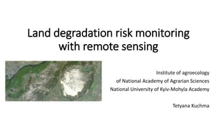
Land degradation risk
monitoring with remote
sensing
Institute of agroecology and natural management
National University of Kyiv-Mohyla Academy
Tetyana Kuchma
tanyakuchma@gmail.com
fragmentation of landscapes Lack of water protection zones and shelterbelts Plow to the boundary of forest and water bodies
Climate change mitigation requires the improvement of technologies to reduce the risks of
land degradation, especially in regions with deficient landscape structure and erodibility risk
Land degradation risk 2
Soil erosion monitoring
- 15 mln ha of erodive lands in Ukraine
- 15-20 ton of soil loss per year
- 100,000 ha/year the erosion rate
(Tarariko, 2016)
3
Soil erosion monitoring
Legend
soil samples
soil class 1 (chornozem clayey)
soil class 2 (chornozem normal)
soil class 3 (chornozem on granites)
soil class 4 (chornozem on sand)
soil class 5 (meadow soils)
Humus
-1,5 - 2,03
2,04 - 2,87
2,88 - 3,5
3,51 - 4,09
4,1 - 5,43
Multiple regression analysis of humus samples and reflection
combination (Landsat-8, 11 bands) for different soil types
4
Soil erosion monitoring
Humus
-1,5 - 2,03
2,04 - 2,87
2,88 - 3,5
3,51 - 4,09
4,1 - 5,43
Sample
humus
Model humus Model and sample humus
difference
Soil
class
Error
(%)
5
Total accuracy > 85%
Soil erosion monitoring
vegetation
soil erodibility
very high
high
moderate
low
Soil erodibility risk assessment and recommendations
development for crop structure and land use
management
• development of contour reclamation project (forestbelts
and terraces development)
• exclusion the lands with very high soil erodibility from
intensive agriculture
6
Soil erosion monitoring
Soil erodibility risk assessment and recommendations
development
Сontour reclamation project (Tarariko, 1990), decreasing a soil erodibility risk and crop condition according to the field
observation
7
Soil moisture monitoring
Soil moisture data is essential for planning agricultural
activities, crop condition monitoring and drought prediction.
InSAR remote sensing technology offers a means of measuring
surface soil moisture, however temporal and spatial data
resolution is crucial for effective remote sensing soil moisture
data integration in decision making.
NASA SMAP mission provides volumetric measurement of
water content in surface soil with three day revisit time
producing to the wide number of time series with global
coverage.
8
Soil moisture monitoring
0
0,1
0,2
0,3
0,4
0,5
0,6
0 10 20 30 40 50 60
R = 0,66
Precipitation, mm
Soilmoisture,cm3/cm3
Comparison of soil moisture map, obtained from SMAP data
and ground measurements of precipitation from gauging
stations (Ukrainian Hydrometcenter)
9
Soil moisture dynamic in Kyiv region
Data product time series were developed for the vegetation period (May– September 2016)
Soil moisture monitoring
0
0,05
0,1
0,15
0,2
0,25
0,3
0,35
0,4
12.05.2016
19.05.2016
26.05.2016
02.06.2016
09.06.2016
16.06.2016
23.06.2016
30.06.2016
07.07.2016
14.07.2016
21.07.2016
28.07.2016
04.08.2016
11.08.2016
18.08.2016
25.08.2016
01.09.2016
soil moisture dynamic
Since the loss of radar of SMAP satellite there
are only low spatial resolution data products
of 40 km is available from SMAP radiometer.
Dry soils are observed since 20th of June, 2016
10
Soil moisture monitoring
L3_SM_40km Gridded Radiometer Brightness Temperature / Soil Moisture and Sentinel-1A images were used to merge
with Sentinel-1 Radar data
> 70 % accuracy based on SMAP 9-km soil moisture L3 GRID
Combined use of Sentinel-1 and SMAP data for soil moisture mapping
11
Conclusions
• Need for continuous monitoring using common and clear for
agrarians land degradation indicators at national level
• Need for recommendations development and scenario modelling
algorithms to mitigate land degradation at local level
12
Thank you for your attention
Tetyana Kuchma, PhD
tanyakuchma@gmail.com
Oleshky Sands, one of the largest European desert (>160 km2)

More Related Content

What's hot

Application of GIS and RS in Watershed Management
Application of GIS and RS in Watershed ManagementApplication of GIS and RS in Watershed Management
Application of GIS and RS in Watershed Managementholegajendra
 
Iirs overview -Remote sensing and GIS application in Water Resources Management
Iirs overview -Remote sensing and GIS application in Water Resources ManagementIirs overview -Remote sensing and GIS application in Water Resources Management
Iirs overview -Remote sensing and GIS application in Water Resources ManagementTushar Dholakia
 
hyperspectral remote sensing and its geological applications
hyperspectral remote sensing and its geological applicationshyperspectral remote sensing and its geological applications
hyperspectral remote sensing and its geological applicationsabhijeet_banerjee
 
Soil crusting - causes, prevention and rectification
Soil crusting -   causes, prevention and rectificationSoil crusting -   causes, prevention and rectification
Soil crusting - causes, prevention and rectificationTamil Amutham Gopalan
 
Basic of gis concept and theories
Basic of gis concept and theoriesBasic of gis concept and theories
Basic of gis concept and theoriesMohsin Siddique
 
Aerial photography abraham thomas
Aerial photography abraham thomasAerial photography abraham thomas
Aerial photography abraham thomasSumant Diwakar
 
Application of RS and GIS in Groundwater Prospects Zonation
Application of RS and GIS in Groundwater Prospects ZonationApplication of RS and GIS in Groundwater Prospects Zonation
Application of RS and GIS in Groundwater Prospects ZonationVishwanath Awati
 
Soil mapping approach in gis
Soil mapping approach in gisSoil mapping approach in gis
Soil mapping approach in gisSakthivel R
 
identification of ground water potential zones using gis and remote sensing
identification of ground water potential zones using gis and remote sensingidentification of ground water potential zones using gis and remote sensing
identification of ground water potential zones using gis and remote sensingtp jayamohan
 
Flight planning (aerial Photogrammetry)
Flight planning            (aerial Photogrammetry)Flight planning            (aerial Photogrammetry)
Flight planning (aerial Photogrammetry)Mr Amol Ghogare
 
WETLAND MAPPING USING RS AND GIS
WETLAND MAPPING USING RS AND GISWETLAND MAPPING USING RS AND GIS
WETLAND MAPPING USING RS AND GISAbhiram Kanigolla
 
Climate change impact assessment on hydrology on river basins
Climate change impact assessment on hydrology on river basinsClimate change impact assessment on hydrology on river basins
Climate change impact assessment on hydrology on river basinsAbhiram Kanigolla
 
Remote sensing
 Remote sensing Remote sensing
Remote sensingFidy Zegge
 
Application of Remote sensing in wasteland Mappings.pptx
Application of Remote sensing in wasteland Mappings.pptxApplication of Remote sensing in wasteland Mappings.pptx
Application of Remote sensing in wasteland Mappings.pptxsapna kinattinkara
 
Introduction to soil property mapping
Introduction to soil property mappingIntroduction to soil property mapping
Introduction to soil property mappingExternalEvents
 
Application of gis and remote sensing in agriculture
Application of gis and remote sensing in agricultureApplication of gis and remote sensing in agriculture
Application of gis and remote sensing in agricultureRehana Qureshi
 

What's hot (20)

Application of GIS and RS in Watershed Management
Application of GIS and RS in Watershed ManagementApplication of GIS and RS in Watershed Management
Application of GIS and RS in Watershed Management
 
Remote sensing & gis
Remote sensing & gisRemote sensing & gis
Remote sensing & gis
 
Optical remote sensing
Optical remote sensingOptical remote sensing
Optical remote sensing
 
Iirs overview -Remote sensing and GIS application in Water Resources Management
Iirs overview -Remote sensing and GIS application in Water Resources ManagementIirs overview -Remote sensing and GIS application in Water Resources Management
Iirs overview -Remote sensing and GIS application in Water Resources Management
 
hyperspectral remote sensing and its geological applications
hyperspectral remote sensing and its geological applicationshyperspectral remote sensing and its geological applications
hyperspectral remote sensing and its geological applications
 
Soil crusting - causes, prevention and rectification
Soil crusting -   causes, prevention and rectificationSoil crusting -   causes, prevention and rectification
Soil crusting - causes, prevention and rectification
 
Basic of gis concept and theories
Basic of gis concept and theoriesBasic of gis concept and theories
Basic of gis concept and theories
 
Aerial photography abraham thomas
Aerial photography abraham thomasAerial photography abraham thomas
Aerial photography abraham thomas
 
Application of RS and GIS in Groundwater Prospects Zonation
Application of RS and GIS in Groundwater Prospects ZonationApplication of RS and GIS in Groundwater Prospects Zonation
Application of RS and GIS in Groundwater Prospects Zonation
 
Soil mapping approach in gis
Soil mapping approach in gisSoil mapping approach in gis
Soil mapping approach in gis
 
identification of ground water potential zones using gis and remote sensing
identification of ground water potential zones using gis and remote sensingidentification of ground water potential zones using gis and remote sensing
identification of ground water potential zones using gis and remote sensing
 
Flight planning (aerial Photogrammetry)
Flight planning            (aerial Photogrammetry)Flight planning            (aerial Photogrammetry)
Flight planning (aerial Photogrammetry)
 
Ground water prospects map
Ground water prospects mapGround water prospects map
Ground water prospects map
 
WETLAND MAPPING USING RS AND GIS
WETLAND MAPPING USING RS AND GISWETLAND MAPPING USING RS AND GIS
WETLAND MAPPING USING RS AND GIS
 
Climate change impact assessment on hydrology on river basins
Climate change impact assessment on hydrology on river basinsClimate change impact assessment on hydrology on river basins
Climate change impact assessment on hydrology on river basins
 
Remote sensing
 Remote sensing Remote sensing
Remote sensing
 
Evaluating soil erosion using gis
Evaluating soil erosion using gisEvaluating soil erosion using gis
Evaluating soil erosion using gis
 
Application of Remote sensing in wasteland Mappings.pptx
Application of Remote sensing in wasteland Mappings.pptxApplication of Remote sensing in wasteland Mappings.pptx
Application of Remote sensing in wasteland Mappings.pptx
 
Introduction to soil property mapping
Introduction to soil property mappingIntroduction to soil property mapping
Introduction to soil property mapping
 
Application of gis and remote sensing in agriculture
Application of gis and remote sensing in agricultureApplication of gis and remote sensing in agriculture
Application of gis and remote sensing in agriculture
 

Viewers also liked

Application of remote sensing in agriculture
Application of remote sensing in agricultureApplication of remote sensing in agriculture
Application of remote sensing in agriculturevajinder kalra
 
FISHERY RESOURCES MAEGEMENT
FISHERY RESOURCES MAEGEMENTFISHERY RESOURCES MAEGEMENT
FISHERY RESOURCES MAEGEMENTbadlongn
 
Urban sustainable vegetation management RS presentation slideshare
Urban sustainable vegetation management RS presentation slideshareUrban sustainable vegetation management RS presentation slideshare
Urban sustainable vegetation management RS presentation slideshareArborCarbon Pty Ltd
 
Companywide Assesment Of Quality
Companywide Assesment Of QualityCompanywide Assesment Of Quality
Companywide Assesment Of QualityHenmaidi Alfian
 
Soil Erosion for Vishwamitri River watershed using RS and GIS
Soil Erosion for Vishwamitri River watershed using RS and GISSoil Erosion for Vishwamitri River watershed using RS and GIS
Soil Erosion for Vishwamitri River watershed using RS and GISvishvam Pancholi
 
Health Need Assessment
Health Need AssessmentHealth Need Assessment
Health Need AssessmentRajbir Kaur
 
Application of Remote Sensing in Agriculture
Application of Remote Sensing in AgricultureApplication of Remote Sensing in Agriculture
Application of Remote Sensing in AgricultureUTTAM KUMAR
 
Natural vegetation (By Shaurya Nagpal)
Natural vegetation (By Shaurya Nagpal)Natural vegetation (By Shaurya Nagpal)
Natural vegetation (By Shaurya Nagpal)Kashish Nagpal
 
APPLICATIONS OF REMOTE SENSING AND GIS IN WATERSHED MANAGEMENT
APPLICATIONS OF REMOTE SENSING AND GIS IN WATERSHED MANAGEMENTAPPLICATIONS OF REMOTE SENSING AND GIS IN WATERSHED MANAGEMENT
APPLICATIONS OF REMOTE SENSING AND GIS IN WATERSHED MANAGEMENTSriram Chakravarthy
 
2011 sec 3 elective geography chapter 03 • types of natural vegetation
2011 sec 3 elective geography chapter 03 • types of natural vegetation2011 sec 3 elective geography chapter 03 • types of natural vegetation
2011 sec 3 elective geography chapter 03 • types of natural vegetationedmundgoy
 
payroll process
payroll processpayroll process
payroll processonearbaein
 
Natural vegetation and wildlife
Natural vegetation and wildlifeNatural vegetation and wildlife
Natural vegetation and wildlifeSaket Jain
 

Viewers also liked (16)

Application of remote sensing in agriculture
Application of remote sensing in agricultureApplication of remote sensing in agriculture
Application of remote sensing in agriculture
 
Presentation
PresentationPresentation
Presentation
 
FISHERY RESOURCES MAEGEMENT
FISHERY RESOURCES MAEGEMENTFISHERY RESOURCES MAEGEMENT
FISHERY RESOURCES MAEGEMENT
 
Urban sustainable vegetation management RS presentation slideshare
Urban sustainable vegetation management RS presentation slideshareUrban sustainable vegetation management RS presentation slideshare
Urban sustainable vegetation management RS presentation slideshare
 
IFPRI-Using new technologies to validating Crop-Cutting Experiments-Michael Mann
IFPRI-Using new technologies to validating Crop-Cutting Experiments-Michael MannIFPRI-Using new technologies to validating Crop-Cutting Experiments-Michael Mann
IFPRI-Using new technologies to validating Crop-Cutting Experiments-Michael Mann
 
Soil moisture
Soil moistureSoil moisture
Soil moisture
 
Companywide Assesment Of Quality
Companywide Assesment Of QualityCompanywide Assesment Of Quality
Companywide Assesment Of Quality
 
Soil Erosion for Vishwamitri River watershed using RS and GIS
Soil Erosion for Vishwamitri River watershed using RS and GISSoil Erosion for Vishwamitri River watershed using RS and GIS
Soil Erosion for Vishwamitri River watershed using RS and GIS
 
Health Need Assessment
Health Need AssessmentHealth Need Assessment
Health Need Assessment
 
Ppt of land degradation
Ppt of land degradation Ppt of land degradation
Ppt of land degradation
 
Application of Remote Sensing in Agriculture
Application of Remote Sensing in AgricultureApplication of Remote Sensing in Agriculture
Application of Remote Sensing in Agriculture
 
Natural vegetation (By Shaurya Nagpal)
Natural vegetation (By Shaurya Nagpal)Natural vegetation (By Shaurya Nagpal)
Natural vegetation (By Shaurya Nagpal)
 
APPLICATIONS OF REMOTE SENSING AND GIS IN WATERSHED MANAGEMENT
APPLICATIONS OF REMOTE SENSING AND GIS IN WATERSHED MANAGEMENTAPPLICATIONS OF REMOTE SENSING AND GIS IN WATERSHED MANAGEMENT
APPLICATIONS OF REMOTE SENSING AND GIS IN WATERSHED MANAGEMENT
 
2011 sec 3 elective geography chapter 03 • types of natural vegetation
2011 sec 3 elective geography chapter 03 • types of natural vegetation2011 sec 3 elective geography chapter 03 • types of natural vegetation
2011 sec 3 elective geography chapter 03 • types of natural vegetation
 
payroll process
payroll processpayroll process
payroll process
 
Natural vegetation and wildlife
Natural vegetation and wildlifeNatural vegetation and wildlife
Natural vegetation and wildlife
 

Similar to Land degradation risk assesment with remote sensing presentation

Application of the EUROSEM model in drainage basins in areas of the Valencian...
Application of the EUROSEM model in drainage basins in areas of the Valencian...Application of the EUROSEM model in drainage basins in areas of the Valencian...
Application of the EUROSEM model in drainage basins in areas of the Valencian...ExternalEvents
 
2. VULNERABILITY ASSESSMENT OF SOIL EROSION USING GEOSPATIAL TECHNIQUES
2. VULNERABILITY ASSESSMENT OF SOIL EROSION USING GEOSPATIAL TECHNIQUES2. VULNERABILITY ASSESSMENT OF SOIL EROSION USING GEOSPATIAL TECHNIQUES
2. VULNERABILITY ASSESSMENT OF SOIL EROSION USING GEOSPATIAL TECHNIQUESDr. Ravinder Jangra
 
Predicting root zone soil moisture with satellite near-surface moisture data ...
Predicting root zone soil moisture with satellite near-surface moisture data ...Predicting root zone soil moisture with satellite near-surface moisture data ...
Predicting root zone soil moisture with satellite near-surface moisture data ...Salvatore Manfreda
 
Merging remote and in-situ land degradation indicators in soil erosion contro...
Merging remote and in-situ land degradation indicators in soil erosion contro...Merging remote and in-situ land degradation indicators in soil erosion contro...
Merging remote and in-situ land degradation indicators in soil erosion contro...Stankovic G
 
McNairn soil moisture IGARSS 2011 v2.ppt
McNairn soil moisture IGARSS 2011 v2.pptMcNairn soil moisture IGARSS 2011 v2.ppt
McNairn soil moisture IGARSS 2011 v2.pptgrssieee
 
Merging remote and in-situ land degradation indicators in soil erosion contro...
Merging remote and in-situ land degradation indicators in soil erosion contro...Merging remote and in-situ land degradation indicators in soil erosion contro...
Merging remote and in-situ land degradation indicators in soil erosion contro...ExternalEvents
 
Comparison of remote sensing soil moisture dataset across a range of spatial ...
Comparison of remote sensing soil moisture dataset across a range of spatial ...Comparison of remote sensing soil moisture dataset across a range of spatial ...
Comparison of remote sensing soil moisture dataset across a range of spatial ...ICGCat
 
Introduction of three nuclear techniques integrated in order to strengthen i...
 Introduction of three nuclear techniques integrated in order to strengthen i... Introduction of three nuclear techniques integrated in order to strengthen i...
Introduction of three nuclear techniques integrated in order to strengthen i...ExternalEvents
 
Predicting and mapping soil properties using proximal/remote sensing by Zhou ...
Predicting and mapping soil properties using proximal/remote sensing by Zhou ...Predicting and mapping soil properties using proximal/remote sensing by Zhou ...
Predicting and mapping soil properties using proximal/remote sensing by Zhou ...FAO
 
Predicting longterm-dynamics-of-soil-salinity-and-sodicity-on-a-global-scale2...
Predicting longterm-dynamics-of-soil-salinity-and-sodicity-on-a-global-scale2...Predicting longterm-dynamics-of-soil-salinity-and-sodicity-on-a-global-scale2...
Predicting longterm-dynamics-of-soil-salinity-and-sodicity-on-a-global-scale2...erosslo
 
Ukrainian chernozems as a factor in global food security and resilience of ag...
Ukrainian chernozems as a factor in global food security and resilience of ag...Ukrainian chernozems as a factor in global food security and resilience of ag...
Ukrainian chernozems as a factor in global food security and resilience of ag...ExternalEvents
 
Soil spectroscopy as a tool for the spatial assessment of soil erosion states...
Soil spectroscopy as a tool for the spatial assessment of soil erosion states...Soil spectroscopy as a tool for the spatial assessment of soil erosion states...
Soil spectroscopy as a tool for the spatial assessment of soil erosion states...FAO
 
SOIL MOISTURE: A key variable for linking small scale catchment hydrology to ...
SOIL MOISTURE: A key variable for linking small scale catchment hydrology to ...SOIL MOISTURE: A key variable for linking small scale catchment hydrology to ...
SOIL MOISTURE: A key variable for linking small scale catchment hydrology to ...Luca Brocca
 
Spatial variation in surface runoff at catchment scale, the case study of adi...
Spatial variation in surface runoff at catchment scale, the case study of adi...Spatial variation in surface runoff at catchment scale, the case study of adi...
Spatial variation in surface runoff at catchment scale, the case study of adi...Alexander Decker
 
The use of spectral libraries to reduce the influence of soil moisture on the...
The use of spectral libraries to reduce the influence of soil moisture on the...The use of spectral libraries to reduce the influence of soil moisture on the...
The use of spectral libraries to reduce the influence of soil moisture on the...FAO
 
Integrated hydro-geological risk for Mallero (Alpine Italy) – part 1: geology
Integrated hydro-geological risk for Mallero (Alpine Italy) – part 1: geologyIntegrated hydro-geological risk for Mallero (Alpine Italy) – part 1: geology
Integrated hydro-geological risk for Mallero (Alpine Italy) – part 1: geologyMaryam Izadifar
 

Similar to Land degradation risk assesment with remote sensing presentation (20)

Application of the EUROSEM model in drainage basins in areas of the Valencian...
Application of the EUROSEM model in drainage basins in areas of the Valencian...Application of the EUROSEM model in drainage basins in areas of the Valencian...
Application of the EUROSEM model in drainage basins in areas of the Valencian...
 
2. VULNERABILITY ASSESSMENT OF SOIL EROSION USING GEOSPATIAL TECHNIQUES
2. VULNERABILITY ASSESSMENT OF SOIL EROSION USING GEOSPATIAL TECHNIQUES2. VULNERABILITY ASSESSMENT OF SOIL EROSION USING GEOSPATIAL TECHNIQUES
2. VULNERABILITY ASSESSMENT OF SOIL EROSION USING GEOSPATIAL TECHNIQUES
 
Predicting root zone soil moisture with satellite near-surface moisture data ...
Predicting root zone soil moisture with satellite near-surface moisture data ...Predicting root zone soil moisture with satellite near-surface moisture data ...
Predicting root zone soil moisture with satellite near-surface moisture data ...
 
Merging remote and in-situ land degradation indicators in soil erosion contro...
Merging remote and in-situ land degradation indicators in soil erosion contro...Merging remote and in-situ land degradation indicators in soil erosion contro...
Merging remote and in-situ land degradation indicators in soil erosion contro...
 
Why care about peatlands? (Daniel Murdiyarso)
Why care about peatlands? (Daniel Murdiyarso)Why care about peatlands? (Daniel Murdiyarso)
Why care about peatlands? (Daniel Murdiyarso)
 
McNairn soil moisture IGARSS 2011 v2.ppt
McNairn soil moisture IGARSS 2011 v2.pptMcNairn soil moisture IGARSS 2011 v2.ppt
McNairn soil moisture IGARSS 2011 v2.ppt
 
Merging remote and in-situ land degradation indicators in soil erosion contro...
Merging remote and in-situ land degradation indicators in soil erosion contro...Merging remote and in-situ land degradation indicators in soil erosion contro...
Merging remote and in-situ land degradation indicators in soil erosion contro...
 
Edri et al 2016
Edri et al 2016Edri et al 2016
Edri et al 2016
 
Comparison of remote sensing soil moisture dataset across a range of spatial ...
Comparison of remote sensing soil moisture dataset across a range of spatial ...Comparison of remote sensing soil moisture dataset across a range of spatial ...
Comparison of remote sensing soil moisture dataset across a range of spatial ...
 
Jaysukh C Songara
Jaysukh C SongaraJaysukh C Songara
Jaysukh C Songara
 
Introduction of three nuclear techniques integrated in order to strengthen i...
 Introduction of three nuclear techniques integrated in order to strengthen i... Introduction of three nuclear techniques integrated in order to strengthen i...
Introduction of three nuclear techniques integrated in order to strengthen i...
 
Predicting and mapping soil properties using proximal/remote sensing by Zhou ...
Predicting and mapping soil properties using proximal/remote sensing by Zhou ...Predicting and mapping soil properties using proximal/remote sensing by Zhou ...
Predicting and mapping soil properties using proximal/remote sensing by Zhou ...
 
Predicting longterm-dynamics-of-soil-salinity-and-sodicity-on-a-global-scale2...
Predicting longterm-dynamics-of-soil-salinity-and-sodicity-on-a-global-scale2...Predicting longterm-dynamics-of-soil-salinity-and-sodicity-on-a-global-scale2...
Predicting longterm-dynamics-of-soil-salinity-and-sodicity-on-a-global-scale2...
 
Ukrainian chernozems as a factor in global food security and resilience of ag...
Ukrainian chernozems as a factor in global food security and resilience of ag...Ukrainian chernozems as a factor in global food security and resilience of ag...
Ukrainian chernozems as a factor in global food security and resilience of ag...
 
Soil spectroscopy as a tool for the spatial assessment of soil erosion states...
Soil spectroscopy as a tool for the spatial assessment of soil erosion states...Soil spectroscopy as a tool for the spatial assessment of soil erosion states...
Soil spectroscopy as a tool for the spatial assessment of soil erosion states...
 
SOIL MOISTURE: A key variable for linking small scale catchment hydrology to ...
SOIL MOISTURE: A key variable for linking small scale catchment hydrology to ...SOIL MOISTURE: A key variable for linking small scale catchment hydrology to ...
SOIL MOISTURE: A key variable for linking small scale catchment hydrology to ...
 
Spatial variation in surface runoff at catchment scale, the case study of adi...
Spatial variation in surface runoff at catchment scale, the case study of adi...Spatial variation in surface runoff at catchment scale, the case study of adi...
Spatial variation in surface runoff at catchment scale, the case study of adi...
 
The use of spectral libraries to reduce the influence of soil moisture on the...
The use of spectral libraries to reduce the influence of soil moisture on the...The use of spectral libraries to reduce the influence of soil moisture on the...
The use of spectral libraries to reduce the influence of soil moisture on the...
 
Sabaghy_Workshop
Sabaghy_WorkshopSabaghy_Workshop
Sabaghy_Workshop
 
Integrated hydro-geological risk for Mallero (Alpine Italy) – part 1: geology
Integrated hydro-geological risk for Mallero (Alpine Italy) – part 1: geologyIntegrated hydro-geological risk for Mallero (Alpine Italy) – part 1: geology
Integrated hydro-geological risk for Mallero (Alpine Italy) – part 1: geology
 

Recently uploaded

Hot Call Girls |Delhi |Preet Vihar ☎ 9711199171 Book Your One night Stand
Hot Call Girls |Delhi |Preet Vihar ☎ 9711199171 Book Your One night StandHot Call Girls |Delhi |Preet Vihar ☎ 9711199171 Book Your One night Stand
Hot Call Girls |Delhi |Preet Vihar ☎ 9711199171 Book Your One night Standkumarajju5765
 
(PARI) Viman Nagar Call Girls Just Call 7001035870 [ Cash on Delivery ] Pune ...
(PARI) Viman Nagar Call Girls Just Call 7001035870 [ Cash on Delivery ] Pune ...(PARI) Viman Nagar Call Girls Just Call 7001035870 [ Cash on Delivery ] Pune ...
(PARI) Viman Nagar Call Girls Just Call 7001035870 [ Cash on Delivery ] Pune ...ranjana rawat
 
BOOK Call Girls in (Dwarka) CALL | 8377087607 Delhi Escorts Services
BOOK Call Girls in (Dwarka) CALL | 8377087607 Delhi Escorts ServicesBOOK Call Girls in (Dwarka) CALL | 8377087607 Delhi Escorts Services
BOOK Call Girls in (Dwarka) CALL | 8377087607 Delhi Escorts Servicesdollysharma2066
 
(AISHA) Wagholi Call Girls Just Call 7001035870 [ Cash on Delivery ] Pune Esc...
(AISHA) Wagholi Call Girls Just Call 7001035870 [ Cash on Delivery ] Pune Esc...(AISHA) Wagholi Call Girls Just Call 7001035870 [ Cash on Delivery ] Pune Esc...
(AISHA) Wagholi Call Girls Just Call 7001035870 [ Cash on Delivery ] Pune Esc...ranjana rawat
 
Call Girls Mumbai Gayatri 8617697112 Independent Escort Service Mumbai
Call Girls Mumbai Gayatri 8617697112 Independent Escort Service MumbaiCall Girls Mumbai Gayatri 8617697112 Independent Escort Service Mumbai
Call Girls Mumbai Gayatri 8617697112 Independent Escort Service MumbaiCall girls in Ahmedabad High profile
 
Mumbai Call Girls, 💞 Prity 9892124323, Navi Mumbai Call girls
Mumbai Call Girls, 💞  Prity 9892124323, Navi Mumbai Call girlsMumbai Call Girls, 💞  Prity 9892124323, Navi Mumbai Call girls
Mumbai Call Girls, 💞 Prity 9892124323, Navi Mumbai Call girlsPooja Nehwal
 
(ANAYA) Call Girls Hadapsar ( 7001035870 ) HI-Fi Pune Escorts Service
(ANAYA) Call Girls Hadapsar ( 7001035870 ) HI-Fi Pune Escorts Service(ANAYA) Call Girls Hadapsar ( 7001035870 ) HI-Fi Pune Escorts Service
(ANAYA) Call Girls Hadapsar ( 7001035870 ) HI-Fi Pune Escorts Serviceranjana rawat
 
VIP Call Girls Ramanthapur ( Hyderabad ) Phone 8250192130 | ₹5k To 25k With R...
VIP Call Girls Ramanthapur ( Hyderabad ) Phone 8250192130 | ₹5k To 25k With R...VIP Call Girls Ramanthapur ( Hyderabad ) Phone 8250192130 | ₹5k To 25k With R...
VIP Call Girls Ramanthapur ( Hyderabad ) Phone 8250192130 | ₹5k To 25k With R...Suhani Kapoor
 
Environmental Toxicology (environmental biology)
Environmental Toxicology (environmental biology)Environmental Toxicology (environmental biology)
Environmental Toxicology (environmental biology)RaviPrajapat11
 
(NANDITA) Hadapsar Call Girls Just Call 7001035870 [ Cash on Delivery ] Pune ...
(NANDITA) Hadapsar Call Girls Just Call 7001035870 [ Cash on Delivery ] Pune ...(NANDITA) Hadapsar Call Girls Just Call 7001035870 [ Cash on Delivery ] Pune ...
(NANDITA) Hadapsar Call Girls Just Call 7001035870 [ Cash on Delivery ] Pune ...ranjana rawat
 
Sustainable Clothing Strategies and Challenges
Sustainable Clothing Strategies and ChallengesSustainable Clothing Strategies and Challenges
Sustainable Clothing Strategies and ChallengesDr. Salem Baidas
 
Call Girls Service Nagpur Aditi Call 7001035870 Meet With Nagpur Escorts
Call Girls Service Nagpur Aditi Call 7001035870 Meet With Nagpur EscortsCall Girls Service Nagpur Aditi Call 7001035870 Meet With Nagpur Escorts
Call Girls Service Nagpur Aditi Call 7001035870 Meet With Nagpur EscortsCall Girls in Nagpur High Profile
 
The Most Attractive Pune Call Girls Shirwal 8250192130 Will You Miss This Cha...
The Most Attractive Pune Call Girls Shirwal 8250192130 Will You Miss This Cha...The Most Attractive Pune Call Girls Shirwal 8250192130 Will You Miss This Cha...
The Most Attractive Pune Call Girls Shirwal 8250192130 Will You Miss This Cha...ranjana rawat
 
(DIYA) Call Girls Sinhagad Road ( 7001035870 ) HI-Fi Pune Escorts Service
(DIYA) Call Girls Sinhagad Road ( 7001035870 ) HI-Fi Pune Escorts Service(DIYA) Call Girls Sinhagad Road ( 7001035870 ) HI-Fi Pune Escorts Service
(DIYA) Call Girls Sinhagad Road ( 7001035870 ) HI-Fi Pune Escorts Serviceranjana rawat
 
(ANIKA) Call Girls Wagholi ( 7001035870 ) HI-Fi Pune Escorts Service
(ANIKA) Call Girls Wagholi ( 7001035870 ) HI-Fi Pune Escorts Service(ANIKA) Call Girls Wagholi ( 7001035870 ) HI-Fi Pune Escorts Service
(ANIKA) Call Girls Wagholi ( 7001035870 ) HI-Fi Pune Escorts Serviceranjana rawat
 
Call Girls In Okhla DELHI ~9654467111~ Short 1500 Night 6000
Call Girls In Okhla DELHI ~9654467111~ Short 1500 Night 6000Call Girls In Okhla DELHI ~9654467111~ Short 1500 Night 6000
Call Girls In Okhla DELHI ~9654467111~ Short 1500 Night 6000Sapana Sha
 
webinaire-green-mirror-episode-2-Smart contracts and virtual purchase agreeme...
webinaire-green-mirror-episode-2-Smart contracts and virtual purchase agreeme...webinaire-green-mirror-episode-2-Smart contracts and virtual purchase agreeme...
webinaire-green-mirror-episode-2-Smart contracts and virtual purchase agreeme...Cluster TWEED
 

Recently uploaded (20)

Hot Call Girls |Delhi |Preet Vihar ☎ 9711199171 Book Your One night Stand
Hot Call Girls |Delhi |Preet Vihar ☎ 9711199171 Book Your One night StandHot Call Girls |Delhi |Preet Vihar ☎ 9711199171 Book Your One night Stand
Hot Call Girls |Delhi |Preet Vihar ☎ 9711199171 Book Your One night Stand
 
(PARI) Viman Nagar Call Girls Just Call 7001035870 [ Cash on Delivery ] Pune ...
(PARI) Viman Nagar Call Girls Just Call 7001035870 [ Cash on Delivery ] Pune ...(PARI) Viman Nagar Call Girls Just Call 7001035870 [ Cash on Delivery ] Pune ...
(PARI) Viman Nagar Call Girls Just Call 7001035870 [ Cash on Delivery ] Pune ...
 
BOOK Call Girls in (Dwarka) CALL | 8377087607 Delhi Escorts Services
BOOK Call Girls in (Dwarka) CALL | 8377087607 Delhi Escorts ServicesBOOK Call Girls in (Dwarka) CALL | 8377087607 Delhi Escorts Services
BOOK Call Girls in (Dwarka) CALL | 8377087607 Delhi Escorts Services
 
9953056974 ,Low Rate Call Girls In Adarsh Nagar Delhi 24hrs Available
9953056974 ,Low Rate Call Girls In Adarsh Nagar  Delhi 24hrs Available9953056974 ,Low Rate Call Girls In Adarsh Nagar  Delhi 24hrs Available
9953056974 ,Low Rate Call Girls In Adarsh Nagar Delhi 24hrs Available
 
(AISHA) Wagholi Call Girls Just Call 7001035870 [ Cash on Delivery ] Pune Esc...
(AISHA) Wagholi Call Girls Just Call 7001035870 [ Cash on Delivery ] Pune Esc...(AISHA) Wagholi Call Girls Just Call 7001035870 [ Cash on Delivery ] Pune Esc...
(AISHA) Wagholi Call Girls Just Call 7001035870 [ Cash on Delivery ] Pune Esc...
 
Call Girls Mumbai Gayatri 8617697112 Independent Escort Service Mumbai
Call Girls Mumbai Gayatri 8617697112 Independent Escort Service MumbaiCall Girls Mumbai Gayatri 8617697112 Independent Escort Service Mumbai
Call Girls Mumbai Gayatri 8617697112 Independent Escort Service Mumbai
 
Mumbai Call Girls, 💞 Prity 9892124323, Navi Mumbai Call girls
Mumbai Call Girls, 💞  Prity 9892124323, Navi Mumbai Call girlsMumbai Call Girls, 💞  Prity 9892124323, Navi Mumbai Call girls
Mumbai Call Girls, 💞 Prity 9892124323, Navi Mumbai Call girls
 
(ANAYA) Call Girls Hadapsar ( 7001035870 ) HI-Fi Pune Escorts Service
(ANAYA) Call Girls Hadapsar ( 7001035870 ) HI-Fi Pune Escorts Service(ANAYA) Call Girls Hadapsar ( 7001035870 ) HI-Fi Pune Escorts Service
(ANAYA) Call Girls Hadapsar ( 7001035870 ) HI-Fi Pune Escorts Service
 
Call Girls In Pratap Nagar꧁❤ 🔝 9953056974🔝❤꧂ Escort ServiCe
Call Girls In Pratap Nagar꧁❤ 🔝 9953056974🔝❤꧂ Escort ServiCeCall Girls In Pratap Nagar꧁❤ 🔝 9953056974🔝❤꧂ Escort ServiCe
Call Girls In Pratap Nagar꧁❤ 🔝 9953056974🔝❤꧂ Escort ServiCe
 
VIP Call Girls Ramanthapur ( Hyderabad ) Phone 8250192130 | ₹5k To 25k With R...
VIP Call Girls Ramanthapur ( Hyderabad ) Phone 8250192130 | ₹5k To 25k With R...VIP Call Girls Ramanthapur ( Hyderabad ) Phone 8250192130 | ₹5k To 25k With R...
VIP Call Girls Ramanthapur ( Hyderabad ) Phone 8250192130 | ₹5k To 25k With R...
 
Environmental Toxicology (environmental biology)
Environmental Toxicology (environmental biology)Environmental Toxicology (environmental biology)
Environmental Toxicology (environmental biology)
 
(NANDITA) Hadapsar Call Girls Just Call 7001035870 [ Cash on Delivery ] Pune ...
(NANDITA) Hadapsar Call Girls Just Call 7001035870 [ Cash on Delivery ] Pune ...(NANDITA) Hadapsar Call Girls Just Call 7001035870 [ Cash on Delivery ] Pune ...
(NANDITA) Hadapsar Call Girls Just Call 7001035870 [ Cash on Delivery ] Pune ...
 
Sustainable Clothing Strategies and Challenges
Sustainable Clothing Strategies and ChallengesSustainable Clothing Strategies and Challenges
Sustainable Clothing Strategies and Challenges
 
Green Banking
Green Banking Green Banking
Green Banking
 
Call Girls Service Nagpur Aditi Call 7001035870 Meet With Nagpur Escorts
Call Girls Service Nagpur Aditi Call 7001035870 Meet With Nagpur EscortsCall Girls Service Nagpur Aditi Call 7001035870 Meet With Nagpur Escorts
Call Girls Service Nagpur Aditi Call 7001035870 Meet With Nagpur Escorts
 
The Most Attractive Pune Call Girls Shirwal 8250192130 Will You Miss This Cha...
The Most Attractive Pune Call Girls Shirwal 8250192130 Will You Miss This Cha...The Most Attractive Pune Call Girls Shirwal 8250192130 Will You Miss This Cha...
The Most Attractive Pune Call Girls Shirwal 8250192130 Will You Miss This Cha...
 
(DIYA) Call Girls Sinhagad Road ( 7001035870 ) HI-Fi Pune Escorts Service
(DIYA) Call Girls Sinhagad Road ( 7001035870 ) HI-Fi Pune Escorts Service(DIYA) Call Girls Sinhagad Road ( 7001035870 ) HI-Fi Pune Escorts Service
(DIYA) Call Girls Sinhagad Road ( 7001035870 ) HI-Fi Pune Escorts Service
 
(ANIKA) Call Girls Wagholi ( 7001035870 ) HI-Fi Pune Escorts Service
(ANIKA) Call Girls Wagholi ( 7001035870 ) HI-Fi Pune Escorts Service(ANIKA) Call Girls Wagholi ( 7001035870 ) HI-Fi Pune Escorts Service
(ANIKA) Call Girls Wagholi ( 7001035870 ) HI-Fi Pune Escorts Service
 
Call Girls In Okhla DELHI ~9654467111~ Short 1500 Night 6000
Call Girls In Okhla DELHI ~9654467111~ Short 1500 Night 6000Call Girls In Okhla DELHI ~9654467111~ Short 1500 Night 6000
Call Girls In Okhla DELHI ~9654467111~ Short 1500 Night 6000
 
webinaire-green-mirror-episode-2-Smart contracts and virtual purchase agreeme...
webinaire-green-mirror-episode-2-Smart contracts and virtual purchase agreeme...webinaire-green-mirror-episode-2-Smart contracts and virtual purchase agreeme...
webinaire-green-mirror-episode-2-Smart contracts and virtual purchase agreeme...
 

Land degradation risk assesment with remote sensing presentation

  • 1. Land degradation risk monitoring with remote sensing Institute of agroecology and natural management National University of Kyiv-Mohyla Academy Tetyana Kuchma tanyakuchma@gmail.com
  • 2. fragmentation of landscapes Lack of water protection zones and shelterbelts Plow to the boundary of forest and water bodies Climate change mitigation requires the improvement of technologies to reduce the risks of land degradation, especially in regions with deficient landscape structure and erodibility risk Land degradation risk 2
  • 3. Soil erosion monitoring - 15 mln ha of erodive lands in Ukraine - 15-20 ton of soil loss per year - 100,000 ha/year the erosion rate (Tarariko, 2016) 3
  • 4. Soil erosion monitoring Legend soil samples soil class 1 (chornozem clayey) soil class 2 (chornozem normal) soil class 3 (chornozem on granites) soil class 4 (chornozem on sand) soil class 5 (meadow soils) Humus -1,5 - 2,03 2,04 - 2,87 2,88 - 3,5 3,51 - 4,09 4,1 - 5,43 Multiple regression analysis of humus samples and reflection combination (Landsat-8, 11 bands) for different soil types 4
  • 5. Soil erosion monitoring Humus -1,5 - 2,03 2,04 - 2,87 2,88 - 3,5 3,51 - 4,09 4,1 - 5,43 Sample humus Model humus Model and sample humus difference Soil class Error (%) 5 Total accuracy > 85%
  • 6. Soil erosion monitoring vegetation soil erodibility very high high moderate low Soil erodibility risk assessment and recommendations development for crop structure and land use management • development of contour reclamation project (forestbelts and terraces development) • exclusion the lands with very high soil erodibility from intensive agriculture 6
  • 7. Soil erosion monitoring Soil erodibility risk assessment and recommendations development Сontour reclamation project (Tarariko, 1990), decreasing a soil erodibility risk and crop condition according to the field observation 7
  • 8. Soil moisture monitoring Soil moisture data is essential for planning agricultural activities, crop condition monitoring and drought prediction. InSAR remote sensing technology offers a means of measuring surface soil moisture, however temporal and spatial data resolution is crucial for effective remote sensing soil moisture data integration in decision making. NASA SMAP mission provides volumetric measurement of water content in surface soil with three day revisit time producing to the wide number of time series with global coverage. 8
  • 9. Soil moisture monitoring 0 0,1 0,2 0,3 0,4 0,5 0,6 0 10 20 30 40 50 60 R = 0,66 Precipitation, mm Soilmoisture,cm3/cm3 Comparison of soil moisture map, obtained from SMAP data and ground measurements of precipitation from gauging stations (Ukrainian Hydrometcenter) 9
  • 10. Soil moisture dynamic in Kyiv region Data product time series were developed for the vegetation period (May– September 2016) Soil moisture monitoring 0 0,05 0,1 0,15 0,2 0,25 0,3 0,35 0,4 12.05.2016 19.05.2016 26.05.2016 02.06.2016 09.06.2016 16.06.2016 23.06.2016 30.06.2016 07.07.2016 14.07.2016 21.07.2016 28.07.2016 04.08.2016 11.08.2016 18.08.2016 25.08.2016 01.09.2016 soil moisture dynamic Since the loss of radar of SMAP satellite there are only low spatial resolution data products of 40 km is available from SMAP radiometer. Dry soils are observed since 20th of June, 2016 10
  • 11. Soil moisture monitoring L3_SM_40km Gridded Radiometer Brightness Temperature / Soil Moisture and Sentinel-1A images were used to merge with Sentinel-1 Radar data > 70 % accuracy based on SMAP 9-km soil moisture L3 GRID Combined use of Sentinel-1 and SMAP data for soil moisture mapping 11
  • 12. Conclusions • Need for continuous monitoring using common and clear for agrarians land degradation indicators at national level • Need for recommendations development and scenario modelling algorithms to mitigate land degradation at local level 12
  • 13. Thank you for your attention Tetyana Kuchma, PhD tanyakuchma@gmail.com Oleshky Sands, one of the largest European desert (>160 km2)