The "forest application" under Forest (Conservation) Act, 1980 also require clarity on "mining leases", acquire under the Mines & Minerals (Development & Regulation) Act, 1957; Coal Bearing Areas (Acquisition & Development) Act, 1957 or Coal Areas Special Provisions Act, 2015.
The applicant is required to submit "lease covenant" of explain the absence of the document. Details of reconnaissance permit, prospecting licence, geological reports, geological or extractable reserves, opencast versus underground mining, phase-wise mining possible or not, land subsidence report in case of underground mines, mining plan - duly sanctioned by the Ministry of Coal of Indian Bureau of Mines or the State Government.
Reclamation Plan along with maps, phase-wise technical and biological reclamation of mined-out areas, ultimate mine pit, if any.
Safety Zone Management plan, Landscape Management Plan, etc. for consideration by the "Forest Appraisal Committee" (FAC) under the Forest (Conservation) Act, 1980.
SELECTION OF U NDERGROUND COAL MINING TECHNOLOGY FOR DEEP SEATED COAL DEPOSITS, VIZ; CONTINUOUS MINER, LONGWALL, OPERATIONAL & TECHNICAL PARAMETERS CONSIDERED FOR SELECTION OF CONTINUOUS MINER
This presentation deals with introductory lecture on Mining Law in India and also focuses on the Constitutional framework regarding Mining Law in the country
SLOPE STABILITY RADAR-AN ADVANCED SLOPE MOVEMENT MONITORING SYSTEMRathin Biswas
Pit Slope Monitoring is a vital concern for Geotechnical Engineering. An early warning is required for
safety of the miners; proper selection of the monitoring tool is a vital parameter for miners safety visa-
vis economics. Slope Stability Radar being an advanced monitoring system, gives advance information
for slope movement.
Definition of Open pit Mining Parameters, Open pit Mining method, Bench, Open Pit Bench Terminology; Bench height; Cutoff grade; Open Pit Stability, Pit slope, Pit wall stability, Rock strength, Pit Depth, Pit diameter, Water Damage, Strip Ratio, Open-pit mining sequence, Various open-pit and orebody configurations; Ultimate Pit Definition, Manual Design, Computer Methods, Lerchs-Grossman method, Floating cone method; Open pit Optimization, The management of pit optimization, A simple example; The effects of scheduling on the optimal outline ; Optimum production scheduling; Materials handling Ex-Mine; Waste disposal; Dump design; Stability of mine waste dumps; Mine reclamation; Example of Open Pit Mining Methods
Its a presentation about the design aspect of open cast mine. The author believes it will surely help the mining engineering students at the beginning level.
subsidence, upsidence, subsidence limits, components of subsidence, prediction of subsidence, analysis of subsidence, coal mines, control of subsidence, subsidence trough, harmonic extraction, abandoned mines subsidence prevention, subsidence prevention in working coal mines, factors affecting subsidence
COAL BED METHANE (CBM); Coal Seam Gas (CSG), or Coal-mine Methane (CMM); What and why CBM?; How do we estimate the amount of methane gas which will come from a region underlain by coal? ; Benefits of CBM ; Coal seams as aquifers; CBM product water ; What is saline water and why is it considered saline?; What is sodic water and why is it considered sodic? ; Irrigation of crops with CBM water; Current management practices for disposal of CBM product water
Presentation on " Tara Coal Block of CMDC IFFCO Coal Limited for Diversion" made before the Forest Appraisal Committee (FAC), Ministry of Environment & Forests, Government of India
Robert Hughes and Michael Hewitt, EPCAMR, “3D Modeling of Eastern Pennsylvani...Michael Hewitt, GISP
The complex geologic setting and historical mining of the anthracite mines creates a challenge to calculate the volume of water stored within the underground mines. EPCAMR’s recent mapping effort has reasonably found that almost 9 billion gallons of mine water resides in storage in 10 mines in the Southern Field and approximately 435 billion gallons in all the Northern Field. This associated report attempts to build on previous investigations to locate and quantify large volumes of water existing in underground mine voids, known as Mine Pools, in the Southern and Northern Anthracite Coal Fields of Eastern Pennsylvania. The goal of this project was to produce 3D Modeling of Eastern Pennsylvania Anthracite Mine Pools in Earthvision to Improve Water Quality Restoration and AMD Treatment via Consumptive Use Mitigation Projects in the Susquehanna River Basin. When pairing treatment with the ability to control the amount of water coming out of the mines, large flushes of stormwater that would normally escape untreated could be retained, later treated and released in times of low water or drought conditions.
Distribution of petroleum product within the oil rich Niger Delta area of Nigeria is a daunting
task because of its deltaic nature. To solve this challenge, fixed fuel dispensing stations will be built in the
coastal environment to receive and make supplies available to fishermen and marine transporters. Building of
such fuel stations require proper foundation design. Soil test results of the region was obtained and a foundation
design was made to ascertain the number of piles pile depth, pile spacing, skin friction, lateral load bearing
capacity and end bearing capacity. API codes where used to check and ensure that the results obtained are
within safety limits. This will ensure that the offshore structure completes it intended and designed life span.
There are seven identified prioritized abandoned mine sites: Philippine Pyrite Corporation - Bagacay, Hinabangan, Western Samar; Basay Mining Corporation - Brgy. Maglinao, Basay, Negros Oriental, Thanksgiving Mine, Benguet Exploration Inc. - Camp 6, Kennon Road, Tuba, Benguet, Black Mountain Inc. - Tuba, Benguet, Consolidated Mines, Inc. - Ino & Capayang, Mogpog, Marinduque, Palawan Quicksilver Mines - Tagburos, Puerto Princesa, Palawan, Western Minolco Corp. - Atok, Benguet The Bagacay Mine in Western Samar ranks first for remediation. The Bagacay site, which was formerly worked for the recovery of pyrite/copper, is located at the border of a nature reserve. It exhibits many environmental problems, including the formation of Acid Mine Drainage (AMD) and the related spread to nature of potential toxic metals. MGB has conducted a preliminary investigation into the environmental impacts at Bagacay Mine and developed some initial rehabilitation plans including some revegetation trials. These plans are insufficient for final closure and rehabilitation but can be identified as interim remediation measures...
The content defines geophysics and focuses on roles of seismic on exploration, well planning. It provides insights on integration of various disciplines.
To Mine or Not to Mine
The Case of the Tampakan Copper-Gold Project: Mindanao, Philippines
Presented to the Department of National Defense. Conference Room , 3rd Floor, DND Building. Camp Aguinaldo.
Quezon City, Philippines
May 31, 2012
Esteban C. Godilano, Ph.D.
With contributions by Atty. Christian S. Monsod
Climate
Change
Congress of the
Philippines
Similar to 7. MINING LEASE, RECLAMATION PLANNING AND SAFETY ZONE MANAGEMENT PLAN. (20)
10 . "Forest Clearance" under Forest (Conservation Act, 1980 and linkage with...RavindraSaksena
After obtaining "Forest Clearance" under Forest (Conservation Act, 1980. The forest areas require clearance under Forest Rights Act, 2006 and Panchayati Raj Extension to Scheduled Areas Act, 1996.
8. TREE ENUMERATION, CROP ASSESSMENT, BASAL AREA DETERMINATION, PHOTOGRAPHY &...RavindraSaksena
Forest (Conservation) Act, 1980 requires "tree enumeration" in the proposed diversion area". Important parameter, because over or under estimation is likely to get rejection of the case.
Statistical design of the tree enumeration looking to site quality, treatment type, crown density, areas of high crown density, peculiar crop conditions, susceptibility to crop mortality, predicting crop assessment, basal area detrmination for assessment, regeneration survey, determination of crop longevity,
Photography and videography of the diversion areas.
6. THE FOREST (CONSERVATION) MAPS, BIODIVERSITY INDEXING, WILDLIFE IMPACT ASS...RavindraSaksena
The maps are integral part of the application for seeking "forest clearance" under Forest Conservation Act, 1980.
The application requires political map of the State, State Forest Cover Map, Map of wildlife protected areas and other areas under the international conventions, important bird areas, biosphere reserves, mineral maps of the district, forest stock maps, forest management maps, compartment histories, working plan prescriptions, biodiversity indexing, regeneration survey maps, wildlife activity areas, sites of compensatory afforestation, safety zones, Tiger and Elephant corridors, water bodies in the vicinity, archaeological sites or monuments, mineral reserves, coal seams, phase-wise felling planning, reclamation phase wise planning, etc.
The Government of India accord "forest clearance" for operation of all "non-forest activity" in forest areas under the Forest (Conservation) Act, 1980. Since wildlife is integral part of "forest areas", the impact of "non-forest' activity on wildlife is also assessed by the State Wildlife Boards and the Standing Committee of the National Wildlife Board.
The applicant seeking "wildlife clearance" under Section-38O(g), of Wildlife (Protection) Act, 1972 is required to submit proposal to Field Director or Divisional Forest Officer. The proposal is prepared after the "wildlife impact assessment" of the diversion area. The "wildlife habitat management plan" is prepared to mitigate the adverse impact of diversion area. Then this "wildlife proposal" is scrutinized at the level of Chief Wildlife Warden, State Government; State Wildlife Board and to the Standing Committee of the National Wildlife Board for final approval.
Central India is having "Tiger Reserves" and "Elephant Reserves" both. Even linear ancillary activities of mines - water hydro-structures, pipelines, transmission lines, tram lines, conveyor belts, coal handling plants, railway lines etc. adversely interact with the tiger and elephant corridors.
Thus "wildlife clearance" is necssary for operation of these mines.
All "deforestations or diversion" of forest areas including reserve forests, protected forests, unclassed forests, revenue forests, dictionary meaning of forests and DLC lands require "prior approval" under Section-2(ii) of Forest (Conservation) Act, 1980 from the Government of India. The State Governments are not having any power for this purpose.
The "mining leases" cannot be operate unless the "diversion order" has been obtained from the Ministry of Environment, Forests & Climate Change. The mining leases can be executed under the Mines & Minerals (Development & Regulation) Act, 1957; Coal Bearing (Special Provisions) Act, 2015 or transfer of old leases etc. all require prior sanction of the Government of India.
For submitting the technical and legal proposal, guidance has been provide to the greenfield project investors. The presentation shall shall be useful for the understanding of Forest (Conservation) Act, 1980.
3 THE INDIAN FOREST ACT, 1927 LAND MATTERS AND BLANKET NOTIFICATIONSRavindraSaksena
The reserve forest and protected forest and unclassed forests areas are defined under Indian Forest Act, 1927. The order dated 12th December, 1996 of the Hon'ble Supreme Court defines "forests of dictionary meaning". The various States are having different "definition" of "dictionary meaning of forests". During 19th Centuary different Provincial Governments and Princely State notified "forests under blanket notification" (without formal area specific notifications) - Thus understanding is must for smooth operation and legal compliance.
All proposals under Forest (Conservation) Act, 1980 require details of "forest crop", crown density, forest crop assessment Biodiversity Indexing, limitations of the satellite imageries for assessment
The subject of "forests and wildlife" are placed in the List-III, Concurrent List, Seventh Schedule of the Constitution of India. The Article-351 and 354 provides that the State Governments and State Assemblies cannot take any decision repugnant to the Central Acts.
All mining activities require "forest clearance" under the Forest (Conservation) Act, 1980; "environment clearance" under teh Environment Impact assessment Notification, 2006 (under revision) and "wildlife clearance" under Section-38O9g) of Wildlife (Protection) Act, 1972.
The forest areas are also impacted by Forest Rights Act, 2006 and Panchayati Raj Extension to Scheduled Areas Act, 1996.
Thus it is necessary to under the holistic "legal framework" to carry-out mining in forest areas.
2 Forest Types working plans_limitation of satellite imageriesRavindraSaksena
Presentation on FOREST TYPES, CROWN DENSITYY, BIODIVERSITY INDEXING FOREST COVER OF JHARKHAND AND LIMITATION OF SATELLITE IMAGERIES made to the managers of Tata Steel Limited
RNS State Action Plan on Climate Change EPCO_forest_cc_20.09.2018RavindraSaksena
Presentation on "Impact of Climate Change on Forests of Madhya Pradesh" made in a workshop organised by the Environment Protetion & Conservation Organisation for State Action Plan on Climate Change
Icfre mangement issues in sal & teak forests 24.11.2014RavindraSaksena
Presentation on "Management Issues in Sal (Shorea robusta) & Teak (Tectona grandis) Forests in India" made in the National Silviculture Congress, 2014 organised by the Forest Research Institute, Dehra Dun, India
Presentation on "Reclamation Planning of Mined-out Areas" made in the National Silviculture Congress, 2014; Forest Research Institute, Dehra Dun, India
Presentation on "Forest (Conservation) Act, 1980 –
Constitutional and Statutory Provisions, Legal Analysis,
& Reforms" an article written for the Federation of Indian Mineral Industries.
Presentation made on the "Environmental Issues in the Administration of Bhopal Master Plan" in a workshop organised by the All India Institute of Local Self Government
WRI’s brand new “Food Service Playbook for Promoting Sustainable Food Choices” gives food service operators the very latest strategies for creating dining environments that empower consumers to choose sustainable, plant-rich dishes. This research builds off our first guide for food service, now with industry experience and insights from nearly 350 academic trials.
Epcon is One of the World's leading Manufacturing Companies.EpconLP
Epcon is One of the World's leading Manufacturing Companies. With over 4000 installations worldwide, EPCON has been pioneering new techniques since 1977 that have become industry standards now. Founded in 1977, Epcon has grown from a one-man operation to a global leader in developing and manufacturing innovative air pollution control technology and industrial heating equipment.
Top 8 Strategies for Effective Sustainable Waste Management.pdfJhon Wick
Discover top strategies for effective sustainable waste management, including product removal and product destruction. Learn how to reduce, reuse, recycle, compost, implement waste segregation, and explore innovative technologies for a greener future.
UNDERSTANDING WHAT GREEN WASHING IS!.pdfJulietMogola
Many companies today use green washing to lure the public into thinking they are conserving the environment but in real sense they are doing more harm. There have been such several cases from very big companies here in Kenya and also globally. This ranges from various sectors from manufacturing and goes to consumer products. Educating people on greenwashing will enable people to make better choices based on their analysis and not on what they see on marketing sites.
ENVIRONMENT~ Renewable Energy Sources and their future prospects.tiwarimanvi3129
This presentation is for us to know that how our Environment need Attention for protection of our natural resources which are depleted day by day that's why we need to take time and shift our attention to renewable energy sources instead of non-renewable sources which are better and Eco-friendly for our environment. these renewable energy sources are so helpful for our planet and for every living organism which depends on environment.
Climate Change All over the World .pptxsairaanwer024
Climate change refers to significant and lasting changes in the average weather patterns over periods ranging from decades to millions of years. It encompasses both global warming driven by human emissions of greenhouse gases and the resulting large-scale shifts in weather patterns. While climate change is a natural phenomenon, human activities, particularly since the Industrial Revolution, have accelerated its pace and intensity
Improving the viability of probiotics by encapsulation methods for developmen...Open Access Research Paper
The popularity of functional foods among scientists and common people has been increasing day by day. Awareness and modernization make the consumer think better regarding food and nutrition. Now a day’s individual knows very well about the relation between food consumption and disease prevalence. Humans have a diversity of microbes in the gut that together form the gut microflora. Probiotics are the health-promoting live microbial cells improve host health through gut and brain connection and fighting against harmful bacteria. Bifidobacterium and Lactobacillus are the two bacterial genera which are considered to be probiotic. These good bacteria are facing challenges of viability. There are so many factors such as sensitivity to heat, pH, acidity, osmotic effect, mechanical shear, chemical components, freezing and storage time as well which affects the viability of probiotics in the dairy food matrix as well as in the gut. Multiple efforts have been done in the past and ongoing in present for these beneficial microbial population stability until their destination in the gut. One of a useful technique known as microencapsulation makes the probiotic effective in the diversified conditions and maintain these microbe’s community to the optimum level for achieving targeted benefits. Dairy products are found to be an ideal vehicle for probiotic incorporation. It has been seen that the encapsulated microbial cells show higher viability than the free cells in different processing and storage conditions as well as against bile salts in the gut. They make the food functional when incorporated, without affecting the product sensory characteristics.
Characterization and the Kinetics of drying at the drying oven and with micro...Open Access Research Paper
The objective of this work is to contribute to valorization de Nephelium lappaceum by the characterization of kinetics of drying of seeds of Nephelium lappaceum. The seeds were dehydrated until a constant mass respectively in a drying oven and a microwawe oven. The temperatures and the powers of drying are respectively: 50, 60 and 70°C and 140, 280 and 420 W. The results show that the curves of drying of seeds of Nephelium lappaceum do not present a phase of constant kinetics. The coefficients of diffusion vary between 2.09.10-8 to 2.98. 10-8m-2/s in the interval of 50°C at 70°C and between 4.83×10-07 at 9.04×10-07 m-8/s for the powers going of 140 W with 420 W the relation between Arrhenius and a value of energy of activation of 16.49 kJ. mol-1 expressed the effect of the temperature on effective diffusivity.
Global Peatlands Map and Hotspot Explanation Atlas
7. MINING LEASE, RECLAMATION PLANNING AND SAFETY ZONE MANAGEMENT PLAN.
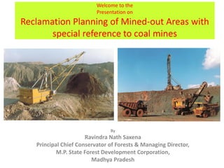
1. Welcome to the
Presentation on
Reclamation Planning of Mined-out Areas with
special reference to coal mines
By
Ravindra Nath Saxena
Principal Chief Conservator of Forests & Managing Director,
M.P. State Forest Development Corporation,
Madhya Pradesh
2. Statutory provision for Mining Plan &
Reclamation Plan
• Mineral Concession Rules, 1960.
• Mineral Concession & Development Rules, 1988.
• Coal Mines Regulation.
• Mines & Minerals (Development & Regulation) Act, 2010.
• Section-2(ii), Forest (Conservation) Act, 1980 (Reclamation
Plan is not statutory provision).
• State Minor Mineral Rules are silent on reclamation
planning of mined-out areas.
Thoroughly study of sanctioned “Mining Plan” to prepare
“Reclamation Plan” – there is vital co-relationship
between two processes.
3. Forest Cover of India*
Sites with high potential
for MiningProjects, coal,
CBM, Also high vulnerability to
Schedule-VI areas, tribal
communities, FRA,
Ecologically Fragile Zones
4. Red indicates that a change in vegetation is projected at that grid in the
time-period of 2021-2050 and 2071-2100 (under A1B scenario). Green
indicates that no change in vegetation is projected by that period.
Climate Change and Forests
Vegetational changes projected by 2021-2050 and 2071-2100
Based on computer simulation models of National Remote Sensing Agency & ICFRE
5. Biodiversity Vulnerable Grids of India (marked red) in the A1B
scenario – for India - 2035 and 2085
Climate Change and Biodiversity
Vegetational changes projected by 2021-2050 and 2071-2100
6. Coal
Block
Study baseline data of district & project location, satellite Imagery
map depicting protected area, wildlife activity areas and
compensatory afforestation sites
Thoroughly study climatic and edaphic factors
before starting reclamation planning
7. Sample Plots & Biodiversity indexing
To carry-out biodiversity indexing to obtain baseline data
– Shannon Weiner Index and Importance Value Index
8. * N.B. Kind attention invited to blanks, under stocked and encroachments
Leave aside areas with High Ecological Index
and phased felling to reduce adverse impact
9. Phase-wise felling and reclamation planning
S.
No
.
Phase of
the
Project
Mine
progression
years
Area
(in ha.)
Felling operations Safety Zone &
Reclamation operations
1. Phase - I 0 to 5 594.19 Forest clearance in
594.19 ha.. No felling
in Phase-I except area
for incline, CHP, haul
roads, power line &
workshop etc. Likely
felling of 27498 trees.
Transplanting of
14877 trees.
Scrapping & stacking
of top soil.
Creation & development
of safety zone.
Transplanting of 60 cms
g.b.h. trees to Salka Power
Plant, water
impoundment, conveyor
belt, water & ash slurry
pipelines. Gabion
structure in Garjar nala.
Technical reclamation
starts in 3rd year.
2. Phase – II 6 to 10 296.30 Felling in 296.30 ha.
Likely felling of 27147
trees. Transplanting of
18571 trees.
Scrapping & stacking
of top soil.
Technical reclamation in
594.19 ha. Transplanting
of 60 cms g.b.h. trees to
Phase-I area after
technical reclamation &
partial biological
reclamation.
11. Exhibit Location of important components, wildlife
migration routes & Tiger / Elephant Reserve Corridors
Coal Block located
at the fringe of
Hasdeo Arand
Power Plant
site
12. Maps and satellite imageries
Forest maps are vital for silviculture crop assessment and
determination of prescriptions for reclamation planning
13. Forest Satellite Imagery – only land-use discernible,
legal status cannot be ascertained
“Gap Light Analyser” is available for Crown Density
Determination. The forest crop should be analysed on crown
density, site quality, regeneration, Yield Table parameters,
Basal Area calculation based on Wedge Prism.
14. Tree Enumeration & Biodiversity Assessment
• Biodiversity indexing – Shannon-Weiner Index ,
Brillouin Index, Brillouin Eveness Index, Simpson’s
Index , Margalef Index, McIntosh's Measure of
Diversity, Berger-Parker Index etc.
19. “Reclamation & Safety Zone Management Plan”
• Should having adequate prescriptions to take care of adverse
impact of mining on the site.
• The mine bock shall be protected against soil erosion, siltation of
adjoining water bodies by profuse deployment of Gabion
structures, retaining walls, geo-textiles to reduce soil erosion.
• With the passage of time (operation period 1 to 15 years) Gabion
structure shall be constructed on the vulnerable sides of the site to
stop any possible escape of overburden.
• The ultimate water body shall have depth of not more then 10
meters. The wall of this water body shall be strengthened by
“retaining walls”.
• The catchment area of this water body should be small.; thus there
would be no possibility of bursting of earthen dam even in
torrential rains. To take care of escape of silt an additional “Silt
Settling Pond” should be planned, to reduce probability of escape
of overburden.
20. Salient features of Safety Zone
S.
No.
Direction
Length of
safety zone
(in meters)
Width of
safety zone
(in meters)
Area for
treatment
(in ha.)
1. North - 7.5 -
2. East - 7.5 -
3. South - 7.5 -
4. West - 7.5 -
Total - -
The width of safety zone should be 50-100 meters
depending on vulnerability of the site
21.
22. Diagrammatic presentation of progressive reclamation
planning, involving direct movement of top and sub-soil
(block numbers denote sequence of operations)
30. Plate : RP-III
Map of Coal Block exhibiting opening of opencast mine in
Ist Year
31. S.
No
.
Phase
of the
Project
Mine
progress
ion
years
Area
(in ha.)
Felling operations Safety Zone & Reclamation
operations
3. Phase –
III
11 to 15 249.50 Felling in 249.50 ha.
Likely felling of
21901 trees.
Transplanting of
12158 trees.
Scrapping & stacking
of top soil. Selection
of 6 dumps for
storage of top soil.
Technical reclamation in 296.30
ha. Transplanting of 60 cms g.b.h.
trees to Phase-II area after
technical reclamation & partial
biological reclamation. Succession
Stage-II and III plantations in
Phase-I and II areas. Additional
Gabion structures creation on
East and West side of Block.
4. Phase –
IV
16 to 20 351.65 Felling in 351.65 ha.
Likely felling of
25355 trees.
Transplanting of
12225 trees.
Scrapping & stacking
of top soil in 6 dumps
already selected for
storage of top soil.
Technical reclamation in 249.50
ha. Transplanting of 60 cms g.b.h.
trees to Phase-II and III areas
after technical reclamation &
partial biological reclamation.
Succession Stage-II and III
plantations in Phase-II and III
areas. Additional Gabion
structures creation on East and
West side of Tara Coal Block.
32. Plate : RP-VI
Map of Coal Block exhibiting opening of opencast mine in
Ist Year and progression of mine upto Xth year
33. S.
No
.
Phase of
the
Project
Mine
progress
ion
years
Area
(in ha.)
Felling operations Safety Zone & Reclamation
operations
5. Phase – V 21 to 25 176.55 Felling in 176.55
ha. Likely felling of
7098 trees.
Transplanting of
5393 trees.
Scrapping &
stacking of top soil
in 6 dumps already
selected for storage
of top soil
Technical reclamation in 351.65
ha. Transplanting of 60 cms g.b.h.
trees to Phase-III and IV areas
after technical reclamation &
partial biological reclamation.
Succession Stage-II and III
plantations in Phase-II and III
areas. Additional Gabion
structures creation on East and
West side of Tara Coal Block.
6. Phase - VI 26 to 30 133.12 Felling in 133.12
ha. Likely felling of
8644 trees.
Transplanting of
6888 trees.
Scrapping &
stacking of top soil
in 3 dumps already
selected for storage
of top soil
Technical reclamation in 176.55
ha. Transplanting of 60 cms g.b.h.
trees to Phase-IV and V areas
after technical reclamation &
partial biological reclamation.
Succession Stage-II and III
plantations in Phase-IV and V
areas. Additional Gabion
structures creation on East and
West side of Tara Coal Block.
34. Plate : RP-VII
Map of Coal Block exhibiting opening of opencast mine in
Ist Year and progression of mine upto XXth year
35. S.
No.
Phase of
the
Project
Mine
progress
ion
years
Area
(in ha.)
Felling operations Safety Zone & Reclamation
operations
7. Phase-VII 31 to 35 - No felling or
transplanting
envisaged.
Technical reclamation in 133.12
ha. Transplanting of 60 cms
g.b.h. trees to Phase-V and VI
areas after technical reclamation
& partial biological reclamation.
Succession Stage-II and III
plantations in Phase-V and VI
areas. Planting of climax species
in Phase-V and VI areas. Creation
of water body, settling pond and
retaining walls.
36. Plate : RP-X
Map of Coal Block exhibiting final stage dump after
closure activities
43. Diagrammatic
illustration of use of
contour wattling,
mulching and coir-
netting for over-
burden dump
stabilization.
Very useful for reducing
flow of debris outside
mineral reserve
47. The advance growth of 5th to 10th year may be shifted
to the technically reclaimed site of 0 to 5th year. And
this process shall be repeated for subsequent V-VI
phases as well. The technology for shifting of small trees
to short distance is available.
If rainfall range of 900-1500 m.m. available, the shifting
and survival of small trees shall not be a problem.
59. 59
Techniques of Sal Regeneration
The technique for Sal regeneration is available on these three counts:
A. Technique for direct seed sowing of Sal seeds have been
developed by J.P. Sharma et al (refer Indian Forester, 2004; the
Sal trees developed by this techniques can be seen at Ambikapur
nursery, Ramanujganj Road, Ambikapur, district Surguja, C.G.).
B. The technology of direct sowing of Sal seeds in polypot in nursery
is also available. The Korba Forests Division and certain private
coal mine operators have carried out Sal plantations in mined
out area of their mine.
C. Recently Jharkhand Forests Department has developed technique
for developing “Clonal Sal Seedlings”. This methodology is based
on the lines of Eucalyptus Clonal Seedlings. In this methodology
selected Sal trees are felled and allowed to develop coppice
shoots, then these coppice shoots are harvested and 3” to 4”
long cuttings are placed in polypots or root trainers for
development of roots along with application of rooting
hormone. This methodology has got success rate of about 40%.
63. Eco friendly approach
o Adherence to latest Eco-friendly technology – Surface Miner
o Phase-wise felling to reduce adverse ecological impact .
Transplanting of trees to reduce genetic losses.
o Sequential mining
o Transportation through belt conveyors.
o Scientific Void Management - Internal dumping will start after 3rd
year i.e. no external dumping from 4th year onwards with effective
top soil management.
o Effective Top soil Management
o Planned felling of trees & afforestation
o Progressive mine closure.
o Entire area shall be reclaimed with in lease period with formation
of multi-tier climax forest community.
o Landscape planning
Forests & Wildlife Management
1. Simultaneous Compensatory Afforestation (153trees to replace 1
tree felled)
2. Wildlife Habitat Conservation & Management Plan for 10 years.