
Recommended
Recommended
More Related Content
Similar to Mining Overview For Coal And Bauxite Mine of Nalco.pptx
Similar to Mining Overview For Coal And Bauxite Mine of Nalco.pptx (20)
Recently uploaded
Recently uploaded (20)
Mining Overview For Coal And Bauxite Mine of Nalco.pptx
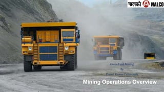
- 1. Mining Operations Overview Green Field Mining By Pramit Kumar Pattanayak
- 5. 1. Steps to Open a Mine a) To prove the potentiality of reserve, rehabilitation prog. b) To workout the demand profile. c) The available infrastructure(Road, Power line, Rly. Siding, Housing, Market etc.) d) Nature of deposit (Operating cost must be least). e) Availability of equipment, Procurement of equipment vis-a-vis mine target. f) Financial Involvement and rate of return. g) Manpower assessment. h) Notice of opening in form1 to DGMS and also to DMS of that region. 5 Project Report: Based on the report supplied by GSI or other prospecting agencies, A complete project report is to be prepared by CMPDIL or by other approved body. This report is to be submitted to G.O.I for its approval and necessary orders: a) Land area requirement and its acquisition b) Program including shifting of population and their rehabilitation. c) Life of the mine including M.O.W (Method of Working), selection of customer in mode of return , dispatch system , machinery. d) Employment status in recruitment procedure. e) EMP f) EIA g) Reclamation programme (Applicable for O/C) i.e. Green belt vegetation.
- 6. 2. Overview of Mining processes (1/2) 6 Processing Dry Plant Wet Plant Despatch CLO/ fines despatch to customers Iron Ore Mining Process Flow
- 7. 2. Overview of Mining processes (2/2) 7 Coal Mining Process Flow MC CC TC RJ Quarry Raw Coal and OB Removal Raw Coal processing to get Clean Coal To Customers and Power Plants Crushing RC: Raw Coal TC: Tailing Coal CC: Clean Coal MC: Middling Coal RJ: Reject W: Waste IC: Internal Customer Q: Mine Quarry W: Waste Coal Dispatch Coal Beneficiation (Crushing and Washing) Washery RC RC w Q Coal Mining
- 8. MINES OPENCAST MINES UNDERGROUND MINES • Opencast Coal Mines Underground Coal Mines • Opencast Metal Mines Underground Metal Mines (Trench mining in NALCO)
- 9. PANCHPATMALI BAUXITE MINES OF NALCO. Panchaptmali Bauxite Mines of NALCO BALABHADRA KONARK SUBHADRA ARKHAPAL-B BHUBANESWARI LINGRAJ BALIPATA DURGA RADHIKAPUR D C KOSLA GOPAL PRASAD WEST HINGULA NISA TOWN B2 B1 KALINGA EAST C' PADMA D NATRAJ NANDIRA TALCHER E' DUELBERA DHARAMPUR TALCHER AUNLI PATRA- PADA MACHHAKATA MAHANADI CHHENDIPADA BHAGIRATHI BAITARNI TIKRA ALAKNANDA NAINI BANKHUI MANDAKINI NEELACHAL KANIHA STPC SAMAL TOWN A'- JAGANNATH B'- C'- D'- E'- SOUTH ANANTA ANANTA HANDIDHUA O.C. BALANDA O.C. O.C. O.C. EXPN U.G. INDEX BARAKAR KARHARBARI NALA/ TALCHER METAMORPHIC ROAD EXISTING RLY. LINE RIVER COLONY NANDIRA JHOR ROAD ROAD ANGUL TOWN NALCO SMELTER N A L C O TPS (NALCO) TO CUTTACK T O C U T T A C K /P A R A D IP /V IZ A G FERT. PLANT FCI NH -23 TO ROURKELA UTKAL A TO SAMBALPUR TALCHER SAMBALPUR RAILWAY LINE ROAD NH-42 0M 4675M 9350M 84°-45' 2 0°-50' 2 1°-00' 2 1°-10' 84°-45' 85°-00' 85°-15' 85°-25' 2 1°-00' 2 0°-55' T O P A L L A H A D A TIK RA N A DI R O A D Bharatpur south Bharatpur north CHHENDIPADA BAITARNI EAST WEST WEST EAST Promotional Promotional BRAHMNI KALINGA GOPAL PRASAD EAST WEST NC NC NC Cptv. Cptv. Cptv. Cptv. Cptv. Cptv. ( KANIHA-II) Non potential BALABHADRA Cptv. Kosla exploration camp Brahmni River RAMCHANDI Cptv. UTKAL RADHIKAPUR EAST(INCL. UTKAL F) SINGHARA JHOR NC SAKHIGOPAL-B NC ARKHAPAL-A NC NC UTKAL E BLOCK BLOCK LOCATIONMAP NATIONAL ALUMINIUM COMPANY LIMITED MINING PLAN FOR UTKAL-EOCP UTKAL E GEN-II UTKAL-E & UTKAL-D COAL MINES OF NALCO. Utkal-D&E Coal Mines of NALCO NALCO MINES
- 10. BRIEF ABOUT UTKAL D& E (Combined) COAL MINE Sl . N o Details Utkal D & E 1 Total area 825.01 Hectare (Ha) Forest land 312.70 Ha 3 Extractable Reserve 176.05 Million Tonnes 4 Area of Excavation 393.44Ha 5 Peak Rated Capacity 4.0 Mtpa 6 Coal Grade G-13 (avg) 7 Expected Life of Mine 48 year
- 11. 11 THERE ARE 04(FOUR) PILLARS OF ANY GREEN FIELD MINING 1. Environmental Clearance 2. Land acquisition 3. Mining Lease 4. Forest Clearance
- 12. 12 12 MAJOR ACTIVITIES FOR GREEN FIELD COAL MINE PROJECT Land Acquisition for: - Mining Lease Area, R&R,CISF Colony ,Township - Transport Corridor Mining Lease Environmental Clearance Forest Clearance EPCM Consultancy contract Coal and OB out sourcing contract (MDO) Electrical Power Water (Industrial and Drinking) clearances
- 13. Miscellaneous activities. Explosive Magazine Permission from Controller of Explosive, Nagpur Permission for Establishing Diesel Bunk and Using Diesel Bousers Wild Life Clearance from PCCF(WL) and CWLW. Consent to establish Coal Mine from OSPCB Tree felling permission from Forest Department Mining Opening Permission from DGMS. Permission to use water and electricity from Govt. Authorities
- 17. Land Acquisition step(As per land acquisition act 1894) • NOTIFICATION NO ACTIVITIES 1. Short title, extent and commencement. 2. (Repealed) 3. Definitions. 4(1). Publication of Notification in official Gazette and in two daily news 5. Payment of compensation for damage done to land during the course of surveying 6(1). Declaration that the land is required for a public purpose. 7. After draft declaration under Section–6 Collector to take order for the acquisition of the land. 8. Land to be marked out measured and planned, unless it has already been done under Section – 4 Family generology survey Land Survey Structural Survey Tree Enumeration LAND ACQUISITION
- 18. 18 NOTIFICATION NO ACTIVITIES 9. Collector to cause public notice to be given at convenient places on or near the land inviting claims to compensation for all interests in land. 10. Power to require and enforce the making of Statements as to names and interests. 11. Enquiry and award by Collector. 12. Collector to give immediate notice of award (12-2) to those who are not present when award made. 13. Adjournment of enquiry. 13A. Correction of clerical errors, etc. 14. Power to summon and enforce attendance of witnesses and production of documents. 15. Matters to be considered and neglected. 15A. Power to call for records, etc. Taking possession
- 22. 22 Mining lease
- 23. 23 Mining Lease Application Inspection by Geologists Spot inspection report to Director Geology & Mining Technical recommendations to department of Mines, State Government Inspection by RI/Tahasildar Spot inspection report to Collector Revenue recommendation to Department of Mines , State Government. Department of Mines, State Government Recommendation by Ministry of Mines State Govt Ministry of Coal , Govt. of India Concurrence for grant to State Govt. Intention to grant order by state Govt. ML order by state Govt. Approval of Mining Plan Site clearance from MoEF Project Clearance from MoEF ML Deed Execution Land demarcation and Stamp duty Adjudication Permission from DGMS Mine Opening Notice Mining Operation COLLECTORATE DGPS Survey
- 25. 25 25 PROPOSED AREA TO BE ACQUIRED FOR R&R SITE FOR 350 FAMILIES :- MINIMUM FACILITIES TO BE PROVIDED IN PROPOSED R&R SITE School Roads, Drains and playground Drinking water and electricity facilities in village Village Sabhagruha Mahila Samiti Gruha Temple, Church and Maszid as per religion Cremation ground/Burial ground Arrangement for enhancement of Skills Common pond. Any other facilities as required for day to day life
- 30. Utkal-D & E Coal Mines - INTRODUCTION Particulars Details Lease area 825 Ha No. of workable coal seams 17 Geological Reserve 297.578 Million tonnes Extractable Reserve 176.05 Million Tonnes Grade of Coal G-13 (Avg. GCV- 3747 kcal/Kg) Stripping Ratio 2.27: 1 Mine Capacity 4.0 Million Tonnes per Annum Mine Life 46 Years Mining Method Mechanised Opencast including Highwall mining Coal: Surface Miner, Payloader & Dumpers OB: Drilling & Blasting, Shovel Dumper combination Mode of operation of Mine Through Mine Developer cum Operator M/s UCMIPL (Consortium of M/s Mythri Infrastructure Pvt. Ltd & M/s AMR Ltd.) Notice of Mine Opening 22.08.2022 Status of Mining Operation Mining Operation from Utkal-D Coal Mine was started w.e.f.09.11.2022 and Clearances for Utkal-D&E Coal Block (Combined) is under process. 30
- 31. LOCATION DETAILS Particular Details Area Project area: 862.526 ha (ML Area: 824.316 ha + freehold area: 38.21 ha) Location of Mine site Villages Nandichhod (Gopiballavpur), Gopinathpur Jungle, Kosla, Kundajhari Jungle, Korada, Raijharan, Similisahi Tehsil Chhendipada District Angul State Odisha Toposheet No Core Zone: 73D/13 Buffer Zone: 73H/1, 73G/4, 73C/16 and 73D/13 Category Category “A”, 1(a)-(3) Mining of Mineral Project Utkal D & E 31
- 32. Sub-bituminous coal or black lignite is a grey-black or dark brown coal. It ranges from hard to soft as it represents an intermediate stage between low quality lignite and higher quality bituminous coal. The carbon content of sub-bituminous coal varies from 70-76%.[8] Sub-bituminous coals are among the younger coals geologically—approximately 251 million years old. Therefore, the longer burial time compared to lignite increases it's energy density ranges from 18-23 MJ/kg.[4] This type of coal is the most commonly used, with 30% of coal resources being sub- bituminous Coal available in Our Mines
- 33. 33 Timeline/Milestones Sl. No. Milestone Timeline (Actual / Expected) 1 Allotment of Utkal D&E Coal Mines in favour of Nalco (Zero Date) 02.05.2016 2 Grant order for Mining lease of Utkal-D 16.04.2020 3 EC (Environment Clearance) of Utkal-D Coal Block 11.08.2020 4 Revision of Zero Date of Utkal-D&E Coal Block 21.08.2020 5 FC (Forest Clearance) of Utkal-D Coal Block 06.01.2021 6 Execution of Mining Lease of Utkal-D Coal Block 25.03.2021 7 Grant order for Mining lease of Utkal-E 12.04.2021 8 Grant of Mine opening permission of Utkal-D Coal block 21.05.2021 9 FC (Forest Clearance) of Utkal-E Coal Block 31.01.2022 10 Engagement of MDO (LOA) 28.02.2022 11 Execution of Mining Lease of Utkal-E Coal Block 31.03.2022 12 Grant of Mine opening permission of Utkal-E Coal block 30.09.2022 13 Construction of Railway siding 31.10.2023 14 Development of major Mining Infrastructure, Roads, Buildings, workshop, Lab. etc including Development of R & R Colony - Completion 31.10.2023 15 Commercial Operation date 31.12.2023
- 34. GEOLOGY Utkal-D&E coal blocks are located in the southcentral part of Talcher coalfield, Odisha. Talcher coalfield is the south-eastern most part of lower Gondwana basin within northwest southeast trending Sone- Mahanadi master basin belt. The coalfield is nearly elliptical in shape having strike length of about 80km (east-west) and dip extension (north-south) of around 26km. Strike and Dip General strike of the beds in mainly E-W to ESE- WNW with slight variations in the central part of the block. The direction of the dip of the strata is towards N to NNE and the amount varies from 3 °-8 °. 3 faults with throw ranging from 0 to 15m heading both North & Southward. Faults occur mostly in the central part of the block; thus major part of the combined block remains almost free from structural disturbance. Dip of the fault plane is around 70° -75°. Gross Geological Reserve "Mt“-303.71 Blocked Reserve "Mt“- 113.3520 Extractable Reserves "Mt" 176.0500 Excavation Area 393.4400 External Dump 345.4100 4. Safety Zone 23.3100 5. Other Use 29.8200 6. Infrastructure area 65.1100
- 35. RULES & REGULATION IN COAL MINES SAFETY 35 Sl. No. Statute 1 The Mines Act, 1952 2 The Mines Rules, 1955 3 The Coal Mines Regulations, 2017 4 The Mines Rescue Rules, 1985 5 The Mines Vocational Training Rules, 1966 6 The Mines Crèche Rules, 1966 7 The Mines Maternity Benefit Act & Rules, 1963 8 The Indian Explosive Act, 1884 9 The Explosive Rules, 2008 10 The Workmen Compensation Act, 2010 11 The Electricity Act, 2003 12 The Central Electricity Authority (measures related to safety & supply) Regulations, 2010
- 36. RULES & REGULATION IN COAL MINES SAFETY(Envt) 36 Sl. No. Statute 1 The Environment (Protection) Act 1986 (EPA); 2 The Forest (Conservation) Act 1980; 3 The Water (Prevention and Control of Pollution) Act 1974; and 4 The Air (Prevention and Control of Pollution) Act 1981. 5 MMDR Act 1957 6 Mineral Concession Rule 1960 7 Mineral Conservation and Development Rules 1988 8 Wildlife protection act 1972
- 37. Mining Operation in Utkal D Coal Mine Mining Method- Surface Mining using Surface Miner + shovel-Dumper combination in coal excavation. Drilling- blasting + shovel-Dumper combination for removal of Overburden.
- 38. Development process of a new mine Geological survey Exploration Mine development Mining Rehabilitation: acid mine drainage, selective mining, waste rock dumping site, cover system, erosion control, revegetation etc. Environmental monitoring 2
- 39. Mining Methods Surface/open cut mines: Strip mining; dragline open pit mining; truck & shovel, BWE etc. Underground mines: manual, semi- mechanized, fully- mechanized Bord/Room-and-pillar mining Longwall/shortwall mining Other methods depending on seam conditions 3
- 40. Open cut/surface mining: 40% of total produced coal (WCI) (For example, 80%: Australia,67%: USA) •Strip mining: horizontal~gentle dip seams(side-casting, in-pit disposal) •Open pit: Steep dip and multi-seams (dump site, out-of-pit disposal) •Mountain top removal mining (Appalachian coal field, USA) Stripping Ratio = Volume of Material (bcm)/ Extraction of Coal (ROM-ton*) 4
- 41. Strip Mining 5
- 42. Open pit mining (shovel & truck): flexible 4 2
- 43. Seismic survey and exploration drilling 4 3
- 44. Topsoil stripping by bulldozer or scraper 4 4
- 45. Overburden drilling for blast holes and blasting 4 5
- 47. Explosives ANFO (Ammonium Nitrate Fuel Oil Explosive) Slurry, Watergel, Emulsion Explosives High Density ANFO (emulsion blends or heavy ANFO) Velocity of detonation: ANFO Watergels Emulsions 2,200-4,000 m/s 3,500-5,000 m/s 4,500-6,100 m/s 12
- 48. Dragline (50 million US$) 13
- 50. Bucket Wheel Excavator (over 1 billion US$) 50
- 52. Super dump truck-Komatsu 960E (Payload:327t) 5 million US$ 52
- 53. Coal extraction (truck, dozer & shovel) 53
- 54. The major equipment for the mine producing 7 Mt/yr 6 x electric rotary drills (250 mm dia.) for overburden 12 x electric shovels with 17 m3 buckets for overburden 4 x hydraulic shovels with 11 m3 buckets for coal 6 x rubber tired front end loaders with 9.6 m3 buckets 50 x 154 t 900 kW rear dump trucks for waste haulage 14 x 109 t 900 kW rear dump trucks for coal haulage 19 x 300 kW track-mounted bulldozers 3 x 224 kW wheeled bulldozers Other vehicles (Pick-up cars, Site-mixing truck, Graders, Water spray trucks etc.) 54
- 55. Performance of equipment Availability = Operated hours/Scheduled hours x 100 (%) Efficiency = Operated hours/Available hours x 100 (%) Utilization = Real work hours/Operated hours x 100 (%) The bigger, the better! 55
- 56. Typical underground mining systems 56
- 57. Room (Bord)-and-pillar (Continuous miner and shuttle car) 57
- 58. Wongawilli method and break line support (BLS) 23
- 59. Longwall mining Shield Supports Shearing Machine Armored Face Conveyor Stageloader & Belt Tailpiece Drive Unit For Armored Face Conveyor 59
- 60. Mining Operation in Utkal D Coal Mine Mining Method- Surface Mining using Surface Miner + shovel-Dumper combination in coal excavation. Drilling- blasting + shovel-Dumper combination for removal of Overburden.
- 61. Longwall face with shearer and shield supports Seam thickness: 1.5-7.0m High performance 61
- 62. Plow mining for thin seams: Seam thickness: 0.6-2.3 m Full automation 62
- 64. Prop and cap mining system 物理探査の の 概要 概要 64
- 65. “Kakkuchi” (Cut & fill) mining for steep coal seam 65
- 66. Longwall top coal caving (LTCC) method for extra-thick seam 66
- 67. Multi-slicing method for thick seam 31
- 70. Longwall Panel Design Geological conditions: faults, coal seam Panel size: Panel width; 50-250 m, Panel length; 300-1000m, ave. 450m Super panel in the USA Panel length; over 3000m Twenty-mile mine: Panel length; about 6000m 34
- 71. Vertical stress distribution around a longwall panel 71
- 73. Stability of the longwall face using shield supports 73
- 74. 74
- 75. 75
- 76. Rapid roadway drivage with S- 100 Roadheader 76
- 78. Rockbolts 42
- 79. Roadway drivage with bolter miner 43
- 80. Dual support system with steel supports and bolts Roof bolt (2.4m) Rib bolt(1.5m) W-strap with steel mesh Steel pipe Fiber mesh Standing steel support 80
- 81. Stress conditions in UK and Japan coal mines 81
- 82. Strata Behavior Monitoring System (a) Monitoring System 82 (b) Tell-tale System
- 83. Accidents in underground coal mines 1) Roof and rib falls 2) Outbursts of coal, rock and gas 3) Spontaneous combustion 4)Coal dust explosion: frictional sparks from machine cutting 5)Gas explosion: frictional sparks from machine cutting 6) Mine fire 7) Water inrush and flooding 47
- 84. 48
- 85. Causes of roof fall Geological conditions: weak strata, deterioration due to water (humidity), wet/dry cycle of ventilated air Stress conditions: magnitude and direction, heading faces, intersections, mining activities Support systems: bolting, standing supports (steel arches, three-piece sets, articulated supports, yielding supports, etc.) 49
- 86. Highwall mining systems Transit mining systems from surface to underground Safest underground mining system because of none working in underground Mining systems 1) Auger mining 2) Metec Miner System 3)Continuous Highwall Mining (CHM) System: Add car system, Archveyor system 50
- 87. Auger mining 87
- 89. Add car system (CHM) 89
- 93. Methane gas emission/diffusion at ponds 93
- 94. Rehabilitation Sedimentation pond Recovery of a disturbed land into a stable, safe and forming a sustainable forest ecosystem 59
- 95. 60
- 96. Mining Area Coal Mining Operation
- 98. Salient features of Bauxite Mine -Largest Bauxite deposit in Asia -Largest Bauxite producing Mine in Asia -Open cast, fully mechanized, trench concept Mining -Simultaneous Reclamation -Largest double roll tooth crusher -Longest single flight conveyor on hilly terrain
- 99. North block Central block South block Present Working area PANCHPATMALI BAUXITE MINES Status as on dt. 31-03-2021 1. Bauxite Transported to Refinery: 142.7 mill. Tons apprx. 1. Balance Mineable reserves : 164.3 mill. Tons apprx. 1. Balance Life of Mine (apprx): 22 yrs @ 7.5mtpy. The deposit occupies the crest of the Panchpatmali plateau, which is about 21kms long and trends in NNE- SSW direction. It has a plateau top area of 16.80 sq.Kms
- 100. Key parameters Top soil 0 – 1 mtr. OB thickness 2 - 4 mts. Bxt. thickness 14 mtr. Avg. Tonnage (Total) 310 mil.tons Al2O3 40 - 44 % SiO2 2 - 3 %
- 101. Field Samples SABmis2ppt OB/Aluminous Laterite Bauxite PLK Khondalite
- 102. PANCHPATMALI BAUXITE DEPOSIT Bottom bauxite (3-4 m) Main Bauxite (8-10m) Lateritic OB (2-4 m) Top soil (0-1 m) Top soil (0-1 m) Lateritic OB (2-4 m) Main Bauxite (8-10m) Bottom bauxite (3-4 m) Backfilled area Plantation s Cross section Vertical section
- 103. FUNCTIONS OF GEOLOGY DEPT. (As per MCDR 2017) • Carry out Prospecting & Exploratory works. • Prepare Geological Maps, Plans & Sections. • Maintain Bore hole Samples, logs & Records. • Calculate Ore Reserves and Grades. • Update Mineral Resources as per UNFC guidelines. • Conserve & Optimise use of Mineral Resources. • Guide Mining Operations to Optimise Ore Quality & Qauntity. • Develop appropriate Sampling methods & Prepare samples. • Carry out Mineralogical studies. • Implement IBM guidelines as applicable.
- 104. Drilling Sample Processing Reserve Estimation & Mine Planning Plan Implementation & Quality Control Drill Sample PROCESS FLOW CHART
- 105. KPA Objectives Pre-Production Drilling Drilling on 25m x 25m grid. Mine planning 1. Reserve Estimation (100/25m grid) 2. Long term Plans(5yrs) and Short term plans Annual / Monthly Mine plans . Sample Collection & processing 1. Hourly ROM samples 2. Blast /Rip/Btm bxt. /Field Samples Quality control 1. Ensure ROM Quality - Al2O3(T) & SiO2(T) 2. Maximise Ore Recovery KEY OBJECTIVES
- 106. 106 ❖ Pre-Production drilling is required to know the grade and thickness of overburden and Bauxite ore. ❖ PP Drilling carried out on 25m x 25m grid. ❖ Powder sample is collected from each meter of drilling ❖ Each sample after being dried and processed (grinded up to -200 Mesh size) is sent to laboratory for chemical analysis ❖ The analysis of meter wise sample data is used for mine planning purpose, where the estimation is done using SURPAC Mine planning Software
- 107. Blocks Area Overburden (Top soil + Laterite) Bauxite Tonnage (Mill.T) Al2O3 % SiO2% Thickness In Mtrs Tonnage (Mill.T) Al2O3% SiO2% Thickness In Mtrs Central & North Block NB* 3.48 36.73 16.46 2.2 20.27 41.57 4.12 14.0 CB-I # 0.16 38.85 12.09 1.5 1.33 42.25 3.37 14.5 CB-II 3.87 35.44 14.02 1.1 63.10 43.85 3.56 14.5 C-N Mine 7.51 36.11 15.11 1.6 84.70 43.28 3.69 14.4 South Block SB 7.94 35.91 16.34 1.6 79.94 42.37 3.88 13.6 Panchpatmali C-N + SB 15.45 36.01 15.74 1.6 164.64 42.84 3.78 14.0 Balance Reserve As on 31.03.2021
- 108. THE MONTHLY ROM QUALITY AT PANCHPATMALI BAUXITE MINE SHOULD BE MAINTAINED AS FOLLOWS : • Total Al2O3 : 42.50 ± 2.0 % • Total SiO2 : 3.84 ± 0.50 % QUALITY CONTROL
- 109. ⮚ Removal of Top Soil ⮚ Loosening of Lateritic OB by Drilling-Blasting/Ripping-Dozing ⮚ Loosening of Main Bauxite by Ripping-Dozing/Drilling-Blasting ⮚ Selective excavation of bottom bauxite by Excavators ⮚ Loading by Wheel loaders or directly by Back hoe excavators ⮚ Transportation by 55T/100T rear dumpers ⮚ Crushing and Conveying of ROM Bauxite to Alumina Plant Process involved in Bauxite Mining
- 110. RECLAMATION AND REHABILITATION OF MINED OUT AREA
- 111. Thank You
- 112. Safety first! • Thank you • for your kind • attention! 61