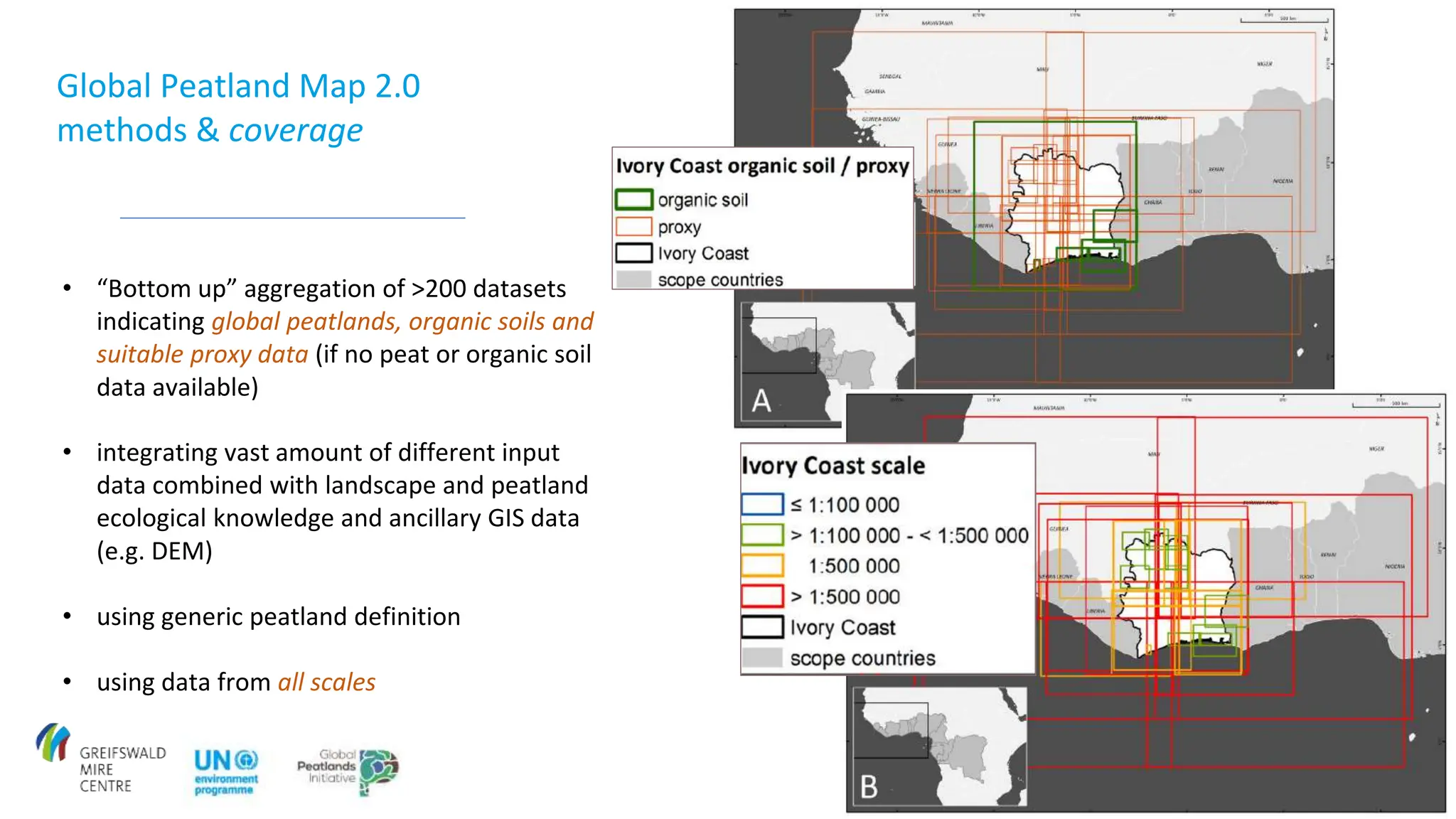
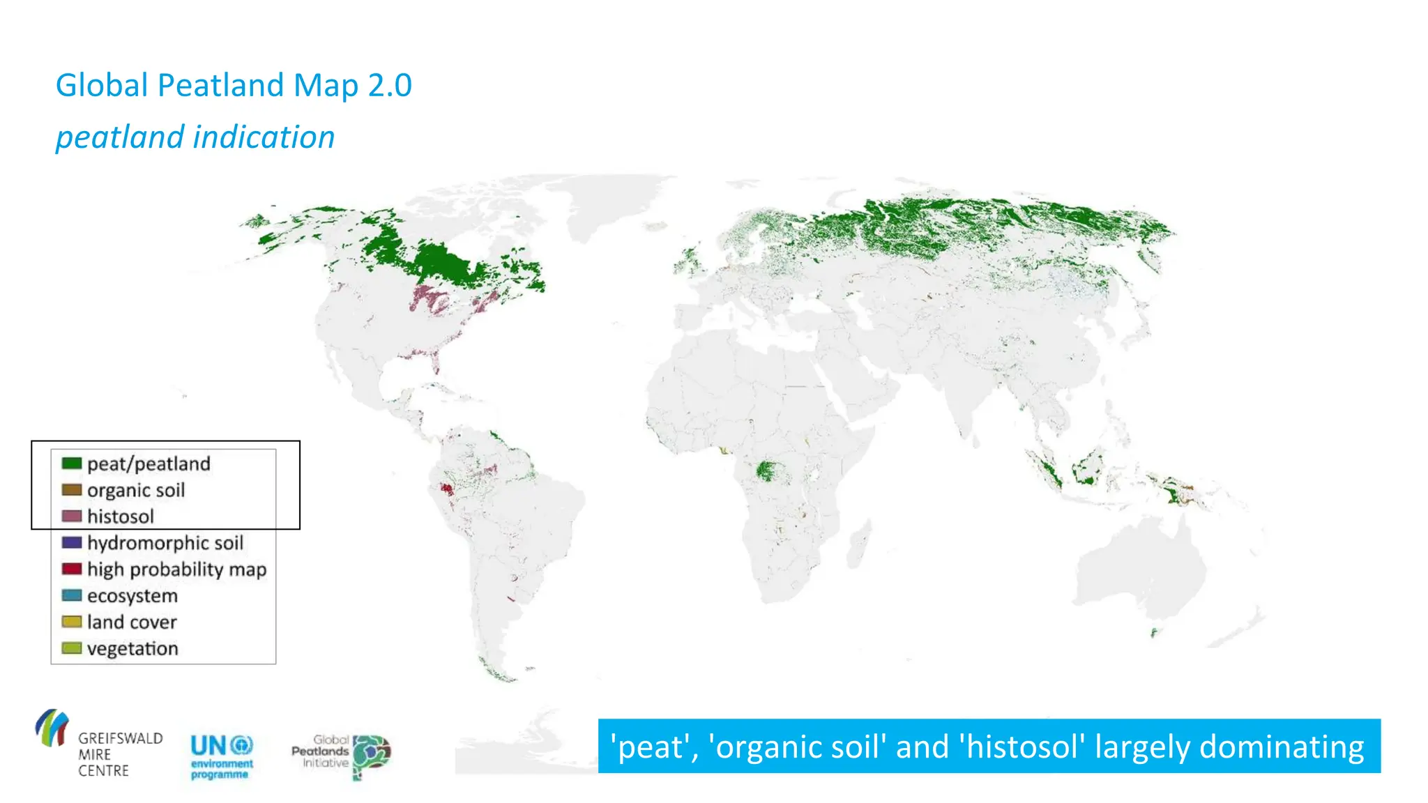
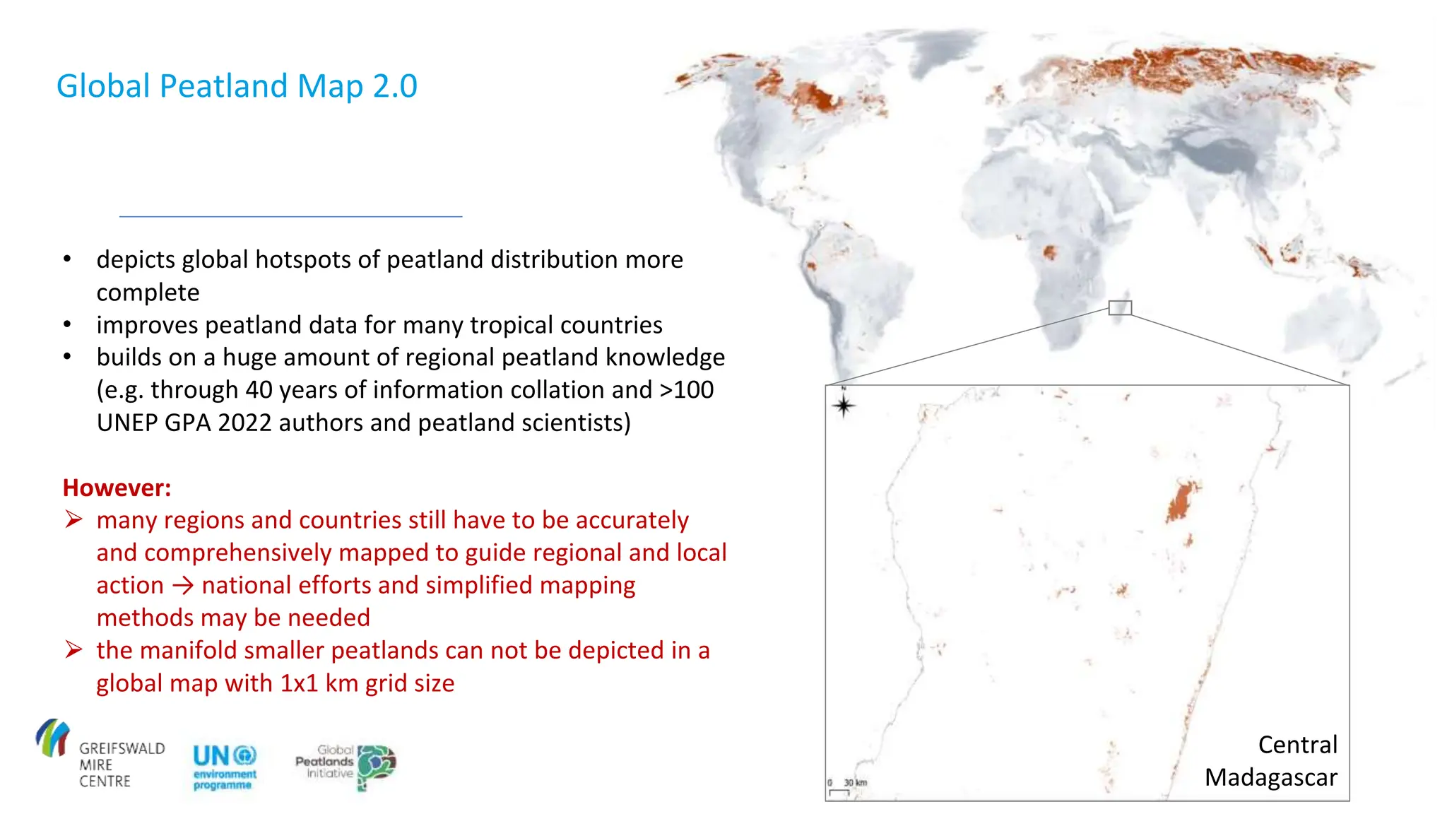
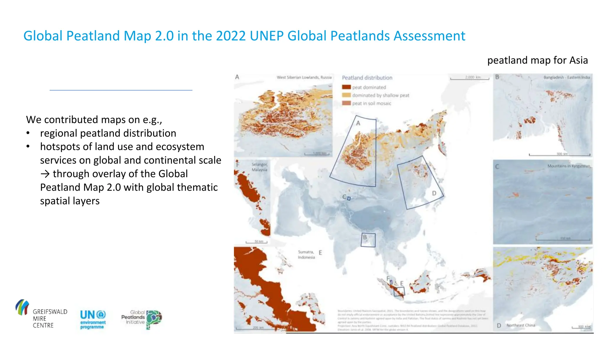
Download to read offline
![Global Peatland Map 2.0
aims
• to cover all important peatland regions
globally (at least indicative with focus on
[Sub-]Tropics and southern hemisphere)
• to check input datasets on its accuracy
completeness and plausibility
• to maintain a high level of transparency by
supplementary maps and extensive meta-
data
…tropical setting in
which peatlands
may occur](https://image.slidesharecdn.com/glfbarthelmes-240606141401-f1273f3f/75/Global-Peatlands-Map-and-Hotspot-Explanation-Atlas-3-2048.jpg)
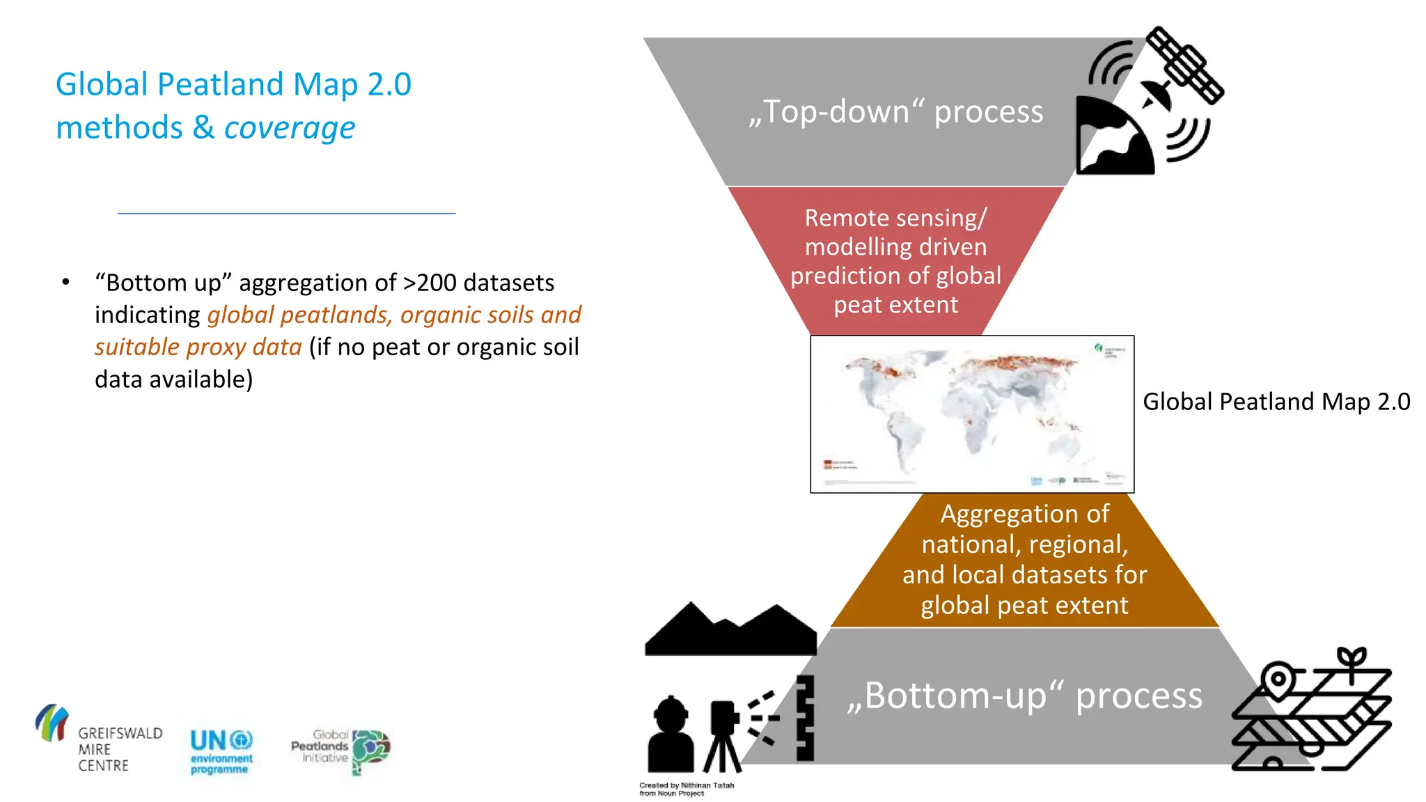


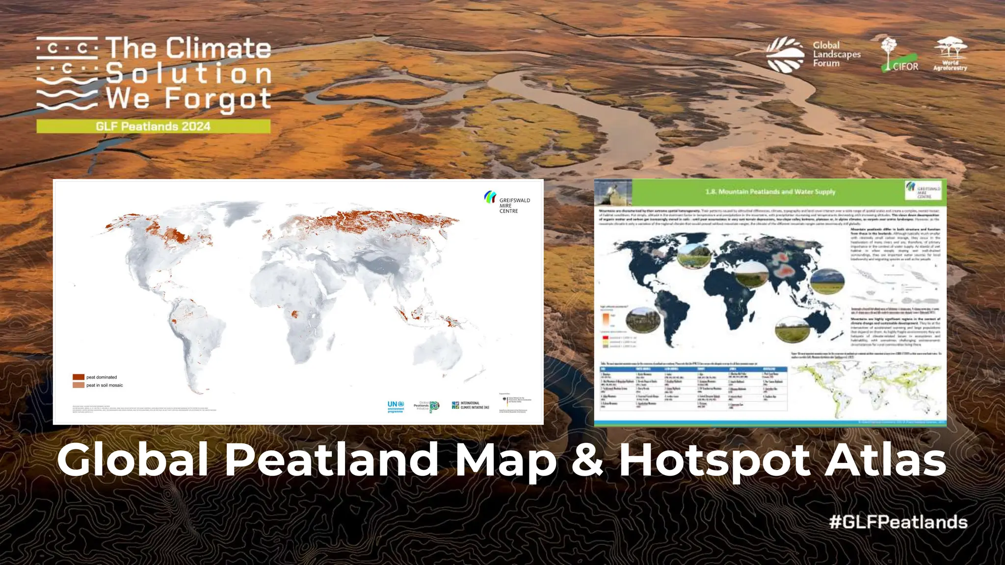
The document discusses the Global Peatland Map and Hotspot Atlas initiative in Tanzania, which aims to compile and update spatial data on peatlands worldwide. It emphasizes a comprehensive approach through both top-down and bottom-up methods, integrating over 200 datasets while identifying significant regions requiring further mapping. The final output will include various thematic maps outlining peatland distribution, land use, threats, and ecosystem services, which will serve decision-makers and researchers.


