Download to read offline


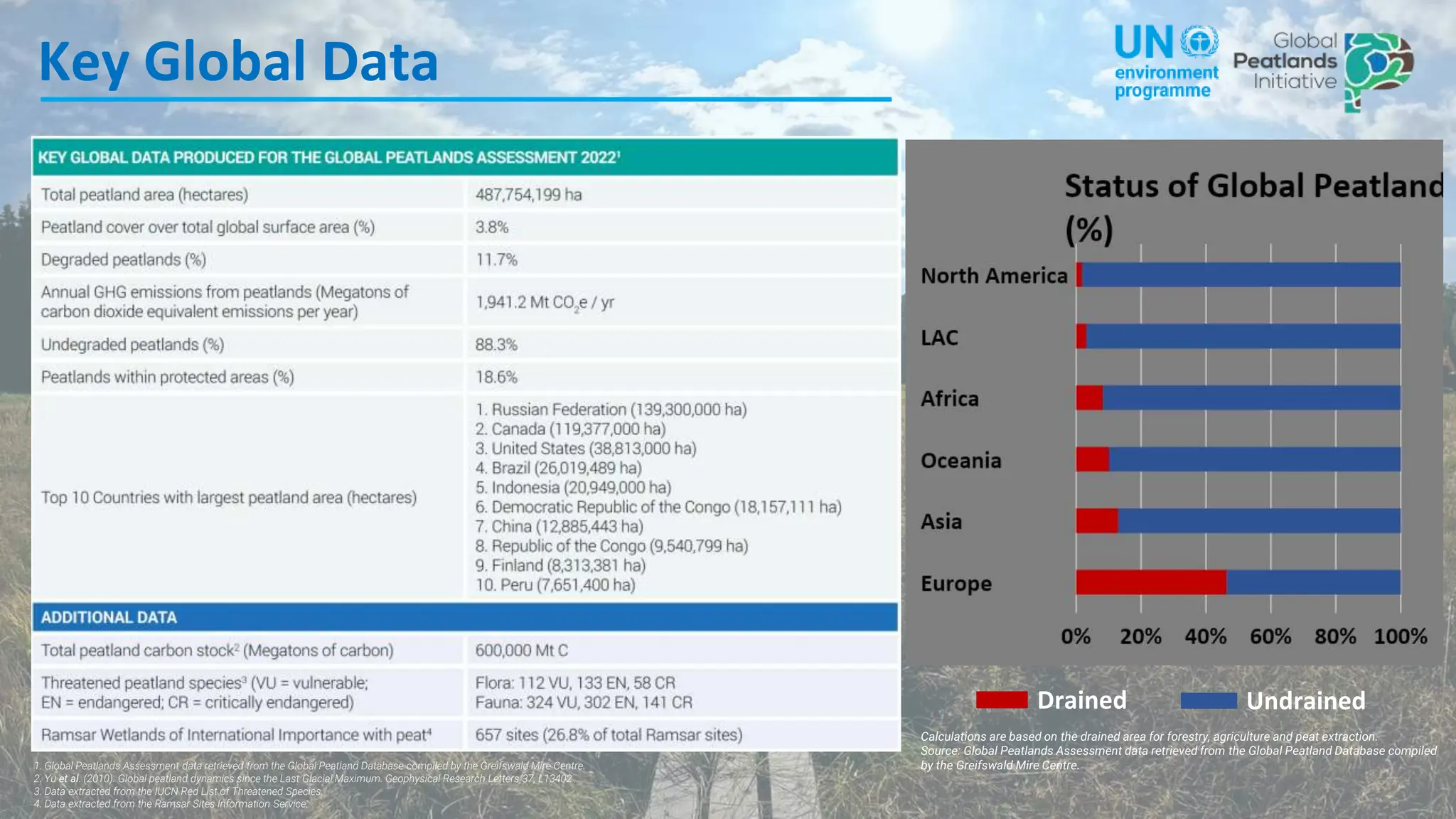


The Global Peatlands Assessment provides a comprehensive overview of the distribution and extent of peatlands across 177 UN member states, with contributions from 226 experts. It highlights the significance of peatlands in terms of greenhouse gas emissions and emphasizes the need for action and policy change to protect these critical ecosystems. The assessment aims to raise awareness and support initiatives that address peatland conservation and management.


