SlideShare a Scribd company logo
1 of 21
S.SRINIVAS REDDY
LEVELING
DEFINATION :
Levelling is a branch of surveying in civil engineering which deals with the
relative heights of different points on, above or below the surface of earth .
Thus in levelling ,the measurements are taken in vertical plane .
PRINCIPLE :
The principle of levelling is to obtain horizontal line of sight with respect to
which vertical distances of the points above or below this line of sight are
found
OBJECTIVE :
To Find the elevation of given point with respect to some assumed
reference line called datum.
TERMS:
LEVEL SURFACE :
It is a curved surface perpendicular to direction of gravity or parallel to surface o the earth
HORIZONTAL PLANE:
Horizontal plane through a point is a plane tangential to the level surface and perpendicular to
the plum bob
VERTICAL PLANE :
It is a normal horizontal plane and shown by the plum bob.
LEVEL LINE :
Line lying on level surface
DATUM :
It is an arbitrary level surface from
which elevation of points may be
referred
TERMS
MEAN SEA LEVEL (MSL):
Average height of sea for all the stages of sides considered for 19years period.
BACK SIGHT:
The first reading from a new instrument stand point(i.e. take the height of
instrument)
FORE SIGHT :
The last reading from the current instrument station (i.e. give the height to a
benchmark)
BENCHMARK :
It is a fixed reference point of known elevation with respect to datum.
PERMANENT BENCH MARK :
These are established between the great trigonometric survey by the government
agencies clearly defined and permanent points such as top of parapet wall of a
bridge or kilometer stones or railways platforms etc.
Basic Rules for Leveling:
• Always start and finish leveling run on a benchmark and close
the loops
• Keep foresight and back sight distances as equal as possible
• Keep lines of sight short (normally <50m)
• Never read below 0.5m on a staff
• Use stable , well defined change points
• Beware of shadowing effects and crossing waters
• Simple Leveling
It is a simple and basic form of leveling in which the leveling instrument is
placed between the points which elevation is to be find. Leveling rods are
placed at that points and sighted them through leveling instrument. It is
performed only when the points are nearer to each other without any
obstacles.
TYPES OF LEVELING
Differential Leveling
Differential leveling is performed when the distance between two points is
more. In this process, number of inter stations are located and instrument is
shifted to each station and observed the elevation of inter station points.
Finally difference between original two points is determined.
TYPES OF LEVELING
TYPES OF LEVELING
• Fly Leveling
Fly leveling is conducted when the benchmark is very far from the work
station. In such case, a temporary bench mark is located at the work station
which is located based on the original benchmark. Fly levelling is just like
differential levelling carried out to check the accuracy of levelling work. In
fly levelling only B.S. and F.S. are taken
• Profile Leveling
Profile leveling is generally adopted to find elevation of points along a line
such as for road, rails or rivers etc. The object is to determine the
undulations of the ground surface along the alignment.
TYPES OF LEVELING
• Precise Leveling
It is used for establishing bench marks for future public use. It is carried out
with high degree of accuracy using advanced instruments Trigonometric
Levelling . The accuracy of 1 mm per 1 km is achieved.
• Check Leveling :
This kind of levelling is carried out to check the accuracy of work. It is
done at the end of the days work in the form of fly levelling to connect the
finishing point and starting point
TYPES OF LEVELING
• Reciprocal Leveling
This method is adopted to accurately determine the difference of level
between two points which are far apart.
It is also used when it is not possible to setup level in midway between two
points.
TYPES OF LEVELING
• Trigonometric Leveling
• The process of leveling in which the elevation of point or the
difference between points is measured from the observed horizontal
distances and vertical angles in the field is called trigonometric
leveling.
• In this method, trigonometric relations are used to find the elevation
of a point from angle and horizontal distance so, it is called as
trigonometric leveling. It is also called as indirect leveling.
• Barometric Leveling
• Barometer is an instrument used to measure atmosphere at any altitude. So,
in this method of leveling, atmospheric pressure at two different points is
observed, based on which the vertical difference between two points is
determined. It is a rough estimation and used rarely.
• Stadia Leveling
It is a modified form of trigonometric leveling in which Tachometer
principle is used to determine the elevation of point. In this case the line of
sight is inclined from the horizontal. It is more accurate and suitable for
surveying in hilly terrains.
Methods of Reducing Levels
• Height of Instrument Method:
This method consist of finding H.I. for every setup of instrument, and then
obtaining the R.L. of point of reference with respect to H.I
Methods of Reducing Levels
• Rise and Fall Method
• This method consist of determining the difference of level between
consecutive points by comparing each point with immediate preceding
point.
Methods of Reducing Levels
ERRORS IN LEVELLING
Personal Error:
• The Instruments may not be levelled
• The focusing of eye piece and objective glass may not be perfect
• The position of staff may have changed
• Entry and recording in the field book may not be correct
• The staff may not be fully extended, may not be held vertical.
Instrumental Error
• The Permanent adjustment of the instrument may not be perfect. That is the
line of collimation may not be horizontal line.
• The internal arrangement of focusing tube may not be correct
• Defective bubble tube, if the bubble tube is sluggish, it may apparently be in
the mid-position even though the bubble line is not horizontal.
USES:
• To prepare the contour maps
• Altitudes of different levels in a hill station
• To prepare layouts of water distribution system
• To prepare LS(longitudinal sectioning) and cross sectioning of
a project
THANK YOU

More Related Content

What's hot

Theodolite traversing, purpose and principles of theodolite traversing
Theodolite traversing, purpose and principles of theodolite traversingTheodolite traversing, purpose and principles of theodolite traversing
Theodolite traversing, purpose and principles of theodolite traversing
Dolat Ram
 
Fly Levelling
Fly LevellingFly Levelling
Fly Levelling
Bahzad5
 

What's hot (20)

Linear Measurements
Linear MeasurementsLinear Measurements
Linear Measurements
 
Trigonometric levelling
Trigonometric levellingTrigonometric levelling
Trigonometric levelling
 
Theodolite surveying
Theodolite surveying Theodolite surveying
Theodolite surveying
 
Levelling
LevellingLevelling
Levelling
 
Plane Table Surveying PPt
Plane Table Surveying PPtPlane Table Surveying PPt
Plane Table Surveying PPt
 
Theodolite traversing, purpose and principles of theodolite traversing
Theodolite traversing, purpose and principles of theodolite traversingTheodolite traversing, purpose and principles of theodolite traversing
Theodolite traversing, purpose and principles of theodolite traversing
 
Fly Levelling
Fly LevellingFly Levelling
Fly Levelling
 
1.1 Linear measurement original: Chaining & Ranging
1.1 Linear measurement original: Chaining & Ranging1.1 Linear measurement original: Chaining & Ranging
1.1 Linear measurement original: Chaining & Ranging
 
Tacheometric surveying
Tacheometric surveying Tacheometric surveying
Tacheometric surveying
 
Tacheometric surveying ppt
Tacheometric surveying pptTacheometric surveying ppt
Tacheometric surveying ppt
 
Leveling
LevelingLeveling
Leveling
 
Levelling, terms related to levelling, methods of levelling
Levelling, terms related to levelling, methods of levellingLevelling, terms related to levelling, methods of levelling
Levelling, terms related to levelling, methods of levelling
 
Theodolite surveying
Theodolite surveyingTheodolite surveying
Theodolite surveying
 
Surveying Lab II Manual
Surveying Lab II ManualSurveying Lab II Manual
Surveying Lab II Manual
 
Contouring
ContouringContouring
Contouring
 
Curve setting ppt
Curve setting pptCurve setting ppt
Curve setting ppt
 
Setting out of curve (Survey)
Setting out of curve (Survey)Setting out of curve (Survey)
Setting out of curve (Survey)
 
Tacheometry ppt
Tacheometry pptTacheometry ppt
Tacheometry ppt
 
Theodolite survey
Theodolite surveyTheodolite survey
Theodolite survey
 
Chain surveying
Chain surveyingChain surveying
Chain surveying
 

Similar to Levelling

FALLSEM2017-18_CLE1003_ETH_TT334_VL2017181007250_Reference Material II_CLE100...
FALLSEM2017-18_CLE1003_ETH_TT334_VL2017181007250_Reference Material II_CLE100...FALLSEM2017-18_CLE1003_ETH_TT334_VL2017181007250_Reference Material II_CLE100...
FALLSEM2017-18_CLE1003_ETH_TT334_VL2017181007250_Reference Material II_CLE100...
divyapriya balasubramani
 
Week1 introductiontobasicsurveying
Week1 introductiontobasicsurveyingWeek1 introductiontobasicsurveying
Week1 introductiontobasicsurveying
Jackie Arul
 
contouring-180417110533.pdf
contouring-180417110533.pdfcontouring-180417110533.pdf
contouring-180417110533.pdf
shucaybcabdi
 

Similar to Levelling (20)

FALLSEM2017-18_CLE1003_ETH_TT334_VL2017181007250_Reference Material II_CLE100...
FALLSEM2017-18_CLE1003_ETH_TT334_VL2017181007250_Reference Material II_CLE100...FALLSEM2017-18_CLE1003_ETH_TT334_VL2017181007250_Reference Material II_CLE100...
FALLSEM2017-18_CLE1003_ETH_TT334_VL2017181007250_Reference Material II_CLE100...
 
Levelling.pptx for civil engineering and b tech
Levelling.pptx for civil engineering and b techLevelling.pptx for civil engineering and b tech
Levelling.pptx for civil engineering and b tech
 
3_ORDINARY SPIRIT LEVELLING.pptx
3_ORDINARY SPIRIT LEVELLING.pptx3_ORDINARY SPIRIT LEVELLING.pptx
3_ORDINARY SPIRIT LEVELLING.pptx
 
B.sc. agri i foswce unit 2 leveling
B.sc. agri i foswce unit 2 levelingB.sc. agri i foswce unit 2 leveling
B.sc. agri i foswce unit 2 leveling
 
B.sc. agri i foswce unit 2 leveling
B.sc. agri i foswce unit 2 levelingB.sc. agri i foswce unit 2 leveling
B.sc. agri i foswce unit 2 leveling
 
Levelling
LevellingLevelling
Levelling
 
levelling and contouring
levelling and contouringlevelling and contouring
levelling and contouring
 
Levelling
LevellingLevelling
Levelling
 
Ch 5 levelling
Ch 5 levellingCh 5 levelling
Ch 5 levelling
 
Levelling
LevellingLevelling
Levelling
 
Week1 introductiontobasicsurveying
Week1 introductiontobasicsurveyingWeek1 introductiontobasicsurveying
Week1 introductiontobasicsurveying
 
LEVELING AND CONTOURING
LEVELING AND CONTOURINGLEVELING AND CONTOURING
LEVELING AND CONTOURING
 
Unit 3
Unit 3Unit 3
Unit 3
 
LEVELLING METHODS AND INSTRUMENTS IN SURVEYING
LEVELLING METHODS AND INSTRUMENTS IN SURVEYINGLEVELLING METHODS AND INSTRUMENTS IN SURVEYING
LEVELLING METHODS AND INSTRUMENTS IN SURVEYING
 
UNIT FOUR.pptx
UNIT FOUR.pptxUNIT FOUR.pptx
UNIT FOUR.pptx
 
contouring-180417110533.pdf
contouring-180417110533.pdfcontouring-180417110533.pdf
contouring-180417110533.pdf
 
Contouring
ContouringContouring
Contouring
 
SSA LESSON 5- LEVELLING- AV.pptx
SSA LESSON 5- LEVELLING- AV.pptxSSA LESSON 5- LEVELLING- AV.pptx
SSA LESSON 5- LEVELLING- AV.pptx
 
surveying contouring
surveying contouring surveying contouring
surveying contouring
 
Levelling in Surveying
Levelling in SurveyingLevelling in Surveying
Levelling in Surveying
 

More from srinivas cnu

More from srinivas cnu (11)

problems on Staad.pro and analysis of a 5 storey building using Etabs
problems on Staad.pro and analysis of a 5 storey building using Etabsproblems on Staad.pro and analysis of a 5 storey building using Etabs
problems on Staad.pro and analysis of a 5 storey building using Etabs
 
FLEXURAL VIBRATION OF FIXED SUPPORTED BEAMS
FLEXURAL VIBRATION OF FIXED SUPPORTED BEAMS FLEXURAL VIBRATION OF FIXED SUPPORTED BEAMS
FLEXURAL VIBRATION OF FIXED SUPPORTED BEAMS
 
PPT PRESENTATION ON COULOMB DAMPING AND VISCOUS DAMPING
PPT PRESENTATION ON  COULOMB DAMPING AND VISCOUS DAMPINGPPT PRESENTATION ON  COULOMB DAMPING AND VISCOUS DAMPING
PPT PRESENTATION ON COULOMB DAMPING AND VISCOUS DAMPING
 
PPT ON DESIGN OF COLUMN BRACES
PPT ON DESIGN OF COLUMN BRACESPPT ON DESIGN OF COLUMN BRACES
PPT ON DESIGN OF COLUMN BRACES
 
ADVANCED ANALYSIS OF SPACE STEEL FRAMES
ADVANCED ANALYSIS OF SPACE STEEL FRAMESADVANCED ANALYSIS OF SPACE STEEL FRAMES
ADVANCED ANALYSIS OF SPACE STEEL FRAMES
 
BALANCED CANTILEVER BRIDGE
BALANCED CANTILEVER BRIDGEBALANCED CANTILEVER BRIDGE
BALANCED CANTILEVER BRIDGE
 
SEMINAR PRESENTATION ON BOX CULVERTS
SEMINAR PRESENTATION ON  BOX CULVERTSSEMINAR PRESENTATION ON  BOX CULVERTS
SEMINAR PRESENTATION ON BOX CULVERTS
 
Geosynthetics
GeosyntheticsGeosynthetics
Geosynthetics
 
Shotcrete concrete
Shotcrete concreteShotcrete concrete
Shotcrete concrete
 
ppt on Earthquakes
ppt on Earthquakesppt on Earthquakes
ppt on Earthquakes
 
ppt on Kargil war
ppt on Kargil warppt on Kargil war
ppt on Kargil war
 

Recently uploaded

Hospital management system project report.pdf
Hospital management system project report.pdfHospital management system project report.pdf
Hospital management system project report.pdf
Kamal Acharya
 
Kuwait City MTP kit ((+919101817206)) Buy Abortion Pills Kuwait
Kuwait City MTP kit ((+919101817206)) Buy Abortion Pills KuwaitKuwait City MTP kit ((+919101817206)) Buy Abortion Pills Kuwait
Kuwait City MTP kit ((+919101817206)) Buy Abortion Pills Kuwait
jaanualu31
 
Standard vs Custom Battery Packs - Decoding the Power Play
Standard vs Custom Battery Packs - Decoding the Power PlayStandard vs Custom Battery Packs - Decoding the Power Play
Standard vs Custom Battery Packs - Decoding the Power Play
Epec Engineered Technologies
 
1_Introduction + EAM Vocabulary + how to navigate in EAM.pdf
1_Introduction + EAM Vocabulary + how to navigate in EAM.pdf1_Introduction + EAM Vocabulary + how to navigate in EAM.pdf
1_Introduction + EAM Vocabulary + how to navigate in EAM.pdf
AldoGarca30
 
XXXXXXXXXXXXXXXXXXXXXXXXXXXXXXXXXXXXXXXXXXXXXXXXXXXX
XXXXXXXXXXXXXXXXXXXXXXXXXXXXXXXXXXXXXXXXXXXXXXXXXXXXXXXXXXXXXXXXXXXXXXXXXXXXXXXXXXXXXXXXXXXXXXXXXXXXXXXX
XXXXXXXXXXXXXXXXXXXXXXXXXXXXXXXXXXXXXXXXXXXXXXXXXXXX
ssuser89054b
 

Recently uploaded (20)

Hospital management system project report.pdf
Hospital management system project report.pdfHospital management system project report.pdf
Hospital management system project report.pdf
 
data_management_and _data_science_cheat_sheet.pdf
data_management_and _data_science_cheat_sheet.pdfdata_management_and _data_science_cheat_sheet.pdf
data_management_and _data_science_cheat_sheet.pdf
 
Work-Permit-Receiver-in-Saudi-Aramco.pptx
Work-Permit-Receiver-in-Saudi-Aramco.pptxWork-Permit-Receiver-in-Saudi-Aramco.pptx
Work-Permit-Receiver-in-Saudi-Aramco.pptx
 
Engineering Drawing focus on projection of planes
Engineering Drawing focus on projection of planesEngineering Drawing focus on projection of planes
Engineering Drawing focus on projection of planes
 
Online food ordering system project report.pdf
Online food ordering system project report.pdfOnline food ordering system project report.pdf
Online food ordering system project report.pdf
 
kiln thermal load.pptx kiln tgermal load
kiln thermal load.pptx kiln tgermal loadkiln thermal load.pptx kiln tgermal load
kiln thermal load.pptx kiln tgermal load
 
Hostel management system project report..pdf
Hostel management system project report..pdfHostel management system project report..pdf
Hostel management system project report..pdf
 
Orlando’s Arnold Palmer Hospital Layout Strategy-1.pptx
Orlando’s Arnold Palmer Hospital Layout Strategy-1.pptxOrlando’s Arnold Palmer Hospital Layout Strategy-1.pptx
Orlando’s Arnold Palmer Hospital Layout Strategy-1.pptx
 
Unit 4_Part 1 CSE2001 Exception Handling and Function Template and Class Temp...
Unit 4_Part 1 CSE2001 Exception Handling and Function Template and Class Temp...Unit 4_Part 1 CSE2001 Exception Handling and Function Template and Class Temp...
Unit 4_Part 1 CSE2001 Exception Handling and Function Template and Class Temp...
 
HAND TOOLS USED AT ELECTRONICS WORK PRESENTED BY KOUSTAV SARKAR
HAND TOOLS USED AT ELECTRONICS WORK PRESENTED BY KOUSTAV SARKARHAND TOOLS USED AT ELECTRONICS WORK PRESENTED BY KOUSTAV SARKAR
HAND TOOLS USED AT ELECTRONICS WORK PRESENTED BY KOUSTAV SARKAR
 
Kuwait City MTP kit ((+919101817206)) Buy Abortion Pills Kuwait
Kuwait City MTP kit ((+919101817206)) Buy Abortion Pills KuwaitKuwait City MTP kit ((+919101817206)) Buy Abortion Pills Kuwait
Kuwait City MTP kit ((+919101817206)) Buy Abortion Pills Kuwait
 
Online electricity billing project report..pdf
Online electricity billing project report..pdfOnline electricity billing project report..pdf
Online electricity billing project report..pdf
 
Computer Lecture 01.pptxIntroduction to Computers
Computer Lecture 01.pptxIntroduction to ComputersComputer Lecture 01.pptxIntroduction to Computers
Computer Lecture 01.pptxIntroduction to Computers
 
Standard vs Custom Battery Packs - Decoding the Power Play
Standard vs Custom Battery Packs - Decoding the Power PlayStandard vs Custom Battery Packs - Decoding the Power Play
Standard vs Custom Battery Packs - Decoding the Power Play
 
A CASE STUDY ON CERAMIC INDUSTRY OF BANGLADESH.pptx
A CASE STUDY ON CERAMIC INDUSTRY OF BANGLADESH.pptxA CASE STUDY ON CERAMIC INDUSTRY OF BANGLADESH.pptx
A CASE STUDY ON CERAMIC INDUSTRY OF BANGLADESH.pptx
 
Bhubaneswar🌹Call Girls Bhubaneswar ❤Komal 9777949614 💟 Full Trusted CALL GIRL...
Bhubaneswar🌹Call Girls Bhubaneswar ❤Komal 9777949614 💟 Full Trusted CALL GIRL...Bhubaneswar🌹Call Girls Bhubaneswar ❤Komal 9777949614 💟 Full Trusted CALL GIRL...
Bhubaneswar🌹Call Girls Bhubaneswar ❤Komal 9777949614 💟 Full Trusted CALL GIRL...
 
1_Introduction + EAM Vocabulary + how to navigate in EAM.pdf
1_Introduction + EAM Vocabulary + how to navigate in EAM.pdf1_Introduction + EAM Vocabulary + how to navigate in EAM.pdf
1_Introduction + EAM Vocabulary + how to navigate in EAM.pdf
 
GEAR TRAIN- BASIC CONCEPTS AND WORKING PRINCIPLE
GEAR TRAIN- BASIC CONCEPTS AND WORKING PRINCIPLEGEAR TRAIN- BASIC CONCEPTS AND WORKING PRINCIPLE
GEAR TRAIN- BASIC CONCEPTS AND WORKING PRINCIPLE
 
XXXXXXXXXXXXXXXXXXXXXXXXXXXXXXXXXXXXXXXXXXXXXXXXXXXX
XXXXXXXXXXXXXXXXXXXXXXXXXXXXXXXXXXXXXXXXXXXXXXXXXXXXXXXXXXXXXXXXXXXXXXXXXXXXXXXXXXXXXXXXXXXXXXXXXXXXXXXX
XXXXXXXXXXXXXXXXXXXXXXXXXXXXXXXXXXXXXXXXXXXXXXXXXXXX
 
Moment Distribution Method For Btech Civil
Moment Distribution Method For Btech CivilMoment Distribution Method For Btech Civil
Moment Distribution Method For Btech Civil
 

Levelling

  • 2. DEFINATION : Levelling is a branch of surveying in civil engineering which deals with the relative heights of different points on, above or below the surface of earth . Thus in levelling ,the measurements are taken in vertical plane . PRINCIPLE : The principle of levelling is to obtain horizontal line of sight with respect to which vertical distances of the points above or below this line of sight are found OBJECTIVE : To Find the elevation of given point with respect to some assumed reference line called datum.
  • 3. TERMS: LEVEL SURFACE : It is a curved surface perpendicular to direction of gravity or parallel to surface o the earth HORIZONTAL PLANE: Horizontal plane through a point is a plane tangential to the level surface and perpendicular to the plum bob VERTICAL PLANE : It is a normal horizontal plane and shown by the plum bob. LEVEL LINE : Line lying on level surface DATUM : It is an arbitrary level surface from which elevation of points may be referred
  • 4. TERMS MEAN SEA LEVEL (MSL): Average height of sea for all the stages of sides considered for 19years period. BACK SIGHT: The first reading from a new instrument stand point(i.e. take the height of instrument) FORE SIGHT : The last reading from the current instrument station (i.e. give the height to a benchmark) BENCHMARK : It is a fixed reference point of known elevation with respect to datum. PERMANENT BENCH MARK : These are established between the great trigonometric survey by the government agencies clearly defined and permanent points such as top of parapet wall of a bridge or kilometer stones or railways platforms etc.
  • 5. Basic Rules for Leveling: • Always start and finish leveling run on a benchmark and close the loops • Keep foresight and back sight distances as equal as possible • Keep lines of sight short (normally <50m) • Never read below 0.5m on a staff • Use stable , well defined change points • Beware of shadowing effects and crossing waters
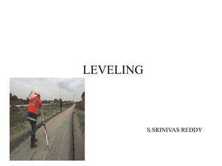
  • 6. • Simple Leveling It is a simple and basic form of leveling in which the leveling instrument is placed between the points which elevation is to be find. Leveling rods are placed at that points and sighted them through leveling instrument. It is performed only when the points are nearer to each other without any obstacles. TYPES OF LEVELING
  • 7. Differential Leveling Differential leveling is performed when the distance between two points is more. In this process, number of inter stations are located and instrument is shifted to each station and observed the elevation of inter station points. Finally difference between original two points is determined. TYPES OF LEVELING
  • 8. TYPES OF LEVELING • Fly Leveling Fly leveling is conducted when the benchmark is very far from the work station. In such case, a temporary bench mark is located at the work station which is located based on the original benchmark. Fly levelling is just like differential levelling carried out to check the accuracy of levelling work. In fly levelling only B.S. and F.S. are taken
  • 9. • Profile Leveling Profile leveling is generally adopted to find elevation of points along a line such as for road, rails or rivers etc. The object is to determine the undulations of the ground surface along the alignment. TYPES OF LEVELING
  • 10. • Precise Leveling It is used for establishing bench marks for future public use. It is carried out with high degree of accuracy using advanced instruments Trigonometric Levelling . The accuracy of 1 mm per 1 km is achieved. • Check Leveling : This kind of levelling is carried out to check the accuracy of work. It is done at the end of the days work in the form of fly levelling to connect the finishing point and starting point TYPES OF LEVELING
  • 11. • Reciprocal Leveling This method is adopted to accurately determine the difference of level between two points which are far apart. It is also used when it is not possible to setup level in midway between two points. TYPES OF LEVELING
  • 12. • Trigonometric Leveling • The process of leveling in which the elevation of point or the difference between points is measured from the observed horizontal distances and vertical angles in the field is called trigonometric leveling. • In this method, trigonometric relations are used to find the elevation of a point from angle and horizontal distance so, it is called as trigonometric leveling. It is also called as indirect leveling.
  • 13. • Barometric Leveling • Barometer is an instrument used to measure atmosphere at any altitude. So, in this method of leveling, atmospheric pressure at two different points is observed, based on which the vertical difference between two points is determined. It is a rough estimation and used rarely.
  • 14. • Stadia Leveling It is a modified form of trigonometric leveling in which Tachometer principle is used to determine the elevation of point. In this case the line of sight is inclined from the horizontal. It is more accurate and suitable for surveying in hilly terrains.
  • 15. Methods of Reducing Levels • Height of Instrument Method: This method consist of finding H.I. for every setup of instrument, and then obtaining the R.L. of point of reference with respect to H.I
  • 17. Methods of Reducing Levels • Rise and Fall Method • This method consist of determining the difference of level between consecutive points by comparing each point with immediate preceding point.
  • 19. ERRORS IN LEVELLING Personal Error: • The Instruments may not be levelled • The focusing of eye piece and objective glass may not be perfect • The position of staff may have changed • Entry and recording in the field book may not be correct • The staff may not be fully extended, may not be held vertical. Instrumental Error • The Permanent adjustment of the instrument may not be perfect. That is the line of collimation may not be horizontal line. • The internal arrangement of focusing tube may not be correct • Defective bubble tube, if the bubble tube is sluggish, it may apparently be in the mid-position even though the bubble line is not horizontal.
  • 20. USES: • To prepare the contour maps • Altitudes of different levels in a hill station • To prepare layouts of water distribution system • To prepare LS(longitudinal sectioning) and cross sectioning of a project