2.characteristics of countours
•Download as PPT, PDF•
0 likes•741 views
This document contains a lecture on contour mapping given by Mohd Salman Ahmed, a lecturer in civil engineering at Ahmed's Institute of Excellence. The lecture discusses the characteristics of contours, how to read contour plans, and how to interpret information from contour maps. Key points covered include that contours have the same elevation, spacing depends on slope, closed contours indicate hills or depressions, and contours cannot cross except at overhanging cliffs. The document provides examples and a short quiz to assess understanding.
Report
Share
Report
Share

Recommended
Levelling in Surveying
Simple levelling
Differential levelling
Fly levelling
Profile levelling
Cross sectional levelling
Reciprocal levelling
Height of instrument (or plane of collimation) method
Rise and fall method
Mode of measurement, rules for deduction of plastering & brickwork
Mode of measurement, rules for deduction of plastering, rules for deduction of brickwork, Measurement of work as per IS 1200
Contouring
This document discusses contouring and contour maps. It defines a contour line as a line connecting points of equal elevation. The vertical distance between consecutive contours is called the contour interval, which depends on factors like the nature of the ground and the map scale. Contour maps show the topography of an area and can be used for engineering projects, route selection, and estimating earthworks. Methods of plotting contours include direct methods using levels or hand levels, and indirect methods like gridding, cross-sectioning, and radial lines. Characteristics of contours provide information about the landscape.
Setting out work
*Introduction
*Controls For Setting Out
*Horizontal control
*Vertical control
*SETTING OUT A BUILDING
*The equipment required for the job
*Method(1):-By using a Circumscribing Rectangle
*Method(2):- By using centre-line-rectangle
* Setting out of culverts
*SETTING OUT A TUNNEL
Specification writing-I
The document discusses specifications in engineering projects. It defines specifications as a detailed description of materials, workmanship, and other requirements to complete a project according to its drawings. Specifications are necessary to define quality standards, guide construction, and resolve disputes. They form an essential part of contract documents along with drawings, bills of quantities, and schedules of rates. The document outlines how to write specifications by describing materials, workmanship, tools, testing, and protection of works. It also differentiates between general and detailed specifications.
Linear Measurements
This document provides an overview of linear measurements and chain surveying techniques. It discusses different types of ranging methods, including direct and reciprocal ranging, to locate intermediate points along a survey line. It also describes instruments used for chain surveying, such as different types of chains, tapes, arrows, ranging rods, and plumb bobs. The key principle of chain surveying is that it involves measuring the sides of triangles within the survey area using a chain or tape, without taking any angular measurements.
Contouring
1) Contour lines on a map connect points of equal elevation and represent the topography of the land.
2) Contour surveys are conducted at the start of engineering projects to select suitable sites, locate alignments to minimize earthworks, and understand the terrain.
3) Contours are located either directly by tracing lines in the field or indirectly by taking spot levels and interpolating lines on the map. Indirect methods using cross-sections or tacheometry are more efficient for large areas.
Levelling
1. Levelling is used to determine relative heights and elevations of points and establish points at required elevations. It involves using instruments like levels and staffs.
2. There are different types of levels (dumpy, tilting, wye, automatic) and staffs (self-reading, target). Precise levelling is done to establish permanent benchmarks.
3. Adjustments must be made to level instruments during setup and permanently. Methods like differential, profile and cross levelling are used depending on the task. Reciprocal levelling involves backsight-foresight exchange to check for errors.
Plane Table Survey
The document provides information on plane table surveying. It describes plane table surveying as a graphical surveying method where field observations and plotting are done simultaneously. Key instruments used include a plane table mounted on a tripod, an alidade, and accessories like a trough compass and spirit level. There are different methods of plane table surveying, including radiation, intersection, and resection, which involve drawing radial lines from survey stations to locate points.
Tacheometric surveying ppt
Tacheometric surveying uses a tacheometer to determine horizontal and vertical distances through angular measurements. A tacheometer is a theodolite fitted with stadia hairs and an anallatic lens. The tacheometric formula relates the staff intercept, focal length, stadia interval and additive constant to calculate horizontal distances. Methods include stadia, fixed/movable hair, and non-stadia techniques. Determining the tacheometer constant involves measuring distances and staff intervals at stations to solve equations. Errors arise from incorrect stadia intervals or graduations. Tacheometric surveying provides distances in rough terrain but with less precision than other methods.
Contouring - Surveying...for civil Engineering and Architecture..
Contouring - Surveying...for civil Engineering and Architecture students. It contains all the syllabus according to Pokhara University, Nepal
---By Assistant Professor. Pramesh Hada
Nepal Engineering College
CHangunarayan, Bhaktapur
Types of level
This document discusses different types of levels used in surveying and engineering projects. It describes dumpy levels, tilting levels, automatic levels, and digital levels. Dumpy levels have a rigidly fixed telescope but are simple and stable. Tilting levels allow the telescope to be tilted for precise work. Automatic levels have a compensator to keep the line of sight horizontal. Digital levels determine heights and distances digitally with high accuracy up to 100 meters. Leveling is important for engineering projects to determine relative elevations of points.
Tacheometric surveying
Tacheometric surveying is a method of rapidly determining horizontal and vertical positions of points using optical measurements rather than traditional tape or chain measurements. A tacheometer, which is a transit theodolite fitted with a stadia diaphragm, is used to measure the horizontal and vertical angles to a stadia rod or staff held at survey points. Formulas involving the stadia interval, staff intercept readings, and calculated constants are used to determine horizontal distances and elevations from the instrument to points. Measurements can be taken with horizontal lines of sight or inclined lines of sight when the staff is held vertically or normal to the line of sight.
Levelling
1) Levelling is the process of determining the relative elevations of points on or near the earth's surface. It is important for engineering projects to determine elevations along alignments.
2) Levelling is used to prepare contour maps, determine altitudes, and create longitudinal and cross sections needed for projects.
3) Key terms include bench mark, datum, reduced level, line of collimation, and height of instrument. Different types of levelling include simple, differential, fly, longitudinal, and cross-sectional levelling.
Surveying and Leveling
The document provides information about lectures on surveying topics including:
- Classification of theodolites as transit, non-transit, vernier, and micrometer theodolites.
- Uses of theodolites for measuring horizontal and vertical angles, locating points, and other surveying tasks.
- Terms used in manipulating a transit vernier theodolite such as centering, transiting, swinging the telescope, and changing face.
- Bearings and the rules for converting whole circle bearings to quadrantal/reduced bearings.
- Definitions of open and closed traverses and the formula to check the interior angles of a closed traverse.
- An example problem on calculating
Topographical Survey
Topographical Surveys provide a detailed picture of an area of land which may range from small site surveys prior to development to larger areas such as proposed golf courses, environmental projects and Street Scenes. All features are shown to a level of detail and scale appropriate to the individual project.
Topic 2 area & volume
The document provides information on calculating area and volume for engineering projects. It discusses several methods for calculating the area of regular and irregular shapes, including using mathematical equations, coordinates, planimeters, trapezoidal rule, mid-ordinate rule, and Simpson's rule. It also outlines various approaches to calculating volumes based on cross-sections, spot levels, and contour lines, including end area method, mean area method, and prismoidal formula. Examples are provided to demonstrate calculating area and volume using these different techniques.
Setting out construction works 01
Introduction to Setting out construction works
Precautions in Setting out construction works
Setting out of Bridge
Types of estimates, checklist of items of work, role of estimator
This document discusses different types of construction estimates including approximate estimates, detailed estimates, revised estimates, supplementary estimates, repair and maintenance estimates, and renovation estimates. It provides examples of when each type would be used such as for changes to design, additional work added, or repairs needed to structures. Common items included in estimates for RCC and brick masonry structures are also listed. The estimating process involves preparing a checklist of items, calculating quantities, expressing quantities in correct units, and preparing measurement and abstract sheets.
Building Stones
Stones have been used in construction for thousands of years in buildings all over the world. They are classified geologically based on their mode of formation as igneous, sedimentary, or metamorphic rocks. Igneous rocks form from cooling magma, sedimentary rocks form from compressed sediments, and metamorphic rocks form from changes to existing rocks. Stones are also classified chemically based on their dominant composition of silica, calcareous, or argillaceous minerals. Structurally, stones can occur as massive unstratified rocks, stratified layered rocks, or foliated banded rocks. Many historical structures were constructed of stone and it remains an important building material.
surveying instruments
This document discusses surveying instruments used in civil engineering. It describes various tools like chains for measuring distance, clinometers for measuring inclined angles, planimeters for measuring irregular areas, and compasses for determining directions. Additional instruments mentioned include ranging rods, reflector prisms, auto levels, staff rods, theodolites, total stations, tripods, pegs, scales, plan tables, and plumb bobs. Each tool has a specific purpose in surveying applications.
Chain surveying.1
This document discusses the topic of chain surveying for a civil engineering class project. It provides definitions of chain surveying, noting that it involves measuring linear distances between survey stations to divide an area into triangles without taking angular measurements. It then outlines the key principles and terms of chain surveying, such as defining main stations, subsidiary stations, tie stations, main survey lines, base lines, check lines, and tie lines. Finally, it provides the basic procedures for conducting a chain survey between two stations.
Levelling
Element Of Civil Engineering subject as per GTU syllabus 1st sem carry out all content. also usefull for general idea about civil branch.
Lec. 11 setting out simple circular curve
1. The document discusses three methods for setting out a simple circular curve in engineering and surveying projects: the tangential angle method, the tangent offset method, and the chord offset method.
2. The tangential angle method uses a theodolite to measure deflection angles and chords to lay out points along the curve.
3. The tangent offset method uses only a chain and tape, measuring offsets perpendicular to tangents to locate points for small curves where high accuracy is not required.
4. Similarly, the chord offset method divides a chord between the PC and PT into segments and measures offsets perpendicular to locate points along the curve.
Total station Surveying
This document provides an overview of a total station, including its key components and functions. A total station is an electronic surveying instrument that combines an electronic distance meter and theodolite to measure horizontal and vertical angles and distances. It allows simultaneous measurement of all surveying parameters needed for construction layout and topographic surveys. The total station's main components include an electronic distance measurement system, angle measurement circles, telescope, microprocessor, keyboard, and display. Accessories such as prisms, data collectors, and software enable various surveying tasks.
Plane table surveying
This document provides an overview of plane table surveying. It describes the equipment used, which includes the plane table, alidade, U-fork with plumb bob, spirit level, compass, and drawing paper. It explains the working operations of plane table surveying, which involves fixing the plane table to the tripod, leveling it, centering it over survey points, and orienting it. Finally, it outlines several methods of plane table surveying, including radiation, intersection, traversing, resection, and solving two-point and three-point problems.
Bricks bats and closers
Brick sizes and positions vary according to local custom and usage. Standard brick sizes ensure proper burning and weight. Bricks are laid in different positions like stretcher, header, shiner, rowlock, sailor, and soldier based on which face is exposed. Various brick terminologies describe features like lap, perpend, bed, racking back, toothing, arris, quoin, frog. Bats and closers are cut portions used to complete bonds - bats have width cut, closers length. Special shaped bricks include bull nose, splays, and dogleg for rounded corners and angled quoins.
FUNDAMENTALS OF ARCHITECTURE
The document discusses the importance of space in architecture. It explains that space can be inhabited and architects carefully configure spaces to accommodate building functions through variables like size, proportion, organization, and materials. Vertical elements and openings in walls are also discussed as defining and impacting spaces by establishing boundaries and connections to other areas. The qualities of an architectural space depend on the properties of its enclosure, including the degree of enclosure, light, and views provided.
1.introduction to contours
The document discusses topographic maps and contour lines. It defines a topographic map as a map that shows both horizontal and vertical control to accurately depict ground surfaces and elevation. Contours are imaginary lines on the map that connect points of equal elevation. The spacing between contours is called the contour interval and depends on factors like terrain, map scale, and purpose. Drawing contours is known as contouring. Examples of contours include shorelines and contour lines on a topographic map help indicate changes in elevation.
Graphics-full ppt.ppt
This document provides an overview of topics related to engineering graphics and drawings. It includes sections on scales, engineering curves, loci of points, orthographic projections, projections of points/lines/planes/solids, sections and developments, intersections of surfaces, and isometric projections. For each topic, it lists sub-topics and provides example problems and step-by-step solutions for understanding concepts and practicing techniques in engineering graphics. The overall objective is to help readers visualize engineering situations and designs through practice with examples.
More Related Content
What's hot
Plane Table Survey
The document provides information on plane table surveying. It describes plane table surveying as a graphical surveying method where field observations and plotting are done simultaneously. Key instruments used include a plane table mounted on a tripod, an alidade, and accessories like a trough compass and spirit level. There are different methods of plane table surveying, including radiation, intersection, and resection, which involve drawing radial lines from survey stations to locate points.
Tacheometric surveying ppt
Tacheometric surveying uses a tacheometer to determine horizontal and vertical distances through angular measurements. A tacheometer is a theodolite fitted with stadia hairs and an anallatic lens. The tacheometric formula relates the staff intercept, focal length, stadia interval and additive constant to calculate horizontal distances. Methods include stadia, fixed/movable hair, and non-stadia techniques. Determining the tacheometer constant involves measuring distances and staff intervals at stations to solve equations. Errors arise from incorrect stadia intervals or graduations. Tacheometric surveying provides distances in rough terrain but with less precision than other methods.
Contouring - Surveying...for civil Engineering and Architecture..
Contouring - Surveying...for civil Engineering and Architecture students. It contains all the syllabus according to Pokhara University, Nepal
---By Assistant Professor. Pramesh Hada
Nepal Engineering College
CHangunarayan, Bhaktapur
Types of level
This document discusses different types of levels used in surveying and engineering projects. It describes dumpy levels, tilting levels, automatic levels, and digital levels. Dumpy levels have a rigidly fixed telescope but are simple and stable. Tilting levels allow the telescope to be tilted for precise work. Automatic levels have a compensator to keep the line of sight horizontal. Digital levels determine heights and distances digitally with high accuracy up to 100 meters. Leveling is important for engineering projects to determine relative elevations of points.
Tacheometric surveying
Tacheometric surveying is a method of rapidly determining horizontal and vertical positions of points using optical measurements rather than traditional tape or chain measurements. A tacheometer, which is a transit theodolite fitted with a stadia diaphragm, is used to measure the horizontal and vertical angles to a stadia rod or staff held at survey points. Formulas involving the stadia interval, staff intercept readings, and calculated constants are used to determine horizontal distances and elevations from the instrument to points. Measurements can be taken with horizontal lines of sight or inclined lines of sight when the staff is held vertically or normal to the line of sight.
Levelling
1) Levelling is the process of determining the relative elevations of points on or near the earth's surface. It is important for engineering projects to determine elevations along alignments.
2) Levelling is used to prepare contour maps, determine altitudes, and create longitudinal and cross sections needed for projects.
3) Key terms include bench mark, datum, reduced level, line of collimation, and height of instrument. Different types of levelling include simple, differential, fly, longitudinal, and cross-sectional levelling.
Surveying and Leveling
The document provides information about lectures on surveying topics including:
- Classification of theodolites as transit, non-transit, vernier, and micrometer theodolites.
- Uses of theodolites for measuring horizontal and vertical angles, locating points, and other surveying tasks.
- Terms used in manipulating a transit vernier theodolite such as centering, transiting, swinging the telescope, and changing face.
- Bearings and the rules for converting whole circle bearings to quadrantal/reduced bearings.
- Definitions of open and closed traverses and the formula to check the interior angles of a closed traverse.
- An example problem on calculating
Topographical Survey
Topographical Surveys provide a detailed picture of an area of land which may range from small site surveys prior to development to larger areas such as proposed golf courses, environmental projects and Street Scenes. All features are shown to a level of detail and scale appropriate to the individual project.
Topic 2 area & volume
The document provides information on calculating area and volume for engineering projects. It discusses several methods for calculating the area of regular and irregular shapes, including using mathematical equations, coordinates, planimeters, trapezoidal rule, mid-ordinate rule, and Simpson's rule. It also outlines various approaches to calculating volumes based on cross-sections, spot levels, and contour lines, including end area method, mean area method, and prismoidal formula. Examples are provided to demonstrate calculating area and volume using these different techniques.
Setting out construction works 01
Introduction to Setting out construction works
Precautions in Setting out construction works
Setting out of Bridge
Types of estimates, checklist of items of work, role of estimator
This document discusses different types of construction estimates including approximate estimates, detailed estimates, revised estimates, supplementary estimates, repair and maintenance estimates, and renovation estimates. It provides examples of when each type would be used such as for changes to design, additional work added, or repairs needed to structures. Common items included in estimates for RCC and brick masonry structures are also listed. The estimating process involves preparing a checklist of items, calculating quantities, expressing quantities in correct units, and preparing measurement and abstract sheets.
Building Stones
Stones have been used in construction for thousands of years in buildings all over the world. They are classified geologically based on their mode of formation as igneous, sedimentary, or metamorphic rocks. Igneous rocks form from cooling magma, sedimentary rocks form from compressed sediments, and metamorphic rocks form from changes to existing rocks. Stones are also classified chemically based on their dominant composition of silica, calcareous, or argillaceous minerals. Structurally, stones can occur as massive unstratified rocks, stratified layered rocks, or foliated banded rocks. Many historical structures were constructed of stone and it remains an important building material.
surveying instruments
This document discusses surveying instruments used in civil engineering. It describes various tools like chains for measuring distance, clinometers for measuring inclined angles, planimeters for measuring irregular areas, and compasses for determining directions. Additional instruments mentioned include ranging rods, reflector prisms, auto levels, staff rods, theodolites, total stations, tripods, pegs, scales, plan tables, and plumb bobs. Each tool has a specific purpose in surveying applications.
Chain surveying.1
This document discusses the topic of chain surveying for a civil engineering class project. It provides definitions of chain surveying, noting that it involves measuring linear distances between survey stations to divide an area into triangles without taking angular measurements. It then outlines the key principles and terms of chain surveying, such as defining main stations, subsidiary stations, tie stations, main survey lines, base lines, check lines, and tie lines. Finally, it provides the basic procedures for conducting a chain survey between two stations.
Levelling
Element Of Civil Engineering subject as per GTU syllabus 1st sem carry out all content. also usefull for general idea about civil branch.
Lec. 11 setting out simple circular curve
1. The document discusses three methods for setting out a simple circular curve in engineering and surveying projects: the tangential angle method, the tangent offset method, and the chord offset method.
2. The tangential angle method uses a theodolite to measure deflection angles and chords to lay out points along the curve.
3. The tangent offset method uses only a chain and tape, measuring offsets perpendicular to tangents to locate points for small curves where high accuracy is not required.
4. Similarly, the chord offset method divides a chord between the PC and PT into segments and measures offsets perpendicular to locate points along the curve.
Total station Surveying
This document provides an overview of a total station, including its key components and functions. A total station is an electronic surveying instrument that combines an electronic distance meter and theodolite to measure horizontal and vertical angles and distances. It allows simultaneous measurement of all surveying parameters needed for construction layout and topographic surveys. The total station's main components include an electronic distance measurement system, angle measurement circles, telescope, microprocessor, keyboard, and display. Accessories such as prisms, data collectors, and software enable various surveying tasks.
Plane table surveying
This document provides an overview of plane table surveying. It describes the equipment used, which includes the plane table, alidade, U-fork with plumb bob, spirit level, compass, and drawing paper. It explains the working operations of plane table surveying, which involves fixing the plane table to the tripod, leveling it, centering it over survey points, and orienting it. Finally, it outlines several methods of plane table surveying, including radiation, intersection, traversing, resection, and solving two-point and three-point problems.
Bricks bats and closers
Brick sizes and positions vary according to local custom and usage. Standard brick sizes ensure proper burning and weight. Bricks are laid in different positions like stretcher, header, shiner, rowlock, sailor, and soldier based on which face is exposed. Various brick terminologies describe features like lap, perpend, bed, racking back, toothing, arris, quoin, frog. Bats and closers are cut portions used to complete bonds - bats have width cut, closers length. Special shaped bricks include bull nose, splays, and dogleg for rounded corners and angled quoins.
FUNDAMENTALS OF ARCHITECTURE
The document discusses the importance of space in architecture. It explains that space can be inhabited and architects carefully configure spaces to accommodate building functions through variables like size, proportion, organization, and materials. Vertical elements and openings in walls are also discussed as defining and impacting spaces by establishing boundaries and connections to other areas. The qualities of an architectural space depend on the properties of its enclosure, including the degree of enclosure, light, and views provided.
What's hot (20)
Contouring - Surveying...for civil Engineering and Architecture..
Contouring - Surveying...for civil Engineering and Architecture..
Types of estimates, checklist of items of work, role of estimator
Types of estimates, checklist of items of work, role of estimator
Similar to 2.characteristics of countours
1.introduction to contours
The document discusses topographic maps and contour lines. It defines a topographic map as a map that shows both horizontal and vertical control to accurately depict ground surfaces and elevation. Contours are imaginary lines on the map that connect points of equal elevation. The spacing between contours is called the contour interval and depends on factors like terrain, map scale, and purpose. Drawing contours is known as contouring. Examples of contours include shorelines and contour lines on a topographic map help indicate changes in elevation.
Graphics-full ppt.ppt
This document provides an overview of topics related to engineering graphics and drawings. It includes sections on scales, engineering curves, loci of points, orthographic projections, projections of points/lines/planes/solids, sections and developments, intersections of surfaces, and isometric projections. For each topic, it lists sub-topics and provides example problems and step-by-step solutions for understanding concepts and practicing techniques in engineering graphics. The overall objective is to help readers visualize engineering situations and designs through practice with examples.
Engineering-Drawing-Part-1[1].ppt
This document provides information on various types of engineering scales and their construction and applications. It discusses plain scales, which can measure dimensions up to a single decimal place, and provides examples of their construction and use. It also covers diagonal scales, which can measure up to two decimal places, and vernier scales, which also measure up to two decimal places. Comparative scales are described for comparing different units, and scales of cords are introduced for measuring and constructing angles. Construction techniques and example problems are provided for different scale types. The document serves as a reference for understanding and applying various engineering scales.
Engineering graphics by harshid panchal
this is the ppt on engineering graphics,. ..
with all problem solution. .this is not made by me. .
but i think this is the best ppt for engineering graphics.. .the whole engineering graphics is cover in this ppt
COMPLETE-engineering-graphics PPT.ppt
This document provides an overview of various topics related to engineering graphics including scales, engineering curves, loci of points, orthographic projections, projections of points/lines/planes/solids, sections and developments, intersections of surfaces, and isometric projections. It describes the key concepts, methods, and example problems for each topic. Plain scales, diagonal scales, vernier scales, and comparative scales are introduced for measuring distances with different levels of precision. Engineering curves like ellipses, parabolas, hyperbolas, involutes, and spirals are defined along with methods for drawing tangents and normals. Orthographic projections convert between pictorial and multi-view drawings. Projections determine how points, lines, planes and
Engineering drawing-part-1
The document provides an overview of topics related to engineering graphics and orthographic projections. It contains 14 sections that cover various concepts such as scales, engineering curves, loci of points, orthographic projections, projections of points and lines, projections of planes and solids, sections and developments, intersections of surfaces, and isometric projections. For each section, it lists the subtopics that will be covered along with brief explanations and examples. The document serves as a table of contents or syllabus for an engineering graphics course, outlining the key concepts and methods that will be taught.
GI - Map skills and hypothesis
This document discusses key geographical skills including topographical map reading, geographical data techniques, and conducting geographical investigations. It covers topics such as reading grid references, measuring distances on maps, interpreting map symbols and scales, describing landforms and relief, settlement patterns, and using compasses to find bearings. It also discusses creating and interpreting various types of graphs to display geographical data, such as line graphs, bar graphs, pie charts, scatterplots, climographs, and histograms. Finally, it discusses the phases of conducting geographical fieldwork and how to develop hypotheses or guiding questions.
8.Charts
This document provides information about basic concepts related to charts used for aviation purposes. It discusses key terms like maps, charts, projections and distortions that occur when representing the spherical Earth on a flat surface. It also describes different types of projections including plane, conical, cylindrical and their characteristics. Specific projections like Mercator and Lambert Conformal are explained in more detail.
Engineering Graphics PPT By A.D Rajput
Userfull for engineers....
Engineering graphics..
PPT made by our sir "A.D.Rajput..
Contact me on whatsapp for more updates.... num-9898528376
Or find me on fb/iamharsh.prajapati
Thnx :)
Full engineering-graphics
Okay, let's solve this step-by-step:
1) Given: Actual area of plot = 1.28 hectares = 12800 sqm
Area shown on map = 8 sqcm
2) To calculate RF:
RF = Actual Dimension / Shown Dimension
RF = 12800 sqm / 8 sqcm
RF = 12800 / 8 = 1600
RF = 1/1600
3) Length of scale = RF x Maximum length to be measured
Maximum length = 100m
Length of scale = 1/1600 x 100m = 6.25cm = 6cm (approx.)
4) Draw a line 6cm long divided into 10 equal parts to read up to 10m
5)
1080093 634446814277798750
Okay, let's solve this step-by-step:
1) Given: Actual area of plot = 1.28 hectares = 12800 sqm
Area shown on map = 8 sqcm
2) To calculate RF:
RF = Actual Dimension / Shown Dimension
RF = 12800 sqm / 8 sqcm
RF = 12800 / 8 = 1600
RF = 1/1600
3) Length of scale = RF x Maximum length to be measured
Maximum length = 100m
Length of scale = 1/1600 x 100m = 6.25cm = 6cm (approx.)
4) Draw a line 6cm long divided into 10 equal parts to read up to 10m
5)
Eg whole subject
Okay, let's solve this step-by-step:
1) Given: Actual area of plot = 1.28 hectares = 12800 sqm
Map area = 8 sqcm
2) To calculate RF:
RF = Map Area / Actual Area
= 8 sqcm / 12800 sqm
= 8 / 12800
= 1/1600
3) Length of scale = RF x Maximum length
= 1/1600 x 100m (let's take max length as 100m)
= 100/1600 cm = 6.25 cm
4) Draw a line 6.25 cm long and divide it into 10 equal parts to read up to 1 decimal place.
5) Draw a perpendicular line
EG.pps.ppt
This document provides information on various topics related to engineering drawing including scales, curves, loci of points, orthographic projections, projections of points and lines, planes, solids, sections and developments, intersections of surfaces, and isometric projections. It contains definitions, explanations, methods of construction, examples and problems for each topic. The document aims to help readers visualize concepts in engineering drawing through illustrations and practice problems to aid in learning and solving problems independently. It encourages reviewing notes, discussing doubts with teachers, and practicing techniques on their own for success.
UNit no 1 Contouring.pptx
Contour lines on a map represent points of equal elevation and indicate the terrain's shape and elevation. A contour map uses contour lines to depict the landform of an area. The process of producing contour lines by determining elevation points is called contouring. Contouring can be done directly by measuring points along contour lines or indirectly by taking spot elevations and interpolating between them. The contour interval, or elevation difference between contour lines, depends on factors like terrain, map scale, and purpose of the survey. Common contour intervals range from 0.2m to 25m. Contour characteristics provide information about terrain features like hills, valleys, ridges, and slopes.
( Engineering-graphics) for-be-students .(EG).
This document contains information about various topics related to engineering graphics including scales, engineering curves, loci of points, orthographic projections, projections of points and lines, projections of planes, projections of solids, sections and development, intersection of surfaces, and isometric projections. It provides definitions, classifications, methods of construction, and example problems for each topic. The goal of the document is to help the reader visualize concepts in engineering graphics and provide practice problems to aid in learning and solving problems related to these topics.
Engineering graphics A to Z
This presentation is very useful for students who are just beginning their journey to learn Engineering graphics.
It has a very basic explanation with simple to complex example strategy
Engineering graphics Sheet for BE Students
This document provides an overview of topics related to engineering graphics and projections. It includes sections on scales, engineering curves, loci of points, orthographic projections, projections of points and lines, projections of planes, projections of solids, sections and development, intersection of surfaces, and isometric projections. Each section provides definitions, methods, and example problems related to the specific topic. The objective is to use illustrations and examples to help the reader visualize concepts and reach correct solutions through practice of the techniques.
ENGINEERING GRAPHICS-ED-FOR-BE/B.TECH-STUDENTS
This document provides information on various topics related to engineering drawing, including scales, engineering curves, loci of points, orthographic projections, projections of points and lines, projections of planes, projections of solids, sections and development, intersection of surfaces, and isometric projections. It contains definitions, explanations, methods of construction, and example problems for each topic. The document aims to help readers visualize concepts in engineering drawing and provide practice through example problems to gain proficiency in applying techniques and reaching correct solutions. Interactive features like illustrations, notes, and tips are included throughout to aid understanding and learning.
Engneering drawing
This document provides an overview of topics related to engineering graphics and projections. It includes sections on scales, engineering curves, loci of points, orthographic projections, projections of points and lines, projections of planes, projections of solids, sections and development, intersection of surfaces, and isometric projections. Each section provides definitions and explanations of concepts, as well as example problems and solutions. The document serves as a comprehensive reference guide for learning different techniques in engineering graphics.
Engineering drawing
slide show for Engineering graphics and drawing for those who find it difficult to clear their ED/EG in initial semesters
Similar to 2.characteristics of countours (20)
Recently uploaded
Your Skill Boost Masterclass: Strategies for Effective Upskilling
Your Skill Boost Masterclass: Strategies for Effective UpskillingExcellence Foundation for South Sudan
Strategies for Effective Upskilling is a presentation by Chinwendu Peace in a Your Skill Boost Masterclass organisation by the Excellence Foundation for South Sudan on 08th and 09th June 2024 from 1 PM to 3 PM on each day.PCOS corelations and management through Ayurveda.
This presentation includes basic of PCOS their pathology and treatment and also Ayurveda correlation of PCOS and Ayurvedic line of treatment mentioned in classics.
A Strategic Approach: GenAI in Education
Artificial Intelligence (AI) technologies such as Generative AI, Image Generators and Large Language Models have had a dramatic impact on teaching, learning and assessment over the past 18 months. The most immediate threat AI posed was to Academic Integrity with Higher Education Institutes (HEIs) focusing their efforts on combating the use of GenAI in assessment. Guidelines were developed for staff and students, policies put in place too. Innovative educators have forged paths in the use of Generative AI for teaching, learning and assessments leading to pockets of transformation springing up across HEIs, often with little or no top-down guidance, support or direction.
This Gasta posits a strategic approach to integrating AI into HEIs to prepare staff, students and the curriculum for an evolving world and workplace. We will highlight the advantages of working with these technologies beyond the realm of teaching, learning and assessment by considering prompt engineering skills, industry impact, curriculum changes, and the need for staff upskilling. In contrast, not engaging strategically with Generative AI poses risks, including falling behind peers, missed opportunities and failing to ensure our graduates remain employable. The rapid evolution of AI technologies necessitates a proactive and strategic approach if we are to remain relevant.
Advanced Java[Extra Concepts, Not Difficult].docx
This is part 2 of my Java Learning Journey. This contains Hashing, ArrayList, LinkedList, Date and Time Classes, Calendar Class and more.
Hindi varnamala | hindi alphabet PPT.pdf
हिंदी वर्णमाला पीपीटी, hindi alphabet PPT presentation, hindi varnamala PPT, Hindi Varnamala pdf, हिंदी स्वर, हिंदी व्यंजन, sikhiye hindi varnmala, dr. mulla adam ali, hindi language and literature, hindi alphabet with drawing, hindi alphabet pdf, hindi varnamala for childrens, hindi language, hindi varnamala practice for kids, https://www.drmullaadamali.com
Digital Artifact 1 - 10VCD Environments Unit
Digital Artifact 1 - 10VCD Environments Unit - NGV Pavilion Concept Design
How to Fix the Import Error in the Odoo 17
An import error occurs when a program fails to import a module or library, disrupting its execution. In languages like Python, this issue arises when the specified module cannot be found or accessed, hindering the program's functionality. Resolving import errors is crucial for maintaining smooth software operation and uninterrupted development processes.
BÀI TẬP BỔ TRỢ TIẾNG ANH 8 CẢ NĂM - GLOBAL SUCCESS - NĂM HỌC 2023-2024 (CÓ FI...
BÀI TẬP BỔ TRỢ TIẾNG ANH 8 CẢ NĂM - GLOBAL SUCCESS - NĂM HỌC 2023-2024 (CÓ FI...Nguyen Thanh Tu Collection
https://app.box.com/s/y977uz6bpd3af4qsebv7r9b7s21935vdA Survey of Techniques for Maximizing LLM Performance.pptx
A Survey of Techniques for Maximizing LLM Performance
The simplified electron and muon model, Oscillating Spacetime: The Foundation...
Discover the Simplified Electron and Muon Model: A New Wave-Based Approach to Understanding Particles delves into a groundbreaking theory that presents electrons and muons as rotating soliton waves within oscillating spacetime. Geared towards students, researchers, and science buffs, this book breaks down complex ideas into simple explanations. It covers topics such as electron waves, temporal dynamics, and the implications of this model on particle physics. With clear illustrations and easy-to-follow explanations, readers will gain a new outlook on the universe's fundamental nature.
Chapter 4 - Islamic Financial Institutions in Malaysia.pptx
Chapter 4 - Islamic Financial Institutions in Malaysia.pptxMohd Adib Abd Muin, Senior Lecturer at Universiti Utara Malaysia
This slide is special for master students (MIBS & MIFB) in UUM. Also useful for readers who are interested in the topic of contemporary Islamic banking.
RPMS TEMPLATE FOR SCHOOL YEAR 2023-2024 FOR TEACHER 1 TO TEACHER 3
RPMS Template 2023-2024 by: Irene S. Rueco
Exploiting Artificial Intelligence for Empowering Researchers and Faculty, In...
Exploiting Artificial Intelligence for Empowering Researchers and Faculty, In...Dr. Vinod Kumar Kanvaria
Exploiting Artificial Intelligence for Empowering Researchers and Faculty,
International FDP on Fundamentals of Research in Social Sciences
at Integral University, Lucknow, 06.06.2024
By Dr. Vinod Kumar KanvariaIntroduction to AI for Nonprofits with Tapp Network
Dive into the world of AI! Experts Jon Hill and Tareq Monaur will guide you through AI's role in enhancing nonprofit websites and basic marketing strategies, making it easy to understand and apply.
Top five deadliest dog breeds in America
Thinking of getting a dog? Be aware that breeds like Pit Bulls, Rottweilers, and German Shepherds can be loyal and dangerous. Proper training and socialization are crucial to preventing aggressive behaviors. Ensure safety by understanding their needs and always supervising interactions. Stay safe, and enjoy your furry friends!
The History of Stoke Newington Street Names
Presented at the Stoke Newington Literary Festival on 9th June 2024
www.StokeNewingtonHistory.com
Recently uploaded (20)
Your Skill Boost Masterclass: Strategies for Effective Upskilling
Your Skill Boost Masterclass: Strategies for Effective Upskilling
BÀI TẬP BỔ TRỢ TIẾNG ANH 8 CẢ NĂM - GLOBAL SUCCESS - NĂM HỌC 2023-2024 (CÓ FI...
BÀI TẬP BỔ TRỢ TIẾNG ANH 8 CẢ NĂM - GLOBAL SUCCESS - NĂM HỌC 2023-2024 (CÓ FI...
A Survey of Techniques for Maximizing LLM Performance.pptx
A Survey of Techniques for Maximizing LLM Performance.pptx
The simplified electron and muon model, Oscillating Spacetime: The Foundation...
The simplified electron and muon model, Oscillating Spacetime: The Foundation...
Chapter 4 - Islamic Financial Institutions in Malaysia.pptx
Chapter 4 - Islamic Financial Institutions in Malaysia.pptx
Digital Artefact 1 - Tiny Home Environmental Design
Digital Artefact 1 - Tiny Home Environmental Design
RPMS TEMPLATE FOR SCHOOL YEAR 2023-2024 FOR TEACHER 1 TO TEACHER 3
RPMS TEMPLATE FOR SCHOOL YEAR 2023-2024 FOR TEACHER 1 TO TEACHER 3
Exploiting Artificial Intelligence for Empowering Researchers and Faculty, In...
Exploiting Artificial Intelligence for Empowering Researchers and Faculty, In...
Introduction to AI for Nonprofits with Tapp Network
Introduction to AI for Nonprofits with Tapp Network
2.characteristics of countours
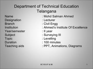
- 1. Department of Technical Education Telangana Name : Mohd Salman Ahmed Designation : Lecturer Branch : Civil Engg Institution : Ahmed’s Institute Of Excellence Year/semester : II year Subject : Surveying III Topic : Levelling Duration : 100 minutes Teaching aids : PPT, Animations, Diagrams 9C105.97 & 98 1
- 2. Objectives • Upon completion of this topic, you would be able to understand • The characteristics of contours • How to read contour plan • How to get information from contour plan 9C105.97 & 98 2
- 3. Contours • Every point on contour has same elevation • Contour plan will depict character of ground 9C105.97 & 98 3
- 4. Characteristics of Contours (contd.) 2. The contour lines are closed curves. They may close on the map itself or out side of the map depending upon the topography 9C105.97 & 98 4
- 5. Characteristics of Contours 1. The spacing between the contour lines depends upon the slope of the topography a) In steep slopes the spacing is small and for gentle slopes the spacing is large 9C105.97 & 98 5 Steep slope Gentle slope
- 6. Characteristics of Contours (Contd.) 9C105.97 & 98 6 b) Uniformly placed contours indicate uniform slope
- 7. Characteristics of Contours (Contd.) c) Straight and equally spaced contours indicate plane surface 9C105.97 & 98 7
- 8. Characteristics of Contours (Contd.) d) If the contour lines are parallel, straight and equally placed, they represent a plane surface 9C105.97 & 98 8 Plane surface
- 9. Characteristics of Contours (Contd.) 3. A series of closed contour lines on the map or plan indicate either hill or pond a) In case of hill the values of elevation go on increasing towards the centre 9C105.97 & 98 9
- 10. Characteristics of Contours (Contd.) b) A series of closed contours with higher values outside indicate a depression 9C105.97 & 98 10
- 11. Characteristics of Contours (Contd.) 4. Contour lines can not end anywhere but close on themselves 5. Contour lines can not merge or cross one another on map except in the case of an overhanging cliff 9C105.97 & 98 11 Overhanging cliff
- 12. Characteristics of Contours (Contd.) 6. A vertical cliff is indicated when several contours coincide When the horizontal equivalent is zero they coincide to form a one line and indicate a vertical cliff 9C105.97 & 98 12
- 13. Characteristics of Contours (Contd.) 7. The Contour lines form pair of loops in case of “saddle” 9C105.97 & 98 13
- 14. Characteristics of Contours 8. Irregular contours indicate rugged terrain • A Ridge line is indicated when the values inside the loop are higher 9C105.97 & 98 14
- 15. Characteristics of Contours 10. A valley line is indicated when lower values are inside the loop 9C105.97 & 98 15
- 16. Summary We have discussed • The characteristics of contours • How to read contour plans • How to interpret contour maps 9C105.97 & 98 16
- 17. Quiz 1. Closed contours with higher values inside represent A. Hill B. Depression C. Flat surface D. Steep slope Ans: A 9C105.97 & 98 17
- 18. 2. Closed contours with lower values inside represent A. Hill B. Depression C. Flat surface D. Steep slope Ans: B 9C105.97 & 98 18 Quiz (contd.)
- 19. 3. Contour lines merge or cross in a a. Hill b. Depression c. Over hanging cliff d. Vertical cliff Ans: C 9C105.97 & 98 19 Quiz (contd.)
- 20. 4. Contour lines coincide in case of A. Hill B. Depression C. Overhanging cliff D. Vertical cliff Ans: D 9C105.97 & 98 20 Quiz (contd.)
- 21. Frequently asked questions 1) Explain the characteristics of contours. 2) Draw neat sketches of contours for the following a) Hill b) Vertical cliff 9C105.97 & 98 21
- 22. AHMED’S INSTITUTE OF EXCELLENCEAHMED’S INSTITUTE OF EXCELLENCE NEAR YAKUTPURA RAILWAY STATION, HYDERABAD, TELANGANA TUITION CLASSES FORTUITION CLASSES FOR DIPLOMA, (CIVIL, MECHANICAL, ECE, EEE & CME) INTERMEDIATE,(MPC, CEC & HEC) DEGREE,(B.COM, BSC & BA) ENGINEERING (CIVIL, MECHANICAL, ECE, EEE & CSE) CONTACT:CONTACT: MOHD SALMAN AHMED 9700573988 DIRECTOR DCE.,BE.,ME