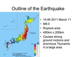
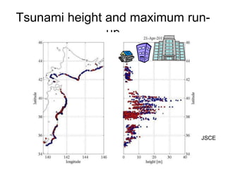
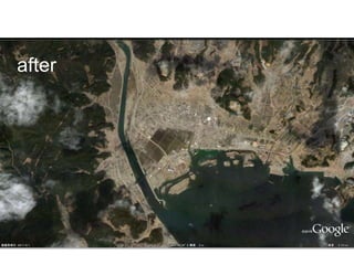
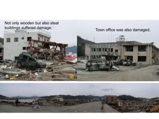
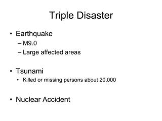
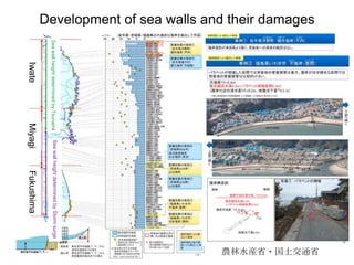
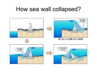
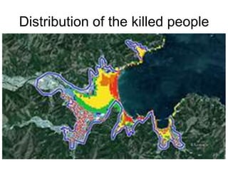
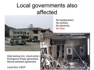
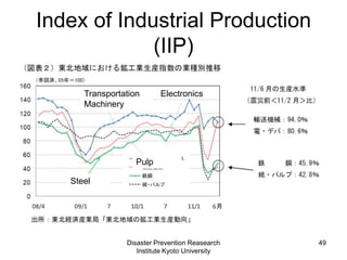
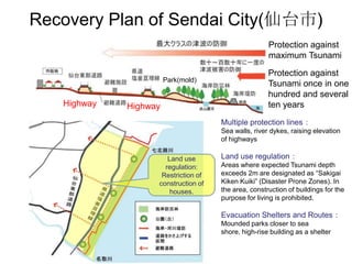
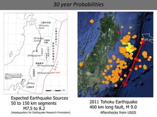
1) The 2011 Great East Japan Earthquake and Tsunami was one of the largest earthquakes ever recorded at magnitude 9.0. It caused widespread damage including over 15,000 deaths from tsunami waves as high as 40 meters.
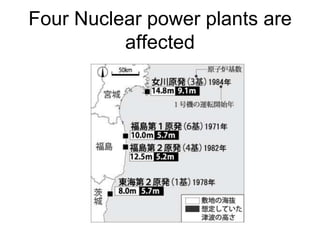
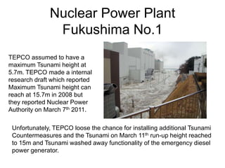
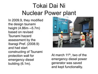
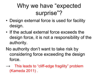
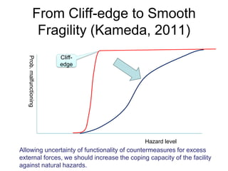
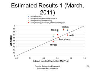
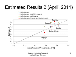
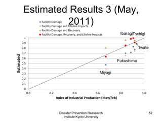
2) The earthquake damaged nuclear power plants in Fukushima and caused meltdowns. This revealed flaws in assuming that risks beyond design standards were improbable. It showed the importance of considering lower probability higher impact events and increasing infrastructure flexibility.
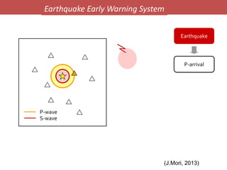
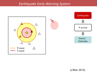
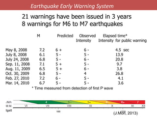
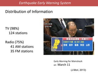
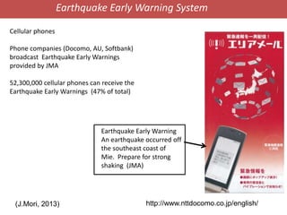
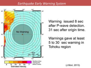
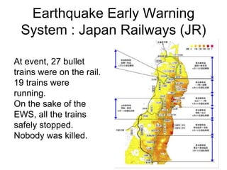
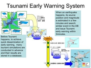
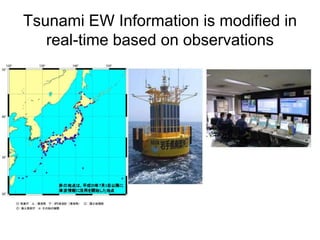
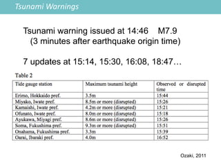
3) Early warning systems helped reduce losses from the earthquake and tsunami. The earthquake early warning was issued only 8 seconds after shaking was detected, allowing some trains to stop safely. Updated tsunami warnings were issued as data came in.