SlideShare a Scribd company logo
1 of 30
Download to read offline
…by I•GIS
Detailed geological modelling in urban areas
– focus on structures relevant to the near-surface groundwater flow and
surface water recharge.
Senior Geologist Tom Martlev Pallesen (I•GIS)
Detailed Geological Modelling In Urban Areas
…by I•GIS
Disposition
Detailed Geological Modelling In Urban Areas
Background
Challenges -
detailed modelling in urban areas
Datatypes
Model types
Summary
Model setup and workflow
Development of new tools
…by I•GIS
Background
The case shows an example from Odense City (DK) where new geological modelling techniques
has been developed in the geological modelling software GeoScene3D, and used to create a
detailed voxel model of the anthropogenic layer (the soil zone where human activity has
changed the original geological layers).
The example is part of a pilot project partly financed by VTU (Foundation for Development of
Technology in the Danish Water Sector) and involves many different datatypes such as human
related elements (landfill, pipelines, roadbeds etc.).
I•GIS have modelled the anthropogenic layer in the pilot area Thomas B. Thriges Gade.
GeoScene3D is a geological modelling software, widely used
to make geological models in the context of groundwater
mapping.
In Denmark GeoScene3D is being used at Geological Survey
(GEUS), the Ministry of Environment and Food, Danish
Regions, municipalities, water companies, consultants
and educational institutions.
Detailed Geological Modelling In Urban Areas
Background Challenges
detailed modelling Datatypes Model types Development of new
tools
Model setup and
workflow Summary
…by I•GIS
Detailed Geological Modelling In Urban Areas
Selected developments
• Import of pipelines and structural elements and the use of attributes
• Tools to create buffers surrounding 3D elements
• 3D objects transformed to voxels in a voxel data grid
• (Tool to georeference jpg, bmp and pdf files at a specific XYZ point and correct
vertical scale, e.g. well logs)
Background Challenges
detailed modelling Datatypes Model types Development of new
tools
Model setup and
workflow Summary
…by I•GIS
Modelling surface near geology and landfill layers in urban
areas are complex. This is partly due to :
• Often high geological variability.
• Many human-induced changes in the original geology (excavations, constructions,
landfill) – often a long history.
• A general need of great level of detail in the models (thin layers and there
propagation are highly relevant when calculating surface near groundwater flow,
infiltration of surface water, propagation of contaminations etc.).
• All boreholes in the Thomas B. Thriges Gade pilot area shows layers of landfill.
Detailed Geological Modelling In Urban Areas
Background Challenges
detailed modelling Datatypes Model types Development of new
tools
Model setup and
workflow Summary
…by I•GIS
The complex culture layer (anthropogenic layer)
Detailed Geological Modelling In Urban Areas
Background Challenges
detailed modelling Datatypes Model types Development of new
tools
Model setup and
workflow Summary
…by I•GIS
The knowledge of the structural elements can be handled and
used in the process of making very detailed geological models.
Detailed Geological Modelling In Urban Areas
Background Challenges
detailed modelling Datatypes Model types Development of new
tools
Model setup and
workflow Summary
Voxel model based on sand-clay fraction (sand=reddish, clay=brownish)
…by I•GIS
What kind of data are we using…
• Geological related data
• Structural elements and constructions
• (historical maps, geotechnical boreholes and many more)
Detailed Geological Modelling In Urban Areas
Datatype Data-subtype Bemærkninger
Terræn 1,6 m grid
Boringer PC-Jupiter 208 boringer
Boringer Region Midt GeoCloud 192 boringer. Næsten alle overlapper med
PC-Jupiter
Boringer Lokal database (Watertech) Diverse korte boringer
Boringer GeoGIS (Rambøll) Diverse korte boringer
Fyldlag/type Tolket på baggrund af tilgængelige
borejournaler i PC-Jupiter eller detail-
beskrivelser i de øvrige databaser.
Bygninger
Bygningsfundamenter Samles i ét vektortema
Befæstede arealer Veje m.m. Samles i ét vektortema
Befæstede arealer Parkeringspladser o.lign. Samles i ét vektortema
Rørledninger Vandforsyning Samles i ét vektortema
Rørledninger Spildevand Samles i ét vektortema
Rørledninger Fjernvarme Samles i ét vektortema
Samlet vektortema Rørledninger og befæstede arealer. Alle temaer fra ”Samles i ét vektortema”)
Background Challenges
detailed modelling Datatypes Model types Development of new
tools
Model setup and
workflow Summary
…by I•GIS
What kind of data are we using…
Geological related data (lithology):
• Geological soil sample descriptions
• An overall evaluation and classification
of land fill type in “fill classes” based on
assumed sand-clay fraction.
Detailed Geological Modelling In Urban Areas
Background Challenges
detailed modelling Datatypes Model types Development of new
tools
Model setup and
workflow Summary
…by I•GIS
What kind of data are we using…
Structural elements, constructions and land fill-types
• Overall evaluation of dimensions and material type used for fill in traces, roadbeds etc.
Detailed Geological Modelling In Urban Areas
• Development over time relative to the establishment and due to the
use of different material types over time
Background Challenges
detailed modelling Datatypes Model types Development of new
tools
Model setup and
workflow Summary
…by I•GIS
Detailed Geological Modelling In Urban Areas
Use of attributes
Vector data (e.g. pipelines) can be imported into GeoScene3D and can be handled due
to dimension, age, material type, manufacturer etc.
Background Challenges
detailed modelling Datatypes Model types Development of new
tools
Model setup and
workflow Summary
…by I•GIS
Detailed Geological Modelling In Urban Areas
What are attributes?
One or more properties (e.g. diameter, age, material type) that can be linked to
an element (e.g. water pipes):
Background Challenges
detailed modelling Datatypes Model types Development of new
tools
Model setup and
workflow Summary
…by I•GIS
What kind of geological model types can
handle these different and complex
datatypes?
Detailed Geological Modelling In Urban Areas
Background Challenges
detailed modelling Datatypes Model types Development of new
tools
Model setup and
workflow Summary
…by I•GIS
Issues
In general, geological modelling software to make
detailed geological models in urban areas have
limitations due to
1. Handling of ”untraditional” data types
2. Meet the need of a high level of detail
3. Create a model that gives the users an good overview and a model that is relatively
easy to update
Most geological models (in Denmark) are made as layered models, where interpretation points
are interpolated into surfaces, which defines top or bottom of individual layer units.
These models are has limitations when it comes to handling many and discontinuous layers, due
to the need for the geologist to define top, bottom and horizontal extent for each layer. The
number of individual layer units can be extremely high in a detailed geological model.
Typically the need for a high level of geological detail have been handled by e.g. zonation in the
groundwater modelling software. These software aren't designed for neither geological
interpretation, nor visual presentations, and won’t create overview.
Detailed geological modelling is typically are complex and time consuming process with lots of
manual work, also when the model needs to bee updated.
Detailed Geological Modelling In Urban Areas
Possible solution:
Voxel models
Background Challenges
detailed modelling Datatypes Model types Development of new
tools
Model setup and
workflow Summary
…by I•GIS
Detailed Geological Modelling In Urban Areas
Interpretation strategies and model types
Layered models
• Modelling of layer top and bottom
• Interpretationpoints interpolated to surfaces
• Well known methodology
• Often assumes near parallel layers.
• Significant simplification of the real geological
• Settings.
Voxelmodels
• ”Boxes” with a user defined size (X, Y, Z).
• Each voxel can be assigned different properties (lithology, hydraulic conductivity, age,
porosity…).
• In principle, all geology can be handled and with a
• high level of detail.
Layered model
Voxelmodel
Background Challenges
detailed modelling Datatypes Model types Development of new
tools
Model setup and
workflow Summary
…by I•GIS
Detailed Geological Modelling In Urban Areas
The classical layered models assumes that the layers in the underground are more or less
plane parallel…
In reality we generally see them as very inhomogeneous and non-parallel due to geologically
and human related processes. ….
This is the reality we can handle with voxel models
Background Challenges
detailed modelling Datatypes Model types Development of new
tools
Model setup and
workflow Summary
…by I•GIS
Voxel models gives the modeller new opportunities by using new datatypes in a
high level of model detail, e.g.:
Detailed Geological Modelling In Urban Areas
• Pipelines and traces.
• Buildings and underground structures
• Roads and road beds
Buildings (blue structures), pipelines and boreholes
Background Challenges
detailed modelling Datatypes Model types Development of new
tools
Model setup and
workflow Summary
…by I•GIS
Detailed Geological Modelling In Urban Areas
Development of new tools in GeoScene3D for handling ”Urbane Data”.
Background Challenges
detailed modelling Datatypes Model types Development of new
tools
Model setup and
workflow Summary
…by I•GIS
Detailed Geological Modelling In Urban Areas
Development of new tools in geoScene3D
Buildings, basements, traces etc. can be handled due to attributes such as depth,
dimension, age etc. and can be used directly to select voxels in a 3D grid.
Colour of buildings
indicates basement depth
in meters below terrain
(e.g. medium blue = 1,2
mbt.).
Pipelines colour coded and
dimensioned on the basis
of attributes ”Dimension”
and ”Age”.
Background Challenges
detailed modelling Datatypes Model types Development of new
tools
Model setup and
workflow Summary
…by I•GIS
Detailed Geological Modelling In Urban Areas
Development of new tools in geoScene3D
• Objects (basements, pipelines, roadbeds etc.) can be converted to voxels in a user-
defined voxel grid (3D grid).
• All voxels in the voxel grid, that are cut by a object, can be selected and assigned an
user defined property.
• This assignment can be relative, and by that takes into account that often only a
part of a voxel are cut by the object.
100/0
50
Background Challenges
detailed modelling Datatypes Model types Development of new
tools
Model setup and
workflow Summary
…by I•GIS
Detailed Geological Modelling In Urban Areas
Development of new tools in geoScene3D
• ”Vector Theme” and ”Box”/”Pipe” selection.
Selection using the ”Pipe” function: Selection using the ”Box” function:
(voxels assigned to a grid with excisting
information)
Background Challenges
detailed modelling Datatypes Model types Development of new
tools
Model setup and
workflow Summary
…by I•GIS
Detailed Geological Modelling In Urban Areas
Workflow
1) Modelling process
• Define model area, including extent of voxelgrid and cell size.
• Prepare data. Setup using attributes and depth information.
• Define temporal order (time of establishment) for the individual datasets:
Which structures cuts other structures. Which came first, which came last?
• Define ”background geology” and initially fill voxels based on this.
• Incorporate structural elements. For this part; use the new tools ”Box”,
”Pipe”, ”Blend” etc.).
Background Challenges
detailed modelling Datatypes Model types Development of new
tools
Model setup and
workflow Summary
…by I•GIS
Detailed Geological Modelling In Urban Areas
Workflow
1) Preparation of data
• Define attributes for each dataset. These are used for positioning,
dimensioning and visualizing the individual datasets.
• Define fill layer using e.g. lithology or sand-clay fraction.
Background Challenges
detailed modelling Datatypes Model types Development of new
tools
Model setup and
workflow Summary
…by I•GIS
Detailed Geological Modelling In Urban Areas
Workflow
1) Preparation of data
• Depth and composition of landfill: 3 fill-type classes with an estimated sand-
clay proportion (highly unscientific, subjective evaluation).
Land fill type Estimated sand content
(%)
Sand, some brick fragments, very silty
Clay, topsoil, with bricks (fragments)
Clay, sandy
Peat, sandy, with bricks
30
Sand topsoil, topsoil with brick fragments
Sand, pretty coarse, concrete, bricks, charcoal
Topsoil with brick fragments
Topsoil, sandy
Peat
Topsoil, peat, clayey, sandy, brick fragments
60
Sand and gravel, concrete fragments
Sand, coarse, stony
80
Background Challenges
detailed modelling Datatypes Model types Development of new
tools
Model setup and
workflow Summary
…by I•GIS
Detailed Geological Modelling In Urban Areas
Workflow
1) Preparation of data
• Interpolation of fill layer data in 3D.
• After that – fill the rest of the fill layer and incorporate structural elements.
Background Challenges
detailed modelling Datatypes Model types Development of new
tools
Model setup and
workflow Summary
…by I•GIS
Detailed Geological Modelling In Urban Areas
Urban voxel model – simplified example of workflow
1. Boreholes, water- and waste water pipes are imported and positioned according to diameter2. Bottom of landfill and the user defined land fill classes are imported3. Fill layer interpolated in 3D.
4. The rest of the land fill layer are filled with an estimated average land fill (here; reused
moraine clay).
5. Buildings and other structures are incorporated. Surfaces from an existing regional geological model are
imported and layers are converted to voxels
100% sand
100% clay
Background Challenges
detailed modelling Datatypes Model types Development of new
tools
Model setup and
workflow Summary
…by I•GIS
Detailed Geological Modelling In Urban Areas
The Thomas B. Thriges Gade model – some facts
• The voxel grid in the Thomas B. Thriges Gade pilot area contains 3,74 mio. voxels
• Cell size is 5 x 5 x 0,5 m.
• Grid size: 1200 x 1300 x 30 m
• GeoScene3D can handle voxel grids up to 16 mio. voxels
• The voxel grids are regular with even cell sizes (user defined X, Y, Z)
• More voxel grids can be combined.
• Existing layer models can easily be converted to voxels
Number of voxels based on different grid geometries.
X (meter) Y (meter) Z (range) Z (vertical cell size) XY (horizontal cell size) Cells (total)
100 100 30 0,5 5,0 24.000
250 250 30 0,5 5,0 150.000
1.200 1.300 30 0,5 5,0 3.744.000
250 250 30 0,5 2,5 600.000
1.200 1.300 30 0,5 2,5 14.976.000
10.000 10.000 30 2 25 2.400.000
TBT pilot area
Background Challenges
detailed modelling Datatypes Model types Development of new
tools
Model setup and
workflow Summary
…by I•GIS
Detailed Geological Modelling In Urban Areas
Urbane voxel models - opportunities and perspectives
• Development of highly detailed geological models.
• The possibilities of using many different datatypes, and hereby to implement e.g.
the human impact.
• Development of detailed models for many purposes (urban development,
geotechnical, Water Sensitive Urban Design (WSUD), contaminated field sites,
groundwater flow, vulnerability assessments etc.).
• One model optimized for several purposes.
• Import and export of data in different formats.
Background Challenges
detailed modelling Datatypes Model types Development of new
tools
Model setup and
workflow Summary
…by I•GIS
Detailed Geological Modelling In Urban Areas
20-50% sand. Total volume = 1.960.000 m3.
Horizontal slices. Clay-sand distribution. Level 4 (DNN).
Background Challenges
detailed modelling Datatypes Model types Development of new
tools
Model setup and
workflow Summary
60-100% sand within region. Total volume
154.038 m3.
Vertical slices.
Cross sections
Urbane voxel models - opportunities and perspectives
• Easy model update (when data and work flow are ready).
• Voxels can be changed individually. Easy creation of different model scenarios for
hydraulic calculations
• Preparation of data can be time consuming
• Visualization
- isolating individual lithology classes or values
- Horizontal and vertical cross sections.
• Volume calculations based on user defined limits (values, surfaces, regions)
…by I•GIS
Detailed Geological Modelling In Urban Areas
Thank you for your attention
•
Background Challenges
detailed modelling Datatypes Model types Development of new
tools
Model setup and
workflow Summary

More Related Content

What's hot

Arc Geographic Information System (GIS) Digital Elevation Models (DEM).
Arc Geographic Information System (GIS) Digital Elevation Models (DEM).Arc Geographic Information System (GIS) Digital Elevation Models (DEM).
Arc Geographic Information System (GIS) Digital Elevation Models (DEM).Uday Kumar Shil
 
P8 sig pertambangan principle steps in gis spatial
P8 sig pertambangan principle steps in gis spatialP8 sig pertambangan principle steps in gis spatial
P8 sig pertambangan principle steps in gis spatialInpensyah Harianja
 
3D BUILDING Modeling with MULTI-SOURCE DATA : A STUDY OF HIGH-DENSITY URBAN ...
3D BUILDING Modeling with MULTI-SOURCE DATA: A STUDY OF HIGH-DENSITY URBAN ...3D BUILDING Modeling with MULTI-SOURCE DATA: A STUDY OF HIGH-DENSITY URBAN ...
3D BUILDING Modeling with MULTI-SOURCE DATA : A STUDY OF HIGH-DENSITY URBAN ...DeWolf Xue
 
Petrel course Module_1: Import data and management, make simple surfaces
Petrel course Module_1: Import data and management, make simple surfacesPetrel course Module_1: Import data and management, make simple surfaces
Petrel course Module_1: Import data and management, make simple surfacesMarc Diviu Franco
 
A hybrid gwr based height estimation method for building
A hybrid gwr based height estimation method for buildingA hybrid gwr based height estimation method for building
A hybrid gwr based height estimation method for buildingAbery Au
 
3d hydrogeological conceptual model building in denmark
3d hydrogeological conceptual model building in denmark3d hydrogeological conceptual model building in denmark
3d hydrogeological conceptual model building in denmarkTorben Bach
 
Smart Interpretation - Fast AEM Modelling - SAGEEP 2017
Smart Interpretation - Fast AEM Modelling - SAGEEP 2017Smart Interpretation - Fast AEM Modelling - SAGEEP 2017
Smart Interpretation - Fast AEM Modelling - SAGEEP 2017Torben Bach
 
Use of CityGML standard in the context of Smart City
Use of CityGML standard in the context of Smart CityUse of CityGML standard in the context of Smart City
Use of CityGML standard in the context of Smart Cityi-SCOPE Project
 
Seismic vulnerability assessment using field survey and Remote Sensing techni...
Seismic vulnerability assessment using field survey and Remote Sensing techni...Seismic vulnerability assessment using field survey and Remote Sensing techni...
Seismic vulnerability assessment using field survey and Remote Sensing techni...Beniamino Murgante
 
Fast modelling of Airborne EM data using "Smart Interpretation"
Fast modelling of Airborne EM data using "Smart Interpretation"Fast modelling of Airborne EM data using "Smart Interpretation"
Fast modelling of Airborne EM data using "Smart Interpretation"Torben Bach
 

What's hot (20)

Arc Geographic Information System (GIS) Digital Elevation Models (DEM).
Arc Geographic Information System (GIS) Digital Elevation Models (DEM).Arc Geographic Information System (GIS) Digital Elevation Models (DEM).
Arc Geographic Information System (GIS) Digital Elevation Models (DEM).
 
P8 sig pertambangan principle steps in gis spatial
P8 sig pertambangan principle steps in gis spatialP8 sig pertambangan principle steps in gis spatial
P8 sig pertambangan principle steps in gis spatial
 
conversion of digital elevation maps to geological information
conversion of digital elevation maps to geological informationconversion of digital elevation maps to geological information
conversion of digital elevation maps to geological information
 
Digital Elevation Model (DEM)
Digital Elevation Model (DEM)Digital Elevation Model (DEM)
Digital Elevation Model (DEM)
 
3D BUILDING Modeling with MULTI-SOURCE DATA : A STUDY OF HIGH-DENSITY URBAN ...
3D BUILDING Modeling with MULTI-SOURCE DATA: A STUDY OF HIGH-DENSITY URBAN ...3D BUILDING Modeling with MULTI-SOURCE DATA: A STUDY OF HIGH-DENSITY URBAN ...
3D BUILDING Modeling with MULTI-SOURCE DATA : A STUDY OF HIGH-DENSITY URBAN ...
 
Hawaii Pacific GIS Conference 2012: 3D GIS - Has GIS Become 3D Yet?
Hawaii Pacific GIS Conference 2012: 3D GIS - Has GIS Become 3D Yet?Hawaii Pacific GIS Conference 2012: 3D GIS - Has GIS Become 3D Yet?
Hawaii Pacific GIS Conference 2012: 3D GIS - Has GIS Become 3D Yet?
 
Bci 2
Bci 2Bci 2
Bci 2
 
Petrel course Module_1: Import data and management, make simple surfaces
Petrel course Module_1: Import data and management, make simple surfacesPetrel course Module_1: Import data and management, make simple surfaces
Petrel course Module_1: Import data and management, make simple surfaces
 
Iccsa 2008 Gotthard Meinel
Iccsa 2008 Gotthard MeinelIccsa 2008 Gotthard Meinel
Iccsa 2008 Gotthard Meinel
 
Thesis defense
Thesis defenseThesis defense
Thesis defense
 
Hedrick_Poster
Hedrick_PosterHedrick_Poster
Hedrick_Poster
 
A hybrid gwr based height estimation method for building
A hybrid gwr based height estimation method for buildingA hybrid gwr based height estimation method for building
A hybrid gwr based height estimation method for building
 
3d hydrogeological conceptual model building in denmark
3d hydrogeological conceptual model building in denmark3d hydrogeological conceptual model building in denmark
3d hydrogeological conceptual model building in denmark
 
Cartographic data structures
Cartographic data structuresCartographic data structures
Cartographic data structures
 
3D Modeling by GIS
3D Modeling by GIS3D Modeling by GIS
3D Modeling by GIS
 
Smart Interpretation - Fast AEM Modelling - SAGEEP 2017
Smart Interpretation - Fast AEM Modelling - SAGEEP 2017Smart Interpretation - Fast AEM Modelling - SAGEEP 2017
Smart Interpretation - Fast AEM Modelling - SAGEEP 2017
 
Use of CityGML standard in the context of Smart City
Use of CityGML standard in the context of Smart CityUse of CityGML standard in the context of Smart City
Use of CityGML standard in the context of Smart City
 
Seismic vulnerability assessment using field survey and Remote Sensing techni...
Seismic vulnerability assessment using field survey and Remote Sensing techni...Seismic vulnerability assessment using field survey and Remote Sensing techni...
Seismic vulnerability assessment using field survey and Remote Sensing techni...
 
A step towards interactive displays of digital elevation models
A step towards interactive displays of digital elevation modelsA step towards interactive displays of digital elevation models
A step towards interactive displays of digital elevation models
 
Fast modelling of Airborne EM data using "Smart Interpretation"
Fast modelling of Airborne EM data using "Smart Interpretation"Fast modelling of Airborne EM data using "Smart Interpretation"
Fast modelling of Airborne EM data using "Smart Interpretation"
 

Similar to Tom Martlev - detailed geological modelling in urban areas focused on structures relevant to the near surface groundwater flow

Danish groundwater mapping – geological information building and disseminatio...
Danish groundwater mapping – geological information building and disseminatio...Danish groundwater mapping – geological information building and disseminatio...
Danish groundwater mapping – geological information building and disseminatio...Geological Survey of Sweden
 
SEG_2022_Presentation_16633576222324.pdf
SEG_2022_Presentation_16633576222324.pdfSEG_2022_Presentation_16633576222324.pdf
SEG_2022_Presentation_16633576222324.pdfhiltongonzales12
 
Harmonization of Data Formats for Tsunami Simulation Products
Harmonization of Data Formats for Tsunami Simulation ProductsHarmonization of Data Formats for Tsunami Simulation Products
Harmonization of Data Formats for Tsunami Simulation Productsstreamspotter
 
GIS and Agent-based modeling: Part 1
GIS and Agent-based modeling: Part 1GIS and Agent-based modeling: Part 1
GIS and Agent-based modeling: Part 1crooksAndrew
 
Crowd sourcing gis for global urban area mapping
Crowd sourcing gis for global urban area mappingCrowd sourcing gis for global urban area mapping
Crowd sourcing gis for global urban area mappingHiroyuki Miyazaki
 
Interaktívne webové mapy ako nástroj pre analýzu heterogénnych dát pre krízov...
Interaktívne webové mapy ako nástroj pre analýzu heterogénnych dát pre krízov...Interaktívne webové mapy ako nástroj pre analýzu heterogénnych dát pre krízov...
Interaktívne webové mapy ako nástroj pre analýzu heterogénnych dát pre krízov...Geokomunita
 
Land Suitability Analysis.pdf
Land Suitability Analysis.pdfLand Suitability Analysis.pdf
Land Suitability Analysis.pdfMarkMwari
 
Review on Digital Elevation Model
Review on Digital Elevation ModelReview on Digital Elevation Model
Review on Digital Elevation ModelIJMER
 
Remote Exploration Technique. Dr. V. Galkine
Remote Exploration Technique. Dr. V. GalkineRemote Exploration Technique. Dr. V. Galkine
Remote Exploration Technique. Dr. V. GalkineVadim Galkine
 
PIAS 2013-GIS.pptxfskjczjsbchdbfscnnND dHSA
PIAS 2013-GIS.pptxfskjczjsbchdbfscnnND  dHSAPIAS 2013-GIS.pptxfskjczjsbchdbfscnnND  dHSA
PIAS 2013-GIS.pptxfskjczjsbchdbfscnnND dHSAFloridaTLaoaten
 
Mac Kinnon Cig2005 Presentation
Mac Kinnon Cig2005 PresentationMac Kinnon Cig2005 Presentation
Mac Kinnon Cig2005 PresentationTed MacKinnon
 
Building_Complex_Seismic_Velocity_Models_for_Deep_Learning_Inversion.pdf
Building_Complex_Seismic_Velocity_Models_for_Deep_Learning_Inversion.pdfBuilding_Complex_Seismic_Velocity_Models_for_Deep_Learning_Inversion.pdf
Building_Complex_Seismic_Velocity_Models_for_Deep_Learning_Inversion.pdfDeepak Kumar
 
Torben Bach - danish groundwater mapping and geodata management
Torben Bach - danish groundwater mapping and geodata managementTorben Bach - danish groundwater mapping and geodata management
Torben Bach - danish groundwater mapping and geodata managementGeological Survey of Sweden
 
Scianna & Sciortino - input2012
Scianna & Sciortino - input2012Scianna & Sciortino - input2012
Scianna & Sciortino - input2012INPUT 2012
 
01_JAMS_intro_ITB_Webinar_2020_short.pdf
01_JAMS_intro_ITB_Webinar_2020_short.pdf01_JAMS_intro_ITB_Webinar_2020_short.pdf
01_JAMS_intro_ITB_Webinar_2020_short.pdfgondaling99
 

Similar to Tom Martlev - detailed geological modelling in urban areas focused on structures relevant to the near surface groundwater flow (20)

Danish groundwater mapping – geological information building and disseminatio...
Danish groundwater mapping – geological information building and disseminatio...Danish groundwater mapping – geological information building and disseminatio...
Danish groundwater mapping – geological information building and disseminatio...
 
3D Sub-Surface Modelling
3D Sub-Surface Modelling3D Sub-Surface Modelling
3D Sub-Surface Modelling
 
John McGaughey - Towards integrated interpretation
John McGaughey - Towards integrated interpretationJohn McGaughey - Towards integrated interpretation
John McGaughey - Towards integrated interpretation
 
SEG_2022_Presentation_16633576222324.pdf
SEG_2022_Presentation_16633576222324.pdfSEG_2022_Presentation_16633576222324.pdf
SEG_2022_Presentation_16633576222324.pdf
 
Harmonization of Data Formats for Tsunami Simulation Products
Harmonization of Data Formats for Tsunami Simulation ProductsHarmonization of Data Formats for Tsunami Simulation Products
Harmonization of Data Formats for Tsunami Simulation Products
 
GIS and Agent-based modeling: Part 1
GIS and Agent-based modeling: Part 1GIS and Agent-based modeling: Part 1
GIS and Agent-based modeling: Part 1
 
Crowd sourcing gis for global urban area mapping
Crowd sourcing gis for global urban area mappingCrowd sourcing gis for global urban area mapping
Crowd sourcing gis for global urban area mapping
 
Interaktívne webové mapy ako nástroj pre analýzu heterogénnych dát pre krízov...
Interaktívne webové mapy ako nástroj pre analýzu heterogénnych dát pre krízov...Interaktívne webové mapy ako nástroj pre analýzu heterogénnych dát pre krízov...
Interaktívne webové mapy ako nástroj pre analýzu heterogénnych dát pre krízov...
 
Machine learning for Seismic Data Analysis
Machine learning for Seismic Data AnalysisMachine learning for Seismic Data Analysis
Machine learning for Seismic Data Analysis
 
Land Suitability Analysis.pdf
Land Suitability Analysis.pdfLand Suitability Analysis.pdf
Land Suitability Analysis.pdf
 
A short introduction to GIS
A short introduction to GISA short introduction to GIS
A short introduction to GIS
 
Review on Digital Elevation Model
Review on Digital Elevation ModelReview on Digital Elevation Model
Review on Digital Elevation Model
 
Remote Exploration Technique. Dr. V. Galkine
Remote Exploration Technique. Dr. V. GalkineRemote Exploration Technique. Dr. V. Galkine
Remote Exploration Technique. Dr. V. Galkine
 
PIAS 2013-GIS.pptxfskjczjsbchdbfscnnND dHSA
PIAS 2013-GIS.pptxfskjczjsbchdbfscnnND  dHSAPIAS 2013-GIS.pptxfskjczjsbchdbfscnnND  dHSA
PIAS 2013-GIS.pptxfskjczjsbchdbfscnnND dHSA
 
Mac Kinnon Cig2005 Presentation
Mac Kinnon Cig2005 PresentationMac Kinnon Cig2005 Presentation
Mac Kinnon Cig2005 Presentation
 
Building_Complex_Seismic_Velocity_Models_for_Deep_Learning_Inversion.pdf
Building_Complex_Seismic_Velocity_Models_for_Deep_Learning_Inversion.pdfBuilding_Complex_Seismic_Velocity_Models_for_Deep_Learning_Inversion.pdf
Building_Complex_Seismic_Velocity_Models_for_Deep_Learning_Inversion.pdf
 
Torben Bach - danish groundwater mapping and geodata management
Torben Bach - danish groundwater mapping and geodata managementTorben Bach - danish groundwater mapping and geodata management
Torben Bach - danish groundwater mapping and geodata management
 
Scianna & Sciortino - input2012
Scianna & Sciortino - input2012Scianna & Sciortino - input2012
Scianna & Sciortino - input2012
 
01_JAMS_intro_ITB_Webinar_2020_short.pdf
01_JAMS_intro_ITB_Webinar_2020_short.pdf01_JAMS_intro_ITB_Webinar_2020_short.pdf
01_JAMS_intro_ITB_Webinar_2020_short.pdf
 
zero lecture_CIV393.pptx
zero lecture_CIV393.pptxzero lecture_CIV393.pptx
zero lecture_CIV393.pptx
 

More from Geological Survey of Sweden

Nikolas Hoglund-Hydrogeological-respons-to-injction-fluids
Nikolas Hoglund-Hydrogeological-respons-to-injction-fluidsNikolas Hoglund-Hydrogeological-respons-to-injction-fluids
Nikolas Hoglund-Hydrogeological-respons-to-injction-fluidsGeological Survey of Sweden
 
Emil Vikberg Samuelsson-Vilka-data-gommer-sig-pa-sgu
Emil Vikberg Samuelsson-Vilka-data-gommer-sig-pa-sguEmil Vikberg Samuelsson-Vilka-data-gommer-sig-pa-sgu
Emil Vikberg Samuelsson-Vilka-data-gommer-sig-pa-sguGeological Survey of Sweden
 
Robert Earon-Grundvattensakerhet-i-ett-andrat-klimat
Robert Earon-Grundvattensakerhet-i-ett-andrat-klimatRobert Earon-Grundvattensakerhet-i-ett-andrat-klimat
Robert Earon-Grundvattensakerhet-i-ett-andrat-klimatGeological Survey of Sweden
 
A Lindhe & L Rosen-Grundvattentjansters-varde-i-samhallet
A Lindhe & L Rosen-Grundvattentjansters-varde-i-samhalletA Lindhe & L Rosen-Grundvattentjansters-varde-i-samhallet
A Lindhe & L Rosen-Grundvattentjansters-varde-i-samhalletGeological Survey of Sweden
 
Mattias Gustafsson-Vad-gor-sgu-nar-det-ar-vattenbrist
Mattias Gustafsson-Vad-gor-sgu-nar-det-ar-vattenbristMattias Gustafsson-Vad-gor-sgu-nar-det-ar-vattenbrist
Mattias Gustafsson-Vad-gor-sgu-nar-det-ar-vattenbristGeological Survey of Sweden
 
Jonas Sundell m.fl.-Grundvattendagarna-ostlanken-vastlanken-forbifarten
Jonas Sundell m.fl.-Grundvattendagarna-ostlanken-vastlanken-forbifartenJonas Sundell m.fl.-Grundvattendagarna-ostlanken-vastlanken-forbifarten
Jonas Sundell m.fl.-Grundvattendagarna-ostlanken-vastlanken-forbifartenGeological Survey of Sweden
 
Olof Taromi Sandstrom-Vardet-av-grundvattnets-funktion
Olof Taromi Sandstrom-Vardet-av-grundvattnets-funktionOlof Taromi Sandstrom-Vardet-av-grundvattnets-funktion
Olof Taromi Sandstrom-Vardet-av-grundvattnets-funktionGeological Survey of Sweden
 
Karin Sjostrand-Metoder-for-atgardsprioritering-i-omraden-med-vattenbrist
Karin Sjostrand-Metoder-for-atgardsprioritering-i-omraden-med-vattenbristKarin Sjostrand-Metoder-for-atgardsprioritering-i-omraden-med-vattenbrist
Karin Sjostrand-Metoder-for-atgardsprioritering-i-omraden-med-vattenbristGeological Survey of Sweden
 
J Thorn-M Lindstrom-Statistisk-bearbetning-for-analys-av-grundvattennivaer
J Thorn-M Lindstrom-Statistisk-bearbetning-for-analys-av-grundvattennivaerJ Thorn-M Lindstrom-Statistisk-bearbetning-for-analys-av-grundvattennivaer
J Thorn-M Lindstrom-Statistisk-bearbetning-for-analys-av-grundvattennivaerGeological Survey of Sweden
 
Johan Strandberg-Dricksvattenproduktion-nar-spelreglerna-andras
Johan Strandberg-Dricksvattenproduktion-nar-spelreglerna-andrasJohan Strandberg-Dricksvattenproduktion-nar-spelreglerna-andras
Johan Strandberg-Dricksvattenproduktion-nar-spelreglerna-andrasGeological Survey of Sweden
 
Jakob Eng-Grundvattenpaverkan-av-taktverksamhet-runt-File-Hajdar-Gotland
Jakob Eng-Grundvattenpaverkan-av-taktverksamhet-runt-File-Hajdar-GotlandJakob Eng-Grundvattenpaverkan-av-taktverksamhet-runt-File-Hajdar-Gotland
Jakob Eng-Grundvattenpaverkan-av-taktverksamhet-runt-File-Hajdar-GotlandGeological Survey of Sweden
 
Irene Bohman-Vattenbrist-det-behovs-mer-kunskap-battre-verktyg-och-samarbete
Irene Bohman-Vattenbrist-det-behovs-mer-kunskap-battre-verktyg-och-samarbeteIrene Bohman-Vattenbrist-det-behovs-mer-kunskap-battre-verktyg-och-samarbete
Irene Bohman-Vattenbrist-det-behovs-mer-kunskap-battre-verktyg-och-samarbeteGeological Survey of Sweden
 
Ezra Haaf-Vilken-information-gar-att-fa-ut-av-grundvattennivamatserier-verkty...
Ezra Haaf-Vilken-information-gar-att-fa-ut-av-grundvattennivamatserier-verkty...Ezra Haaf-Vilken-information-gar-att-fa-ut-av-grundvattennivamatserier-verkty...
Ezra Haaf-Vilken-information-gar-att-fa-ut-av-grundvattennivamatserier-verkty...Geological Survey of Sweden
 
David Nilsson-Vad-ar-det-som-ar-sa-speciellt-med-grundvatten
David Nilsson-Vad-ar-det-som-ar-sa-speciellt-med-grundvattenDavid Nilsson-Vad-ar-det-som-ar-sa-speciellt-med-grundvatten
David Nilsson-Vad-ar-det-som-ar-sa-speciellt-med-grundvattenGeological Survey of Sweden
 

More from Geological Survey of Sweden (20)

Screening miljögifter i enskilda brunnar
Screening miljögifter i enskilda brunnarScreening miljögifter i enskilda brunnar
Screening miljögifter i enskilda brunnar
 
Nikolas Hoglund-Hydrogeological-respons-to-injction-fluids
Nikolas Hoglund-Hydrogeological-respons-to-injction-fluidsNikolas Hoglund-Hydrogeological-respons-to-injction-fluids
Nikolas Hoglund-Hydrogeological-respons-to-injction-fluids
 
Emil Vikberg Samuelsson-Vilka-data-gommer-sig-pa-sgu
Emil Vikberg Samuelsson-Vilka-data-gommer-sig-pa-sguEmil Vikberg Samuelsson-Vilka-data-gommer-sig-pa-sgu
Emil Vikberg Samuelsson-Vilka-data-gommer-sig-pa-sgu
 
Peter Dahlqvist-Grundvatten-i-kustzonen
Peter Dahlqvist-Grundvatten-i-kustzonenPeter Dahlqvist-Grundvatten-i-kustzonen
Peter Dahlqvist-Grundvatten-i-kustzonen
 
Robert Earon-Grundvattensakerhet-i-ett-andrat-klimat
Robert Earon-Grundvattensakerhet-i-ett-andrat-klimatRobert Earon-Grundvattensakerhet-i-ett-andrat-klimat
Robert Earon-Grundvattensakerhet-i-ett-andrat-klimat
 
A Lindhe & L Rosen-Grundvattentjansters-varde-i-samhallet
A Lindhe & L Rosen-Grundvattentjansters-varde-i-samhalletA Lindhe & L Rosen-Grundvattentjansters-varde-i-samhallet
A Lindhe & L Rosen-Grundvattentjansters-varde-i-samhallet
 
Mattias Gustafsson-Vad-gor-sgu-nar-det-ar-vattenbrist
Mattias Gustafsson-Vad-gor-sgu-nar-det-ar-vattenbristMattias Gustafsson-Vad-gor-sgu-nar-det-ar-vattenbrist
Mattias Gustafsson-Vad-gor-sgu-nar-det-ar-vattenbrist
 
Jonas Sundell m.fl.-Grundvattendagarna-ostlanken-vastlanken-forbifarten
Jonas Sundell m.fl.-Grundvattendagarna-ostlanken-vastlanken-forbifartenJonas Sundell m.fl.-Grundvattendagarna-ostlanken-vastlanken-forbifarten
Jonas Sundell m.fl.-Grundvattendagarna-ostlanken-vastlanken-forbifarten
 
Eva Wendelin-Geodata-i-3-d
Eva Wendelin-Geodata-i-3-dEva Wendelin-Geodata-i-3-d
Eva Wendelin-Geodata-i-3-d
 
Olof Taromi Sandstrom-Vardet-av-grundvattnets-funktion
Olof Taromi Sandstrom-Vardet-av-grundvattnets-funktionOlof Taromi Sandstrom-Vardet-av-grundvattnets-funktion
Olof Taromi Sandstrom-Vardet-av-grundvattnets-funktion
 
Jenny Norrman-Okad-kunskap-om-vattenuttag
Jenny Norrman-Okad-kunskap-om-vattenuttagJenny Norrman-Okad-kunskap-om-vattenuttag
Jenny Norrman-Okad-kunskap-om-vattenuttag
 
Katarina Stensen-Okad-kunskap-om-vattenuttag
Katarina Stensen-Okad-kunskap-om-vattenuttagKatarina Stensen-Okad-kunskap-om-vattenuttag
Katarina Stensen-Okad-kunskap-om-vattenuttag
 
Karin Sjostrand-Metoder-for-atgardsprioritering-i-omraden-med-vattenbrist
Karin Sjostrand-Metoder-for-atgardsprioritering-i-omraden-med-vattenbristKarin Sjostrand-Metoder-for-atgardsprioritering-i-omraden-med-vattenbrist
Karin Sjostrand-Metoder-for-atgardsprioritering-i-omraden-med-vattenbrist
 
J Thorn-M Lindstrom-Statistisk-bearbetning-for-analys-av-grundvattennivaer
J Thorn-M Lindstrom-Statistisk-bearbetning-for-analys-av-grundvattennivaerJ Thorn-M Lindstrom-Statistisk-bearbetning-for-analys-av-grundvattennivaer
J Thorn-M Lindstrom-Statistisk-bearbetning-for-analys-av-grundvattennivaer
 
Johan Strandberg-Dricksvattenproduktion-nar-spelreglerna-andras
Johan Strandberg-Dricksvattenproduktion-nar-spelreglerna-andrasJohan Strandberg-Dricksvattenproduktion-nar-spelreglerna-andras
Johan Strandberg-Dricksvattenproduktion-nar-spelreglerna-andras
 
Joel Jansson-Grundvatten-och-ekosystem-i-VISS
Joel Jansson-Grundvatten-och-ekosystem-i-VISSJoel Jansson-Grundvatten-och-ekosystem-i-VISS
Joel Jansson-Grundvatten-och-ekosystem-i-VISS
 
Jakob Eng-Grundvattenpaverkan-av-taktverksamhet-runt-File-Hajdar-Gotland
Jakob Eng-Grundvattenpaverkan-av-taktverksamhet-runt-File-Hajdar-GotlandJakob Eng-Grundvattenpaverkan-av-taktverksamhet-runt-File-Hajdar-Gotland
Jakob Eng-Grundvattenpaverkan-av-taktverksamhet-runt-File-Hajdar-Gotland
 
Irene Bohman-Vattenbrist-det-behovs-mer-kunskap-battre-verktyg-och-samarbete
Irene Bohman-Vattenbrist-det-behovs-mer-kunskap-battre-verktyg-och-samarbeteIrene Bohman-Vattenbrist-det-behovs-mer-kunskap-battre-verktyg-och-samarbete
Irene Bohman-Vattenbrist-det-behovs-mer-kunskap-battre-verktyg-och-samarbete
 
Ezra Haaf-Vilken-information-gar-att-fa-ut-av-grundvattennivamatserier-verkty...
Ezra Haaf-Vilken-information-gar-att-fa-ut-av-grundvattennivamatserier-verkty...Ezra Haaf-Vilken-information-gar-att-fa-ut-av-grundvattennivamatserier-verkty...
Ezra Haaf-Vilken-information-gar-att-fa-ut-av-grundvattennivamatserier-verkty...
 
David Nilsson-Vad-ar-det-som-ar-sa-speciellt-med-grundvatten
David Nilsson-Vad-ar-det-som-ar-sa-speciellt-med-grundvattenDavid Nilsson-Vad-ar-det-som-ar-sa-speciellt-med-grundvatten
David Nilsson-Vad-ar-det-som-ar-sa-speciellt-med-grundvatten
 

Recently uploaded

SOLID WASTE MANAGEMENT SYSTEM OF FENI PAURASHAVA, BANGLADESH.pdf
SOLID WASTE MANAGEMENT SYSTEM OF FENI PAURASHAVA, BANGLADESH.pdfSOLID WASTE MANAGEMENT SYSTEM OF FENI PAURASHAVA, BANGLADESH.pdf
SOLID WASTE MANAGEMENT SYSTEM OF FENI PAURASHAVA, BANGLADESH.pdfMahamudul Hasan
 
History of Morena Moshoeshoe birth death
History of Morena Moshoeshoe birth deathHistory of Morena Moshoeshoe birth death
History of Morena Moshoeshoe birth deathphntsoaki
 
BEAUTIFUL PLACES TO VISIT IN LESOTHO.pptx
BEAUTIFUL PLACES TO VISIT IN LESOTHO.pptxBEAUTIFUL PLACES TO VISIT IN LESOTHO.pptx
BEAUTIFUL PLACES TO VISIT IN LESOTHO.pptxthusosetemere
 
Using AI to boost productivity for developers
Using AI to boost productivity for developersUsing AI to boost productivity for developers
Using AI to boost productivity for developersTeri Eyenike
 
ECOLOGY OF FISHES.pptx full presentation
ECOLOGY OF FISHES.pptx full presentationECOLOGY OF FISHES.pptx full presentation
ECOLOGY OF FISHES.pptx full presentationFahadFazal7
 
Digital collaboration with Microsoft 365 as extension of Drupal
Digital collaboration with Microsoft 365 as extension of DrupalDigital collaboration with Microsoft 365 as extension of Drupal
Digital collaboration with Microsoft 365 as extension of DrupalFabian de Rijk
 
LITTLE ABOUT LESOTHO FROM THE TIME MOSHOESHOE THE FIRST WAS BORN
LITTLE ABOUT LESOTHO FROM THE TIME MOSHOESHOE THE FIRST WAS BORNLITTLE ABOUT LESOTHO FROM THE TIME MOSHOESHOE THE FIRST WAS BORN
LITTLE ABOUT LESOTHO FROM THE TIME MOSHOESHOE THE FIRST WAS BORNtntlai16
 
Ready Set Go Children Sermon about Mark 16:15-20
Ready Set Go Children Sermon about Mark 16:15-20Ready Set Go Children Sermon about Mark 16:15-20
Ready Set Go Children Sermon about Mark 16:15-20rejz122017
 
Proofreading- Basics to Artificial Intelligence Integration - Presentation:Sl...
Proofreading- Basics to Artificial Intelligence Integration - Presentation:Sl...Proofreading- Basics to Artificial Intelligence Integration - Presentation:Sl...
Proofreading- Basics to Artificial Intelligence Integration - Presentation:Sl...David Celestin
 
The Concession of Asaba International Airport: Balancing Politics and Policy ...
The Concession of Asaba International Airport: Balancing Politics and Policy ...The Concession of Asaba International Airport: Balancing Politics and Policy ...
The Concession of Asaba International Airport: Balancing Politics and Policy ...Kayode Fayemi
 
Jual obat aborsi Jakarta 085657271886 Cytote pil telat bulan penggugur kandun...
Jual obat aborsi Jakarta 085657271886 Cytote pil telat bulan penggugur kandun...Jual obat aborsi Jakarta 085657271886 Cytote pil telat bulan penggugur kandun...
Jual obat aborsi Jakarta 085657271886 Cytote pil telat bulan penggugur kandun...ZurliaSoop
 
Introduction to Artificial intelligence.
Introduction to Artificial intelligence.Introduction to Artificial intelligence.
Introduction to Artificial intelligence.thamaeteboho94
 
Unlocking Exploration: Self-Motivated Agents Thrive on Memory-Driven Curiosity
Unlocking Exploration: Self-Motivated Agents Thrive on Memory-Driven CuriosityUnlocking Exploration: Self-Motivated Agents Thrive on Memory-Driven Curiosity
Unlocking Exploration: Self-Motivated Agents Thrive on Memory-Driven CuriosityHung Le
 
"I hear you": Moving beyond empathy in UXR
"I hear you": Moving beyond empathy in UXR"I hear you": Moving beyond empathy in UXR
"I hear you": Moving beyond empathy in UXRMegan Campos
 
2024 mega trends for the digital workplace - FINAL.pdf
2024 mega trends for the digital workplace - FINAL.pdf2024 mega trends for the digital workplace - FINAL.pdf
2024 mega trends for the digital workplace - FINAL.pdfNancy Goebel
 
BIG DEVELOPMENTS IN LESOTHO(DAMS & MINES
BIG DEVELOPMENTS IN LESOTHO(DAMS & MINESBIG DEVELOPMENTS IN LESOTHO(DAMS & MINES
BIG DEVELOPMENTS IN LESOTHO(DAMS & MINESfuthumetsaneliswa
 

Recently uploaded (19)

SOLID WASTE MANAGEMENT SYSTEM OF FENI PAURASHAVA, BANGLADESH.pdf
SOLID WASTE MANAGEMENT SYSTEM OF FENI PAURASHAVA, BANGLADESH.pdfSOLID WASTE MANAGEMENT SYSTEM OF FENI PAURASHAVA, BANGLADESH.pdf
SOLID WASTE MANAGEMENT SYSTEM OF FENI PAURASHAVA, BANGLADESH.pdf
 
History of Morena Moshoeshoe birth death
History of Morena Moshoeshoe birth deathHistory of Morena Moshoeshoe birth death
History of Morena Moshoeshoe birth death
 
in kuwait௹+918133066128....) @abortion pills for sale in Kuwait City
in kuwait௹+918133066128....) @abortion pills for sale in Kuwait Cityin kuwait௹+918133066128....) @abortion pills for sale in Kuwait City
in kuwait௹+918133066128....) @abortion pills for sale in Kuwait City
 
BEAUTIFUL PLACES TO VISIT IN LESOTHO.pptx
BEAUTIFUL PLACES TO VISIT IN LESOTHO.pptxBEAUTIFUL PLACES TO VISIT IN LESOTHO.pptx
BEAUTIFUL PLACES TO VISIT IN LESOTHO.pptx
 
Using AI to boost productivity for developers
Using AI to boost productivity for developersUsing AI to boost productivity for developers
Using AI to boost productivity for developers
 
ECOLOGY OF FISHES.pptx full presentation
ECOLOGY OF FISHES.pptx full presentationECOLOGY OF FISHES.pptx full presentation
ECOLOGY OF FISHES.pptx full presentation
 
Digital collaboration with Microsoft 365 as extension of Drupal
Digital collaboration with Microsoft 365 as extension of DrupalDigital collaboration with Microsoft 365 as extension of Drupal
Digital collaboration with Microsoft 365 as extension of Drupal
 
LITTLE ABOUT LESOTHO FROM THE TIME MOSHOESHOE THE FIRST WAS BORN
LITTLE ABOUT LESOTHO FROM THE TIME MOSHOESHOE THE FIRST WAS BORNLITTLE ABOUT LESOTHO FROM THE TIME MOSHOESHOE THE FIRST WAS BORN
LITTLE ABOUT LESOTHO FROM THE TIME MOSHOESHOE THE FIRST WAS BORN
 
Ready Set Go Children Sermon about Mark 16:15-20
Ready Set Go Children Sermon about Mark 16:15-20Ready Set Go Children Sermon about Mark 16:15-20
Ready Set Go Children Sermon about Mark 16:15-20
 
Proofreading- Basics to Artificial Intelligence Integration - Presentation:Sl...
Proofreading- Basics to Artificial Intelligence Integration - Presentation:Sl...Proofreading- Basics to Artificial Intelligence Integration - Presentation:Sl...
Proofreading- Basics to Artificial Intelligence Integration - Presentation:Sl...
 
The Concession of Asaba International Airport: Balancing Politics and Policy ...
The Concession of Asaba International Airport: Balancing Politics and Policy ...The Concession of Asaba International Airport: Balancing Politics and Policy ...
The Concession of Asaba International Airport: Balancing Politics and Policy ...
 
ICT role in 21st century education and it's challenges.pdf
ICT role in 21st century education and it's challenges.pdfICT role in 21st century education and it's challenges.pdf
ICT role in 21st century education and it's challenges.pdf
 
Jual obat aborsi Jakarta 085657271886 Cytote pil telat bulan penggugur kandun...
Jual obat aborsi Jakarta 085657271886 Cytote pil telat bulan penggugur kandun...Jual obat aborsi Jakarta 085657271886 Cytote pil telat bulan penggugur kandun...
Jual obat aborsi Jakarta 085657271886 Cytote pil telat bulan penggugur kandun...
 
Introduction to Artificial intelligence.
Introduction to Artificial intelligence.Introduction to Artificial intelligence.
Introduction to Artificial intelligence.
 
Abortion Pills Fahaheel ௹+918133066128💬@ Safe and Effective Mifepristion and ...
Abortion Pills Fahaheel ௹+918133066128💬@ Safe and Effective Mifepristion and ...Abortion Pills Fahaheel ௹+918133066128💬@ Safe and Effective Mifepristion and ...
Abortion Pills Fahaheel ௹+918133066128💬@ Safe and Effective Mifepristion and ...
 
Unlocking Exploration: Self-Motivated Agents Thrive on Memory-Driven Curiosity
Unlocking Exploration: Self-Motivated Agents Thrive on Memory-Driven CuriosityUnlocking Exploration: Self-Motivated Agents Thrive on Memory-Driven Curiosity
Unlocking Exploration: Self-Motivated Agents Thrive on Memory-Driven Curiosity
 
"I hear you": Moving beyond empathy in UXR
"I hear you": Moving beyond empathy in UXR"I hear you": Moving beyond empathy in UXR
"I hear you": Moving beyond empathy in UXR
 
2024 mega trends for the digital workplace - FINAL.pdf
2024 mega trends for the digital workplace - FINAL.pdf2024 mega trends for the digital workplace - FINAL.pdf
2024 mega trends for the digital workplace - FINAL.pdf
 
BIG DEVELOPMENTS IN LESOTHO(DAMS & MINES
BIG DEVELOPMENTS IN LESOTHO(DAMS & MINESBIG DEVELOPMENTS IN LESOTHO(DAMS & MINES
BIG DEVELOPMENTS IN LESOTHO(DAMS & MINES
 

Tom Martlev - detailed geological modelling in urban areas focused on structures relevant to the near surface groundwater flow

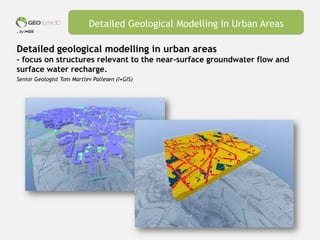
  • 1. …by I•GIS Detailed geological modelling in urban areas – focus on structures relevant to the near-surface groundwater flow and surface water recharge. Senior Geologist Tom Martlev Pallesen (I•GIS) Detailed Geological Modelling In Urban Areas
  • 2. …by I•GIS Disposition Detailed Geological Modelling In Urban Areas Background Challenges - detailed modelling in urban areas Datatypes Model types Summary Model setup and workflow Development of new tools
  • 3. …by I•GIS Background The case shows an example from Odense City (DK) where new geological modelling techniques has been developed in the geological modelling software GeoScene3D, and used to create a detailed voxel model of the anthropogenic layer (the soil zone where human activity has changed the original geological layers). The example is part of a pilot project partly financed by VTU (Foundation for Development of Technology in the Danish Water Sector) and involves many different datatypes such as human related elements (landfill, pipelines, roadbeds etc.). I•GIS have modelled the anthropogenic layer in the pilot area Thomas B. Thriges Gade. GeoScene3D is a geological modelling software, widely used to make geological models in the context of groundwater mapping. In Denmark GeoScene3D is being used at Geological Survey (GEUS), the Ministry of Environment and Food, Danish Regions, municipalities, water companies, consultants and educational institutions. Detailed Geological Modelling In Urban Areas Background Challenges detailed modelling Datatypes Model types Development of new tools Model setup and workflow Summary
  • 4. …by I•GIS Detailed Geological Modelling In Urban Areas Selected developments • Import of pipelines and structural elements and the use of attributes • Tools to create buffers surrounding 3D elements • 3D objects transformed to voxels in a voxel data grid • (Tool to georeference jpg, bmp and pdf files at a specific XYZ point and correct vertical scale, e.g. well logs) Background Challenges detailed modelling Datatypes Model types Development of new tools Model setup and workflow Summary
  • 5. …by I•GIS Modelling surface near geology and landfill layers in urban areas are complex. This is partly due to : • Often high geological variability. • Many human-induced changes in the original geology (excavations, constructions, landfill) – often a long history. • A general need of great level of detail in the models (thin layers and there propagation are highly relevant when calculating surface near groundwater flow, infiltration of surface water, propagation of contaminations etc.). • All boreholes in the Thomas B. Thriges Gade pilot area shows layers of landfill. Detailed Geological Modelling In Urban Areas Background Challenges detailed modelling Datatypes Model types Development of new tools Model setup and workflow Summary
  • 6. …by I•GIS The complex culture layer (anthropogenic layer) Detailed Geological Modelling In Urban Areas Background Challenges detailed modelling Datatypes Model types Development of new tools Model setup and workflow Summary
  • 7. …by I•GIS The knowledge of the structural elements can be handled and used in the process of making very detailed geological models. Detailed Geological Modelling In Urban Areas Background Challenges detailed modelling Datatypes Model types Development of new tools Model setup and workflow Summary Voxel model based on sand-clay fraction (sand=reddish, clay=brownish)
  • 8. …by I•GIS What kind of data are we using… • Geological related data • Structural elements and constructions • (historical maps, geotechnical boreholes and many more) Detailed Geological Modelling In Urban Areas Datatype Data-subtype Bemærkninger Terræn 1,6 m grid Boringer PC-Jupiter 208 boringer Boringer Region Midt GeoCloud 192 boringer. Næsten alle overlapper med PC-Jupiter Boringer Lokal database (Watertech) Diverse korte boringer Boringer GeoGIS (Rambøll) Diverse korte boringer Fyldlag/type Tolket på baggrund af tilgængelige borejournaler i PC-Jupiter eller detail- beskrivelser i de øvrige databaser. Bygninger Bygningsfundamenter Samles i ét vektortema Befæstede arealer Veje m.m. Samles i ét vektortema Befæstede arealer Parkeringspladser o.lign. Samles i ét vektortema Rørledninger Vandforsyning Samles i ét vektortema Rørledninger Spildevand Samles i ét vektortema Rørledninger Fjernvarme Samles i ét vektortema Samlet vektortema Rørledninger og befæstede arealer. Alle temaer fra ”Samles i ét vektortema”) Background Challenges detailed modelling Datatypes Model types Development of new tools Model setup and workflow Summary
  • 9. …by I•GIS What kind of data are we using… Geological related data (lithology): • Geological soil sample descriptions • An overall evaluation and classification of land fill type in “fill classes” based on assumed sand-clay fraction. Detailed Geological Modelling In Urban Areas Background Challenges detailed modelling Datatypes Model types Development of new tools Model setup and workflow Summary
  • 10. …by I•GIS What kind of data are we using… Structural elements, constructions and land fill-types • Overall evaluation of dimensions and material type used for fill in traces, roadbeds etc. Detailed Geological Modelling In Urban Areas • Development over time relative to the establishment and due to the use of different material types over time Background Challenges detailed modelling Datatypes Model types Development of new tools Model setup and workflow Summary
  • 11. …by I•GIS Detailed Geological Modelling In Urban Areas Use of attributes Vector data (e.g. pipelines) can be imported into GeoScene3D and can be handled due to dimension, age, material type, manufacturer etc. Background Challenges detailed modelling Datatypes Model types Development of new tools Model setup and workflow Summary
  • 12. …by I•GIS Detailed Geological Modelling In Urban Areas What are attributes? One or more properties (e.g. diameter, age, material type) that can be linked to an element (e.g. water pipes): Background Challenges detailed modelling Datatypes Model types Development of new tools Model setup and workflow Summary
  • 13. …by I•GIS What kind of geological model types can handle these different and complex datatypes? Detailed Geological Modelling In Urban Areas Background Challenges detailed modelling Datatypes Model types Development of new tools Model setup and workflow Summary
  • 14. …by I•GIS Issues In general, geological modelling software to make detailed geological models in urban areas have limitations due to 1. Handling of ”untraditional” data types 2. Meet the need of a high level of detail 3. Create a model that gives the users an good overview and a model that is relatively easy to update Most geological models (in Denmark) are made as layered models, where interpretation points are interpolated into surfaces, which defines top or bottom of individual layer units. These models are has limitations when it comes to handling many and discontinuous layers, due to the need for the geologist to define top, bottom and horizontal extent for each layer. The number of individual layer units can be extremely high in a detailed geological model. Typically the need for a high level of geological detail have been handled by e.g. zonation in the groundwater modelling software. These software aren't designed for neither geological interpretation, nor visual presentations, and won’t create overview. Detailed geological modelling is typically are complex and time consuming process with lots of manual work, also when the model needs to bee updated. Detailed Geological Modelling In Urban Areas Possible solution: Voxel models Background Challenges detailed modelling Datatypes Model types Development of new tools Model setup and workflow Summary
  • 15. …by I•GIS Detailed Geological Modelling In Urban Areas Interpretation strategies and model types Layered models • Modelling of layer top and bottom • Interpretationpoints interpolated to surfaces • Well known methodology • Often assumes near parallel layers. • Significant simplification of the real geological • Settings. Voxelmodels • ”Boxes” with a user defined size (X, Y, Z). • Each voxel can be assigned different properties (lithology, hydraulic conductivity, age, porosity…). • In principle, all geology can be handled and with a • high level of detail. Layered model Voxelmodel Background Challenges detailed modelling Datatypes Model types Development of new tools Model setup and workflow Summary
  • 16. …by I•GIS Detailed Geological Modelling In Urban Areas The classical layered models assumes that the layers in the underground are more or less plane parallel… In reality we generally see them as very inhomogeneous and non-parallel due to geologically and human related processes. …. This is the reality we can handle with voxel models Background Challenges detailed modelling Datatypes Model types Development of new tools Model setup and workflow Summary
  • 17. …by I•GIS Voxel models gives the modeller new opportunities by using new datatypes in a high level of model detail, e.g.: Detailed Geological Modelling In Urban Areas • Pipelines and traces. • Buildings and underground structures • Roads and road beds Buildings (blue structures), pipelines and boreholes Background Challenges detailed modelling Datatypes Model types Development of new tools Model setup and workflow Summary
  • 18. …by I•GIS Detailed Geological Modelling In Urban Areas Development of new tools in GeoScene3D for handling ”Urbane Data”. Background Challenges detailed modelling Datatypes Model types Development of new tools Model setup and workflow Summary
  • 19. …by I•GIS Detailed Geological Modelling In Urban Areas Development of new tools in geoScene3D Buildings, basements, traces etc. can be handled due to attributes such as depth, dimension, age etc. and can be used directly to select voxels in a 3D grid. Colour of buildings indicates basement depth in meters below terrain (e.g. medium blue = 1,2 mbt.). Pipelines colour coded and dimensioned on the basis of attributes ”Dimension” and ”Age”. Background Challenges detailed modelling Datatypes Model types Development of new tools Model setup and workflow Summary
  • 20. …by I•GIS Detailed Geological Modelling In Urban Areas Development of new tools in geoScene3D • Objects (basements, pipelines, roadbeds etc.) can be converted to voxels in a user- defined voxel grid (3D grid). • All voxels in the voxel grid, that are cut by a object, can be selected and assigned an user defined property. • This assignment can be relative, and by that takes into account that often only a part of a voxel are cut by the object. 100/0 50 Background Challenges detailed modelling Datatypes Model types Development of new tools Model setup and workflow Summary
  • 21. …by I•GIS Detailed Geological Modelling In Urban Areas Development of new tools in geoScene3D • ”Vector Theme” and ”Box”/”Pipe” selection. Selection using the ”Pipe” function: Selection using the ”Box” function: (voxels assigned to a grid with excisting information) Background Challenges detailed modelling Datatypes Model types Development of new tools Model setup and workflow Summary
  • 22. …by I•GIS Detailed Geological Modelling In Urban Areas Workflow 1) Modelling process • Define model area, including extent of voxelgrid and cell size. • Prepare data. Setup using attributes and depth information. • Define temporal order (time of establishment) for the individual datasets: Which structures cuts other structures. Which came first, which came last? • Define ”background geology” and initially fill voxels based on this. • Incorporate structural elements. For this part; use the new tools ”Box”, ”Pipe”, ”Blend” etc.). Background Challenges detailed modelling Datatypes Model types Development of new tools Model setup and workflow Summary
  • 23. …by I•GIS Detailed Geological Modelling In Urban Areas Workflow 1) Preparation of data • Define attributes for each dataset. These are used for positioning, dimensioning and visualizing the individual datasets. • Define fill layer using e.g. lithology or sand-clay fraction. Background Challenges detailed modelling Datatypes Model types Development of new tools Model setup and workflow Summary
  • 24. …by I•GIS Detailed Geological Modelling In Urban Areas Workflow 1) Preparation of data • Depth and composition of landfill: 3 fill-type classes with an estimated sand- clay proportion (highly unscientific, subjective evaluation). Land fill type Estimated sand content (%) Sand, some brick fragments, very silty Clay, topsoil, with bricks (fragments) Clay, sandy Peat, sandy, with bricks 30 Sand topsoil, topsoil with brick fragments Sand, pretty coarse, concrete, bricks, charcoal Topsoil with brick fragments Topsoil, sandy Peat Topsoil, peat, clayey, sandy, brick fragments 60 Sand and gravel, concrete fragments Sand, coarse, stony 80 Background Challenges detailed modelling Datatypes Model types Development of new tools Model setup and workflow Summary
  • 25. …by I•GIS Detailed Geological Modelling In Urban Areas Workflow 1) Preparation of data • Interpolation of fill layer data in 3D. • After that – fill the rest of the fill layer and incorporate structural elements. Background Challenges detailed modelling Datatypes Model types Development of new tools Model setup and workflow Summary
  • 26. …by I•GIS Detailed Geological Modelling In Urban Areas Urban voxel model – simplified example of workflow 1. Boreholes, water- and waste water pipes are imported and positioned according to diameter2. Bottom of landfill and the user defined land fill classes are imported3. Fill layer interpolated in 3D. 4. The rest of the land fill layer are filled with an estimated average land fill (here; reused moraine clay). 5. Buildings and other structures are incorporated. Surfaces from an existing regional geological model are imported and layers are converted to voxels 100% sand 100% clay Background Challenges detailed modelling Datatypes Model types Development of new tools Model setup and workflow Summary
  • 27. …by I•GIS Detailed Geological Modelling In Urban Areas The Thomas B. Thriges Gade model – some facts • The voxel grid in the Thomas B. Thriges Gade pilot area contains 3,74 mio. voxels • Cell size is 5 x 5 x 0,5 m. • Grid size: 1200 x 1300 x 30 m • GeoScene3D can handle voxel grids up to 16 mio. voxels • The voxel grids are regular with even cell sizes (user defined X, Y, Z) • More voxel grids can be combined. • Existing layer models can easily be converted to voxels Number of voxels based on different grid geometries. X (meter) Y (meter) Z (range) Z (vertical cell size) XY (horizontal cell size) Cells (total) 100 100 30 0,5 5,0 24.000 250 250 30 0,5 5,0 150.000 1.200 1.300 30 0,5 5,0 3.744.000 250 250 30 0,5 2,5 600.000 1.200 1.300 30 0,5 2,5 14.976.000 10.000 10.000 30 2 25 2.400.000 TBT pilot area Background Challenges detailed modelling Datatypes Model types Development of new tools Model setup and workflow Summary
  • 28. …by I•GIS Detailed Geological Modelling In Urban Areas Urbane voxel models - opportunities and perspectives • Development of highly detailed geological models. • The possibilities of using many different datatypes, and hereby to implement e.g. the human impact. • Development of detailed models for many purposes (urban development, geotechnical, Water Sensitive Urban Design (WSUD), contaminated field sites, groundwater flow, vulnerability assessments etc.). • One model optimized for several purposes. • Import and export of data in different formats. Background Challenges detailed modelling Datatypes Model types Development of new tools Model setup and workflow Summary
  • 29. …by I•GIS Detailed Geological Modelling In Urban Areas 20-50% sand. Total volume = 1.960.000 m3. Horizontal slices. Clay-sand distribution. Level 4 (DNN). Background Challenges detailed modelling Datatypes Model types Development of new tools Model setup and workflow Summary 60-100% sand within region. Total volume 154.038 m3. Vertical slices. Cross sections Urbane voxel models - opportunities and perspectives • Easy model update (when data and work flow are ready). • Voxels can be changed individually. Easy creation of different model scenarios for hydraulic calculations • Preparation of data can be time consuming • Visualization - isolating individual lithology classes or values - Horizontal and vertical cross sections. • Volume calculations based on user defined limits (values, surfaces, regions)
  • 30. …by I•GIS Detailed Geological Modelling In Urban Areas Thank you for your attention • Background Challenges detailed modelling Datatypes Model types Development of new tools Model setup and workflow Summary