SlideShare a Scribd company logo
1 of 19
Download to read offline
EGI Facility As-Built Services 3D Modelling Using GIS System for Existing
Facility & Data Management in Iraq.
SUMMARY
• Engineering with Geographic
Information Systems (GIS).
• Balanced approach will enables to
collecting information that can be
used to support the development of
high accuracy models as well as rich
geodatabase deliverables.
• High accuracy data collection system capable
of producing survey grade Global Navigation
Satellite System (GNSS) accuracy for asset
locations in Iraq.
• All data is to be processed using GIS tools and
formatted to integrate with Computer-aided
Design (CAD) modelling software.
• Data attribute models are fully
customizable to promote flexibility
and value for a broad range of
customer requirements.
AS BUILT PROCESS
VALUE OF HIGH ACCURACY AS-BUILT
• With an accurate 3D model, owners are able
to reverse engineer existing sites in order to
increase the operational efficiency. :
• Significant Improvement to projects.
• Establishing a high quality as-built for existing
facilities is a critical component for operations,
engineering, and integrity groups.
• Inaccurate drawings or a lack of information on
existing facilities make the processes for
maintenance, optimization, and expansion can
be tedious and expensive.
• Improved understanding of operational conditions.
• Improved engineering records for facility expansion
• Easy generation of 2D site plans
• Streamlined P&ID and PFD development
• Easy generation of isometric and spool drawings
• Easy generation of bill of materials
• Easy generation of Line Lists
• Improved data collection accuracy.
• Easy integration into asset management applications
• More efficient and lower costs for field data
collection
Engineering
Mechanical, civil, process, and electrical
engineers to support our drafting
professionals.
Customize the drafting standards to
integrate with our customer’s
specifications and requirements.
Engineering
Use of customizable Geo Referenced
Datasets for Pipe and Fittings, Asset Tag
Data, Vessels, Valves, Buried pipe,
Buildings, Piles, and Photos.
Geodatabase information is
the foundational reference
for the 3D model.
Customize geodatabase deliverables to
integrate with any corporate GIS system
and most asset management
applications.
As a result, we should
be able to collect rich
datasets for onsite
assets and provide GIS
based deliverables as a
component of our
service.
Process and validate GIS data
GIS
Expertise
APPROACH & METHODOLOGY
FIELD DATA
COLLECTION
DRAFTING 3D
MODELING
Web
Enabling of
GIS software
applications
LOCAL CONTENT
TRAINING &
SUPPORT
DATA
MANAGEMENT&
INFRASTRUCTURE
FIELD DATA COLLECTION
Field data collection requires the combination of multiple skill sets. EGI field data collection teams include the following disciplines:
• Engineers: to ensure the material
specifications, measurements,
valves, pressure safety valve’s
(PSV), vessels, and process
equipment are accurately
documented, and that the overall
plant processes are well
understood.
• Drafting Technicians: It is a major
benefit to have a modeler and
drafter present during the field
data collection process in order
to streamline the drafting process
and create a heightened
familiarity with the asset.
• Pipe and Fittings
• Asset Tag Data
• Vessels
• Valves
• Buried pipe
• Building
• GIS Technicians: These technicians
will ensure that asset data is
spatially accurate as well as
verifiable, traceable and complete.
• GIS team : Complete field data
collection initiatives should people
with professional designations.
• GIS DATA PROCESSING
• Best in class GIS tools to process the
geospatial field data and create the
geodatabase for the facility as-built.
• The processes and procedures will
enable us evaluate and process data
daily to ensure accuracy and
completeness.
• The work by GIS technicians produces
the foundation for the 3D model and
the ultimate geodatabase deliverable.
3D Model
(Intergraph®
CADWorx®)
Piping and
Instrumentation
Design (P&ID)
(Autodesk
AutoCAD®)
Site Plans
(Autodesk
AutoCAD®)
3D Model Viewer
(Autodesk
Navisworks
Freedom 3D
Viewer)
Process Flow
Diagrams (PFD)
(Autodesk
AutoCAD®)
Bentley
AutoPLANT
P&ID.For the rest
of web based
tools supports
reporting and file
sharing
Bentley has
another useful
software called
Vision for easy
access to 3D
models
DRAFTING
3D
MODELING
DATA MANAGEMENT& INFRASTRUCTURE
01
A web-based platform : Enables the Client
to plan, manage, and monitor engineering
and EPC projects in real time
02
This platform is used for internal communication
between team members or for external
communication between management and
stakeholders
03
It helps collaboration across departments (like engineering
and customer service, engineering and on-site, etc.) and to
control every aspect of project management from to-do
lists to progress reports to delivery forecasts.
04The engineers could create, share, update,
secure, import or archive drawings and
worksheets in the parent software (like
Autocad or Excel)
05
During reviews, teams and individuals
could discuss and make changes to a
drawing online, and then get the changes
updated automatically
06
Everybody on a project team (drafting
engineers, senior project directors) will
benefit from this platform.
Streamlines day-to-day technical activities
(sharing and updating documents) as well as
'big picture' activities
Web Enabling of GIS software applications
• As an industry standard many software product companies are migrating their applications to web technology,
• Provide the right mix of experience and exposure on varied platforms and development tools which assist in offering
software services related to web enabling of GIS applications.
• All applications can be tailored to your specific needs, IT implementation environments, and preferences.
Application development services include:
Platform and
technology
selection for GIS
applications, GIS
integration with MS
applications
Application Design
and Development
including GUI design
Implementation
support
Application Testing
for performance
and security
Application
maintenance and
enhancement
Training
programs for
Client
employees
Soft Skills
Training &
Support
LOCAL CONTENT TRAINING & SUPPORT
• Process equipment field collection
& documentation
• Materials specifications,
measurements, valves, pressure
safety valve’s (PSV), vessels.
• Drafting & modeling
• 3D Model
• 3D Model Viewer
• Process Flow Diagrams (PFD)
(Autodesk AutoCAD®)
• Piping and Instrumentation Design
(P&ID) (Autodesk AutoCAD®)
• Site Plans (Autodesk AutoCAD®)
• CAD Operators
Engineering
Training &
Support
FUTURE PROJECT SCOPE – ONE STOP SHOP
• Select an existing pilot project.
• Working with engineering, operations, and asset
integrity groups to ensure that all needs are
evaluated and addressed
• In Job Training Plan
• Prepare Client team for future projects
• Assist Client to
• A thorough review of all existing
drawings and records is a component of
the scoping phase.
Results shall include the delivery of the following:
• Document drawing
standards and specification
• Build project data base.
• Improve Asset data
requirements.
• Improve GIS and Asset
Management teams capabilities
with respect to the integration of
the geodatabase
• Improve technicians capabilities
in field data collection
• Train Engineers & CAD operators
to enable effective utilization of
the model
• Support client in any future
projects
THANK YOU FOR WATCHING

More Related Content

What's hot

Creating, Managing and Sharing 3D Cities with FME
Creating, Managing and Sharing 3D Cities with FMECreating, Managing and Sharing 3D Cities with FME
Creating, Managing and Sharing 3D Cities with FMESafe Software
 
Laser scanning technology in civil engg
Laser scanning technology in civil enggLaser scanning technology in civil engg
Laser scanning technology in civil enggSurya C D
 
lifecycle-bim-gis-user-group-april-2017
lifecycle-bim-gis-user-group-april-2017lifecycle-bim-gis-user-group-april-2017
lifecycle-bim-gis-user-group-april-2017Dale Ritchie
 
3D Web Services And Models For The Web: Where Do We Stand?
3D Web Services And Models For The Web: Where Do We Stand?3D Web Services And Models For The Web: Where Do We Stand?
3D Web Services And Models For The Web: Where Do We Stand?Camptocamp
 
Urban Data Fusion
Urban Data Fusion Urban Data Fusion
Urban Data Fusion Umit Isikdag
 
From 2D Drawings to 3D Navigation networks built with FME
From 2D Drawings to 3D Navigation networks built with FMEFrom 2D Drawings to 3D Navigation networks built with FME
From 2D Drawings to 3D Navigation networks built with FMESafe Software
 
Spatial Computing and the Future of Utility GIS
Spatial Computing and the Future of Utility GISSpatial Computing and the Future of Utility GIS
Spatial Computing and the Future of Utility GISGeorge Percivall
 
Spring 2013
Spring 2013Spring 2013
Spring 2013Esri
 
On the-design-of-geographic-information-system-procedures
On the-design-of-geographic-information-system-proceduresOn the-design-of-geographic-information-system-procedures
On the-design-of-geographic-information-system-proceduresArmando Guevara
 
Presentation dr abeermoh_bahrain_gbforum2012kuwait
Presentation dr abeermoh_bahrain_gbforum2012kuwaitPresentation dr abeermoh_bahrain_gbforum2012kuwait
Presentation dr abeermoh_bahrain_gbforum2012kuwaitgreenbuilding
 
City of Vancouver CAD - GIS - 3D Integration A Dimension Too Far?
City of Vancouver CAD - GIS - 3D Integration A Dimension Too Far?City of Vancouver CAD - GIS - 3D Integration A Dimension Too Far?
City of Vancouver CAD - GIS - 3D Integration A Dimension Too Far?Andrew Bashfield
 
FME in Urban Information Modeling
FME in Urban Information ModelingFME in Urban Information Modeling
FME in Urban Information ModelingSafe Software
 
CrowdMap: Accurate Reconstruction of Indoor Floor Plan from Crowdsourced Sens...
CrowdMap: Accurate Reconstruction of Indoor Floor Plan from Crowdsourced Sens...CrowdMap: Accurate Reconstruction of Indoor Floor Plan from Crowdsourced Sens...
CrowdMap: Accurate Reconstruction of Indoor Floor Plan from Crowdsourced Sens...Si Chen
 
3D GIS for urban development
3D GIS for urban development3D GIS for urban development
3D GIS for urban developmentYash Shah
 
Semantic 3D City Models with CityGML
Semantic 3D City Models with CityGMLSemantic 3D City Models with CityGML
Semantic 3D City Models with CityGMLICGCat
 
CityGML goes to Broadway - An Open Data 3D City Model for New York City
CityGML goes to Broadway - An Open Data 3D City Model for New York CityCityGML goes to Broadway - An Open Data 3D City Model for New York City
CityGML goes to Broadway - An Open Data 3D City Model for New York CityTechnische Universität München
 
Enabling numerical Simulations in semantic 3D City Models using CityGML
Enabling  numerical Simulations in  semantic 3D City Models using CityGMLEnabling  numerical Simulations in  semantic 3D City Models using CityGML
Enabling numerical Simulations in semantic 3D City Models using CityGMLvirtualcitySYSTEMS GmbH
 

What's hot (20)

Creating, Managing and Sharing 3D Cities with FME
Creating, Managing and Sharing 3D Cities with FMECreating, Managing and Sharing 3D Cities with FME
Creating, Managing and Sharing 3D Cities with FME
 
Laser scanning technology in civil engg
Laser scanning technology in civil enggLaser scanning technology in civil engg
Laser scanning technology in civil engg
 
lifecycle-bim-gis-user-group-april-2017
lifecycle-bim-gis-user-group-april-2017lifecycle-bim-gis-user-group-april-2017
lifecycle-bim-gis-user-group-april-2017
 
3D Web Services And Models For The Web: Where Do We Stand?
3D Web Services And Models For The Web: Where Do We Stand?3D Web Services And Models For The Web: Where Do We Stand?
3D Web Services And Models For The Web: Where Do We Stand?
 
3 D Lidar Epfl Iccsa 08
3 D Lidar Epfl Iccsa 083 D Lidar Epfl Iccsa 08
3 D Lidar Epfl Iccsa 08
 
Urban Data Fusion
Urban Data Fusion Urban Data Fusion
Urban Data Fusion
 
From 2D Drawings to 3D Navigation networks built with FME
From 2D Drawings to 3D Navigation networks built with FMEFrom 2D Drawings to 3D Navigation networks built with FME
From 2D Drawings to 3D Navigation networks built with FME
 
Spatial Computing and the Future of Utility GIS
Spatial Computing and the Future of Utility GISSpatial Computing and the Future of Utility GIS
Spatial Computing and the Future of Utility GIS
 
Spring 2013
Spring 2013Spring 2013
Spring 2013
 
On the-design-of-geographic-information-system-procedures
On the-design-of-geographic-information-system-proceduresOn the-design-of-geographic-information-system-procedures
On the-design-of-geographic-information-system-procedures
 
Symposium 2008
Symposium 2008Symposium 2008
Symposium 2008
 
Presentation dr abeermoh_bahrain_gbforum2012kuwait
Presentation dr abeermoh_bahrain_gbforum2012kuwaitPresentation dr abeermoh_bahrain_gbforum2012kuwait
Presentation dr abeermoh_bahrain_gbforum2012kuwait
 
City of Vancouver CAD - GIS - 3D Integration A Dimension Too Far?
City of Vancouver CAD - GIS - 3D Integration A Dimension Too Far?City of Vancouver CAD - GIS - 3D Integration A Dimension Too Far?
City of Vancouver CAD - GIS - 3D Integration A Dimension Too Far?
 
FME in Urban Information Modeling
FME in Urban Information ModelingFME in Urban Information Modeling
FME in Urban Information Modeling
 
CrowdMap: Accurate Reconstruction of Indoor Floor Plan from Crowdsourced Sens...
CrowdMap: Accurate Reconstruction of Indoor Floor Plan from Crowdsourced Sens...CrowdMap: Accurate Reconstruction of Indoor Floor Plan from Crowdsourced Sens...
CrowdMap: Accurate Reconstruction of Indoor Floor Plan from Crowdsourced Sens...
 
3D GIS for urban development
3D GIS for urban development3D GIS for urban development
3D GIS for urban development
 
Semantic 3D City Models with CityGML
Semantic 3D City Models with CityGMLSemantic 3D City Models with CityGML
Semantic 3D City Models with CityGML
 
CityGML goes to Broadway - An Open Data 3D City Model for New York City
CityGML goes to Broadway - An Open Data 3D City Model for New York CityCityGML goes to Broadway - An Open Data 3D City Model for New York City
CityGML goes to Broadway - An Open Data 3D City Model for New York City
 
Enabling numerical Simulations in semantic 3D City Models using CityGML
Enabling  numerical Simulations in  semantic 3D City Models using CityGMLEnabling  numerical Simulations in  semantic 3D City Models using CityGML
Enabling numerical Simulations in semantic 3D City Models using CityGML
 
Map Integration PPT_f
Map Integration PPT_fMap Integration PPT_f
Map Integration PPT_f
 

Viewers also liked (19)

Data Models - GIS I
Data Models - GIS IData Models - GIS I
Data Models - GIS I
 
levellingrisk
levellingrisklevellingrisk
levellingrisk
 
Coaching Profile
Coaching ProfileCoaching Profile
Coaching Profile
 
liane CV
liane CVliane CV
liane CV
 
AJP67631460835000
AJP67631460835000AJP67631460835000
AJP67631460835000
 
Draw to win
Draw to winDraw to win
Draw to win
 
11 nurses how to communicate
11 nurses how to communicate11 nurses how to communicate
11 nurses how to communicate
 
MatHistory
MatHistoryMatHistory
MatHistory
 
Combo fix
Combo fixCombo fix
Combo fix
 
Combo fix
Combo fixCombo fix
Combo fix
 
Resume Bob 6
Resume Bob 6Resume Bob 6
Resume Bob 6
 
Subir un archivo
Subir un archivoSubir un archivo
Subir un archivo
 
Drawing and Design Examples
Drawing and Design ExamplesDrawing and Design Examples
Drawing and Design Examples
 
Bvent Profile
Bvent ProfileBvent Profile
Bvent Profile
 
Automated Nitrogen Drying
Automated Nitrogen DryingAutomated Nitrogen Drying
Automated Nitrogen Drying
 
gazettenet_HMBnetwork
gazettenet_HMBnetworkgazettenet_HMBnetwork
gazettenet_HMBnetwork
 
Indian economic evolution new
Indian economic evolution newIndian economic evolution new
Indian economic evolution new
 
TeachLulu_FullPackage
TeachLulu_FullPackageTeachLulu_FullPackage
TeachLulu_FullPackage
 
Answering question 1
Answering question 1Answering question 1
Answering question 1
 

Similar to 3D Modeling by GIS

Improve Operational Efficiency in AEC with Data Integration
Improve Operational Efficiency in AEC with Data IntegrationImprove Operational Efficiency in AEC with Data Integration
Improve Operational Efficiency in AEC with Data IntegrationSafe Software
 
Field Activity Planner SaaS SW for the Digital Oilfield
Field Activity Planner SaaS SW for the Digital OilfieldField Activity Planner SaaS SW for the Digital Oilfield
Field Activity Planner SaaS SW for the Digital OilfieldOlav Sylthe
 
11. Jassera Engineering Presentation.pdf
11. Jassera Engineering Presentation.pdf11. Jassera Engineering Presentation.pdf
11. Jassera Engineering Presentation.pdfMohammedAlbazzaz3
 
Augview UK distributor Select Surveys talks about augmented reality in the field
Augview UK distributor Select Surveys talks about augmented reality in the fieldAugview UK distributor Select Surveys talks about augmented reality in the field
Augview UK distributor Select Surveys talks about augmented reality in the fieldGeo AR Games
 
Mark Field Resume
Mark Field ResumeMark Field Resume
Mark Field Resumembfbsae90
 
Cadison project-engineer
Cadison project-engineerCadison project-engineer
Cadison project-engineerCADISON
 
Cadison project-engineer
Cadison project-engineerCadison project-engineer
Cadison project-engineerCADISON
 
Project Engineer
Project EngineerProject Engineer
Project EngineerCADISON
 
Autocad civil3d brochure 3d civil
Autocad civil3d brochure 3d civilAutocad civil3d brochure 3d civil
Autocad civil3d brochure 3d civiljcps
 
OSL BIMevoke statement
OSL BIMevoke statementOSL BIMevoke statement
OSL BIMevoke statementOSL Rail Ltd
 
Cadison electric-designer
Cadison  electric-designerCadison  electric-designer
Cadison electric-designerCADISON
 
Cadison electric-designer
Cadison  electric-designerCadison  electric-designer
Cadison electric-designerCADISON
 
3D Models for Construction Estimating
3D Models for Construction Estimating3D Models for Construction Estimating
3D Models for Construction EstimatingIan McGaw
 
Data-Centric Approach for Project Delivery
Data-Centric Approach for Project DeliveryData-Centric Approach for Project Delivery
Data-Centric Approach for Project DeliveryAVEVA Group plc
 
ETDP 2015 D1 Technology Enabled Facility Lifecycle Data Management - Grace Wa...
ETDP 2015 D1 Technology Enabled Facility Lifecycle Data Management - Grace Wa...ETDP 2015 D1 Technology Enabled Facility Lifecycle Data Management - Grace Wa...
ETDP 2015 D1 Technology Enabled Facility Lifecycle Data Management - Grace Wa...Comit Projects Ltd
 
Cgc general profile
Cgc general profileCgc general profile
Cgc general profilePaul Timola
 

Similar to 3D Modeling by GIS (20)

Improve Operational Efficiency in AEC with Data Integration
Improve Operational Efficiency in AEC with Data IntegrationImprove Operational Efficiency in AEC with Data Integration
Improve Operational Efficiency in AEC with Data Integration
 
Field Activity Planner SaaS SW for the Digital Oilfield
Field Activity Planner SaaS SW for the Digital OilfieldField Activity Planner SaaS SW for the Digital Oilfield
Field Activity Planner SaaS SW for the Digital Oilfield
 
Geospatial Product Watch 2015
Geospatial Product Watch 2015Geospatial Product Watch 2015
Geospatial Product Watch 2015
 
11. Jassera Engineering Presentation.pdf
11. Jassera Engineering Presentation.pdf11. Jassera Engineering Presentation.pdf
11. Jassera Engineering Presentation.pdf
 
Augview UK distributor Select Surveys talks about augmented reality in the field
Augview UK distributor Select Surveys talks about augmented reality in the fieldAugview UK distributor Select Surveys talks about augmented reality in the field
Augview UK distributor Select Surveys talks about augmented reality in the field
 
Mark Field Resume
Mark Field ResumeMark Field Resume
Mark Field Resume
 
Atul_T_Biradar_CV
Atul_T_Biradar_CVAtul_T_Biradar_CV
Atul_T_Biradar_CV
 
Cadison project-engineer
Cadison project-engineerCadison project-engineer
Cadison project-engineer
 
Cadison project-engineer
Cadison project-engineerCadison project-engineer
Cadison project-engineer
 
Project Engineer
Project EngineerProject Engineer
Project Engineer
 
Autocad civil3d brochure 3d civil
Autocad civil3d brochure 3d civilAutocad civil3d brochure 3d civil
Autocad civil3d brochure 3d civil
 
OSL BIMevoke statement
OSL BIMevoke statementOSL BIMevoke statement
OSL BIMevoke statement
 
Cadison electric-designer
Cadison  electric-designerCadison  electric-designer
Cadison electric-designer
 
Cadison electric-designer
Cadison  electric-designerCadison  electric-designer
Cadison electric-designer
 
Brochure_Design_Final_11x17_wbleed._Revise
Brochure_Design_Final_11x17_wbleed._ReviseBrochure_Design_Final_11x17_wbleed._Revise
Brochure_Design_Final_11x17_wbleed._Revise
 
3D Models for Construction Estimating
3D Models for Construction Estimating3D Models for Construction Estimating
3D Models for Construction Estimating
 
Data-Centric Approach for Project Delivery
Data-Centric Approach for Project DeliveryData-Centric Approach for Project Delivery
Data-Centric Approach for Project Delivery
 
ETDP 2015 D1 Technology Enabled Facility Lifecycle Data Management - Grace Wa...
ETDP 2015 D1 Technology Enabled Facility Lifecycle Data Management - Grace Wa...ETDP 2015 D1 Technology Enabled Facility Lifecycle Data Management - Grace Wa...
ETDP 2015 D1 Technology Enabled Facility Lifecycle Data Management - Grace Wa...
 
Cgc general profile
Cgc general profileCgc general profile
Cgc general profile
 
What is cad cam
What is cad camWhat is cad cam
What is cad cam
 

3D Modeling by GIS

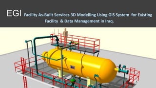
  • 1. EGI Facility As-Built Services 3D Modelling Using GIS System for Existing Facility & Data Management in Iraq.
  • 2.
  • 3. SUMMARY • Engineering with Geographic Information Systems (GIS). • Balanced approach will enables to collecting information that can be used to support the development of high accuracy models as well as rich geodatabase deliverables. • High accuracy data collection system capable of producing survey grade Global Navigation Satellite System (GNSS) accuracy for asset locations in Iraq. • All data is to be processed using GIS tools and formatted to integrate with Computer-aided Design (CAD) modelling software. • Data attribute models are fully customizable to promote flexibility and value for a broad range of customer requirements.
  • 5. VALUE OF HIGH ACCURACY AS-BUILT • With an accurate 3D model, owners are able to reverse engineer existing sites in order to increase the operational efficiency. : • Significant Improvement to projects. • Establishing a high quality as-built for existing facilities is a critical component for operations, engineering, and integrity groups. • Inaccurate drawings or a lack of information on existing facilities make the processes for maintenance, optimization, and expansion can be tedious and expensive. • Improved understanding of operational conditions. • Improved engineering records for facility expansion • Easy generation of 2D site plans • Streamlined P&ID and PFD development • Easy generation of isometric and spool drawings • Easy generation of bill of materials • Easy generation of Line Lists • Improved data collection accuracy. • Easy integration into asset management applications • More efficient and lower costs for field data collection
  • 6. Engineering Mechanical, civil, process, and electrical engineers to support our drafting professionals. Customize the drafting standards to integrate with our customer’s specifications and requirements.
  • 8.
  • 9. Use of customizable Geo Referenced Datasets for Pipe and Fittings, Asset Tag Data, Vessels, Valves, Buried pipe, Buildings, Piles, and Photos. Geodatabase information is the foundational reference for the 3D model. Customize geodatabase deliverables to integrate with any corporate GIS system and most asset management applications. As a result, we should be able to collect rich datasets for onsite assets and provide GIS based deliverables as a component of our service. Process and validate GIS data GIS Expertise
  • 10. APPROACH & METHODOLOGY FIELD DATA COLLECTION DRAFTING 3D MODELING Web Enabling of GIS software applications LOCAL CONTENT TRAINING & SUPPORT DATA MANAGEMENT& INFRASTRUCTURE
  • 11. FIELD DATA COLLECTION Field data collection requires the combination of multiple skill sets. EGI field data collection teams include the following disciplines: • Engineers: to ensure the material specifications, measurements, valves, pressure safety valve’s (PSV), vessels, and process equipment are accurately documented, and that the overall plant processes are well understood. • Drafting Technicians: It is a major benefit to have a modeler and drafter present during the field data collection process in order to streamline the drafting process and create a heightened familiarity with the asset. • Pipe and Fittings • Asset Tag Data • Vessels • Valves • Buried pipe • Building • GIS Technicians: These technicians will ensure that asset data is spatially accurate as well as verifiable, traceable and complete. • GIS team : Complete field data collection initiatives should people with professional designations. • GIS DATA PROCESSING • Best in class GIS tools to process the geospatial field data and create the geodatabase for the facility as-built. • The processes and procedures will enable us evaluate and process data daily to ensure accuracy and completeness. • The work by GIS technicians produces the foundation for the 3D model and the ultimate geodatabase deliverable.
  • 12. 3D Model (Intergraph® CADWorx®) Piping and Instrumentation Design (P&ID) (Autodesk AutoCAD®) Site Plans (Autodesk AutoCAD®) 3D Model Viewer (Autodesk Navisworks Freedom 3D Viewer) Process Flow Diagrams (PFD) (Autodesk AutoCAD®) Bentley AutoPLANT P&ID.For the rest of web based tools supports reporting and file sharing Bentley has another useful software called Vision for easy access to 3D models DRAFTING 3D MODELING
  • 13. DATA MANAGEMENT& INFRASTRUCTURE 01 A web-based platform : Enables the Client to plan, manage, and monitor engineering and EPC projects in real time 02 This platform is used for internal communication between team members or for external communication between management and stakeholders 03 It helps collaboration across departments (like engineering and customer service, engineering and on-site, etc.) and to control every aspect of project management from to-do lists to progress reports to delivery forecasts. 04The engineers could create, share, update, secure, import or archive drawings and worksheets in the parent software (like Autocad or Excel) 05 During reviews, teams and individuals could discuss and make changes to a drawing online, and then get the changes updated automatically 06 Everybody on a project team (drafting engineers, senior project directors) will benefit from this platform. Streamlines day-to-day technical activities (sharing and updating documents) as well as 'big picture' activities
  • 14. Web Enabling of GIS software applications • As an industry standard many software product companies are migrating their applications to web technology, • Provide the right mix of experience and exposure on varied platforms and development tools which assist in offering software services related to web enabling of GIS applications. • All applications can be tailored to your specific needs, IT implementation environments, and preferences.
  • 15. Application development services include: Platform and technology selection for GIS applications, GIS integration with MS applications Application Design and Development including GUI design Implementation support Application Testing for performance and security Application maintenance and enhancement
  • 16. Training programs for Client employees Soft Skills Training & Support LOCAL CONTENT TRAINING & SUPPORT • Process equipment field collection & documentation • Materials specifications, measurements, valves, pressure safety valve’s (PSV), vessels. • Drafting & modeling • 3D Model • 3D Model Viewer • Process Flow Diagrams (PFD) (Autodesk AutoCAD®) • Piping and Instrumentation Design (P&ID) (Autodesk AutoCAD®) • Site Plans (Autodesk AutoCAD®) • CAD Operators Engineering Training & Support
  • 17. FUTURE PROJECT SCOPE – ONE STOP SHOP • Select an existing pilot project. • Working with engineering, operations, and asset integrity groups to ensure that all needs are evaluated and addressed • In Job Training Plan • Prepare Client team for future projects • Assist Client to • A thorough review of all existing drawings and records is a component of the scoping phase.
  • 18. Results shall include the delivery of the following: • Document drawing standards and specification • Build project data base. • Improve Asset data requirements. • Improve GIS and Asset Management teams capabilities with respect to the integration of the geodatabase • Improve technicians capabilities in field data collection • Train Engineers & CAD operators to enable effective utilization of the model • Support client in any future projects
  • 19. THANK YOU FOR WATCHING