Download as PDF, PPTX

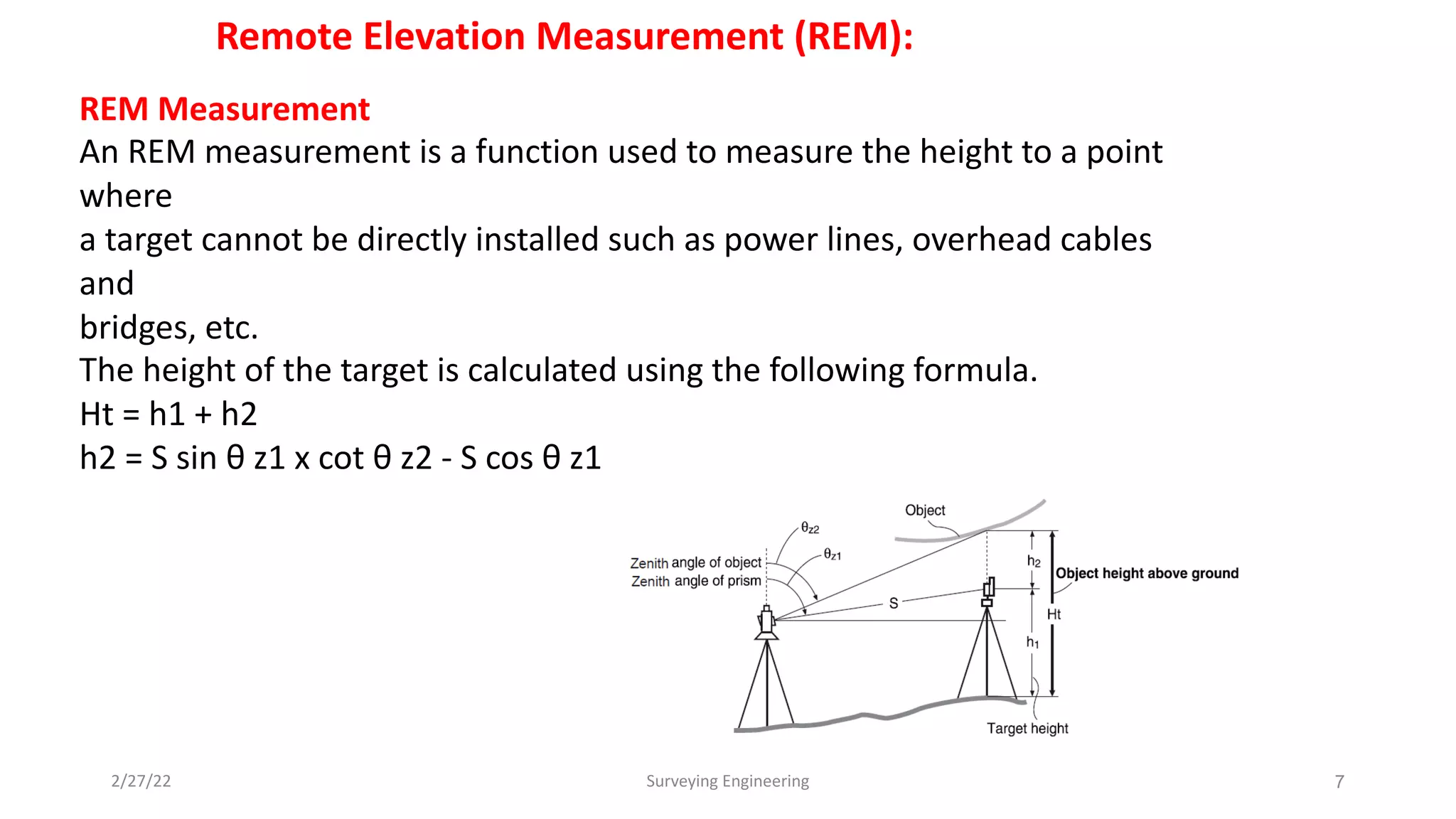
![Surface Area Calculation:
You can calculate the area of land (slope area and horizontal area) enclosed by three or more known
points on a line by inputting the coordinates of the points.
Input:
Coordinates : P1 (Ni, El, Z1) P5 (N5, E5, Z5)
Output:
Surface area: S (slope area and horizontal area)
Surface Area Calculation by Observing Points
Procedure:
1- Set up the instrument and enter the
instrument station data (NEZ)
2-In the second OBS mode screen, press [MENU],
then select "Area calc."
3-Select "Area calculation" in <Area calculation>.
4-Sight the first point on the line enclosing the
area, and press [OBS].
4](https://image.slidesharecdn.com/lecture4r-220910190526-6a46987a/75/Lecture_-4-_R-E-M-and-Area-Calculation-4-2048.jpg)
![5-Press [MEAS] to begin observation.
The measured values are displayed.
6-Press [OK] to enter the value of the first point in "01".
• Press [REC] in the second screen of step 5 to record code,target height,
and point name. The point name recorded here will be displayed in "01".
7-epeat steps 4 to 6 until all points have been measured. Points on an
enclosed area are observed in a clockwise or counter-clockwise direction.
For example, the area specified by entering point
names 1, 2, 3, 4, 5 or 5, 4, 3, 2, 1 implies the same shape.
After observing all necessary known points calculate the surface area for points
that have been observed, [CALC] is displayed.
8- Press [CALC] to display the calculated area.
PT: number of set points
S area: slope area
H area: horizontal area
9-Press [REC] in the screen of step 8 to record results and return to <Menu>.
Press [OK] to return to <Menu> without recording results. 5](https://image.slidesharecdn.com/lecture4r-220910190526-6a46987a/75/Lecture_-4-_R-E-M-and-Area-Calculation-5-2048.jpg)

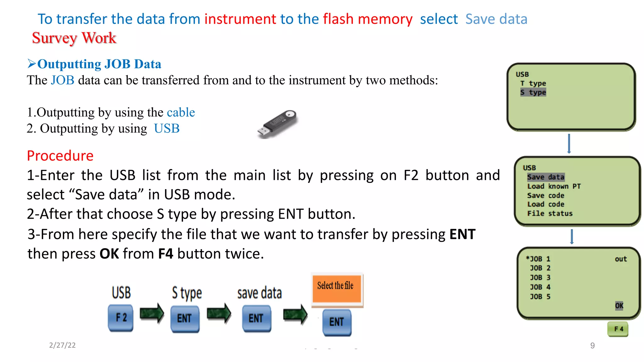
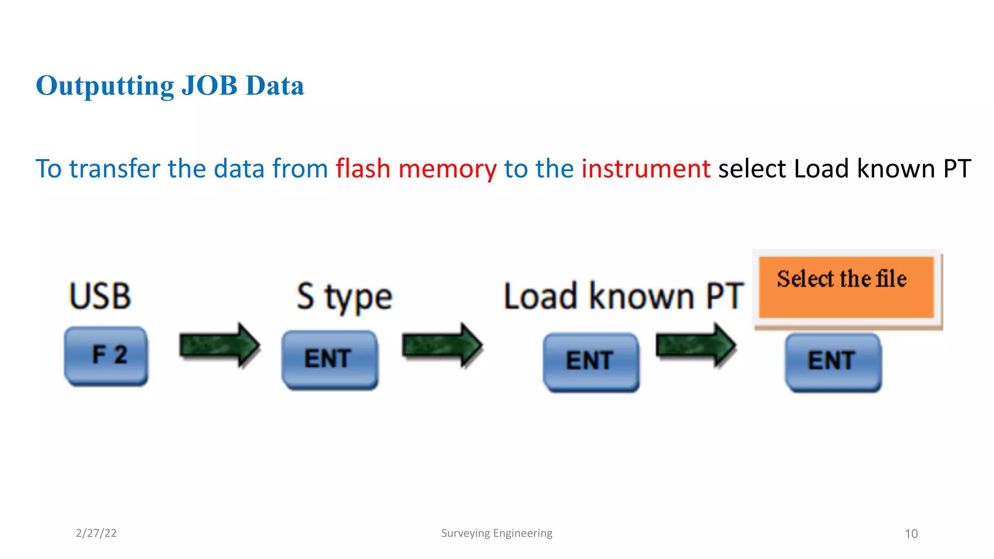

The document provides detailed instructions on using a total station for engineering surveying, focusing on coordinate measurement, remote elevation measurement, and surface area calculations. It emphasizes the correct procedures for observing points, entering coordinates in order, and the use of the total station's functionalities for accurate measurements. Furthermore, it outlines the steps for transferring job data between the total station and external devices.


