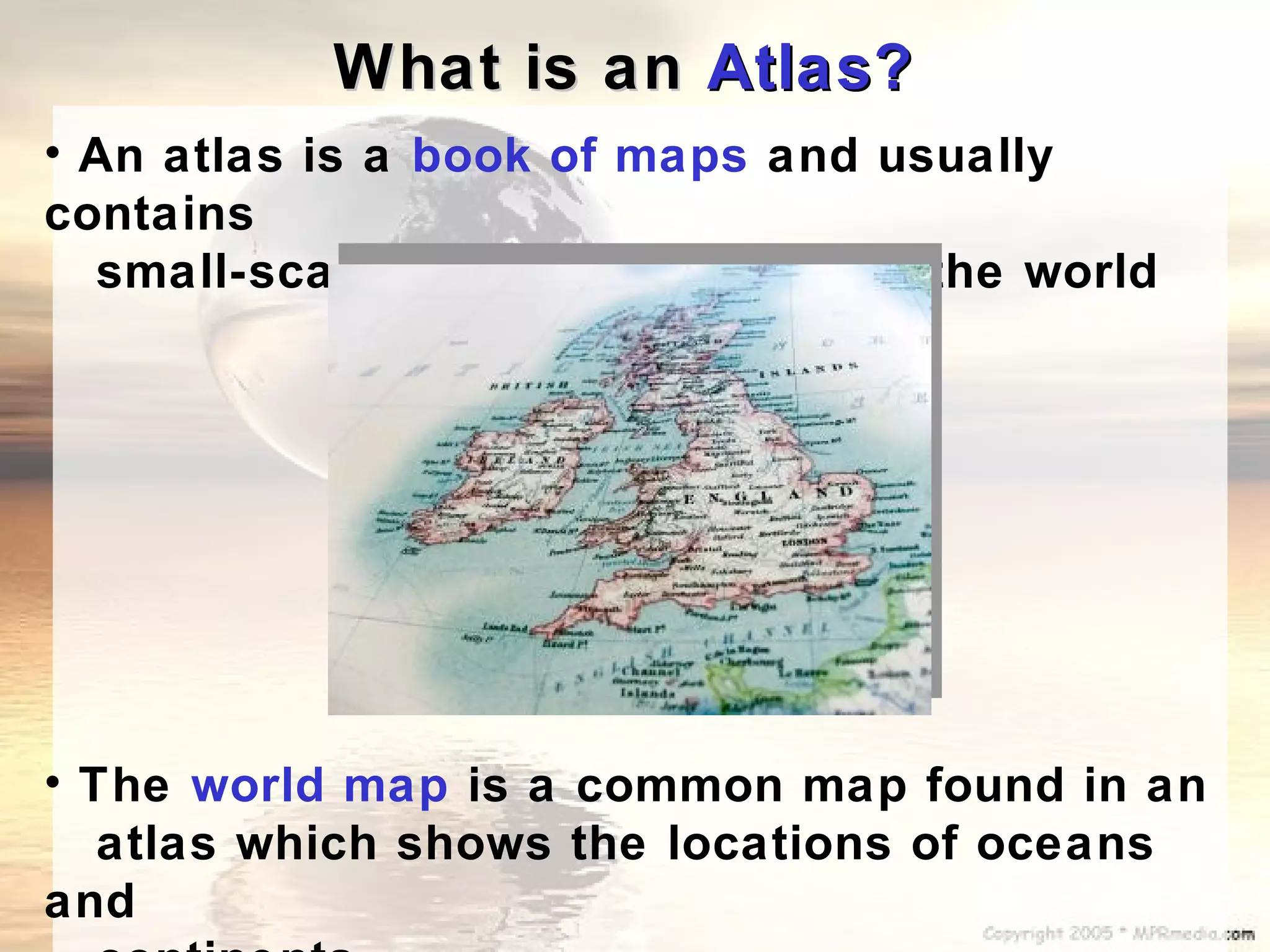
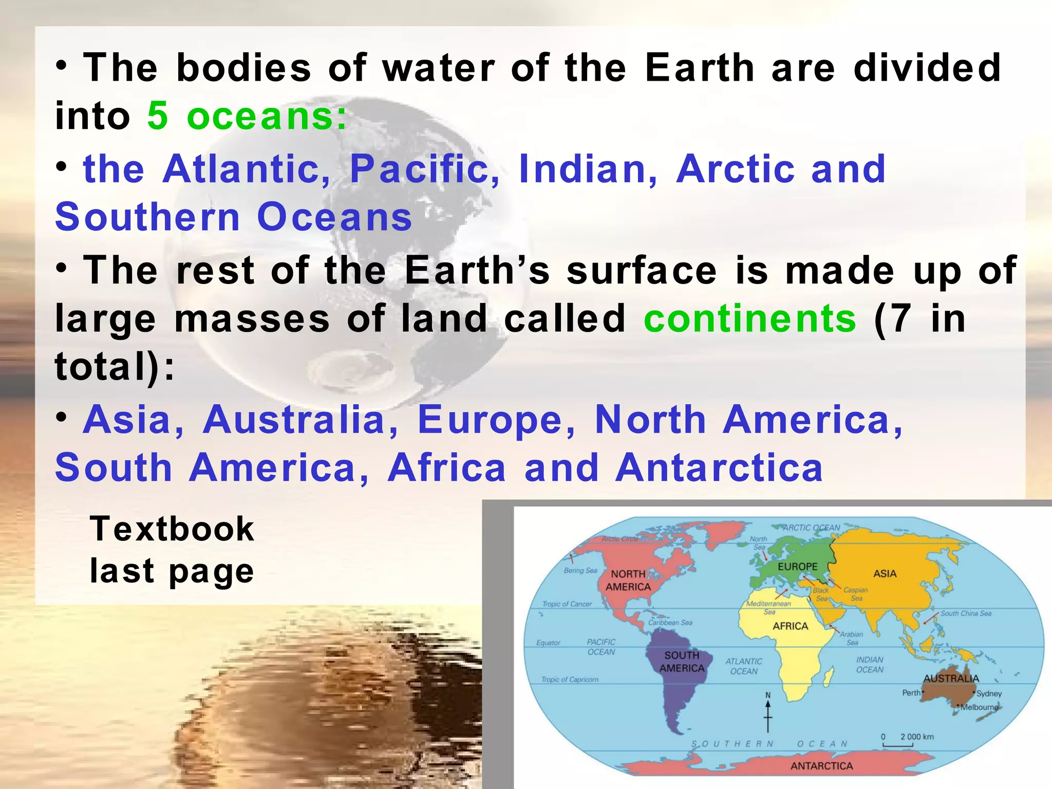
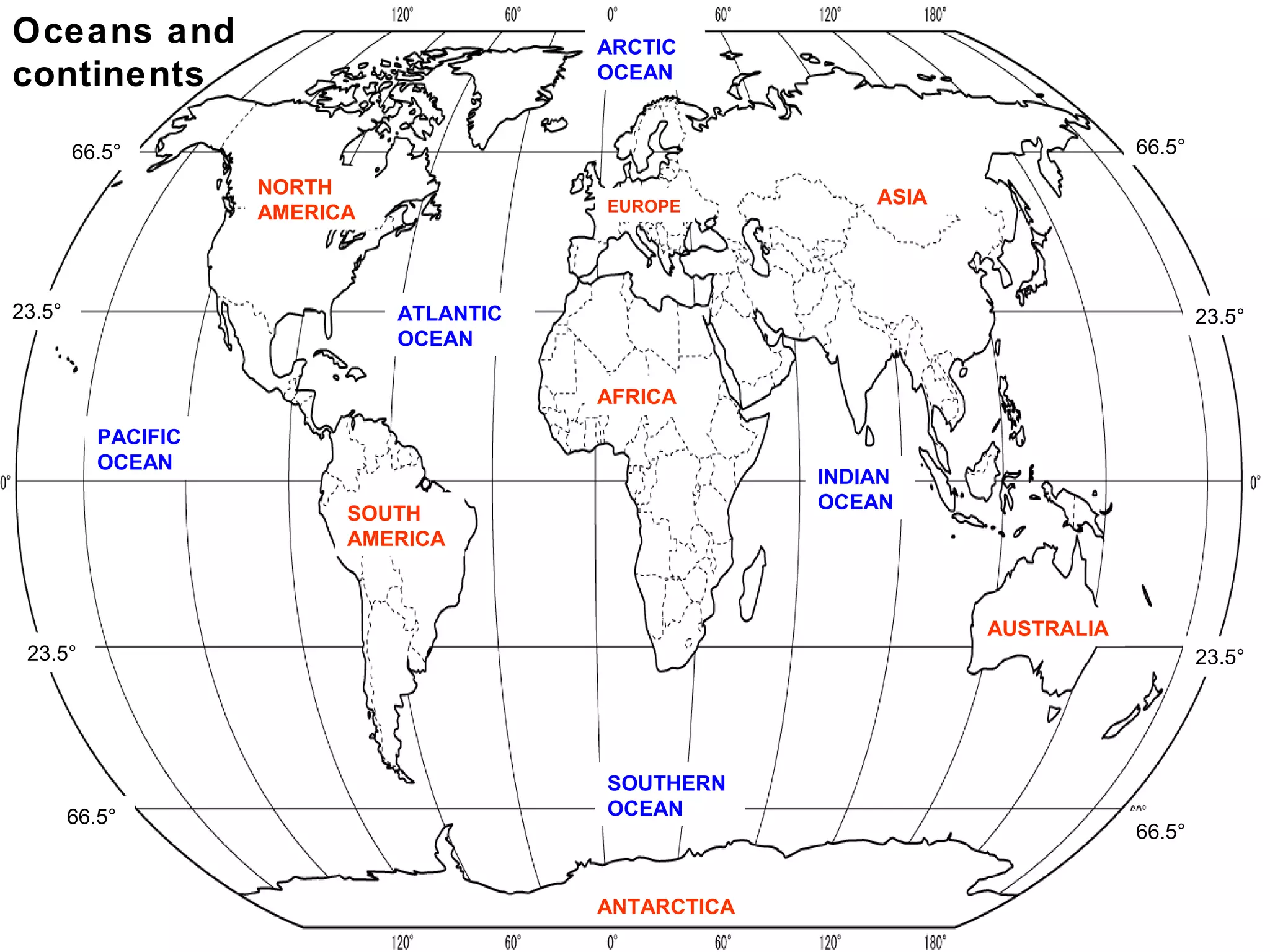
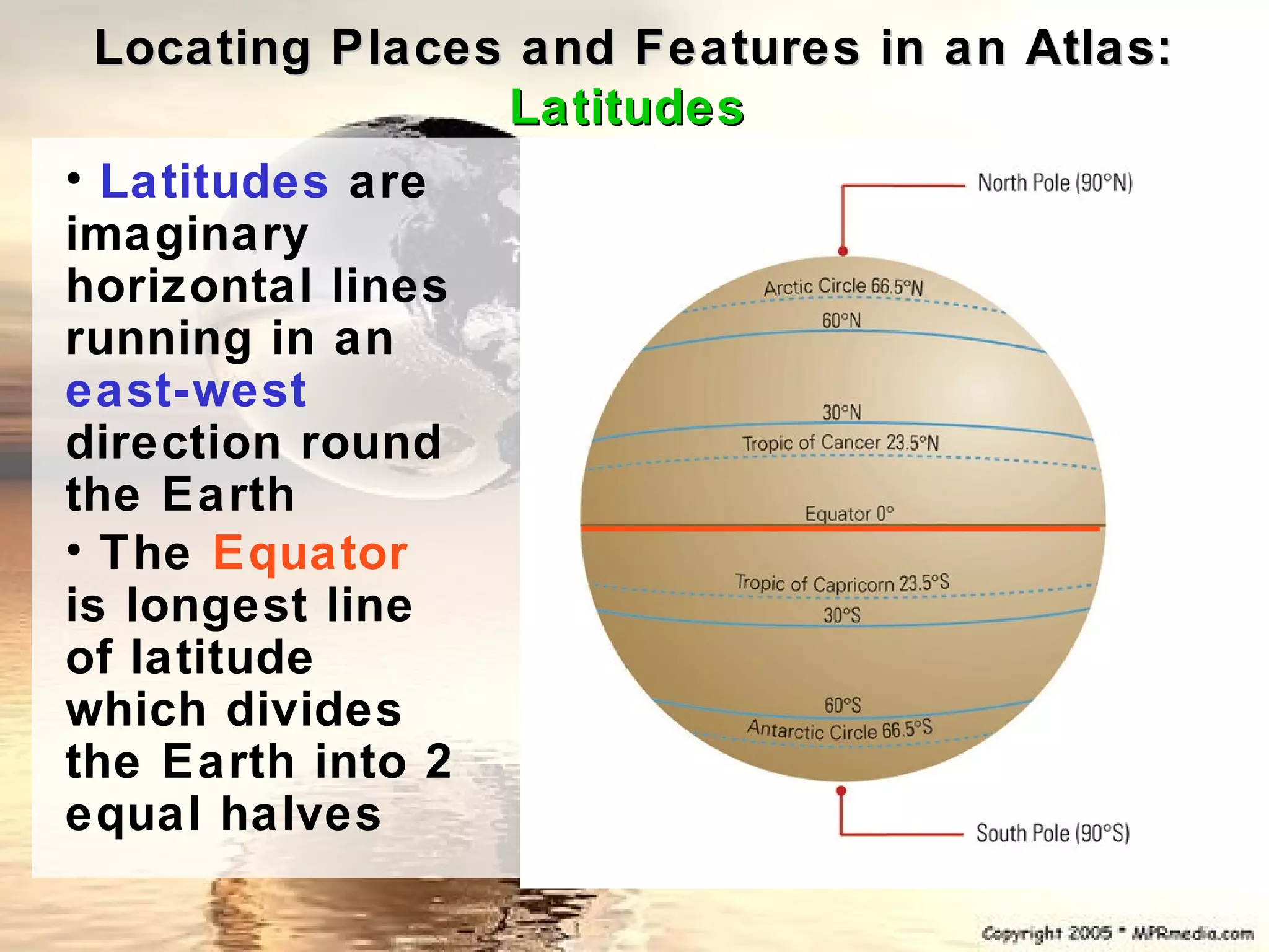
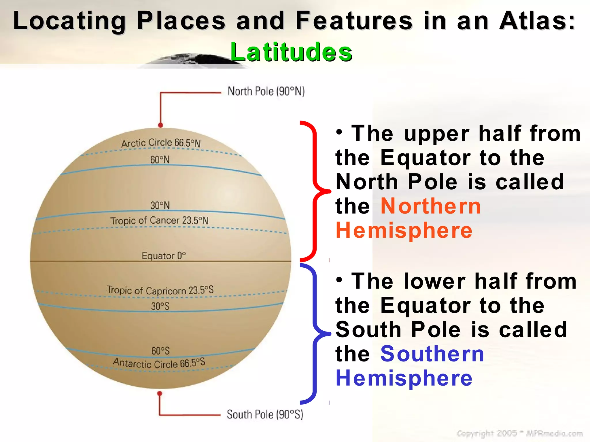
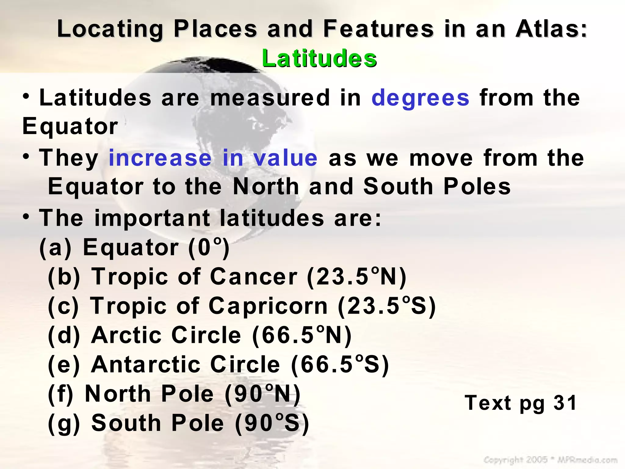
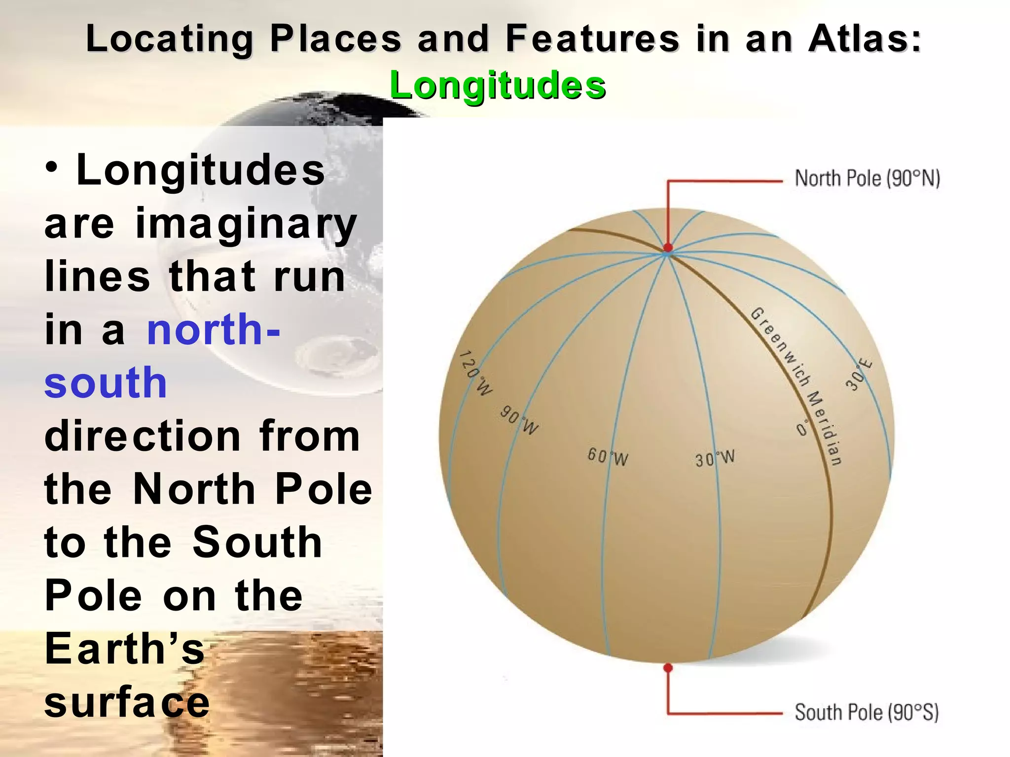
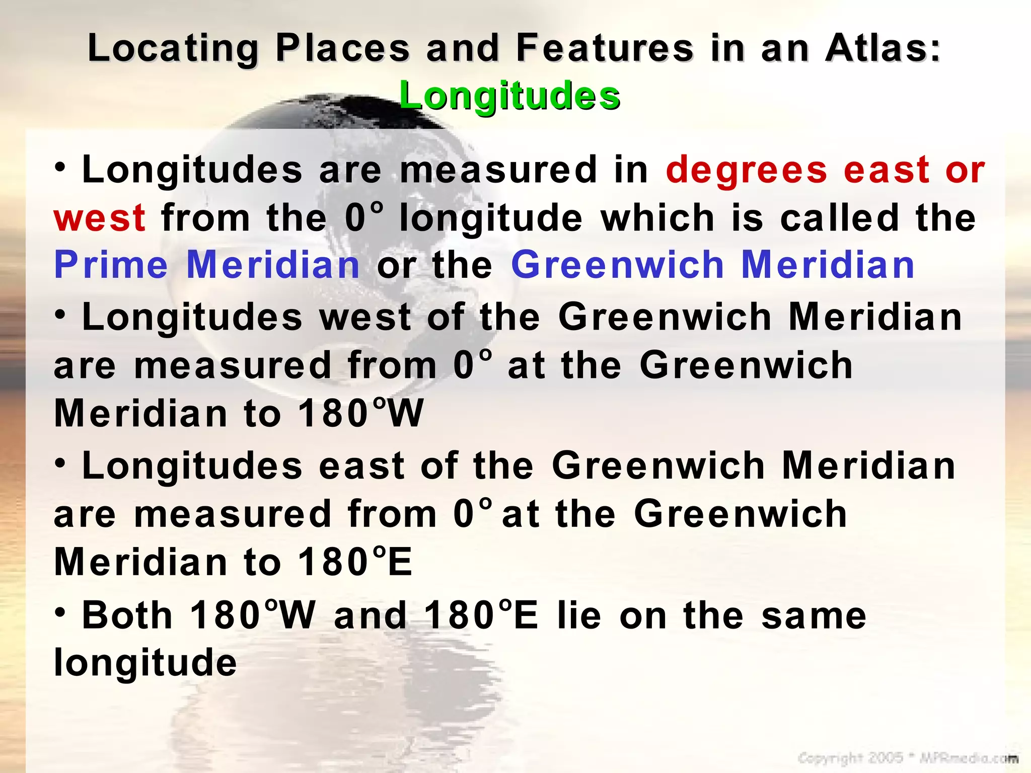
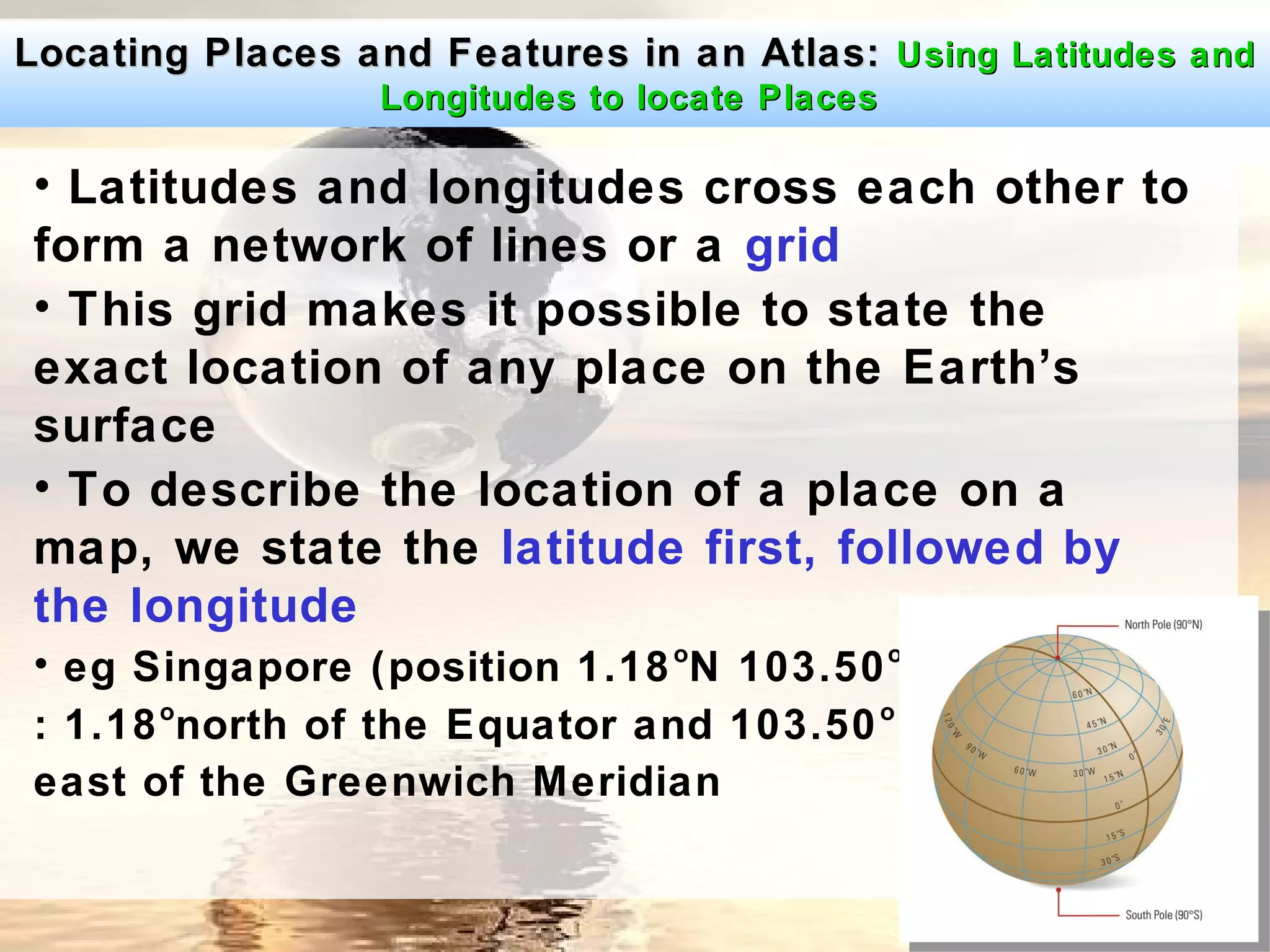
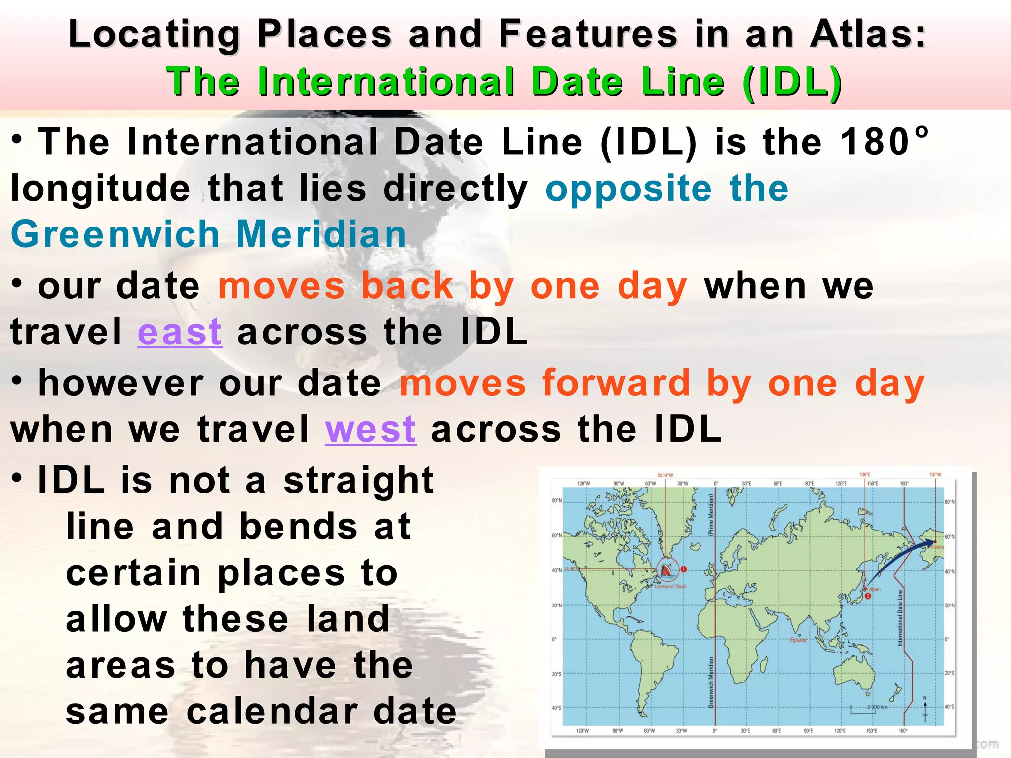
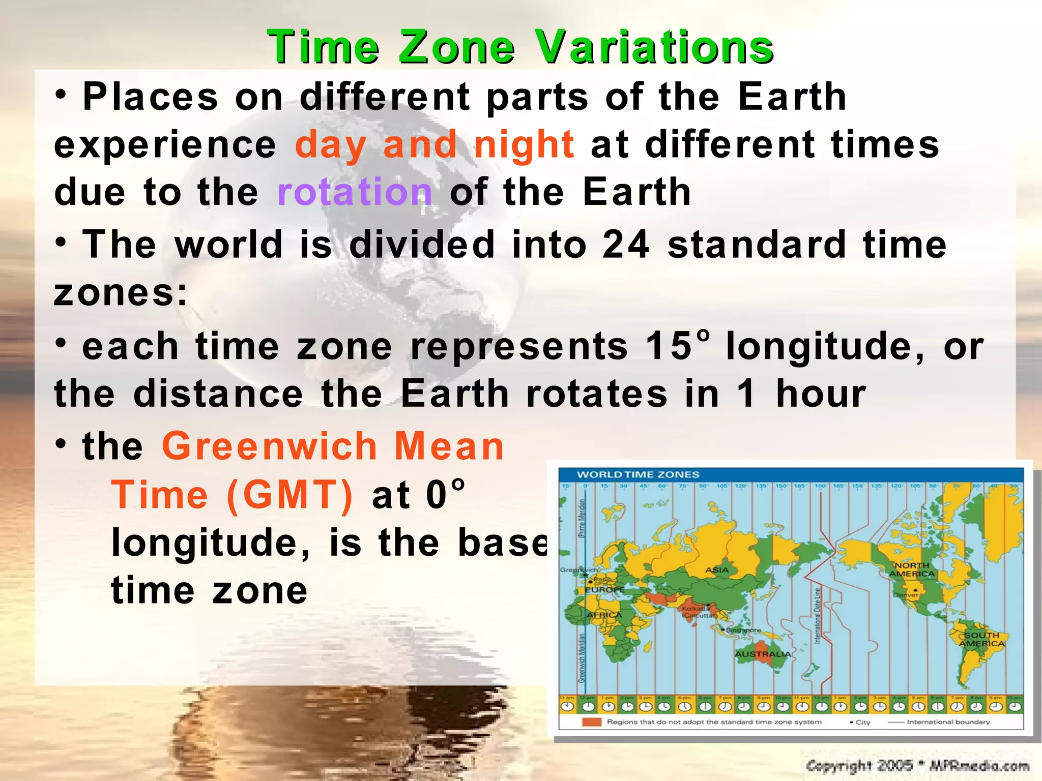
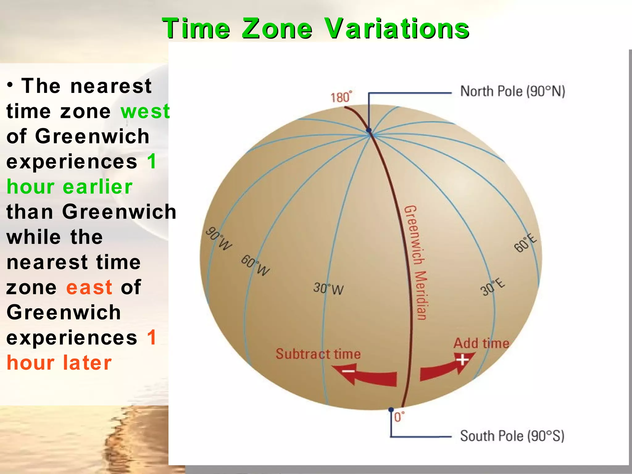
ENVIRONMENTS THROUGH
     MAPS (PART 1)
What is an Atlas?
• An atlas is a book of maps and usually
contains
  small-scale maps of countries in the world


• The world map is a common map found in an
   atlas which shows the locations of oceans
and
• The bodies of water of the Earth are divided
into 5 oceans:
• the Atlantic, Pacific, Indian, Arctic and
Southern Oceans
• The rest of the Earth’s surface is made up of
large masses of land called continents (7 in
total):
• Asia, Australia, Europe, North America,
South America, Africa and Antarctica
 Textbook
 last page
Oceans and                                ARCTIC
continents                                OCEAN


        66.5°                                                                 66.5°
                     NORTH                                 ASIA
                     AMERICA              EUROPE


23.5°                          ATLANTIC                                               23.5°
                               OCEAN

                                          AFRICA
           PACIFIC
           OCEAN
                                                       INDIAN
                                                       OCEAN
                           SOUTH
                           AMERICA


                                                                  AUSTRALIA
 23.5°                                                                                23.5°


                                          SOUTHERN
        66.5°                             OCEAN
                                                                              66.5°


                                          ANTARCTICA
Locating Places and Features in an Atlas:
                 Latitudes
• Latitudes are
imaginary
horizontal lines
running in an
east-west
direction round
the Earth
• The Equator
is longest line
of latitude
which divides
the Earth into 2
equal halves
Locating Places and Features in an Atlas:
               Latitudes


                       • The upper half from
                       the Equator to the
                       North Pole is called
                       the Northern
                       Hemisphere

                       • The lower half from
                       the Equator to the
                       South Pole is called
                       the Southern
                       Hemisphere
Locating Places and Features in an Atlas:
                 Latitudes
• Latitudes are measured in degrees from the
Equator
• They increase in value as we move from the
   Equator to the North and South Poles
• The important latitudes are:
                 o
  (a) Equator (0 )
                                o
   (b) Tropic of Cancer (23.5 N)
                                  o
   (c) Tropic of Capricorn (23.5 S)
                          o
   (d) Arctic Circle (66.5 N)
                              o
   (e) Antarctic Circle (66.5 S)
                      o
   (f) North Pole (90 N)            Text pg 31
                        o
   (g) South Pole (90 S)
Locating Places and Features in an Atlas:
               Longitudes

• Longitudes
are imaginary
lines that run
in a north-
south
direction from
the North Pole
to the South
Pole on the
Earth’s
surface
Locating Places and Features in an Atlas:
               Longitudes
• Longitudes are measured in degrees east or
               o
west from the 0 longitude which is called the
Prime Meridian or the Greenwich Meridian
• Longitudes west of the Greenwich Meridian
                     o
are measured from 0 at the Greenwich
                o
Meridian to 180 W
• Longitudes east of the Greenwich Meridian
                     o
are measured from 0 at the Greenwich
                o
Meridian to 180 E
• Both 180 W and 180 E lie on the same
          o            o

longitude
Locating Places and Features in an Atlas: Using Latitudes and
                 Longitudes to locate Places

• Latitudes and longitudes cross each other to
form a network of lines or a grid
• This grid makes it possible to state the
exact location of any place on the Earth’s
surface
• To describe the location of a place on a
map, we state the latitude first, followed by
the longitude
• eg Singapore (position 1.18 oN 103.50 oE)
      o                                o
: 1.18 north of the Equator and 103.50
east of the Greenwich Meridian
Locating Places and Features in an Atlas:
         The International Date Line (IDL)
• The International Date Line (IDL) is the 180 o

longitude that lies directly opposite the
Greenwich Meridian
• our date moves back by one day when we
travel east across the IDL
• however our date moves forward by one day
when we travel west across the IDL
• IDL is not a straight
   line and bends at
   certain places to
   allow these land
   areas to have the
   same calendar date
Time Zone Variations
• Places on different parts of the Earth
experience day and night at different times
due to the rotation of the Earth
• The world is divided into 24 standard time
zones:
• each time zone represents 15 longitude, or
                                 o

the distance the Earth rotates in 1 hour
• the Greenwich Mean
                      o
    Time (GMT) at 0
    longitude, is the base
    time zone
Time Zone Variations
• The nearest
time zone west
of Greenwich
experiences 1
hour earlier
than Greenwich
while the
nearest time
zone east of
Greenwich
experiences 1
hour later

Maps part 1 blog

  • 1.
    ENVIRONMENTS THROUGH MAPS (PART 1)
  • 2.
    What is anAtlas? • An atlas is a book of maps and usually contains small-scale maps of countries in the world • The world map is a common map found in an atlas which shows the locations of oceans and
  • 3.
    • The bodiesof water of the Earth are divided into 5 oceans: • the Atlantic, Pacific, Indian, Arctic and Southern Oceans • The rest of the Earth’s surface is made up of large masses of land called continents (7 in total): • Asia, Australia, Europe, North America, South America, Africa and Antarctica Textbook last page
  • 4.
    Oceans and ARCTIC continents OCEAN 66.5° 66.5° NORTH ASIA AMERICA EUROPE 23.5° ATLANTIC 23.5° OCEAN AFRICA PACIFIC OCEAN INDIAN OCEAN SOUTH AMERICA AUSTRALIA 23.5° 23.5° SOUTHERN 66.5° OCEAN 66.5° ANTARCTICA
  • 5.
    Locating Places andFeatures in an Atlas: Latitudes • Latitudes are imaginary horizontal lines running in an east-west direction round the Earth • The Equator is longest line of latitude which divides the Earth into 2 equal halves
  • 6.
    Locating Places andFeatures in an Atlas: Latitudes • The upper half from the Equator to the North Pole is called the Northern Hemisphere • The lower half from the Equator to the South Pole is called the Southern Hemisphere
  • 7.
    Locating Places andFeatures in an Atlas: Latitudes • Latitudes are measured in degrees from the Equator • They increase in value as we move from the Equator to the North and South Poles • The important latitudes are: o (a) Equator (0 ) o (b) Tropic of Cancer (23.5 N) o (c) Tropic of Capricorn (23.5 S) o (d) Arctic Circle (66.5 N) o (e) Antarctic Circle (66.5 S) o (f) North Pole (90 N) Text pg 31 o (g) South Pole (90 S)
  • 8.
    Locating Places andFeatures in an Atlas: Longitudes • Longitudes are imaginary lines that run in a north- south direction from the North Pole to the South Pole on the Earth’s surface
  • 9.
    Locating Places andFeatures in an Atlas: Longitudes • Longitudes are measured in degrees east or o west from the 0 longitude which is called the Prime Meridian or the Greenwich Meridian • Longitudes west of the Greenwich Meridian o are measured from 0 at the Greenwich o Meridian to 180 W • Longitudes east of the Greenwich Meridian o are measured from 0 at the Greenwich o Meridian to 180 E • Both 180 W and 180 E lie on the same o o longitude
  • 10.
    Locating Places andFeatures in an Atlas: Using Latitudes and Longitudes to locate Places • Latitudes and longitudes cross each other to form a network of lines or a grid • This grid makes it possible to state the exact location of any place on the Earth’s surface • To describe the location of a place on a map, we state the latitude first, followed by the longitude • eg Singapore (position 1.18 oN 103.50 oE) o o : 1.18 north of the Equator and 103.50 east of the Greenwich Meridian
  • 11.
    Locating Places andFeatures in an Atlas: The International Date Line (IDL) • The International Date Line (IDL) is the 180 o longitude that lies directly opposite the Greenwich Meridian • our date moves back by one day when we travel east across the IDL • however our date moves forward by one day when we travel west across the IDL • IDL is not a straight line and bends at certain places to allow these land areas to have the same calendar date
  • 12.
    Time Zone Variations •Places on different parts of the Earth experience day and night at different times due to the rotation of the Earth • The world is divided into 24 standard time zones: • each time zone represents 15 longitude, or o the distance the Earth rotates in 1 hour • the Greenwich Mean o Time (GMT) at 0 longitude, is the base time zone
  • 13.
    Time Zone Variations •The nearest time zone west of Greenwich experiences 1 hour earlier than Greenwich while the nearest time zone east of Greenwich experiences 1 hour later