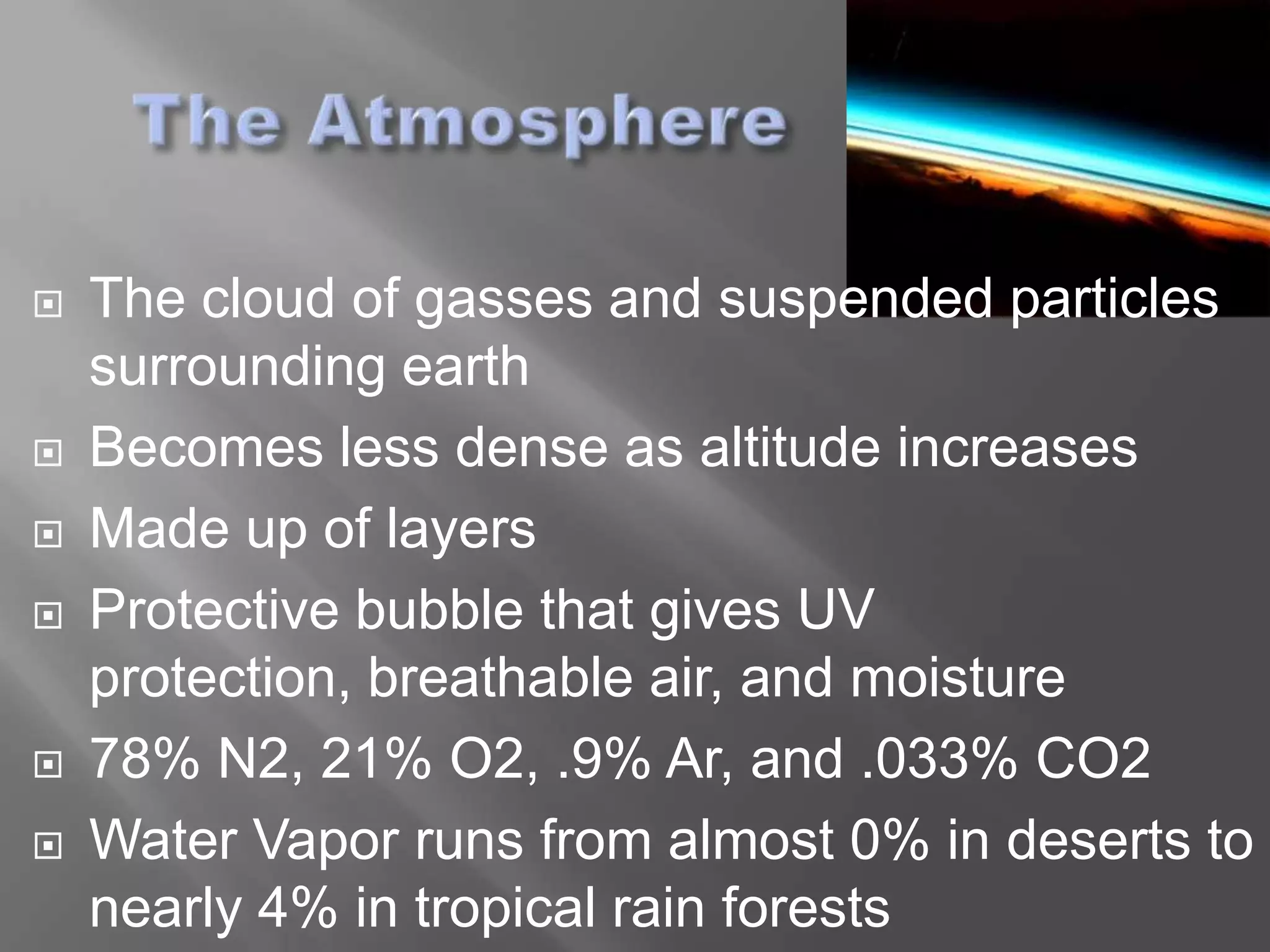
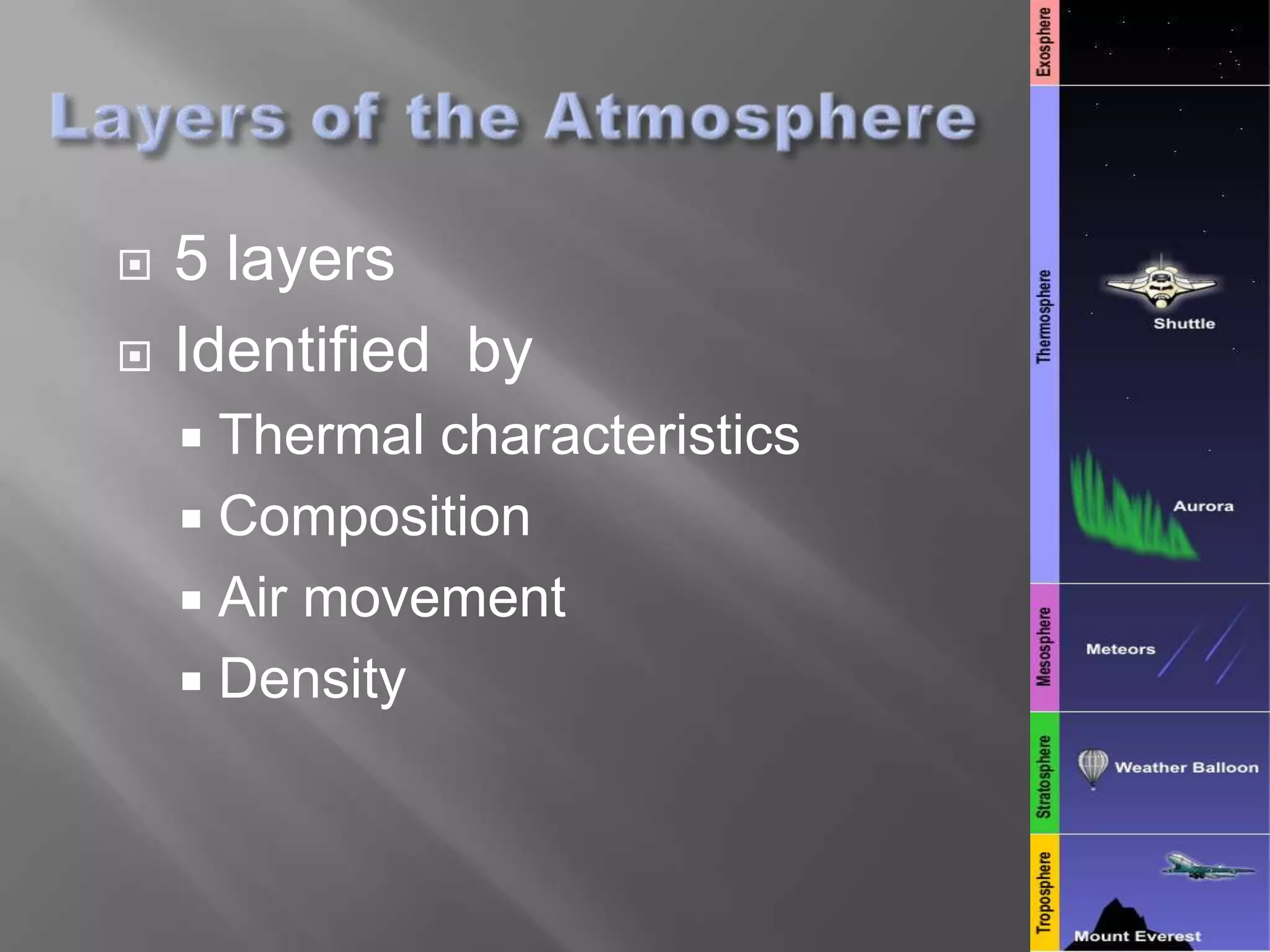
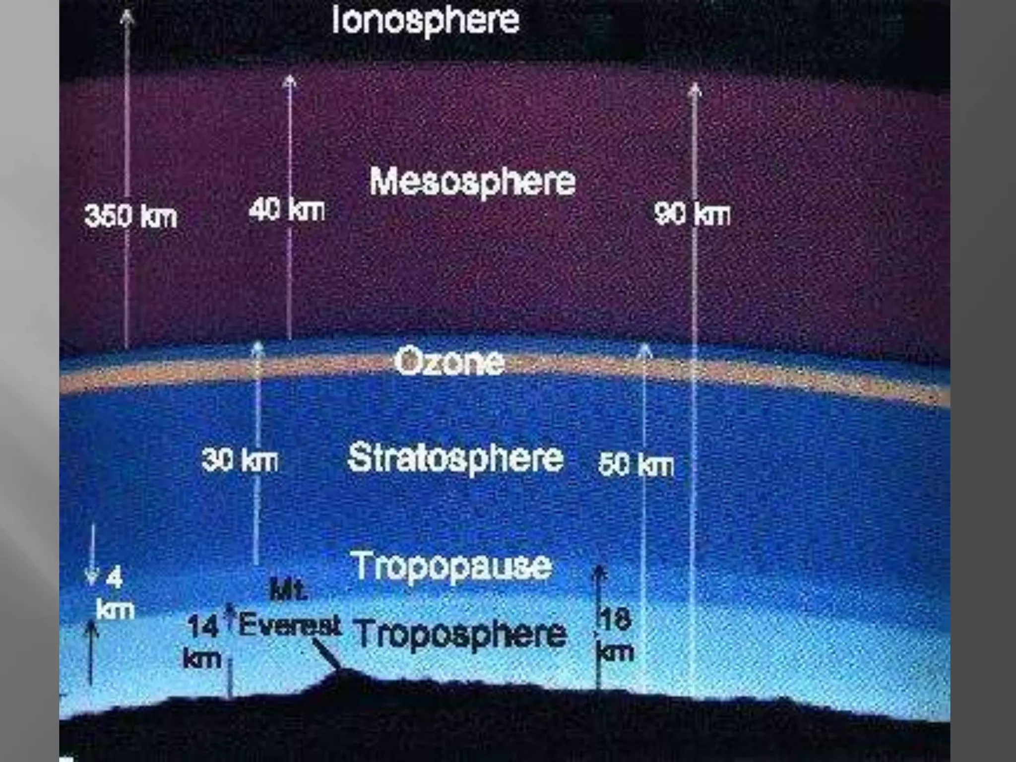
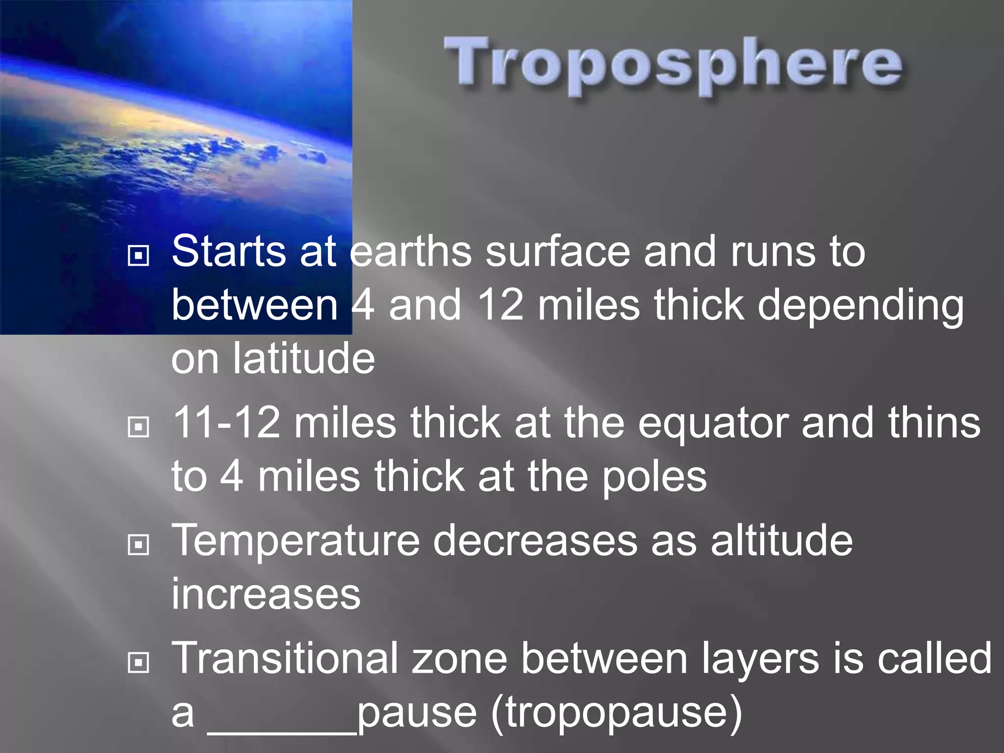
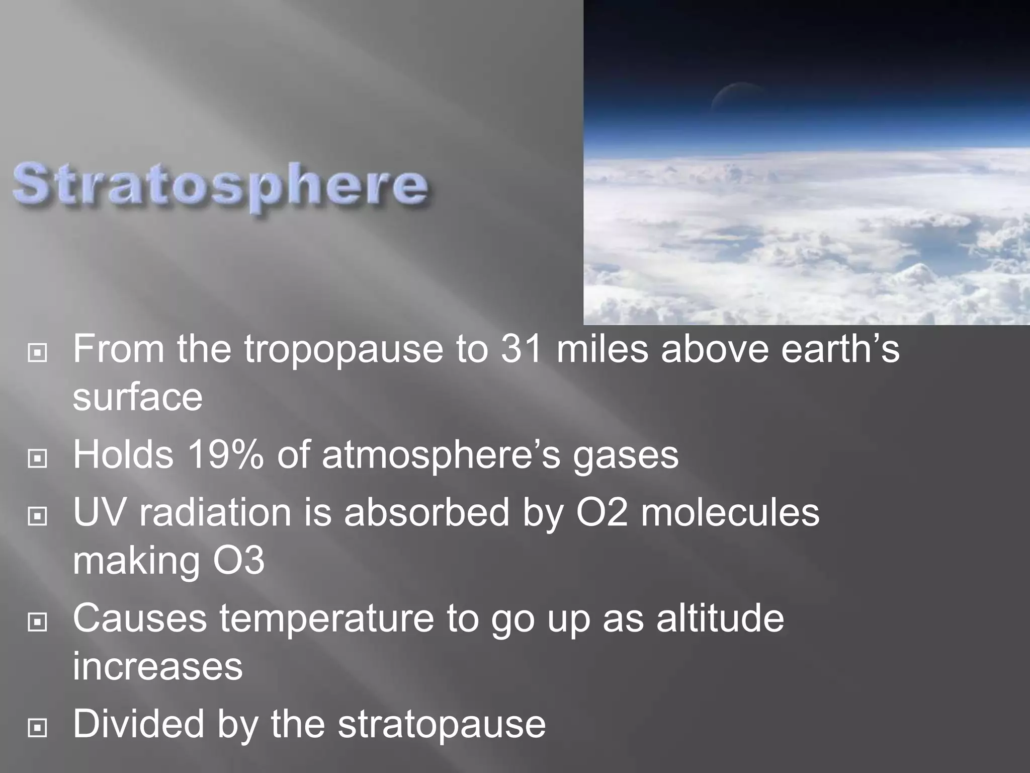
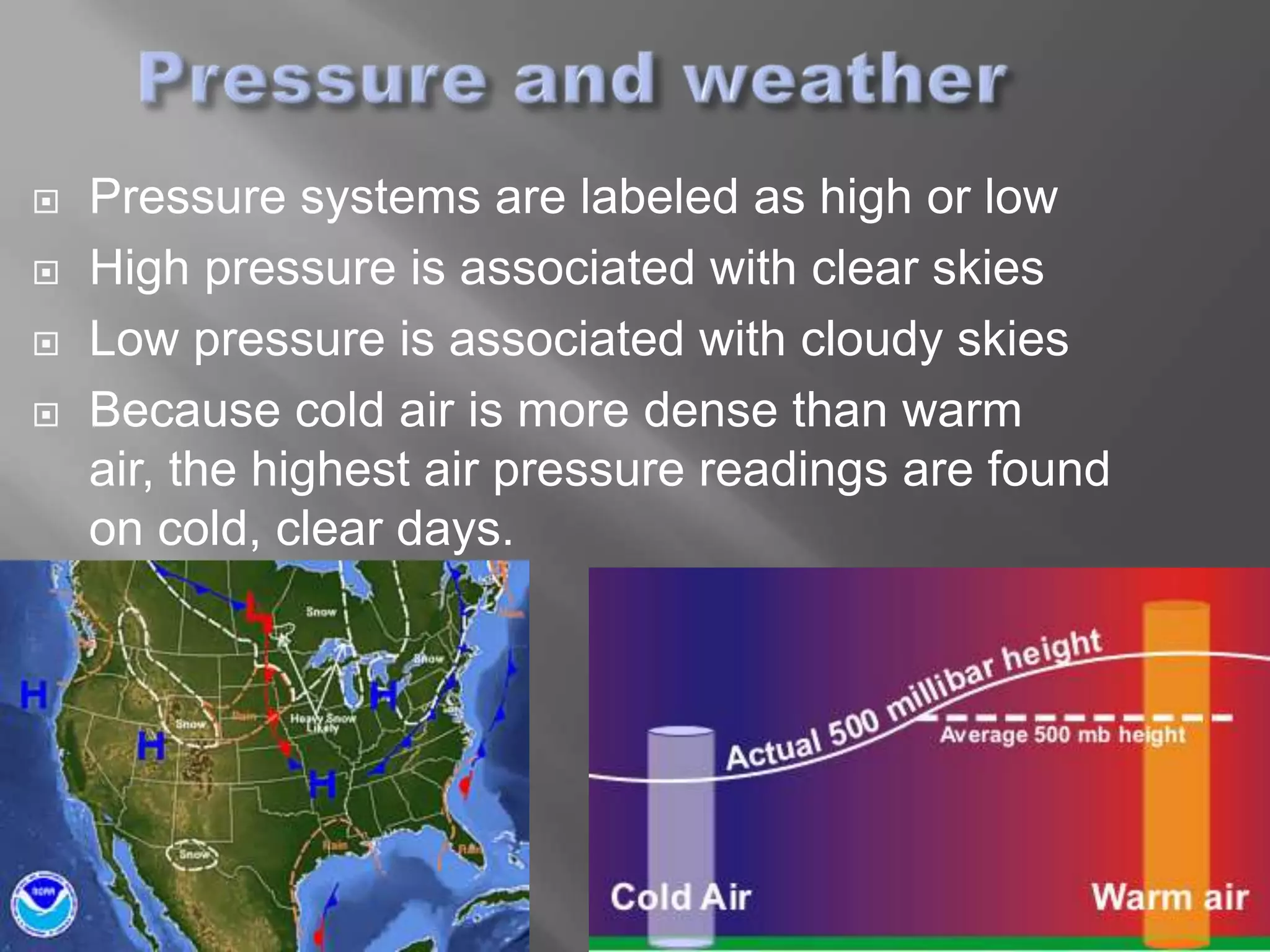
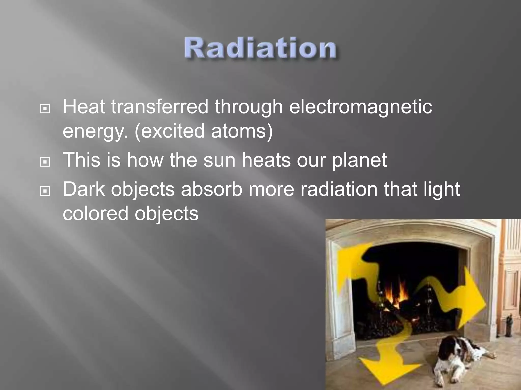
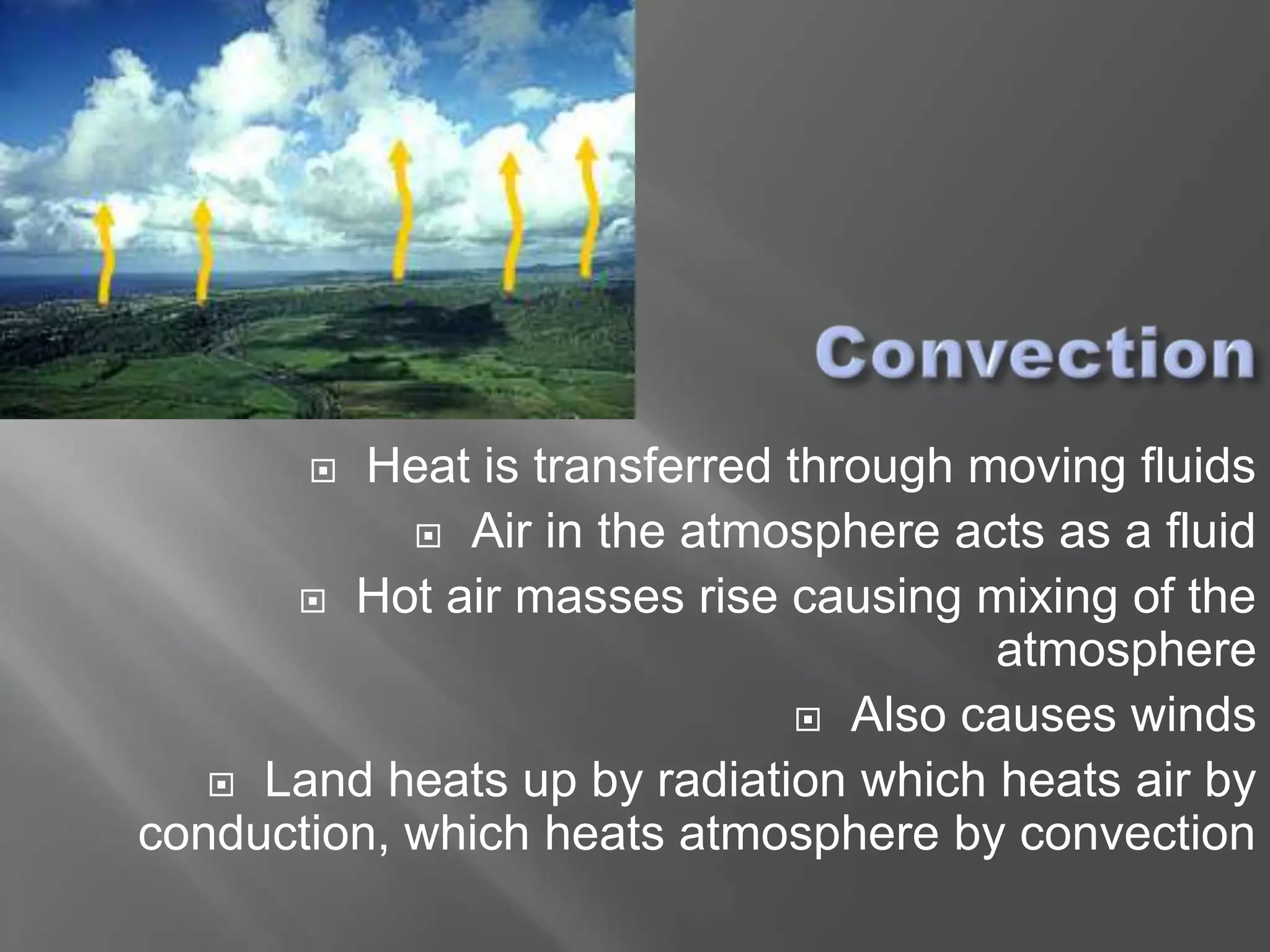
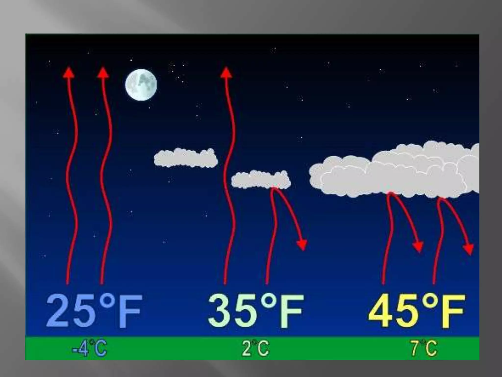
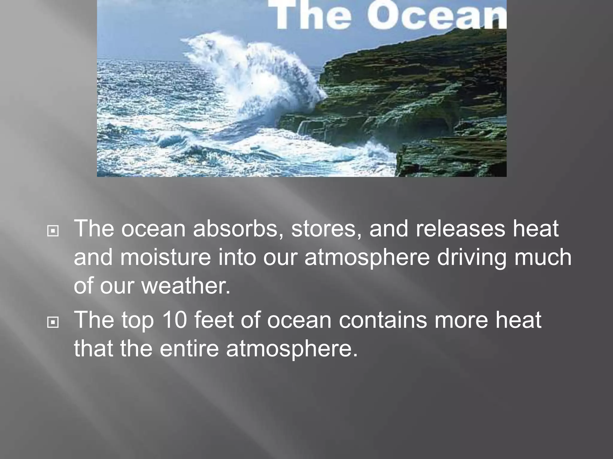
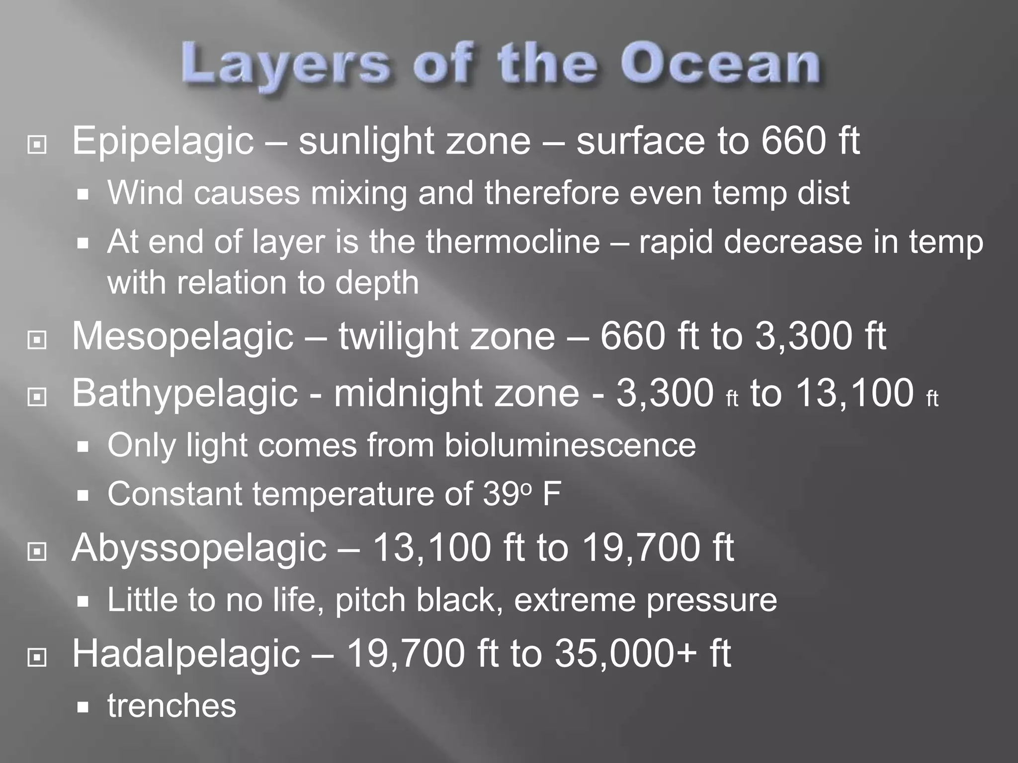
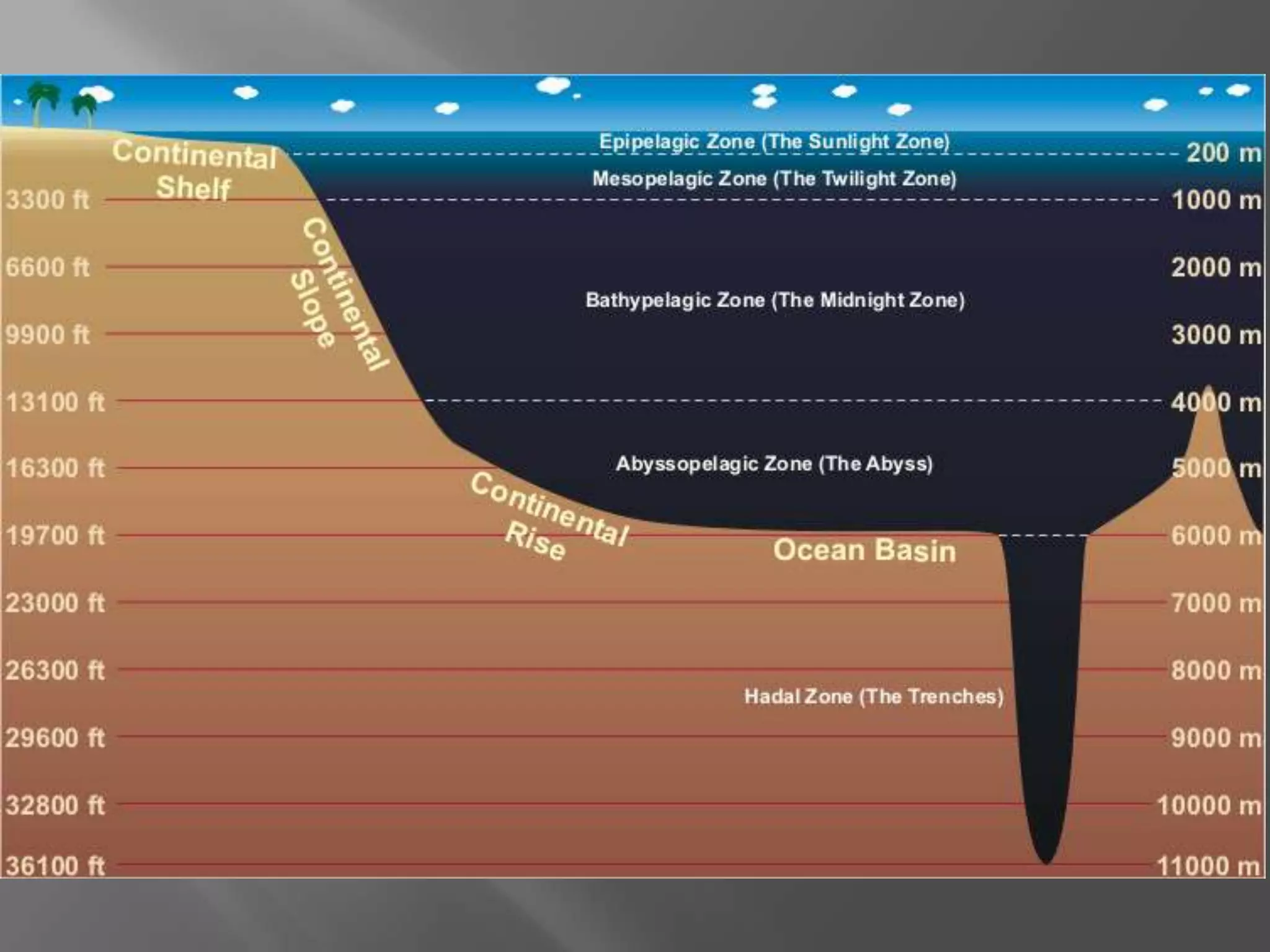
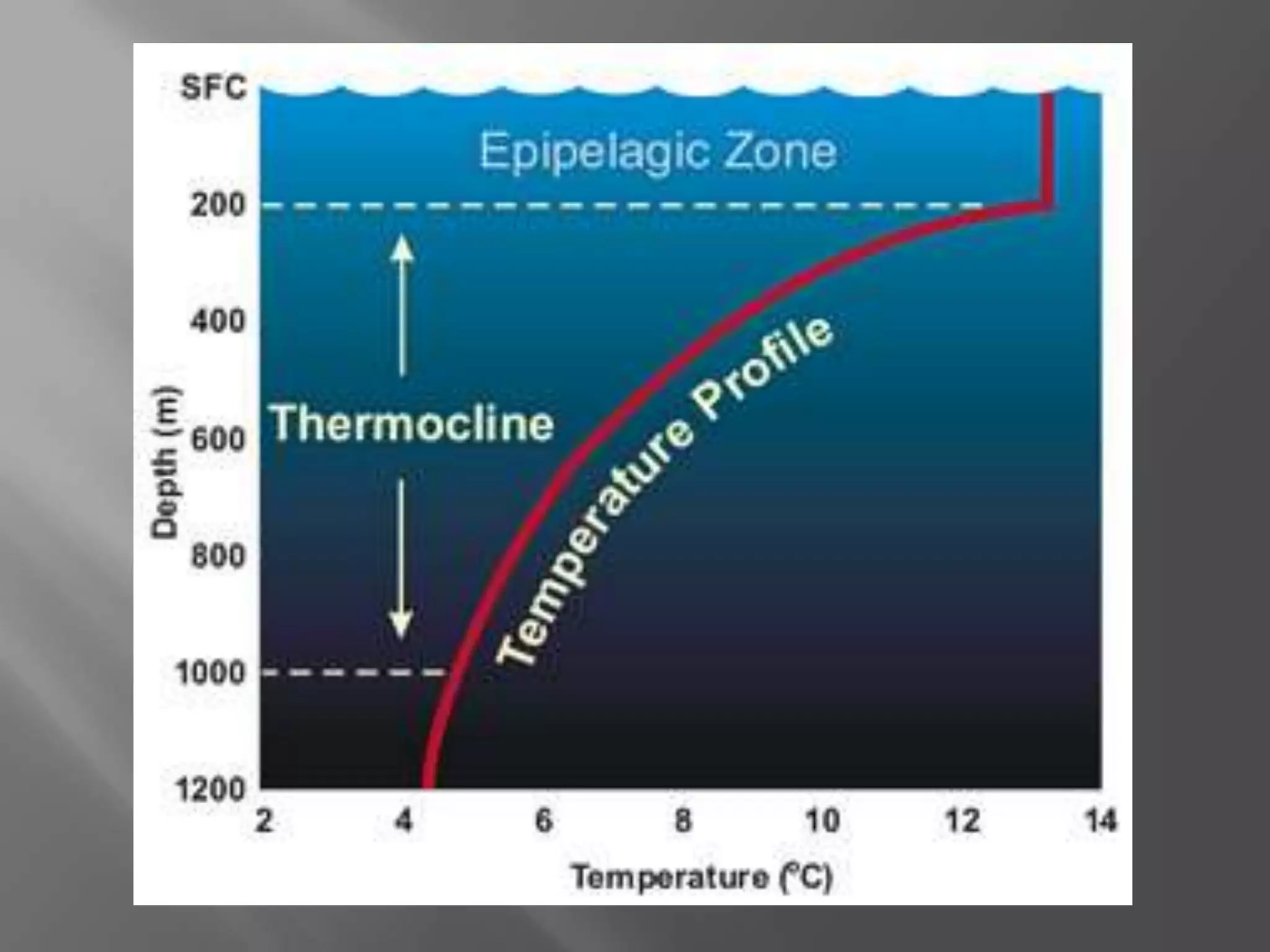
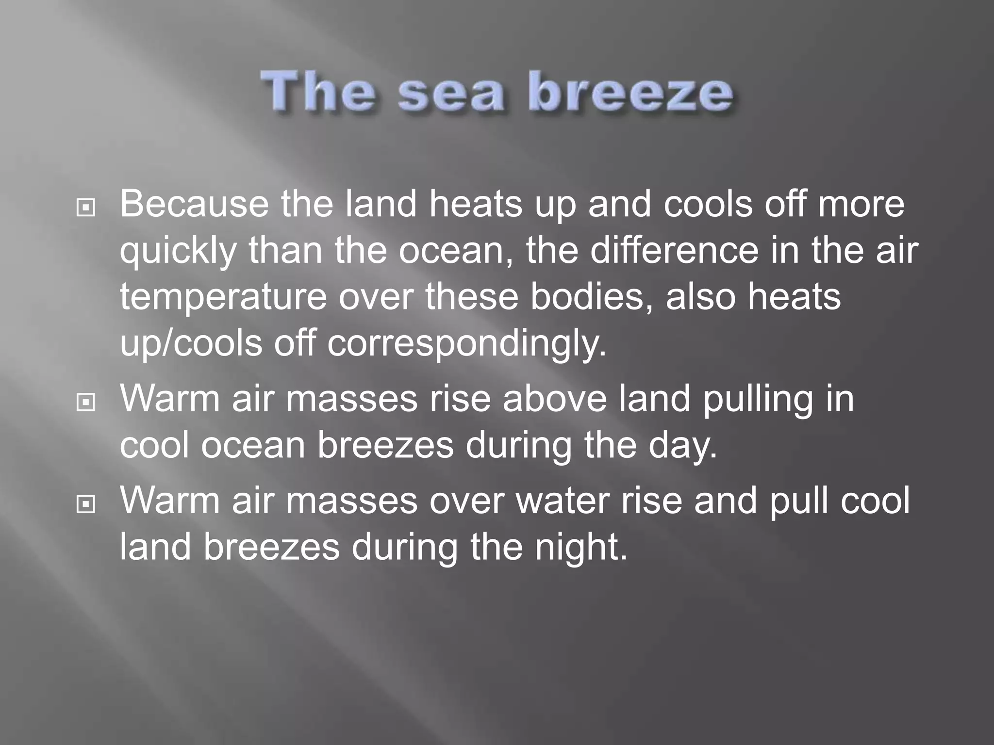
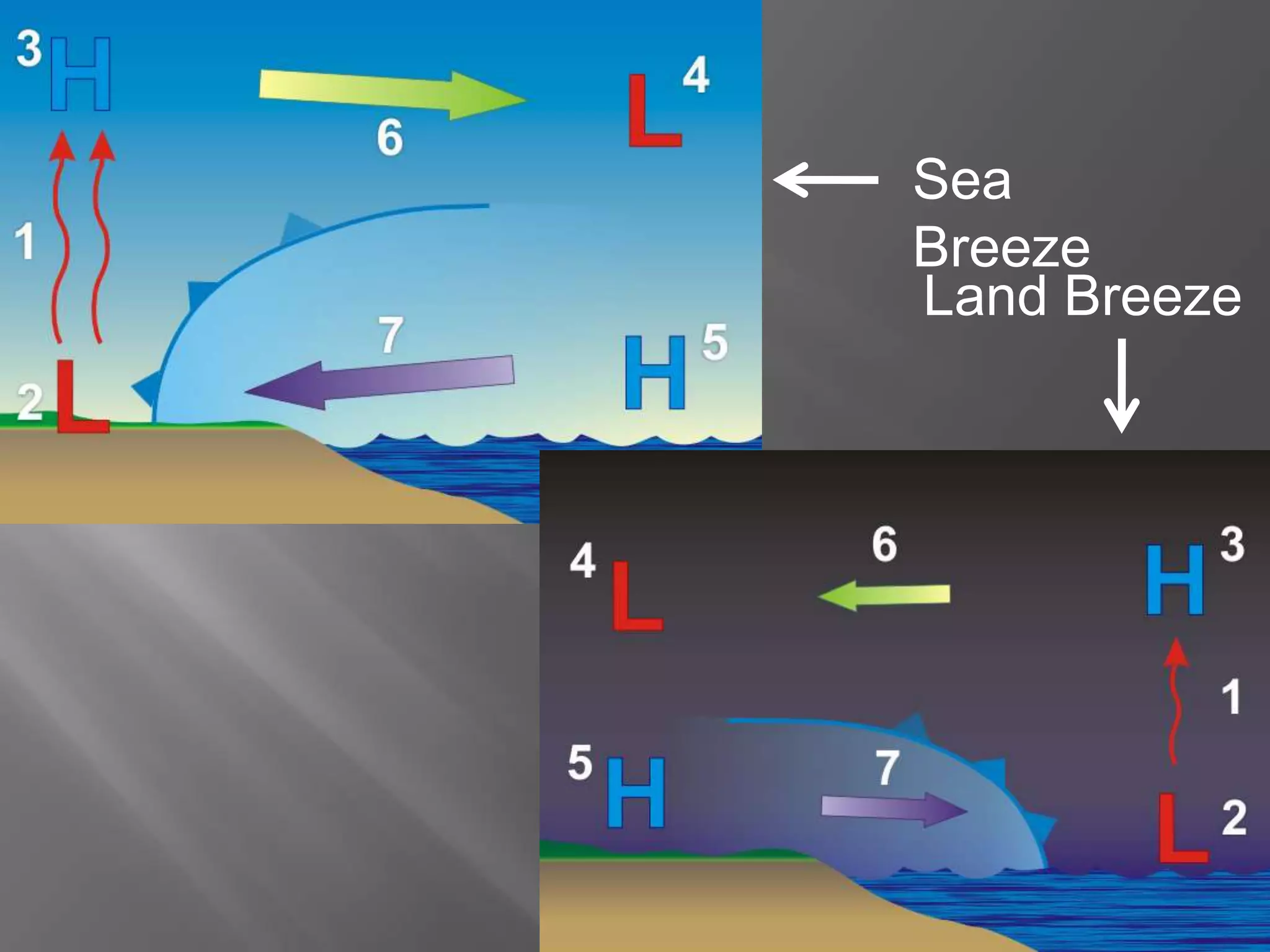
   The cloud of gasses and suspended particles
    surrounding earth
   Becomes less dense as altitude increases
   Made up of layers
   Protective bubble that gives UV
    protection, breathable air, and moisture
   78% N2, 21% O2, .9% Ar, and .033% CO2
   Water Vapor runs from almost 0% in deserts to
    nearly 4% in tropical rain forests
   5 layers
   Identified by
     Thermal characteristics
     Composition
     Air movement
     Density
   Starts at earths surface and runs to
    between 4 and 12 miles thick depending
    on latitude
   11-12 miles thick at the equator and thins
    to 4 miles thick at the poles
   Temperature decreases as altitude
    increases
   Transitional zone between layers is called
    a ______pause (tropopause)
   From the tropopause to 31 miles above earth’s
    surface
   Holds 19% of atmosphere’s gases
   UV radiation is absorbed by O2 molecules
    making O3
   Causes temperature to go up as altitude
    increases
   Divided by the stratopause
   From stratopause to 53 miles above earth’s
    surface
   Less dense than stratosphere
   As altitude increases, temperature decreases
   Slows down meteorites, leaving a trail in the
    night sky
   From mesopause to 430 miles above earth’s
    surface
   Exposed to very high amounts of UV radiation
    and X-rays
   As altitude increase, temperature increases
   Feels cold because of very low density
   Contains ionosphere – causes radio waves to
    reflect back to earth
       Also causes aroras
   From thermopause to 6200 miles above earth
   Area where satellites orbit
   Air has mass and therefore exerts pressure as it
    piles up above us
   As the density of air increases, the pressure of the
    air increases
   As the temperature of air increases, the density of
    the air decreases
   Air pressure is exerted in all directions at once
   Standard air pressure at sea level is 14.7 lbs/in2
   As elevation increases, air pressure
    decreases, because there is less atmosphere above
    you.
   Due to this variation, air pressure at two different
    locations cannot be compared.
   We use sea level as the basis for a standard
    conversion for each location.
   Measure air pressure in inches of mercury or
    millibars.
   Standard air pressure at sea level is 29.92 inches of
    mercury or 1013.2 millibars.
   Pressure systems are labeled as high or low
   High pressure is associated with clear skies
   Low pressure is associated with cloudy skies
   Because cold air is more dense than warm
    air, the highest air pressure readings are found
    on cold, clear days.
   Heat energy is transferred through:
       Radiation
       Conduction
       Convection

    The Sun’s heat is what fuels our planet’s weather.
   Heat transferred through electromagnetic
    energy. (excited atoms)
   This is how the sun heats our planet
   Dark objects absorb more radiation that light
    colored objects
   Transfers heat through two solid objects
    touching
   Metal spoon on a hot surface gets hot
  Heat is transferred through moving fluids
             Air in the atmosphere acts as a fluid

       Hot air masses rise causing mixing of the
                                       atmosphere
                                Also causes winds

    Land heats up by radiation which heats air by
conduction, which heats atmosphere by convection
   We have incoming energy from the sun and
    outgoing energy reflected by earth’s surface
   The air molecules trap some reflected
    heat, creating a warming “blanket” around
    earth
   This stabilizes our temperature
   Cloud cover traps even more of the reflected
    heat closer to the earth’s surface
   Cloudy nights cool off less that clear nights
   The ocean absorbs, stores, and releases heat
    and moisture into our atmosphere driving much
    of our weather.
   The top 10 feet of ocean contains more heat
    that the entire atmosphere.
   Epipelagic – sunlight zone – surface to 660 ft
       Wind causes mixing and therefore even temp dist
       At end of layer is the thermocline – rapid decrease in temp
        with relation to depth
   Mesopelagic – twilight zone – 660 ft to 3,300 ft
   Bathypelagic - midnight zone - 3,300 ft to 13,100 ft
       Only light comes from bioluminescence
       Constant temperature of 39o F
   Abyssopelagic – 13,100 ft to 19,700 ft
       Little to no life, pitch black, extreme pressure
   Hadalpelagic – 19,700 ft to 35,000+ ft
       trenches
   Ocean water is salty.
       Most of the salt is NaCl, but some is MgCl or KCl.
   Different areas of the earth’s oceans are saltier
    than others.
       Around the equator and the poles are the least salty
        because of high rain fall and ice melt.
       The Atlantic, Persian Gulf, and Red Sea are the most
        salty due to high evaporation.
   Salinity is measured in grams of salt per liter.
       Normal salt levels are around 35 g/l
   The density of water increases as temperature
    decreases up to about 40o F.
   Between 40o F and 32o F, the molecules begin
    locking together and decreasing the density.
   As a result, ice floats and expands.
       About 9% expansion by volume.
   However, salt decreases the temperature at which
    water freezes.
       Sea water freezes around 28o F
   The temperature and
    salinity of the water impacts
    is density.
   The density of ocean water
    directly impacts ocean
    circulation patterns.
   Ocean circulation patterns
    influence most of our
    weather patterns in one
    way or another.
   Surface currents along the west coasts flow toward
    the equator and bring cold water from the poles to
    the equator.
       California Current that keeps San Francisco cool.
   Surface currents along the east coasts flow toward
    the poles and bring warm water to the poles.
       Gulf Stream that keeps England warmer.
   The deep ocean currents
    that circulate the global
    oceans is called the great
    ocean conveyor.
Themohaline Circulation – Thermo (tempurature) & Haline (salt)

  Water takes about 1000 years to complete
                  Sinking             Up
                                      welling
   Because the land heats up and cools off more
    quickly than the ocean, the difference in the air
    temperature over these bodies, also heats
    up/cools off correspondingly.
   Warm air masses rise above land pulling in
    cool ocean breezes during the day.
   Warm air masses over water rise and pull cool
    land breezes during the night.
Sea
Breeze
Land Breeze

Weather Part 1

  • 2.
    The cloud of gasses and suspended particles surrounding earth  Becomes less dense as altitude increases  Made up of layers  Protective bubble that gives UV protection, breathable air, and moisture  78% N2, 21% O2, .9% Ar, and .033% CO2  Water Vapor runs from almost 0% in deserts to nearly 4% in tropical rain forests
  • 3.
    5 layers  Identified by  Thermal characteristics  Composition  Air movement  Density
  • 5.
    Starts at earths surface and runs to between 4 and 12 miles thick depending on latitude  11-12 miles thick at the equator and thins to 4 miles thick at the poles  Temperature decreases as altitude increases  Transitional zone between layers is called a ______pause (tropopause)
  • 6.
    From the tropopause to 31 miles above earth’s surface  Holds 19% of atmosphere’s gases  UV radiation is absorbed by O2 molecules making O3  Causes temperature to go up as altitude increases  Divided by the stratopause
  • 7.
    From stratopause to 53 miles above earth’s surface  Less dense than stratosphere  As altitude increases, temperature decreases  Slows down meteorites, leaving a trail in the night sky
  • 8.
    From mesopause to 430 miles above earth’s surface  Exposed to very high amounts of UV radiation and X-rays  As altitude increase, temperature increases  Feels cold because of very low density  Contains ionosphere – causes radio waves to reflect back to earth  Also causes aroras
  • 9.
    From thermopause to 6200 miles above earth  Area where satellites orbit
  • 10.
    Air has mass and therefore exerts pressure as it piles up above us  As the density of air increases, the pressure of the air increases  As the temperature of air increases, the density of the air decreases  Air pressure is exerted in all directions at once  Standard air pressure at sea level is 14.7 lbs/in2
  • 11.
    As elevation increases, air pressure decreases, because there is less atmosphere above you.  Due to this variation, air pressure at two different locations cannot be compared.  We use sea level as the basis for a standard conversion for each location.  Measure air pressure in inches of mercury or millibars.  Standard air pressure at sea level is 29.92 inches of mercury or 1013.2 millibars.
  • 13.
    Pressure systems are labeled as high or low  High pressure is associated with clear skies  Low pressure is associated with cloudy skies  Because cold air is more dense than warm air, the highest air pressure readings are found on cold, clear days.
  • 14.
    Heat energy is transferred through:  Radiation  Conduction  Convection The Sun’s heat is what fuels our planet’s weather.
  • 15.
    Heat transferred through electromagnetic energy. (excited atoms)  This is how the sun heats our planet  Dark objects absorb more radiation that light colored objects
  • 16.
    Transfers heat through two solid objects touching  Metal spoon on a hot surface gets hot
  • 17.
     Heatis transferred through moving fluids  Air in the atmosphere acts as a fluid  Hot air masses rise causing mixing of the atmosphere  Also causes winds  Land heats up by radiation which heats air by conduction, which heats atmosphere by convection
  • 18.
    We have incoming energy from the sun and outgoing energy reflected by earth’s surface  The air molecules trap some reflected heat, creating a warming “blanket” around earth  This stabilizes our temperature  Cloud cover traps even more of the reflected heat closer to the earth’s surface  Cloudy nights cool off less that clear nights
  • 20.
    The ocean absorbs, stores, and releases heat and moisture into our atmosphere driving much of our weather.  The top 10 feet of ocean contains more heat that the entire atmosphere.
  • 21.
    Epipelagic – sunlight zone – surface to 660 ft  Wind causes mixing and therefore even temp dist  At end of layer is the thermocline – rapid decrease in temp with relation to depth  Mesopelagic – twilight zone – 660 ft to 3,300 ft  Bathypelagic - midnight zone - 3,300 ft to 13,100 ft  Only light comes from bioluminescence  Constant temperature of 39o F  Abyssopelagic – 13,100 ft to 19,700 ft  Little to no life, pitch black, extreme pressure  Hadalpelagic – 19,700 ft to 35,000+ ft  trenches
  • 24.
    Ocean water is salty.  Most of the salt is NaCl, but some is MgCl or KCl.  Different areas of the earth’s oceans are saltier than others.  Around the equator and the poles are the least salty because of high rain fall and ice melt.  The Atlantic, Persian Gulf, and Red Sea are the most salty due to high evaporation.  Salinity is measured in grams of salt per liter.  Normal salt levels are around 35 g/l
  • 25.
    The density of water increases as temperature decreases up to about 40o F.  Between 40o F and 32o F, the molecules begin locking together and decreasing the density.  As a result, ice floats and expands.  About 9% expansion by volume.  However, salt decreases the temperature at which water freezes.  Sea water freezes around 28o F
  • 26.
    The temperature and salinity of the water impacts is density.  The density of ocean water directly impacts ocean circulation patterns.  Ocean circulation patterns influence most of our weather patterns in one way or another.
  • 27.
    Surface currents along the west coasts flow toward the equator and bring cold water from the poles to the equator.  California Current that keeps San Francisco cool.  Surface currents along the east coasts flow toward the poles and bring warm water to the poles.  Gulf Stream that keeps England warmer.  The deep ocean currents that circulate the global oceans is called the great ocean conveyor.
  • 28.
    Themohaline Circulation –Thermo (tempurature) & Haline (salt) Water takes about 1000 years to complete Sinking Up welling
  • 29.
    Because the land heats up and cools off more quickly than the ocean, the difference in the air temperature over these bodies, also heats up/cools off correspondingly.  Warm air masses rise above land pulling in cool ocean breezes during the day.  Warm air masses over water rise and pull cool land breezes during the night.
  • 30.