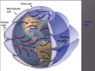
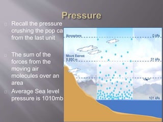
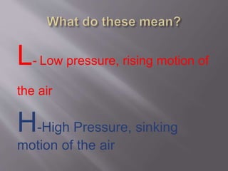
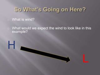
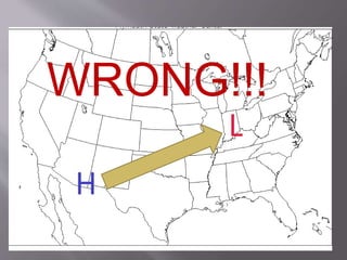
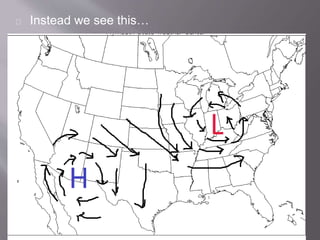
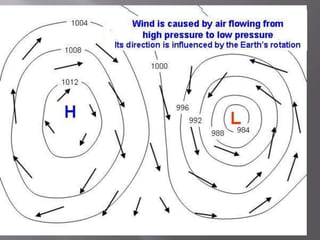
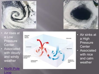
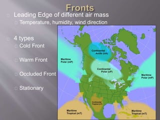
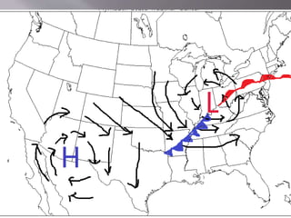
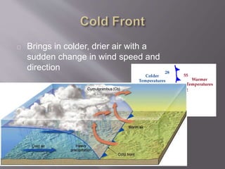
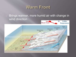
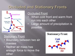
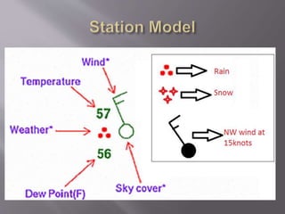
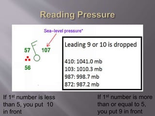
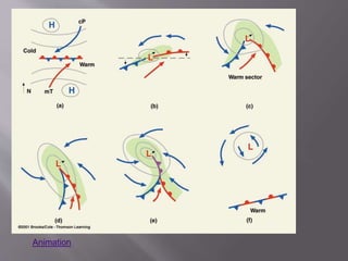
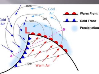
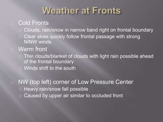
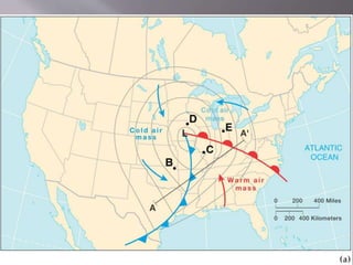
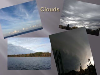
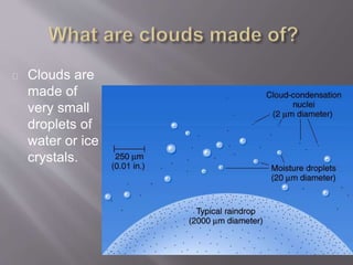
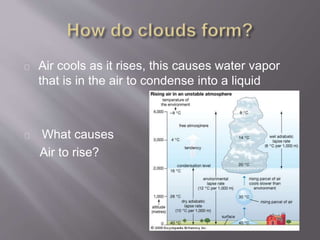
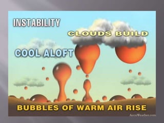
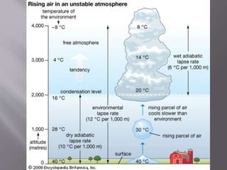
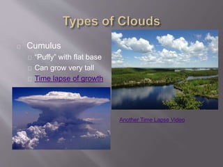
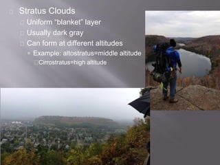
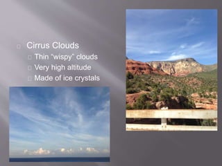
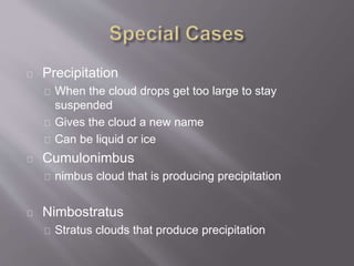
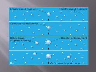
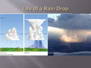
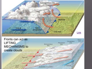
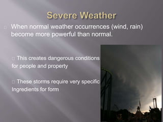
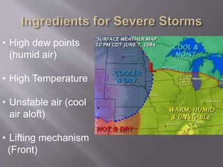
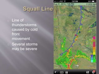
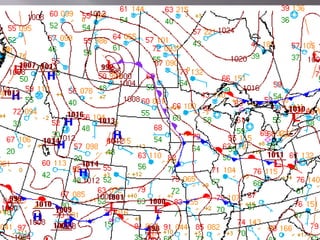
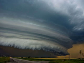
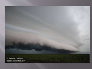
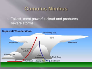
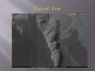
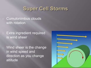
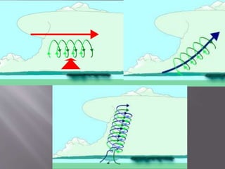
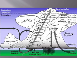
This document summarizes key concepts about atmospheric pressure and weather patterns. It explains that high and low pressure centers drive wind patterns due to differences in air pressure. Air rises at low pressure centers and sinks at high pressure centers. The document also outlines different types of fronts where different air masses meet, including cold, warm, occluded, and stationary fronts. It describes cloud formation and types of clouds like cumulus, stratus, and cirrus clouds. Finally, it discusses severe weather events like thunderstorms and tornadoes that form from conditions including humidity, heat, unstable air masses, and lifting mechanisms like fronts.
4. Recall the pressure
crushing the pop can
from the last unit
The sum of the
forces from the
moving air
molecules over an
area
Average Sea level
pressure is 1010mb
5. L- Low pressure, rising motion of
the air
H-High Pressure, sinking
motion of the air
6. What is wind?
What would we expect the wind to look like in this
example?
H
L
10. Caused by the Earth’s Rotation
Causes the Rotation of air around pressure
centers
Opposite effects on southern hemisphere
Simpsons video
http://earth.nullschool.net/
Example
11. • Air rises at
a Low
Pressure
Center
• Associated
with cloudy
and windy
weather
• North Pole
Loop
• Air sinks at
a High
Pressure
Center
• Associated
with nice
and calm
weather
12. Isotherm
Line of equal
temperature
Isobar
Line of equal
pressure
Gradient is shown
by lines drawn close
together
Very important to find
fronts!
13. Leading Edge of different air mass
Temperature, humidity, wind direction
4 types
Cold Front
Warm Front
Occluded Front
Stationary
14.
15. Brings in colder, drier air with a
sudden change in wind speed and
direction
17. Occluded Front
• When cold front and warm front
run into each other
• Large amount of precipitation is
possible
Stationary Front
• Boundary between two air
masses
• Neither air mass has
enough force to move the
other
18.
19. If 1st number is less
than 5, you put 10
in front
If 1st number is more
than or equal to 5,
you put 9 in front
22. Cold Fronts
Clouds, rain/snow in narrow band right on frontal boundary
Clear skies quickly follow frontal passage with strong
N/NW winds
Warm front
Thin clouds/blanket of clouds with light rain possible ahead
of the frontal boundary
Winds shift to the south
NW (top left) corner of Low Pressure Center
Heavy rain/snow fall possible
Caused by upper air similar to occluded front
23.
24. Pressure Centers control where fronts go
Prevailing winds and the jet stream control
where pressure systems go
Link
25.
26. Clouds are
made of
very small
droplets of
water or ice
crystals.
27. Air cools as it rises, this causes water vapor
that is in the air to condense into a liquid
What causes
Air to rise?
28.
29.
30. Cumulus
“Puffy” with flat base
Can grow very tall
Time lapse of growth
Another Time Lapse Video
31. Stratus Clouds
Uniform “blanket” layer
Usually dark gray
Can form at different altitudes
Example: altostratus=middle altitude
Cirrostratus=high altitude
32. Cirrus Clouds
Thin “wispy” clouds
Very high altitude
Made of ice crystals
33. Precipitation
When the cloud drops get too large to stay
suspended
Gives the cloud a new name
Can be liquid or ice
Cumulonimbus
nimbus cloud that is producing precipitation
Nimbostratus
Stratus clouds that produce precipitation
37. When normal weather occurrences (wind, rain)
become more powerful than normal.
This creates dangerous conditions
for people and property
These storms require very specific
Ingredients for form
38. • High dew points
(humid air)
• High Temperature
• Unstable air (cool
air aloft)
• Lifting mechanism
(Front)
46. Cumulonimbus clouds
with rotation
Extra ingredient required
is wind sheer
Wind sheer is the change
in wind speed and
direction as you change
altitude