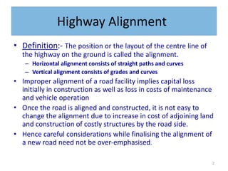
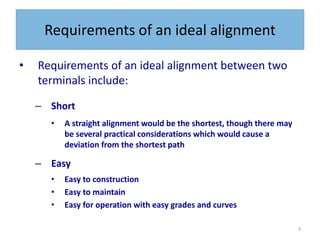
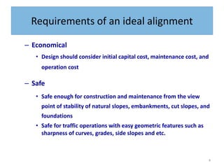
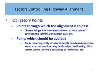
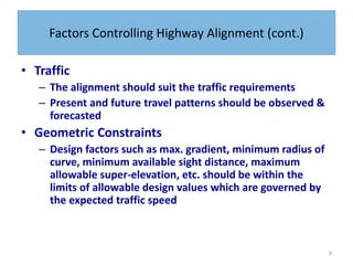
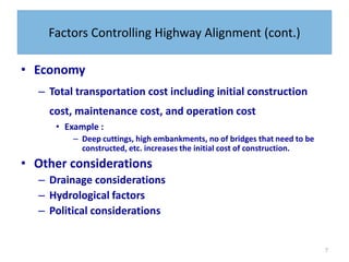
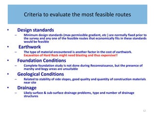
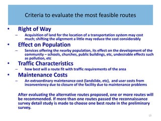
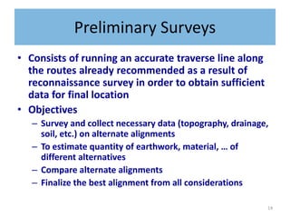
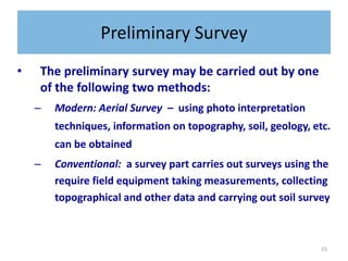
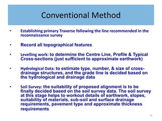
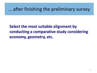
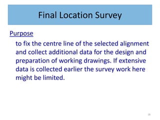
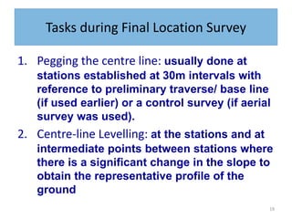
Chapter2 - Route Surveys and
Location
2
Highway Alignment
• Definition:- The position or the layout of the centre line of
the highway on the ground is called the alignment.
– Horizontal alignment consists of straight paths and curves
– Vertical alignment consists of grades and curves
• Improper alignment of a road facility implies capital loss
initially in construction as well as loss in costs of maintenance
and vehicle operation
• Once the road is aligned and constructed, it is not easy to
change the alignment due to increase in cost of adjoining land
and construction of costly structures by the road side.
• Hence careful considerations while finalising the alignment of
a new road need not be over-emphasised.
3
Requirements of an ideal alignment
• Requirements of an ideal alignment between two
terminals include:
– Short
• A straight alignment would be the shortest, though there may
be several practical considerations which would cause a
deviation from the shortest path
– Easy
• Easy to construction
• Easy to maintain
• Easy for operation with easy grades and curves
4
Requirements of an ideal alignment
– Economical
• Design should consider initial capital cost, maintenance cost, and
operation cost
– Safe
• Safe enough for construction and maintenance from the view
point of stability of natural slopes, embankments, cut slopes, and
foundations
• Safe for traffic operations with easy geometric features such as
sharpness of curves, grades, side slopes and etc.
5
Factors Controlling Highway Alignment
• Obligatory Points
– Points through which the alignment is to pass
– Chosen Bridge Site, Intermediate town to be accessed
between the termini, a mountain pass, etc.
– Points which should be avoided
– Areas requiring costly structures, highly developed expensive
areas, marshes and low lying lands subject to flooding, hilly
terrain where there is a possibility of land slides, etc.
6
Factors Controlling Highway Alignment (cont.)
• Traffic
– The alignment should suit the traffic requirements
– Present and future travel patterns should be observed &
forecasted
• Geometric Constraints
– Design factors such as max. gradient, minimum radius of
curve, minimum available sight distance, maximum
allowable super-elevation, etc. should be within the
limits of allowable design values which are governed by
the expected traffic speed
7
Factors Controlling Highway Alignment (cont.)
• Economy
– Total transportation cost including initial construction
cost, maintenance cost, and operation cost
• Example :
– Deep cuttings, high embankments, no of bridges that need to be
constructed, etc. increases the initial cost of construction.
• Other considerations
– Drainage considerations
– Hydrological factors
– Political considerations
8
Special considerations on Hilly Roads
• Slope Stability
– a common problem in hill roads is land slide. Special care should be
taken to choose the side that is more stable
• Drainage
– Numerous hill-side drains to adequately drain the water across the
road should be provided
– But, attempts should be made to align the road where the number of
cross-drainage structures are minimized
• Geometry
– Different standards of grades, curves, sight distances, speeds and
other related features are followed in hill roads
9
Route Location Surveys
• In order to select the best road corridor, the
following engineering surveys are usually
carried out:
• Reconnaissance Surveys
• Preliminary Surveys
• Detailed (Location) Surveys
10
Reconnaissance Surveys
• 1st phase of Reconnaissance: Desk Study
– Involves an examination of a relatively large area between
terminal points for the purpose of determining a broad corridors
through which a road alignment may pass
– Usually such survey is made by the use of available maps and
Aerial Photographs (stereoscopy)
• Probable Alignment is identified on the map by:
– Avoiding valleys, ponds, etc.;
– Avoiding river bends where bridges should not be
located;
– Keeping in view of geometric standards (e.g. avoiding
steep topographies, etc)
11
Reconnaissance Surveys
• 2nd phase of Reconnaissance: Field Study
– Involves inspection of each band (identified during the desk study) to
determine the most feasible route based on some basic criteria
– A survey party inspects a fairly broad stretch of land along the proposed
routes identified on the map during the 1st phase and collects all relevant
details not available on the map
– Some of the details include:
• valley, ponds, lakes, marshy land, ridge, hills, permanent structures, &
other obstructions;
• gradient, length of gradient, and radius of curves;
• number & types of cross-drainage structures, and maximum flood level;
• soil types from field identification;
• sources of construction materials, water and location stone quarries;
• geological formation, type of rock, depth of strata, seepage flow, etc to
identify stable sides of a hill
– A rapid field study of the area, especially, when it is vast and the terrain is
difficult may be done by aerial survey
12
Criteria to evaluate the most feasible routes
• Design standards
– Minimum design standards (max permissible gradient, etc ) are normally fixed prior to
the survey and any one of the feasible routes that economically fits in these standards
would be feasible
• Earthwork
– The type of material encountered is another factor in the cost of earthwork.
Excavation of Hard Rock might need blasting and thus expensive!!
• Foundation Conditions
– Complete foundation study is not done during Reconnaissance, but the presence of
marshy and bogy areas are unsuitable
• Geological Conditions
– Related to stability of side slopes, good quality and quantity of construction materials
near site
• Drainage
– Likely surface & sub-surface drainage problems, type and number of drainage
structures
13
Criteria to evaluate the most feasible routes
• Right of Way
– Acquisition of land for the location of a transportation system may cost
much; shifting the alignment a little may reduce the cost considerably
• Effect on Population
– Services offering the nearby population, its effect on the development of the
community – schools, churches, public buildings, etc, undesirable effects such
as pollution, etc
• Traffic Characteristics
– how best will a route fit with traffic requirements of the area
• Maintenance Costs
– An extraordinary maintenance cost (landslide, etc), and user costs from
inconveniency due to closure of the facility due to maintenance problems
After evaluating the alternative routes proposed, one or more routes will
be recommended. If more than one routes passed the reconnaissance
survey detail study is made to choose one best route in the preliminary
survey.
14
Preliminary Surveys
• Consists of running an accurate traverse line along
the routes already recommended as a result of
reconnaissance survey in order to obtain sufficient
data for final location
• Objectives
– Survey and collect necessary data (topography, drainage,
soil, etc.) on alternate alignments
– To estimate quantity of earthwork, material, … of
different alternatives
– Compare alternate alignments
– Finalize the best alignment from all considerations
15
Preliminary Survey
• The preliminary survey may be carried out by one
of the following two methods:
– Modern: Aerial Survey – using photo interpretation
techniques, information on topography, soil, geology, etc.
can be obtained
– Conventional: a survey part carries out surveys using the
require field equipment taking measurements, collecting
topographical and other data and carrying out soil survey
16
Conventional Method
• Establishing primary Traverse following the line recommended in the
reconnaissance survey
• Record all topographical features
• Levelling work: to determine the Centre Line, Profile & Typical
Cross-sections (just sufficient to approximate earthwork)
• Hydrological Data: to estimate type, number, & size of cross-
drainage structures, and the grade line is decided based on
the hydrological and drainage data
• Soil Survey: the suitability of proposed alignment is to be
finally decided based on the soil survey data. The soil survey
at this stage helps to workout details of earthwork, slopes,
suitability of materials, sub-soil and surface drainage
requirements, pavement type and approximate thickness
requirements
17
… after finishing the preliminary survey
Select the most suitable alignment by
conducting a comparative study considering
economy, geometry, etc.
18
Final Location Survey
Purpose
to fix the centre line of the selected alignment
and collect additional data for the design and
preparation of working drawings. If extensive
data is collected earlier the survey work here
might be limited.
19
Tasks during Final Location Survey
1. Pegging the centre line: usually done at
stations established at 30m intervals with
reference to preliminary traverse/ base line
(if used earlier) or a control survey (if aerial
survey was used).
2. Centre-line Levelling: at the stations and at
intermediate points between stations where
there is a significant change in the slope to
obtain the representative profile of the
ground
20
Tasks (cont.)
3. Cross-section Levelling: at each station (!)
and at points with significant change in
ground slope
4. Intersecting Roads: the directions of the
centre line of all intersecting roads,
profiles, and cross-sections for some
distance on both sides
5. Ditches and Streams: horizontal alignment,
profile, and cross section levelling of the
banks of the stream/river
21
Drawings & Reports
• The data, after the necessary investigation and final location
survey, is sent to the design office to be used for
– geometric design, pavement design, and design of drainage and
other structures, preparation of drawings, reports, and specifications
• A complete sets of drawings for a road design includes:
– Site plan of proposed alignment
– Detailed Plan & Profile
– Cross-sections for Earth work
– Typical Roadway sections at selected locations (e.g. junctions)
– A mass-haul diagram
– Construction details of structures like bridges, culverts, ….

2 - Route Surveys and Location.pptx

  • 1.
    Chapter2 - RouteSurveys and Location
  • 2.
    2 Highway Alignment • Definition:-The position or the layout of the centre line of the highway on the ground is called the alignment. – Horizontal alignment consists of straight paths and curves – Vertical alignment consists of grades and curves • Improper alignment of a road facility implies capital loss initially in construction as well as loss in costs of maintenance and vehicle operation • Once the road is aligned and constructed, it is not easy to change the alignment due to increase in cost of adjoining land and construction of costly structures by the road side. • Hence careful considerations while finalising the alignment of a new road need not be over-emphasised.
  • 3.
    3 Requirements of anideal alignment • Requirements of an ideal alignment between two terminals include: – Short • A straight alignment would be the shortest, though there may be several practical considerations which would cause a deviation from the shortest path – Easy • Easy to construction • Easy to maintain • Easy for operation with easy grades and curves
  • 4.
    4 Requirements of anideal alignment – Economical • Design should consider initial capital cost, maintenance cost, and operation cost – Safe • Safe enough for construction and maintenance from the view point of stability of natural slopes, embankments, cut slopes, and foundations • Safe for traffic operations with easy geometric features such as sharpness of curves, grades, side slopes and etc.
  • 5.
    5 Factors Controlling HighwayAlignment • Obligatory Points – Points through which the alignment is to pass – Chosen Bridge Site, Intermediate town to be accessed between the termini, a mountain pass, etc. – Points which should be avoided – Areas requiring costly structures, highly developed expensive areas, marshes and low lying lands subject to flooding, hilly terrain where there is a possibility of land slides, etc.
  • 6.
    6 Factors Controlling HighwayAlignment (cont.) • Traffic – The alignment should suit the traffic requirements – Present and future travel patterns should be observed & forecasted • Geometric Constraints – Design factors such as max. gradient, minimum radius of curve, minimum available sight distance, maximum allowable super-elevation, etc. should be within the limits of allowable design values which are governed by the expected traffic speed
  • 7.
    7 Factors Controlling HighwayAlignment (cont.) • Economy – Total transportation cost including initial construction cost, maintenance cost, and operation cost • Example : – Deep cuttings, high embankments, no of bridges that need to be constructed, etc. increases the initial cost of construction. • Other considerations – Drainage considerations – Hydrological factors – Political considerations
  • 8.
    8 Special considerations onHilly Roads • Slope Stability – a common problem in hill roads is land slide. Special care should be taken to choose the side that is more stable • Drainage – Numerous hill-side drains to adequately drain the water across the road should be provided – But, attempts should be made to align the road where the number of cross-drainage structures are minimized • Geometry – Different standards of grades, curves, sight distances, speeds and other related features are followed in hill roads
  • 9.
    9 Route Location Surveys •In order to select the best road corridor, the following engineering surveys are usually carried out: • Reconnaissance Surveys • Preliminary Surveys • Detailed (Location) Surveys
  • 10.
    10 Reconnaissance Surveys • 1stphase of Reconnaissance: Desk Study – Involves an examination of a relatively large area between terminal points for the purpose of determining a broad corridors through which a road alignment may pass – Usually such survey is made by the use of available maps and Aerial Photographs (stereoscopy) • Probable Alignment is identified on the map by: – Avoiding valleys, ponds, etc.; – Avoiding river bends where bridges should not be located; – Keeping in view of geometric standards (e.g. avoiding steep topographies, etc)
  • 11.
    11 Reconnaissance Surveys • 2ndphase of Reconnaissance: Field Study – Involves inspection of each band (identified during the desk study) to determine the most feasible route based on some basic criteria – A survey party inspects a fairly broad stretch of land along the proposed routes identified on the map during the 1st phase and collects all relevant details not available on the map – Some of the details include: • valley, ponds, lakes, marshy land, ridge, hills, permanent structures, & other obstructions; • gradient, length of gradient, and radius of curves; • number & types of cross-drainage structures, and maximum flood level; • soil types from field identification; • sources of construction materials, water and location stone quarries; • geological formation, type of rock, depth of strata, seepage flow, etc to identify stable sides of a hill – A rapid field study of the area, especially, when it is vast and the terrain is difficult may be done by aerial survey
  • 12.
    12 Criteria to evaluatethe most feasible routes • Design standards – Minimum design standards (max permissible gradient, etc ) are normally fixed prior to the survey and any one of the feasible routes that economically fits in these standards would be feasible • Earthwork – The type of material encountered is another factor in the cost of earthwork. Excavation of Hard Rock might need blasting and thus expensive!! • Foundation Conditions – Complete foundation study is not done during Reconnaissance, but the presence of marshy and bogy areas are unsuitable • Geological Conditions – Related to stability of side slopes, good quality and quantity of construction materials near site • Drainage – Likely surface & sub-surface drainage problems, type and number of drainage structures
  • 13.
    13 Criteria to evaluatethe most feasible routes • Right of Way – Acquisition of land for the location of a transportation system may cost much; shifting the alignment a little may reduce the cost considerably • Effect on Population – Services offering the nearby population, its effect on the development of the community – schools, churches, public buildings, etc, undesirable effects such as pollution, etc • Traffic Characteristics – how best will a route fit with traffic requirements of the area • Maintenance Costs – An extraordinary maintenance cost (landslide, etc), and user costs from inconveniency due to closure of the facility due to maintenance problems After evaluating the alternative routes proposed, one or more routes will be recommended. If more than one routes passed the reconnaissance survey detail study is made to choose one best route in the preliminary survey.
  • 14.
    14 Preliminary Surveys • Consistsof running an accurate traverse line along the routes already recommended as a result of reconnaissance survey in order to obtain sufficient data for final location • Objectives – Survey and collect necessary data (topography, drainage, soil, etc.) on alternate alignments – To estimate quantity of earthwork, material, … of different alternatives – Compare alternate alignments – Finalize the best alignment from all considerations
  • 15.
    15 Preliminary Survey • Thepreliminary survey may be carried out by one of the following two methods: – Modern: Aerial Survey – using photo interpretation techniques, information on topography, soil, geology, etc. can be obtained – Conventional: a survey part carries out surveys using the require field equipment taking measurements, collecting topographical and other data and carrying out soil survey
  • 16.
    16 Conventional Method • Establishingprimary Traverse following the line recommended in the reconnaissance survey • Record all topographical features • Levelling work: to determine the Centre Line, Profile & Typical Cross-sections (just sufficient to approximate earthwork) • Hydrological Data: to estimate type, number, & size of cross- drainage structures, and the grade line is decided based on the hydrological and drainage data • Soil Survey: the suitability of proposed alignment is to be finally decided based on the soil survey data. The soil survey at this stage helps to workout details of earthwork, slopes, suitability of materials, sub-soil and surface drainage requirements, pavement type and approximate thickness requirements
  • 17.
    17 … after finishingthe preliminary survey Select the most suitable alignment by conducting a comparative study considering economy, geometry, etc.
  • 18.
    18 Final Location Survey Purpose tofix the centre line of the selected alignment and collect additional data for the design and preparation of working drawings. If extensive data is collected earlier the survey work here might be limited.
  • 19.
    19 Tasks during FinalLocation Survey 1. Pegging the centre line: usually done at stations established at 30m intervals with reference to preliminary traverse/ base line (if used earlier) or a control survey (if aerial survey was used). 2. Centre-line Levelling: at the stations and at intermediate points between stations where there is a significant change in the slope to obtain the representative profile of the ground
  • 20.
    20 Tasks (cont.) 3. Cross-sectionLevelling: at each station (!) and at points with significant change in ground slope 4. Intersecting Roads: the directions of the centre line of all intersecting roads, profiles, and cross-sections for some distance on both sides 5. Ditches and Streams: horizontal alignment, profile, and cross section levelling of the banks of the stream/river
  • 21.
    21 Drawings & Reports •The data, after the necessary investigation and final location survey, is sent to the design office to be used for – geometric design, pavement design, and design of drainage and other structures, preparation of drawings, reports, and specifications • A complete sets of drawings for a road design includes: – Site plan of proposed alignment – Detailed Plan & Profile – Cross-sections for Earth work – Typical Roadway sections at selected locations (e.g. junctions) – A mass-haul diagram – Construction details of structures like bridges, culverts, ….