Downloaded 352 times


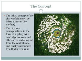
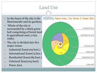


The document summarizes the town plan for Auroville, a universal township located in Tamil Nadu, India. It describes Auroville as a place where people from any country or caste can live in peace. Currently, Auroville has a population of 2,345 people from 45 countries, with the original master plan aiming for 50,000 residents. The central concept and layout of Auroville was developed by Mirra Alfassa, with land divided into residential, industrial, international, cultural and peace zones surrounding a green belt. Infrastructure for water, waste water treatment, power generation, roads and transportation focuses on renewable resources and sustainability.