Town palnning.india
•Download as PPT, PDF•
6 likes•1,523 views

Origin of Town Planning in India during the colonial period and reason for town planning. Town Planning in India.

Recommended
More Related Content
What's hot
What's hot (20)
Similar to Town palnning.india
Similar to Town palnning.india (20)
More from Abu Shahma Rasheed
Recently uploaded
Recently uploaded (20)
Town palnning.india
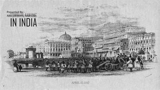
- 1. Presented By:- ABU SHAHMA RASHEEDTOWN PLANNING IN INDIA APRIL-17-2017
- 2. CONTENT ORIGIN. TOWN PLANNING IN COLONIAL PERIOD. EVOLUTION OF TOWNS. BOMBAY: THE PRIME CITY OF INDIA. TOWN PLANNING IN BOMBAY. DELHI : THE NEW CAPITAL OF INDIA. PLANNING OF DELHI. ROAD NETWORK OF DELHI. DELHI – ZONING. GOVERNMENT COMPLEX. BUNGALOW ZONE. COMMERCIAL DISTRICT. THE GOVERNMENT COMPLEX/ ADMINISTRATIVE AREA. THE RASHTRAPATI BHAWAN. THE SECRETARIAT. THE PARLIAMENT HOUSE. THE PRINCLEY STATE. THE HYDERABAD HOUSE. THE BARODA HOUSE. THE PATIALA HOUSE. THE JAIPUR HOUSE. DRAWBACKS.
- 3. ORIGIN The history of urban planning in India back to the cities of the Bronze Age Indus period (2600–1900 BCE). Defined by rectilinear streets and supported by a well-developed infrastructure, cities such as Dholavira, Ganweriwala, Mehrgarh, Harappa, and Mohenjo-daro (but particularly the last two) sit at the centre of India’s city planning heritage.
- 4. TOWN PLANNING IN COLONIAL PERIOD REASON India was the centre – piece of the British Empire on account of – limit less material resources, insatiable markets, enormous man power resource. These attributes funded Britain industrialisation making India the Jewel in the Crown. Both the architectural style for British buildings in India and town planning ideas were imported from British. Colonisation brought urbanization. It rise density in the urban centres. Urbanisation led to the rise of the suburb. The arrival of the railways accelerated urban growth. Calcutta, Bombay and Madras grew rapidly and soon became sprawling cities.
- 5. After the Revolt of 1857 British attitudes in India were shaped by a constant fear of rebellion. They felt that towns needed to be better defended, and white people had to live in more secure and segregated enclaves, away from the threat of the “natives”. Pasturelands and agricultural fields around the older towns were cleared, and new urban spaces called “Civil Lines” were set up. White people began to live in the Civil Lines. Cantonments– places where Indian troops under European command were stationed – were also developed as safe enclaves .These areas were separate from but attached to the Indian towns. With broad streets, 21 bungalows set amidst large gardens, barracks, parade ground and church, they were meant as a safe heaven for Europeans as well as a model of ordered urban life in contrast to the densely built-up Indian towns. EVOLUTION OF TOWNS Ludlow Castle building in Civil Lines, Delhi
- 6. BOMBAY: THE PRIME CITY OF INDIA Bombay became the capital of Bombay presidency in 1819, after the Maratha defeat in Anglo-Maratha war. Bombay was a crowded city and didn’t grow according to any plan. The richer Parsi, Muslims and upper caste traders and Industrialists of Bombay lived in sprawling spacious bunglows. Whereas more than 70 percent of working people lived in thickly populated Chawls of Bombay.
- 7. TOWN PLANNING IN BOMBAY Town Planning came in Bombay as a result of fears about the plague epidemic. The Bombay City Improvement Trust was established in 1898. It focused on clearing poorer homes out of the city centre. By 1918, trust schemes had deprived 64000 people of their homes, But only 14000 were rehoused. In 1918, a rent act was passed to keep rent reasonable, but it had the opposite effect of producing a severe housing crisis, since landlord withdrew houses from the market. The need for additional commercial space in the mid-nineteenth century led to the formation several plans, both by the government and private companies, for the reclamation of more land from the sea in taking Financial risks. In 1864, the Back Bay reclamation company won the right to reclaim the western foreshore from the tip of Malabar hill to the end of colaba. As the population continued to increase rapidly in the early twentieth century, every bit of the available area was built over the new areas were reclaimed from the sea. Subsequently, the famous Marine Drive of Bombay was developed.
- 8. DELHI : THE NEW CAPITAL OF INDIA Reasons for the shifting of the capital: • Controversial partitioning of Bengal In 1905 - right to vote between Bengali Hindus n Muslims. • Delhi’s geographical position at the centre of northern India (roughly equidistant from Bombay and Calcutta) • Delhi’s historic importance (Important seat of the Mughal empire) (For Hindus – Mahabharata-era city of Indraprastah) • Perceived political need to rearticulate British power.
- 9. PLANNING OF DELHI Lutyens had initially designed Delhi with all the streets crossing at right angles, much like in New York. However, Lord Hardinge told him of the dust storms that sweep the landscape in these parts, insisting on roundabouts, hedges and trees to break their force, giving him the plans of Rome, Paris and Washington to study and apply to Delhi. The plan reflects Lutyens’ “transcendent fervour for geometric symmetry,” which is expressed through amazing sequences of triangles and hexagons, through sightlines and axes. Lutyens’ plan is also remarkable for the generous green spaces, lawns, watercourses, flower and fruit-bearing trees, and their integration with the parks developed around monuments. The attempt was to include all natural and historical wonders in the new city. Intentions of the Layout: Lutyens’ Delhi was planned on the most spacious garden city lines with the great avenues decorated with classical buildings with lush landscape. The layout of Lutyens Delhi was governed by three major visual corridors, linking the government complex with : Jama Masjid, Indraprastha and Safdarjungs Tomb
- 10. ROAD NETWORK OF DELHI Besides the major Pathway, there were extremely wide avenues. The original design of the road network was capable of accommodating 6000 vehicles, however these avenues, had the potential of increasing their carriageway-the reason why the road layout has survived till today. In general the road network consisted of diagonals and radials, at 30 degree/ 60 degree angles to the main axis, forming triangles and hexagons.
- 11. DELHI - ZONING GOVERNMENT COMPLEX BUNGLOW ZONE COMMERCIAL DISTRICT
- 13. BUNGALOW ZONE
- 15. THE GOVERNMENT COMPLEX/ ADMINISTRATIVE AREA 1. Lutyens laid out the central administrative area of the city. 2. At the heart of the city was the impressive Rashtrapati Bhawan, located on the top of Raisina Hill. The Raj path connects India Gate to Rashtrapati Bhawan, while Janpath, which crosses it at a right angle, connects South end with Connaught Place. 3. The Secretariat Building, which houses various ministries of the Government of India including Prime Minister's Office are beside the Rashtrapati Bhawan and were designed by Herbert Baker. 4. Also designed by Baker was the Parliament House, located on the Sansad Marg, running parallel with the Raj path.
- 16. THE RASHTRAPATI BHAWAN Lutyen's grandiose Government House (Rashtrapati Bhawan) - located on Raisina Hill, and one of New Delhi's major thoroughfares, Rajpath, connects it to the Purana Qila. Lord Hardinge chose the Raisina Hill for locating the viceroy’s palace because: • It was a well drained. • Constituted of slopes and plains between the ridge and the river. • Its eastern and southern margins were studded with monuments of vanished empires. A broad crescent from Shahjahanabad and Kotla Firoz Shah, south to Tughlaqabad and the Qutub with tombs of Safdarjung and Lodhis as well as Jantar Mantar in the foreground could be viewed from the site.
- 17. THE SECRETARIAT The Secretariat Building was designed by architect Herbert Baker in Indo-Saracenic Revival architecture. Much of the building is in classical architectural style, yet it incorporated Mughal and Rajasthani architecture style and motifs in its architecture. These are visible in the use of Jali. Another feature of the building is a dome-like structure known as the Chatri. The style of architecture used in Secretariat Building is unique to Raisina Hill. In front of the main gates on buildings are the four "dominion columns", given by Canada, Australia, New Zealand and South Africa.
- 18. THE PARLIAMENT HOUSE The Parliament Hous was designed by Edwin Lutyens and Herbert Baker. It was built with indigenous materials and by Indian labour and the architecture of the building bears a close imprint of the Indian tradition. The layout of fountains both inside and outside the building, the use of Indian symbols, the "Chhajjas” and the varied forms of "Jali" in marble are reminders of the story of the craftsmanship displayed in ancient monuments and memorials.
- 19. COMMON FEATURES JALIS THICK BAND JALIS BUDDHIST DOME THICK BAND JALI S BUDDHIST DOME THICK BAND
- 20. THE PRINCLEY STATE • Starting from India Gate, at the lowest and eastern end of Rajpath, nearby land was allocated to numerous princely states, each of which built small palaces, such as the Bikaner House (now the Rajasthan tourism office) and Jaipur House (now the National Gallery of Modern Art). • It might be said that this placement mirrored the British sentiments toward the princes, who lost much of their former power and status during the British Raj. Here, too, are the state Bhavans (houses), where you can taste the cuisine of each state.
- 21. THE HYDERABAD HOUSE The largest of all palaces in New Delhi — a building that suited the status of the Nizam of Hyderabad. Designed by Edwin Lutyens. The majestic mansion had 36 rooms. Lutyens designed Hyderabad House in the shape of a butterfly — a plan that he had first used for Papillon Hall in Leicestershire in 1903. The main architectural feature of Hyderabad House is a dome with an entrance hall beneath which symmetrical wings radiate at an angle of fifty-five degrees. Its round arches flanked by rectangular openings to the height of the impost was inspired by the Pantheon in Rome, a city where Lutyens stayed in 1909. For the first floor windows of the grand place, Lutyens chose a combination of rectangular and round arches that were inspired by the Uffizi to the Arno in Florence. The majestic building that boasts of courtyards, archways, obelisks, large flower containers, grand stairways, marble fireplaces, fountains, had a pre- dominantly European character with some Mughal motifs.
- 22. THE BARODA HOUSE Situated next to Hyderabad House, is another magnificent building designed by Edwin Lutyens. He designed the Baroda House on a train from Bombay in 1921, and it took 15 years to build it. The Gaekwad of Baroda , who was educated in England, wanted his palace in New Delhi to be Anglo-Saxon in style. The grand Baroda House was known for its terraces, grand corridors, cooling arcades, beautiful gardens and well-ventilated salons and richly done up living rooms. Gaekwad led a very westernized lifestyle.
- 23. THE PATIALA HOUSE Patiala House was formerly the palatial residence of the Maharaja of Patiala (in Punjab). part of central vista, this building, built in the 1930s, has a central dome with a butterfly layout, similar to other buildings o the Lutyens zone. Today it houses the district Courts complex for New Delhi District. 'A double Vtoreyed building, the central portion is emphasized with a domed pavilion on the terrace and projection porchover the upper storey, there is a projecting chajja running the entire length of the old building. It has seen interesting occupants ever since the Maharaja vacated it.
- 24. THE JAIPUR HOUSE Jaipur House (National Gallery of Modern Art) is located diametrically opposite Hyderabad House. Like other princes’ residences, the building was also designed in the shape of a butterfly with a central dome. But very few people know that it was British architect Charles Blomfield, who designed the building. It was designed in a mix of neo-classical and Art Deco style. The butterfly-shaped building has two symmetrical ‘wings’ radiating from the central court. Two similar wings radiate towards the back facing the gardens. The façade of this comparatively austere palace is marked by two levels of small, vertical, slit-like windows. A continuous sunshade or ‘chajja’ in redstone caps the entire façade. The building has arched openings framed by Rajput columns.
- 25. DRAWBACKS • In this whole process almost no attention was paid to the problems of Old Delhi. Due to the creation of New Delhi, Old Delhi experienced a 28% surge in population from 1916-1926 resulting in the spilling over of the population from inside the walled city to the Paharganj area, whose restructuring was later abandoned by Lutyens due to resource constraints. • Also, no provision of housing was premeditated for the large no. of skilled and unskilled workers which immigrated in for the construction work of New Delhi. • This negligence of the planners towards Old Delhi resulted in its transformation to a large slum area through deterioration and dilapidation.
- 26. THANKYOU