PPT on India's Drainage System (River System) Rohan Karmakar
The following presentation is on India's drainage or river system. It includes information about some of the major river systems in India. All comments are welcomed. Please LIKE this presentation.
PPT on India's Drainage System (River System) Rohan Karmakar
The following presentation is on India's drainage or river system. It includes information about some of the major river systems in India. All comments are welcomed. Please LIKE this presentation.
The Indian sub-continent is characterised by a great and diversified group of physical features.
They are classified into the following physiographic units :
1. The Himalayas and other ranges.
2. The Indo-Gangetic plain.
3. The Thar Deserts
4. The Peninsular Plateau.
5. The Coastal belts and Islands.
India is one of the ancient civilizations in the
world. It has achieved multi faceted socioeconomic
progress during the last five decades.
It has moved forward displaying
remarkable progress in the field of
agriculture, industry, technology and overall
economic development. India has also
contributed significantly.
NCERT based class ix
“The land of India displays great physical variations”. Based on physical features, India physical geography is broadly divided into the following sections-The great mountain of North; Northern Plain ; Peninsular Plateau; Coastal Plains; Desert; Islands
Chapter - 2, Physical Features of India, Geography, Social Science, Class 9Shivam Parmar
I have expertise in making educational and other PPTs. Email me for more PPTs at a very reasonable price that perfectly fits in your budget.
Email: parmarshivam105@gmail.com
Chapter - 2, Physical Features of India, Geography, Social Science, Class 9
INTRODUCTION
THEORY OF PLATE TECTONICS
THE HIMALAYAN MOUNTAINS
1. HIMADRI
2. HIMACHAL
3. SHIVALIK
DIVISION OF HIMALAYAS FROM WEST TO EAST
THE NORTHERN PLAIN
THE INDIAN DESERT
THE ISLAND GROUP
Every topic of this chapter is well written concisely and visuals will help you in understanding and imagining the practicality of all the topics.
By Shivam Parmar (PPT Designer)
Chapter - 1, India: Size & Location, Geography, Social Science, Class 9Shivam Parmar
I have expertise in making educational and other PPTs. Email me for more PPTs at a very reasonable price that perfectly fits in your budget.
Email: parmarshivam105@gmail.com
Chapter - 1, India: Size & Location, Geography, Social Science, Class 9
INTRODUCTION
IMPORTANT TERMS
SIZE (FACTS AND FIGURES OF INDIA)
STANDARD MERIDIAN
INDIA AND THE WORLD
INDIA’S NEIGHBOURS
Every topic of this chapter is well written concisely and visuals will help you in understanding and imagining the practicality of all the topics.
By Shivam Parmar (PPT Designer)
IN THIS POWERPOINT I ADDED FULLY HD PHOTO.AND THE INFORMATION AND STYLE ARE ADDED BY ME OWN.
DOWNLOAD AS FAST YOU CAN.
DON'T FORGET TO LIKE AND TO FOLLOW.
FOR ASKING FOR POWERPOINT OF OTHER SUBJECT.CONTACT TO shubhamrathi800@gmail.com or shubhamrathi99@hotmail.com
T H A N K YOU. . . . . .
this power point will completely inform you about the great northern mountains-HIMALAYAS........how they were formed....description.....composition........age and many other things.....
it explains about the deccan plateau and the flora the fauna and the life style of people there.it consists of lot of animations which cannot be seen unless you save it and play it on ur comp.
An outdoor party can require all different types of equipment to ensure the event goes over well. Try this site http://temembrane.com/ for more information on Fabric Structures. Regardless if you are sponsoring an award show, hosting a conference or any other outdoor event, a fabric structure will provide you with first class shelter to motivate, inspire and excite all of your guests. Therefore opt for the best and the most efficient Fabric Structures.
Follow us https://tensilefabricstructuresspecialist.wordpress.com/
Read and remember in an easy way the
-Location
-Physical features
-Divisions of the Northern Plains
-The Satluj basin
-The Ganga Basin
-The Brahmaputra Basin
-Places in the Northern Plain
-Importance of the Region
CLASS 9 GEOGRAPHY CHAPTER 2 PHYSICAL FEATURES OF INDIA .pptxvirendrachoudhary040
This is ppt of Physical features of India which is chapter of Class 9 Geography, This slide contains very part of chapter whether it is a Do you Know or Fact.
Characterization and the Kinetics of drying at the drying oven and with micro...Open Access Research Paper
The objective of this work is to contribute to valorization de Nephelium lappaceum by the characterization of kinetics of drying of seeds of Nephelium lappaceum. The seeds were dehydrated until a constant mass respectively in a drying oven and a microwawe oven. The temperatures and the powers of drying are respectively: 50, 60 and 70°C and 140, 280 and 420 W. The results show that the curves of drying of seeds of Nephelium lappaceum do not present a phase of constant kinetics. The coefficients of diffusion vary between 2.09.10-8 to 2.98. 10-8m-2/s in the interval of 50°C at 70°C and between 4.83×10-07 at 9.04×10-07 m-8/s for the powers going of 140 W with 420 W the relation between Arrhenius and a value of energy of activation of 16.49 kJ. mol-1 expressed the effect of the temperature on effective diffusivity.
WRI’s brand new “Food Service Playbook for Promoting Sustainable Food Choices” gives food service operators the very latest strategies for creating dining environments that empower consumers to choose sustainable, plant-rich dishes. This research builds off our first guide for food service, now with industry experience and insights from nearly 350 academic trials.
Artificial Reefs by Kuddle Life Foundation - May 2024punit537210
Situated in Pondicherry, India, Kuddle Life Foundation is a charitable, non-profit and non-governmental organization (NGO) dedicated to improving the living standards of coastal communities and simultaneously placing a strong emphasis on the protection of marine ecosystems.
One of the key areas we work in is Artificial Reefs. This presentation captures our journey so far and our learnings. We hope you get as excited about marine conservation and artificial reefs as we are.
Please visit our website: https://kuddlelife.org
Our Instagram channel:
@kuddlelifefoundation
Our Linkedin Page:
https://www.linkedin.com/company/kuddlelifefoundation/
and write to us if you have any questions:
info@kuddlelife.org
Natural farming @ Dr. Siddhartha S. Jena.pptxsidjena70
A brief about organic farming/ Natural farming/ Zero budget natural farming/ Subash Palekar Natural farming which keeps us and environment safe and healthy. Next gen Agricultural practices of chemical free farming.
4. FORMATION…
The northern plain of India is formed by the interplay of three major rivers –
Ganga, Indus and Brahmaputra. In the Tertiary period there was a sea ,
Tethys , with extension to north and west . Due to the movement of tectonic
plate the Indian lithospheric plate under thrusts the lighter Eurasian plate on
the north .This shallow basin marine sediments began folding due to
compressive forces acting from north and south .The evolution and upheaval
of Himalaya began. The plain was the fore deep of the folded mountain. Thus
numerous streams took birth and flowed down the Himalayan along with load
of sediments . Sediments continued lying down on the uneven basement of
the fore deep .Orogeny continued till its third phase along with making
Himalaya higher and higher. And sediments filled the 3-6 km deep trough .
However this deepness of trough is also due to subsidence because of
increasing load of sediments. so the Himalayan orogeny and filling erodes
from Himalaya in it made this fertile land for us…. And the fertile plain of India
was formed.
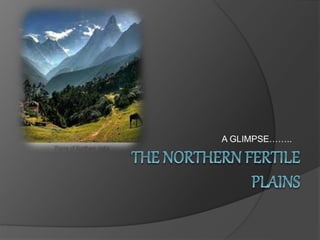
7. THE NORTHERN PLAINS ARE LOCATED BETWEEN THE HIMALAYAS
AND THE PENINSULAR PLATEAUS
8. LOCATION
As a large plain, the exact
extent can vary from source to
source. Roughly, the Indo-
Gangetic Plain stretches across:
Kashmir in the north;
the Punjab (Pakistan) a
provincial region of Pakistan
and the Aravalli Range;
Sindh in the west;
the Himalayan foothills
of Assam and Bangladesh in the
east; and
the Vindhya and Sapura Range,
and the Chota Nagpur
Plateau in the south.
10. HOW THE PLAINS ARE DIVIDED?
PUNJAB PLAINS GANGA PLAINS
BRAHMAPUTRA
PLAINS
11. PUNJAB PLAINS
The Punjab plain is an
alluvial plain in Pakistan
and north-west of
India.The plain includes
the Pakistani province of
Punjab and Haryana and is
around 35,000 square
miles in area.The plain is
extensively farmed for
cereals and cotton.The
plain is the western part of
the Northern Plain in
Pakistan formed by the
Indus River and its
tributaries.
GANGA PLAINS
The Ganga plain is a trans-
boundary river of Asia which
flows through India and
Bangladesh. It is the third
largest river by discharge. The
Ganges is the most sacred river
to Hindus. It is worshipped as
the
goddess Ganga in Hinduism.
The Ganges was ranked as the fifth
most polluted river of the world
in 2007.
The 2,525 km (1,569 mi) river rises
in the western Himalayas in the
Indian state of Uttarakhand, and
flows south and east through
the Gangetic Plain of North
India into Bangladesh, where it
empties into the Bay of Bengal
12. BRAHMAPUTRA PLAINS
The Brahmaputra is a trans-
boundary river and one of the major
rivers of Asia. It flows southwest
through the Assam Valley as
Brahmaputra and south
through Bangladesh as the Jamuna.
About 1,800 miles (2,900 km) long,
the Brahmaputra is an important
river for irrigation and
transportation The river drains the
Himalaya east of the Indo-Nepal
border, southern-central portion of
the Tibetan plateau above
theGanges basin, south-eastern
portion of Tibet, the Patkai-Bum
hills, the northern slopes of the
Meghalaya hills, the Assam plains
and the northern portion of
Bangladesh.
14. RELIEF FEATURES – DETAILED STUDY
BHABAR
Bhabhar is the
region south of the
Lower Himalayas a
nd the Siwalik
Hills[1] It is
the alluvial
apron of sediments
washed down from
the Siwaliks along
the northern edge
of the Indo-
Gangetic Plain.
TERAI
The Terai is a belt of
marshy grasslands, sa
vannas, and
forests located south of
the outer foothills of
the Himalaya,
the Siwalik Hills, and
north of the Indo-
Gangetic Plain of
the Ganges, Brahmapu
tra and their
tributaries.
15. BHANGAR
Bhangarh is a town
in India that is famous
for its historical ruins.
It is in the
Rajgarh municipality
of the Alwar district in
the state of Rajasthan.
Bhangarh is at the
edge of the Sariska
Tiger Reserve. The
modern village has a
population of 1,306 in
200
households. Bhangah
is also a popular
tourist attraction.
KHADAR
Khādir is the terms used
in Hindustani,Punjabi and
Sindhi in the Indo-
Gangetic plains of North
India and Pakistan to
differentiate between two
types
of river plains and alluvial
soils. Khadir or Khadar plai
ns are those that are low-
lying next to a
river. Khadir areas are
prone to flooding and
sometimes include
portions of former river-
beds that became
available for agriculture
when a river changed
course.[1
17. EXTRA FACTS
1. The Himalayan Mountains are a series of mountains
ranges stretching from Jammu and Kashmir to Arunachal
Pradesh. They protect our country in many ways.
2. They contain some of the highest mountain peaks in the
world.
3. The Eastern and Western Ghats, Aravalli Hills and
Nilgiri Hills are the hills in Southern and Central India.
4. Rivers like the Ganga, Yamuna and Brahmaputra
originate in the Himalayas and get their water from
glaciers when the snow melts in summer.
5. The Northern plains stretch from Punjab in the
northwest to Assam in the east.
18. 6. The Northern Plains are vast flat areas
and the soil in these plains is mostly fertile.
7. The Brahmaputra Basin, the Ganga
Basin and the Sutlej Basin drain the
Northern Plains.
8. Deserts are stretches of sandy or rocky
land where rain and vegetation is scarce
9. Rajasthan, a state that lies south-west of
the Northern Plains, is the main desert
area of our country.
10. The climate in the deserts is extreme
and most places receive little or no rainfall.
19. . 11. All the states and regions in India have
people with diverse lifestyles, occupations and
ways of dressing.
12. The Southern Plateau region of India is a
raised flat land that lies to the south of the
Northern Plains and is triangular in shape.
13. It has the Eastern and Western Ghats on its
two lower sides, the Aravalli Hills its north-west.
14. The Southern Plateaus are actually a group
of three plateaus—the Malwa Plateau, Chota
Nagpur Plateau and the Deccan Plateau.
15. The main rivers flowing through the
plateaus are Narmada, Mahanadi, Krishna and
and Tapti.
20. 16. The Western Coastal Plains are the area
between the Western Ghats and the Arabian
Sea.
17. They are divided into three parts; the
Saurashtra Coast, the Konkan Coast and the
Malabar Coast.
18. The Eastern Coastal Plains stretch from
Kanyakumari in the south to West Bengal in the
east.
19. The southern half of the eastern coast is
called the Coromandel Coast. It includes coastal
Tamil Nadu.
20. The Mahanadi and Kaveri are two major
rivers of the Eastern Coastal Plains that flow into
the Bay of Bengal.
21. 21. The Northern Plains lie to the south of the
Himalayas extending 2,500 km in length from
East to West.
22. It consists of two river basins-the Indus and
the Ganga-Brahmaputra. It is made up of fertile
alluvial soil. These support very dense
population.
23. The Northern Plains can be divided into four
parts:
(a) The Rajasthan Plains
(b) Indus Plain
(c) Ganga Plain
(d) Brahmaputra Plain
22. 24. The Northern Plains are important
because:
(а) They are the largest alluvial plains in the
world formed by the deposition of silt by the
major rivers of the plain.
(b) The rivers are navigable and have water in
them throughout the year (Perennial).
(c) Flat land helps in the construction of roads
and railways.
(d) Irrigation facilities have made the plains the
largest wheat growing areas.
(e) A number of H.E.P. Projects have been
constructed which have helped in irrigation and
generation of power.