SlideShare a Scribd company logo
PHYSICAL FEATURES OF INDIA
Relief
Structure
Major Physiographic Unit
ACTIVITIES RESPONSIBLE FOR
THE FORMATION OF LANDFORMS
THEORY OF PLATE TECTONICS
Crust of earth made up of seven major and some minor plates.
Movement caused stresses with in the plates and continental
rocks.
Volcanic
activity
Faulting
Folding
KV
FOLDING
VOLCANIC
ACTIVITY
FAULTING
• Convergent
boundary
• Divergent boundary
• Transform boundary
KV
SEVEN MAJOR PLATES OF THE EARTH
1. Indi-Australian plate
2. South-American plate
3. Pacific plate
4. North American plate
5. Antarctic plate
6. Eurasian plate
7. African plate
KV
SEVEN
PHYSICAL
FEATURES
OF INDIA
1.The
Himalayan
Mountains
2.The
Northern
Plains
3.The
Peninsular
Plateau
4.The
Indian
Desert
5.The
Coastal
Plains
6.The
Islands
KV
THE HIMALAYAN MOUNTAINS
LOFTIEST YOUNG FOLD MOUNTAINS.
RUGGED MOUNTAIN BARRIERS OF THE WORLD.
FORMED FEW YEARS AGO BY FOLDING THE EARTH CRUST.
PARALLEL RANGES SECTIONS
HIMADRI
HIMACHAL
SHIWALIK
PUNJAB HIMALAYAS
KUMAON HIMALAYAS
NEPAL HIMALAYAS
ASSAM HIMALAYAS
HIMALAYAS
THREE PARALLEL RANGES
TO THE LONGITUDINAL EXTENT
DIVIDED INTO FOUR
SECTIONS
KV
Page: 10
They form an arc, which covers a distance of about 2,400 Km.
Their width varies from 400 Km in Kashmir to 150 Km in Arunachal Pradesh.
KV
FORMATION OF HIMALAYAS
According to theory of tectonic plates the earth’s crust was
initially a single , giant landmass called PANGEA.
Northern part known as Angara land, Southern part was known
as the Gondwana Land
The crust was split due to convectional currents
Drift of Indo-Australian plate towards north.
Northern drift resulted in the collision with the Eurasian Plate
Accumulation in the geosyncline (known as TETHYs) in the
sedimentary rock due to collision were folded to form to form
Mountain system in western Asia.
KV
HIMADRI
(Great or Inner
Himalayas)
Most continuous
range
Northernmost
range
Loftiest peak
(height) 6000mtrs
Covered with snow
throughout the
year
Contains
prominent peaks
HIMADRI
(Lesser
Himalayas)
Rugged mountain
system
Composed of highly
rugged and altered
rocks
Avg height 3700-
4500mtrs
Width: 50kms
Famous ranges: Pir
Panjal, Dhaula Dhar,
Mahabharta ranges
Famous valleys:
Kashmir, Kullu,
Kangra
SHIVALIKS
(Outer
Himalayas)
Outermost range
Height 900-
1100mtrs.
Composed of
unconsolidated
rock
Prone to
earthquakes and
landslides
Called Duns like
dehradun, Kotli
dun patti dun etc.
KV
PUNJAB HIMALAYAS
(Between Indus and Satluj)
KUMAON HIMALAYAS
(Between Satluj and Kali)
NEPAL HIMALAYAS (Between
Kali and Tista)
ASSAM HIMALAYAS (Between
Tista and Dibang)
Himalayas
division as per
sections
PURVACHAL OR THE EASTERN HILLS AND MOUNTAINS.
Bharamputra river
Hills running through the north-eastern states.
Composed of strong sandstones, (sedimentary rocks).
Covered with dense forests, (run as parallel ranges and valleys).
Comprises the Patkai hills, the Naga hills, the Manipur hills and the Mizo hills.
KV
1. Distinguish between Convergent Boundaries, Divergent Boundaries and
transform Boundaries.
2. Describe how the Himalayas are formed?
3. Which hills are called Purvanchal?
4. How Purvanchal or Eastern hills formed?
5. Classify Himalayas on the basis of
1. Sections from the west to east 2. longitudinal ranges
(A)Mountain Ranges: The Karakoram, The Zaskar, The Shiwalik, The
Aravali, The Vindhya, The Satpura, Western & Eastern ghats
(B) Mountain Peaks – K2, Kanchan Junga, Anai Mudi
Note: use your previous year maps for map work or try to trace your map.
NORHERN PLAINS
1.Ganga Plains 2.Punjab Plains
3.Bhrahamputra Plains
Total Area of 7lakhs
sq.km. , (2400km long
240-320km broad)
Rivers entering from
northern mountains
associated with
depositional work.
Split in the numerous
channels(lower course) due
to deposition of slit known
as DISTRIBUTARIES
Have three sections and
four regions with
different relief features
KV
BHABAR
(Lies at shiwalik, a
narrow 8-16km wide
belt of pebbles)
TERAI
(West marshy area
with wildlife & forest)
KHADAR
(Young alluvial of the
flood plain)
BANGAR
(Older alluvial plain
rises above the level of
the flood plain)
THE NORTHERN PLAINS
KV
Check point 02 (G2)
1.Give an account of the Northern
plains of India.
KV
EASTERN AND WESTERN EDGES
1. Eastern Ghats
(Lower than Western Ghats)
2. Western Ghats
(Higher than eastern Ghats)
DIVIDED INTO TWO DIVISION
1.Central Highlands
2. Deccan Plateau
EASTWARD EXTENSIONS
LOCALLY KNOWN AS:
1.Bundelkhand and Bagahelkhand
2. Chotanagpur Plateau
DECCAN PLATEAU
The black soil found in this area known as
Deccan Plateau
THE PENINSULAR
PLATEAU
(A table land created by
breaking and drifting of
Gondawana land)
KV
FEATURES OF HIMALAYAN REGION
&PENINSULAR PLATEAU
HIMALAYAN REGION PENINSULAR PLATEAU
Young fold mountains formed by
uplift of the strata of sedimentary
rocks
Created from metamorphic and
igneous rock after splitting from
Gondwana
Loftiest mountains and deep valley Broad and shallow valley and rounded
hills
I-shaped ranges U-shaped valleys Horsts rift valleys and troughts
Origin of perennial river Rain fed seasonal valley
Unstable zone Stable zone
KV
Western Ghats Eastern Ghats
1. mark the Western
edges of the
plateau.
mark the Eastern
edges of the
plateau.
2. parallel and continuous
hill ranges with
no gaps.
Irregular and have gaps
through which
rivers flow into
the Bay of Bengal.
3. average height - 900-1600 metres average height -600 metres
4. The highest peaks
include the Anai
Mudi and the
Doda Betta.
Mahendragiri is
the highest peak
5. The Western Ghats
cause orographic
rain
The Eastern Ghats
do not cause
orographic rain.
KV
• Garo, Khasi and
Jaintia hills.
WEST TO EAST
RANGES
• Satpura range,
Eastern part-
Mahadev and
Kaimur hills and
the Maikal range.
NORTHERN
RANGES
• Aravali hills
WESTERN AND
NORTH-
WESTERN
MARGINS
• Meghalaya,
Karbi-Anglong
Plateau and
North Cachar
Hills.
• separated by a
fault (a crack in
the earth’s crust)
from the
Chotanagpur
Plateau.
NORTHEAST(to
cover a wide
area)
DECCAN PLATEAU
The Deccan Plateau is a part of the Peninsular Plateau.
It is triangular in shape and lies to the south of river Narmada.
It is higher in the west and slopes gently towards the east.
DECCAN TRAP:
Black Soil Area
Formed by lava that came out during volcanic activity
Rich in minerals and hence, very important for industrial development.
KV
CENTRAL HIGHLANDS
• Lie to the north of river Narmada,
• Covering -Malwa plateau
Chottanagpur plateau of the Peninsular plateau.
• Rivers: Ken, Chambal, Sind, Betwa and Damodar,
• Flow from south-west to north-east indicating the slope
of the land.
• The Central Highlands -wider in the west but narrower
in the east.
• The eastward extensions- Bundelkhand and
Baghelkhand.
• the extension takes it to the Chotanagpur Plateau.
KV
Check Point 03 (G2)
1. Distinguish between
(i) Western Ghats and Eastern Ghats
(ii) The Himalayan Region and Peninsular Plateau
2. Write a short note on Central highlands and
Deccan plateau
COASTAL PLAINS
The Peninsular plateau is flanked by stretch of narrow coastal strips,
running along the Arabian Sea on the west and the Bay of Bengal on the
east.
Western
Coastal Plain
Eastern
Coastal Plain
lies between the Western Ghats and the
Arabian Sea.
lies between the Eastern Ghats and the
Bay of Bengal.
Narrow Wide and level
Three sections. Two divisions
Northern- Konkan,
Central stretch-Kannad Plain
Southern-Malabar
Coast.
Northern-Northern
Circar
Southern-Coromandel
Coast.
No deltas Rivers like Mahanadi, Krishna, Kaveri,
Godavari form deltas.
KV
THE
INDIAN
DESERT
Towards the
western
margins of
the Aravali
Hills
Receives low
rainfall
(150mm per
yr.)
Only River-
Luni
Sandy plains
covered with
sand dunes
Major area
covered by
Barchans
(crescent
shaped
dunes)
KV
The
Islands
Andaman &
Nicobar
Elongated chain located in Bay
of Bengal
Bigger in size and scattered
Andaman(North)
Nicobar(South)
Lakshadweep
Lying close to Malabar coast of
Kerala
Composer of small coral islands
Small area of 32 sq km
KV
Check point 04 (G2)
Answer the following questions briefly.
(i) Which continents of today were part of the Gondwana
Land?
(ii) Which plateau lies between the Aravali and the
Vindhyan ranges?
(iii) Distinguish between Western Coastal Plain and
Eastern coastal Plain
(iv)Write a short notes on
(a) Indian Desert
(b) The Islands groups of India
Assignment 01 (G2)
1. Choose the right answer from the four alternatives given below.
(i) A landmass bounded by sea on three sides is referred to as
(a) Coast
(b) Peninsula
(c) Island
(d) none of the above
2. Mountain ranges in the eastern part of India forming its boundary with Myanmar are
collectively called as
(a) Himachal
(c) Purvanchal
(b) Uttaranchal
(d) none of the above
3. The western coastal strip, south of Goa is referred to as
(a) Coromandal
(b) Kannad
(c) Konkan
(d) Northern Circar
4. The highest peak in the Eastern Ghats is
(a) Anai Mudi
(b) Mahendragiri
(c) Kanchenjunga
(d) Khasi

More Related Content

What's hot

Chapter - 2, Physical Features of India, Geography, Social Science, Class 9
Chapter - 2, Physical Features of India, Geography, Social Science, Class 9Chapter - 2, Physical Features of India, Geography, Social Science, Class 9
Chapter - 2, Physical Features of India, Geography, Social Science, Class 9
Shivam Parmar
 
Physical features of india
Physical features of indiaPhysical features of india
Physical features of india
NARESH KUMAR
 
PPT on India's Drainage System (River System)
PPT on India's Drainage System (River System) PPT on India's Drainage System (River System)
PPT on India's Drainage System (River System)
Rohan Karmakar
 
ppt new questions and ideas history class 6
 ppt new questions and ideas history class 6 ppt new questions and ideas history class 6
ppt new questions and ideas history class 6
Akash Vashistha
 
The physiographic features of india - By Jnanam Shah
The physiographic features of india - By Jnanam ShahThe physiographic features of india - By Jnanam Shah
The physiographic features of india - By Jnanam Shah
Soham
 
Peninsular River System
Peninsular River SystemPeninsular River System
Peninsular River SystemVarun Devang
 
Ch.2 Physical Features of India
Ch.2 Physical Features of India Ch.2 Physical Features of India
Ch.2 Physical Features of India
JagannathDhere
 
Physical features of india
Physical features of indiaPhysical features of india
Physical features of india
Sanchit Kanwar
 
Our Changing Earth (Grade 7)
Our Changing Earth (Grade 7)Our Changing Earth (Grade 7)
Our Changing Earth (Grade 7)
Sandeep Patnaik
 
Drainage
DrainageDrainage
Drainage
deepak190
 
Ppt of Class 6 ,ch 2, globe , Geography pdf
Ppt of Class 6 ,ch 2, globe , Geography  pdfPpt of Class 6 ,ch 2, globe , Geography  pdf
Ppt of Class 6 ,ch 2, globe , Geography pdf
PoonamMudaliar
 
Equality (Grade 7 - Civics)
Equality (Grade 7 - Civics)Equality (Grade 7 - Civics)
Equality (Grade 7 - Civics)
Sandeep Patnaik
 
Geographical features of india
Geographical features of indiaGeographical features of india
Geographical features of india
AMALDASKH
 
Drainage
DrainageDrainage
Drainage
Shivangi Sehgal
 
Indian rivers
Indian riversIndian rivers
Indian rivers
Neha Agarwal
 
Drainage
DrainageDrainage
Drainage
Vipul Jain
 
Major Landforms on Earth, Geography class 6 cbse
Major Landforms on Earth, Geography class 6 cbseMajor Landforms on Earth, Geography class 6 cbse
Major Landforms on Earth, Geography class 6 cbse
A. ABDUL SHUMZ, Kendriya Vidyalaya Kanjikode
 
Physical features of India
Physical features of IndiaPhysical features of India
Physical features of India
Aggraj Sharma
 

What's hot (20)

Chapter - 2, Physical Features of India, Geography, Social Science, Class 9
Chapter - 2, Physical Features of India, Geography, Social Science, Class 9Chapter - 2, Physical Features of India, Geography, Social Science, Class 9
Chapter - 2, Physical Features of India, Geography, Social Science, Class 9
 
Physical features of india
Physical features of indiaPhysical features of india
Physical features of india
 
PPT on India's Drainage System (River System)
PPT on India's Drainage System (River System) PPT on India's Drainage System (River System)
PPT on India's Drainage System (River System)
 
ppt new questions and ideas history class 6
 ppt new questions and ideas history class 6 ppt new questions and ideas history class 6
ppt new questions and ideas history class 6
 
The physiographic features of india - By Jnanam Shah
The physiographic features of india - By Jnanam ShahThe physiographic features of india - By Jnanam Shah
The physiographic features of india - By Jnanam Shah
 
Peninsular River System
Peninsular River SystemPeninsular River System
Peninsular River System
 
Ch.2 Physical Features of India
Ch.2 Physical Features of India Ch.2 Physical Features of India
Ch.2 Physical Features of India
 
Physical features of india
Physical features of indiaPhysical features of india
Physical features of india
 
Our Changing Earth (Grade 7)
Our Changing Earth (Grade 7)Our Changing Earth (Grade 7)
Our Changing Earth (Grade 7)
 
Drainage
DrainageDrainage
Drainage
 
The indus river system
The indus river systemThe indus river system
The indus river system
 
Ppt of Class 6 ,ch 2, globe , Geography pdf
Ppt of Class 6 ,ch 2, globe , Geography  pdfPpt of Class 6 ,ch 2, globe , Geography  pdf
Ppt of Class 6 ,ch 2, globe , Geography pdf
 
Equality (Grade 7 - Civics)
Equality (Grade 7 - Civics)Equality (Grade 7 - Civics)
Equality (Grade 7 - Civics)
 
Geographical features of india
Geographical features of indiaGeographical features of india
Geographical features of india
 
Drainage
DrainageDrainage
Drainage
 
Indian rivers
Indian riversIndian rivers
Indian rivers
 
Uses of Rivers
Uses of Rivers Uses of Rivers
Uses of Rivers
 
Drainage
DrainageDrainage
Drainage
 
Major Landforms on Earth, Geography class 6 cbse
Major Landforms on Earth, Geography class 6 cbseMajor Landforms on Earth, Geography class 6 cbse
Major Landforms on Earth, Geography class 6 cbse
 
Physical features of India
Physical features of IndiaPhysical features of India
Physical features of India
 

Similar to Physical features Of India

The physical features of INDIA
The physical features of INDIA The physical features of INDIA
The physical features of INDIA
TANVIPARAKH3
 
9 std geo
9 std geo9 std geo
9 std geo
Bhakti Gaunkar
 
physical features of india
physical features of indiaphysical features of india
physical features of india
Bhakti Gaunkar
 
Physical feature of india by ayush dewangan 😘.pptx
Physical feature of india by ayush dewangan 😘.pptxPhysical feature of india by ayush dewangan 😘.pptx
Physical feature of india by ayush dewangan 😘.pptx
ayushDewangan19
 
Physical features of India.pptx
Physical features of India.pptxPhysical features of India.pptx
Physical features of India.pptx
parvaizmalik
 
Physicalfeaturesofindia
Physicalfeaturesofindia Physicalfeaturesofindia
Physicalfeaturesofindia madan kumar
 
Physiographic divisions of India class IX
Physiographic divisions of India class IXPhysiographic divisions of India class IX
Physiographic divisions of India class IX
AnveshaWalve
 
Physical features of india
Physical features of indiaPhysical features of india
Physical features of india
Rajni Arya
 
Ch.2 Physical Features of India
Ch.2 Physical Features of India Ch.2 Physical Features of India
Ch.2 Physical Features of India
8821009262
 
Physical features of india
Physical features of indiaPhysical features of india
Physical features of india
UshaJoy
 
Physical Features of India Class 9 Free Study Material pdf
Physical Features of India Class 9 Free Study Material pdfPhysical Features of India Class 9 Free Study Material pdf
Physical Features of India Class 9 Free Study Material pdf
Vivekanand Anglo Vedic Academy
 
physiography_of_india_upsc_notes_10.pdf
physiography_of_india_upsc_notes_10.pdfphysiography_of_india_upsc_notes_10.pdf
physiography_of_india_upsc_notes_10.pdf
prabanjanprabanjan
 
Social science power point presentaion.
Social science power point presentaion.Social science power point presentaion.
Social science power point presentaion.
JIBIN JOSEPH
 
CLASS 9 GEOGRAPHY CHAPTER 2 PHYSICAL FEATURES OF INDIA .pptx
CLASS 9 GEOGRAPHY CHAPTER 2 PHYSICAL FEATURES OF INDIA .pptxCLASS 9 GEOGRAPHY CHAPTER 2 PHYSICAL FEATURES OF INDIA .pptx
CLASS 9 GEOGRAPHY CHAPTER 2 PHYSICAL FEATURES OF INDIA .pptx
virendrachoudhary040
 
Physical features of india
Physical features of indiaPhysical features of india
Physical features of indiaUday Pal
 
Physical features -Grade 9
Physical features -Grade 9Physical features -Grade 9
Physical features -Grade 9
AnushkaJoshi20
 
Physical features of india
Physical features of indiaPhysical features of india
Physical features of india
Neil Rojan
 
Ch 2 Physical Features of India 1.pptx.pdf
Ch 2 Physical Features of India 1.pptx.pdfCh 2 Physical Features of India 1.pptx.pdf
Ch 2 Physical Features of India 1.pptx.pdf
SangeetaChaudhary32
 
Sst ppt on physical features of india
Sst ppt on physical features of indiaSst ppt on physical features of india
Sst ppt on physical features of india
indrani97321
 
Sstppt
SstpptSstppt
Sstppt
DivyeAwasthi
 

Similar to Physical features Of India (20)

The physical features of INDIA
The physical features of INDIA The physical features of INDIA
The physical features of INDIA
 
9 std geo
9 std geo9 std geo
9 std geo
 
physical features of india
physical features of indiaphysical features of india
physical features of india
 
Physical feature of india by ayush dewangan 😘.pptx
Physical feature of india by ayush dewangan 😘.pptxPhysical feature of india by ayush dewangan 😘.pptx
Physical feature of india by ayush dewangan 😘.pptx
 
Physical features of India.pptx
Physical features of India.pptxPhysical features of India.pptx
Physical features of India.pptx
 
Physicalfeaturesofindia
Physicalfeaturesofindia Physicalfeaturesofindia
Physicalfeaturesofindia
 
Physiographic divisions of India class IX
Physiographic divisions of India class IXPhysiographic divisions of India class IX
Physiographic divisions of India class IX
 
Physical features of india
Physical features of indiaPhysical features of india
Physical features of india
 
Ch.2 Physical Features of India
Ch.2 Physical Features of India Ch.2 Physical Features of India
Ch.2 Physical Features of India
 
Physical features of india
Physical features of indiaPhysical features of india
Physical features of india
 
Physical Features of India Class 9 Free Study Material pdf
Physical Features of India Class 9 Free Study Material pdfPhysical Features of India Class 9 Free Study Material pdf
Physical Features of India Class 9 Free Study Material pdf
 
physiography_of_india_upsc_notes_10.pdf
physiography_of_india_upsc_notes_10.pdfphysiography_of_india_upsc_notes_10.pdf
physiography_of_india_upsc_notes_10.pdf
 
Social science power point presentaion.
Social science power point presentaion.Social science power point presentaion.
Social science power point presentaion.
 
CLASS 9 GEOGRAPHY CHAPTER 2 PHYSICAL FEATURES OF INDIA .pptx
CLASS 9 GEOGRAPHY CHAPTER 2 PHYSICAL FEATURES OF INDIA .pptxCLASS 9 GEOGRAPHY CHAPTER 2 PHYSICAL FEATURES OF INDIA .pptx
CLASS 9 GEOGRAPHY CHAPTER 2 PHYSICAL FEATURES OF INDIA .pptx
 
Physical features of india
Physical features of indiaPhysical features of india
Physical features of india
 
Physical features -Grade 9
Physical features -Grade 9Physical features -Grade 9
Physical features -Grade 9
 
Physical features of india
Physical features of indiaPhysical features of india
Physical features of india
 
Ch 2 Physical Features of India 1.pptx.pdf
Ch 2 Physical Features of India 1.pptx.pdfCh 2 Physical Features of India 1.pptx.pdf
Ch 2 Physical Features of India 1.pptx.pdf
 
Sst ppt on physical features of india
Sst ppt on physical features of indiaSst ppt on physical features of india
Sst ppt on physical features of india
 
Sstppt
SstpptSstppt
Sstppt
 

Recently uploaded

Language Across the Curriculm LAC B.Ed.
Language Across the  Curriculm LAC B.Ed.Language Across the  Curriculm LAC B.Ed.
Language Across the Curriculm LAC B.Ed.
Atul Kumar Singh
 
CACJapan - GROUP Presentation 1- Wk 4.pdf
CACJapan - GROUP Presentation 1- Wk 4.pdfCACJapan - GROUP Presentation 1- Wk 4.pdf
CACJapan - GROUP Presentation 1- Wk 4.pdf
camakaiclarkmusic
 
Operation Blue Star - Saka Neela Tara
Operation Blue Star   -  Saka Neela TaraOperation Blue Star   -  Saka Neela Tara
Operation Blue Star - Saka Neela Tara
Balvir Singh
 
Francesca Gottschalk - How can education support child empowerment.pptx
Francesca Gottschalk - How can education support child empowerment.pptxFrancesca Gottschalk - How can education support child empowerment.pptx
Francesca Gottschalk - How can education support child empowerment.pptx
EduSkills OECD
 
Unit 2- Research Aptitude (UGC NET Paper I).pdf
Unit 2- Research Aptitude (UGC NET Paper I).pdfUnit 2- Research Aptitude (UGC NET Paper I).pdf
Unit 2- Research Aptitude (UGC NET Paper I).pdf
Thiyagu K
 
A Survey of Techniques for Maximizing LLM Performance.pptx
A Survey of Techniques for Maximizing LLM Performance.pptxA Survey of Techniques for Maximizing LLM Performance.pptx
A Survey of Techniques for Maximizing LLM Performance.pptx
thanhdowork
 
aaaaaaaaaaaaaaaaaaaaaaaaaaaaaaaaaaaaaaaaa
aaaaaaaaaaaaaaaaaaaaaaaaaaaaaaaaaaaaaaaaaaaaaaaaaaaaaaaaaaaaaaaaaaaaaaaaaaaaaaaaaa
aaaaaaaaaaaaaaaaaaaaaaaaaaaaaaaaaaaaaaaaa
siemaillard
 
The Challenger.pdf DNHS Official Publication
The Challenger.pdf DNHS Official PublicationThe Challenger.pdf DNHS Official Publication
The Challenger.pdf DNHS Official Publication
Delapenabediema
 
June 3, 2024 Anti-Semitism Letter Sent to MIT President Kornbluth and MIT Cor...
June 3, 2024 Anti-Semitism Letter Sent to MIT President Kornbluth and MIT Cor...June 3, 2024 Anti-Semitism Letter Sent to MIT President Kornbluth and MIT Cor...
June 3, 2024 Anti-Semitism Letter Sent to MIT President Kornbluth and MIT Cor...
Levi Shapiro
 
Acetabularia Information For Class 9 .docx
Acetabularia Information For Class 9  .docxAcetabularia Information For Class 9  .docx
Acetabularia Information For Class 9 .docx
vaibhavrinwa19
 
Thesis Statement for students diagnonsed withADHD.ppt
Thesis Statement for students diagnonsed withADHD.pptThesis Statement for students diagnonsed withADHD.ppt
Thesis Statement for students diagnonsed withADHD.ppt
EverAndrsGuerraGuerr
 
Marketing internship report file for MBA
Marketing internship report file for MBAMarketing internship report file for MBA
Marketing internship report file for MBA
gb193092
 
Group Presentation 2 Economics.Ariana Buscigliopptx
Group Presentation 2 Economics.Ariana BuscigliopptxGroup Presentation 2 Economics.Ariana Buscigliopptx
Group Presentation 2 Economics.Ariana Buscigliopptx
ArianaBusciglio
 
Honest Reviews of Tim Han LMA Course Program.pptx
Honest Reviews of Tim Han LMA Course Program.pptxHonest Reviews of Tim Han LMA Course Program.pptx
Honest Reviews of Tim Han LMA Course Program.pptx
timhan337
 
special B.ed 2nd year old paper_20240531.pdf
special B.ed 2nd year old paper_20240531.pdfspecial B.ed 2nd year old paper_20240531.pdf
special B.ed 2nd year old paper_20240531.pdf
Special education needs
 
BÀI TẬP BỔ TRỢ TIẾNG ANH GLOBAL SUCCESS LỚP 3 - CẢ NĂM (CÓ FILE NGHE VÀ ĐÁP Á...
BÀI TẬP BỔ TRỢ TIẾNG ANH GLOBAL SUCCESS LỚP 3 - CẢ NĂM (CÓ FILE NGHE VÀ ĐÁP Á...BÀI TẬP BỔ TRỢ TIẾNG ANH GLOBAL SUCCESS LỚP 3 - CẢ NĂM (CÓ FILE NGHE VÀ ĐÁP Á...
BÀI TẬP BỔ TRỢ TIẾNG ANH GLOBAL SUCCESS LỚP 3 - CẢ NĂM (CÓ FILE NGHE VÀ ĐÁP Á...
Nguyen Thanh Tu Collection
 
The Accursed House by Émile Gaboriau.pptx
The Accursed House by Émile Gaboriau.pptxThe Accursed House by Émile Gaboriau.pptx
The Accursed House by Émile Gaboriau.pptx
DhatriParmar
 
Overview on Edible Vaccine: Pros & Cons with Mechanism
Overview on Edible Vaccine: Pros & Cons with MechanismOverview on Edible Vaccine: Pros & Cons with Mechanism
Overview on Edible Vaccine: Pros & Cons with Mechanism
DeeptiGupta154
 
Digital Tools and AI for Teaching Learning and Research
Digital Tools and AI for Teaching Learning and ResearchDigital Tools and AI for Teaching Learning and Research
Digital Tools and AI for Teaching Learning and Research
Vikramjit Singh
 
Welcome to TechSoup New Member Orientation and Q&A (May 2024).pdf
Welcome to TechSoup   New Member Orientation and Q&A (May 2024).pdfWelcome to TechSoup   New Member Orientation and Q&A (May 2024).pdf
Welcome to TechSoup New Member Orientation and Q&A (May 2024).pdf
TechSoup
 

Recently uploaded (20)

Language Across the Curriculm LAC B.Ed.
Language Across the  Curriculm LAC B.Ed.Language Across the  Curriculm LAC B.Ed.
Language Across the Curriculm LAC B.Ed.
 
CACJapan - GROUP Presentation 1- Wk 4.pdf
CACJapan - GROUP Presentation 1- Wk 4.pdfCACJapan - GROUP Presentation 1- Wk 4.pdf
CACJapan - GROUP Presentation 1- Wk 4.pdf
 
Operation Blue Star - Saka Neela Tara
Operation Blue Star   -  Saka Neela TaraOperation Blue Star   -  Saka Neela Tara
Operation Blue Star - Saka Neela Tara
 
Francesca Gottschalk - How can education support child empowerment.pptx
Francesca Gottschalk - How can education support child empowerment.pptxFrancesca Gottschalk - How can education support child empowerment.pptx
Francesca Gottschalk - How can education support child empowerment.pptx
 
Unit 2- Research Aptitude (UGC NET Paper I).pdf
Unit 2- Research Aptitude (UGC NET Paper I).pdfUnit 2- Research Aptitude (UGC NET Paper I).pdf
Unit 2- Research Aptitude (UGC NET Paper I).pdf
 
A Survey of Techniques for Maximizing LLM Performance.pptx
A Survey of Techniques for Maximizing LLM Performance.pptxA Survey of Techniques for Maximizing LLM Performance.pptx
A Survey of Techniques for Maximizing LLM Performance.pptx
 
aaaaaaaaaaaaaaaaaaaaaaaaaaaaaaaaaaaaaaaaa
aaaaaaaaaaaaaaaaaaaaaaaaaaaaaaaaaaaaaaaaaaaaaaaaaaaaaaaaaaaaaaaaaaaaaaaaaaaaaaaaaa
aaaaaaaaaaaaaaaaaaaaaaaaaaaaaaaaaaaaaaaaa
 
The Challenger.pdf DNHS Official Publication
The Challenger.pdf DNHS Official PublicationThe Challenger.pdf DNHS Official Publication
The Challenger.pdf DNHS Official Publication
 
June 3, 2024 Anti-Semitism Letter Sent to MIT President Kornbluth and MIT Cor...
June 3, 2024 Anti-Semitism Letter Sent to MIT President Kornbluth and MIT Cor...June 3, 2024 Anti-Semitism Letter Sent to MIT President Kornbluth and MIT Cor...
June 3, 2024 Anti-Semitism Letter Sent to MIT President Kornbluth and MIT Cor...
 
Acetabularia Information For Class 9 .docx
Acetabularia Information For Class 9  .docxAcetabularia Information For Class 9  .docx
Acetabularia Information For Class 9 .docx
 
Thesis Statement for students diagnonsed withADHD.ppt
Thesis Statement for students diagnonsed withADHD.pptThesis Statement for students diagnonsed withADHD.ppt
Thesis Statement for students diagnonsed withADHD.ppt
 
Marketing internship report file for MBA
Marketing internship report file for MBAMarketing internship report file for MBA
Marketing internship report file for MBA
 
Group Presentation 2 Economics.Ariana Buscigliopptx
Group Presentation 2 Economics.Ariana BuscigliopptxGroup Presentation 2 Economics.Ariana Buscigliopptx
Group Presentation 2 Economics.Ariana Buscigliopptx
 
Honest Reviews of Tim Han LMA Course Program.pptx
Honest Reviews of Tim Han LMA Course Program.pptxHonest Reviews of Tim Han LMA Course Program.pptx
Honest Reviews of Tim Han LMA Course Program.pptx
 
special B.ed 2nd year old paper_20240531.pdf
special B.ed 2nd year old paper_20240531.pdfspecial B.ed 2nd year old paper_20240531.pdf
special B.ed 2nd year old paper_20240531.pdf
 
BÀI TẬP BỔ TRỢ TIẾNG ANH GLOBAL SUCCESS LỚP 3 - CẢ NĂM (CÓ FILE NGHE VÀ ĐÁP Á...
BÀI TẬP BỔ TRỢ TIẾNG ANH GLOBAL SUCCESS LỚP 3 - CẢ NĂM (CÓ FILE NGHE VÀ ĐÁP Á...BÀI TẬP BỔ TRỢ TIẾNG ANH GLOBAL SUCCESS LỚP 3 - CẢ NĂM (CÓ FILE NGHE VÀ ĐÁP Á...
BÀI TẬP BỔ TRỢ TIẾNG ANH GLOBAL SUCCESS LỚP 3 - CẢ NĂM (CÓ FILE NGHE VÀ ĐÁP Á...
 
The Accursed House by Émile Gaboriau.pptx
The Accursed House by Émile Gaboriau.pptxThe Accursed House by Émile Gaboriau.pptx
The Accursed House by Émile Gaboriau.pptx
 
Overview on Edible Vaccine: Pros & Cons with Mechanism
Overview on Edible Vaccine: Pros & Cons with MechanismOverview on Edible Vaccine: Pros & Cons with Mechanism
Overview on Edible Vaccine: Pros & Cons with Mechanism
 
Digital Tools and AI for Teaching Learning and Research
Digital Tools and AI for Teaching Learning and ResearchDigital Tools and AI for Teaching Learning and Research
Digital Tools and AI for Teaching Learning and Research
 
Welcome to TechSoup New Member Orientation and Q&A (May 2024).pdf
Welcome to TechSoup   New Member Orientation and Q&A (May 2024).pdfWelcome to TechSoup   New Member Orientation and Q&A (May 2024).pdf
Welcome to TechSoup New Member Orientation and Q&A (May 2024).pdf
 

Physical features Of India

  • 1.
  • 2.
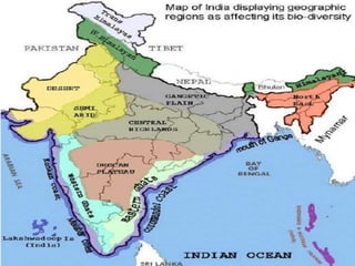
  • 3. PHYSICAL FEATURES OF INDIA Relief Structure Major Physiographic Unit
  • 4. ACTIVITIES RESPONSIBLE FOR THE FORMATION OF LANDFORMS THEORY OF PLATE TECTONICS Crust of earth made up of seven major and some minor plates. Movement caused stresses with in the plates and continental rocks. Volcanic activity Faulting Folding KV
  • 6. SEVEN MAJOR PLATES OF THE EARTH 1. Indi-Australian plate 2. South-American plate 3. Pacific plate 4. North American plate 5. Antarctic plate 6. Eurasian plate 7. African plate KV
  • 8. THE HIMALAYAN MOUNTAINS LOFTIEST YOUNG FOLD MOUNTAINS. RUGGED MOUNTAIN BARRIERS OF THE WORLD. FORMED FEW YEARS AGO BY FOLDING THE EARTH CRUST. PARALLEL RANGES SECTIONS HIMADRI HIMACHAL SHIWALIK PUNJAB HIMALAYAS KUMAON HIMALAYAS NEPAL HIMALAYAS ASSAM HIMALAYAS HIMALAYAS THREE PARALLEL RANGES TO THE LONGITUDINAL EXTENT DIVIDED INTO FOUR SECTIONS KV
  • 9. Page: 10 They form an arc, which covers a distance of about 2,400 Km. Their width varies from 400 Km in Kashmir to 150 Km in Arunachal Pradesh. KV
  • 10. FORMATION OF HIMALAYAS According to theory of tectonic plates the earth’s crust was initially a single , giant landmass called PANGEA. Northern part known as Angara land, Southern part was known as the Gondwana Land The crust was split due to convectional currents Drift of Indo-Australian plate towards north. Northern drift resulted in the collision with the Eurasian Plate Accumulation in the geosyncline (known as TETHYs) in the sedimentary rock due to collision were folded to form to form Mountain system in western Asia. KV
  • 11. HIMADRI (Great or Inner Himalayas) Most continuous range Northernmost range Loftiest peak (height) 6000mtrs Covered with snow throughout the year Contains prominent peaks HIMADRI (Lesser Himalayas) Rugged mountain system Composed of highly rugged and altered rocks Avg height 3700- 4500mtrs Width: 50kms Famous ranges: Pir Panjal, Dhaula Dhar, Mahabharta ranges Famous valleys: Kashmir, Kullu, Kangra SHIVALIKS (Outer Himalayas) Outermost range Height 900- 1100mtrs. Composed of unconsolidated rock Prone to earthquakes and landslides Called Duns like dehradun, Kotli dun patti dun etc. KV
  • 12. PUNJAB HIMALAYAS (Between Indus and Satluj) KUMAON HIMALAYAS (Between Satluj and Kali) NEPAL HIMALAYAS (Between Kali and Tista) ASSAM HIMALAYAS (Between Tista and Dibang) Himalayas division as per sections PURVACHAL OR THE EASTERN HILLS AND MOUNTAINS. Bharamputra river Hills running through the north-eastern states. Composed of strong sandstones, (sedimentary rocks). Covered with dense forests, (run as parallel ranges and valleys). Comprises the Patkai hills, the Naga hills, the Manipur hills and the Mizo hills. KV
  • 13. 1. Distinguish between Convergent Boundaries, Divergent Boundaries and transform Boundaries. 2. Describe how the Himalayas are formed? 3. Which hills are called Purvanchal? 4. How Purvanchal or Eastern hills formed? 5. Classify Himalayas on the basis of 1. Sections from the west to east 2. longitudinal ranges (A)Mountain Ranges: The Karakoram, The Zaskar, The Shiwalik, The Aravali, The Vindhya, The Satpura, Western & Eastern ghats (B) Mountain Peaks – K2, Kanchan Junga, Anai Mudi Note: use your previous year maps for map work or try to trace your map.
  • 14. NORHERN PLAINS 1.Ganga Plains 2.Punjab Plains 3.Bhrahamputra Plains Total Area of 7lakhs sq.km. , (2400km long 240-320km broad) Rivers entering from northern mountains associated with depositional work. Split in the numerous channels(lower course) due to deposition of slit known as DISTRIBUTARIES Have three sections and four regions with different relief features KV
  • 15. BHABAR (Lies at shiwalik, a narrow 8-16km wide belt of pebbles) TERAI (West marshy area with wildlife & forest) KHADAR (Young alluvial of the flood plain) BANGAR (Older alluvial plain rises above the level of the flood plain) THE NORTHERN PLAINS KV
  • 16. Check point 02 (G2) 1.Give an account of the Northern plains of India. KV
  • 17. EASTERN AND WESTERN EDGES 1. Eastern Ghats (Lower than Western Ghats) 2. Western Ghats (Higher than eastern Ghats) DIVIDED INTO TWO DIVISION 1.Central Highlands 2. Deccan Plateau EASTWARD EXTENSIONS LOCALLY KNOWN AS: 1.Bundelkhand and Bagahelkhand 2. Chotanagpur Plateau DECCAN PLATEAU The black soil found in this area known as Deccan Plateau THE PENINSULAR PLATEAU (A table land created by breaking and drifting of Gondawana land) KV
  • 18. FEATURES OF HIMALAYAN REGION &PENINSULAR PLATEAU HIMALAYAN REGION PENINSULAR PLATEAU Young fold mountains formed by uplift of the strata of sedimentary rocks Created from metamorphic and igneous rock after splitting from Gondwana Loftiest mountains and deep valley Broad and shallow valley and rounded hills I-shaped ranges U-shaped valleys Horsts rift valleys and troughts Origin of perennial river Rain fed seasonal valley Unstable zone Stable zone KV
  • 19. Western Ghats Eastern Ghats 1. mark the Western edges of the plateau. mark the Eastern edges of the plateau. 2. parallel and continuous hill ranges with no gaps. Irregular and have gaps through which rivers flow into the Bay of Bengal. 3. average height - 900-1600 metres average height -600 metres 4. The highest peaks include the Anai Mudi and the Doda Betta. Mahendragiri is the highest peak 5. The Western Ghats cause orographic rain The Eastern Ghats do not cause orographic rain. KV
  • 20. • Garo, Khasi and Jaintia hills. WEST TO EAST RANGES • Satpura range, Eastern part- Mahadev and Kaimur hills and the Maikal range. NORTHERN RANGES • Aravali hills WESTERN AND NORTH- WESTERN MARGINS • Meghalaya, Karbi-Anglong Plateau and North Cachar Hills. • separated by a fault (a crack in the earth’s crust) from the Chotanagpur Plateau. NORTHEAST(to cover a wide area) DECCAN PLATEAU The Deccan Plateau is a part of the Peninsular Plateau. It is triangular in shape and lies to the south of river Narmada. It is higher in the west and slopes gently towards the east. DECCAN TRAP: Black Soil Area Formed by lava that came out during volcanic activity Rich in minerals and hence, very important for industrial development. KV
  • 21. CENTRAL HIGHLANDS • Lie to the north of river Narmada, • Covering -Malwa plateau Chottanagpur plateau of the Peninsular plateau. • Rivers: Ken, Chambal, Sind, Betwa and Damodar, • Flow from south-west to north-east indicating the slope of the land. • The Central Highlands -wider in the west but narrower in the east. • The eastward extensions- Bundelkhand and Baghelkhand. • the extension takes it to the Chotanagpur Plateau. KV
  • 22. Check Point 03 (G2) 1. Distinguish between (i) Western Ghats and Eastern Ghats (ii) The Himalayan Region and Peninsular Plateau 2. Write a short note on Central highlands and Deccan plateau
  • 23. COASTAL PLAINS The Peninsular plateau is flanked by stretch of narrow coastal strips, running along the Arabian Sea on the west and the Bay of Bengal on the east. Western Coastal Plain Eastern Coastal Plain lies between the Western Ghats and the Arabian Sea. lies between the Eastern Ghats and the Bay of Bengal. Narrow Wide and level Three sections. Two divisions Northern- Konkan, Central stretch-Kannad Plain Southern-Malabar Coast. Northern-Northern Circar Southern-Coromandel Coast. No deltas Rivers like Mahanadi, Krishna, Kaveri, Godavari form deltas. KV
  • 24. THE INDIAN DESERT Towards the western margins of the Aravali Hills Receives low rainfall (150mm per yr.) Only River- Luni Sandy plains covered with sand dunes Major area covered by Barchans (crescent shaped dunes) KV
  • 25. The Islands Andaman & Nicobar Elongated chain located in Bay of Bengal Bigger in size and scattered Andaman(North) Nicobar(South) Lakshadweep Lying close to Malabar coast of Kerala Composer of small coral islands Small area of 32 sq km KV
  • 26. Check point 04 (G2) Answer the following questions briefly. (i) Which continents of today were part of the Gondwana Land? (ii) Which plateau lies between the Aravali and the Vindhyan ranges? (iii) Distinguish between Western Coastal Plain and Eastern coastal Plain (iv)Write a short notes on (a) Indian Desert (b) The Islands groups of India
  • 27. Assignment 01 (G2) 1. Choose the right answer from the four alternatives given below. (i) A landmass bounded by sea on three sides is referred to as (a) Coast (b) Peninsula (c) Island (d) none of the above 2. Mountain ranges in the eastern part of India forming its boundary with Myanmar are collectively called as (a) Himachal (c) Purvanchal (b) Uttaranchal (d) none of the above 3. The western coastal strip, south of Goa is referred to as (a) Coromandal (b) Kannad (c) Konkan (d) Northern Circar 4. The highest peak in the Eastern Ghats is (a) Anai Mudi (b) Mahendragiri (c) Kanchenjunga (d) Khasi