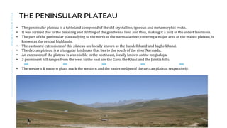
The document discusses the physical features of India. It describes the major physical divisions of India including the Himalayan Mountains, Northern Plains, Peninsular Plateau, Indian Desert, coastal plains, and islands. It provides details about each region, their formation and characteristics. The Himalayas are divided into various ranges from west to east. The Peninsular Plateau is composed of ancient crystalline and metamorphic rocks and forms the oldest landmass. The Northern Plains were formed by deposition of sediments from the Himalayas and Peninsular Plateau over millions of years.
India has significant geographic diversity due to its complex geological history. The key physical features formed at different times include the Himalayan mountains in the north, which are young and formed by tectonic plate collisions; the older Peninsular Plateau containing hills and valleys in central and southern India; and the large, fertile Northern Plains formed by deposition of silt from the Indus, Ganges, and Brahmaputra river systems. These features continue to be shaped by ongoing plate tectonics and erosion processes.
The document provides information on the various physical features of India, including the Himalayan Mountains, Northern Plains, Peninsular Plateau, Indian Desert, Coastal Plains, and Islands. It describes the key characteristics of each feature, such as the three parallel ranges that make up the Himalayas, the different sections of the vast Northern Plains formed by major river systems, and the Central Highlands and Deccan Plateau that comprise the Peninsular Plateau. Brief overviews are also given of the Indian Desert, Coastal Plains along both the western and eastern coasts, and the island groups of Lakshadweep and Andaman and Nicobar.
India has a variety of physical features including mountains, plains, deserts, plateaus and islands. The Himalayas stretch along the northern border. The northern plains were formed by deposition of alluvium from the Indus, Ganges and Brahmaputra rivers. The Peninsular Plateau consists of the Central Highlands and Deccan Plateau. Other physical features include the Indian Desert, coastal plains, and islands like the Lakshadweep and Andaman & Nicobar Islands.
India has diverse physical features ranging from the Himalayan mountains in the north to the coastal plains and islands in the south. The country can be divided into six major physiographic divisions - the Himalayan mountains, northern plains, peninsular plateau, Indian desert, coastal plains and islands. The northern plains are formed by the interplay of the Indus, Ganges and Brahmaputra river systems. The peninsular plateau consists of the older crystalline and metamorphic rocks of the Deccan trap and forms the tableland south of the Narmada River. India also has coastal plains along the western and eastern coasts and island groups of Lakshadweep and Andaman & Nicobar islands.
India has a variety of landforms created by geological processes over time. It has mountains, plains, deserts, and plateaus formed during different geological periods. India's relief has also been modified by weathering, erosion, and deposition. The Himalayas were formed by the collision of the Indian and Eurasian tectonic plates over millions of years, which caused the sediments of the former Tethys Sea to fold and uplift into mountains. The northern plains were formed by deposits of the Indus, Ganges, and Brahmaputra river systems and their tributaries. The Peninsular Plateau in southern India was formed from the oldest rock of the former Gondwana land and is divided into
India has a variety of landforms created by geological processes over time. It has mountains, plains, deserts, and plateaus formed during different geological periods. India's relief has been modified by weathering, erosion, and deposition. The Himalayas were formed by the collision of the Indian and Eurasian tectonic plates over millions of years, which caused the sediments of the former Tethys Sea to fold and uplift into mountains. The northern plains were formed by deposits of the Indus, Ganges, and Brahmaputra river systems and their tributaries. The Peninsular Plateau in southern India was formed from the oldest rock of the former Gondwana land and is divided into the
This document provides information about the Northern Plains of India. It discusses the key details of the Northern Plains, including its extension from Assam to Punjab, its fertile alluvial soil deposited by Himalayan rivers, and its importance as the major agricultural region and most densely populated area of India. The plains are divided into the Indus and Ganga-Brahmaputra river basins. The document also notes the plains' flat terrain, irrigation infrastructure like canals and dams, and role in India's economic development through industries and agriculture. In summary, the Northern Plains are India's most fertile and populated region, extending along the Himalayas and watered by major rivers.
The document summarizes the major physical features of India. It describes 6 physiographic divisions: 1) The Himalayan Mountains, 2) The Northern Plains, 3) The Peninsular Plateau, 4) The Indian Desert, 5) The Coastal Plains, and 6) The Islands. It provides details about the characteristics of each division, including mountain ranges, rivers, climate, vegetation, and more.
The physical features of India can be divided into several major physiographic divisions that were formed by the movement of tectonic plates and the collision of the Indian subcontinent with Eurasia. These include the Himalayan Mountains, the Northern Plains, the Peninsular Plateau, the Indian Desert, and Coastal Plains. The Himalayas continue along India's northern border and are the youngest mountains, formed by the uplift caused when India collided with Eurasia. The Northern Plains were formed by sediments deposited by rivers flowing from the Himalayas. The Peninsular Plateau is a tableland formed from the ancient rocks of the former Gondwana land.
CLASS 9 GEOGRAPHY CHAPTER 2 PHYSICAL FEATURES OF INDIA .pptxvirendrachoudhary040
This is ppt of Physical features of India which is chapter of Class 9 Geography, This slide contains very part of chapter whether it is a Do you Know or Fact.
The document provides information on the physical geography of India. It describes the major landforms of India including the Himalayan mountain range, northern plains, peninsular plateau, coastal plains, Thar Desert, and islands. It discusses how these landforms were formed through geological processes like plate tectonics, weathering, erosion, and deposition over millions of years. The summary also provides brief descriptions of the key characteristics and divisions of each major landform region.
India has several major physical features that define its geography. These include the Himalayan mountains in the north, the northern plains formed by major river systems below the mountains, the peninsular plateau that makes up most of central and southern India, the Indian desert in the northwest, and the coastal plains along the eastern and western shores. India is also home to the island groups of Lakshadweep off the western coast and the Andaman and Nicobar Islands in the bay of Bengal.
The document summarizes the physiography and physical features of India. It discusses the different physiographic divisions of India including the Himalayas, Northern Plains, Peninsular Plateau, Indian Desert, Coastal Plains, and Islands. It provides details on the location, terrain, and other characteristics of each division. For example, it notes that the Himalayas form the northern boundary and consist of parallel mountain ranges, while the Peninsular Plateau is the oldest stable landmass composed of crystalline and metamorphic rocks.
Physical feature of india by ayush dewangan 😘.pptxayushDewangan19
India has a wide variety of physical features including mountains, plains, deserts, plateaus, and islands that were formed through geological processes over millions of years. The document divides India's physical features into several major physiographic divisions: the Himalayan mountains, northern plains, peninsular plateau, Indian desert, coastal plains, and islands. It provides details on the characteristics and sub-regions of each of these physiographic divisions. In conclusion, the document states that India's diverse physical geography has created various resources and opportunities for development across the country.
The document summarizes the major physical features of India. It discusses the country's varied terrain including the Himalayan mountains, northern plains, peninsular plateau, Indian desert, coastal plains, and islands. The Himalayas are described as having three parallel mountain ranges including the Greater Himalayas containing India's highest peaks. The northern plains are formed by large river systems and divided into the Punjab, Ganga, and Brahmaputra plains. The peninsular plateau consists of the central highlands and Deccan plateau. Smaller features mentioned include the Thar desert, Western and Eastern Ghats, and the Andaman and Nicobar and Lakshadweep islands.
This document provides information about the physical features of India. It discusses the major landforms of India which were formed due to plate tectonics and geological events over time. The major physiographic divisions of India described are the Himalayan Mountains, Northern Plains, Peninsular Plateau, Indian Desert, Coastal Plains and Islands. Details are provided about the characteristics and formation of each region. The highest peaks of the Himalayas like Mount Everest are also mentioned along with the major river systems of India.
This document provides an overview of the physical features of India. It discusses how the Indian subcontinent was formed from the breakup of Gondwana land and the subsequent collision with the Eurasian plate. This led to the formation of key landforms like the Himalayas and the peninsular plateau. It then describes the major physical divisions of India including the Himalayan mountains, northern plains, peninsular plateau, Indian desert, coastal plains, and islands. It provides details about the characteristics of each region and how they were formed.
The document summarizes the major physiographic divisions of India. It discusses the Himalayan Mountains, the Northern Plain, the Peninsula Plateau, the Indian Desert, the Coastal Plain and the Islands. The Himalayan Mountains are divided into the Great Himalayas, Lesser Himalayas and Shivaliks. The Northern Plain was formed by major river systems and spreads over 7 lakh square kilometers. The Peninsula Plateau consists of the Central Highlands and Deccan Plateau divided by the Narmada River.
The northern plain of India is formed by the interplay of three major rivers - the Ganga, Indus, and Brahmaputra. During the Tertiary period, a sea called Tethys extended north and west. Due to the movement of tectonic plates, the Indian plate underthrust the Eurasian plate, causing folding of marine sediments from compressive forces. This created the Himalayas and left the northern plain as a foredeep filled with sediments eroded from the mountains. The three dominant rivers continue depositing alluvial soil, making the plain one of the most fertile regions and important agricultural areas in India.
India has a variety of physical features due to its formation from different geological periods and the movement of tectonic plates. The major physical divisions of India are the Himalayan Mountains, Northern Plains, Peninsular Plateau, Indian Desert, Coastal Plains, and Islands. The Himalayas were formed by the collision of the Indian plate with Eurasia, and include India's highest peaks. The Northern Plains were formed by deposition of sediment from Himalayan rivers. The Peninsular Plateau is one of Earth's oldest landmasses.
The document provides an overview of the physical features of India, including its major physiographic divisions and underlying geological structures formed by plate tectonics. It discusses the Himalayan Mountains, Northern Plains, Peninsular Plateau, Indian Desert, Coastal Plains, and Islands. Key points include the formation of the Himalayas, composition of the Northern Plains drained by the Indus, Ganges and Brahmaputra rivers, description of the Peninsular Plateau and its Central Highlands and Deccan sections, and brief overview of the other regions.
Social science power point presentaion.JIBIN JOSEPH
This document summarizes the major physical features of India, dividing the country into several physiographic divisions formed by geological processes. The Himalayas were formed by the collision of the Indian plate with Eurasia. Other divisions include the Northern Plains formed by sediment deposition along river systems, the Peninsular Plateau comprising older crystalline rocks, the Indian Desert, and Coastal Plains. Each region has unique climates and landscapes that have influenced civilization and hold natural resource potential.
Physiographic divisions of India class IXAnveshaWalve
The document describes the physiographic divisions of India, which were formed by continental drift and tectonic plate movement. It discusses 6 divisions: 1) The Northern Mountains, formed by the Himalayan ranges. 2) The Great Northern Plains, formed by deposition of silt from Himalayan rivers. 3) The Peninsular Plateau, the oldest landmass in India with Central Highlands and Deccan Plateau. 4) The Coastal Plains, formed along the eastern and western coasts. 5) The Indian Deserts, including the Thar Desert. 6) The Islands, which include the Andaman and Nicobar Islands. Each division has unique geographical features and importance.
India is located in southern Asia between the Arabian Sea and the Bay of Bengal. It stretches from the Himalayan mountains in the north to the Indian Ocean in the south. The climate is influenced by the monsoon winds, with a hot, wet summer and a mild, dry winter. The diverse terrain includes the northern plains, the hilly northeast, the deserts in the west, and the southern peninsula. Major physical features include the Himalayas, Ganges River basin, Thar Desert, and Western and Eastern Ghats mountain ranges, which impact settlement and economic activity across regions.
The document summarizes the key physical features of India. It describes the six main physiographic divisions: 1) The Himalayan Mountains, which contain the highest peaks in the world like Everest; 2) The Northern Plains; 3) The Peninsular Plateau, divided into the Central Highlands and Deccan Plateau; 4) The Indian Desert; 5) The Coastal Plains along the eastern and western coasts; and 6) The Islands off the coasts. It provides details about the characteristics of each division, such as the three ranges that make up the Himalayas and the rivers that flow through the Northern Plains.
Kinetic studies on malachite green dye adsorption from aqueous solutions by A...Open Access Research Paper
Water polluted by dyestuffs compounds is a global threat to health and the environment; accordingly, we prepared a green novel sorbent chemical and Physical system from an algae, chitosan and chitosan nanoparticle and impregnated with algae with chitosan nanocomposite for the sorption of Malachite green dye from water. The algae with chitosan nanocomposite by a simple method and used as a recyclable and effective adsorbent for the removal of malachite green dye from aqueous solutions. Algae, chitosan, chitosan nanoparticle and algae with chitosan nanocomposite were characterized using different physicochemical methods. The functional groups and chemical compounds found in algae, chitosan, chitosan algae, chitosan nanoparticle, and chitosan nanoparticle with algae were identified using FTIR, SEM, and TGADTA/DTG techniques. The optimal adsorption conditions, different dosages, pH and Temperature the amount of algae with chitosan nanocomposite were determined. At optimized conditions and the batch equilibrium studies more than 99% of the dye was removed. The adsorption process data matched well kinetics showed that the reaction order for dye varied with pseudo-first order and pseudo-second order. Furthermore, the maximum adsorption capacity of the algae with chitosan nanocomposite toward malachite green dye reached as high as 15.5mg/g, respectively. Finally, multiple times reusing of algae with chitosan nanocomposite and removing dye from a real wastewater has made it a promising and attractive option for further practical applications.
Evolving Lifecycles with High Resolution Site Characterization (HRSC) and 3-D...Joshua Orris
The incorporation of a 3DCSM and completion of HRSC provided a tool for enhanced, data-driven, decisions to support a change in remediation closure strategies. Currently, an approved pilot study has been obtained to shut-down the remediation systems (ISCO, P&T) and conduct a hydraulic study under non-pumping conditions. A separate micro-biological bench scale treatability study was competed that yielded positive results for an emerging innovative technology. As a result, a field pilot study has commenced with results expected in nine-twelve months. With the results of the hydraulic study, field pilot studies and an updated risk assessment leading site monitoring optimization cost lifecycle savings upwards of $15MM towards an alternatively evolved best available technology remediation closure strategy.
Recycling and Disposal on SWM Raymond Einyu pptxRayLetai1
Increasing urbanization, rural–urban migration, rising standards of living, and rapid development associated with population growth have resulted in increased solid waste generation by industrial, domestic and other activities in Nairobi City. It has been noted in other contexts too that increasing population, changing consumption patterns, economic development, changing income, urbanization and industrialization all contribute to the increased generation of waste.
With the increasing urban population in Kenya, which is estimated to be growing at a rate higher than that of the country’s general population, waste generation and management is already a major challenge. The industrialization and urbanization process in the country, dominated by one major city – Nairobi, which has around four times the population of the next largest urban centre (Mombasa) – has witnessed an exponential increase in the generation of solid waste. It is projected that by 2030, about 50 per cent of the Kenyan population will be urban.
Aim:
A healthy, safe, secure and sustainable solid waste management system fit for a world – class city.
Improve and protect the public health of Nairobi residents and visitors.
Ecological health, diversity and productivity and maximize resource recovery through the participatory approach.
Goals:
Build awareness and capacity for source separation as essential components of sustainable waste management.
Build new environmentally sound infrastructure and systems for safe disposal of residual waste and replacing current dumpsites which should be commissioned.
Current solid waste management situation:
The status.
Solid waste generation rate is at 2240 tones / day
collection efficiently is at about 50%.
Actors i.e. city authorities, CBO’s , private firms and self-disposal
Current SWM Situation in Nairobi City:
Solid waste generation – collection – dumping
Good Practices:
• Separation – recycling – marketing.
• Open dumpsite dandora dump site through public education on source separation of waste, of which the situation can be reversed.
• Nairobi is one of the C40 cities in this respect , various actors in the solid waste management space have adopted a variety of technologies to reduce short lived climate pollutants including source separation , recycling , marketing of the recycled products.
• Through the network, it should expect to benefit from expertise of the different actors in the network in terms of applicable technologies and practices in reducing the short-lived climate pollutants.
Good practices:
Despite the dismal collection of solid waste in Nairobi city, there are practices and activities of informal actors (CBOs, CBO-SACCOs and yard shop operators) and other formal industrial actors on solid waste collection, recycling and waste reduction.
Practices and activities of these actor groups are viewed as innovations with the potential to change the way solid waste is handled.
CHALLENGES:
• Resource Allocation.
Epcon is One of the World's leading Manufacturing Companies.EpconLP
Epcon is One of the World's leading Manufacturing Companies. With over 4000 installations worldwide, EPCON has been pioneering new techniques since 1977 that have become industry standards now. Founded in 1977, Epcon has grown from a one-man operation to a global leader in developing and manufacturing innovative air pollution control technology and industrial heating equipment.
ENVIRONMENT~ Renewable Energy Sources and their future prospects.tiwarimanvi3129
This presentation is for us to know that how our Environment need Attention for protection of our natural resources which are depleted day by day that's why we need to take time and shift our attention to renewable energy sources instead of non-renewable sources which are better and Eco-friendly for our environment. these renewable energy sources are so helpful for our planet and for every living organism which depends on environment.
Improving the viability of probiotics by encapsulation methods for developmen...Open Access Research Paper
The popularity of functional foods among scientists and common people has been increasing day by day. Awareness and modernization make the consumer think better regarding food and nutrition. Now a day’s individual knows very well about the relation between food consumption and disease prevalence. Humans have a diversity of microbes in the gut that together form the gut microflora. Probiotics are the health-promoting live microbial cells improve host health through gut and brain connection and fighting against harmful bacteria. Bifidobacterium and Lactobacillus are the two bacterial genera which are considered to be probiotic. These good bacteria are facing challenges of viability. There are so many factors such as sensitivity to heat, pH, acidity, osmotic effect, mechanical shear, chemical components, freezing and storage time as well which affects the viability of probiotics in the dairy food matrix as well as in the gut. Multiple efforts have been done in the past and ongoing in present for these beneficial microbial population stability until their destination in the gut. One of a useful technique known as microencapsulation makes the probiotic effective in the diversified conditions and maintain these microbe’s community to the optimum level for achieving targeted benefits. Dairy products are found to be an ideal vehicle for probiotic incorporation. It has been seen that the encapsulated microbial cells show higher viability than the free cells in different processing and storage conditions as well as against bile salts in the gut. They make the food functional when incorporated, without affecting the product sensory characteristics.
Optimizing Post Remediation Groundwater Performance with Enhanced Microbiolog...Joshua Orris
Results of geophysics and pneumatic injection pilot tests during 2003 – 2007 yielded significant positive results for injection delivery design and contaminant mass treatment, resulting in permanent shut-down of an existing groundwater Pump & Treat system.
Accessible source areas were subsequently removed (2011) by soil excavation and treated with the placement of Emulsified Vegetable Oil EVO and zero-valent iron ZVI to accelerate treatment of impacted groundwater in overburden and weathered fractured bedrock. Post pilot test and post remediation groundwater monitoring has included analyses of CVOCs, organic fatty acids, dissolved gases and QuantArray® -Chlor to quantify key microorganisms (e.g., Dehalococcoides, Dehalobacter, etc.) and functional genes (e.g., vinyl chloride reductase, methane monooxygenase, etc.) to assess potential for reductive dechlorination and aerobic cometabolism of CVOCs.
In 2022, the first commercial application of MetaArray™ was performed at the site. MetaArray™ utilizes statistical analysis, such as principal component analysis and multivariate analysis to provide evidence that reductive dechlorination is active or even that it is slowing. This creates actionable data allowing users to save money by making important site management decisions earlier.
The results of the MetaArray™ analysis’ support vector machine (SVM) identified groundwater monitoring wells with a 80% confidence that were characterized as either Limited for Reductive Decholorination or had a High Reductive Reduction Dechlorination potential. The results of MetaArray™ will be used to further optimize the site’s post remediation monitoring program for monitored natural attenuation.
Microbial characterisation and identification, and potability of River Kuywa ...Open Access Research Paper
Water contamination is one of the major causes of water borne diseases worldwide. In Kenya, approximately 43% of people lack access to potable water due to human contamination. River Kuywa water is currently experiencing contamination due to human activities. Its water is widely used for domestic, agricultural, industrial and recreational purposes. This study aimed at characterizing bacteria and fungi in river Kuywa water. Water samples were randomly collected from four sites of the river: site A (Matisi), site B (Ngwelo), site C (Nzoia water pump) and site D (Chalicha), during the dry season (January-March 2018) and wet season (April-July 2018) and were transported to Maseno University Microbiology and plant pathology laboratory for analysis. The characterization and identification of bacteria and fungi were carried out using standard microbiological techniques. Nine bacterial genera and three fungi were identified from Kuywa river water. Clostridium spp., Staphylococcus spp., Enterobacter spp., Streptococcus spp., E. coli, Klebsiella spp., Shigella spp., Proteus spp. and Salmonella spp. Fungi were Fusarium oxysporum, Aspergillus flavus complex and Penicillium species. Wet season recorded highest bacterial and fungal counts (6.61-7.66 and 3.83-6.75cfu/ml) respectively. The results indicated that the river Kuywa water is polluted and therefore unsafe for human consumption before treatment. It is therefore recommended that the communities to ensure that they boil water especially for drinking.
Presented by The Global Peatlands Assessment: Mapping, Policy, and Action at GLF Peatlands 2024 - The Global Peatlands Assessment: Mapping, Policy, and Action
Climate Change All over the World .pptxsairaanwer024
Climate change refers to significant and lasting changes in the average weather patterns over periods ranging from decades to millions of years. It encompasses both global warming driven by human emissions of greenhouse gases and the resulting large-scale shifts in weather patterns. While climate change is a natural phenomenon, human activities, particularly since the Industrial Revolution, have accelerated its pace and intensity
2. INTRODUCTION
PRESENTATION
TITLE
2
1. THE LAND OF INDIA DISPLAYS GREAT PHYSICAL VARIATION.
2. GEOLOGICALLY, THE PENINSULAR PLATEAU CONSTITUTES ONE OF
THE ANCIENT LANDMASSES ON THE EARTH’S SURFACE.
3. THE PENINSULAR PLATEAU IS COMPOSED OF IGNEOUS AND
METAMORPHIC ROCKS WITH GENTLY RISING HILLS AND WIDE
VALLEYS
3. MAJOR DIVISIONS
3
1. The Himalayan Mountains
2. The Northern Plains
3. The Peninsular Plateau
4. The Indian Desert
5. The coastal
6. The Islands
The Himalayan Mountains-
- Geologically young and structured fold mountains
- These mountain ranges run in a west-east direction from the
Indus to the Brahmaputra
- They represent the loftiest and one of the most rugged
mountains ranges
- The northernmost range is known as the Great or Inner
Himalayas or the Himadri.
- The range lying to the south of the Himadri forms the most
rugged mountain system and is known as Himachal or lesser
Himalayas.
- While the pir panjal range forms the longest and the most
important range
- The outermost range of the Himalayas is called the Shiwaliks.
4. 4
• The longitudinal valley lying between the lesser Himalayas and the
Shiwaliks are known as Duns, Dehra Dun, Kotli Dun, and Patli Dun are
some of the well-known Duns.
• The eastern mountain ranges of the Himalayas are known as the
Purvanchal/ Eastern Hills and mountains
• These hills running through the northeastern states are mostly composed
of strong sandstones, which are sedimentary rocks.
• The Purvanchal comprises the Patkai Hills, the Naga Hills, the Manipur
Hills, and the Mizo Hills.
The Northern Plains
• Formed by three major river systems namely- The INDUS, the Ganga
and the Brahmaputra along with their Tributaries.
• This plain is formed of alluvial soil.
• The deposition of alluvium is a vast basin lying at the foothills of the
Himalaya over millions of years, formed this fertile plain.
• The plain being about 2400 km lakh sqkm
• The rivers in their lower course split into numerous channels due to
the deposition of silt.
• These channels are known distributaries.
5. 5
• The western part of the northern plain is referred to as the Punjab plains.
• Formed by the Indus and its tributaries.
• The largere part of this plain lies in Pakistan.
• The Indus and its tributaries- the Jhelum, the Chenab, the Ravi, the Beas and
the Satluj originate in the Himalaya.
• This section of the plain is dominated by the Doabs.
DOAB- is made up of two words
‘do’- two
‘ab’- water
Punjab- is also made up of two words
Punj- 5 (Jhelum, chenab, ravi, beas, satluj.)
Ab – water
• The ganga plain extends between Ghagar and Teesta rivers. It is spread over the states
of North India, Haryana, Delhi, UP, Bihar, partly Jharkhand and West Bengal to its East
particularly in Assam lies the Brahmaputra Plain.
• Definitions of Important terms:
6. IMPORTANT TERMS-
1. Bhabar- the rivers, after descending from the mountains deposit pebbles in a narrow belt of about 8
to 16 km in width lying parallel to the slopes of the Shiwaliks.
2. Terai- the streams and rivers re-emerge and create a wet, swampy and marshy region known as
terai.
3. Bhangar- The largest part of the northern plain is formed of older alluvium. It lies above the
floodplains of the rivers and presents a terrace-like feature. It is less fertile.
4. Kankar- the Indo gangetic plain soils contains calcerous deposits, locally known as Kankar.
5. Khadar- the newer, younger deposits of the floodplains are called khadar.
7. Bhabar is found along the base of the Himalayas.
Bhabar is characterized by alluvial soil, dense vegetation
and small rivers and streams.
Bhabar is a narrow strip of land.
Bhabar is known for its small rivers and streams.
Bhabar is the first zone of the Himalayan foothills.
Is found south of the Himalayas
Terai is characterized by flat land, dense forests and
grasslands
Terai is relatively larger in area
Terai is known for its biodiversity
Terai is the low-lying area south of the Bhabar.
BHABHAR & TERAI
7
8. 8
Bhangar soil is found in areas above the flood levels.
This soil is often mixed with small lime nodules.
It is the older alluvial plain that represents the upland
alluvial tract.
Bhangar soils are suitable for Agriculture.
It gives a rich yield than Khadar soil.
Khadar soil is found in areas below the flood levels
This soil only contains clay and fine silt.
These are the new plains formed due to alluvial
deposition along the river’s course.
Khadar soil is suitable for cultivating sugarcane, maize,
wheat, rice and oilseeds.
It gives less yield than Bhangar soil.
BHANGAR & KHADAR
9. THE PENINSULAR PLATEAU
PRESENTATION
TITLE
• The peninsular plateau is a tableland composed of the old crystalline, igneous and metamorphic rocks.
• It was formed due to the breaking and drifting of the gondwana land and thus, making it a part of the oldest landmass.
• The part of the peninsular plateau lying to the north of the narmada river, covering a major area of the malwa plateau, is
known as the central highlands.
• The eastward extensions of this plateau are locally known as the bundelkhand and baghelkhand.
• The deccan plateau is a triangular landmass that lies to the south of the river Narmada.
• An extension of the plateau is also visible in the northeast, locally known as the meghalaya.
• 3 prominent hill ranges from the west to the east are the Garo, the Khasi and the Jaintia hills.
• The western & eastern ghats mark the western and the eastern edges of the deccan plateau respectively.
9
10. DIFFERENCE B/W
1 0
WESTERN GHATS
1. The western ghats are continuous chains of mountains
and can be crossed through passes only.
2. The height ranges from 900-1600 meters.
3. Most of the Peninsular rivers originate from western ghats.
4. The soil is highly fertile.
5. The onset of monsoon is felt by the western ghats.
EASTERN GHATS
The eastern ghats are not continuous and are cut by rivers
falling into the bay of Bengal.
Theie height is lower than the western ghats, height
ranges from 600 to 900 meter
No major river originates from eastern ghats.
The soil is not so fertile here
The retreating of the monsoon is felt here in October and
November.
11. THE INDIAN DESERT
1 1
1. The Indian desert lies towards the western margins of the Aravalli hills.
2. It is an undulating sandy plain covered with sand dunes.
3. This region receives very low rainfall below 150mm per year.
4. It has arid climate with low vegetation cover.
5. Luni is the only large river in this region.
6. Barchans(crescent shaped dunes) cover larger areas but longitudinal dunes become more prominent near the
Indo- Pakistan boundary.
12. THE COASTAL PLAINS
1 2
1. The peninsular plateau is flanked by stretch of narrow coastal strips, running along the arabian sea on the west
and the bay of Bengal on the east.
2. The western coast, sandwiched between the western ghats and the arabian sea, is a narrow plain.
3. The northern part of the coast of the coast is called the konkan( Mumbai- goa), the central stretch is called the
Kankad Plain, while the southern stretch is referred to as Malabar coast.
4. Lake Chilika is important feature along the eastern coast- the largest salt water lake in india.
13. THE COASTAL PLAINS
1 3
1. Lakshadweep Islands group is group of islands composed of small coral islands.
2. This islands group has great diversity of flora and fauna.
3. The pitti island, which is uninhabited has a bird sanctuary
14. How the Himalayas have been divided on the basis of regions from west to east?
Answer:
Punjab Himalayas: these divisions have been demarcated by river valleys. The part of Himalayas lying between Indus and saltus has been traditionally
known as Punjab Himalaya, but it is also known regionally as Kashmir and him Achal Himalaya from west to east respectively.
Kumaon Himalayas: the part of the Himalayas lying between Sutlej and kali rivers is known as Kumaon Himalayas.
Nepal Himalayas: the kali and Teesta rivers demarcate the Nepal Himalayas.
Assam Himalayas: the part lying between Teesta and dihang rivers is known as assam Himalayas.
15. Question 2.
Which are the three main ranges of the himalayas?
Answer:
the himalayas have three ranges which run almost parallel to each other. The distance between these ranges is wider in the west and becomes narrow in the east.
These ranges are—
the outer himalayas or the shiwalik range
the middle himalayas or the himachal range and
the inner or great himalayas or the himadri.
Question 3.
Describe the “theory of plate tectonics”.
Answer:
earth scientists have attempted to explain the formation of physical features with the help of some theories based on certain evidences. One such plausible theory is the ‘theory of plate tectonics’. According to this theory, the crust (upper part) of the earth has been formed out of seven major and some
minor plates. The movement of the plates results in the building up of stresses within the plates and the continental rocks above, leading to folding, faulting and volcanic activity
question 4.
Why is the soil in the northern plain fertile?
Answer:
the soil of this plain has been formed by the sediments brought down by the rivers from the himalayas. Such plain is called an alluvial plain and it is very fertile. This plain is one of the largest and most fertile plains of world. It is the most thickly populated plain. This is also the major crop growing area in
india. This plain is drained by river ganga, brahmaputra and their tributaries. The slope of this plain in the west is south-west and in the east is south-east.
An area through which a river and its tributaries flow is called its basin.
Question 5.
Which plateau lies between the aravali and the vindhya range? Write a brief note on this plateau.
Answer:
the malwa plateau lies between the aravali hills and the vindhya range. The aravali hills lie to the west of the plateau and the vindhya range lies to its south. The part of the peninsular plateau lying to the north of the narmada river, covering a major area of the malwa plateau, is known as the central
highlands.
The malwa plateau lies in madhya pradesh. It is composed of extensive lava flows. There are rolling plains separated by flat-topped hills. The plateau is largely broken in form of ravines near the chambal valley in its east.
Question 6.
What do you mean great himalayas? Write its two characteristics.
Answer:
the northern most range of the himalayas is known as the great or inner himalayas or the himadri.
(A) it is the most continuous range consisting of the loftiest peaks with an average height of 6000 metres. It contains all prominent himalayan peaks.
(B) its folds are asymmetrical in nature and its core is composed of granite rock. It is perennially snow bound, and several glaciers descend from this range.
Question 7.
How was the great northern plains of india formed?
Answer:
the formation of the himalayas due to upliftment of sediments out of the tethys sea and subsidence of the northern flank of the peninsular plateau resulted in the formation of a large basin. In due course of time this depression, gradually got filled with deposition of sediments by the rivers flowing from
the mountains in the north and the peninsular plateau in the south. A flat land of extensive alluvial deposits led to the formation of the northern plains of india.
Question 8.
Write a short note on ‘coral polyps’.
Answer:
coral polyps are short-lived microscopic organisms, which live in colonies. They flourish in shallow, mud-free and warm waters. They secrete hard rock like substance. The coral secretion and their skeletons from coral deposits in the form of reefs.
They are mainly of three kinds—barrier reef, fringing reef and atolls. The great barrier reef of australia is a good example of the first kind of coral reefs. Atolls are circular or horse shoe-shaped coral reefs.
Question 9.
Write a short note on the western coastal plains.
Answer:
the peninsular plateau is flanked by stretch of narrow coastal strips, running along the arabian sea on the west and the bay of bengal on the east. The western coast, sandwiched between the western ghats and the arabian sea, is a narrow plain. It consists of three sections. The northern part of the
coast is called the konkan (mumbai-goa), the central stretch is called the kannad plain while the southern stretch is referred to as the malabar coast