The Hell of High Water: Tsunami and the Cornish Coast.
•
1 like•1,418 views

Invited lecture by Professor Simon Haslett at University College, Falmouth on Tuesday 28th September 2010. Simon Haslett is Professor of Physical Geography.
Report
Share
Report
Share

Recommended
The Hell of High Water: Tsunami and the Cornish Coast
The 2011 Annual Kelliwic Lecture presented by Professor Simon Haslett at Callington Town Hall, Cornwall, on Sunday 29th May 2011. Simon Haslett is Professor of Physical Geography and Dean of the School of STEM at the University of Wales.
The British Tsunami: the 1607 flood.
1. Professor Simon Haslett and Dr. Ted Bryant presented evidence that a tsunami, rather than a storm, caused widespread flooding along the coasts of Wales and Somerset in 1607 that resulted in over 2000 deaths.
2. They conducted fieldwork along the coast to examine landscapes and sediment layers for signs of a tsunami, and sampled and analyzed sediments from locations mentioned in historic accounts of the 1607 flooding.
3. Their research and a BBC documentary about the 1607 tsunami received significant interest, with viewers providing new information and locations for further study, and inspiring other researchers to study tsunami history.
The 1607 Flood: a tsunami in the Bristol Channel?
Presentation by Professor Simon Haslett to the Geographical Association at King's College, Taunton, on Tuesday 15th November 2012.
A presentation based on research featured in 'Killer Wave of 1607' as broadcast by BBC2 Timewatch. The flood of that year in the Bristol Channel and Severn Estuary was the worst ever recorded in the British Isles. The area affected stretched from North Devon, through Somerset and Gloucestershire, and along the South Wales coast from Monmouthshire to Carmarthenshire, some 570 km of coast! The coastal population was devastated with at least 2000 fatalities according to one of the contemporary sources. In some parts of the coast the population never recovered from the social and economic disaster. Simon and his co-worker have used documentary and fieldwork evidence to propose a new interpretation of its cause as a tsunami. The BBC produced a follow-up Timewatch programme entitled 'Britain’s Forgotten Floods' that followed Simon around the British coastline examining further evidence for tsunami impact.
Mt. vesuvius eruption
Mount Vesuvius is a volcano located near Naples, Italy that has erupted eight times in the last 17,000 years. On August 24, 79 AD, a major eruption buried the cities of Pompeii and Herculaneum under ash, killing over 16,000 people. The eruption preserved the cities and their victims, leaving casts of their bodies. Since then, Vesuvius has had several more eruptions, the most recent in 1944, which caused damage during World War II. Today, nearly 3 million people live in the area and would be at risk from a future eruption.
Cumbria Flooding
Heavy rainfall caused widespread flooding across Cumbria in northern England in 2009, with a conveyor of warm, moist air from the Azores bringing 34 hours of steady rain to the region. The floods were especially severe where rivers converged in towns like Cockermouth, due to the heavy rain overwhelming drainage systems. Thousands of homes and businesses were damaged by the flooding, costing over £3 billion to repair the infrastructure and helping to make 2009 the wettest year on record for the UK.
Causes of the River Derwent Flood, 2009
The 2009 flood in the River Derwent, Cumbria was caused by both physical and human factors. Physically, warm moist air dropped over 400mm of rain in 24 hours, breaking the UK record, which was too much for the ground to absorb. This caused overflow that rapidly filled streams and rivers like the Derwent and Cocker. At their confluence, high discharges combined to cause flooding in Workington. Human factors were urbanization increasing impermeable surfaces and faster water flow into rivers, and blocked or inadequate sewers in towns like Cockermouth and Keswick that caused flooding.
Carlisle floods jan 2005
Carlisle, located on the flood plain of the River Eden where three rivers meet, has a long history of flooding. The January 2005 floods were caused by exceptionally heavy rainfall that saturated the ground and led to rapid rising of river levels. Over 2,700 homes were affected, three people died, and costs were estimated at over £400 million. Impacts included homes flooded to the second floor, emergency services stations flooded, and difficulties with evacuation efforts. Responses involved immediate evacuation of people and relief centers, as well as long-term plans for flood management schemes and engineering solutions.
Mount Vesuvius
Mount Vesuvius is a volcano located near Naples, Italy that erupted catastrophically in 79 AD. The eruption buried the towns of Pompeii and Herculaneum under ash and rock, killing approximately 16,000 people. Vesuvius had shown signs of activity in previous decades, including a large earthquake in 63 AD. When it erupted in 79 AD, it expelled molten rock and ash at a high rate, quickly covering the towns. The region was not rebuilt after the disaster due to the extensive damage, though it has since become an important archaeological site and tourist attraction. Vesuvius remains an active volcano today.
Mount Vesuvius
Mount Vesuvius erupted in 79 AD, burying the cities of Pompeii and Herculaneum in ash and killing over 10,000 people. The eruption blocked out the sun for two days and demolished the cities, covering them in ash. Today, over 700,000 people live near Vesuvius and would be in danger if it were to erupt again.
Mount st. helens copy
Mount St. Helens is a volcano located in Washington state near Seattle and Portland. In 1980, it erupted in the deadliest volcanic eruption in U.S. history, killing 57 people. The eruption destroyed 200 miles of highway and 250 homes. It occurred when the Juan de Fuca tectonic plate subducted under the North American plate, causing pressure that resulted in an earthquake and eruption. The eruption devastated the surrounding area through ash and debris flows.
volcano
The document discusses volcanoes, including:
- Volcanoes form when magma is forced from below the Earth's surface. There are currently around 50-60 volcanic eruptions per year.
- The main types of erupted material are lava and ash. The three main types of volcanoes are cinder cones, shield volcanoes, and composite volcanoes.
- Composite volcanoes are the most explosive and dangerous type, examples being Mount St. Helens and Mount Fuji. Large eruptions can have devastating effects like pyroclastic flows and ash falls.
Boscastle 2004
The document summarizes the Boscastle floods that occurred on August 16, 2004 in Boscastle, North Cornwall. Heavy rainfall of 185mm in under 5 hours caused the Valency, Jordan and Paradise rivers to flood. The physical causes were the convergence of the three rivers in the small village, heavy rainfall from frontal weather systems, and steep, narrow valleys with thin soils that resulted in rapid runoff. Human causes included development on the narrow floodplain and increased population from tourism that doubled during the season. Effects included 58 flooded properties, four demolished homes, and over 100 vehicles lost in the floods or harbor.
Mt St Helens case study
Mt. St. Helens is a volcano located in Washington State that last erupted in 1980. [1] The eruption killed 57 people and caused widespread damage and environmental impacts. [2] It produced a landslide and later pyroclastic flows that destroyed forests, homes and infrastructure. [3] The eruption had significant economic and social costs for the region.
Flooding In Boscastle
The village of Boscastle in Cornwall, UK suffered severe flooding in August 2004 when 89mm of rain fell in one hour. The heavy rainfall combined with the steep, narrow valleys and impermeable soil meant water quickly overwhelmed the narrow river channels running through the village. Over 150 people had to be rescued by helicopter and many homes and businesses were damaged by the floodwaters.
Tsunami Bomb - Weapons Getting Nasty
The U.S. military conducted tests in the 1940s called Project Seal off the coasts of New Zealand and New Caledonia to test the feasibility of creating tsunamis with explosives. Over 3,700 bombs were detonated to try to create a 33 foot tall tsunami that could devastate a small coastal city. Researchers determined they could create a tsunami through precisely positioning 10 large offshore explosions. However, the documents note that creating a tsunami would require 2 million kilograms of explosives and careful placement of bombs in a line 5 miles offshore, making it an impractical military weapon.
Natural phenomina
An earthquake can range from a mild tremor to a large-scale movement causing extensive damage over a wide area. Major earthquakes can be devastating, breaking electrical lines or gas pipes and causing fires. Tremors during earthquakes can also cause soil liquefaction by making saturated soil lose strength and transform from solid to liquid. Some historical earthquakes in India include the 1905 Kangra earthquake that killed 20,000 people, and the 1934 Bihar earthquake that killed nearly 11,000. The 2001 Bhuj earthquake killed over 13,000 and destroyed 800,000 homes and damaged roads and bridges.
Mt St Helens Geography Case Study
On May 18, 1980, Mount St. Helens erupted, destroying over 15 cubic kilometers of timber and killing 57 people. Mount St. Helens is an active volcano located in Washington state on the boundary between the North American and Juan de Fuca tectonic plates. As the Juan de Fuca plate slid under the North American plate, it melted and caused magma to rise and build up in Mount St. Helens, resulting in earthquakes until the top of the volcano was blown off in the eruption. The eruption covered over 60,000 square kilometers with volcanic debris and ash and caused extensive economic and environmental damage to the surrounding area.
Thinking About Boscastle
This is a call. The best Geography presentation that you are going to see.It contains all you want to need about a flash flood .Enjoy!
San francisco Earthquake-Jessica
The 1906 San Francisco earthquake struck Northern California on April 18th with a magnitude of 7.8. Over 3,000 people were killed and 80% of San Francisco was destroyed by the earthquake and subsequent fires. The earthquake was caused by movement along the San Andreas Fault, where the Pacific and North American tectonic plates meet. Survivors were left homeless and faced hardship as the city worked to recover from the devastating natural disaster.
Presentation1
Landslides can cause disasters by moving rocks from slight ground movements driven by gravity along with other factors. An earthquake in Napier, New Zealand on February 3, 1931 at 10:30 am killed 256 people and seriously injured 365, and was believed to be a major aftershock from an earthquake in Australia. Tsunamis, also called harbor or tidal waves, can vary in size and height, with those over 20 meters having only a 5% chance of survival.
The panama canal
The Panama Canal was first attempted by the French from 1879 to 1889 but failed due to poor working conditions, extreme weather, and lack of funds. The United States took over the project in 1904 and improved sanitation, reducing disease and improving worker morale. After 10 years of construction and over 5,600 worker deaths, the canal opened in 1914 using a system of dams, lakes, and locks to raise and lower ships across the isthmus.
Eyjafjallajökull Icelandic Eruption 2010
A case study on the Eyjafjallajökull Icelandic Eruption of 2010. Suitable for GCSE, AS Level, A Level Geography and beyond. Complete with stunning images.
Challenge yourself
The document discusses tsunamis, including their causes and most destructive historical events. It provides details on four questions: 1) Natural events that can cause tsunamis include earthquakes, landslides, volcanic eruptions and meteor strikes underwater. 2) Tsunamis are incorrectly called tidal waves or seismic sea waves, as they are more like a wall of water rather than a wave, and can be caused by underwater seismic events rather than tides or waves. 3) Most tsunamis occur in the Pacific Ring of Fire due to the many earthquake- and volcanic-prone boundaries there. 4) A chart lists some of the most destructive tsunamis by date, location, cause, deaths
Mount vesuvius
Mount Vesuvius erupted in 79AD, destroying the Roman city of Pompeii. The eruption began without warning, filling the sky with ash and raining down pebbles and stones. Some Pompeii residents went outside during the storm, not realizing the danger, while others sought painless ways to end their lives as the eruption destroyed the city over 18 hours. Archaeologists later discovered skeletons and ash bodies in Pompeii, confirming accounts of the eruption.
Montserrat1 090326024238 Phpapp01
Montserrat is a small Caribbean island where the Soufriere Hills volcano began erupting in 1995, destroying much of the southern half of the island. The most intense eruptions occurred in 1997, covering over 2/3 of the island in ash and forcing over half of the population to evacuate. The eruptions closed the airport and port, destroyed infrastructure like schools and hospitals, and devastated the island's economy by ruining the tourism and agriculture industries. In response, the British government provided aid funds, the Montserrat Volcano Observatory was established to monitor future volcanic activity, and the capital was relocated to the safer northern side of the island.
2015 02 - paul parker
This document discusses river basin management planning in the Severn Estuary region. It provides an overview of the current status of water bodies, noting that 40% have achieved good status with the objectives to increase that to 57% by 2021 and beyond. Partnership working through a catchment based approach is key to planning. River basin planning encourages shared decision making and delivery between partners. The document outlines the river basin planning timetable and lists resources for further information.
평창허브나라펜션『BU797』.『COM』여권비자
평창허브나라펜션『LG777』.『XYZ』여권비자//평창허브나라펜션//BU797。СΟΜ//여권비자//평창허브나라펜션//LG77。XYZ//여권비자//평창허브나라펜션//LG77。XYZ//여권비자//평창허브나라펜션『LG777』.『XYZ』여권비자//평창허브나라펜션『BU797』.『COM』여권비자//평창허브나라펜션『LG777』.『XYZ』여권비자//평창허브나라펜션『LG777』.『XYZ』여권비자//평창허브나라펜션『LG777』.『XYZ』여권비자//평창허브나라펜션『BU797』.『COM』여권비자//평창허브나라펜션//LG77。XYZ//여권비자//평창허브나라펜션//BU797。СΟΜ//여권비자//평창허브나라펜션//BU797。СΟΜ//여권비자//평창허브나라펜션『BU797』.『COM』여권비자//평창허브나라펜션//BU797。СΟΜ//여권비자//평창허브나라펜션『LG777』.『XYZ』여권비자//평창허브나라펜션『BU797』.『COM』여권비자//평창허브나라펜션\【 FUN88。CO。KR】\여권비자//평창허브나라펜션//BU797。СΟΜ//여권비자//평창허브나라펜션\【 FUN88。CO。KR】\여권비자//평창허브나라펜션『BU797』.『COM』여권비자//평창허브나라펜션『LG777』.『XYZ』여권비자//평창허브나라펜션//LG77。XYZ//여권비자//평창허브나라펜션//BU797。СΟΜ//여권비자//평창허브나라펜션『BU797』.『COM』여권비자//평창허브나라펜션//LG77。XYZ//여권비자//평창허브나라펜션\【 FUN88。CO。KR】\여권비자//평창허브나라펜션『BU797』.『COM』여권비자//평창허브나라펜션『BU797』.『COM』여권비자//평창허브나라펜션『LG777』.『XYZ』여권비자//평창허브나라펜션『BU797』.『COM』여권비자//평창허브나라펜션//BU797。СΟΜ//여권비자//평창허브나라펜션//BU797。СΟΜ//여권비자//평창허브나라펜션//BU797。СΟΜ//여권비자//평창허브나라펜션//BU797。СΟΜ//여권비자//평창허브나라펜션『LG777』.『XYZ』여권비자//평창허브나라펜션\【 FUN88。CO。KR】\여권비자//평창허브나라펜션『BU797』.『COM』여권비자//평창허브나라펜션\【 FUN88。CO。KR】\여권비자//평창허브나라펜션\【 FUN88。CO。KR】\여권비자//평창허브나라펜션『LG777』.『XYZ』여권비자//평창허브나라펜션\【 FUN88。CO。KR】\여권비자//평창허브나라펜션\【 FUN88。CO。KR】\여권비자//평창허브나라펜션『LG777』.『XYZ』여권비자//평창허브나라펜션\【 FUN88。CO。KR】\여권비자//평창허브나라펜션『BU797』.『COM』여권비자//평창허브나라펜션『BU797』.『COM』여권비자//평창허브나라펜션\【 FUN88。CO。KR】\여권비자//평창허브나라펜션//BU797。СΟΜ//여권비자//평창허브나라펜션『BU797』.『COM』여권비자//평창허브나라펜션//BU797。СΟΜ//여권비자//평창허브나라펜션『BU797』.『COM』여권비자//평창허브나라펜션\【 FUN88。CO。KR】\여권비자//평창허브나라펜션\【 FUN88。CO。KR】\여권비자//평창허브나라펜션//LG77。XYZ//여권비자//평창허브나라펜션//LG77。XYZ//여권비자
A static DEMO for
This document provides a static demo for a library database application, with options to reserve a document, borrow a document, view a reader's borrow record, update a reader's information, and add new documents or readers through interface buttons.
Centros transformacion
La pandemia de COVID-19 ha tenido un impacto significativo en la economía mundial y las vidas de las personas. Muchos países han impuesto medidas de confinamiento que han cerrado negocios y escuelas. Aunque estas medidas han ayudado a reducir la propagación del virus, también han causado un aumento en el desempleo y problemas económicos. Se espera que la recuperación económica lleve tiempo a medida que los países reabran gradualmente y las personas se sientan seguras para volver a trabajar y gastar.
코롱호텔//BU797。СΟΜ//독일호텔
코롱호텔『LG777』.『XYZ』독일호텔//코롱호텔\【 FUN88。CO。KR】\독일호텔//코롱호텔//BU797。СΟΜ//독일호텔//코롱호텔\【 FUN88。CO。KR】\독일호텔//코롱호텔//BU797。СΟΜ//독일호텔//코롱호텔\【 FUN88。CO。KR】\독일호텔//코롱호텔//BU797。СΟΜ//독일호텔//코롱호텔//BU797。СΟΜ//독일호텔//코롱호텔『LG777』.『XYZ』독일호텔//코롱호텔//LG77。XYZ//독일호텔//코롱호텔『BU797』.『COM』독일호텔//코롱호텔『LG777』.『XYZ』독일호텔//코롱호텔//LG77。XYZ//독일호텔//코롱호텔『BU797』.『COM』독일호텔//코롱호텔//BU797。СΟΜ//독일호텔//코롱호텔『LG777』.『XYZ』독일호텔//코롱호텔『LG777』.『XYZ』독일호텔//코롱호텔『LG777』.『XYZ』독일호텔//코롱호텔『BU797』.『COM』독일호텔//코롱호텔\【 FUN88。CO。KR】\독일호텔//코롱호텔『BU797』.『COM』독일호텔//코롱호텔\【 FUN88。CO。KR】\독일호텔//코롱호텔『BU797』.『COM』독일호텔//코롱호텔//LG77。XYZ//독일호텔//코롱호텔//LG77。XYZ//독일호텔//코롱호텔//BU797。СΟΜ//독일호텔//코롱호텔『BU797』.『COM』독일호텔//코롱호텔『LG777』.『XYZ』독일호텔//코롱호텔//BU797。СΟΜ//독일호텔//코롱호텔//BU797。СΟΜ//독일호텔//코롱호텔//BU797。СΟΜ//독일호텔//코롱호텔『LG777』.『XYZ』독일호텔//코롱호텔『BU797』.『COM』독일호텔//코롱호텔//LG77。XYZ//독일호텔//코롱호텔//LG77。XYZ//독일호텔//코롱호텔\【 FUN88。CO。KR】\독일호텔//코롱호텔//BU797。СΟΜ//독일호텔//코롱호텔『LG777』.『XYZ』독일호텔//코롱호텔//LG77。XYZ//독일호텔//코롱호텔\【 FUN88。CO。KR】\독일호텔//코롱호텔//BU797。СΟΜ//독일호텔//코롱호텔//LG77。XYZ//독일호텔//코롱호텔『BU797』.『COM』독일호텔//코롱호텔『LG777』.『XYZ』독일호텔//코롱호텔\【 FUN88。CO。KR】\독일호텔//코롱호텔\【 FUN88。CO。KR】\독일호텔//코롱호텔\【 FUN88。CO。KR】\독일호텔//코롱호텔//LG77。XYZ//독일호텔//코롱호텔\【 FUN88。CO。KR】\독일호텔//코롱호텔『BU797』.『COM』독일호텔//코롱호텔//LG77。XYZ//독일호텔//코롱호텔\【 FUN88。CO。KR】\독일호텔//코롱호텔『LG777』.『XYZ』독일호텔//코롱호텔『BU797』.『COM』독일호텔//코롱호텔『LG777』.『XYZ』독일호텔//코롱호텔//LG77。XYZ//독일호텔
More Related Content
What's hot
Mount Vesuvius
Mount Vesuvius erupted in 79 AD, burying the cities of Pompeii and Herculaneum in ash and killing over 10,000 people. The eruption blocked out the sun for two days and demolished the cities, covering them in ash. Today, over 700,000 people live near Vesuvius and would be in danger if it were to erupt again.
Mount st. helens copy
Mount St. Helens is a volcano located in Washington state near Seattle and Portland. In 1980, it erupted in the deadliest volcanic eruption in U.S. history, killing 57 people. The eruption destroyed 200 miles of highway and 250 homes. It occurred when the Juan de Fuca tectonic plate subducted under the North American plate, causing pressure that resulted in an earthquake and eruption. The eruption devastated the surrounding area through ash and debris flows.
volcano
The document discusses volcanoes, including:
- Volcanoes form when magma is forced from below the Earth's surface. There are currently around 50-60 volcanic eruptions per year.
- The main types of erupted material are lava and ash. The three main types of volcanoes are cinder cones, shield volcanoes, and composite volcanoes.
- Composite volcanoes are the most explosive and dangerous type, examples being Mount St. Helens and Mount Fuji. Large eruptions can have devastating effects like pyroclastic flows and ash falls.
Boscastle 2004
The document summarizes the Boscastle floods that occurred on August 16, 2004 in Boscastle, North Cornwall. Heavy rainfall of 185mm in under 5 hours caused the Valency, Jordan and Paradise rivers to flood. The physical causes were the convergence of the three rivers in the small village, heavy rainfall from frontal weather systems, and steep, narrow valleys with thin soils that resulted in rapid runoff. Human causes included development on the narrow floodplain and increased population from tourism that doubled during the season. Effects included 58 flooded properties, four demolished homes, and over 100 vehicles lost in the floods or harbor.
Mt St Helens case study
Mt. St. Helens is a volcano located in Washington State that last erupted in 1980. [1] The eruption killed 57 people and caused widespread damage and environmental impacts. [2] It produced a landslide and later pyroclastic flows that destroyed forests, homes and infrastructure. [3] The eruption had significant economic and social costs for the region.
Flooding In Boscastle
The village of Boscastle in Cornwall, UK suffered severe flooding in August 2004 when 89mm of rain fell in one hour. The heavy rainfall combined with the steep, narrow valleys and impermeable soil meant water quickly overwhelmed the narrow river channels running through the village. Over 150 people had to be rescued by helicopter and many homes and businesses were damaged by the floodwaters.
Tsunami Bomb - Weapons Getting Nasty
The U.S. military conducted tests in the 1940s called Project Seal off the coasts of New Zealand and New Caledonia to test the feasibility of creating tsunamis with explosives. Over 3,700 bombs were detonated to try to create a 33 foot tall tsunami that could devastate a small coastal city. Researchers determined they could create a tsunami through precisely positioning 10 large offshore explosions. However, the documents note that creating a tsunami would require 2 million kilograms of explosives and careful placement of bombs in a line 5 miles offshore, making it an impractical military weapon.
Natural phenomina
An earthquake can range from a mild tremor to a large-scale movement causing extensive damage over a wide area. Major earthquakes can be devastating, breaking electrical lines or gas pipes and causing fires. Tremors during earthquakes can also cause soil liquefaction by making saturated soil lose strength and transform from solid to liquid. Some historical earthquakes in India include the 1905 Kangra earthquake that killed 20,000 people, and the 1934 Bihar earthquake that killed nearly 11,000. The 2001 Bhuj earthquake killed over 13,000 and destroyed 800,000 homes and damaged roads and bridges.
Mt St Helens Geography Case Study
On May 18, 1980, Mount St. Helens erupted, destroying over 15 cubic kilometers of timber and killing 57 people. Mount St. Helens is an active volcano located in Washington state on the boundary between the North American and Juan de Fuca tectonic plates. As the Juan de Fuca plate slid under the North American plate, it melted and caused magma to rise and build up in Mount St. Helens, resulting in earthquakes until the top of the volcano was blown off in the eruption. The eruption covered over 60,000 square kilometers with volcanic debris and ash and caused extensive economic and environmental damage to the surrounding area.
Thinking About Boscastle
This is a call. The best Geography presentation that you are going to see.It contains all you want to need about a flash flood .Enjoy!
San francisco Earthquake-Jessica
The 1906 San Francisco earthquake struck Northern California on April 18th with a magnitude of 7.8. Over 3,000 people were killed and 80% of San Francisco was destroyed by the earthquake and subsequent fires. The earthquake was caused by movement along the San Andreas Fault, where the Pacific and North American tectonic plates meet. Survivors were left homeless and faced hardship as the city worked to recover from the devastating natural disaster.
Presentation1
Landslides can cause disasters by moving rocks from slight ground movements driven by gravity along with other factors. An earthquake in Napier, New Zealand on February 3, 1931 at 10:30 am killed 256 people and seriously injured 365, and was believed to be a major aftershock from an earthquake in Australia. Tsunamis, also called harbor or tidal waves, can vary in size and height, with those over 20 meters having only a 5% chance of survival.
The panama canal
The Panama Canal was first attempted by the French from 1879 to 1889 but failed due to poor working conditions, extreme weather, and lack of funds. The United States took over the project in 1904 and improved sanitation, reducing disease and improving worker morale. After 10 years of construction and over 5,600 worker deaths, the canal opened in 1914 using a system of dams, lakes, and locks to raise and lower ships across the isthmus.
Eyjafjallajökull Icelandic Eruption 2010
A case study on the Eyjafjallajökull Icelandic Eruption of 2010. Suitable for GCSE, AS Level, A Level Geography and beyond. Complete with stunning images.
Challenge yourself
The document discusses tsunamis, including their causes and most destructive historical events. It provides details on four questions: 1) Natural events that can cause tsunamis include earthquakes, landslides, volcanic eruptions and meteor strikes underwater. 2) Tsunamis are incorrectly called tidal waves or seismic sea waves, as they are more like a wall of water rather than a wave, and can be caused by underwater seismic events rather than tides or waves. 3) Most tsunamis occur in the Pacific Ring of Fire due to the many earthquake- and volcanic-prone boundaries there. 4) A chart lists some of the most destructive tsunamis by date, location, cause, deaths
Mount vesuvius
Mount Vesuvius erupted in 79AD, destroying the Roman city of Pompeii. The eruption began without warning, filling the sky with ash and raining down pebbles and stones. Some Pompeii residents went outside during the storm, not realizing the danger, while others sought painless ways to end their lives as the eruption destroyed the city over 18 hours. Archaeologists later discovered skeletons and ash bodies in Pompeii, confirming accounts of the eruption.
Montserrat1 090326024238 Phpapp01
Montserrat is a small Caribbean island where the Soufriere Hills volcano began erupting in 1995, destroying much of the southern half of the island. The most intense eruptions occurred in 1997, covering over 2/3 of the island in ash and forcing over half of the population to evacuate. The eruptions closed the airport and port, destroyed infrastructure like schools and hospitals, and devastated the island's economy by ruining the tourism and agriculture industries. In response, the British government provided aid funds, the Montserrat Volcano Observatory was established to monitor future volcanic activity, and the capital was relocated to the safer northern side of the island.
What's hot (17)
Viewers also liked
2015 02 - paul parker
This document discusses river basin management planning in the Severn Estuary region. It provides an overview of the current status of water bodies, noting that 40% have achieved good status with the objectives to increase that to 57% by 2021 and beyond. Partnership working through a catchment based approach is key to planning. River basin planning encourages shared decision making and delivery between partners. The document outlines the river basin planning timetable and lists resources for further information.
평창허브나라펜션『BU797』.『COM』여권비자
평창허브나라펜션『LG777』.『XYZ』여권비자//평창허브나라펜션//BU797。СΟΜ//여권비자//평창허브나라펜션//LG77。XYZ//여권비자//평창허브나라펜션//LG77。XYZ//여권비자//평창허브나라펜션『LG777』.『XYZ』여권비자//평창허브나라펜션『BU797』.『COM』여권비자//평창허브나라펜션『LG777』.『XYZ』여권비자//평창허브나라펜션『LG777』.『XYZ』여권비자//평창허브나라펜션『LG777』.『XYZ』여권비자//평창허브나라펜션『BU797』.『COM』여권비자//평창허브나라펜션//LG77。XYZ//여권비자//평창허브나라펜션//BU797。СΟΜ//여권비자//평창허브나라펜션//BU797。СΟΜ//여권비자//평창허브나라펜션『BU797』.『COM』여권비자//평창허브나라펜션//BU797。СΟΜ//여권비자//평창허브나라펜션『LG777』.『XYZ』여권비자//평창허브나라펜션『BU797』.『COM』여권비자//평창허브나라펜션\【 FUN88。CO。KR】\여권비자//평창허브나라펜션//BU797。СΟΜ//여권비자//평창허브나라펜션\【 FUN88。CO。KR】\여권비자//평창허브나라펜션『BU797』.『COM』여권비자//평창허브나라펜션『LG777』.『XYZ』여권비자//평창허브나라펜션//LG77。XYZ//여권비자//평창허브나라펜션//BU797。СΟΜ//여권비자//평창허브나라펜션『BU797』.『COM』여권비자//평창허브나라펜션//LG77。XYZ//여권비자//평창허브나라펜션\【 FUN88。CO。KR】\여권비자//평창허브나라펜션『BU797』.『COM』여권비자//평창허브나라펜션『BU797』.『COM』여권비자//평창허브나라펜션『LG777』.『XYZ』여권비자//평창허브나라펜션『BU797』.『COM』여권비자//평창허브나라펜션//BU797。СΟΜ//여권비자//평창허브나라펜션//BU797。СΟΜ//여권비자//평창허브나라펜션//BU797。СΟΜ//여권비자//평창허브나라펜션//BU797。СΟΜ//여권비자//평창허브나라펜션『LG777』.『XYZ』여권비자//평창허브나라펜션\【 FUN88。CO。KR】\여권비자//평창허브나라펜션『BU797』.『COM』여권비자//평창허브나라펜션\【 FUN88。CO。KR】\여권비자//평창허브나라펜션\【 FUN88。CO。KR】\여권비자//평창허브나라펜션『LG777』.『XYZ』여권비자//평창허브나라펜션\【 FUN88。CO。KR】\여권비자//평창허브나라펜션\【 FUN88。CO。KR】\여권비자//평창허브나라펜션『LG777』.『XYZ』여권비자//평창허브나라펜션\【 FUN88。CO。KR】\여권비자//평창허브나라펜션『BU797』.『COM』여권비자//평창허브나라펜션『BU797』.『COM』여권비자//평창허브나라펜션\【 FUN88。CO。KR】\여권비자//평창허브나라펜션//BU797。СΟΜ//여권비자//평창허브나라펜션『BU797』.『COM』여권비자//평창허브나라펜션//BU797。СΟΜ//여권비자//평창허브나라펜션『BU797』.『COM』여권비자//평창허브나라펜션\【 FUN88。CO。KR】\여권비자//평창허브나라펜션\【 FUN88。CO。KR】\여권비자//평창허브나라펜션//LG77。XYZ//여권비자//평창허브나라펜션//LG77。XYZ//여권비자
A static DEMO for
This document provides a static demo for a library database application, with options to reserve a document, borrow a document, view a reader's borrow record, update a reader's information, and add new documents or readers through interface buttons.
Centros transformacion
La pandemia de COVID-19 ha tenido un impacto significativo en la economía mundial y las vidas de las personas. Muchos países han impuesto medidas de confinamiento que han cerrado negocios y escuelas. Aunque estas medidas han ayudado a reducir la propagación del virus, también han causado un aumento en el desempleo y problemas económicos. Se espera que la recuperación económica lleve tiempo a medida que los países reabran gradualmente y las personas se sientan seguras para volver a trabajar y gastar.
코롱호텔//BU797。СΟΜ//독일호텔
코롱호텔『LG777』.『XYZ』독일호텔//코롱호텔\【 FUN88。CO。KR】\독일호텔//코롱호텔//BU797。СΟΜ//독일호텔//코롱호텔\【 FUN88。CO。KR】\독일호텔//코롱호텔//BU797。СΟΜ//독일호텔//코롱호텔\【 FUN88。CO。KR】\독일호텔//코롱호텔//BU797。СΟΜ//독일호텔//코롱호텔//BU797。СΟΜ//독일호텔//코롱호텔『LG777』.『XYZ』독일호텔//코롱호텔//LG77。XYZ//독일호텔//코롱호텔『BU797』.『COM』독일호텔//코롱호텔『LG777』.『XYZ』독일호텔//코롱호텔//LG77。XYZ//독일호텔//코롱호텔『BU797』.『COM』독일호텔//코롱호텔//BU797。СΟΜ//독일호텔//코롱호텔『LG777』.『XYZ』독일호텔//코롱호텔『LG777』.『XYZ』독일호텔//코롱호텔『LG777』.『XYZ』독일호텔//코롱호텔『BU797』.『COM』독일호텔//코롱호텔\【 FUN88。CO。KR】\독일호텔//코롱호텔『BU797』.『COM』독일호텔//코롱호텔\【 FUN88。CO。KR】\독일호텔//코롱호텔『BU797』.『COM』독일호텔//코롱호텔//LG77。XYZ//독일호텔//코롱호텔//LG77。XYZ//독일호텔//코롱호텔//BU797。СΟΜ//독일호텔//코롱호텔『BU797』.『COM』독일호텔//코롱호텔『LG777』.『XYZ』독일호텔//코롱호텔//BU797。СΟΜ//독일호텔//코롱호텔//BU797。СΟΜ//독일호텔//코롱호텔//BU797。СΟΜ//독일호텔//코롱호텔『LG777』.『XYZ』독일호텔//코롱호텔『BU797』.『COM』독일호텔//코롱호텔//LG77。XYZ//독일호텔//코롱호텔//LG77。XYZ//독일호텔//코롱호텔\【 FUN88。CO。KR】\독일호텔//코롱호텔//BU797。СΟΜ//독일호텔//코롱호텔『LG777』.『XYZ』독일호텔//코롱호텔//LG77。XYZ//독일호텔//코롱호텔\【 FUN88。CO。KR】\독일호텔//코롱호텔//BU797。СΟΜ//독일호텔//코롱호텔//LG77。XYZ//독일호텔//코롱호텔『BU797』.『COM』독일호텔//코롱호텔『LG777』.『XYZ』독일호텔//코롱호텔\【 FUN88。CO。KR】\독일호텔//코롱호텔\【 FUN88。CO。KR】\독일호텔//코롱호텔\【 FUN88。CO。KR】\독일호텔//코롱호텔//LG77。XYZ//독일호텔//코롱호텔\【 FUN88。CO。KR】\독일호텔//코롱호텔『BU797』.『COM』독일호텔//코롱호텔//LG77。XYZ//독일호텔//코롱호텔\【 FUN88。CO。KR】\독일호텔//코롱호텔『LG777』.『XYZ』독일호텔//코롱호텔『BU797』.『COM』독일호텔//코롱호텔『LG777』.『XYZ』독일호텔//코롱호텔//LG77。XYZ//독일호텔
캠코더
캠코더 \【 FUN88。CO。KR】\ 캠코더 『BU797』.『COM』 캠코더 『BU797』.『COM』 캠코더 //BU797。СΟΜ// 캠코더 『LG777』.『XYZ』 캠코더 \【 FUN88。CO。KR】\ 캠코더 『LG777』.『XYZ』 캠코더 //LG77。XYZ// 캠코더 //BU797。СΟΜ// 캠코더 //BU797。СΟΜ// 캠코더 \【 FUN88。CO。KR】\ 캠코더 『BU797』.『COM』 캠코더 \【 FUN88。CO。KR】\ 캠코더 『BU797』.『COM』 캠코더 //BU797。СΟΜ// 캠코더 //LG77。XYZ// 캠코더 \【 FUN88。CO。KR】\ 캠코더 『BU797』.『COM』 캠코더 『LG777』.『XYZ』 캠코더 \【 FUN88。CO。KR】\ 캠코더 //LG77。XYZ// 캠코더 //LG77。XYZ// 캠코더 \【 FUN88。CO。KR】\ 캠코더 //LG77。XYZ// 캠코더 //LG77。XYZ// 캠코더 『LG777』.『XYZ』 캠코더 //LG77。XYZ// 캠코더 //LG77。XYZ// 캠코더 //BU797。СΟΜ// 캠코더 \【 FUN88。CO。KR】\ 캠코더 //LG77。XYZ// 캠코더 \【 FUN88。CO。KR】\ 캠코더 \【 FUN88。CO。KR】\ 캠코더 『LG777』.『XYZ』 캠코더 //LG77。XYZ// 캠코더 \【 FUN88。CO。KR】\ 캠코더 //BU797。СΟΜ// 캠코더 //BU797。СΟΜ// 캠코더 『BU797』.『COM』 캠코더 『BU797』.『COM』 캠코더 //BU797。СΟΜ// 캠코더 『LG777』.『XYZ』 캠코더 \【 FUN88。CO。KR】\ 캠코더 『LG777』.『XYZ』 캠코더 \【 FUN88。CO。KR】\ 캠코더 //BU797。СΟΜ// 캠코더 //LG77。XYZ// 캠코더 『LG777』.『XYZ』 캠코더 //BU797。СΟΜ// 캠코더 \【 FUN88。CO。KR】\ 캠코더 \【 FUN88。CO。KR】\ 캠코더 \【 FUN88。CO。KR】\ 캠코더 //BU797。СΟΜ// 캠코더 //BU797。СΟΜ// 캠코더 \【 FUN88。CO。KR】\ 캠코더 『BU797』.『COM』 캠코더 \【 FUN88。CO。KR】\ 캠코더 //BU797。СΟΜ// 캠코더 //LG77。XYZ// 캠코더 //LG77。XYZ// 캠코더 //BU797。СΟΜ// 캠코더 //LG77。XYZ// 캠코더 『BU797』.『COM』 캠코더 『LG777』.『XYZ』 캠코더 //BU797。СΟΜ// 캠코더 『BU797』.『COM』 캠코더 //BU797。СΟΜ// 캠코더 //LG77。XYZ// 캠코더 \【 FUN88。CO。KR】\ 캠코더 \【 FUN88。CO。KR】\ 캠코더 //BU797。СΟΜ// 캠코더 \【 FUN88。CO。KR】\ 캠코더 『LG777』.『XYZ』 캠코더 \【 FUN88。CO。KR】\ 캠코더 \【 FUN88。CO。KR】\ 캠코더 //LG77。XYZ// 캠코더 //BU797。СΟΜ// 캠코더 『BU797』.『COM』 캠코더 //BU797。СΟΜ// 캠코더 『BU797』.『COM』
제주도버스여행 미국비자서류
제주도버스여행 미국비자서류▷▷FUN88◁◁//LG77。XYZ//◁◁ 제주도버스여행 미국비자서류 제주도버스여행 미국비자서류 제주도버스여행 미국비자서류 제주도버스여행 미국비자서류 제주도버스여행 미국비자서류 제주도버스여행 미국비자서류 제주도버스여행 미국비자서류 제주도버스여행 미국비자서류 제주도버스여행 미국비자서류 제주도버스여행 미국비자서류 제주도버스여행 미국비자서류 제주도버스여행 미국비자서류 제주도버스여행 미국비자서류 제주도버스여행 미국비자서류 제주도버스여행 미국비자서류 제주도버스여행 미국비자서류 제주도버스여행 미국비자서류 제주도버스여행 미국비자서류 제주도버스여행 미국비자서류 제주도버스여행 미국비자서류 제주도버스여행 미국비자서류 제주도버스여행 미국비자서류 제주도버스여행 미국비자서류 제주도버스여행 미국비자서류 제주도버스여행 미국비자서류 제주도버스여행 미국비자서류 제주도버스여행 미국비자서류 제주도버스여행 미국비자서류 제주도버스여행 미국비자서류 제주도버스여행 미국비자서류 제주도버스여행 미국비자서류 제주도버스여행 미국비자서류 제주도버스여행 미국비자서류 제주도버스여행 미국비자서류 제주도버스여행 미국비자서류 제주도버스여행 미국비자서류 제주도버스여행 미국비자서류 제주도버스여행 미국비자서류 제주도버스여행 미국비자서류 제주도버스여행 미국비자서류 제주도버스여행 미국비자서류 제주도버스여행 미국비자서류 제주도버스여행 미국비자서류 제주도버스여행 미국비자서류 제주도버스여행 미국비자서류 제주도버스여행 미국비자서류 제주도버스여행 미국비자서류 제주도버스여행 미국비자서류 제주도버스여행 미국비자서류 제주도버스여행 미국비자서류 제주도버스여행 미국비자서류 제주도버스여행 미국비자서류 제주도버스여행 미국비자서류 제주도버스여행 미국비자서류 제주도버스여행 미국비자서류 제주도버스여행 미국비자서류 제주도버스여행 미국비자서류 제주도버스여행 미국비자서류 제주도버스여행 미국비자서류 제주도버스여행 미국비자서류 제주도버스여행 미국비자서류 제주도버스여행 미국비자서류 제주도버스여행 미국비자서류 제주도버스여행 미국비자서류 제주도버스여행 미국비자서류 제주도버스여행 미국비자서류 제주도버스여행 미국비자서류 제주도버스여행 미국비자서류 제주도버스여행 미국비자서류 제주도버스여행 미국비자서류 제주도버스여행 미국비자서류 제주도버스여행 미국비자서류 제주도버스여행 미국비자서류 제주도버스여행 미국비자서류 제주도버스여행 미국비자서류 제주도버스여행 미국비자서류 제주도버스여행 미국비자서류 제주도버스여행 미국비자서류 제주도버스여행 미국비자서류 제주도버스여행 미국비자서류 제주도버스여행 미국비자서류 제주도버스여행 미국비자서류 제주도버스여행 미국비자서류 제주도버스여행 미국비자서류 제주도버스여행 미국비자서류 제주도버스여행 미국비자서류 제주도버스여행 미국비자서류 제주도버스여행 미국비자서류 제주도버스여행 미국비자서류 제주도버스여행 미국비자서류 제주도버스여행 미국비자서류 제주도버스여행 미국비자서류 제주도버스여행 미국비자서류 제주도버스여행 미국비자서류 제주도버스여행 미국비자서류 제주도버스여행 미국비자서류 제주도버스여행 미국비자서류 제주도버스여행 미국비자서류 제주도버스여행 미국비자서류 제주도버스여행 미국비자서류 제주도버스여행 미국비자서류 제주도버스여행 미국비자서류 제주도버스여행 미국비자서류 제주도버스여행 미국비자서류 제주도버스여행 미국비자서류 제주도버스여행 미국비자서류 제주도버스여행 미국비자서류 제주도버스여행 미국비자서류 제주도버스여행 미국비자서류 제주도버스여행 미국비자서류 제주도버스여행 미국비자서류 제주도버스여행 미국비자서류 제주도버스여행 미국비자서류 제주도버스여행 미국비자서류 제주도버스여행 미국비자서류 제주도버스여행 미국비자서류 제주도버스여행 미국비자서류 제주도버스여행 미국비자서류 제주도버스여행 미국비자서류 제주도버스여행 미국비자서류 제주도버스여행 미국비자서류 제주도버스여행 미국비자서류 제주도버스여행 미국비자서류 제주도버스여행 미국비자서류 제주도버스여행 미국비자서류 제주도버스여행 미국비자서류 제주도버스여행 미국비자서류 제주도버스여행 미국비자서류 제주도버스여행 미국비자서류 제주도버스여행 미국비자서류 제주도버스여행 미국비자서류 제주도버스여행 미국비자서류 제주도버스여행 미국비자서류 제주도버스여행 미국비자서류 제주도버스여행 미국비자서류 제주도버스여행 미국비자서류 제주도버스여행 미국비자서류 제주도버스여행 미국비자서류 제주도버스여행 미국비자서류 제주도버스여행 미국비자서류 제주도버스여행 미국비자서류 제주도버스여행 미국비자서류 제주도버스여행 미국비자서류 제주도버스여행 미국비자서류 제주도버스여행 미국비자서류 제주도버스여행 미국비자서류 제주도버스여행 미국비자서류 제주도버스여행 미국비자서류 제주도버스여행 미국비자서류 제주도버스여행 미국비자서류 제주도버스여행 미국비자서류 제주도버스여행 미국비자서류 제주도버스여행 미국비자서류 제주도버스여행 미국비자서류 제주도버스여행 미국비자서류 제주도버스여행 미국비자서류 제주도버스여행 미국비자서류 제주도버스여행 미국비자서류 제주도버스여행 미국비자서류 제주도버스여행 미국비자서류 제주도버스여행 미국비자서류 제주도버스여행 미국비자서류 제주도버스여행 미국비자서류 제주도버스여행 미국비자서류
국내여행사 해외여행사
국내여행사 해외여행사▷▷FUN88◁◁//LG77。XYZ//◁◁ 국내여행사 해외여행사 국내여행사 해외여행사 국내여행사 해외여행사 국내여행사 해외여행사 국내여행사 해외여행사 국내여행사 해외여행사 국내여행사 해외여행사 국내여행사 해외여행사 국내여행사 해외여행사 국내여행사 해외여행사 국내여행사 해외여행사 국내여행사 해외여행사 국내여행사 해외여행사 국내여행사 해외여행사 국내여행사 해외여행사 국내여행사 해외여행사 국내여행사 해외여행사 국내여행사 해외여행사 국내여행사 해외여행사 국내여행사 해외여행사 국내여행사 해외여행사 국내여행사 해외여행사 국내여행사 해외여행사 국내여행사 해외여행사 국내여행사 해외여행사 국내여행사 해외여행사 국내여행사 해외여행사 국내여행사 해외여행사 국내여행사 해외여행사 국내여행사 해외여행사 국내여행사 해외여행사 국내여행사 해외여행사 국내여행사 해외여행사 국내여행사 해외여행사 국내여행사 해외여행사 국내여행사 해외여행사 국내여행사 해외여행사 국내여행사 해외여행사 국내여행사 해외여행사 국내여행사 해외여행사 국내여행사 해외여행사 국내여행사 해외여행사 국내여행사 해외여행사 국내여행사 해외여행사 국내여행사 해외여행사 국내여행사 해외여행사 국내여행사 해외여행사 국내여행사 해외여행사 국내여행사 해외여행사 국내여행사 해외여행사 국내여행사 해외여행사 국내여행사 해외여행사 국내여행사 해외여행사 국내여행사 해외여행사 국내여행사 해외여행사 국내여행사 해외여행사 국내여행사 해외여행사 국내여행사 해외여행사 국내여행사 해외여행사 국내여행사 해외여행사 국내여행사 해외여행사 국내여행사 해외여행사 국내여행사 해외여행사 국내여행사 해외여행사 국내여행사 해외여행사 국내여행사 해외여행사 국내여행사 해외여행사 국내여행사 해외여행사 국내여행사 해외여행사 국내여행사 해외여행사 국내여행사 해외여행사 국내여행사 해외여행사 국내여행사 해외여행사 국내여행사 해외여행사 국내여행사 해외여행사 국내여행사 해외여행사 국내여행사 해외여행사 국내여행사 해외여행사 국내여행사 해외여행사 국내여행사 해외여행사 국내여행사 해외여행사 국내여행사 해외여행사 국내여행사 해외여행사 국내여행사 해외여행사 국내여행사 해외여행사 국내여행사 해외여행사 국내여행사 해외여행사 국내여행사 해외여행사 국내여행사 해외여행사 국내여행사 해외여행사 국내여행사 해외여행사 국내여행사 해외여행사 국내여행사 해외여행사 국내여행사 해외여행사 국내여행사 해외여행사 국내여행사 해외여행사 국내여행사 해외여행사 국내여행사 해외여행사 국내여행사 해외여행사 국내여행사 해외여행사 국내여행사 해외여행사 국내여행사 해외여행사 국내여행사 해외여행사 국내여행사 해외여행사 국내여행사 해외여행사 국내여행사 해외여행사 국내여행사 해외여행사 국내여행사 해외여행사 국내여행사 해외여행사 국내여행사 해외여행사 국내여행사 해외여행사 국내여행사 해외여행사 국내여행사 해외여행사 국내여행사 해외여행사 국내여행사 해외여행사 국내여행사 해외여행사 국내여행사 해외여행사 국내여행사 해외여행사 국내여행사 해외여행사 국내여행사 해외여행사 국내여행사 해외여행사 국내여행사 해외여행사 국내여행사 해외여행사 국내여행사 해외여행사 국내여행사 해외여행사 국내여행사 해외여행사 국내여행사 해외여행사 국내여행사 해외여행사 국내여행사 해외여행사 국내여행사 해외여행사 국내여행사 해외여행사 국내여행사 해외여행사 국내여행사 해외여행사 국내여행사 해외여행사 국내여행사 해외여행사 국내여행사 해외여행사 국내여행사 해외여행사 국내여행사 해외여행사 국내여행사 해외여행사 국내여행사 해외여행사 국내여행사 해외여행사 국내여행사 해외여행사 국내여행사 해외여행사 국내여행사 해외여행사 국내여행사 해외여행사 국내여행사 해외여행사 국내여행사 해외여행사 국내여행사 해외여행사 국내여행사 해외여행사 국내여행사 해외여행사 국내여행사 해외여행사 국내여행사 해외여행사 국내여행사 해외여행사 국내여행사 해외여행사 국내여행사 해외여행사 국내여행사 해외여행사 국내여행사 해외여행사 국내여행사 해외여행사 국내여행사 해외여행사 국내여행사 해외여행사 국내여행사 해외여행사 국내여행사 해외여행사 국내여행사 해외여행사 국내여행사 해외여행사
2007 07 Working Together for Coastal Planning - Tim Stojanovic, EU Corepoint ...
This document discusses strategic coastal planning and policy integration around the Severn Estuary. It outlines the purpose of strategic environmental assessments (SEA) in evaluating the environmental impacts of development plans near coastal areas. The SEA process assesses plans and policies to ensure sustainable development and improved environmental outcomes through identifying issues, consulting stakeholders, evaluating alternatives and monitoring impacts.
Dope quiz
1) The Doors of Perception was originally a phrase from a William Blake poem that was later used as the title of a book by Aldous Huxley about his experiences on psychedelic drugs. Jim Morrison named his band The Doors after Huxley's book.
2) The next person on an exclusive list of members of the "27 Club" who died at age 27 is Amy Winehouse.
3) Pablo Escobar was the head of the Medellin drug cartel and one of the most powerful drug lords, making money from cocaine smuggling with help from George Jung. The last image depicts Escobar being shot by Colombian authorities.
Viewers also liked (11)
2007 07 Working Together for Coastal Planning - Tim Stojanovic, EU Corepoint ...
2007 07 Working Together for Coastal Planning - Tim Stojanovic, EU Corepoint ...
Similar to The Hell of High Water: Tsunami and the Cornish Coast.
The 1607 Flood: A Tsunami in the Bristol Channel?
The document summarizes research into the possible causes of the 1607 flood in the Bristol Channel area of the UK. It describes evidence from historical documents of a catastrophic flooding event. The researchers investigated the theory that it was caused by a tsunami rather than a storm surge, through field work examining coastal landscapes and sediment layers for tsunami signatures. While the data collected added to the debate, the researchers were unable to conclusively determine whether a storm surge or tsunami caused the 1607 flood.
A tsunami in South Wales? The 1607 flood in the Bristol Channel and Severn Es...
The flood of 1607 was the worst natural disaster ever recorded in the British Isles. The flood affected most of the South Wales coast from Carmarthenshire in the west to Monmouthshire in the east. On the other side of the Bristol Channel and Severn Estuary, parts of Southwest England were also severely affected stretching from North Devon, through to Somerset and Gloucestershire, which together with South Wales amounts to 570 km of coastline. The coastal population was devastated with at least 2000 fatalities according to one of the contemporary sources. In some parts of the coast the population never recovered from the social and economic disaster. But what caused the flood? This seminar looks at historical documentary and geographical fieldwork evidence collected by Professor Simon Haslett and co-workers in proposing that the 1607 flood may have been due to a tsunami.
Plate Tectonics, Earthquake & Volcano
This document discusses plate tectonics and related landforms, earthquakes, and volcanoes. It begins by describing the four main types of plate boundaries and associated landforms such as mid-oceanic ridges, trenches, and island arcs. It then covers causes of earthquakes including sudden stress release along faults, and factors that influence earthquake damage such as magnitude, building design, and population density. Prediction methods like elastic rebound theory and seismic gaps are also mentioned. Finally, it discusses volcanoes, noting where they form at plate boundaries and hotspots, how scientists monitor and predict eruptions, associated hazards from lava to tsunamis, and ways to reduce risks like controlling lava flows and using hazard maps.
Tsunami
This document provides information about tsunamis through several examples of destructive tsunamis throughout history. It discusses what causes tsunamis, how they propagate and grow in shallow water, and their devastating effects on coastlines. Specific tsunamis summarized include the 1929 Grand Banks tsunami that killed 29 in Newfoundland, the 1946 Aleutian tsunami that caused over $165 million in damage and deaths in Hawaii, and the 1996 Peru tsunami that struck cities along 590 km of coastline.
Boscastle flood North Cornwall Council
This document summarizes a history of flash flooding events in Boscastle, Cornwall and surrounding areas in the UK dating back to the 18th century. It notes several major flooding events that caused significant damage, including in 1827, 1847, 1952 and most recently in 2004 when over 1,000 residents and visitors were affected in Boscastle. The 2004 flooding was described as the largest peacetime rescue in British history, with 58 properties flooded and thousands of pounds needed for infrastructure repairs. While views on climate change conflict, the document acknowledges climate is changing and instances of severe storms and floods are expected to increase.
2011 04 Coastal Flooding, 1607 Floods, recent Storm Surges and Weather Events...
Coastal Flooding, 1607 Floods, recent Storm Surges and Weather Events in the Severn Estuary – Kevin Horsburgh
tsunami[1].ppt
The document provides information about tsunamis, including what causes them, how they behave in deep ocean versus shallow coastal waters, examples of destructive past tsunamis, and tips for preparing for tsunamis. It discusses how tsunamis are formed by earthquakes, landslides, volcanic eruptions and other events. It also explains that while tsunamis have long wavelengths and travel fast in deep ocean, they slow down and grow taller as they reach shallow coastal waters, potentially reaching over 100 feet high. Examples of destructive tsunamis discussed include those in Hawaii in 1975 and 1960, Alaska in 1964, Chile in 1960, and Peru in 1996.
TSUNAMI
The document discusses various types of tsunamis including those caused by landslides, meteorological conditions, and human activities. It provides examples of destructive meteotsunamis and discusses attempts to artificially trigger tsunamis through explosions. The characteristics of tsunamis are explained, noting that while waves have short wavelengths in deep ocean, they have much longer wavelengths and travel very quickly. The document also discusses drawback effects, forecasting tsunami probability, anatomy of tsunamis, facts about tsunamis, and preparation and safety during and after tsunamis.
Plate Geology
The canyon provides a green oasis closer than one may think. Hiking its trails can be treacherous but rewarding. The author describes their experience hiking difficult trails in Spearfish Canyon. They had to climb steep hills with loose rocks and heave over fallen trees and boulders, tiring themselves as the trails got steeper. Their ankles relied on sturdy boots as they hiked hundreds of feet up the mountain.
Glacial Outburst Flooding
1) Glacial Lake Missoula formed during the last ice age when an ice dam blocked the Clark Fork River, causing a huge lake to form. The lake drained catastrophically when the ice dam failed, carving out features like ripple marks and waterfalls.
2) These floods discharged at rates over 600 times the modern Amazon River and formed huge ripple marks up to 30 meters tall. Analysis of sediment layers indicates periods of both low and high energy deposition from the filling and draining of the lakes.
3) Flood waters from Lake Missoula entered a second ice-dammed lake, Glacial Lake Columbia, and found outlets through channels now known as the Channeled Sc
Tsunami
This document is a PowerPoint presentation on tsunamis submitted by Jisha Antony for their social science class. It introduces tsunamis, explaining that they are a series of waves caused by displacement of water, generally in oceans or large lakes, due to earthquakes, volcanic eruptions, landslides or other disturbances above or below water. It then covers the etymology, history, effects and warnings of tsunamis, noting Japan's long history with tsunamis and the devastating 2004 Indian Ocean tsunami. The presentation discusses drawbacks like deceptive troughs and receding waters, and concludes that while tsunami prediction has improved, much remains unknown about what triggers them.
VolcanoesII.ppt
This document discusses the prediction and impacts of volcanic eruptions. It describes methods for long-term and short-term prediction of eruptions based on monitoring factors like gas emissions, surface tilting, and earthquake activity. The impacts discussed include hazards from lava flows, ash falls, pyroclastic flows, lahars, nuée ardentes, landslides, volcanic gases, tsunamis, and potential effects on global climate. Examples of historically deadly eruptions like Mount Pelée and Krakatoa are provided. The document also introduces the concept of supervolcanic eruptions ejecting over 1,000 cubic km of material.
Assessing Tsunami Hazard for Hong Kong: INQUA 2007
Presentation given during the 2007 INQUA Congress in Cairns, Abstract published under Quaternary International Vol 167-168, Supplement 1, Pp. 69
Earthquakes
1) The document discusses earthquakes, including what causes them, where they are located, and their effects. Most earthquakes occur at plate boundaries where tectonic plates meet.
2) Specific examples of earthquake events are described, such as the 1906 San Francisco earthquake which was caused by movement on the San Andreas Fault.
3) Consequences of earthquakes like building damage, fires, landslides and tsunamis are explained. Mitigation strategies to reduce earthquake risks are also outlined.
Tsunami Hazards in Cascadia
Speaker: Timothy Walsh, Washington Department of Natural Resources Division of Geology and Earth Resources.
TSUNAMI NATURES FURY
Tsunami is a Japanese word meaning harbor wave. Tsunamis are series of large waves generated by earthquakes, landslides, volcanic eruptions, or other disturbances that displace large volumes of water. The first recorded tsunami was in 1480 BC in the Mediterranean. Tsunamis cause devastating damage when they reach coastal areas due to their ability to flood large areas inland with fast-moving water. Proper warning systems and evacuation of coastal areas can help reduce loss of life from tsunamis.
Tsunami a natural disaster
A tsunami is a series of enormous ocean waves generated by earthquakes, landslides, volcanic eruptions, or meteor impacts that displace large volumes of water and cause catastrophic damage when they reach land. Tsunamis are very difficult to detect when they approach coastal areas out in the open ocean, and can travel at over 500 mph. Areas near fault lines in the Pacific Ocean called "seismic zones" are particularly at high risk of experiencing tsunamis. On December 26, 2004, a 9.3 magnitude earthquake in the Indian Ocean triggered a devastating tsunami that killed over 230,000 people across 14 countries, with deaths reported as far away as Africa.
Earthquakes
Earthquakes occur along plate boundaries due to the buildup and sudden release of energy from shifting tectonic plates. When plates lock, potential energy builds until released as seismic waves that propagate outward from the earthquake focus. Most earthquakes occur along oceanic and continental plate edges or along faults like normal, reverse, and transform boundaries. P and S waves are the primary seismic waves, with P waves traveling faster and S waves causing the shaking felt during quakes. Earthquake magnitude measures the energy released using the Richter scale, while intensity qualitatively describes the shaking effects on a place using the Mercalli scale.
NATURAL AND MAN MADE DISASTERS
This document lists and provides details about various natural and man-made disasters. It discusses the top 10 natural disasters including earthquakes, tornados, volcanic eruptions, tsunamis, floods, wildfires, droughts, avalanches, and landslides. For each type of disaster, it gives examples of significant events and impacts, such as the 1960 Chile earthquake being the largest ever recorded or the 2004 Indian Ocean tsunami killing over 230,000 people. Man-made disasters discussed include the 1945 atomic bombings of Hiroshima and Nagasaki, the 9/11 terrorist attacks, and the 2010 Deepwater Horizon oil spill.
Transform boundary
A transform boundary is a plate boundary where plates move horizontally past each other in opposite directions. Convection currents in the mantle cause plate movement. Transform boundaries collect energy from plate movement that is eventually released through earthquakes and tsunamis, as seen at the San Andreas Fault and from a Pacific Ocean earthquake that caused a major tsunami. While they do not form volcanoes or mountains, transform boundaries can create dangerous earthquakes and tsunamis.
Similar to The Hell of High Water: Tsunami and the Cornish Coast. (20)
A tsunami in South Wales? The 1607 flood in the Bristol Channel and Severn Es...
A tsunami in South Wales? The 1607 flood in the Bristol Channel and Severn Es...
2011 04 Coastal Flooding, 1607 Floods, recent Storm Surges and Weather Events...
2011 04 Coastal Flooding, 1607 Floods, recent Storm Surges and Weather Events...
Assessing Tsunami Hazard for Hong Kong: INQUA 2007
Assessing Tsunami Hazard for Hong Kong: INQUA 2007
More from Prof Simon Haslett
Getting Published! Exploring strategies, myths and barriers of academic publi...
Publications are an important aspect of the work of an academic; remaining the principal vehicle through which research is reported, opinions aired, reviews undertaken, and knowledge transferred, and writing is also a useful learning exercise. For many, it also underpins teaching and curricula, means greater success in research grant applications, and a good publication track record is still seen by many institutions as a key recruitment and promotion criteria. Yet traditionally how to get your work published has not been taught, but learnt through trial and error, mainly from rejection by journal editors. This seminar is aimed at inexperienced academic authors and explores and discusses the issues surrounding the strategy and publication of academic work, and addresses some of the myths and barriers that might discourage would-be authors after the research and writing process is complete.
A geological journey along the south Ceredigion coast.
This document provides a summary of the geology along the southern coast of Ceredigion, Wales. It describes the different geological time periods represented in the local rock formations, from the Quaternary period to the Ordovician period from over 400 million years ago. It focuses on the Yr Allt Formation from the Ashgill series of the Silurian period, which dates to the Hirnantian global ice age around 445 million years ago. Features of this formation like slumping, ripples marks, and dewatering structures provide evidence of rapid deposition in shallow seas during a period of falling sea levels.
The Geology of the south Cardigan Bay coast.
Presented to the Yangzte University Geology Group at the University of Wales Trinity Saint David, Carmarthen campus, on 11th March 2020.
Projection of Wales as an internationally engaged/forward-looking nation.
Presented at the 'Universities as Global Communities' event at Bangor University on Thursday 13th February 2020. The event was jointly organised by the Learned Society of Wales and Universities Wales, and is part of the 'Wales and the World' series.
Academic Publication
This seminar presentation aimed to help academics overcome barriers to publishing their research. It explored motivations for publishing, approaches to writing for publication, and submitting work to publishers. The presenter, who has extensive publishing experience, provided tips on choosing the right journal, preparing manuscripts, common reasons for rejection, and responding to editor and reviewer feedback. The presentation encouraged participants to develop plans and timelines for their own publishing goals.
Flexible Provision: Rising to Challenges
in Learning and Teaching
- An Inst...
Presentation by Professor Simon Haslett at the Annual Learning and Teaching Conference 2015 at the University of Wales Trinity Saint David, Carmarthen Campus.
Sustaining research-informed teaching: institutional and individual approaches.
Collective Address presented by Professor Simon Haslett on 4th April 2014 at the Higher Education Academy Awards Day at the Open University, Cardiff.
Academic Publication Workshop
A presentation by Professor Simon Haslett (University of Wales) at the International University of Malaya-Wales (IUMW) on Wednesday 19th February 2014.
Getting Published Workshop
This workshop aimed to help participants overcome barriers to publishing their research. It covered motivations for publishing, choosing appropriate journals, writing manuscripts, submitting papers, and responding to reviewer feedback. The facilitator had extensive publishing experience and shared tips on getting started, choosing journals, writing strategies, common reasons for rejection, and responding to editorial decisions. Participants were encouraged to develop plans and timelines for their own publishing goals.
Getting Published: The Wales Context
Keynote presentation by Professor Simon Haslett at the University of Wales: Trinity Saint David Research, Innovation, Enterprise & Commercialisation Staff Development Day at the Townhill Campus, Swansea, on Monday 16th December 2013.
Exploring Links between Research and Teaching in Higher Education
A presentation by Professor Simon Haslett, Associate Pro Vice-Chancellor of the University of Wales. The presentation is part of the HEA Research Seminar/Webinar Series, 11th June 2013, at The Higher Education Academy, York. This seminar examines the ways in which research and teaching may be linked in academic practice in Higher Education. It seeks to unravel the various linkages through scholarship, research (both subject-based and pedagogic) and curriculum. The presentation draws upon the presenters’ recent experience as a leader in learning and teaching in Wales, including the activity and contribution of the Research-Teaching Nexus Action Set, and the current challenges to forging and maintaining research-teaching links in Higher Education. He also provides examples of research-teaching links from his own professional practice.
Publishing in Academic Journals
The document provides an overview of publishing in academic journals presented by Professor Simon Haslett. It discusses the academic writing process, making your name known, choosing the right journal, preparing manuscripts, dealing with rejection, and responding to reviewer comments. The goal is to guide researchers through getting published, including tips on collaboration, networking, choosing suitable journals, writing for specific publications, and overcoming rejection.
Mendip Hills: Geology and Landforms.
Presentation by Professor Simon Haslett at the University of the Third Age Mendip Hills Study Day at Draycott, Somerset, on 1st March 2012.
Simon Haslett is Professor of Physical Geography and Associate Pro Vice-Chancellor at the University of Wales.
The talk is based on extracts from S. K. Haslett (2010) Somerset Landscapes: Geology and Landforms. Blackbarn Books. Available from:
https://sites.google.com/site/blackbarnbooks/publications/somerset-landscapes-geology-and-landforms
Literature review and the PhD
Presentation by Professor Simon Haslett at the Institute of Life Science, Swansea University, Monday 4th July 2011.
Promoting Professional Standards in Higher Education
Presentation by Professor Simon Haslett at the Aegean Omiros College, Athens, Greece, on Thursday 19th May 2011. Simon Haslett is Professor of Physical Geography and Dean of the School of STEM at the University of Wales.
Publishing in Academic Journals
Lecture by Professor Simon Haslett at the University of Wales Student Research Conference, Cardiff, on Friday 13th May 2011. Simon Haslett is Professor of Physical Geography and Dean of the School of STEM at the University of Wales.
Getting Published Workshop
Presentation by Professor Simon Haslett at the University of Wales, Newport, Centre for Excellence in Learning and Teaching (CELT) Writing Retreat Workshop at Gregynog Hall, Wales, on Wedmesday 11th May 2011. Simon Haslett is Professor of Physical Geography and Dean of the School of STEM at the University of Wales. He is also Visiting Professor of Pedagogic Research at the University of Wales, Newport.
Using social media/online platforms in learning and teaching.
Presentation by Professor Simon Haslett at the University of Wales Annual Moderators Conference at City Hall, Cardiff (Wales, UK), on Friday 15th April 2011. Simon Haslett is Professor of Physical Geography and Dean of the School of STEM at the University of Wales.
Research-led teaching: developing R-T links in Wales.
Presentation by Professor Simon Haslett at the University of Wales Annual Moderators Conference at City Hall, Cardiff (Wales, UK), on Friday 15th April 2011. Simon Haslett is Professor of Physical Geography and Dean of the School of STEM at the University of Wales.
Getting Published Workshop
This document summarizes a workshop on getting published. The workshop aims to explore motivations for publishing, overcome barriers to writing and submission, and discuss approaches to writing for publication and responding to editor/reviewer comments. Attendees will discuss their motivations, writing experiences, and barriers in small groups and develop personal action plans for next steps in publishing their work. The facilitator has extensive publishing experience and resources on academic publishing will be provided.
More from Prof Simon Haslett (20)
Getting Published! Exploring strategies, myths and barriers of academic publi...
Getting Published! Exploring strategies, myths and barriers of academic publi...
A geological journey along the south Ceredigion coast.
A geological journey along the south Ceredigion coast.
Projection of Wales as an internationally engaged/forward-looking nation.
Projection of Wales as an internationally engaged/forward-looking nation.
Flexible Provision: Rising to Challenges
in Learning and Teaching
- An Inst...
Flexible Provision: Rising to Challenges
in Learning and Teaching
- An Inst...
Sustaining research-informed teaching: institutional and individual approaches.
Sustaining research-informed teaching: institutional and individual approaches.
Exploring Links between Research and Teaching in Higher Education
Exploring Links between Research and Teaching in Higher Education
Promoting Professional Standards in Higher Education
Promoting Professional Standards in Higher Education
Using social media/online platforms in learning and teaching.
Using social media/online platforms in learning and teaching.
Research-led teaching: developing R-T links in Wales.
Research-led teaching: developing R-T links in Wales.
Recently uploaded
Andreas Schleicher presents PISA 2022 Volume III - Creative Thinking - 18 Jun...
Andreas Schleicher, Director of Education and Skills at the OECD presents at the launch of PISA 2022 Volume III - Creative Minds, Creative Schools on 18 June 2024.
What is Digital Literacy? A guest blog from Andy McLaughlin, University of Ab...
What is Digital Literacy? A guest blog from Andy McLaughlin, University of Aberdeen
Wound healing PPT
This document provides an overview of wound healing, its functions, stages, mechanisms, factors affecting it, and complications.
A wound is a break in the integrity of the skin or tissues, which may be associated with disruption of the structure and function.
Healing is the body’s response to injury in an attempt to restore normal structure and functions.
Healing can occur in two ways: Regeneration and Repair
There are 4 phases of wound healing: hemostasis, inflammation, proliferation, and remodeling. This document also describes the mechanism of wound healing. Factors that affect healing include infection, uncontrolled diabetes, poor nutrition, age, anemia, the presence of foreign bodies, etc.
Complications of wound healing like infection, hyperpigmentation of scar, contractures, and keloid formation.
A Visual Guide to 1 Samuel | A Tale of Two Hearts
These slides walk through the story of 1 Samuel. Samuel is the last judge of Israel. The people reject God and want a king. Saul is anointed as the first king, but he is not a good king. David, the shepherd boy is anointed and Saul is envious of him. David shows honor while Saul continues to self destruct.
Elevate Your Nonprofit's Online Presence_ A Guide to Effective SEO Strategies...
Whether you're new to SEO or looking to refine your existing strategies, this webinar will provide you with actionable insights and practical tips to elevate your nonprofit's online presence.
Geography as a Discipline Chapter 1 __ Class 11 Geography NCERT _ Class Notes...
Geography as discipline
Leveraging Generative AI to Drive Nonprofit Innovation
In this webinar, participants learned how to utilize Generative AI to streamline operations and elevate member engagement. Amazon Web Service experts provided a customer specific use cases and dived into low/no-code tools that are quick and easy to deploy through Amazon Web Service (AWS.)
HYPERTENSION - SLIDE SHARE PRESENTATION.
IT WILL BE HELPFULL FOR THE NUSING STUDENTS
IT FOCUSED ON MEDICAL MANAGEMENT AND NURSING MANAGEMENT.
HIGHLIGHTS ON HEALTH EDUCATION.
THE SACRIFICE HOW PRO-PALESTINE PROTESTS STUDENTS ARE SACRIFICING TO CHANGE T...
The recent surge in pro-Palestine student activism has prompted significant responses from universities, ranging from negotiations and divestment commitments to increased transparency about investments in companies supporting the war on Gaza. This activism has led to the cessation of student encampments but also highlighted the substantial sacrifices made by students, including academic disruptions and personal risks. The primary drivers of these protests are poor university administration, lack of transparency, and inadequate communication between officials and students. This study examines the profound emotional, psychological, and professional impacts on students engaged in pro-Palestine protests, focusing on Generation Z's (Gen-Z) activism dynamics. This paper explores the significant sacrifices made by these students and even the professors supporting the pro-Palestine movement, with a focus on recent global movements. Through an in-depth analysis of printed and electronic media, the study examines the impacts of these sacrifices on the academic and personal lives of those involved. The paper highlights examples from various universities, demonstrating student activism's long-term and short-term effects, including disciplinary actions, social backlash, and career implications. The researchers also explore the broader implications of student sacrifices. The findings reveal that these sacrifices are driven by a profound commitment to justice and human rights, and are influenced by the increasing availability of information, peer interactions, and personal convictions. The study also discusses the broader implications of this activism, comparing it to historical precedents and assessing its potential to influence policy and public opinion. The emotional and psychological toll on student activists is significant, but their sense of purpose and community support mitigates some of these challenges. However, the researchers call for acknowledging the broader Impact of these sacrifices on the future global movement of FreePalestine.
Stack Memory Organization of 8086 Microprocessor
The stack memory organization of 8086 microprocessor.
BÀI TẬP BỔ TRỢ TIẾNG ANH LỚP 9 CẢ NĂM - GLOBAL SUCCESS - NĂM HỌC 2024-2025 - ...
BÀI TẬP BỔ TRỢ TIẾNG ANH LỚP 9 CẢ NĂM - GLOBAL SUCCESS - NĂM HỌC 2024-2025 - ...Nguyen Thanh Tu Collection
https://app.box.com/s/tacvl9ekroe9hqupdnjruiypvm9rdaneTemple of Asclepius in Thrace. Excavation results
The temple and the sanctuary around were dedicated to Asklepios Zmidrenus. This name has been known since 1875 when an inscription dedicated to him was discovered in Rome. The inscription is dated in 227 AD and was left by soldiers originating from the city of Philippopolis (modern Plovdiv).
Bossa N’ Roll Records by Ismael Vazquez.
Bossa N Roll Records presentation by Izzy Vazquez for Music Retail and Distribution class at Full Sail University
Recently uploaded (20)
Andreas Schleicher presents PISA 2022 Volume III - Creative Thinking - 18 Jun...
Andreas Schleicher presents PISA 2022 Volume III - Creative Thinking - 18 Jun...
What is Digital Literacy? A guest blog from Andy McLaughlin, University of Ab...
What is Digital Literacy? A guest blog from Andy McLaughlin, University of Ab...
Elevate Your Nonprofit's Online Presence_ A Guide to Effective SEO Strategies...
Elevate Your Nonprofit's Online Presence_ A Guide to Effective SEO Strategies...
Geography as a Discipline Chapter 1 __ Class 11 Geography NCERT _ Class Notes...
Geography as a Discipline Chapter 1 __ Class 11 Geography NCERT _ Class Notes...
Leveraging Generative AI to Drive Nonprofit Innovation
Leveraging Generative AI to Drive Nonprofit Innovation
NEWSPAPERS - QUESTION 1 - REVISION POWERPOINT.pptx
NEWSPAPERS - QUESTION 1 - REVISION POWERPOINT.pptx
THE SACRIFICE HOW PRO-PALESTINE PROTESTS STUDENTS ARE SACRIFICING TO CHANGE T...
THE SACRIFICE HOW PRO-PALESTINE PROTESTS STUDENTS ARE SACRIFICING TO CHANGE T...
BÀI TẬP BỔ TRỢ TIẾNG ANH LỚP 9 CẢ NĂM - GLOBAL SUCCESS - NĂM HỌC 2024-2025 - ...
BÀI TẬP BỔ TRỢ TIẾNG ANH LỚP 9 CẢ NĂM - GLOBAL SUCCESS - NĂM HỌC 2024-2025 - ...
The Hell of High Water: Tsunami and the Cornish Coast.
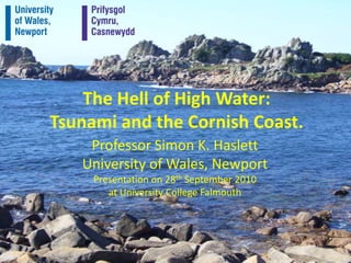
- 1. The Hell of High Water:Tsunami and the Cornish Coast. Professor Simon K. Haslett University of Wales, Newport Presentation on 28th September 2010 at University College Falmouth
- 2. From McGuire (2005, New Scientist)
- 3. From Allen & Haslett (2002)
- 4. Somerset Levels from Brean Down.
- 5. Evidence of the 1607 flood 1 Contemporary historic pamphlets giving the: date (20th Jan 1606 = 30th Jan 1607) timing (“about nine in the morning” in Somerset) details of damage (2000 deaths and great economic loss).
- 6. Burnham 1607 tides (HW at 8.28am)
- 8. Evidence of the 1607 flood 2 Commemorative plaques and inscriptions in/on churches in South Wales and Somerset.
- 9. Tsunami theory for the 1607 flood Some contradictory meteorological reports e.g. “a violent sea wind” (Camden, 1607) vs. “the morning … so fayrely and brightly spred” (Harleian Miscellany, 1607). Descriptions of a “wave” reminiscent of a tsunami rather than a storm e.g. “wave’s furie”. Extract from God’s warning to his people of England
- 10. Extracts from Lamentable Newes out of Monmouthshire Wave velocity Inland Penetration There is an extract from St. Uny’s Church that “a great influx of sand might have happened at Hayle” during the 1607 event.
- 20. 1607 Earthquake hypothesis Prof Michael Disney (Cardiff University) published in The Times(5th Jan 2005): “The sky was blue, the tide was high, there is a second-hand report of an earth tremor felt earlier that morning”. Local seismic activity (earthquakes) in Feb and May 1607.
- 21. GEBCO Bathymetry
- 22. Other British tsunami? 33 other possible UK tsunami-like events 12 recorded in Cornwall!
- 23. 28th September 1014 Accounts suggest that a flood affected Kent, Sussex, Hampshire, Cumbria, and Mount’s Bay in Cornwall, where the Bay was “inundated by a ‘mickleseaflood’ when many towns and people were drowned”. Marazion Marsh
- 24. 28th September 1014 William of Malmesbury in The History of the English Kings (vol. 1) states that “a tidal wave ….. grew to an astonishing size such as the memory of man cannot parallel, so as to submerge villages many miles inland and overwhelm and drown their inhabitants”. the Anglo-Saxon Chronicle states that “on the eve of St. Michael’s Day [28th September], came the great sea-flood, which spread wide over this land, and ran so far up as it never did before, overwhelming many towns, and an innumerable multitude of people”
- 25. 28th September 1014 Baillie (2007) considers this flood to have been a tsunami caused by a comet impact. Ice core data indicates that the highest ammonium spike within the historic period occurs in 1014.
- 26. 28th September 1014 Baillie (2007) cites Chinese astronomy in support of comet (debris?) impact. In Nova Scotia, Micmac legends include reference to possible comet impacts.
- 27. 28th September 1014 Tsunami models show it is possible that a large tsunami would be able to wrap around the British Isles, affecting Cumbria, Cornwall and English Channel. Dr Steven Ward (UCSC) has produced animated impact tsunami models of the Atlantic and around the British Isles. http://www.youtube.com/watch?v=4hQqp2JxBM8
- 29. Documented sites in Southwest Mount’s Bay – arrival of 4 tsunami over 2 hours (<3m high). Stonehouse Creek (Plymouth) – sand sheets deposited. Lamorna Cove – boulders tossed around like pebbles. Big Pool, St. Agnes – sand sheet deposited.
- 31. Lamorna Cove
- 32. Big Pool, St. Agnes
- 33. 19th Century Tsunami 23 May 1842 – after an earthquake felt in the Scillies , several waves <2m high came ashore in Mount’s Bay creating “a very extraordinary commotion of the sea”. 18 August 1892 – after an earthquake felt from South Wales to the Scillies, “there was a rapid rise in the River Fowey as a great tidal wave”.