The document discusses 3D image scan-based reverse engineering and its applications in construction. It provides an overview of trends in 3D scanning technologies, the reverse engineering process from 3D point clouds to BIM, potential benefits and case studies. It also considers factors like precision, density and the automation potential of integrating machine learning for more intelligent and real-time 3D scanning. The research aims to develop methods for automated extraction of construction objects from point clouds to generate infrastructure and building models.
This document provides an overview of building information modeling (BIM). It begins by describing the current state of the architecture, engineering, and construction (AEC) industry as large and complex but fragmented, with many companies using different tools. It then defines BIM as an interoperable database where multiple models from different disciplines can interact. BIM allows for improved coordination, collaboration, and delivery of project information compared to traditional design processes. The document outlines some of the potential benefits and deliverables of using BIM, such as better cost control, fewer changes, and optimization of building performance.
This document discusses integrating geospatial (GIS) data and building information modeling (BIM) to improve land and real estate development projects. It proposes automating land bank records by digitizing parcels with GIS and creating a centralized data warehouse. BIM models would then be built for projects on specific land parcels. This integrated approach could reduce project overruns and cost overruns through improved planning and coordination. The document outlines software, data preparation, and 3D modeling steps needed and argues that combining GIS and BIM can improve project delivery, facility management, and generate cost savings over the lifecycle of a project.
Map Middle East 2009 - Enterprise Mashups in the Cloudsmetalalp
This document discusses enterprise mashups in the cloud. It provides an overview of State Hydraulic Works (DSI) in Turkey and its responsibilities related to water resources management. It then defines mashups and cloud computing, discussing how mashups combine data from multiple sources and how cloud computing provides scalable resources over the internet. The document outlines DSI's vision for using internal mashups and cloud computing, including examples of mashups for flow monitoring stations and energy/dams applications. It demonstrates a mashup prototype created with Google Maps API, ESRI REST API, and other tools, hosted on Google App Engine. It concludes that mashups and cloud computing can make applications easier to build and
The new revolutionary concept of Building Information Modeling (BIM) is a digital representation of physical and functional characteristics of a facility
Should I Adopt a Digital Twin? Memoori was joined by Sebastien Coulon, co-founder of SpinalCom to discuss the OT – IT Convergence challenge of moving from Automated Buildings to Digital Buildings and how Digital Twins support the Real Estate Value Chain.
BIM Contract International Conference 2017Chun Keung Ng
This document provides an overview of a BIM agreement created by HKIUS for design consultancy and subcontracting work. The agreement aims to define the status of the BIM model, roles and responsibilities, and ensure collaboration between project team members. Key aspects covered include defining terms, obligations of team members, the employer's information requirements, the BIM execution plan, information exchange processes, BIM managers' roles, meetings, intellectual property rights, and various schedules. The agreement is intended to facilitate the implementation of BIM on projects and provide a contractual framework for collaboration.
Building information modeling & value to the AEC industry Part 2Stephen Au
BIM Lecture Note (4/6)
Objectives
* The challenges of Building Construction Industry
* To understand how BIM technology improve the building construction industry
* The value of using BIM for the industry
Question
* What are the benefits and limitation in applying BIM technology to the industry?
www.mtech.com.hk
ETDP 2015 D1 Key Note:- Virtualizing Bridges - Ioannis Brilakis, University o...Comit Projects Ltd
COMIT/Fiatech Conference 2015, Hallam, London
Vertical and horizontal infrastructure is comprised of large assets that need sizable budgets to design, construct and operate/maintain them. Cost reductions throughout their lifecycle can generate significant savings to all involved parties. Such reductions can be derived directly through productivity improvements or indirectly through safety and quality control improvements. Creating and maintaining an up-to-date electronic record of these assets in the form of rich Bridge Information Models (BIM) can help generate such improvements. New research is being conducted at the University of Cambridge on inexpensive methods for generating object-oriented infrastructure geometry, detecting and mapping visible defects on the resulting BIM, automatically extracting defect spatial measurements, and sensor and sensor data modelling. The results of these methods are further exploited through their application in design for manufacturing and assembly (DfMA), augmented-reality-enabled mobile inspection, and proactive asset protection from accidental damage. Virtualization methods can produce a reliable digital record of infrastructure and enable owners to reliably protect, monitor and maintain the condition of their asset.
ETDP 2015 D2 Key Note Preparing for a Digital Built Britain - David PhilpComit Projects Ltd
Keynote - Preparing for a Digital Built Britain
David Philp, Director BIM – EMEA at AECOM, Head of BIM, UK BIM Task Group
The Digital Built Britain (DBB) programme will build a digital economy for the construction industry in support of dramatically improving delivery, operations and services provided to citizens building on the standards and savings delivered by the BIM level 2 initiative. This session will explore how the Digital Built Britain strategy will take the next steps in defining advanced standards, creating new commercial models and identifying technologies to transform our approach to social infrastructure development and construction. The session will look at the need for operational data sets and integration of telemetry and IoT within the Built Environment and a shift towards Level 3 BIM. Level 3 will enable the interconnected digital design of different elements in a built environment and will extend BIM into the operation of assets over their lifetimes supporting the accelerated delivery of smart cities, services and grids.
Hendriks Bouw en Ontwikkeling about BIM @ BEM Next colloquiumGijs Derks
The document provides an overview of a colloquium on BIM and its history and future. It discusses the history of BIM dating back to the 1960s and key developments. It profiles major BIM vendors like Autodesk, Nemetschek, Tekla, and Trimble and their acquisitions. The presentation also reviews the history of Hendriks Bouw en Ontwikkeling and their adoption of BIM since 2009. Additional topics covered include BIM workflows, reasons for using BIM, and predictions that BIM will become mainstream with developments in areas like the Internet of Things and big data in the next 5-10 years.
Design and Development of BIM on GIS Interoperability Open Platformslhead1
ecently, Construction data has evolved from CAD to BIM and BIM becomes more important data used in various fields like facility management and 3D GIS construction, so there is an increasing need for developing technologies that can be effectively used in post-construction steps. There are lots of trials to model and service not only geographical terrain and outdoor but also indoor space. From this perspective, establishment of BIM and GIS interoperable method and development of service platform became the most important core technology. On this research, spatial data linkage model has been devised to smoothly implement the interoperability between two different kinds of data - BIM data and GIS data.
The platform basically displays BIM data based on 3D GIS such as WorldWind Java developed by NASA and Google Earth. It is also possible to interactively move in and out the buildings and also to see the outside of the building when a user is inside the building and inside of the building while a user is outside the building. Besides, the platform makes users look up the objects of buildings and properties of objects one by one, floor by floor, by similar properties, or all. Users can also edit the properties of objects and do spatial queries for analysis of the data.
This project is co research project of KICT(Korea Institute of Construction Technology) and Gaia3D and working closely together to develop BIM and GIS Interoperability Open-Platform for the integration of BIM and GIS data since 2012 and have developed the system for smooth operation of big size 3D BIM data and GIS data about plenty of buildings in areas or cities, not just one building. Now, core technologies to integrate BIM into GIS are successfully developed and we will keep improving the system step by step. KICT and Gaia3D together have designed and developed BIM and GIS interoperability open-platform based on the spatial data linkage model. Links between BIM data and GIS data enables efficient and seamless management of indoor and outdoor information at the same time and it also could be used for various services such as real estates and AR (Augmented Reality) services. Gaia3D develops 3D facility management system for Antarctic King Sejong science station to efficiently manage the facilities and publicly promote the station using BIM on GIS system with open source GIS software.
Topic: Streamlining BIM Workflow by Standardising Design Process
Speaker: Desmond Leung
Hong Kong Revit User Group
HKIBIM-CIC BIM Academic Papers Presentation and Showcase 2015
Date: 12-Dec-2015 (Sat)
Time: 1:30 p.m. to 4:30 p.m.
Venue: LT-02, IVE (Morrison Hill), 6 Oi Kwan Road. Wan Chai, Hong Kong
Organizer: The Hong Kong Institute of Building Information Modelling (HKIBIM)
Sponsor: Construction Industry Council (CIC)
Co-organizer:
Department of Land Surveying and Geo-Informatics, The Hong Kong Polytechnic University (PolyU)
Department of Civil and Environmental Engineering, The Hong Kong University of Science and Technology (HKUST)
Hong Kong Institute of Vocational Education (IVE)
Hong Kong Revit User Group (HKRUG)
Event Secretary:
Engineering Discipline In-service Training Office, Vocational Training Council (EDiTO)
ETDP 2015 D2 Mars Rover Image Based Localization Using 3D Point Cloud Models ...Comit Projects Ltd
Mars Rover Image-based Localization using 3D Point Cloud Models for Mobile Field Reporting Applications
Mani Golpavar-Fard, Assistant Professor, University of Illinois and Rayan Jreije, Manager 3D Software Development, CCC
The method which is marker-less and infrastructure-independent, leverages simple digital images taken on a commodity smartphone or a tablet, identifies the location and orientation of the user in 3D, and provides access to project information and Building Information Model (BIM) without the need for storing any of the project information (including BIM) on the mobile device
The document discusses openBIM, which uses open standards like Industry Foundation Classes (IFC) to enable real interoperability between different software applications. OpenBIM allows participants in a building project to use their preferred tools to access and share relevant BIM data. It also facilitates practical collaboration where models, designs, and analyses can progress in parallel. The document then provides an example case study of how an openBIM workflow was implemented for a commercial office building project.
ETDP 2015 D1 Smart City Concept at Sellafield - John Robison, Sellafield LtdComit Projects Ltd
COMIT/Fiatech Conference 2015, Hallam, London
John Robison, Capability Lead, Sellafield Ltd
Smart city Concept at Sellafield
• What is the Sellafield city and how does it compare to a smart city.
• How Smart are Nuclear sites and other industries.
• What can cities learn from Industry?
• BIM, hindrance or help
This document discusses a project using camera drones to monitor construction and operation of capital projects. It describes how current practices for data collection are time consuming and labor intensive. The project aims to develop guidelines for implementing and safely operating drones equipped with cameras and sensors to accurately collect timely data for as-built documentation, progress monitoring, quality control, and safety monitoring. The execution plan has two phases: phase 1 creates guidelines and recommendations for data collection and analytics, and phase 2 develops standards and metrics for measuring performance of data collection and analytics solutions. The project is currently recruiting additional members.
The document outlines 10 key points about building information modeling (BIM):
1. BIM is a process, not just a technology, that is applied throughout construction from design to facilities management.
2. BIM uses various technology platforms to enable aspects like architectural modeling.
3. BIM has different implementation levels from 2D CAD to full integration of data through web services.
BIM results in significant benefits like reduced costs, improved quality, and better predictability for construction projects.
Building Information Modeling (BIM) is a powerful tool for visualizing and virtually constructing in 3D. It is also a database where the information and process for adding data is equally powerful, giving owners and operators the ability to integrate BIM into Facility Management (FM) software and use the model to manage the facility over the building's lifecycle. Learn about Building Information Models and how BIM reinforces collaboration and helps project teams deliver better products and services.
0006-EUBIM-MGT-05-ARCADIS BIM White paper (English)Bram Mommers
1) BIM is defined as the processes and collaborative behaviors associated with creating and sharing object-oriented databases of an asset from its initial design through construction and eventual operation.
2) BIM provides significant advantages over traditional paper-based methods by enabling information sharing between project teams, improved coordination to reduce errors, and dynamic updates that reflect changes across the project documentation.
3) Examples of Arcadis projects demonstrate benefits of BIM including more efficient design processes, reduced project timelines through clashed detection and automatic updates, and improved collaboration between project stakeholders.
Digital construction for integrated project deliveryStephen Au
The industrial challenges and the value proposition, how and what are the Digital Construction with some case studies are discussed in the presentation.
Steven Eglinton is a BIM and digital transformation consultant who gave a presentation on smart BIM and the launch of C2O UK. He discussed what BIM is, key concepts like BIM Level 2, BIM technology, whole-life asset management, and challenges around integrating data across systems, formats, organizations, and disciplines. Eglinton emphasized that digital tools can help unlock asset data for its whole lifecycle, but common standards, language, and views are needed to add value through knowledge, intelligence, and insight.
The future of BIM is open - or - Is proprietary BIM unsustainableBe2camp Admin
The document discusses the future of building information modeling (BIM) being open rather than closed or proprietary. It notes that open, documented, and free formats like SQL and XML may be better communication formats for BIM going forward, rather than closed commercial options like Revit or ArchiCAD. The future of BIM is seen as being open like the internet, with open standards allowing building data to be used more flexibly across different analysis and design programs from multiple developers.
Creating Smart Buildings through Digital TwinsMemoori
Memoori Talks to Steve Nguyen, VP of Product and Marketing at BuildingIQ and Harry Sim, CEO of Cypress Envirosystems. We discuss how together they are working to equip older buildings with AI-driven solutions to provide greater system insight and control, leading to improvements in tenant comfort and energy efficiency. On average, their collaboration enables older buildings to reduce electrical energy usage by 30%.
Fiona Moore, Cirrus Consultant Services
What does a client have to do if they want to benefit from BIM, especially if they don’t have internal BIM expertise. Suppliers are invited to attend too, to better understanding BIM from a client’s perspective.
Covering:
Why. What problems might a client be trying to solve? Procurement time and costs, life-cycle costs, quality assured information
What. What should the Client ask for ask for – Information: Models, Documents and/or Data – Organisational Information Requirements (OIR) into Asset Information Requirements (AIR) – PAS1192-3
How. How to ask for what you want and how to make sure you get it. Employers Information Requirements (EIR) and information exchanges – PAS1192-2.
In this presentation, a quick but comprehensive introduction to Building Information Modeling (BIM) is provided, aiming at showing the benefits of BIM for all the actors of a construction project.
What does BIM mean for Civil Engineers?Chun Keung Ng
BIM is a norm for the building industry. How about for infrastructures? Some countries are over confident on the implementation of BIM in both building and civil engineering industries. Is the BIM technology for infrastructures mature and easily available? Are the professionals ready for BIM?
This document discusses BIM-GIS integration standards and technologies. It provides an overview of a BIM-GIS integration project conducted from 2013-2016 that developed integrated operation technologies based on a BIM/GIS interoperability platform. The project developed applications, an interoperability platform, standard file formats, and conducted various validations and improvements. It discusses key issues in mapping between BIM and GIS standards and provides examples of element and LOD mapping approaches defined in ISO 19166.
This document discusses how Building Information Modeling (BIM) and Building Information Management (BIM) can be applied throughout the entire lifecycle of a building or asset from design through operation and maintenance. It outlines how a platform called EcoDomus provides lifecycle BIM capabilities by integrating various data sources like BIM models, CMMS, CAFM, and BAS systems. The document also discusses challenges with traditional handover of information from contractors to facility managers and how EcoDomus helps address issues like defining required data, responsibilities, and processes to ensure high quality data handover.
SBF(Scan-BIM-Field) 기반 스마트 시설물 관리 기술 개발Tae wook kang
This document discusses a SBF (Scan-BIM-Field) technology for effective facility management of infrastructure. SBF integrates 3D scanning, building information modeling (BIM), and field data from sensors to create a digital twin for infrastructure facilities. The document presents a maturity model for facility management with five levels from manual to smart/intelligent FM. It analyzes barriers and strategies to advance SBF technology, including developing standards, technologies for digital transformation and linking scan data, BIM, and Internet of Things field data.
도시 인프라 공간정보 데이터 커넥션-통합 기술 표준화를 위한 ISO TC211 19166 개발 이야기 Tae wook kang
The document discusses the development of a conceptual mapping standard (ISO/TC211 19166) for linking building information models (BIM) to geospatial information models (GIS). It proposes a framework with three parts: (1) BIM to GIS element mapping, (2) BIM to GIS perspective definition, and (3) BIM to GIS LOD mapping. The framework is driven by use cases and allows standardized rule sets to integrate BIM and GIS data. The standard focuses on requirement definition and reuses existing physical data models like IFC and CityGML.
From BIM to iBIM
Dr. Jack CHENG Associate Professor Department of Civil and Environmental Engineering, The Hong Kong University of Science and Technology
HKIBIM Annual Conference 2017
Theme: Transforming BIM to Action
Date: 22-Nov-2017 (Wed)
Time: 9:00 a.m. – 4:30 p.m.
Venue: Grand Ballroom I-III, Level 6, Royal Plaza Hotel, Hong Kong
Organizers:
The Hong Kong Institute of Building Information Modelling (HKIBIM)
http://www.hkibim.org
HKIBIM Annual Conference 2017 is the 8th Annual Conference organized by the Hong Kong Institute of Building Information Modelling (HKIBIM). It is the premier annual event for experienced professionals to demonstrate the practical use of Building Information Modelling (BIM) processes using real cases. The speakers are encouraged to illustrate lessons learned in practical projects so that more professionals from different disciplines can improve their productivity through efficient use of BIM and advance practical knowledge. This is an exciting opportunity to share your knowledge and experience with the larger BIM community.
The document discusses future technologies for the Korean construction industry, including smart construction, digital transformation, automation, and facility management technologies enabled by BIM, IoT, AI, and other technologies. It outlines issues facing the construction industry and proposes strategies and a roadmap to address these issues through increased digitalization, development of core technologies like AICBM, support for startups, establishing standards and platforms, and developing policies to support an ecosystem for construction technology.
IBM BIM and Maximo: Values for Owners and OperatorsFMMUG
Speakers: Kawan Park and Derek Fu, IBM
Overview: With rapid worldwide BIM (Building Information Modelling) adoption, more owners and operators are taking advantage of the BIM data in operation and maintenance cycle of their assets. This session will cover an overview of how Maximo leverages BIM to create additional values for the owners and operators.
This document provides a short history of building information modeling (BIM) and discusses key developments in the evolution of BIM tools and standards. It notes that BIM evolved from 3D modeling software used in entertainment and other industries in the 1980s-1990s. In the 2000s, BIM began to be used for building design and construction through the development of industry standards like IFC that enabled data exchange between software applications. Several countries and organizations, like Finland, the US GSA, and Skanska, emerged as early adopters of BIM through pilot projects in the 2000s. The document outlines some of the benefits and uses of BIM, such as visualization, analysis, cost estimation, and productivity improvements.
HKIBIM BIM Networking Seminar: Guest Speaker Igor Starkov from EcoDomus on 12 March 2016 at Studio 302, 3/F, IVE (Morrison Hill).
, 6 Oi Kwan Road, Wan Chai, Hong Kong.
This HKIBIM networking Seminar provides the opportunity for all attendees to interact with the speaker and the local BIM community
Guest Speaker: Mr. Igor Starkov - Co-founder and President of EcoDomus Inc.
Mr. Igor Starkov President EcoDomus, Inc.
Mr. Starkov is a computer scientist and entrepreneur with over 25 years of experience in software development, including 14 years of experience leveraging technology to improve construction project delivery and management of the built environment.
Mr. Starkov’s experience in the AEC, IT, and Facilities Management arenas and his in-depth knowledge of BIM, COBie, and Lean workflows provide him with the unique capability of creating versatile information-enabled solutions.
Mr. Starkov co-founded EcoDomus in 2008, and made the company the leading provider of Lifecycle BIM solutions. EcoDomus is working with the clients around the world, including Google, Disney, US Government (GSA), Fedearl Aviation Administration (US), University of Southern California, Singapore's Ministry of Health (MOHH), NTT Facilities (Japan), and many others.
Seminar title:
EcoDomus recent Use Cases in US and Middle East:
The previous presentation done by Igor Starkov at HKIBIM in 2014 was focused on the handover of COBie and BIM to facility owners. This year’s presentation will demonstrate BIM for FM use cases developed by EcoDomus for the leading facility owners in the world, such as Stanford University, Sydney Opera House, Google, etc. and will address the concepts of Central Facility Repository and Common Data Environment.
Case Study about BIM on GIS platform development project with the standard modelTae wook kang
To realize BIM on GIS technology for productivity of AEC industry, we should have some questions like these.
Questions
• What is the benefit from the fusion
between BIM and GIS as the viewpoint of
the public sector
• What do we should do first?
• What is the barrier to realize it?
• How to develop it?
Research and try to
• find the useful use-cases
• define the technology and the organization
including people etc
• survey the issues and define the considerations
• collaborate and research it with the institutes and
the industries
- 2013.5
Building Information Modeling (BIM) & Industry Foundation Classes (IFC)metalalp
The document discusses Building Information Modeling (BIM) and Industry Foundation Classes (IFC). It defines BIM as a process for generating and managing building data throughout its lifecycle using 3D modeling software. IFC is described as an open standard developed to facilitate interoperability between BIM software applications. Examples are given of how IFC represents building elements and projects using it around the world. In conclusion, the document states that while BIM and IFC are emerging technologies, IFC has become a de facto standard for exchanging building data internationally.
What we've done so far with mago3D, an open source based 'Digital Twin' platf...SANGHEE SHIN
mago3D = {Indoor, Outdoor} + {Overground, Underground} + {Objects, Phenomena} + {Static, Dynamic}
It would be awesome if you can have a virtual replica of real world that you can play with and do the simulation to see what would happen. That is 'Digital Twin', the ultimate goal of mago3D!
At the FOSS4G NA 2019, I talked about the recent achievements and improvements of mago3D project, an open source based 'Digital Twin' platform. mago3D(http://mago3d.com) is relatively new project that was first released in July 2017. The ultimate goal of mago3D project is developing an open source based digital twin platform that can replicate and simulate the real world objects, processes, and phenomena on web environment. mago3D is on its way to achieve this goal now. Currently mago3D more focuses on managing and visualization of various types of 3D data ranging from simple box style extrusion model, point clouds, realistic mesh, to complex BIM(Building Information Modeling), AEC(Architecture, Engineering, Construction) data. mago3D supports industry standards 3D formats such as IFC, CityGML, IndoorGML, 3DS, Collada DAE, OBJ, LAS, JT, and so on. mago3D has been used in various industry sectors including ship building, urban management, indoor data management, and national defense. In this talk I showcased several real projects that had employed the mago3D and talked about what I'd learned during this projects. I also talked more about the future plan of mago3D towards visualizing/simulating of {static and dynamic data}, {underground and overground features}, {indoor and outdoor spaces}, {objects and phenomena} at the same time on web browser.
As a tech-savvy country, there're lots of discussions and activities around digital twin in Korea. I also shared my real experiences on this in this talk.
Introduction of super map gis 10i bitcc technology jaysonGeoMedeelel
SuperMap GIS 10i is SuperMap's latest GIS software release. It features cloud native GIS, cross-platform GIS, new 3D GIS capabilities, big data GIS, and AI GIS technologies. SuperMap has over 4,000 employees and 700 partners worldwide, with annual revenues growing from $72.9 million in 2015 to $221 million in 2018.
Introduction to mago3D, an Open Source Based Digital Twin PlatformSANGHEE SHIN
This talk was given at the Busan Eco Delta City(Korea National Pilot Smart City) technical workshop held on 18th July. I talked about introduction and history of mago3D, some core technologies, real cases, and lessons learnt in this workshop.
This document proposes a methodology for implementing BIM concepts for existing federal facilities to improve facility management. The methodology involves 4 steps: 1) Diagramming existing data flows, 2) Designing a web portal interface, 3) Developing an integration hub to connect different systems, and 4) Developing a BIM application. The goal is to integrate facility information from various systems into a shared knowledge resource without replacing existing systems.
오픈소스로 쉽게 따라해보는 Unreal과 IoT 연계 및 개발 방법 소개.pdfTae wook kang
이 소품은 메타버스 구현이란 제목으로 출판하려했던 내용 중 일부입니다. 2021년에 시작했었는 데, 함께 하기로 한 분들이 너무 바쁜 상황이라, 거의 2년 이상 묵혀둔 내용이 되어 버렸습니다.
이 내용을 필요한 분들도 있을 듯하여 eBook으로 정리해 공유합니다. 일부 URL은 너무 오래되어, 최대한 확인해 갱신하였습니다. 이 책은 메타버스나 디지털트윈을 언리얼과 같은 게임엔진으로 개발할 때, IoT와 어떻게 연결해야 하는 지에 대한 기본적인 방법을 다루고 있습니다. 이런 목적에서 내용은 복잡한 부분은 최대한 제거하고, 목적에만 충실히 구현하였습니다.
참고로, 여기에 사용된 언리얼 버전은 Unreal 4입니다(설치 링크 - https://unreal-engine.en.uptodown.com/windows). 그럼에도 이 글에서 사용된 기술은 계속 유지관리되고 있으니 활용 가능하시리라 생각합니다.
언리얼 게임엔진 기반 외부 센서 연결 및 데이터 교환 방법
아두이노 사용방법
간단한 Node.js 서버 개발
IoT 기반 디지털 트윈 및 메타버스 구현
오픈소스 및 하드웨어 사용법
사례 소개
이 소품에 설명된 코드는 아래 링크에서 다운로드 받을 수 있습니다.
링크 - https://github.com/mac999/UnrealSensingCube
몇몇 개발 화면 캡쳐 이미지 화질이 나쁘나 소스를 참고해 보시면 도움이 되실 겁니다.
The document provides instructions on setting up development environments for data analysis and visualization with Python and Node.js. It discusses installing essential packages like NumPy, SciPy, and Pandas for Python, and Express and Three.js for Node.js. It also provides examples of basic data analysis and visualization techniques using Matplotlib and Plotly in Python, and Three.js in a Node.js application.
이 책은 BIM 표준과 구현이란 제목으로 출판하려했던 내용 중 일부입니다. 2013 년에 시작했었는 데, 함께 하기로 한 분들이 너무 바쁜 상황이라, 거의 8 년 이상 묵혀둔 내용이 되어 버렸습니다.
지금은 미국에서 책을 정리할 시간적 여유도 약간 생겼고, 이 내용을 필요한 분들도 있을 듯하여 eBook으로 정리해 공유합니다. 일부 URL은 너무 오래되어, 최대한 확인해 갱신하였습니다. 이 책의 내용은 제가 예전에 관심을 두고 직접 연구 및 개발했던 부분입니다.
이 책은 BIM 개발과 관련된 아래 내용을 주로 다루고 있으니 참고하시길 바랍니다. 아직도 이 글에서 사용된 기술은 계속 유지관리되고 있으니 활용 가능하시리라 생각합니다.
개방형 BIM 모델에 대한 구조 해석
오픈소스 이용하는 방법
BIM 정보추출, 협업, 가시화 개발 절차 및 방법
BIM 지식 서비스 개발
This document proposes a conceptual framework for the ISO 19166 B2GM standard, which defines a conceptual mapping process between building information models (BIM) and geospatial information models (GIS). The framework focuses on defining mapping requirements through three parts: element mapping, level-of-detail mapping, and perspective definition. It is intended to standardize the conceptual mapping process in a use-case driven manner without requiring full physical data integration. The framework is designed to reuse concepts from existing BIM, GIS, and related standards to avoid reinventing concepts.
인공지능 기반 미디어아트 최신 기술, 동향 및 사례를 공유합니다. 특히, 딥러닝을 이용한 예술과 관련된 기술을 확인하고, 관련 작품들을 살펴보겠습니다. 이 세미나는 한전아트센터에서 진행하는 2019년 오픈 미디어아트 전시 세미나(2월 10일 오후 2시)의 하나로 기획되었습니다.
전시 링크 - https://vmspace.com/news/news_view.html?base_seq=NDM5
ISO 19166 BIM to GIS conceptual mapping China (WUHAN) meetingTae wook kang
This document discusses the development of ISO 19166, which provides a conceptual mapping standard for linking building information models (BIM) to geospatial information models. It proposes a conceptual framework that defines requirements for BIM to geospatial (B2GM) element mapping, level of detail (LOD) mapping, and perspective definition to extract necessary data based on use cases. The framework is driven by use cases and produces ruleset definitions and mapping scenarios without requiring a fully integrated physical data model. Comments on the committee draft raise issues regarding dependencies on CityGML LODs and consideration of bi-directional mapping.
This document discusses construction startups and open source technology. It covers topics like Industry 4.0 with open source, open source movements, open source service markets, open source licenses, autonomous vehicles, deep learning, IoT, drones, 3D printing, cloud platforms, smart cities, BIM, VR/AR, robotics, blockchains, open data, and construction startups using open source technologies. The document provides references on these topics as well.
이 글은 블록체인과 건설 분야 유스케이스에 대해 간략히 요약한 자료입니다. 기존 4차 산업혁명과 건설의 관계에 대한 발표 내용을 바탕으로 블록체인 부분만 요약하였습니다.
블록체인 개념, 주요 구성요소, 암호화, 해쉬, 건설 분야 적용 사례 등을 언급하고 있습니다. 스마트시티, BIM, COBie, IoT 등 서비스 토큰, 스마트 건설 계약 및 컨텐츠 형상 무결성 보장 등에 적용 시도되고 있는 상황입니다. 다만, 아직 정책적 기술적인 안전성은 아직 이슈가 있습니다.
이 슬라이드는 4차산업혁명과 건설, 그리고 블록체인에 대한 내용입니다. 건설 관점에서 이런 기술들이 어떻게 서로 엮이고, 새로운 가치를 만들어내는 지를 확인해 봅니다. 블록체인은 스마트 계약의 기반이되며, 다양한 서비스 토큰을 통해, 스마트 건설의 부가가치를 담아 이해당사자들 사이를 전달할 것입니다.
건설 관점에서 블록체인을 이용하기 위해, 블록체인의 기본 개념부터 스마트계약, 토큰 및 ICO를 개발하는 방법을 설명합니다. 아울러, 비트코인과 같은 블록체인의 실행 메커니즘을 구체적으로 다루고 있습니다. 이 자료에 포함된 링크를 통해 좀더 상세한 내용을 확인할 수 있습니다.
메이커 시티가 무엇인지, 어떤 배경에서 진행되고 있는 지에 대해 설명합니다. 메이커 시티의 바탕이 되는 메이커 운동 참여를 통한 경험을 나눔하고, 이를 통해, 국내 메이커 생태계가 발전하려면 어떤 문제를 해결해야 할 지를 질문합니다. 마지막으로 메이커가 되는 작은 방법을 나눔합니다.
This document introduces Tae Wook Kang, a senior researcher at KICT whose interests include BIM, GIS, interoperability, and related fields. It provides an overview of GIS, describing its uses in applications like crime mapping, landscape analysis, civil engineering, and more. It also discusses the relationships between GIS and urban design, covering topics like data collection and management, spatial queries, tools like QGIS and ArcGIS, and coordinate systems.
Smart City Trend and Technology.
포럼에서 이슈가 되고 있는 스마트 시티 해외 시장, 기술, 표준 동향 및 시사점에 대해 15분 발표 정리한 내용입니다.
스마트 시티 프레임웍, KPI, 상호운용성과 표준에 초점을 맞춰 정리하였습니다. 동향은 시장, 표준을 중심으로, 기술은 오픈소스, 오픈데이터, 상호운용을 중심으로 정리하였습니다.
좀 더 상세한 내용은 https://sites.google.com/site/bimprinciple/in-the-news 에서 스마트 시티 관련 주제로 정리되어 있습니다.
This study Examines the Effectiveness of Talent Procurement through the Imple...DharmaBanothu
In the world with high technology and fast
forward mindset recruiters are walking/showing interest
towards E-Recruitment. Present most of the HRs of
many companies are choosing E-Recruitment as the best
choice for recruitment. E-Recruitment is being done
through many online platforms like Linkedin, Naukri,
Instagram , Facebook etc. Now with high technology E-
Recruitment has gone through next level by using
Artificial Intelligence too.
Key Words : Talent Management, Talent Acquisition , E-
Recruitment , Artificial Intelligence Introduction
Effectiveness of Talent Acquisition through E-
Recruitment in this topic we will discuss about 4important
and interlinked topics which are
Tools & Techniques for Commissioning and Maintaining PV Systems W-Animations ...Transcat
Join us for this solutions-based webinar on the tools and techniques for commissioning and maintaining PV Systems. In this session, we'll review the process of building and maintaining a solar array, starting with installation and commissioning, then reviewing operations and maintenance of the system. This course will review insulation resistance testing, I-V curve testing, earth-bond continuity, ground resistance testing, performance tests, visual inspections, ground and arc fault testing procedures, and power quality analysis.
Fluke Solar Application Specialist Will White is presenting on this engaging topic:
Will has worked in the renewable energy industry since 2005, first as an installer for a small east coast solar integrator before adding sales, design, and project management to his skillset. In 2022, Will joined Fluke as a solar application specialist, where he supports their renewable energy testing equipment like IV-curve tracers, electrical meters, and thermal imaging cameras. Experienced in wind power, solar thermal, energy storage, and all scales of PV, Will has primarily focused on residential and small commercial systems. He is passionate about implementing high-quality, code-compliant installation techniques.
Levelised Cost of Hydrogen (LCOH) Calculator ManualMassimo Talia
The aim of this manual is to explain the
methodology behind the Levelized Cost of
Hydrogen (LCOH) calculator. Moreover, this
manual also demonstrates how the calculator
can be used for estimating the expenses associated with hydrogen production in Europe
using low-temperature electrolysis considering different sources of electricity
A high-Speed Communication System is based on the Design of a Bi-NoC Router, ...DharmaBanothu
The Network on Chip (NoC) has emerged as an effective
solution for intercommunication infrastructure within System on
Chip (SoC) designs, overcoming the limitations of traditional
methods that face significant bottlenecks. However, the complexity
of NoC design presents numerous challenges related to
performance metrics such as scalability, latency, power
consumption, and signal integrity. This project addresses the
issues within the router's memory unit and proposes an enhanced
memory structure. To achieve efficient data transfer, FIFO buffers
are implemented in distributed RAM and virtual channels for
FPGA-based NoC. The project introduces advanced FIFO-based
memory units within the NoC router, assessing their performance
in a Bi-directional NoC (Bi-NoC) configuration. The primary
objective is to reduce the router's workload while enhancing the
FIFO internal structure. To further improve data transfer speed,
a Bi-NoC with a self-configurable intercommunication channel is
suggested. Simulation and synthesis results demonstrate
guaranteed throughput, predictable latency, and equitable
network access, showing significant improvement over previous
designs
Digital Twins Computer Networking Paper Presentation.pptxaryanpankaj78
A Digital Twin in computer networking is a virtual representation of a physical network, used to simulate, analyze, and optimize network performance and reliability. It leverages real-time data to enhance network management, predict issues, and improve decision-making processes.
Accident detection system project report.pdfKamal Acharya
The Rapid growth of technology and infrastructure has made our lives easier. The
advent of technology has also increased the traffic hazards and the road accidents take place
frequently which causes huge loss of life and property because of the poor emergency facilities.
Many lives could have been saved if emergency service could get accident information and
reach in time. Our project will provide an optimum solution to this draw back. A piezo electric
sensor can be used as a crash or rollover detector of the vehicle during and after a crash. With
signals from a piezo electric sensor, a severe accident can be recognized. According to this
project when a vehicle meets with an accident immediately piezo electric sensor will detect the
signal or if a car rolls over. Then with the help of GSM module and GPS module, the location
will be sent to the emergency contact. Then after conforming the location necessary action will
be taken. If the person meets with a small accident or if there is no serious threat to anyone’s
life, then the alert message can be terminated by the driver by a switch provided in order to
avoid wasting the valuable time of the medical rescue team.
Impartiality as per ISO /IEC 17025:2017 StandardMuhammadJazib15
This document provides basic guidelines for imparitallity requirement of ISO 17025. It defines in detial how it is met and wiudhwdih jdhsjdhwudjwkdbjwkdddddddddddkkkkkkkkkkkkkkkkkkkkkkkwwwwwwwwwwwwwwwwwwwwwwwwwwwwwwwwwwwwwwwwwwwwwwwwwwwwwwwwwwwwwwwwwwwwwwwwwwwwwwwwwwwwwwwwwwwwwwwwwwwwwwwwwwwwwwwwwwwwwwwwwwwwwwwwwwwwwwwwwwwwwwwwwwwwwwwwwioiiiiiiiiiiiii uwwwwwwwwwwwwwwwwhe wiqqqqqqqqqqqqqqqqqqqqqqqqqqqqqqqqqqqqqqqqqqqqqqqqqqqqqqqqqqqqqqqqqqqqqqqqqqqqqqqqqqqqqqqqqqqqqqqqqqqqqqqqqqqqqqqqqqqqqqqqqqqqqqqqqqqqqqqqqqqqqqqqqqqqqqqqqqqqqqqqqqqqqqqqqqqqqqqqqqqqqqqqqqqqqqqqqqq gbbbbbbbbbbbbb owdjjjjjjjjjjjjjjjjjjjj widhi owqqqqqqqqqqqqqqqqqqqqqqqqqqqqqqqqqq uwdhhhhhhhhhhhhhhhhhhhhhhhhhhhhhhhhhhhhhhhhhhhhhhhhhhhhhhhhhhhhhhhhhhhhhhhhhhhhhhhhhhhhhhhhhhhhhhhhhhhhhhhhhhhhhhhhhhhhhhhhhhhhhhhhhhhhhhhhhhhhhhhhhhhhhhhhhhhhhhhhhhhhhhwqiiiiiiiiiiiiiiiiiiiiiiiiiiiiw0pooooojjjjjjjjjjjjjjjjjjjjjjjjjjjjjjjjjjjjjjjjjjjjjjjjjjjjjj whhhhhhhhhhh wheeeeeeee wihieiiiiii wihe
e qqqqqqqqqqeuwiiiiiiiiiiiiiiiiiiiiiiiiiiiiiiiiiiiiiiiiiiiiiiiiiiiiiiiiiiiiiiiiiiiiiiiiiiiiiiiiiiiiiiiiiiiiiiiiiiiiiiiiiiiiiiiiiiiiiiiiiiiiiiiiiiiiiiiiiiiiiiiiiiiiiiiiiiiiiiiiiiiiiiiiiiiiiiiiiiiiiiiiiiiiiiiiiiiiiiiiiiiiiiiiiiiiiiiiiiiiiiiiiiiiiiiiiiiiiiiiiiiiiiiiiiiiiiiiiiiiiiiiiiiiiiiiiiiiiiiiiiiiiiiiiiiiiiiiiiiiiiiiiiiiiiiiiqw dddddddddd cccccccccccccccv s w c r
cdf cb bicbsad ishd d qwkbdwiur e wetwwwwwwwwwwwwwwwwwwwwwwwwwwwwwwwwwwwwwwwwwwwwwwwwwwwwwwwwwwwwwwwwwwwwww w
dddddddddddddddddddddddddddddddddddddddddddddddddddddddddddddddddddddddddddddddddddddddddddddddddddddddddddfffffffffffffffffffffffffffffffffffffffffffffffffffffffffffffffffffffffffffffffffffffffffffffffffffffffffffffffffffffffffffffffffffffffffffffffffffffffffffffffffffffffffffffffffffffffffffffffffffffffffffffffffffffw
uuuuhhhhhhhhhhhhhhhhhhhhhhhhe qiiiiiiiiiiiiiiiiiiiiiiiiiiiiiiiiiiiiiiiiiiiiiiiiiiiiiiiiiiiiiii iqqqqqqqqqqqqqqqqqqqqqqqqqqqqqqqqqqqqqqqqqqqqqqqqqqqqqqqqqqqqqqqqqqqqqqqqqqqqqqqqqqqqqqqqqqqqqqqqqqqqqqqqqqqqqqqqqqqqqqqqqqqqqqqqqqqqq eeeeeeeeeeeeeeeeeeeeeeeeeeeeeeeeeeeeeeeeeeeeeeeeeeeeeeeeeeeeeeeeeeeeeeeeeeeeeeeeeeeeeeeeeeeeeeeeee qqqqqqqqqqqqqqqqqqqqqqqqqqqqqqqqqqqqqqqqqqqqqqqqqqqqqqqqqqqqqqqqqqqqqqqqqqqqqqqqqqqqqqqqqqqqqqqqqqqqqqqqqqqqqqccccccccccccccccccccccccccccccccccccccccccccccccccccccccccccc ccccccccccccccccccccccccccccccccccc bbbbbbbbbbbbbbbbbbbbbbbbbbbbbbbbbbbbbbbbbbbbbbbbbbbbbbbbbbbbbbbbbbbbbbbbbbbbbbbbu uuuuuuuuuuuuuuuuuuuuuuuuuuuuuuuuuuuuuuuuuuuuuuuuuuuuuuuuuuuuuuuuuuuuuuuuuuuuuuuuuuuuuuuuuuuuuuuuuuuuuuuuuuuuuuuuuuuuuuuuuuuuuuuuuuuuuuuuuuuuuuuuuuuuuuuuuum
m
m mmmmmmmmmmmmmmmmmmmmmmmmmmmmmmmmmmmmmmmmmmmmmmmmmmmmmmmmmmmmmmmmmmmmmmmmmmmmmmmmmmmmmmmmmmmm m i
g i dijsd sjdnsjd ndjajsdnnsa adjdnawddddddddddddd uw
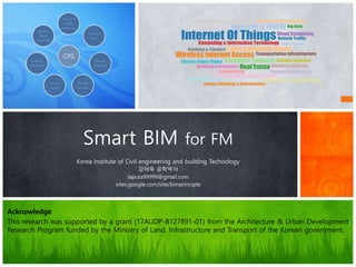
1. Acknowledge
This research was supported by a grant (17AUDP-B127891-01) from the Architecture & Urban Development
Research Program funded by the Ministry of Land, Infrastructure and Transport of the Korean government.
Korea Institute of Civil engineering and building Technology
강태욱 공학박사
laputa99999@gmail.com
sites.google.com/site/bimprinciple
Smart BIM for FM
4. BIM Role in digital transformation
FM-CPS
CPS
Structural
health
monitoring
Track and
trace
Remote
diagnosis
Remote
services
Remote
control
Condition
monitoring
Systems
health
monitoring
BIM
as i-DB
IoT…
AI
Sensor device
ICBM
MRFM
Scan-Vision
5. Smart BIM
BIM
Big data
Processing Data
Mining / Analysis
Smart FM
Dashboard
IoT Big Data processing considering reliability
KPI matrix data ming / analysis
IoT / BAS nodes
PCI Operation
Effectiveness Maximization
KPI management using dashboard
f(x)
bxayxf :)(
Association
analysis
Basic statistics
analysis
Prediction
Analysis
…
Effective decision making support
In the future, when PCI will be over
the criteria?
Expected energy usage in next year?
KICT
8. IoT-BIM connection
BIM
W1
D2
F3
R4
Geo-information
W1
= {LOD1, LOD2, LOD3, LOD4}
D2
= {LOD1, LOD2, LOD3, LOD4}
F3
= {LOD1, LOD2, LOD3, LOD4}
R4
= {LOD1, LOD2, LOD3, LOD4}
B2G LM
B2G EM
IoT
+External
Data Set
• In example, W1 = Wall#1, D2 = Door#2, F3 = Floor#3, R4 = Roof#4.
• External Data Set – External data set related to the specific use-cases such as the facility
management
E1
E2
E3
E4
B2G PDElement Mapping
LOD Mapping
Property Mapping
from External Data
Set using PD
ISO N19166 - B2GM Data Mapping Flow
Data
= {Maker,
Code, Serial
No, Date,
Manual Links,
Drawing
Links,
Historical
Record…}
Object =
Geometry + Data
1
2
3
KICT
12. 3D data set for deep learning
KICT
ShapeNet Part (Princeton, Stanford, TTIC)
51,300 unique 3D models
CIFAR (Alex Krizhevsky, Vinod Nair, and Geoffrey Hinton)
60,000
10 classes
ImageNet (Fei-Fei Li)
Matterport 3D
90 buildings
194,400 RGB+D
10,800 3D (RGB+D)
13. AI Machine Learning (ML) for space scan
VoxNet: A 3D Convolutional Neural Network for real-time object recognition
PointNet: Deep Learning on Point Sets for 3D Classification and Segmentation, 2017
14. GeoIoT-BIM connection
f(x)
bxayxf :)(
SELECT * FROM Alignment, Building WHERE
Buffer(Alignment, Building, ‘1km’) AND
Building.Pset(‘FM’).PCI < ‘50%’
ORDERBY Building.Pset(‘FM’).PCI
BIMGIS
SELECT * FROM Building, Pipe WHERE Overlap(Pipe, Building, ‘1m’)
AND Building.Pset(‘FM’).Owner = ‘LH’ …
Fig. IFC (http://www.iai-tech.org/)
IfcProject – Activity to make product
IfcProcess – Process and activity in project
IfcResource – Used resource object definition in process
IfcActor – Human resource definition in process
IfcProduct – Physical representation object
IfcControl – Control object
IfcGroup – Object set
Kernel
3개기본 확장 패키지
5개AEC/FM공통 패키지
AEC/FM도메인별9개의패키지
26개의 리소스패키지
IFC2x3
Building
Oriented
Format
IFC4
GIS CRS
NURBS
…
but
Heavy
Complex
Ambiguous
•Developed by OGC
•Open 3D urban object model for interoperability(ISO TC211)
•Shape, material, feature information support
•Focusing city Infrastructure object model
•Model abstraction support(LOD)Version 2.0
CityGML
GIS Oriented
Format
LOD
Features
But
Detailed
Building
Information?
Parameter set
Civil engineering
object
Detailed object
information
related to civil
engineering
ex- superelevation
LandXML
Civil
Engineering
Oriented
Format
But
Detailed
Building
Information?
GIS Topology
Element?
GIS BIM
외부
이기종
데이터
External
Dataset
I-DB
도시
시설물
사용자
KPI
(Key
Performanc
e Indicator)
BIM-GIS
연계기술
데이터
분석
IoT nodes
Geospatial BIM External
data object
KICT
15. MR-BIM for Digital Twin
KICT
visualive3d
Ioannis Brilakis(2017.5)
Infrastructure sensing
(Kenichi Soga)
16. KICT
2 Smart BIM
for intelligent FM
BIM-based Data-Mining Method
considering Data Integration and
Function Extension, KSCE
17. Scan-BIM-FM-Field(SBF) R&D overview
용도구분 복합도
(complexity)
규모 (scale)
플랜트
복합건물
병원
대형 쇼핑몰
주거 단지(아파트 단지)
공공건물(학교, 관공서)
근린생활시설(상가, 오피스, 동사무소)
소형주거
5층 이하 정형 건물 6~12층 13층~고층 고층~초고층
소형(연면적 3,000 이하) 중형(3,000~10,000 ) 대형(10,000 이상)
한국건설기술
연구원 본관동
S사 반도체 공장
대형 캠퍼스
대학 병원
코엑스
S사 래미안
세종시 청사
오피스
상가
다세대
주민센터
19. Scan-BIM-FM-Field(SBF) R&D overview
FM BIM 현장
경영정보
시스템(MIS)
1. 하자 확인
2. 유지보수 요청
3. 하자 현장 확인
4. 공사/유지보수 이력확인
5. 공사/유지보수
위치 및 구조/이력 확인 (도면 등)
6. 작업계획작성
시설물 관리
업체
7. 업체작업견적요청
11. 업체견적제출
12. 업체견적검토
13. 작업진행
결재 요청
14. 작업진행승인
15. 업체계약/
작업요청
8. 업체 현장확인
16. 유지보수작업
18. 유지보수작업
전후 결과 및 산출물 제출
17. 유지보수작업
전후 결과 확인
22. 작업비용
결재 요청
19. 유지보수작업 결과 현장 확인
23. 작업비용 결재
및 이력 등록
20. 도면/문서/이력 갱신
DB
24. 유지보수작업 결과 통보
21. 작업비용요청
9. 현장작업
관련자료 요청
10. 현장작업
관련자료 전달
25. 비용결재
요청개체 / 시스템
정보 수집
반복 작업
작업자시설물
관리자
경영관리자
Actor
자체
수행
시설물 관리 BIM DB
C. IoT / Tag
Mobile
VR / AR
B. Big data / Data analysis
Machine Learning
Knowledge model / LCC
A. Scan-BIM
Drawing-BIM
역설계
활용 기술
ICBM
ICBM=IoT, Cloud, Big Data, Mobile
Scan-BIM Field FM
Intelligent
FM
Smart
FM
20. Data Mining Framework for Smart FM
Diversity management perspective
Data
diversity
Service
diversity
Flexible and simple forms of Integrated Data Model (IDB)
Data model transformation (DMT)
Data model validation rule (DVR)
Data binding method considering BIM object (DBM)
Service extensibility (SEB)
Service management method considering reusability (SRU)
Problem description method for implementing services
(PDM)
Before developing BIM-based DM, to identify considerations for ensuring the
support functions such as data transform, binding, integrity, extensibility is
needed.
21. Identification of the framework structure
The B-DM4SEM framework structure is identified based on the consi
derations
B-
DM4SEM
IDB
DMT
DBM
DVRPDM
SEB
SRU
Integrated Data Model
Data model transfo
rmation
Data model validation rule
Data binding method c
onsidering BIM object
Problem description met
hod for implementing ser
vices
Service extensibility
Service managem
ent method consi
dering reusability
22. Identification of the framework structure
Block diagram of B-DM4SEM framework
The B-DM4SEM framework structure is identified based on the considerations
BIM-based Integrated
Database
BIM-based Data Mining
Operator
BIM-based Data Mining
Script
BIM-based Service
Container
Service #1
Service #2
Service #n
BIM Server
BIM-based ETL
BIM Object
Data Binder
Service Plug-ins
BIM-based Data Model
Validation Rule set
Data Mining
Function Library
IFC, Revit …
Excel, Xml …
Xml, Text …
Plug in
B-DM4SEM
manage energy
of building space
Actors
Decision
making support
Energy
usage data
BIM data
Sensor data
24. Definition of operators for BIM-based data mining
The operator definition is divided into CRUDE in consideration of MECE. Here, CRUDE
and the "*" mark have the following definitions.
C, create; R, read query; U, update query; D, delete; E, execute; and *, plural indicator of an
object
Operator Namespace Operator-Supported Object
CRUDE B-DET-OP Data Extractor (TDE), Data Transformer (TDT), Data Loader (TDL)
B-ODB-OP Data Binding Rule (BRU), Data Binding Logger (BLG)
B-DVR-OP
Data Model Validation Rule (MRU), Data Model Validator (MVA), Data Model Va
lidation Logger (MVL)
B-DM-OP
Classification Model (DMCF), Prediction Model (DMPD), Clustering Model (DM
CL), Association Model (DMAS)
CRUD
B-DMS- OP
DomainSchema (BDS), ObjectType (BOT), RelationshipType (BRT), PSetDictio
nary (BPD), PropertyType (BPT), ObjectContainer (BOC), Object (BOJ), Relati
onship (BRS), PSet (BPS), Property (BPR)
CD B-DET-OP Data Source (TDS)
B-ODB-OP Binding Data Source (BDS)
25. Case study
Use cases for the defined building-space energy management applied in this study
are as follows.
1. Which spaces and users of those spaces exceed the specific
reference amount of annual energy usage?
2. When was the first time this reference amount was exceeded, and
for which space, based on the trend of annual energy consumption?
The reference usage value for use case 1 was 1,000 kWh, and that for use case 2 was
5,000 kWh.
f(x)
Regression equation model
bxayxf :)(x and y vector Slope and intercept
26. Case study: use-case #1
B-DM4SEM
1.Executing use case-1
2.Searching
& executing
a service
3.Executing data
miningmodelfor
service
4.Obtaininginformation forservice
5.Rendering data
miningresults with
spatialinformation
27. Case study: use-case #2
B-DM4SEM
1.Executing use case-2
2.Searching
& executing
a service
3.Executing data
miningmodelfor
service
4.Obtaininginformation forservice
5.Rendering data
miningresults with
spatialinformation
Identifying space object in
BIM with data mining results.
30. Experiment result
Test method division and phase
Work performance time
A B C D E
Existing work m
ethod
Related data proc
essing time
Search 827.7 620.1 578.6 537.1 495.5
Collect 185.6 167.4 160.2 161.3 154.1
Integration 1200.8 996.0 955.1 914.1 873.2
Work performance/Report generatio
n
405.0 336.3 322.5 308.8 295.0
Total work time A 2619.0 2119.7 2016.3 1921.2 1817.8
B-DM4SEM met
hod
Work performance/Report generatio
n B
12.0 10.5 11.0 11.5 11.0
Work time difference D = A – (B + C) 2491.5 1993.7 1889.8 1794.2 1691.3
Improved performance ratio R = A / (B + C) 20.5 16.8 15.9 15.1 14.4
Results of the work performance time (min) for each case (
manual)
31. Experiment result
Related data integratio
n rule development tim
e
DB extraction 3.0
BIM integration time 65.0
B-DM script develop
ment time
47.5
Total work time C 115.5
B-DM4SEM data integration rule development time
0.0
500.0
1000.0
1500.0
2000.0
2500.0
3000.0
A B C D E
Existing work
B-DM4SEM
min
Use case
Comparison of work performance time for each case
The maximum annual energy reference usage was divided into the
following phases:
A (5000 kWh), B (6000 kWh), C (7000 kWh), D (8000 kWh), and E (9000
kWh)
33. Smart FM use cases
Watson IoT is connecting the workplace of the future (1:36, IBM)
KICT
34. Smart FM use cases
Watson IoT is connecting the workplace of the future, IBM
KICT
35. Smart FM with BIM
https://www.i-
scoop.eu/industry-4-0/
IoT + BIM
Big data
AI / ML
MR
Smart FM
Usecase
Data
Connection
36. 1. 강태욱, 임지순 역, 2015.2, 스마트 홈 오토메이션, 씨아이알
2. 강태욱, 현소영 역, 2014.12, 스마트 빌딩 시스템, 씨아이알
3. 강태욱, 김호중, 2014.1, BIM기반 건축 협업 디자인, SpaceTime
4. 강태욱, 2011.6, BIM의 원리, SpaceTime
5. Alan Safe, 2016.2.12, How the Internet of Things is Impacting the Construction Industry, For Construction Pros.com
6. Rachel Burger, 2015.7.28, Three Ways the Internet of Things Can Benefit Your Construction Project, Construction
Management
7. Jacqi Levy, 2016.4.28, 4 BIG ways the IoT is impacting design and construction, Internet of Things blog, IBM
8. whitelight group, 2014.8.18, How the Internet of Things is transforming the construction industry
9. Rachel Burger, 2016.8.5, How "The Internet of Things" is Affecting the Construction Industry, the balance.com
10. AIG, Human Condition Safety: Using Sensors to Improve Worker Safety
11. Niina Gromov, 2015.11.23, Offering Value through Internet of Things Case: Construction Companies in Finland, School of
Science, Aalto University
12. Wipro Digital, 2016.4.1, CASE STUDY: INCREASING CUSTOMER VALUE THROUGH IOT FOR JCB INDIA
13. Monitor Deloitte, 2015.7, Every. Thing. Connected.
14. Laura Black, 2015.8.12, An Inside Look at Autodesk’s Project Aquila, ConstructionTech
15. Jeff Walsh, 2015.10.1, Human Condition Aims to Transform Construction-Site Safety With Wearables, Line shape space.com
16. Insights, IoT Logistics Are Transforming the Trucking Industry
17. Chris Topham, 2015.9.10, Case Study: Northumbria Specialist Care Hospital Pushes KNX into the IoT, Abtec Building
Technologies
18. Mike Chino, 2015.11.6, Intel’s Smart Tiny House packs futuristic technology into 264 square feet, inhabitat
19. Wanda Lau, 2016.5.9, KieranTimberlake Offers a New Tool for Architects Wanting an In on IoT
20. CADDIGEST, 2016.7.7, IBM Watson IoT Platform to Add Intelligence to Buildings Worldwide
Reference
KICT
Acknowledge
This research was supported by a grant (17AUDP-B127891-01) from the Architecture & Urban Development
Research Program funded by the Ministry of Land, Infrastructure and Transport of the Korean government.
자산관리는 건설 분야에서 가장 큰 시장 중 하나이다. 자산관리는 시공된 후 획득된 자산의 유지보수, 운영 등을 포함한다. Project Aquila Demo Dec 2015
CCC(Consolidated Contractors Company)는 세계 20대 건설 업체 중 하나로 IoT 기술을 이용하고 있다(Monitor Deloitte, 2015). CCC의 IoT 기술은 실시간 시각적 정보를 세계 40국의 16,500 자산 유지보수 현황을 제공한다. 이를 통해, 11% 개선된 사전 유지보수를 할 수 있었으며, 자산 당 1,100 달러를 매년 비용 절감할 수 있었다.
IBM 왓슨 연구소는 IoT 기술을 연구하고 있다(CADDIGEST, 2016). 최근, 개발한 IoT 클라우드 플랫폼을 이용해, 빌딩 작업자가 작업에 편리한 환경을 만들기 위해 노력하고 있다. 이 기술을 이용해 센서로 부터 취득한 데이터를 분석하고, 사람이 작업하기 편리한 환경을 만드는 데 사용하고 있다. IBM의 Watson IoT 플랫폼은 TRIRIGA 시설물 관리 소프트웨어와 연계되어 활용하고 있다.
이외에 시설물 관리, 환경 관리, 물류, 스마트 그리드 기반 유틸리티 관리 분야에서 큰 기회가 있다. 향후 10년 간 관련 분야에서 많은 스타트업 회사가 생겨날 것이며, 이들이 개발하는 서비스는 건설 분야에 큰 영향을 줄 것이라 생각한다.
(whitelight group, 2014).
자산관리는 건설 분야에서 가장 큰 시장 중 하나이다. 자산관리는 시공된 후 획득된 자산의 유지보수, 운영 등을 포함한다. Project Aquila Demo Dec 2015
CCC(Consolidated Contractors Company)는 세계 20대 건설 업체 중 하나로 IoT 기술을 이용하고 있다(Monitor Deloitte, 2015). CCC의 IoT 기술은 실시간 시각적 정보를 세계 40국의 16,500 자산 유지보수 현황을 제공한다. 이를 통해, 11% 개선된 사전 유지보수를 할 수 있었으며, 자산 당 1,100 달러를 매년 비용 절감할 수 있었다.
IBM 왓슨 연구소는 IoT 기술을 연구하고 있다(CADDIGEST, 2016). 최근, 개발한 IoT 클라우드 플랫폼을 이용해, 빌딩 작업자가 작업에 편리한 환경을 만들기 위해 노력하고 있다. 이 기술을 이용해 센서로 부터 취득한 데이터를 분석하고, 사람이 작업하기 편리한 환경을 만드는 데 사용하고 있다. IBM의 Watson IoT 플랫폼은 TRIRIGA 시설물 관리 소프트웨어와 연계되어 활용하고 있다.
이외에 시설물 관리, 환경 관리, 물류, 스마트 그리드 기반 유틸리티 관리 분야에서 큰 기회가 있다. 향후 10년 간 관련 분야에서 많은 스타트업 회사가 생겨날 것이며, 이들이 개발하는 서비스는 건설 분야에 큰 영향을 줄 것이라 생각한다.