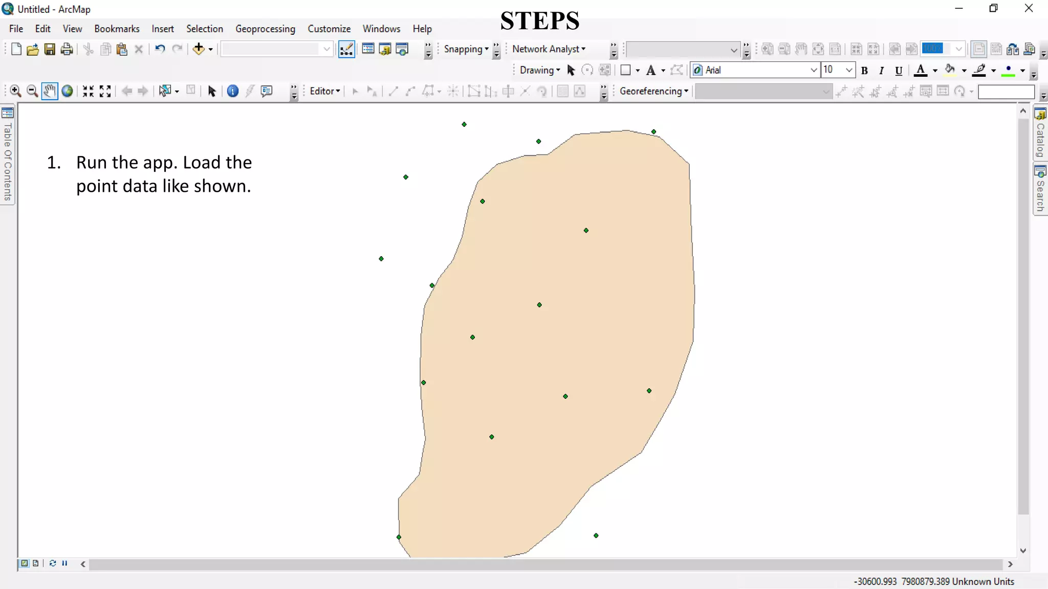
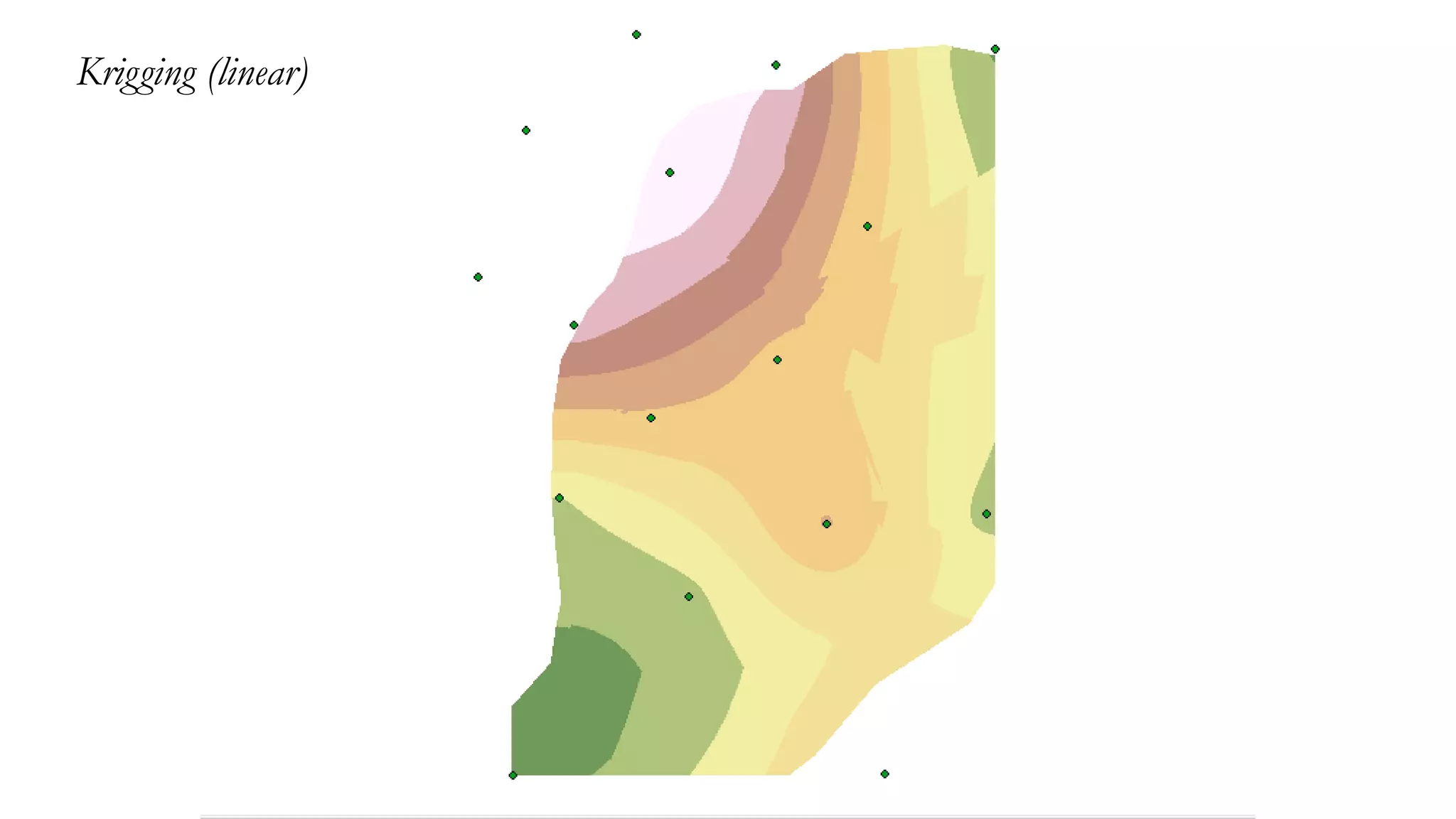
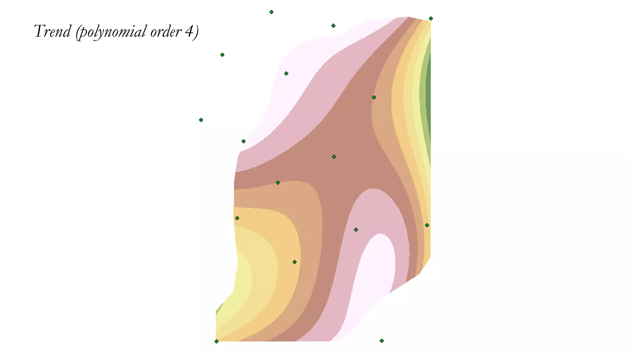
Interpolation is a method to estimate unknown values using known data points, applicable in various fields such as geographic data analysis. Techniques include Inverse Distance Weighting (IDW), spline, kriging, and trend analysis, each with specific uses based on data characteristics and desired outcomes. The document outlines steps for using GIS software to perform these interpolation methods with point data.