Remote sensing uses satellite or aircraft sensors to monitor the environment without direct contact. It can monitor soil, water, and air pollution over large areas in a timely manner. Satellite imagery is used to monitor air quality by detecting pollutants and aerosols. Water quality is monitored by measuring changes in the spectral signature of surface water caused by substances like sediments, algae, and thermal releases. Remote sensing provides synoptic views of large areas but has limitations like spectral interference and inability to distinguish low concentrations of pollutants. It is a useful tool for environmental monitoring when used in conjunction with field data.
Remote sensing application in agriculture & forestry_Dr Menon A R R (The Kera...India Water Portal
This presentation by Dr A R R Menon, Emeritus scientist, CED on Remote Sensing applications in agriculture and forestry was made at at the Kerala Environment Congress, Trivandrum organised by the Centre for Environment and Development
Application of Remote Sensing in AgricultureUTTAM KUMAR
Remote sensing has been found to be a valuable tool in evaluation, monitoring and management of land, water and crop resources. The launching of the Indian remote sensing satellite (IRS) has enhanced the capabilities for better utilization of this technology and significant progress has been made in soil and land cover mapping, land degradation studies, monitoring of waste land, assessment of crop conditions crop acreage and production estimates
APPLICATION OF REMOTE SENSING AND GIS IN AGRICULTURELagnajeetRoy
India is a country that depends on agriculture. Today in this era of technological supremacy, agriculture is also using different new technologies like some robotic machinery to remote sensing and Geographical Information System (GIS) for the betterment of agriculture. It is easy to get the information about that area where human cannot check the condition everyday and help in gathering the data with the help of remote sensing. Whereas GIS helps in preparation of map that shows an accurate representation of data we get through remote sensing. From disease estimation to stress factor due to water, from ground water quality index to acreage estimation in various way agriculture is being profited by the application of remote sensing and GIS in agriculture. The applications of those software or techniques are very new to the agriculture domain still much more exploration is needed in this part. New software’s are developing in different parts of the world and remote sensing. Today farmers understand the beneficiaries of these kinds of techniques to the farm field which help in increasing productivity that will help future generation as technology is hype in traditional system of farming.
Introduction -Remote means – far away ; Sensing means – believing or observing or acquiring some information.
Remote sensing means acquiring information of things from a distance with sensors. (without touching the things)
Sensors are like simple cameras except that they not only use visible light but also other bands of the electromagnetic spectrum such as infrared, microwaves and ultraviolet regions.
Distance of Remote Sensing, Definition of remote sensing - Remote Sensing is:
“The art and science of obtaining information about an object without being in direct contact with the object” (Jensen 2000).
India’s National Remote Sensing Agency (NRSA) defined as : “Remote sensing is the technique of deriving information about objects on the surface of the earth without physically coming into contact with them.”
Remote Sensing Process, - (A) Energy Source or Illumination.
(B) Radiation and the Atmosphere.
(C) Interaction with the Target.
(D) Recording of Energy by the Sensor.
(E) Transmission, Reception, & Processing.
(F) Interpretation and Analysis.
(G) Application.
Remote sensing platforms , History of Remote Sensing, Applications of remote sensing - In Agriculture, In Geology, Applications of National Priority.
Remote Sensing Data Acquisition,Scanning/Imaging systemsdaniyal rustam
full of concepts about RS data acquisition scanning and imaging systems. Best for students of remote sensing. in this presentation we briefly explained the concept of scanning in remote sensing.
Meteorology is a discipline concerned with observational earth sciences and theoretical physics. It has the task of providing an accurate knowledge of the state of the atmosphere. Before the advent of weather satellites the weathermen had been severely handicapped by having only a very limited knowledge of the state of the atmosphere at any given time. Meteorological satellites have to a large extent has enabled to overcome this deficiency.
Presentation on Aerosols, cloud properties Esayas Meresa
This slide was prepared for the course Applications of GIS and RS for water resources in Mekelle University, Institute of Geo-information and earth observation Science(I-GEOS) by Mr. Esayas Meresa.
Archaeological applications of multi/hyper-spectral data: challenges and pote...DART Project
A presentation given at the joint EAC and AARG symposium in Iceland on 25/03/10 by Anthony Beck.
This presentation describes electromagnetic approaches to heritage detections
Characterization and the Kinetics of drying at the drying oven and with micro...Open Access Research Paper
The objective of this work is to contribute to valorization de Nephelium lappaceum by the characterization of kinetics of drying of seeds of Nephelium lappaceum. The seeds were dehydrated until a constant mass respectively in a drying oven and a microwawe oven. The temperatures and the powers of drying are respectively: 50, 60 and 70°C and 140, 280 and 420 W. The results show that the curves of drying of seeds of Nephelium lappaceum do not present a phase of constant kinetics. The coefficients of diffusion vary between 2.09.10-8 to 2.98. 10-8m-2/s in the interval of 50°C at 70°C and between 4.83×10-07 at 9.04×10-07 m-8/s for the powers going of 140 W with 420 W the relation between Arrhenius and a value of energy of activation of 16.49 kJ. mol-1 expressed the effect of the temperature on effective diffusivity.
UNDERSTANDING WHAT GREEN WASHING IS!.pdfJulietMogola
Many companies today use green washing to lure the public into thinking they are conserving the environment but in real sense they are doing more harm. There have been such several cases from very big companies here in Kenya and also globally. This ranges from various sectors from manufacturing and goes to consumer products. Educating people on greenwashing will enable people to make better choices based on their analysis and not on what they see on marketing sites.
Artificial Reefs by Kuddle Life Foundation - May 2024punit537210
Situated in Pondicherry, India, Kuddle Life Foundation is a charitable, non-profit and non-governmental organization (NGO) dedicated to improving the living standards of coastal communities and simultaneously placing a strong emphasis on the protection of marine ecosystems.
One of the key areas we work in is Artificial Reefs. This presentation captures our journey so far and our learnings. We hope you get as excited about marine conservation and artificial reefs as we are.
Please visit our website: https://kuddlelife.org
Our Instagram channel:
@kuddlelifefoundation
Our Linkedin Page:
https://www.linkedin.com/company/kuddlelifefoundation/
and write to us if you have any questions:
info@kuddlelife.org
"Understanding the Carbon Cycle: Processes, Human Impacts, and Strategies for...MMariSelvam4
The carbon cycle is a critical component of Earth's environmental system, governing the movement and transformation of carbon through various reservoirs, including the atmosphere, oceans, soil, and living organisms. This complex cycle involves several key processes such as photosynthesis, respiration, decomposition, and carbon sequestration, each contributing to the regulation of carbon levels on the planet.
Human activities, particularly fossil fuel combustion and deforestation, have significantly altered the natural carbon cycle, leading to increased atmospheric carbon dioxide concentrations and driving climate change. Understanding the intricacies of the carbon cycle is essential for assessing the impacts of these changes and developing effective mitigation strategies.
By studying the carbon cycle, scientists can identify carbon sources and sinks, measure carbon fluxes, and predict future trends. This knowledge is crucial for crafting policies aimed at reducing carbon emissions, enhancing carbon storage, and promoting sustainable practices. The carbon cycle's interplay with climate systems, ecosystems, and human activities underscores its importance in maintaining a stable and healthy planet.
In-depth exploration of the carbon cycle reveals the delicate balance required to sustain life and the urgent need to address anthropogenic influences. Through research, education, and policy, we can work towards restoring equilibrium in the carbon cycle and ensuring a sustainable future for generations to come.
WRI’s brand new “Food Service Playbook for Promoting Sustainable Food Choices” gives food service operators the very latest strategies for creating dining environments that empower consumers to choose sustainable, plant-rich dishes. This research builds off our first guide for food service, now with industry experience and insights from nearly 350 academic trials.
Natural farming @ Dr. Siddhartha S. Jena.pptxsidjena70
A brief about organic farming/ Natural farming/ Zero budget natural farming/ Subash Palekar Natural farming which keeps us and environment safe and healthy. Next gen Agricultural practices of chemical free farming.
Willie Nelson Net Worth: A Journey Through Music, Movies, and Business Venturesgreendigital
Willie Nelson is a name that resonates within the world of music and entertainment. Known for his unique voice, and masterful guitar skills. and an extraordinary career spanning several decades. Nelson has become a legend in the country music scene. But, his influence extends far beyond the realm of music. with ventures in acting, writing, activism, and business. This comprehensive article delves into Willie Nelson net worth. exploring the various facets of his career that have contributed to his large fortune.
Follow us on: Pinterest
Introduction
Willie Nelson net worth is a testament to his enduring influence and success in many fields. Born on April 29, 1933, in Abbott, Texas. Nelson's journey from a humble beginning to becoming one of the most iconic figures in American music is nothing short of inspirational. His net worth, which estimated to be around $25 million as of 2024. reflects a career that is as diverse as it is prolific.
Early Life and Musical Beginnings
Humble Origins
Willie Hugh Nelson was born during the Great Depression. a time of significant economic hardship in the United States. Raised by his grandparents. Nelson found solace and inspiration in music from an early age. His grandmother taught him to play the guitar. setting the stage for what would become an illustrious career.
First Steps in Music
Nelson's initial foray into the music industry was fraught with challenges. He moved to Nashville, Tennessee, to pursue his dreams, but success did not come . Working as a songwriter, Nelson penned hits for other artists. which helped him gain a foothold in the competitive music scene. His songwriting skills contributed to his early earnings. laying the foundation for his net worth.
Rise to Stardom
Breakthrough Albums
The 1970s marked a turning point in Willie Nelson's career. His albums "Shotgun Willie" (1973), "Red Headed Stranger" (1975). and "Stardust" (1978) received critical acclaim and commercial success. These albums not only solidified his position in the country music genre. but also introduced his music to a broader audience. The success of these albums played a crucial role in boosting Willie Nelson net worth.
Iconic Songs
Willie Nelson net worth is also attributed to his extensive catalog of hit songs. Tracks like "Blue Eyes Crying in the Rain," "On the Road Again," and "Always on My Mind" have become timeless classics. These songs have not only earned Nelson large royalties but have also ensured his continued relevance in the music industry.
Acting and Film Career
Hollywood Ventures
In addition to his music career, Willie Nelson has also made a mark in Hollywood. His distinctive personality and on-screen presence have landed him roles in several films and television shows. Notable appearances include roles in "The Electric Horseman" (1979), "Honeysuckle Rose" (1980), and "Barbarosa" (1982). These acting gigs have added a significant amount to Willie Nelson net worth.
Television Appearances
Nelson's char
Willie Nelson Net Worth: A Journey Through Music, Movies, and Business Ventures
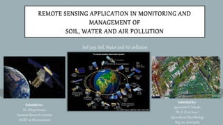
Remote sensing application in monitoring and management of soil, water and air pollution
1. REMOTE SENSING APPLICATION IN MONITORING AND
MANAGEMENT OF
SOIL, WATER AND AIR POLLUTION
Soil 509: Soil, Water and Air pollution
Submittedto:-
Dr. Dileep Kumar
Assistant Research Scientist
AICRP on Micronutrient
Submittedby:-
Jayvirsinh P. Solanki
Ph. D (First Sem.)
Agricultural Microbiology
Reg. no. 1010113084
2. REMOTE SENSING
• The acquisition of information about an object or phenomenon without making physical
contact with the object and thus in contrast to on-site observation, especially the Earth.
• In current usage, the term "remote sensing" generally refers to the use of satellite or
aircraft-based sensor technologies to detect and classify objects on Earth, including on
the surface and in the atmosphere and oceans, based on propagated signals (e.g.
electromagnetic radiation).
• It may be split into "active" remote sensing (i.e., when a signal is emitted by a
satellite or aircraft and its reflection is detected by the sensor) and "passive" remote
sensing (i.e., when the reflection of sunlight is detected by the sensor).
3. MONITORING
Environmental monitoring can be defined as the systematic sampling of air, water, soil
and biota in order to observe and study the environment, as well as to derive knowledge from this
process.
Gaining information about the present levels of harmful / potentially harmful pollutants in
discharges to the environment
Objectives:
• Carried out to assess pollution effects
• To evaluate pollution interactions and patterns
• To assess the need for legislative controls
• To ensure compliance with emission standards
4. TYPES OF MONITORING
1. Source monitoring
2. Ambient environment monitoring
• Air pollution monitoring
• Water pollution monitoring
• Sediment, soil and biological monitoring
• Noise level monitoring
6. SATELLITE IMAGERY IN MONITORING AIR QUALITY
• Provides complete and synoptic views of large areas in one image on a systematic basis due
to the good temporal resolution
• Monitor many pollutants simultaneously
• Capability to monitor in near real-time and provides continuously rapid monitoring
Sensors used in mapping air pollution are:
• 1. Landsat TM/ETM+
• 2. MODIS AOT
• 3. ASTER data
7. TYPES OF MONITORING TECHNIQUES USED TO MAP AIR
POLLUTANTS
Aerosol
Aerosol thickness is
monitored by four different
methods
• Ocean method
• Brightness method
• Contrast-reduction
method
• Dark vegetation method
8. REMOTE SENSING FOR WATER RESOURCES AND POLLUTION
• Snow and Glacier mapping and
monitoring
• Irrigation water management
• Flood disaster monitoring, forecasting
and management
• Water quality monitoring
• Watershed management
• Groundwater prospecting
• Environmental Impact assessment
9. Substances [Suspended sediments, algae, dissolved organic matter
(DOM), oils, aquatic vascular plants, and thermal releases] in surface water
can significantly change the backscattering characteristics of surface water.
Remote sensing techniques depend on the ability to measure these
changes in the spectral signature backscattered from water and relate
these measured changes by empirical or analytical models to a water
quality parameter.
10. ADVANTAGES OF REMOTE SENSING
• Provides complete and synoptic views of large areas in one image on a systematic basis
• Can monitor many pollutants simultaneously
• Reduces the labour work and time in mapping large areas
• reduced fieldwork to a considerable extent
• Soil boundaries are more precisely delineated than in conventional methods.
• While mapping the soil using RS, the stereo data is highly useful in identification of different landforms, which have got
close relationship with soils associated with them.
• The assessment of the levels of heavy metal pollution of soils by collation of multi-spectral imagery and geochemical
data.
• As a result, direct and reversible correlation links were revealed between absolute total contents of heavy metals (Pb,
Cr, Ti, Cu, Zn,Mn) and spectral values of soils on the satellite and spectrophotometric images, which can serve as a
background for qualitative assessment of heavy metal contents in soils and creation of a remote monitoring system.
11. LIMITATIONS OF REMOTE SENSING
• Spectral confusions (i.e., impure pixels) from simultaneous detection of reflectance signals
at the sensors, (One of the major limitations is spectral interference caused by other
atmospheric inhabitances that are not pollution)
• Difficulty in distinguishing plant species,
• Scaling issues, Any pollutant with a low concentration will not be detected
• Low accuracy due to soil and water heterogeneity (e.g., spectral complexities of incomplete
plant cover)
• Absence of long-term satellite data (e.g., Landsat satellite data were available from only
1972 and MODIS from 2000).
• Models may be too simplistic or incomplete (e.g., omit soil depth variability or assume one
type of soil everywhere), because the model design and functionality depend on the
professional background of the model developer. Requires highly qualified staff, and the
process is very expensive
12. • The misuse of Predotransfer Functions (PTFs) in deriving soil physicochemical properties (e.g.,
bulk density, texture, soil moisture content, available water capacity, SOC, etc.) may generate
erroneous results.
• Soil characteristics (e.g., bulk density and texture) which are crucial for assessing soil quality are
difficult to assess using only remote sensing data.
• Some workers report a high correlation between SOC concentration and spectral reflectance
under controlled laboratory conditions, however, from aerial- or space- based platforms the lower
SNR attributed to atmospheric scattering, bi-directional reflectance, adjacency effects,
topographic variation, and geometric and radiometric errors may lower this accuracy.
• Variability in composition or concentration of heterogeneous mixtures of soil or water (i.e., SOC,
FeO3), soil moisture, mineralogy, and chlorophyll) may significantly influence the characteristics of
the reflectance signal detected by the sensor. Deciphering information from remote sensors is
difficult within heterogeneous landscapes.