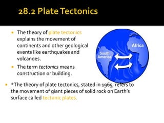
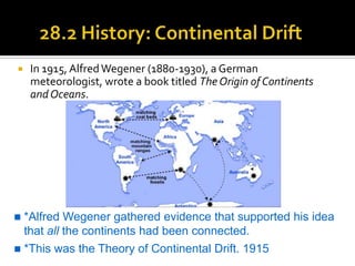
Mrs. Neistadt Physical Science
   The theory of plate tectonics
        explains the movement of
        continents and other geological
        events like earthquakes and
        volcanoes.
       The term tectonics means
        construction or building.

   *The theory of plate tectonics, stated in 1965, refers to
    the movement of giant pieces of solid rock on Earth’s
    surface called tectonic plates.
    In 1915, Alfred Wegener (1880-1930), a German
     meteorologist, wrote a book titled The Origin of Continents
     and Oceans.


   *Alfred Wegener gathered evidence that supported his idea
    that all the continents had been connected.
   *This was the Theory of Continental Drift. 1915
   In the early 1960s, Henry Hess
    (1906-69), a geologist and
    former commander of a Navy
    ship equipped with an echo
    sounder, used the profile of
    the sea floor to propose that it
    was spreading at the mid-
    ocean ridges.                         An echo sounder is used
                                           to make a profile of the
                                           sea floor.
*Harry Hess
 *An American
  geologist who studied
  mid-ocean ridges.
 *He suggested that the
  ocean floors move like
  conveyor belts, carrying
  the continents along
  with them.
   The theory of plate tectonics
    explains the movement of
    continents and other geological
    events like earthquakes and
    volcanoes.
   The term tectonics means
    construction or building.

   *The theory of plate tectonics, stated in 1965, refers to
    the movement of giant pieces of solid rock on Earth’s
    surface called tectonic plates.
   Around the same time,
    Robert Dietz (1914-95), a
    scientist with similar
    ideas, coined the term
    sea-floor spreading.

   *Sea-floor spreading
    describes the sea floor on
    either side of a mid-ocean
    ridge as moving away
    from the ridge and
    creating a rise or valley.
   *Hot fluid from the mantle (called magma) enters the rise or
    valley and cools, creating new sea floor (also called oceanic
    crust).
   In the 1950s and 1960s,
    scientists discovered that the
    rocks of the sea floor have a very
    interesting magnetic pattern.
   *Over geologic time, the
    magnetic polarity of Earth has
    switched.
   *Scientists believe the poles
    switch because of a magnetic
    interaction between the planet’s
    inner and outer core.
   Stripes of rock with a
    north-south orientation
    (normal) alternate with
    stripes of rock with a
    south-north orientation
    (reversed).
   The blue and white stripes
    you see in the figure are an
    interpretation of a
    magnetic profile.
   The Earth is like a bar magnet, It has a North
     and South pole.
                                            Sketch

Bar magnet. Iron filings
line up with magnetic
field.


                                             Concept
   The Geographic North and Magnetic North
    are not in the same place.

          The asterisk marks
          Magnetic North or True
          North.
   *The Earth’s magnetic poles switch direction.
     The south pole becomes the north pole, and the
     north pole becomes the south pole

   *This switch in direction is known as Magnetic
    Reversal.
   Such reversals are caused by changes in Earth’s
    magnetic field.
   *Earth’s Geographic Pole never changes place.
   *Each Magnetic Reversal is recorded in the
    sea-floor rock.
   As the molten material rises and cools, iron
    particles line up with Earth’s magnetic field.
   When the material hardens, these particles
    stay in place like compass needles that are
    stuck in position forever.
 *The records of magnetic reversals line up like stripes
  in a rock
 Evidence of plate movement is found by finding the
  age of the rock.
 The youngest rock shows the last magnetic reversal
  occurred about 760,000 years ago.
 The oldest reversal we have found happened 150
  million years ago.
Can you identify which of the plates are only made of oceanic crust?
   Use usgs.gov to find earthquakes in real-time to map
    the tectonic plates.
   There are three main kinds of plate boundaries:
     divergent
     convergent
     transform
   The tectonic plates that cover Earth’s surface are pieces of
    the lithosphere that fit together and float on the
    asthenosphere (a part of the mantle).
   There are a number of large tectonic plates on Earth’s
    surface, and smaller plates are being identified all the time.
   Diverging plates move apart and new crust forms.
   Divergent boundaries
    are sites of earthquakes
    and volcanic activity.
   Mid-ocean ridges and
    associated sea-floor
    spreading occur at
    divergent plate
    boundaries.
   In effect, a mid-ocean
    ridge is like a very long
    volcano.
   Convergent plate
    boundaries occur where
    two plates approach each
    other.
   One result of two plates
    converging is subduction.
   A deep oceanic trench
    marks the boundary
    between a subducting and
    an overriding plate at a
    convergent boundary.
   The movement of tectonic plates is related to the distribution of
    heat by convection currents in the mantle.
Key Question:
     What will Earth look like in 50 millions
      years?


*Read text section 28.2 BEFORE Investigation 28.2

Plate tectonics ch 28.2

  • 1.
  • 2.
    The theory of plate tectonics explains the movement of continents and other geological events like earthquakes and volcanoes.  The term tectonics means construction or building.  *The theory of plate tectonics, stated in 1965, refers to the movement of giant pieces of solid rock on Earth’s surface called tectonic plates.
  • 3.
    In 1915, Alfred Wegener (1880-1930), a German meteorologist, wrote a book titled The Origin of Continents and Oceans.  *Alfred Wegener gathered evidence that supported his idea that all the continents had been connected.  *This was the Theory of Continental Drift. 1915
  • 5.
    In the early 1960s, Henry Hess (1906-69), a geologist and former commander of a Navy ship equipped with an echo sounder, used the profile of the sea floor to propose that it was spreading at the mid- ocean ridges.  An echo sounder is used to make a profile of the sea floor.
  • 6.
    *Harry Hess  *AnAmerican geologist who studied mid-ocean ridges.  *He suggested that the ocean floors move like conveyor belts, carrying the continents along with them.
  • 8.
    The theory of plate tectonics explains the movement of continents and other geological events like earthquakes and volcanoes.  The term tectonics means construction or building.  *The theory of plate tectonics, stated in 1965, refers to the movement of giant pieces of solid rock on Earth’s surface called tectonic plates.
  • 9.
    Around the same time, Robert Dietz (1914-95), a scientist with similar ideas, coined the term sea-floor spreading.  *Sea-floor spreading describes the sea floor on either side of a mid-ocean ridge as moving away from the ridge and creating a rise or valley.
  • 10.
    *Hot fluid from the mantle (called magma) enters the rise or valley and cools, creating new sea floor (also called oceanic crust).
  • 12.
    In the 1950s and 1960s, scientists discovered that the rocks of the sea floor have a very interesting magnetic pattern.  *Over geologic time, the magnetic polarity of Earth has switched.  *Scientists believe the poles switch because of a magnetic interaction between the planet’s inner and outer core.
  • 13.
    Stripes of rock with a north-south orientation (normal) alternate with stripes of rock with a south-north orientation (reversed).  The blue and white stripes you see in the figure are an interpretation of a magnetic profile.
  • 15.
    The Earth is like a bar magnet, It has a North and South pole. Sketch Bar magnet. Iron filings line up with magnetic field. Concept
  • 16.
    The Geographic North and Magnetic North are not in the same place. The asterisk marks Magnetic North or True North.
  • 17.
    *The Earth’s magnetic poles switch direction.  The south pole becomes the north pole, and the north pole becomes the south pole  *This switch in direction is known as Magnetic Reversal.  Such reversals are caused by changes in Earth’s magnetic field.  *Earth’s Geographic Pole never changes place.
  • 18.
    *Each Magnetic Reversal is recorded in the sea-floor rock.  As the molten material rises and cools, iron particles line up with Earth’s magnetic field.  When the material hardens, these particles stay in place like compass needles that are stuck in position forever.
  • 19.
     *The recordsof magnetic reversals line up like stripes in a rock  Evidence of plate movement is found by finding the age of the rock.  The youngest rock shows the last magnetic reversal occurred about 760,000 years ago.  The oldest reversal we have found happened 150 million years ago.
  • 21.
    Can you identifywhich of the plates are only made of oceanic crust?
  • 22.
    Use usgs.gov to find earthquakes in real-time to map the tectonic plates.
  • 23.
    There are three main kinds of plate boundaries:  divergent  convergent  transform
  • 24.
    The tectonic plates that cover Earth’s surface are pieces of the lithosphere that fit together and float on the asthenosphere (a part of the mantle).  There are a number of large tectonic plates on Earth’s surface, and smaller plates are being identified all the time.
  • 25.
    Diverging plates move apart and new crust forms.
  • 26.
    Divergent boundaries are sites of earthquakes and volcanic activity.  Mid-ocean ridges and associated sea-floor spreading occur at divergent plate boundaries.  In effect, a mid-ocean ridge is like a very long volcano.
  • 27.
    Convergent plate boundaries occur where two plates approach each other.  One result of two plates converging is subduction.  A deep oceanic trench marks the boundary between a subducting and an overriding plate at a convergent boundary.
  • 30.
    The movement of tectonic plates is related to the distribution of heat by convection currents in the mantle.
  • 31.
    Key Question:  What will Earth look like in 50 millions years? *Read text section 28.2 BEFORE Investigation 28.2