
Recommended
More Related Content
Similar to Steps to Plate TectonicsStep 1 – Continental Driftwww.mat.docx
Similar to Steps to Plate TectonicsStep 1 – Continental Driftwww.mat.docx (20)
More from dessiechisomjj4
More from dessiechisomjj4 (20)
Recently uploaded
Recently uploaded (20)
Steps to Plate TectonicsStep 1 – Continental Driftwww.mat.docx
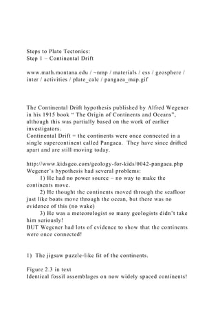
- 1. Steps to Plate Tectonics: Step 1 – Continental Drift www.math.montana.edu / ~nmp / materials / ess / geosphere / inter / activities / plate_calc / pangaea_map.gif The Continental Drift hypothesis published by Alfred Wegener in his 1915 book “ The Origin of Continents and Oceans”, although this was partially based on the work of earlier investigators. Continental Drift = the continents were once connected in a single supercontinent called Pangaea. They have since drifted apart and are still moving today. http://www.kidsgeo.com/geology-for-kids/0042-pangaea.php Wegener’s hypothesis had several problems: 1) He had no power source – no way to make the continents move. 2) He thought the continents moved through the seafloor just like boats move through the ocean, but there was no evidence of this (no wake) 3) He was a meteorologist so many geologists didn’t take him seriously! BUT Wegener had lots of evidence to show that the continents were once connected! 1) The jigsaw puzzle-like fit of the continents. Figure 2.3 in text Identical fossil assemblages on now widely spaced continents!
- 2. best about 250-200 MY ago become increasingly dissimilar the closer to today we look! Garrison, 2012, Essentials of Oceanography 3) Sequences of similar rock types on continents which do not now have the same geologic environment! http://www.geology.ohio- state.edu/~vonfrese/gs100/lect25/index.html 4) Geologic structures (mountain ranges, faults, chains of volcanoes) which match up on either side of oceans but can not be found underwater. 5) Apparent polar wander – paleoclimatic evidence the continents had very different climates 250 MY ago than they do today. either the continents moved or the climate bands moved – which means the Earth’s poles of rotation moved. Earth’s climate zones today are arranged symmetrically around the poles. http://www.webquest.hawaii.edu/kahihi/sciencedictionary/C/cli matezone.php Paleoclimatic data from ˶300 MY ago, figure 2.5 in text
- 3. After Wegener died, his ideas were largely dismissed, until… Post-Wegener evidence for drifting continents (and plate tectonics)… 6) Apparent Polar Wander – Paleomagnetic evidence. Figure 2.7 showing that the Earth has a magnetic field very similar to that created by a bar magnet. Directions of magnets parallel to Earth’s magnetic field lines. Post-Wegener evidence for drifting continents (and plate tectonics)… Figure 2.7b showing how magnets align to the Earth’s magnetic field when allowed to move freely. Rocks containing the mineral magnetite (especially basalt) record the orientation of the Earth’s magnetic field at the time the rocks formed. Figure 2.8a showing apparent polar wander paths for Europe and North America. Figure 2.8b showing alignment of polar wander curves if the Atlantic Ocean is “closed” The polar wander tracks for all the continents show great
- 4. variation, suggesting it is the continents that moved! If we put the continents “back together” we can make their paleomagnetic poles all line up at the true north pole! When geologists studied the paleomagnetic record, they discovered: Old rocks showed that the north pole in the past was not where the north pole is today (did the pole move or did the continent move?) Every continent recorded a different position for the north pole If we “move” the continents back together – reassemble Pangaea – the paleo-North Poles rearrange to all line up together at the position of today’s north pole! Other Important discoveries that confused scientists: 1) The presence of the Mid-Ocean Ridge, a chain of underwater volcanoes that circle through the world’s oceans like the seams on a baseball! www.ceoe.udel.edu / extreme2001 / mission / location / images / ridgemap.gif Other Important discoveries, cont.: 2) The presence of the Deep-Sea Trenches, a series of deep basins on the seafloor next to continents or island chains. Other Important discoveries: 3) No area of the seafloor is older than 200 MY, about 1/20th the age of the oldest continental crust, and
- 5. 4) The seafloor in brand-new at the mid-ocean ridges, and gets older the farther from the ridge we look. The oldest seafloor is located next to the deep sea trenches. Continental Drift: The continents were once connected in a supercontinent called Pangaea, they have since moved apart and are still moving today. Problems: No power source and no “wake.” Evidence for: “Jigsaw puzzle” fit of the continents, matching fossils, rocks, and geologic structures on now widely separated continents apparent polar wander changing climates “wandering” magnetic north pole Other confusing discoveries mid-ocean ridges deep sea trenches age distribution of the seafloor none older than 200 my newest at the mid-ocean ridge, gets older with distance REVIEW REVIEW Steps to Plate Tectonics: Step 2 – Seafloor Spreading The Theory of Seafloor Spreading was first published in 1962 by Harry Hess, a geology professor at Princeton University. It was based on work he did as a naval captain during WWII! According to the Theory of Seafloor Spreading, the seafloor is moving like a conveyor belt from its creation at Spreading
- 6. Centers (mid-ocean ridges) to its destruction at Subduction Zones (deep sea trenches). This process is powered by mantle convection. http://rst.gsfc.nasa.gov/Sect2/Sect2_1b.html Mantle Convection is similar to boiling water in a pot on the stove, but much slower. In mantle convection, the rocks move as fast as your fingernails grow. Hotter, less dense, so rises Cooler, more dense, so sinks Evidence for Seafloor Spreading: 1) Age distribution of the seafloor 2) Presence of Mid-ocean Ridges 3) Presence of Deep Sea Trenches 4) Paleomagnetic Evidence – Seafloor Magnetic Stripes http://portale.ingv.it/research-areas/the-earth/characteristics-of- the-earth-s-magnetic-field Studies of the paleomagnetic field as recorded in rocks worldwide discovered that the Earth’s magnetic field has reversed periodically. N becomes S and S becomes N during one of these flips. Your compass would point south during a reversed period! Normal Field Reversed Field
- 7. On land (rocks don’t move) magnetic reversals are recorded by layers of basalt with normal and reversed magnetic polarity. Figure 2.9 Hess said that, if the seafloor is spreading as he described, then the magnetic reversals should be recorded as a series of normal (+) and reversed (-) polarity stripes. http://higheredbcs.wiley.com/legacy/college/levin/0471697435/ chap_tut/chaps/chapter07-08.html Once scientists began to look for them, they found these magnetic stripes in every ocean basin, suggesting that seafloor spreading did indeed occur as Hess suggested! Garrison, 2007, Oceanography Magnetic stripes are sections of reversed and normal polarity seafloor. These record the Earth’s magnetic field polarity shifts in the same way as a tape recorder records a voice. Like a tape recorder, the sea floor can only record these stripes if it is “turned on”, i.e. if the seafloor is really spreading! The Continental Drift Hypothesis showed that the continents move, but couldn’t explain how or why. The Theory of Seafloor Spreading showed that the seafloor was moving and explained how, but it did not explain the moving continents. ? ? ? ? ? ? ?
- 8. ? ? ? ? ? ? ? According to Plate Tectonics, the Earth is covered by a small number of lithospheric plates that move relative to each other. This movement is powered by mantle convection. The oceanic portion of each plate moves as described in seafloor spreading, carrying the continental portion of the plate with it! Lithosphere = the top 100 km of the Earth = cold and rigid material. Mantle Convection = the slow boiling of the rocks in the mantle due to the heat released during radioactive decay. Garrison, 2009, Oceanography, Introduction to Marine Science The 7 major plates: North American, South American, Indo- Australian, African, Eurasian, Pacific, and Antarctic; plus some minor plates. Note that most plates contain both continental and oceanic lithosphere! Plate Boundaries are the regions where tectonic plates interact or move relative to each other. There are three types of boundaries: 1) divergent – New plate is formed (constructive). 2) convergent – Old plate is destroyed (destructive). 3) transform – Plate size is constant (conservative).
- 9. Garrison, 2012, Essential of Oceanography Garrison, 2012, Essentials of Oceanography Simple plate model showing the three types of plate boundaries formed when plate A moves westward relative to plates B and C. The location of plate boundaries are marked by belts of earthquakes and volcanoes Plate Boundaries, arrows indicate direction of plate motion, numbers show rate of motion. Table 2.1 29 Divergent Plate Boundaries (constructive) occur where two plates pull apart and new oceanic plate is created! Divergent Plate Boundaries (DPB) are also called Mid-Ocean Ridges and Spreading Centers. At Divergent Plate Boundaries, we see
- 10. 1) frequent basaltic volcanic eruptions which build new seafloor 2) small, shallow earthquakes ≤ magnitude 5, ≤ 10 km deep Mature DPB always occur within an ocean basin, where they act to “grow” the ocean larger! Examples of DPB include the Mid-Atlantic Ridge and the East Pacific Rise. Divergent Plate Boundaries form by continental rifting, a process which rips continents apart. This occurs when heat builds up under the thick continent following the development of a mantle plume or “blow torch” of super-heated mantle rock. The warm rock bulges and cracks, letting magma in and splitting the continent. Continued eruptions grow the new ocean. Garrison, 2012, Essentials of Oceanography Map of the East African Rift System = one of two places where we can see active continental rifting and a new ocean basin being “born”. Figure 2.18
- 11. The Gulf of California is the other place where we see continental rifting in action! http://pictures.servegame.org/picture-of-the-gulf-of- california.html http://earthobservatory.nasa.gov/IOTD/view.php?id=1282 Transform Plate Boundaries (conservative) occur where two plates slide past each other! Plate is neither destroyed or constructed. Transform plate boundaries are rips in the rigid plate which form to allow curves in the plate boundary. They always form between two segments of a mid-ocean ridge/DPB Garrison, 2012, Essentials of Oceanography compression stretching compression stretching Transform Plate Boundaries have: 1) large, shallow earthquakes, ≤ 10 – 20 km deep, ≤ magnitude 7 (rarely higher) 2) no volcanoes Examples include our very own San Andreas Fault! http://www.calstatela.edu/dept/geology/SanAndreasFault.htm
- 12. Most transform plate boundaries are found on the seafloor, where they offset divergent plate boundaries. Fig. 2.23 Convergent Plate Boundaries (destructive) occur where two plates push together and old plate is destroyed! There are three possible situations at CPB based on what type of plates are converging: Oceanic – Oceanic, Oceanic – Continental, and Continental – Continental. Each behaves differently… At Oceanic – Oceanic and Oceanic – Continental convergent plate boundaries old, cold oceanic plate is subducted. Subduction = when a lithospheric plate is somehow pushed or pulled into the mantle beneath a second oceanic or continental plate. Subduction is accompanied by: 1) large to great (up to magnitude 8+) and shallow to deep (0 to 700 km) earthquakes 2) explosive andesitic volcanoes – the most dangerous on Earth! 3) mountain building – volcanoes on land or islands 4) accretion of new land (continent) by scraping sediments, islands, coral reefs, etc off of the top of the subducting plate and adding them to the overriding plate. cdn.autoanything.com / images / products / rell / hitch / red_chevy_pushing...
- 13. http://www.geology.um.maine.edu/geodynamics/AnalogWebsite /UndergradProjects2005/Perry/html/index.html Example of oceanic-continental convergence = the Peru-Chili Trench along western South America. Garrison, 2012, Essentials of Oceanography, see also figure 2.20 Example of oceanic-oceanic convergence = subduction at the Japan Trench. Garrison, 2012, Essentials of Oceanography, see also fig. 2.20 At Continental – Continental convergent plate boundaries continental collision occurs. Continental lithosphere is too buoyant to subduct. http://www.los-angeles-injury-lawyer-blog.com/car_accidents/ Continent-continent collision occurs after many years of subduction completely closes an ocean basin! This is how supercontinents like Pangaea are constructed! Continent – continent collision creates chains of tall mountains as the edges of the colliding continents crumple under the pressure. The subducting oceanic plate breaks off and disappears into the mantle. The Himalaya Mountains of Asia are the result of continent – continent collision between India and Eurasia. The collision and mountain building continues today!
- 14. Additional evidence comes from Hot Spot Tracks = chains of volcanoes located in the middle of tectonic plates. The Hawaiian Island – Emperor Sea Mount chain is an example. Figure 2.26 Figure 2.24 showing how we think hot spot volcanoes form over mantle plumes= rising blobs of superheated mantle. Map showing location of active hot spots. Hot spot track volcanoes are always newest on one end and get older the farther up the chain you look. Only the most recent (end) volcano is active. These chains are believed to form as the tectonic plate passes over a hot spot or mantle plume. Mantle Plumes are superheated jets of hot mantle material that remain fixed in place in the mantle. They may also cause continental rifting Once we accept that hot spot chains form over stationary mantle plumes, we can use the age and spacing of the volcanoes to calculate how fast and in what direction the plate moved in the past. In the example, the plate velocity or rate is: 100 km/5 my = 20 km/my = 2 cm/yr
- 15. The direction of plate motion is always from the newest toward the oldest volcano, so in the example, the plate is moving: Northwest N Old Island = 5 MY New Island = 0 MY 100 km One of the many questions left in plate tectonics is how plates move. Present rates are determined by satellite. Notice that the islands erode flat at the surface, then get deeper and sink as they move farther from the hot spot = get older. Why? Isostasy => the extinct volcanoes cool down, get more dense, and sink deeper. Results in guyot = tablemounts = flat topped volcanoes, eroded at the surface, but now far below the surface. The same thing happens at mid-ocean ridges Coral reefs will change shape as the island sinks out from underneath them due to isostasy. Figure 2.28 47
- 16. Figure 2.32 48 The Wilson Cycle. Figure 2.34 49 Supercontinent cycle – plate tectonic cycle from supercontinent, to continental rifting, to drifting of the continents across the Earth as oceans open and close, to eventual creation of a new supercontinent. This cycle probably takes about 500 MY. We think we can identify at least 3 past supercontinents. including Pangaea. The Earth today (left) and 200 my in the future (right) assuming today’s motions continue. http://www.historyoftheuniverse.com/cf200.html Chapter 2:Read the entire chapter. Watch the following Youtube videos from “Geoscience Videos” https://www.youtube.com/watch?v=vxjUn8PVvmc https://www.youtube.com/watch?v=7nxITuot-ko Vocabulary (do not turn in): Alfred Wegener Continental drift
- 17. Evidence for continental drift Jigsaw puzzle fit of continents Matching sequences of rocks Matching sequences of faults and mountain chains http://carnivoraforum.com/topic/9691943/ Climatic evidence Glacial ages Matching fossil assemblages (groups of fossils) Problems with continental drift Power source / why continents move How continent move Harry Hess Seafloor spreading Mantle convection Mid-ocean ridge = spreading center Deep sea/ocean trench = subduction zone Evidence for Seafloor spreading Magnetic stripes on the seafloor Magnetic field Age of the seafloor Heat Flow http://pubs.usgs.gov/gip/dynamic/developing.html Plate Tectonics Evidence for plate tectonics Hot spot tracks Apparent polar wander Igneous rocks Magma Magnetite Basalt Distribution of earthquakes and volcanoes Types of plate boundaries (know examples) Divergent plate boundaries (DPB) Mid-ocean ridge = spreading center = DPB
- 18. Ridge vs. rise Difference in shape, size, and earthquakes Rifting = continental rifting Convergent plate boundaries (CPB) Oceanic vs. Oceanic CPB Island arc Subduction Continental vs. Oceanic CPB types of volcanoes Continental arc types of earthquakes Continental – Continental CPB Continental collision redxken192jyd.blogspot.com Types of earthquakes Transform plate boundaries (TPB) Oceanic transform faults Continental transform faults Earthquakes at TPB Hot Spots Mantle plumes Hot spot tracks Formation of guyot (table mountains) Evidence for plate motion over time Coral reef development and relationship to plate tectonics and isostasy Fringing reef Barrier reef Atoll Paleogeography Continental accretion Predictions for the future Wilson Cycle – life cycle of oceans
- 19. http://www.starrynighteducation.com/sntimes/2012/jan/ Name ____________ Homework: 1) Concept Check 2.1 #1 Cite the lines of evidence Alfred Wegener used to support his idea of continental drift? Why did scientists of the time doubt that continents had drifted? 2) T or F? Harry Hess’s Theory of Seafloor Spreading explains only the motion of the seafloor, but not continental movement. 3) Answer the following questions about evidence for seafloor spreading using the terms magnetic stripes, age of the seafloor, deep sea trenches, mid-ocean ridges, or both. a. Records the periodic switch of the Earth’s magnetic field (N <-> S) like a VCR records a movie._________________ b. Least / smallest at the spreading center, and increases with distance away from the spreading center. _________________
- 20. c. Also known as the spreading center. _________________ d. Locations where seafloor is believed to subduct back into the mantle. _________________ 4) What do I mean when I say that plate tectonics combines continental drift and seafloor spreading? 5) What is the power source that is believed to move the plates? _________________ 6) About how fast do the plates move? a) centimeters per year b) meters per year c) kilometers per year d) what is a plate? 7) T or F? Plates with both divergent and convergent plate boundaries move faster than plates with only a divergent plate boundary (see videos listed above for answer). 8) Concept Check 2.4 #1 How is the age distribution pattern of the Hawaiian Island- Emperor Seamount chain explained by the position of the Hawaiian hot-spot? What could have caused the curious bend in the chain? 9) Complete the following table comparing the various types of plate boundaries.
- 21. Type of Plate Boundary Variety of that Type of Plate Boundary Volcanoes: none, explosive, non-explosive. Earthquakes: small/large, shallow / deep / both Effect on plate size: grows, shrinks, stays the same Example Divergent Plate Boundary (DPB) Non-explosive (basalt) Mid-Atlantic Ridge Convergent Plate Boundary (CPB) Ocean-Ocean
- 22. Marianas Trench Ocean- Continental Continental- Continental Transform Plate Boundaries (TPB) Large, shallow Stays the same 10) T or F? Subduction along a continental margin (edge of a continent) will cause the continent to get bigger (wider) over time. 11) T or F? Table mountains / guyot formed by wave erosion when sea level was much deeper (>2000 m) than it is today?