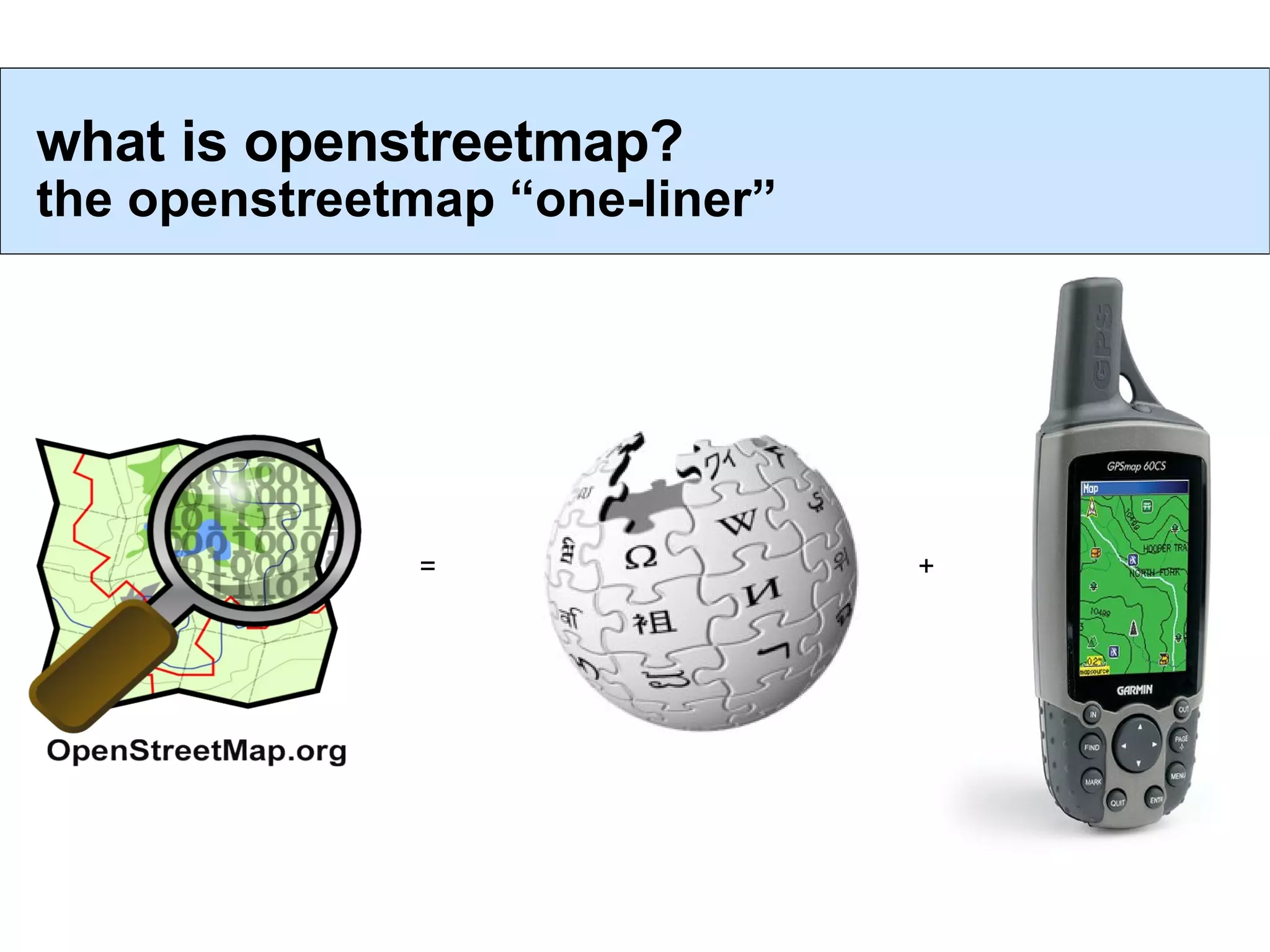
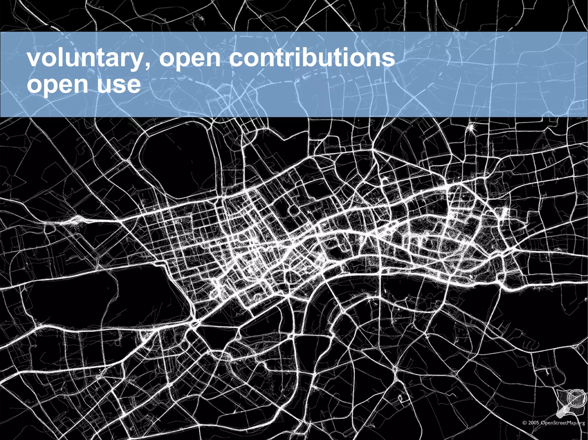
1) OpenStreetMap is a free and open collaborative project to create a map of the world. It allows for voluntary contributions and open use of map data.
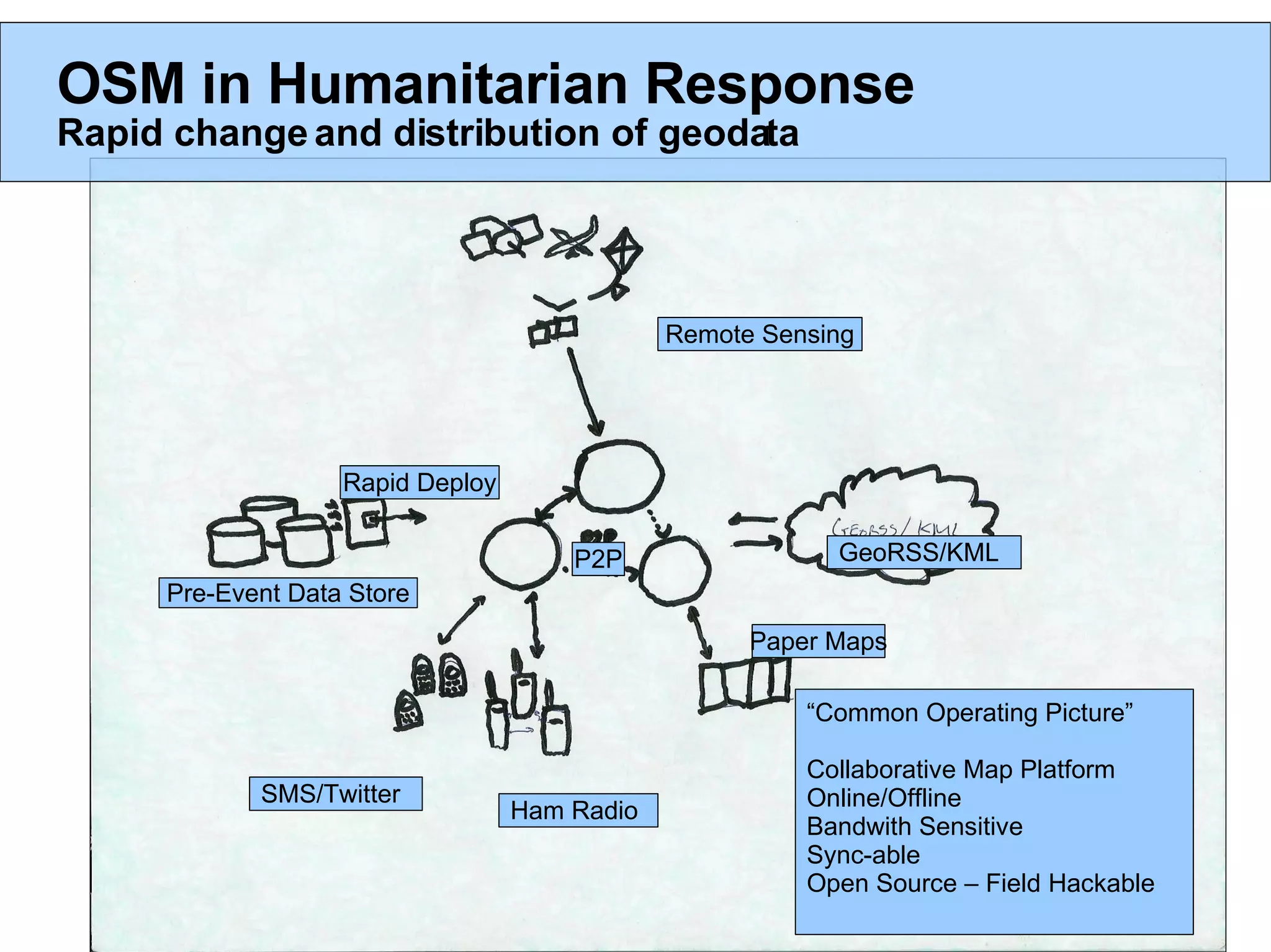
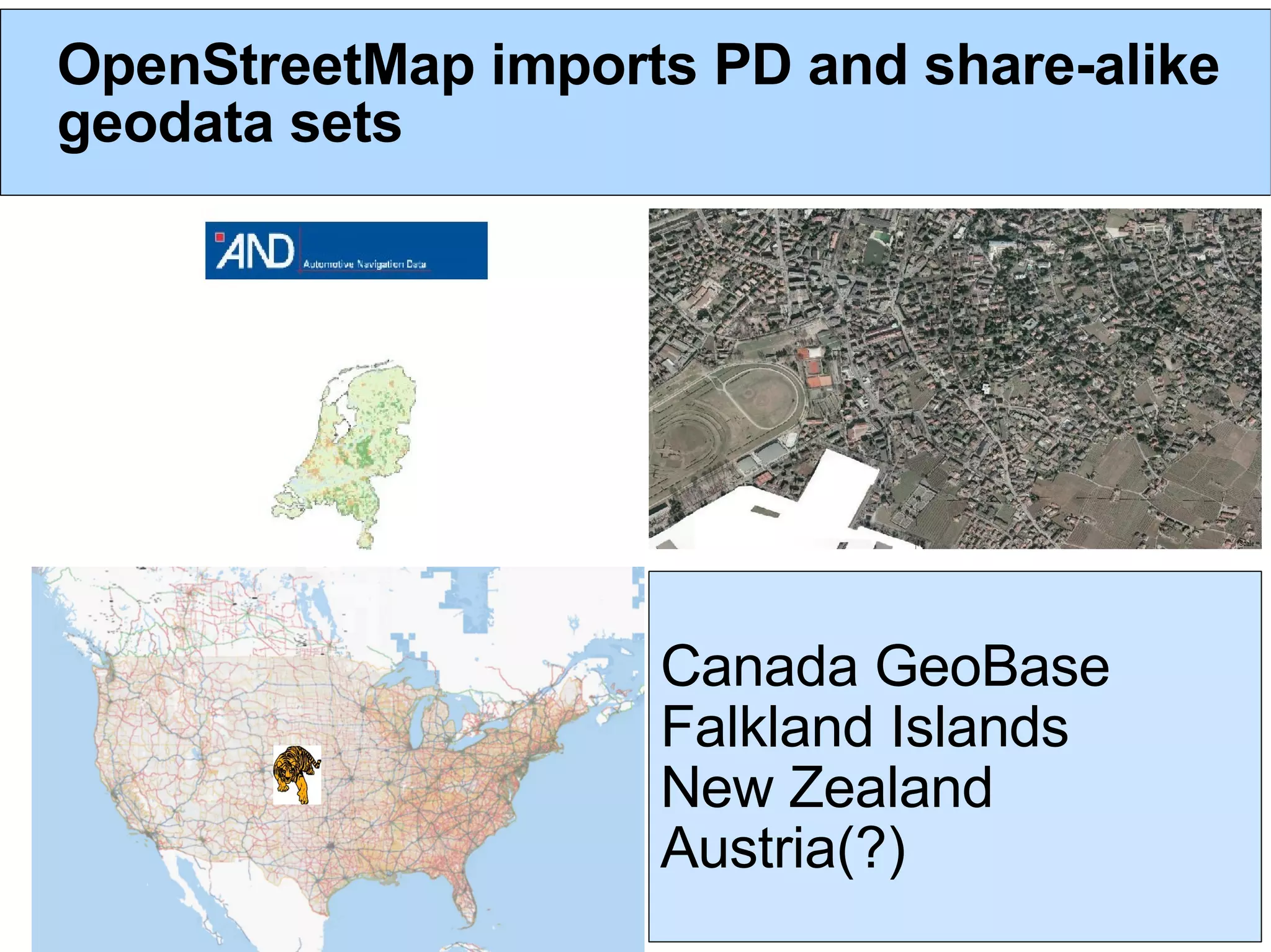
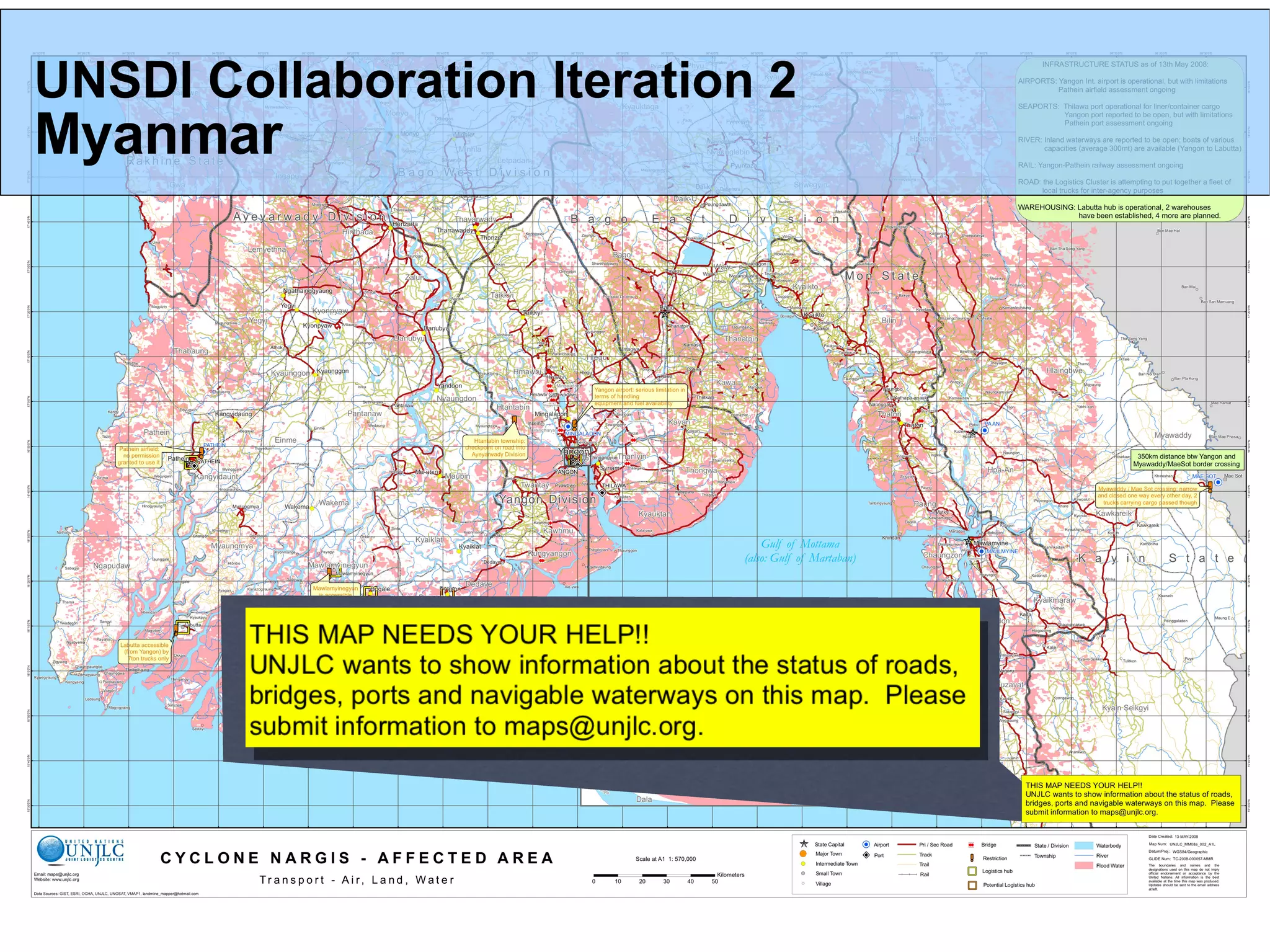
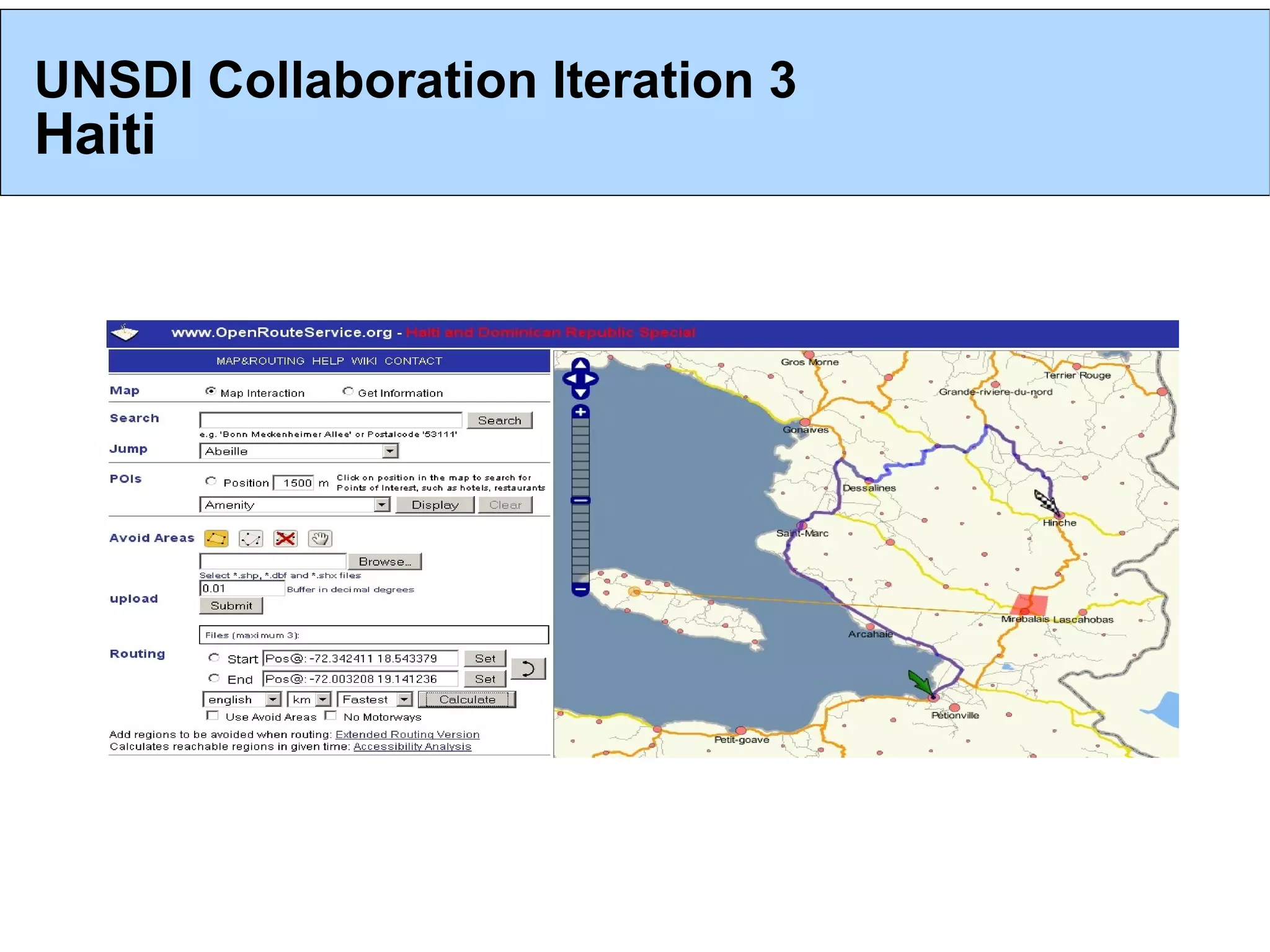
2) OpenStreetMap imports publicly available geospatial data and allows for collaborative mapping through online and offline tools. It has been used in humanitarian responses to enable rapid mapping.
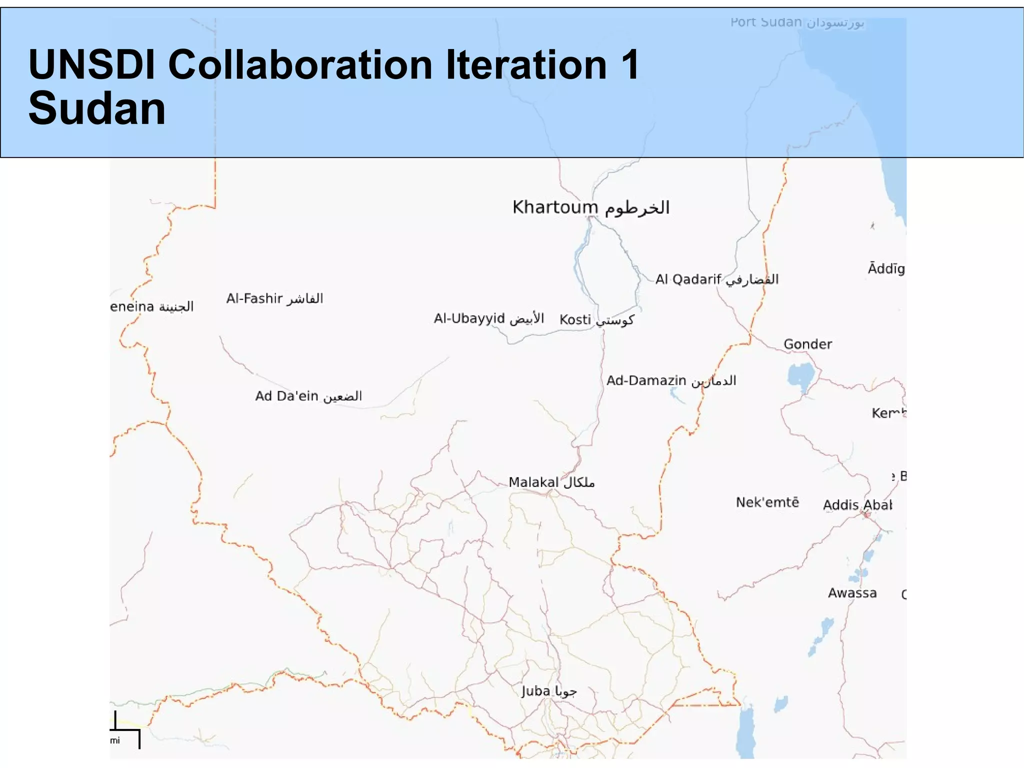
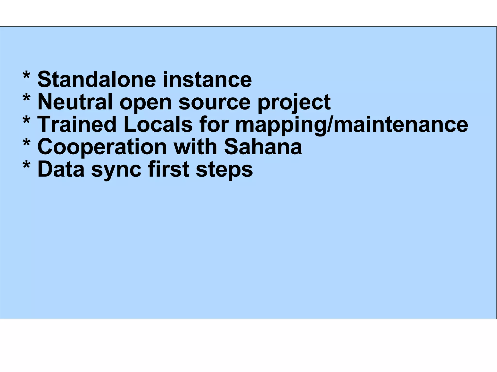
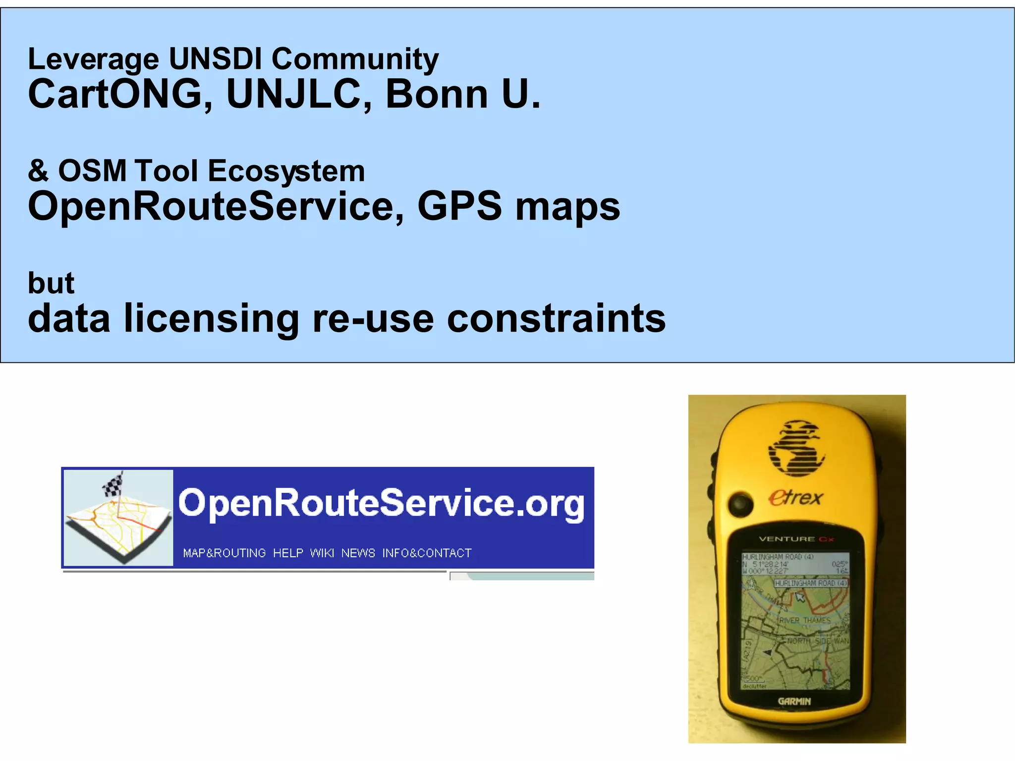
3) OpenStreetMap sees opportunities to partner with UNSDI to explore sharing and serving data, apply outcomes to operations and training, and solve issues within a collaborative spatial data infrastructure.
![OSM Ready to partner! * Framework and methodologies to explore sharing and serving data * Compatible with UNSDI data models * Large skilled community, tools .. join us! * Interesting issues to solve within a working “SDI” * Apply outcomes to operations, training, outreach [email_address]](https://image.slidesharecdn.com/osmunsdit-1226653240736684-8/75/OpenStreetMap-and-UNSDI-t-14-2048.jpg)


![Humanitarian OpenStreetMap Team [H.O.T.] Training for SBTF](https://cdn.slidesharecdn.com/ss_thumbnails/osmhotsbtf-130318160307-phpapp01-thumbnail.jpg?width=640&height=640&fit=bounds)


![Vibe Coding vs. Spec-Driven Development [Free Meetup]](https://cdn.slidesharecdn.com/ss_thumbnails/vibecodingvsspecdrivendevelopment-251209105622-43f455e7-thumbnail.jpg?width=640&height=640&fit=bounds)


