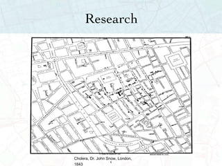
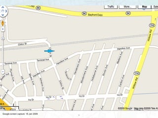
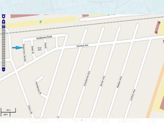
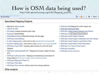
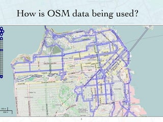
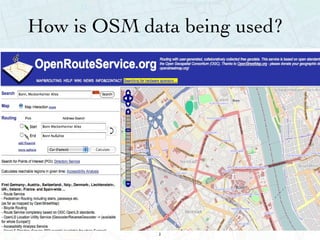
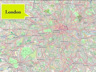
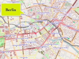
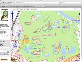
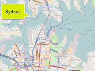
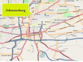
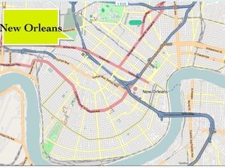
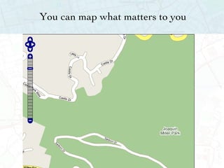
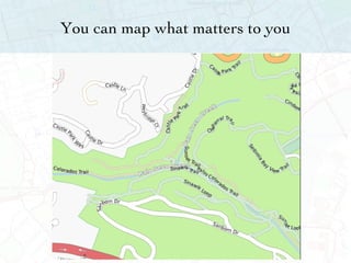
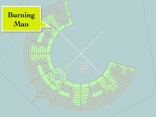
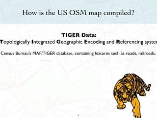
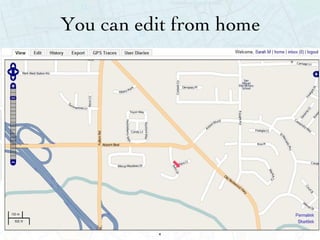
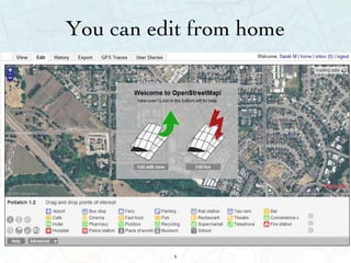
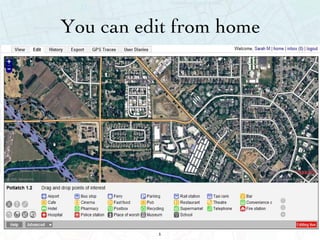
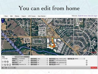
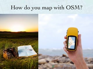
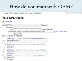
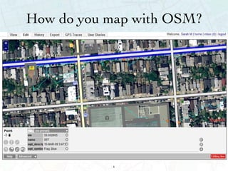
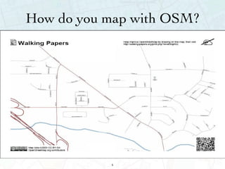
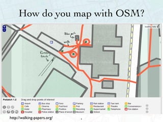
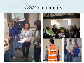
An Introduction to  OpenStreetMap
Sarah Manley OpenStreetMap contributor since Fall 2008 [email_address]
Why Maps?
Perception
Navigation
Research Cholera, Dr. John Snow, London, 1843
Ownership Copyright:  http://www.omninerd.com/images/content/1/4_article_33_full_figure1.jpg
Organization
Organization
Artistic
How accessible are current maps?
How accessible are current maps? Costly   Closed Often out of date 16
Copyright:  http://asia.cnet.com/i/r/2007/pg/62034053/sc001.jpg
How accessible are current maps? Costly  Closed Often out of date 18
Copyrighted 19
Norman Dennison, director of Geographers' A-Z Map Company, confirms that Lye Close is a lie, which will now be removed. "The idea is to put something on the map to protect copyright," he says. "We try to put it in an area or a part of a road which would not be misleading to the ordinary person in the street. They have been put in out-of-the-way places."
How accessible are current maps? Costly  Closed Often out of date 21
Google screen capture: 16 Jan 2009
OSM screen capture: 16 Jan 2009
A thought... “ If you don’t make [lower-resolution mapping data] publicly available, there will be people with their cars and GPS devices, driving around with their laptops .. They will be cataloguing every lane, and enjoying it, driving 4×4s behind your farm at the dead of night. There will, if necessary, be a grass-roots remapping.” Tim Berners-Lee
How is OpenStreetMap different?
"OpenStreetMap is a project aimed squarely at creating and providing free geographic data such as street maps to anyone who wants them."  - openstreetmap.org
So what are the benefits? It’s Free It’s Open It’s as current as the contributers make it 28
Where can you use OSM?
http://wiki.openstreetmap.org/wiki/Mapping_projects How is OSM data being used?
How is OSM data being used?
So what are the benefits? It’s Free It’s Open It’s as current as the contributers make it 32
“ Open source is the peer production development of source code for software that is made available for public collaboration.” “ The promise of open source is better quality, higher reliability, more flexibility, lower cost, and an end to predatory vendor lock-in.” - Wikipedia.org and opensource.org What is Open Source?
How is OSM open? Creative Commons Attribution Share-Alike: This license lets others remix, tweak, and build upon your work even for commercial reasons, as long as they credit you and license their new creations under the identical terms. -creativecommons.org
So what are the benefits? It’s Free It’s Open It’s as current as the contributors make it 36
OSM contributors
Where are people mapping?
London
Berlin
 
Sydney
Johannesburg
Baghdad
http://wiki.openstreetmap.org/wiki/Humanitarian_OSM_Team Gaza
San Francisco
Chicago
New Orleans
You can map what matters to you
Burning Man
How is the US OSM map compiled? TIGER Data:  T opologically  I ntegrated  G eographic  E ncoding and  R eferencing system TIGER/Line®Shapefiles are spatial extracts from the Census Bureau's MAF/TIGER database, containing features such as roads, railroads, rivers, as well as legal and statistical geographic areas.   http://www.census.gov/geo/www/tiger/
How do you (and others) get involved?
You can edit from home
Labeling in the Map
Labeling in the Map
How do you map with OSM?
How do you map with OSM? http://walking-papers.org/
OSM community
Global Events: July 10 -12, 2009: Amsterdam   71
Sarah Manley [email_address]

NIJC presentation

Editor's Notes

  • #3 This is a brief history of how maps have helped to shape the world and our perception. Where maps are
  • #4 This is a brief history of how maps have helped to shape the world and our perception. Where maps are
  • #5 OSM screenshot
  • #7 Need image that is not copyrighted-- but that is either this image, or one similar that -- Dr. Snow used mapping here to discover how cholera was spread
  • #8 http://www.flickr.com/photos/normanbleventhalmapcenter/3120217113/in/set-72157615595630049/
  • #9 from here: http://www.nationmaster.com/encyclopedia/Image:London-Underground-Zone-1.svg
  • #10 need london tube map
  • #11 Artistic map-- such as this---http://sf.biomapping.net/map.htm
  • #13 thoughts on font and background?
  • #14 I need a image here of major map company van-- probably with name/logo not readable
  • #16 Not sure about copyright on this?
  • #19 not sure what to do if we use a google screen shot?
  • #26 how do these screen shots look?
  • #27 how do these screen shots look?
  • #30 any advice ?
  • #39 this slide is great because it shows the details of the central area but then on the left you can see there are sections of town not yet done like wikipedia in the early days the bookends were finished first, then the volumes were filled out.
  • #40 this was done by armchair mappers using potlatch, the OSM editor, this was done by folks in their own homes using Yahoo Aerial Imagery
  • #41 this was done by armchair mappers using potlatch, the OSM editor, this was done by folks in their own homes using Yahoo Aerial Imagery
  • #51 feel free to change this format and screen shot
  • #52 feel free to change this format and screen shot
  • #53 feel free to change this format and screen shot
  • #54 feel free to change this format and screen shot
  • #55 feel free to change this format and screen shot
  • #61 not sure if i need to get permission from these folks
  • #62 not sure if i need to get permission from these folks
  • #63 This is a brief history of how maps have helped to shape the world and our perception. Where maps are