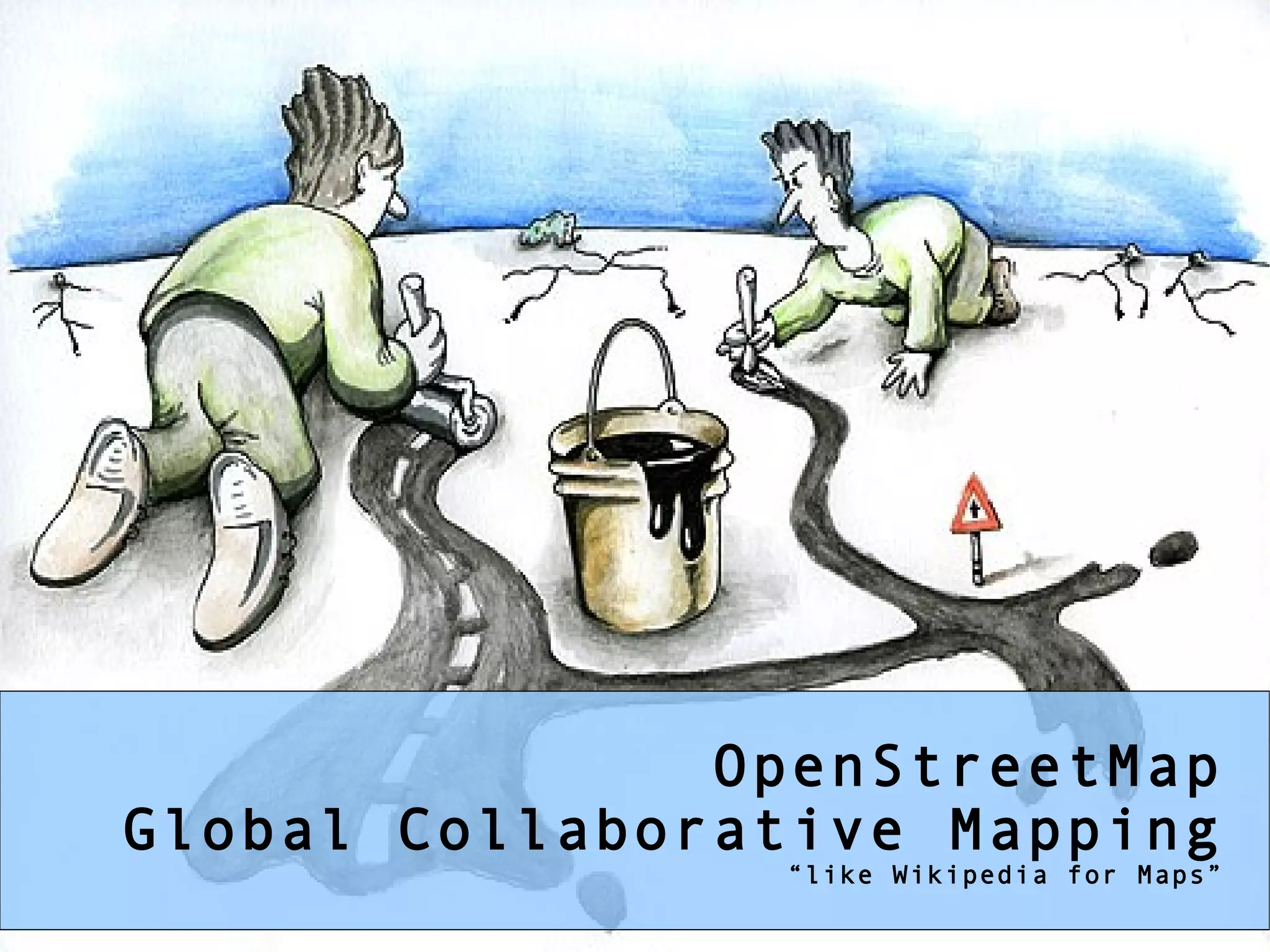
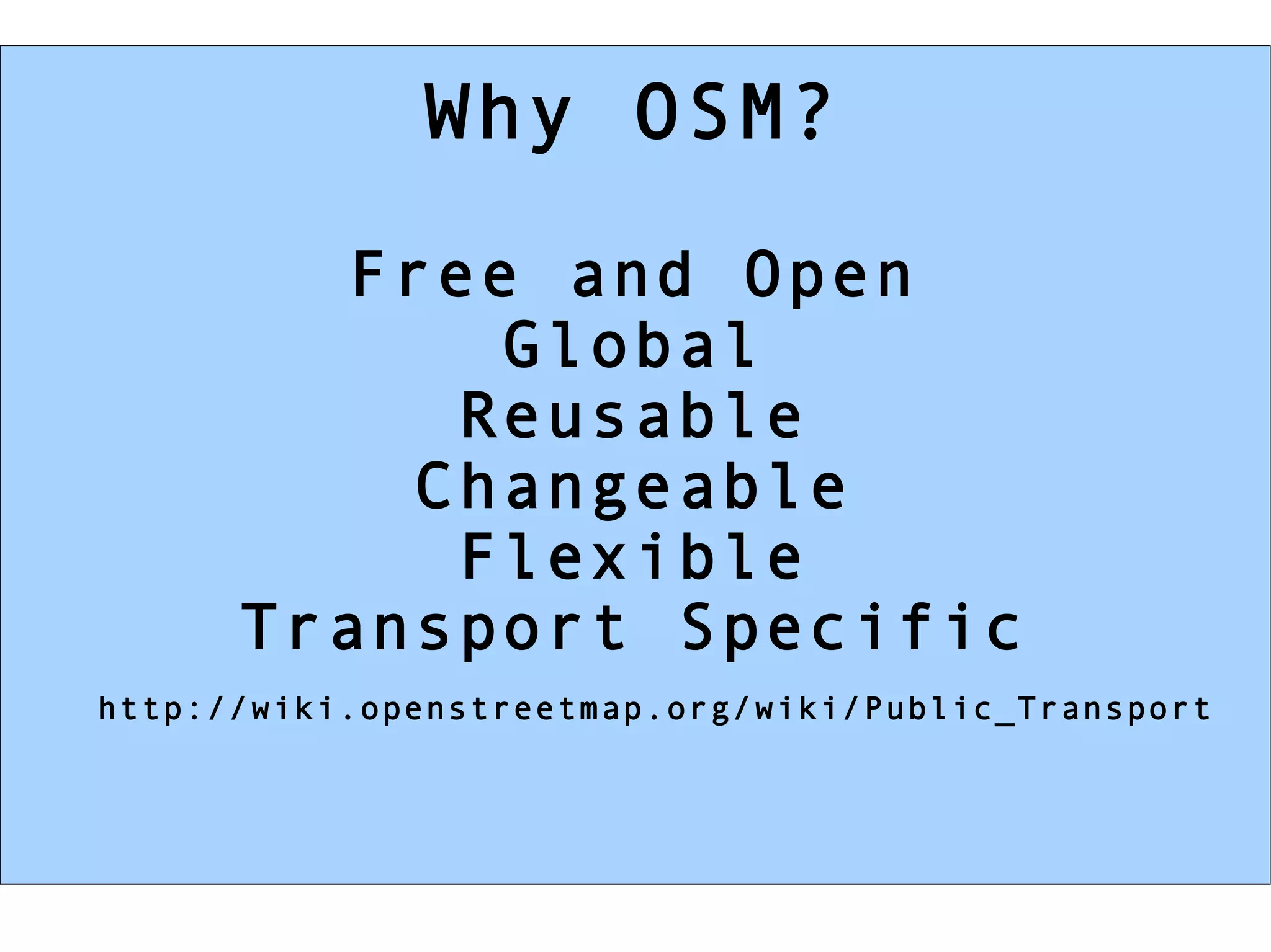
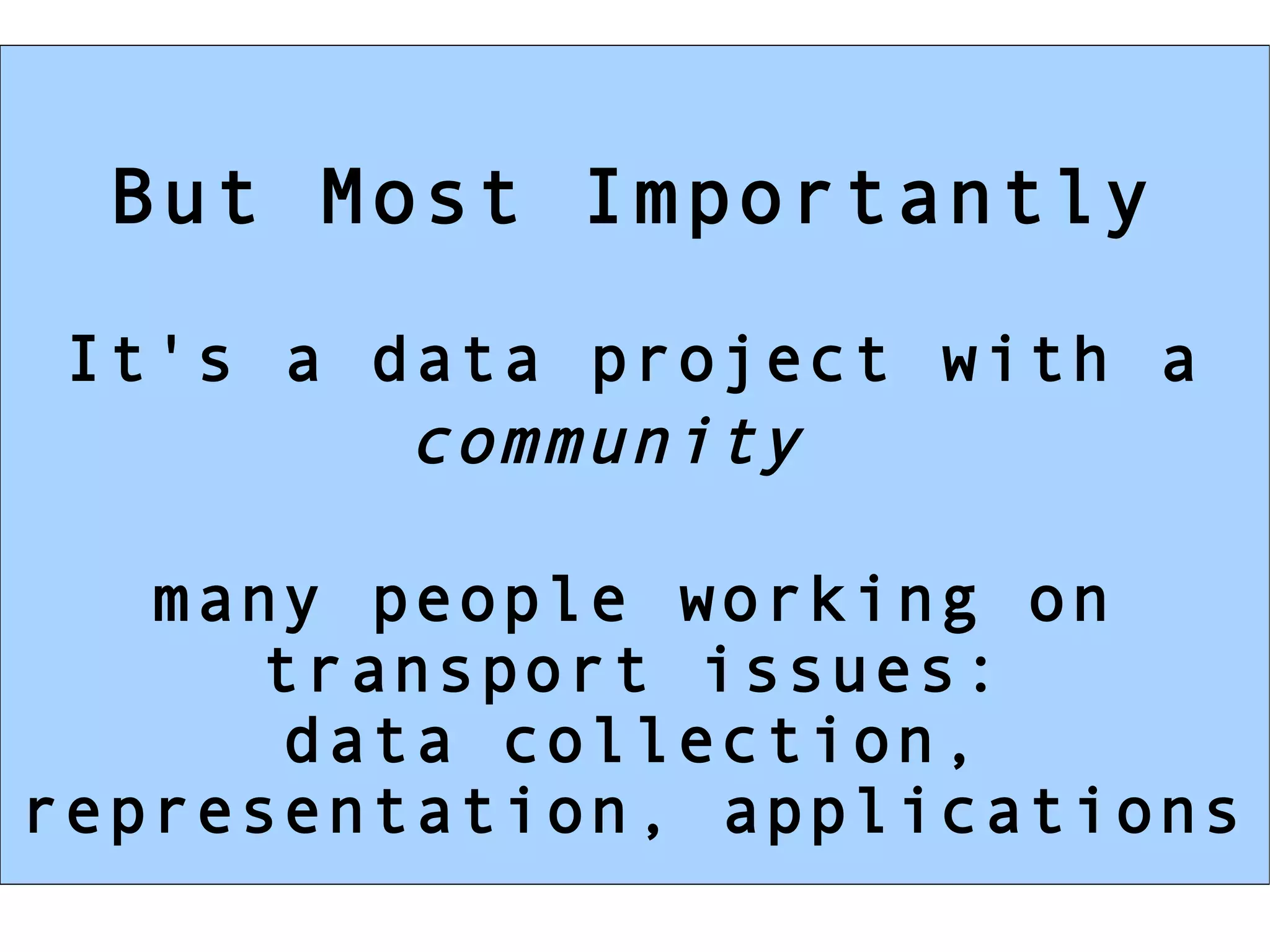
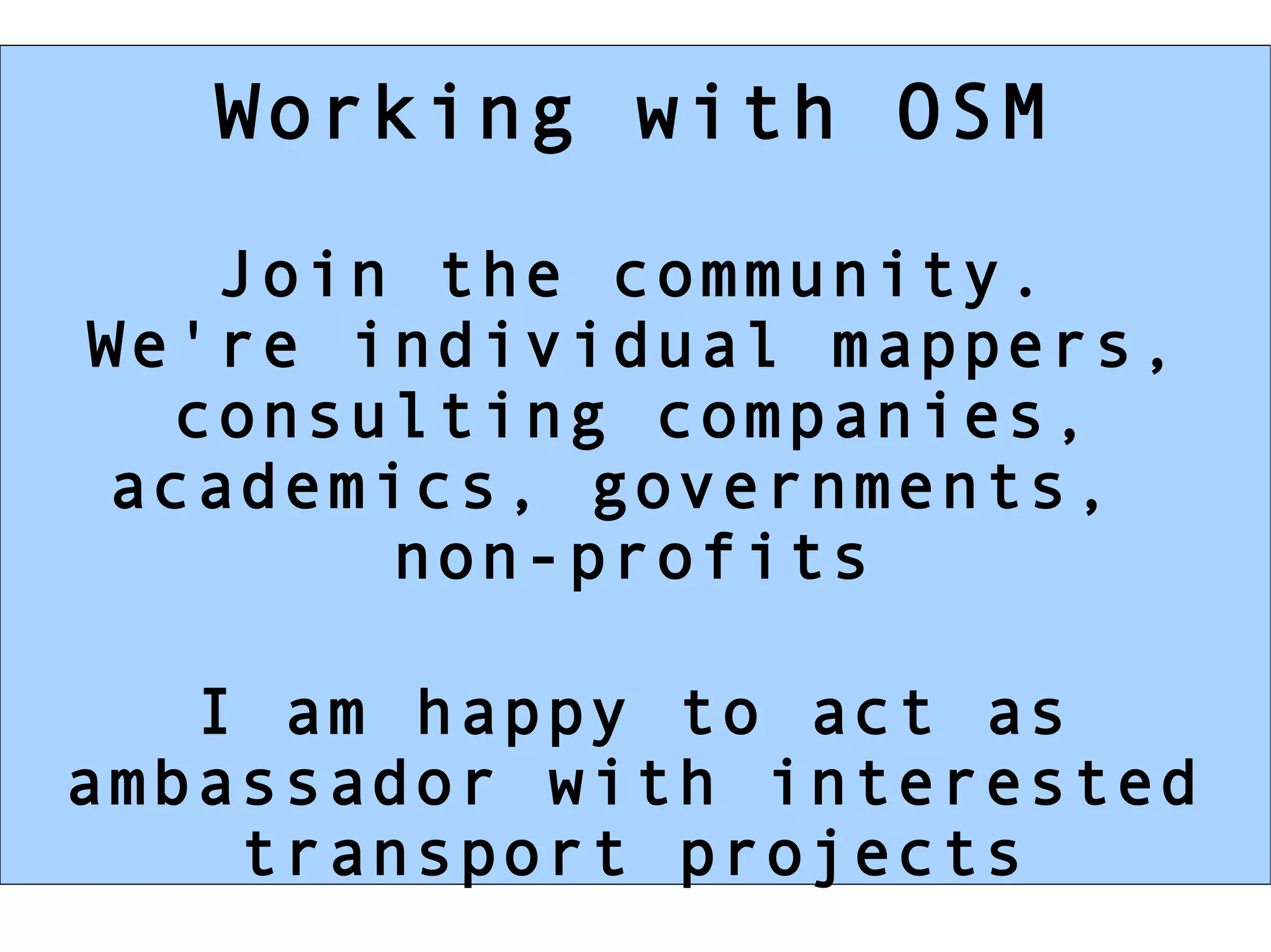
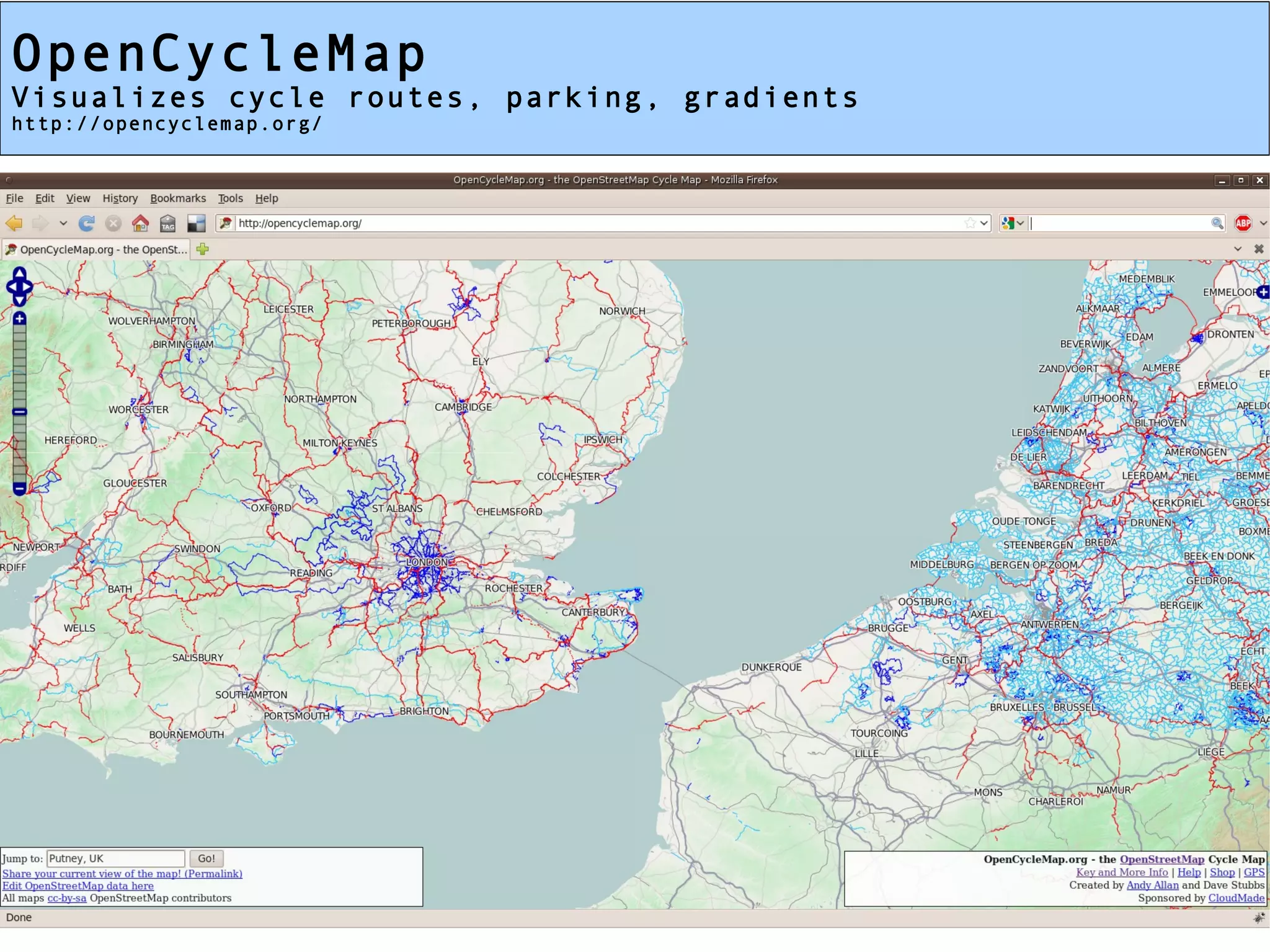
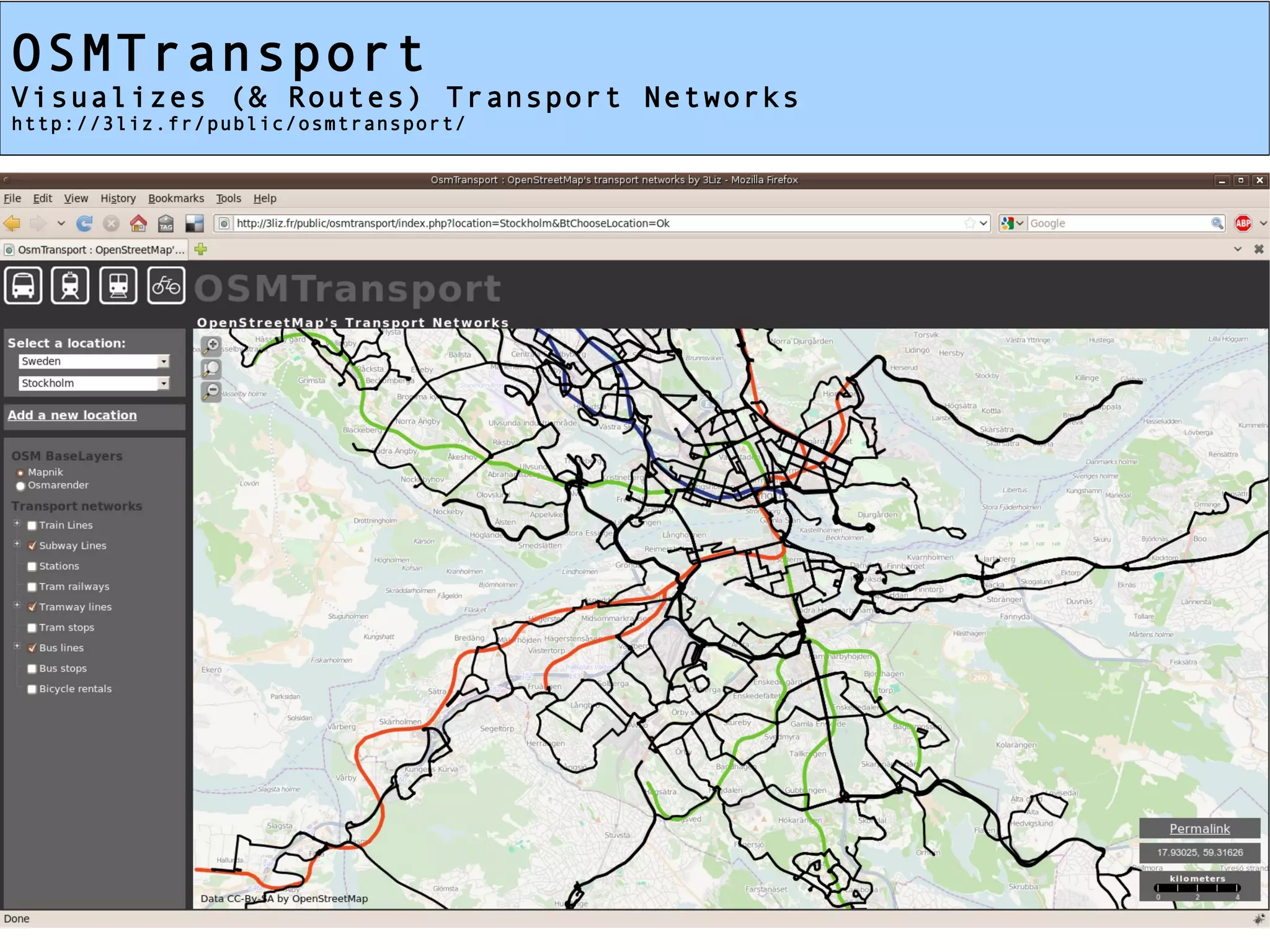
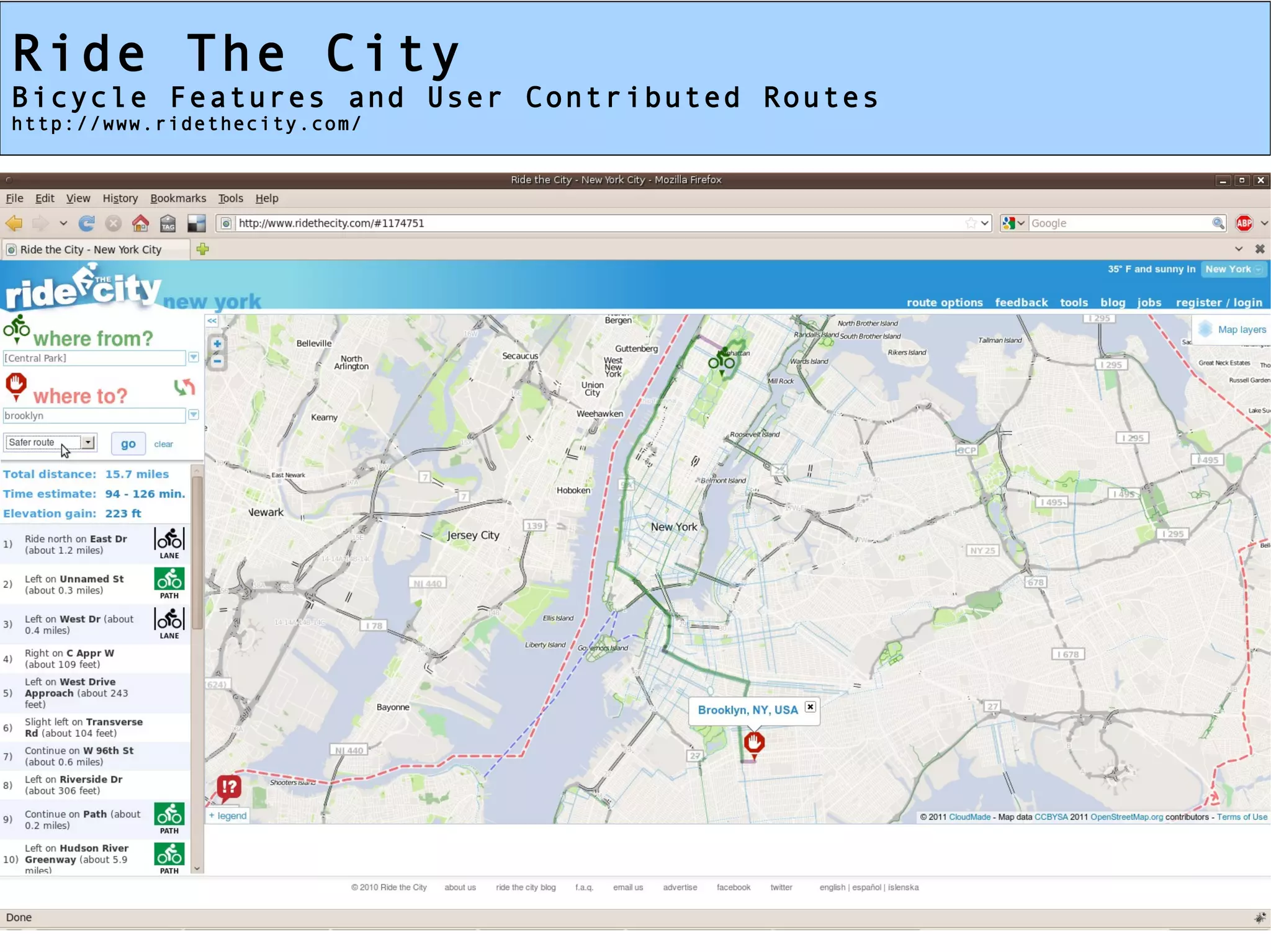
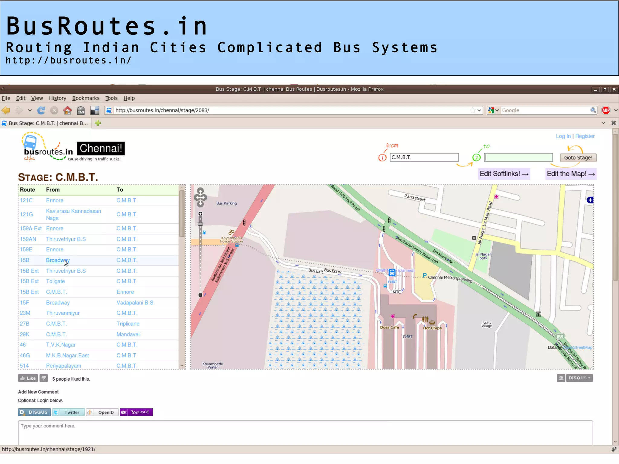
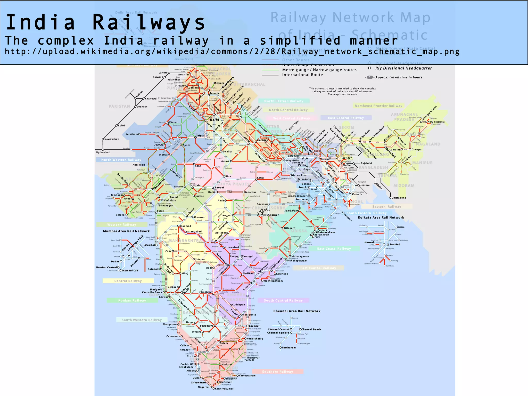
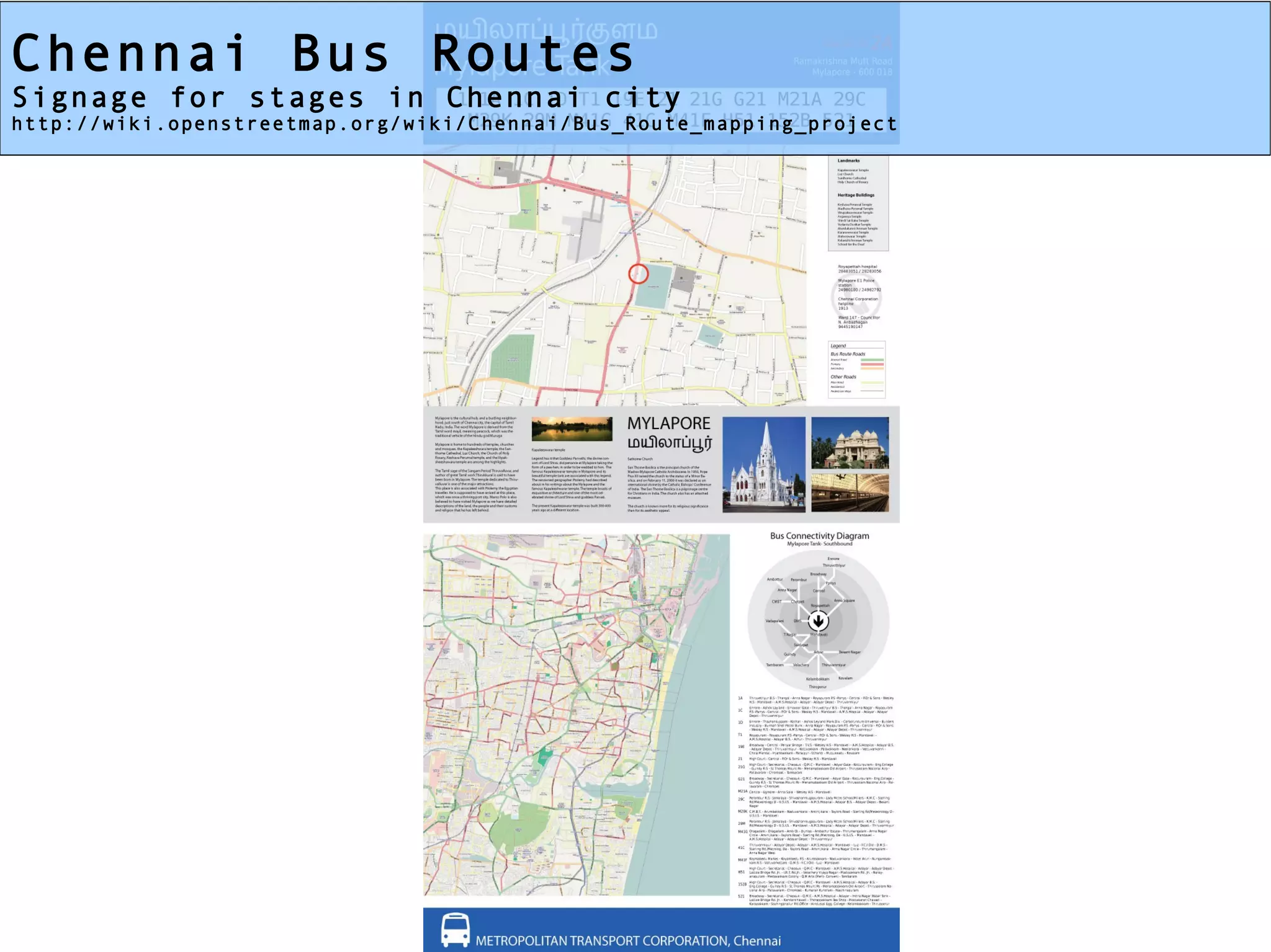
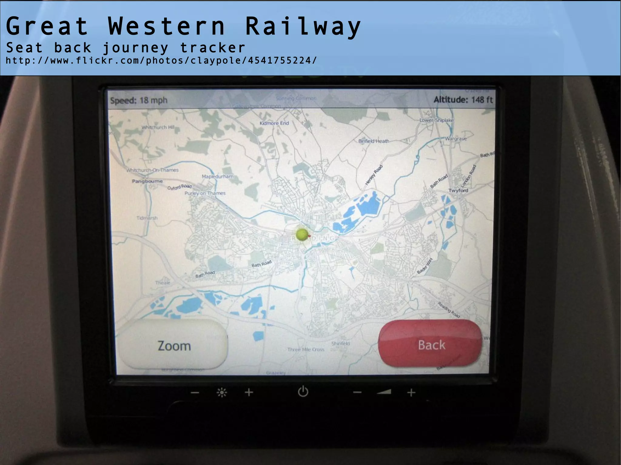
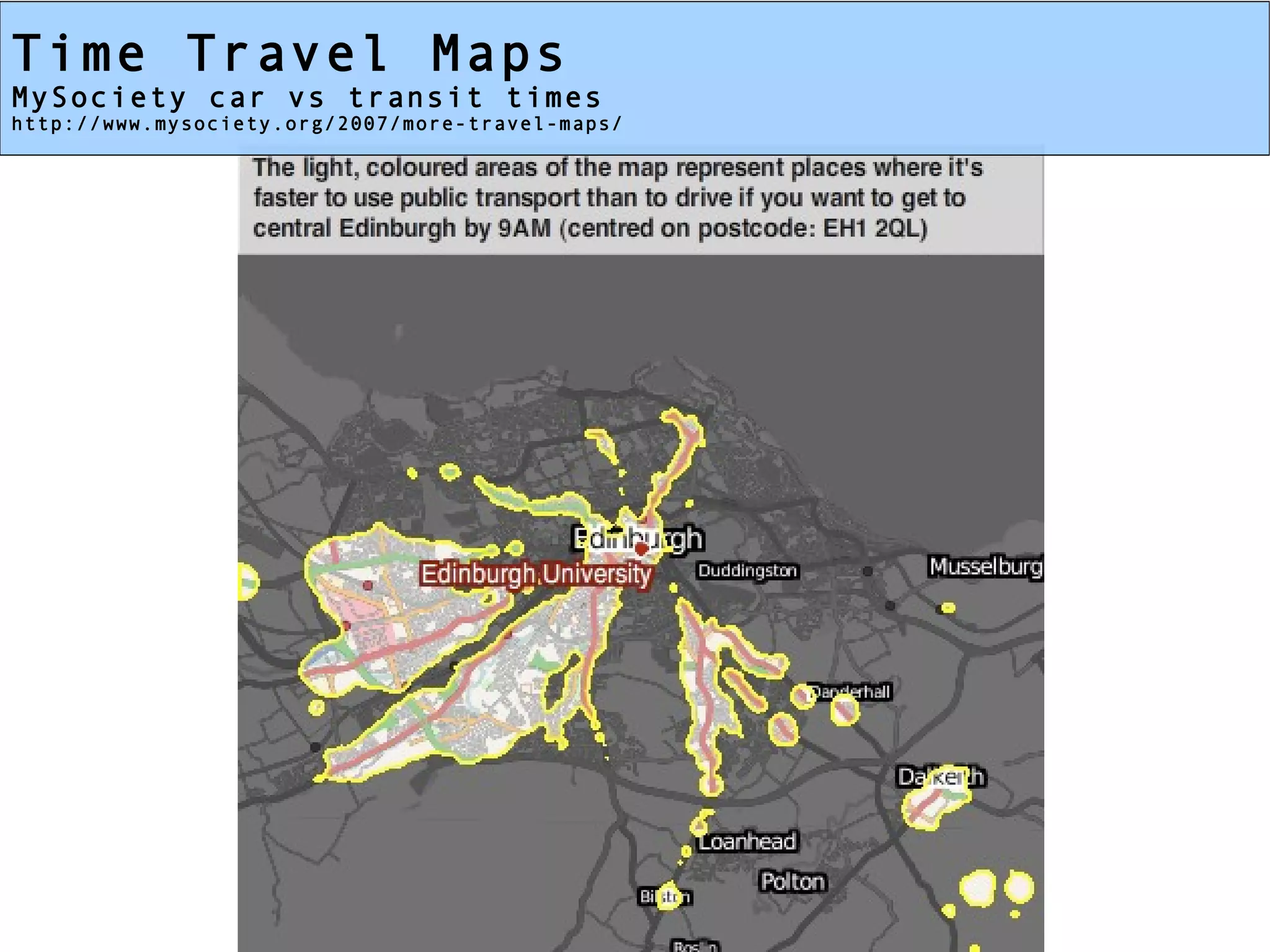
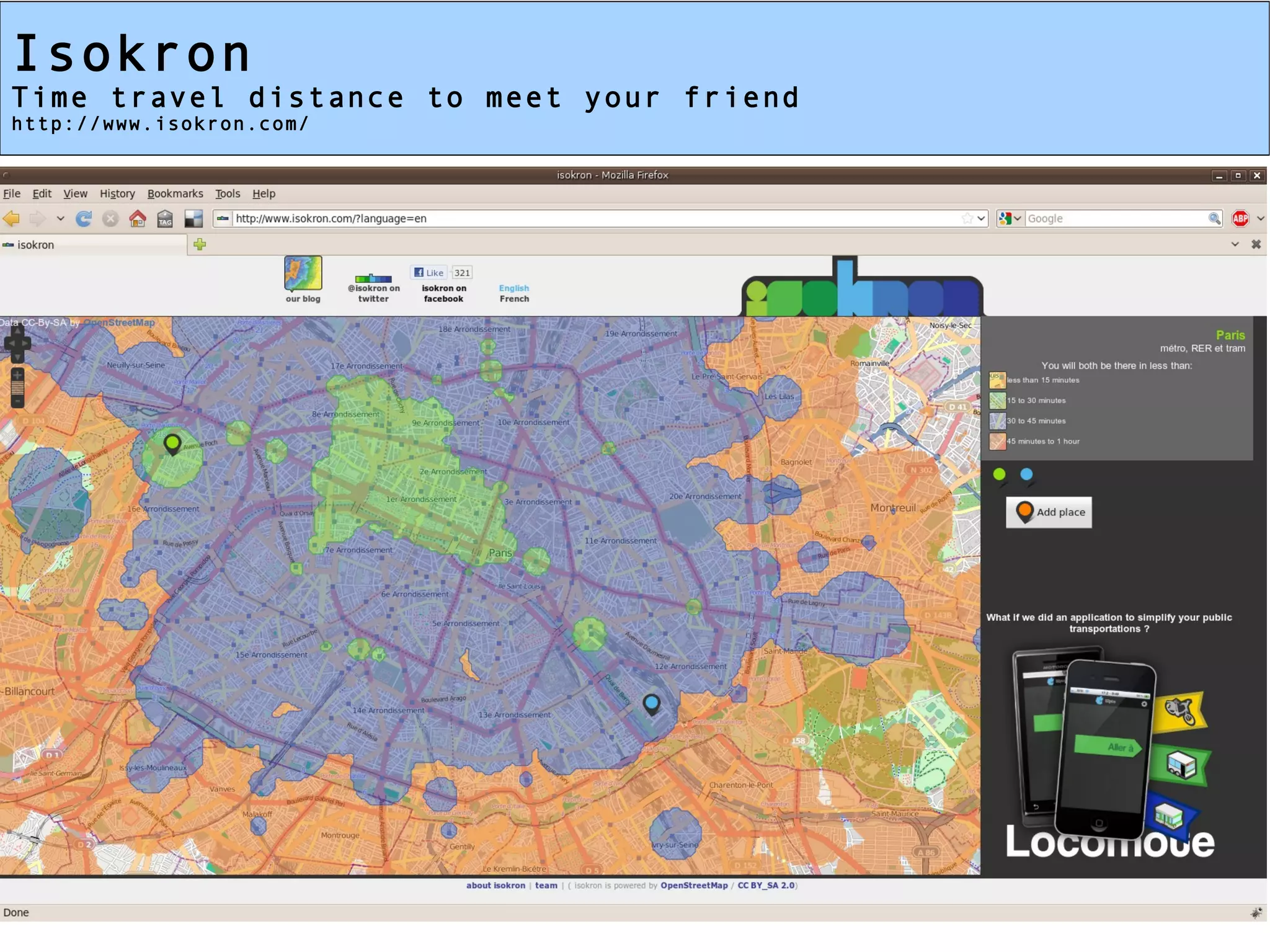
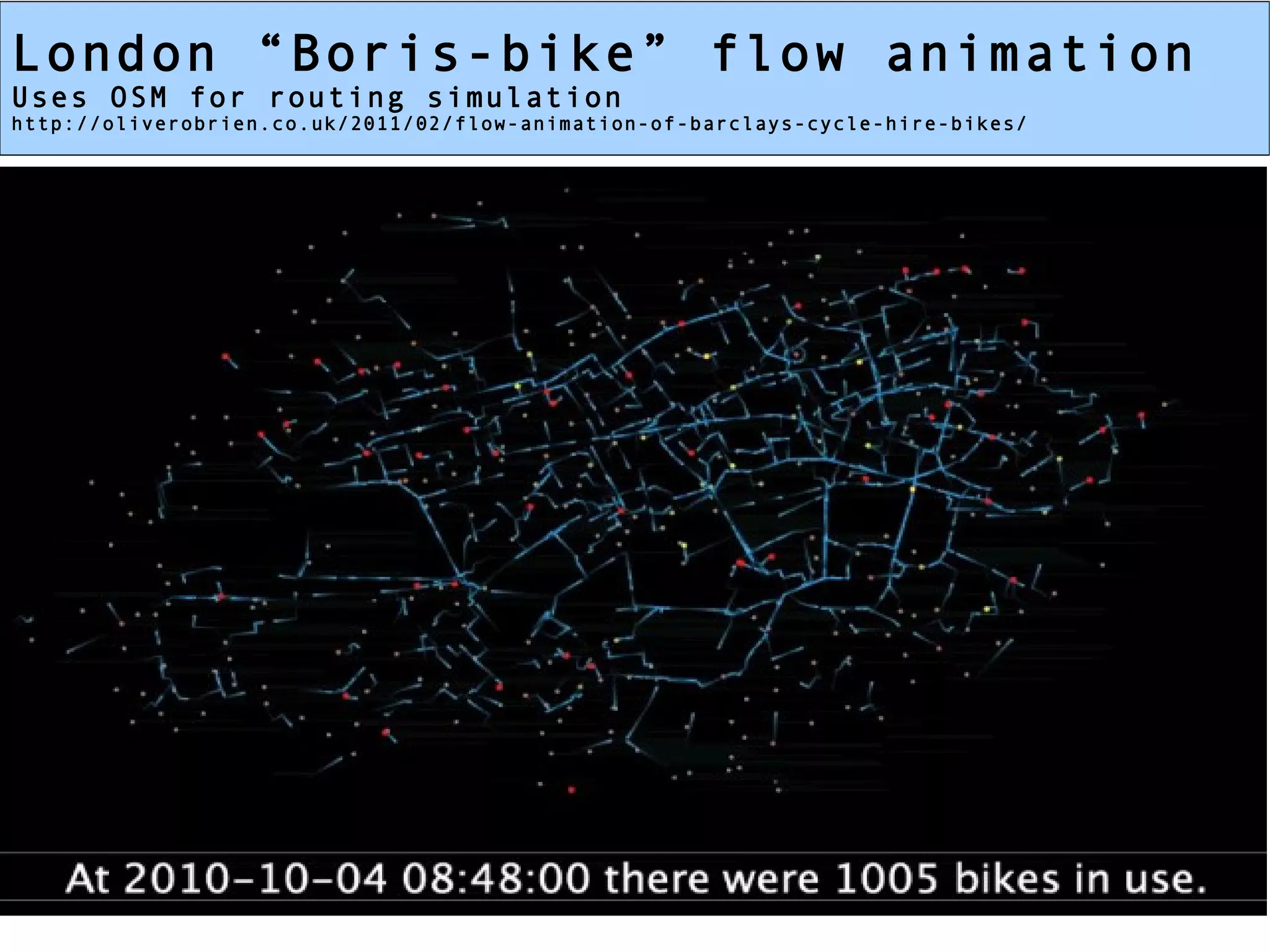
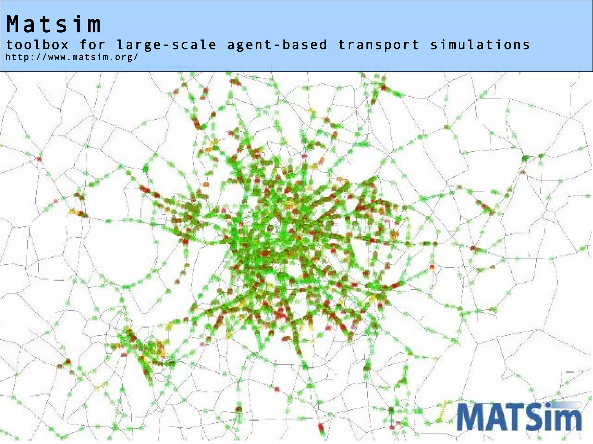
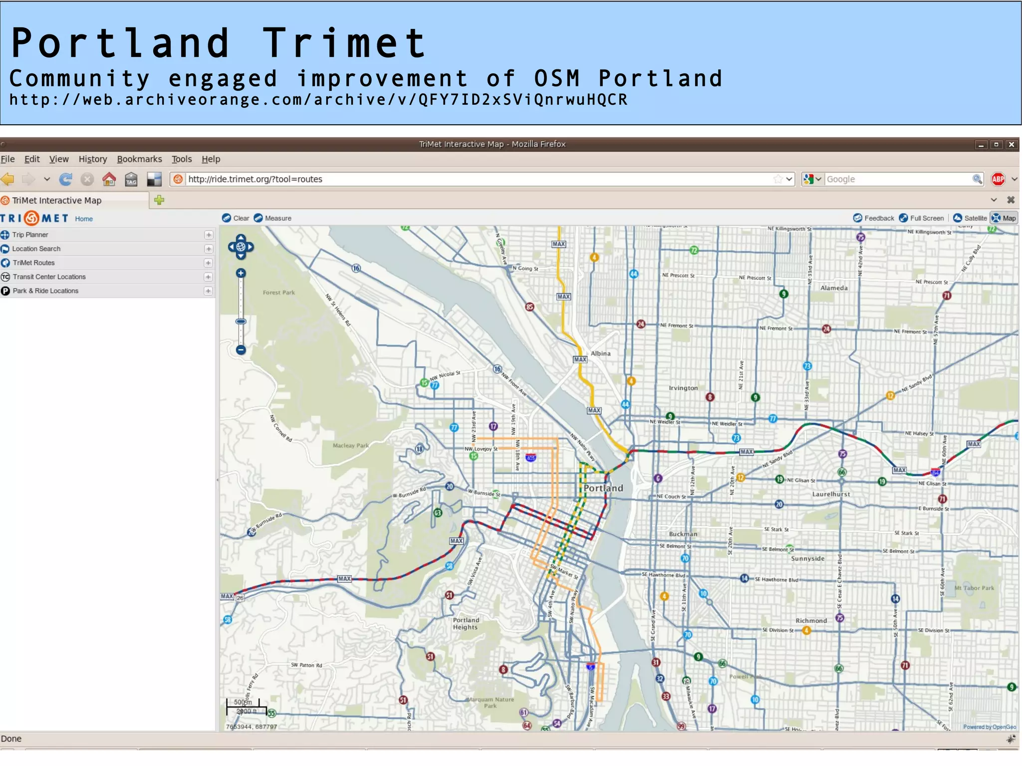
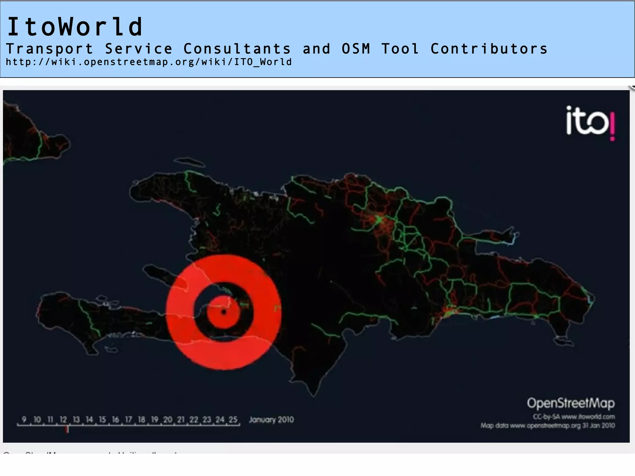
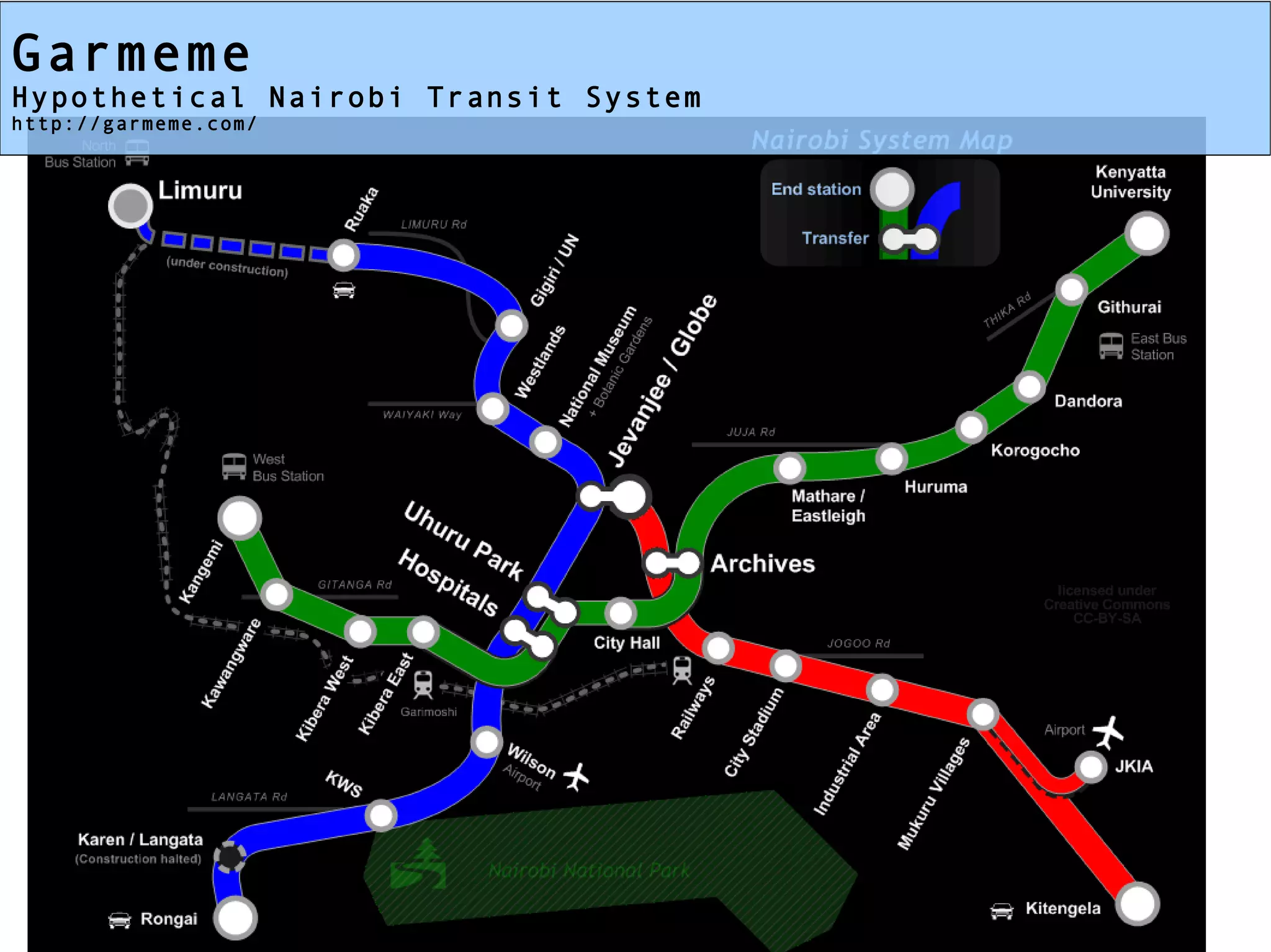
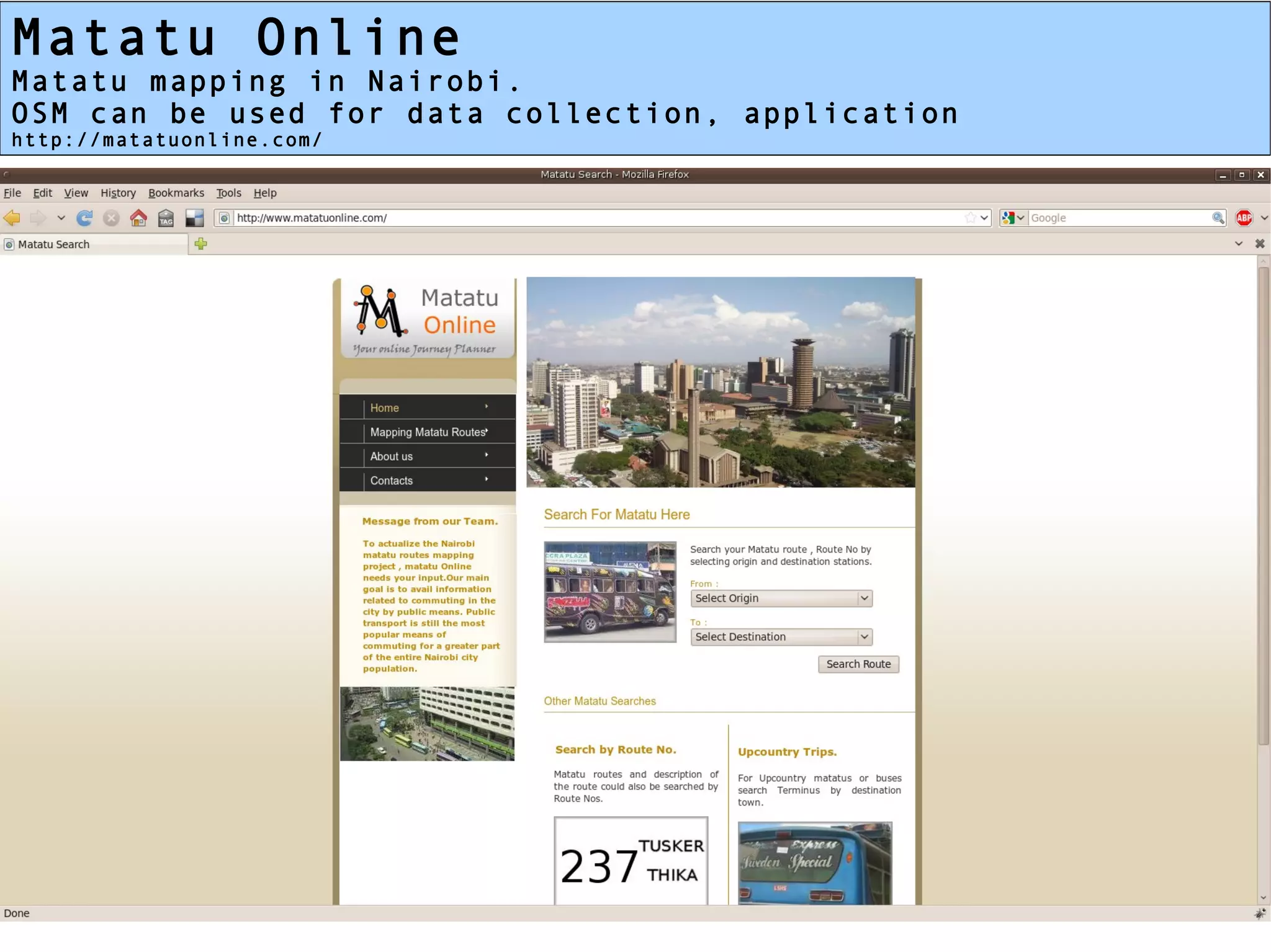
OpenStreetMap and Transport
    Data is a Community

        Mikel Maron


World Bank Transport Forum
       March 30, 2011
Mikel Maron

OpenStreetMap Foundation
      Board Member
       http://osmfoundation.org/


 Humanitarian OSM Team
     Board Member
     http://hot.openstreetmap.org/


 GroundTruth Initiative
      Co-Director
   http://groundtruthinitiative.org/
OpenStreetMap
Global Collaborative Mapping
                “like Wikipedia for Maps”
Well-known initiatives of OSM
Haiti Earthquake Response, Map Kibera, Japan
Why OSM?

         Free and Open
             Global
            Reusable
          Changeable
            Flexible
      Transport Specific
http://wiki.openstreetmap.org/wiki/Public_Transport
But Most Importantly

 It's a data project with a
         community

   many people working on
     transport issues:
      data collection,
representation, applications
Working with OSM

   Join the community.
We're individual mappers,
  consulting companies,
 academics, governments,
       non-profits

   I am happy to act as
ambassador with interested
    transport projects
OSM Use for Transport

Visualizing/Rendering
  Transport Networks
OpenCycleMap
Visualizes cycle routes, parking, gradients
http://opencyclemap.org/
OSMTransport
Visualizes (& Routes) Transport Networks
http://3liz.fr/public/osmtransport/
OSM Use for Transport

              Routing
http://wiki.openstreetmap.org/wiki/Routing
Ride The City
Bicycle Features and User Contributed Routes
http://www.ridethecity.com/
BusRoutes.in
Routing Indian Cities Complicated Bus Systems
http://busroutes.in/
University of Maryland
Hyperlocal, university campus, walking and transport routing
http://map.umd.edu/map/
City of Lund, Sweden
Municipality provided service
http://kartor.lund.se/resejamforaren/start_st.htm
OSM Use for Transport

  Schematic Maps
India Railways
The complex India railway in a simplified manner
http://upload.wikimedia.org/wikipedia/commons/2/28/Railway_network_schematic_map.png
Chennai Bus Routes
Signage for stages in Chennai city
http://wiki.openstreetmap.org/wiki/Chennai/Bus_Route_mapping_project
OSM Use for Transport

   Applications
Great Western Railway
Seat back journey tracker
http://www.flickr.com/photos/claypole/4541755224/
Time Travel Maps
MySociety car vs transit times
http://www.mysociety.org/2007/more-travel-maps/
Isokron
Time travel distance to meet your friend
http://www.isokron.com/
OSM Use for Transport

Planning/Simulations
London “Boris-bike” flow animation
Uses OSM for routing simulation
http://oliverobrien.co.uk/2011/02/flow-animation-of-barclays-cycle-hire-bikes/
Matsim
toolbox for large-scale agent-based transport simulations
http://www.matsim.org/
OSM Use for Transport

Other Engagements
Portland Trimet
Community engaged improvement of OSM Portland
http://web.archiveorange.com/archive/v/QFY7ID2xSViQnrwuHQCR
Abandoned Railways → Rail-trails
Russ Nelson mapping potential new rail trails
http://blog.russnelson.com/bicycling/rail-trails-4.html
Surrey Heath
All local council GIS data managed in OSM
http://www.soc.org.uk/southampton09/presentations/SurreyHeathDC.pdf
ItoWorld
Transport Service Consultants and OSM Tool Contributors
http://wiki.openstreetmap.org/wiki/ITO_World
Garmeme
Hypothetical Nairobi Transit System
http://garmeme.com/
Challenge #2
          Providing Information to the Public

The more than 50 numbered routes plied by the microbuses
have never been made publically available on a route
map, and riders depend on word-of-mouth for route
choice. This is in part because microbuses fall slightly
out of the jurisdiction of the relevant city
departments, but largely because the departments
responsible for transport management lack the technical
capacity / funding to utilize GIS to produce and
continuously update such route maps.

Further, the City does  not have any means to convey
urgent transport (or other public service) information
to residents in a timely manner (e.g., through SMS text
messages). The City has expressed interest in this type
of service but is concerned about logistics and cost of
establishing such a system.
Matatu Online
Matatu mapping in Nairobi.
OSM can be used for data collection, application
http://matatuonline.com/
Thanks

        Mikel Maron
  mikel@osmfoundation.org
          @mikel

http://slideshare.net/mikel_maron/
     http://openstreetmap.org/

OpenStreetMap and Transport

  • 1.
    OpenStreetMap and Transport Data is a Community Mikel Maron World Bank Transport Forum March 30, 2011
  • 2.
    Mikel Maron OpenStreetMap Foundation Board Member http://osmfoundation.org/ Humanitarian OSM Team Board Member http://hot.openstreetmap.org/ GroundTruth Initiative Co-Director http://groundtruthinitiative.org/
  • 3.
    OpenStreetMap Global Collaborative Mapping “like Wikipedia for Maps”
  • 4.
    Well-known initiatives ofOSM Haiti Earthquake Response, Map Kibera, Japan
  • 5.
    Why OSM? Free and Open Global Reusable Changeable Flexible Transport Specific http://wiki.openstreetmap.org/wiki/Public_Transport
  • 6.
    But Most Importantly It's a data project with a community many people working on transport issues: data collection, representation, applications
  • 7.
    Working with OSM Join the community. We're individual mappers, consulting companies, academics, governments, non-profits I am happy to act as ambassador with interested transport projects
  • 8.
    OSM Use forTransport Visualizing/Rendering Transport Networks
  • 9.
    OpenCycleMap Visualizes cycle routes,parking, gradients http://opencyclemap.org/
  • 10.
    OSMTransport Visualizes (& Routes)Transport Networks http://3liz.fr/public/osmtransport/
  • 11.
    OSM Use forTransport Routing http://wiki.openstreetmap.org/wiki/Routing
  • 12.
    Ride The City BicycleFeatures and User Contributed Routes http://www.ridethecity.com/
  • 13.
    BusRoutes.in Routing Indian CitiesComplicated Bus Systems http://busroutes.in/
  • 14.
    University of Maryland Hyperlocal,university campus, walking and transport routing http://map.umd.edu/map/
  • 15.
    City of Lund,Sweden Municipality provided service http://kartor.lund.se/resejamforaren/start_st.htm
  • 16.
    OSM Use forTransport Schematic Maps
  • 17.
    India Railways The complexIndia railway in a simplified manner http://upload.wikimedia.org/wikipedia/commons/2/28/Railway_network_schematic_map.png
  • 18.
    Chennai Bus Routes Signagefor stages in Chennai city http://wiki.openstreetmap.org/wiki/Chennai/Bus_Route_mapping_project
  • 19.
    OSM Use forTransport Applications
  • 20.
    Great Western Railway Seatback journey tracker http://www.flickr.com/photos/claypole/4541755224/
  • 21.
    Time Travel Maps MySocietycar vs transit times http://www.mysociety.org/2007/more-travel-maps/
  • 22.
    Isokron Time travel distanceto meet your friend http://www.isokron.com/
  • 23.
    OSM Use forTransport Planning/Simulations
  • 24.
    London “Boris-bike” flowanimation Uses OSM for routing simulation http://oliverobrien.co.uk/2011/02/flow-animation-of-barclays-cycle-hire-bikes/
  • 25.
    Matsim toolbox for large-scaleagent-based transport simulations http://www.matsim.org/
  • 26.
    OSM Use forTransport Other Engagements
  • 27.
    Portland Trimet Community engagedimprovement of OSM Portland http://web.archiveorange.com/archive/v/QFY7ID2xSViQnrwuHQCR
  • 28.
    Abandoned Railways →Rail-trails Russ Nelson mapping potential new rail trails http://blog.russnelson.com/bicycling/rail-trails-4.html
  • 29.
    Surrey Heath All localcouncil GIS data managed in OSM http://www.soc.org.uk/southampton09/presentations/SurreyHeathDC.pdf
  • 30.
    ItoWorld Transport Service Consultantsand OSM Tool Contributors http://wiki.openstreetmap.org/wiki/ITO_World
  • 31.
    Garmeme Hypothetical Nairobi TransitSystem http://garmeme.com/
  • 32.
    Challenge #2 Providing Information to the Public The more than 50 numbered routes plied by the microbuses have never been made publically available on a route map, and riders depend on word-of-mouth for route choice. This is in part because microbuses fall slightly out of the jurisdiction of the relevant city departments, but largely because the departments responsible for transport management lack the technical capacity / funding to utilize GIS to produce and continuously update such route maps. Further, the City does not have any means to convey urgent transport (or other public service) information to residents in a timely manner (e.g., through SMS text messages). The City has expressed interest in this type of service but is concerned about logistics and cost of establishing such a system.
  • 33.
    Matatu Online Matatu mappingin Nairobi. OSM can be used for data collection, application http://matatuonline.com/
  • 34.
    Thanks Mikel Maron mikel@osmfoundation.org @mikel http://slideshare.net/mikel_maron/ http://openstreetmap.org/