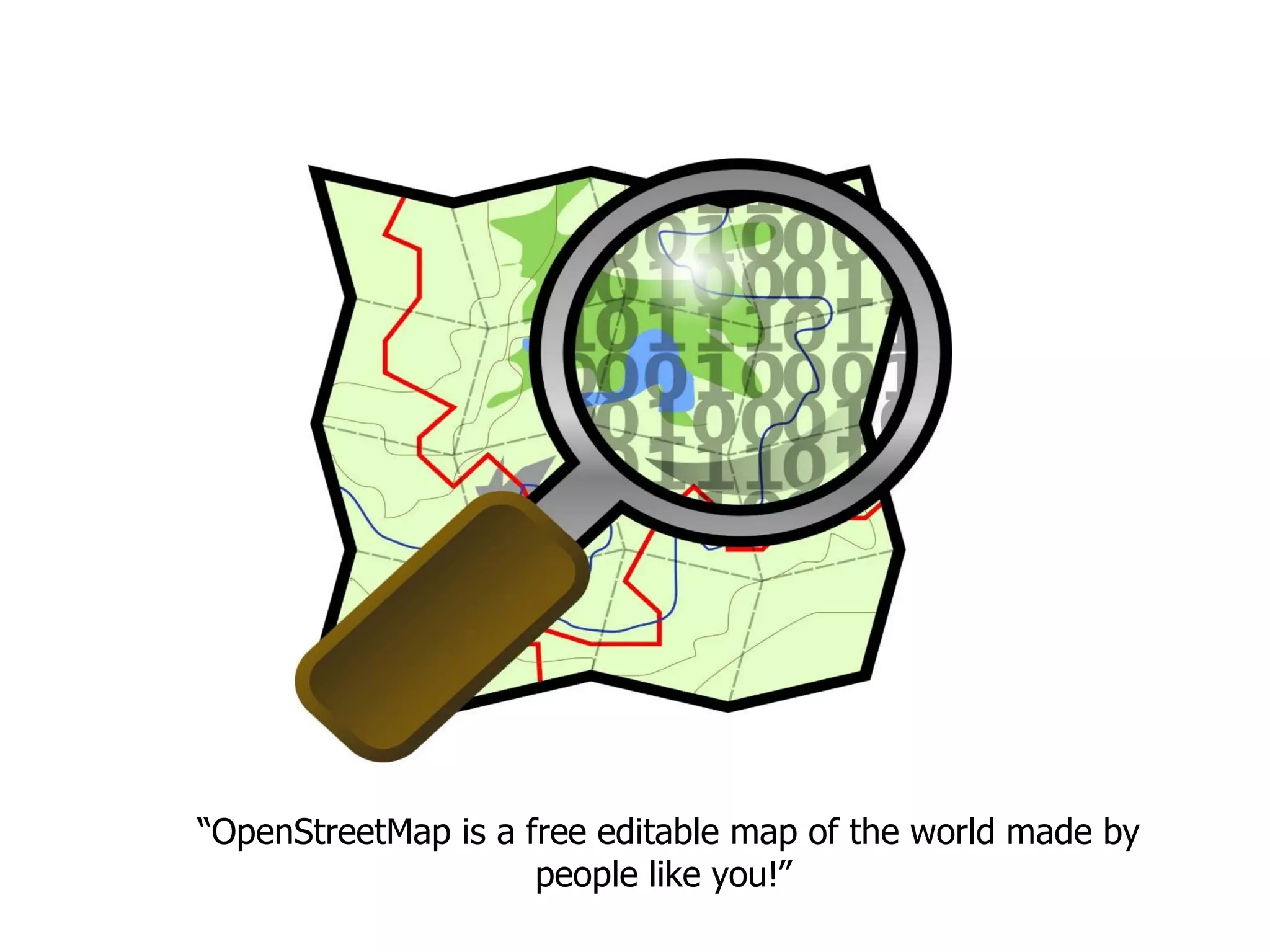
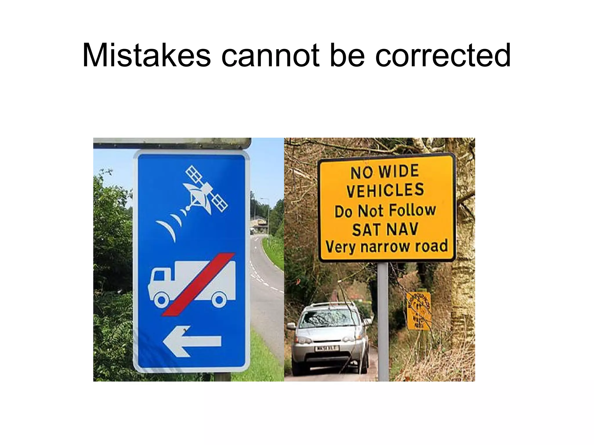
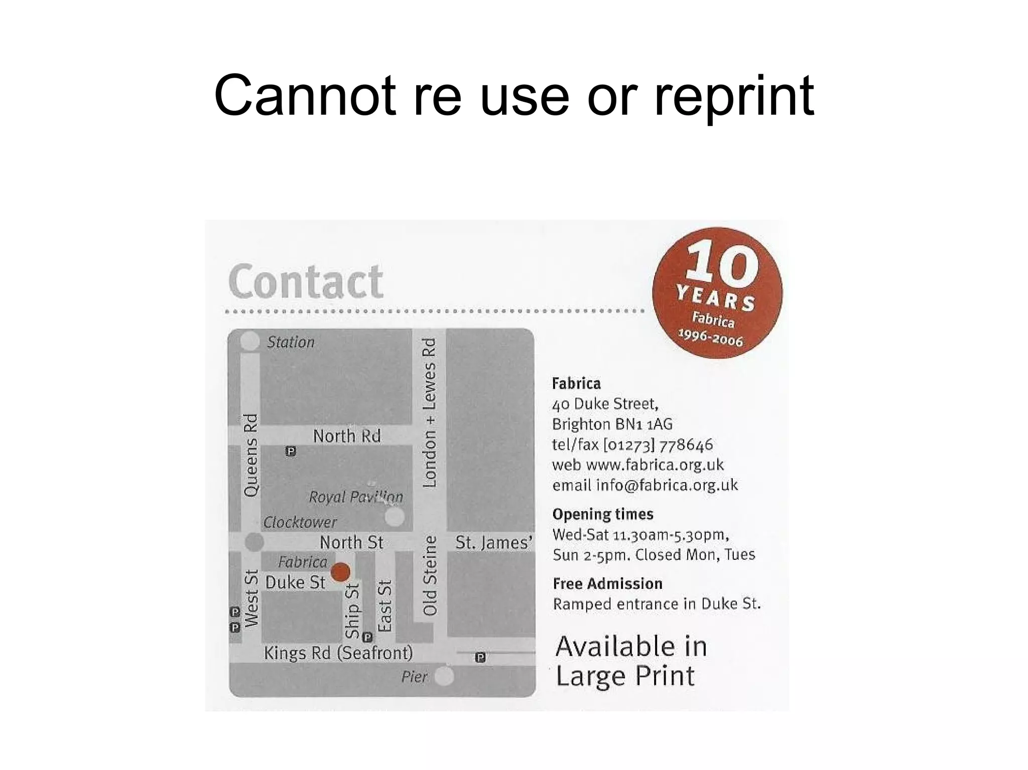
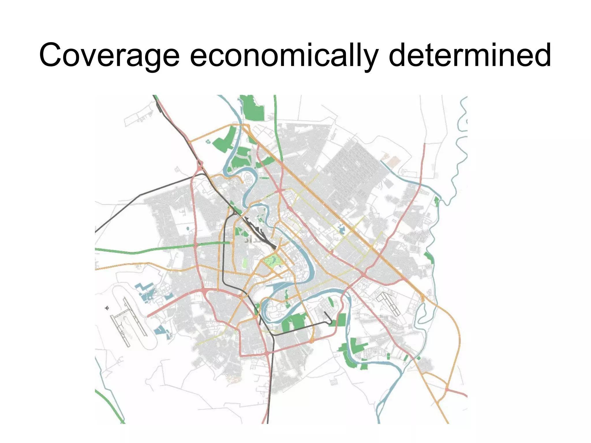
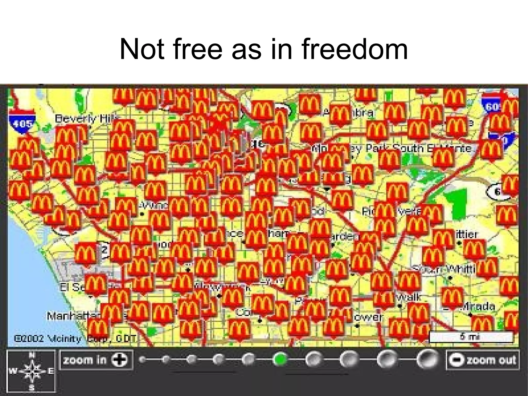
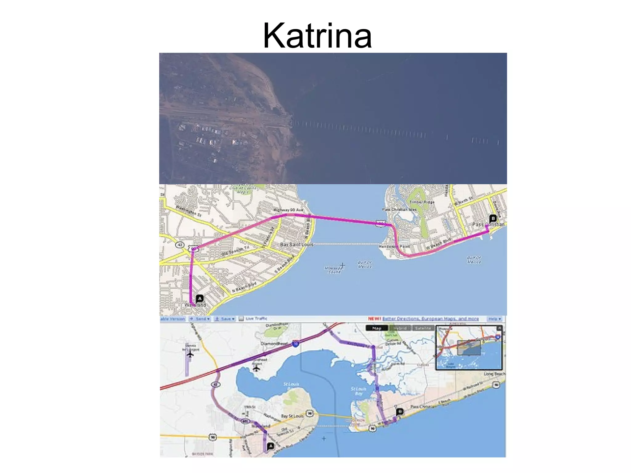
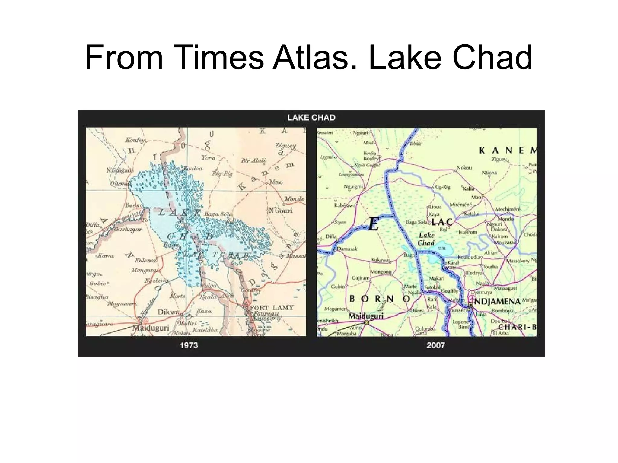
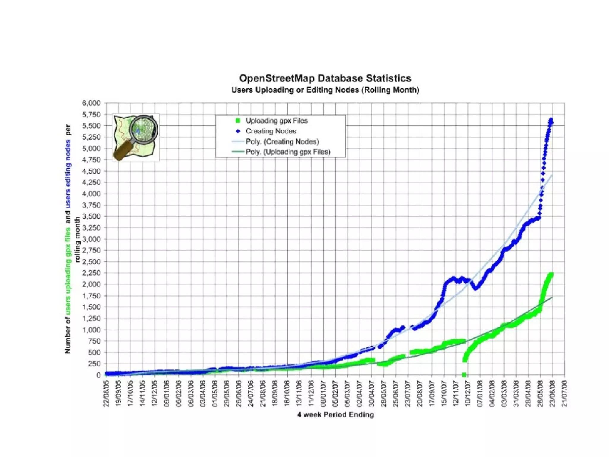
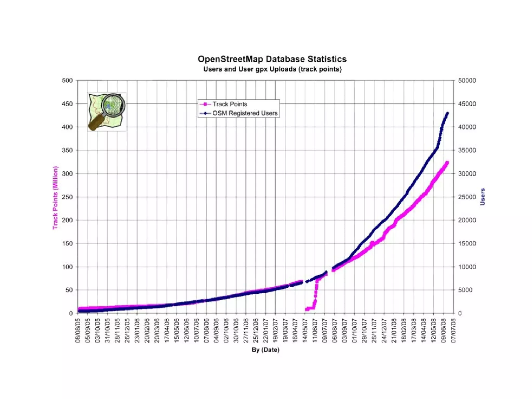
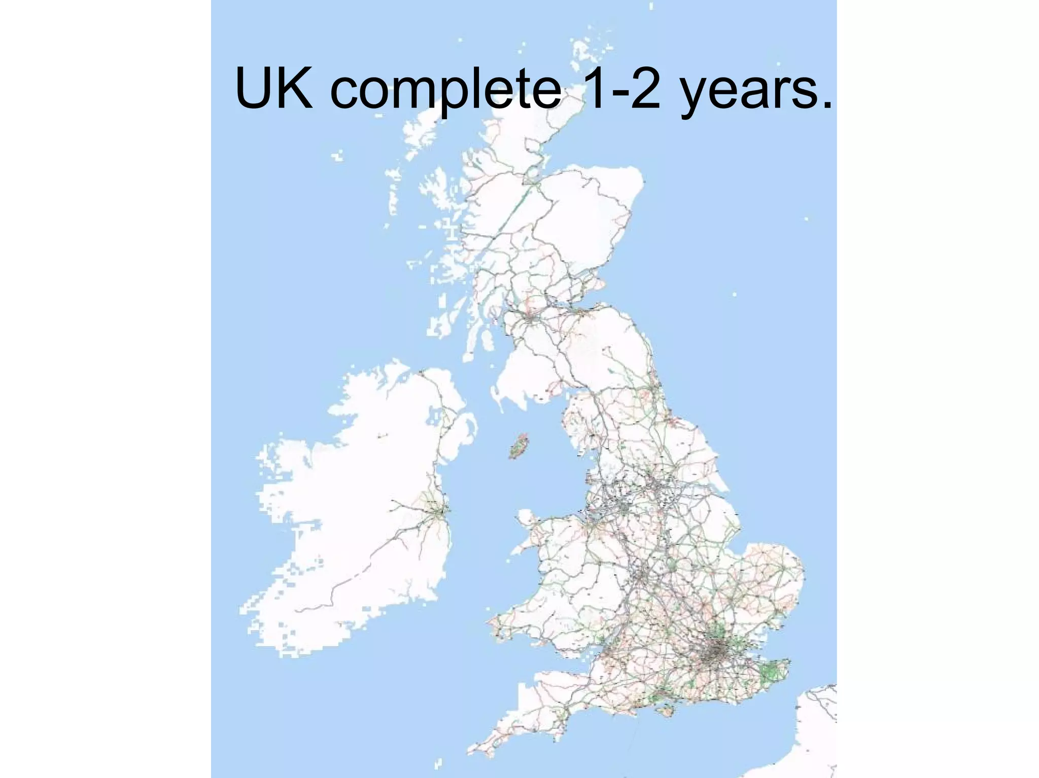
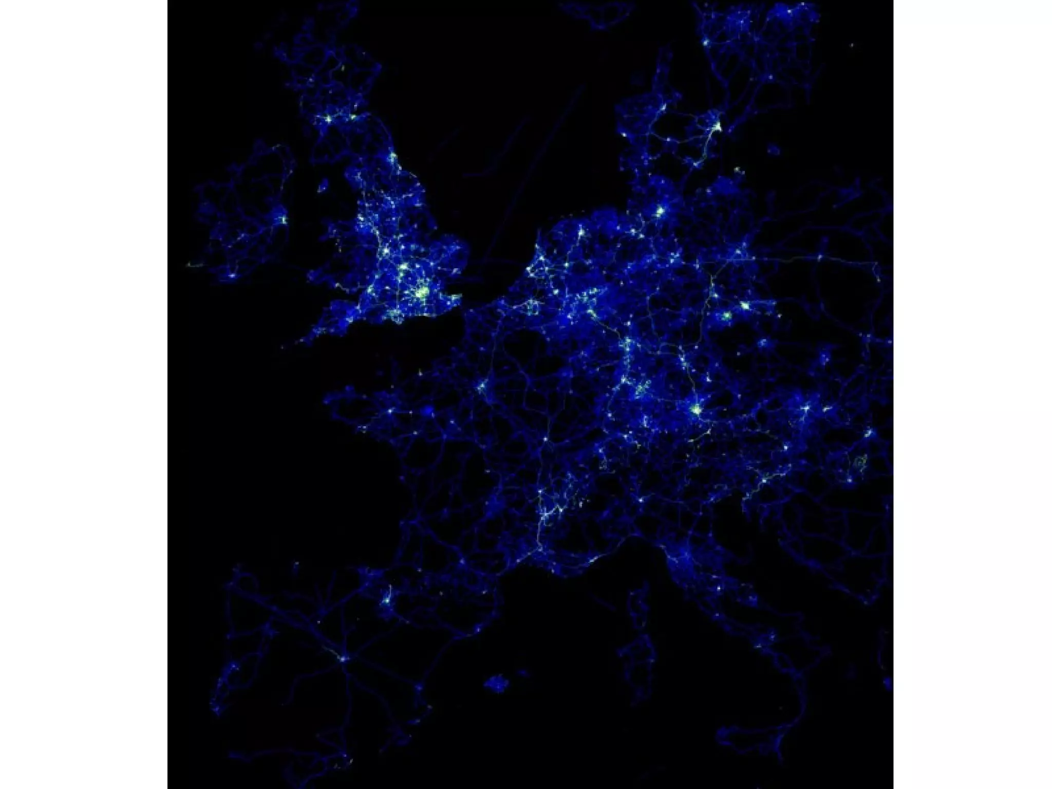
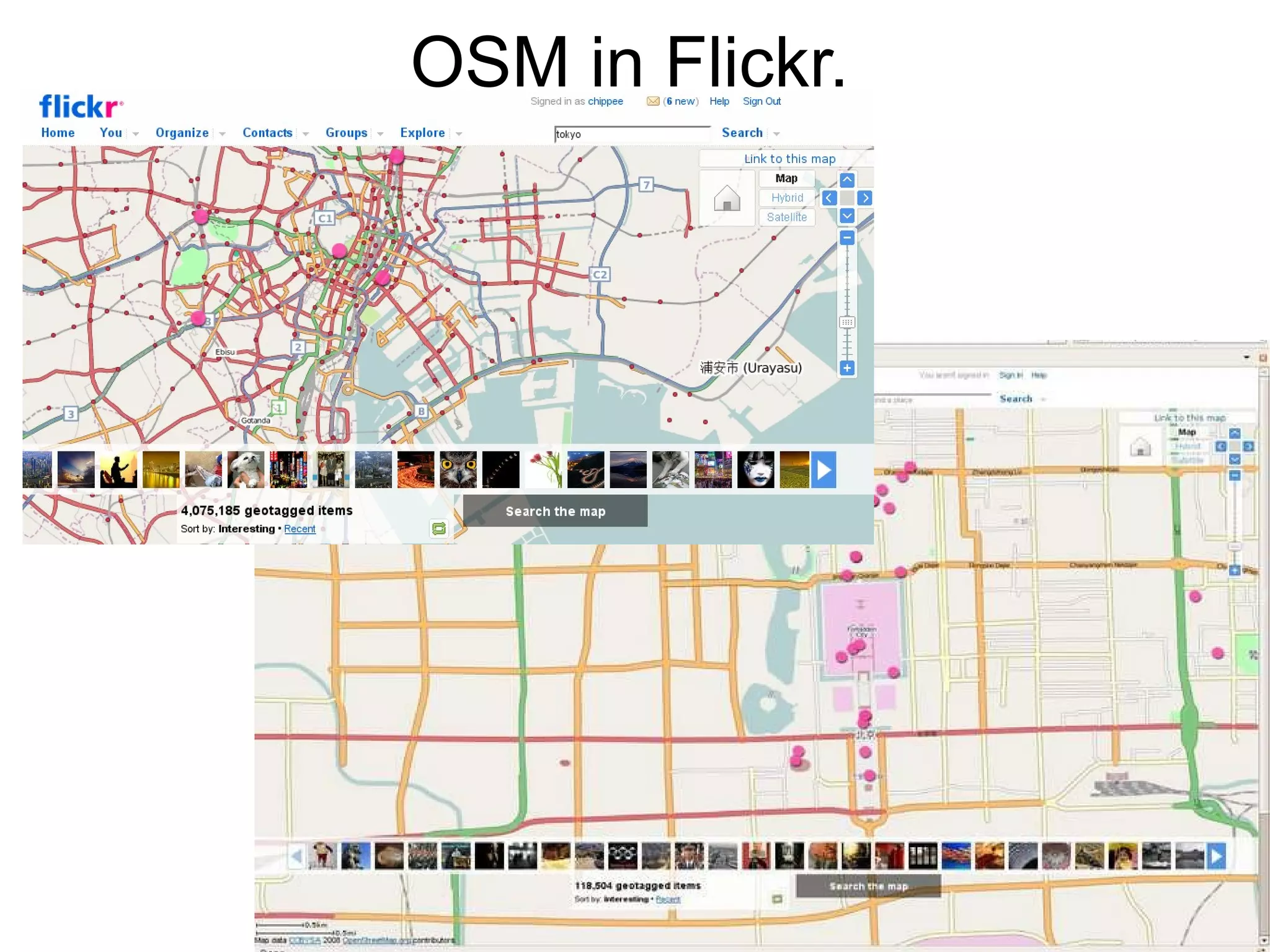
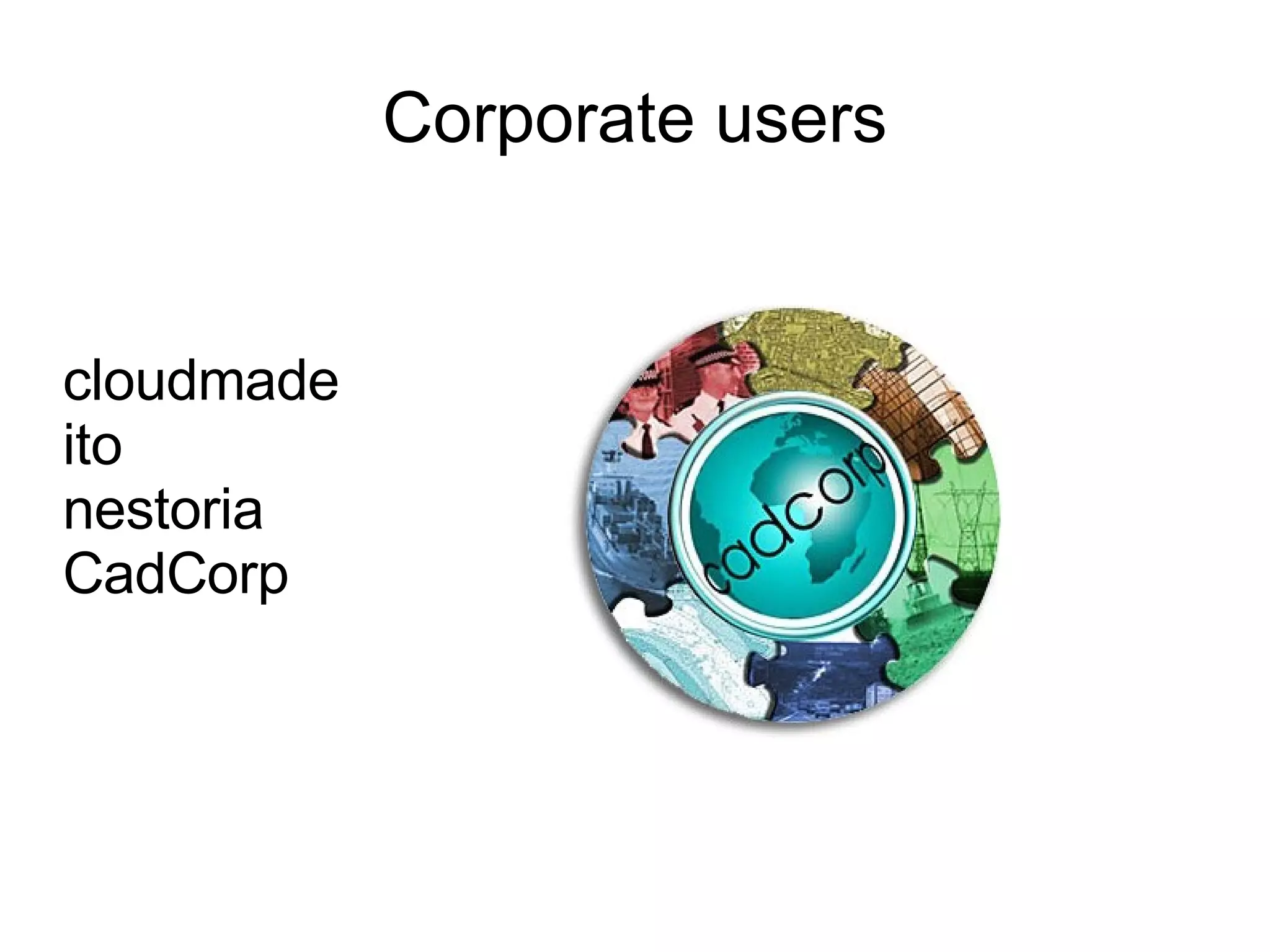
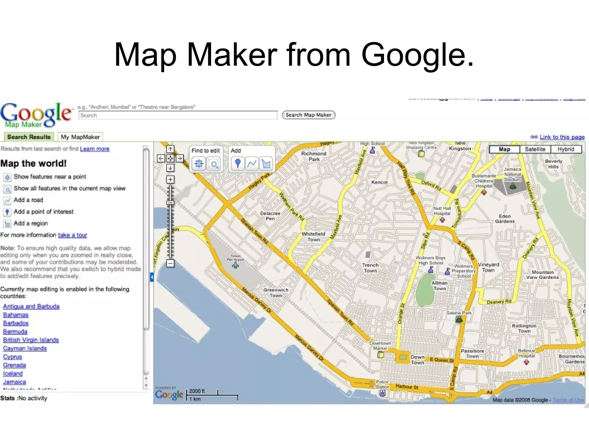
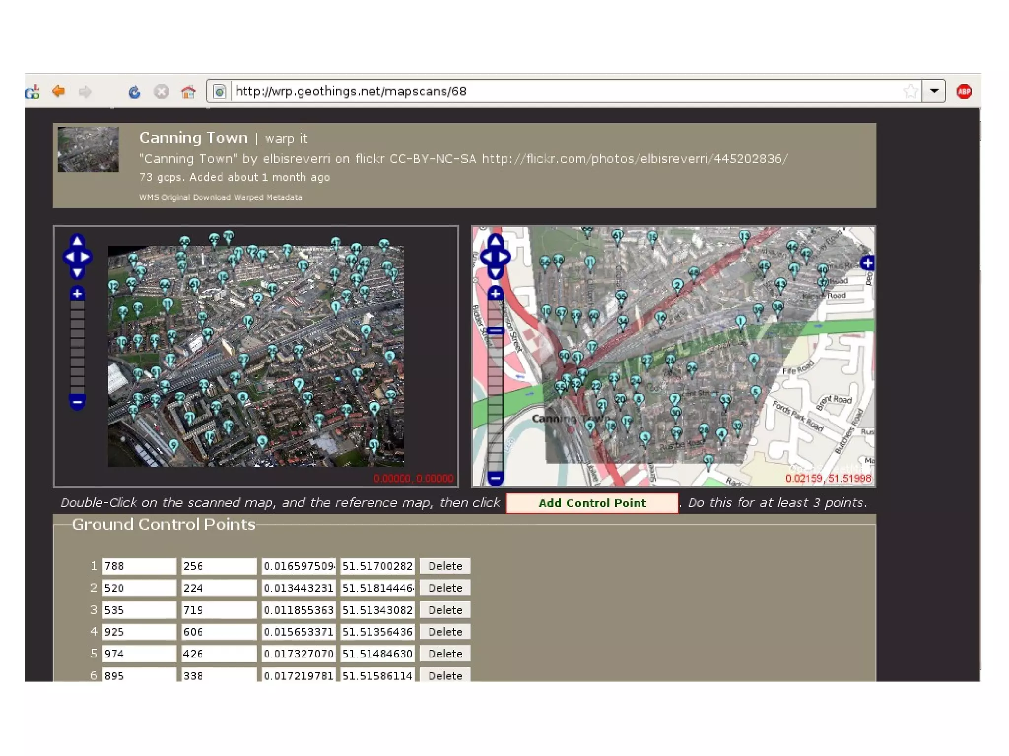
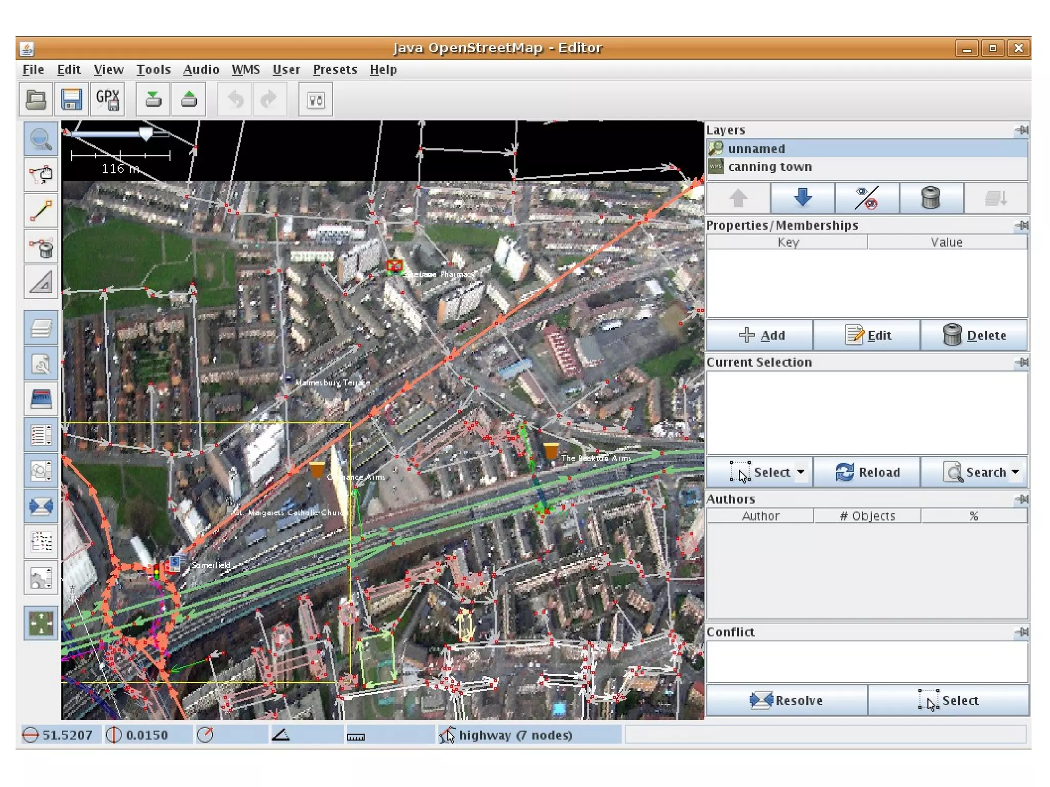
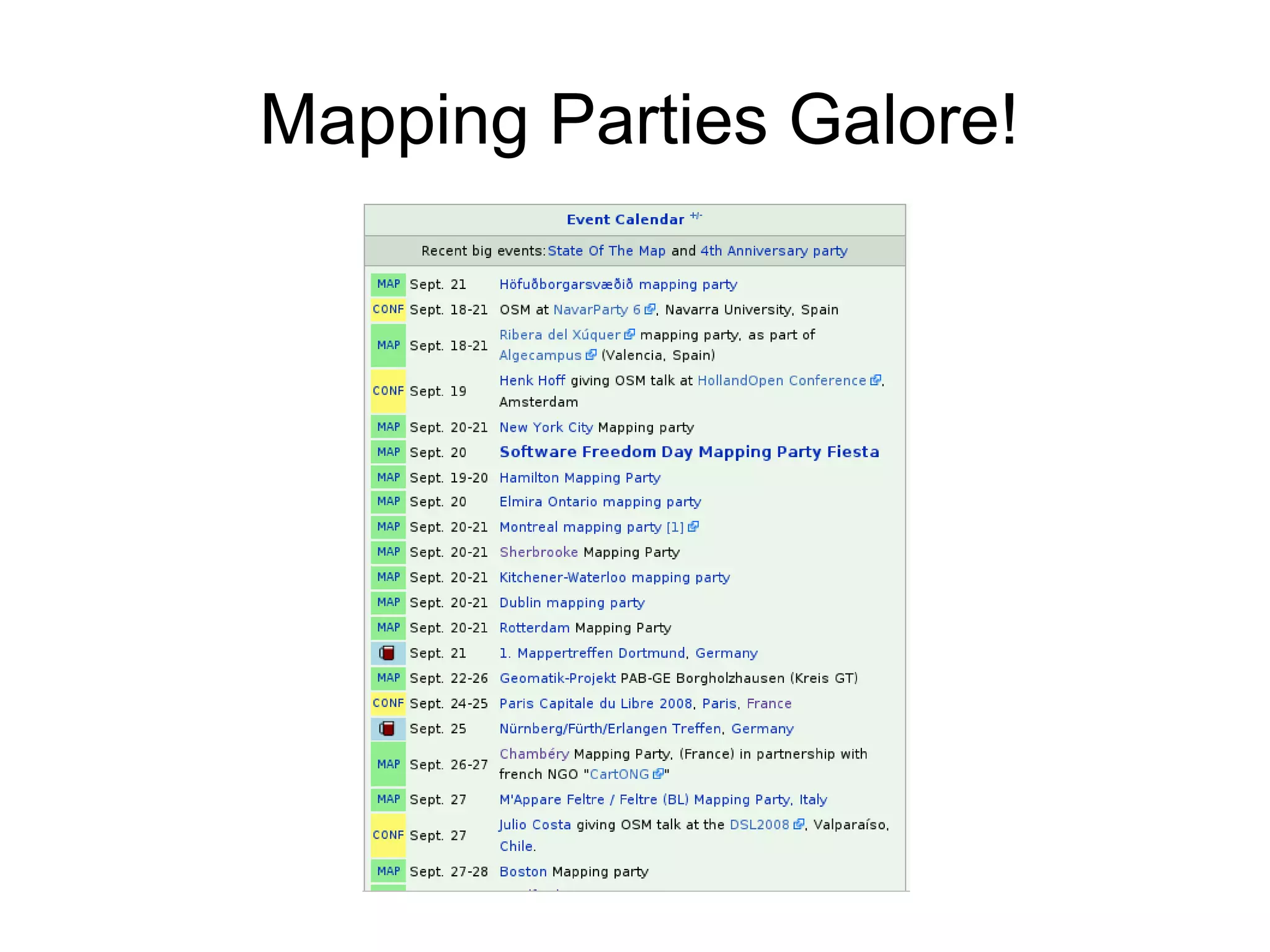
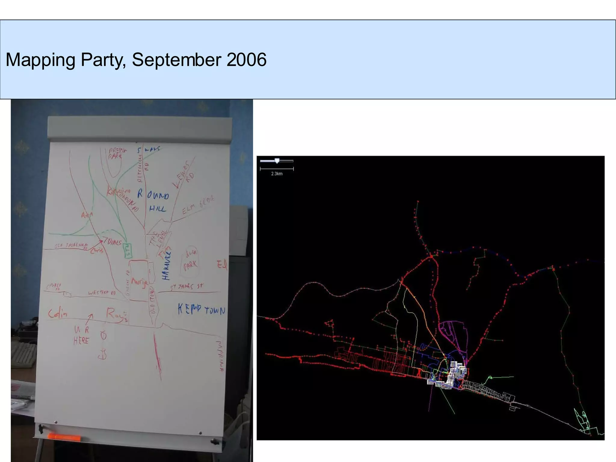
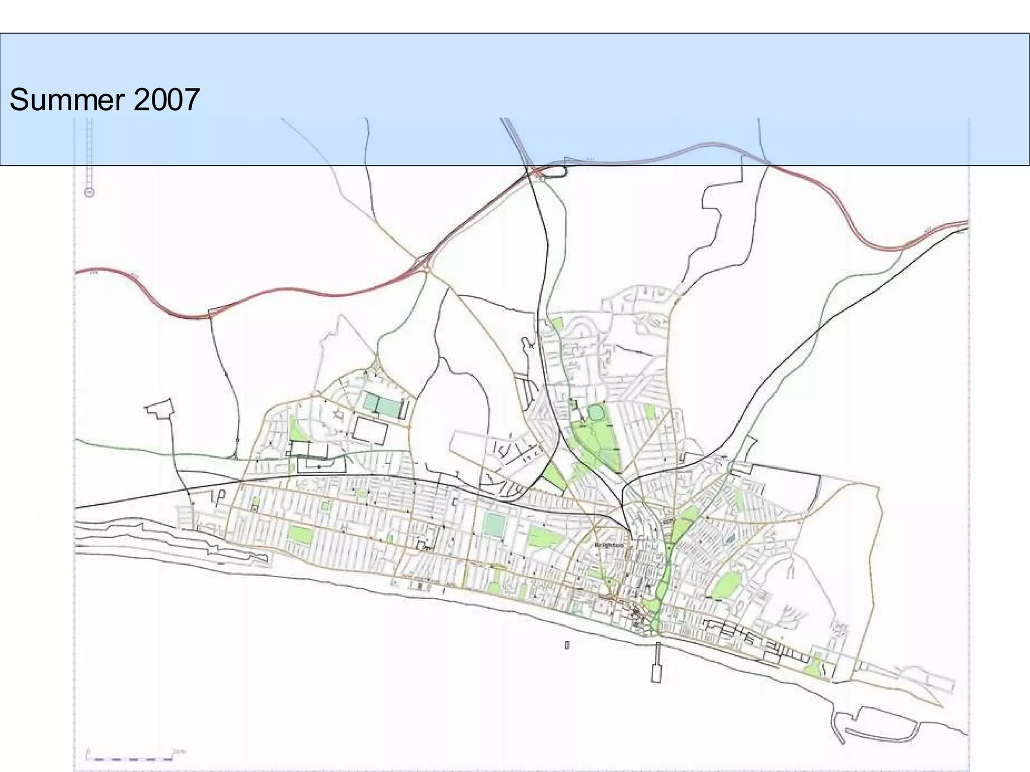
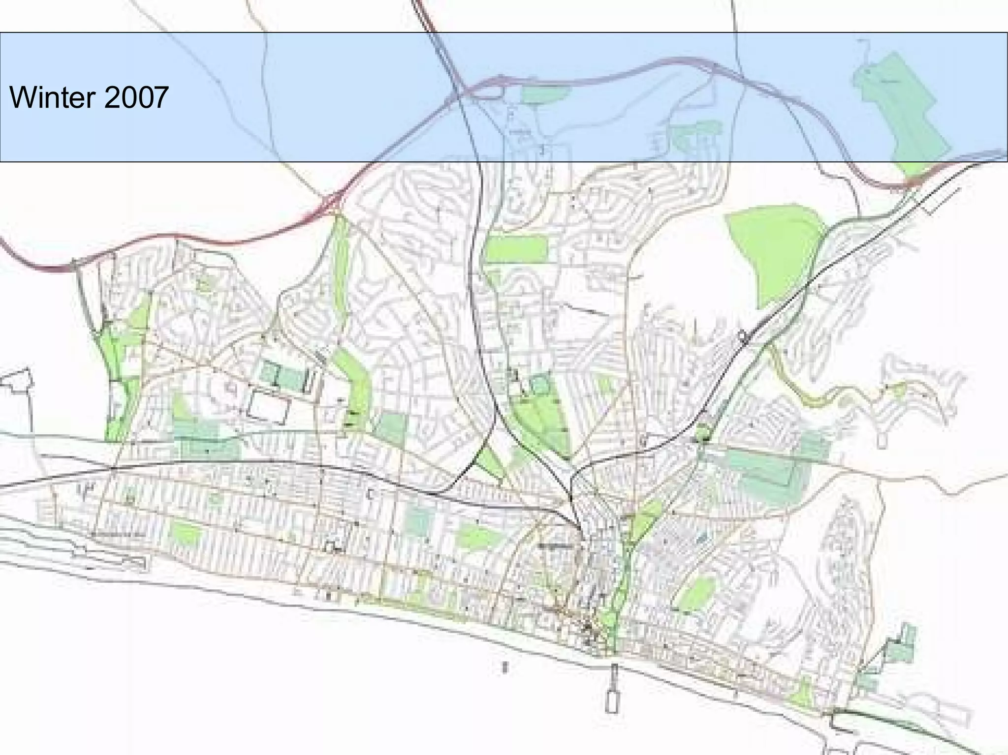
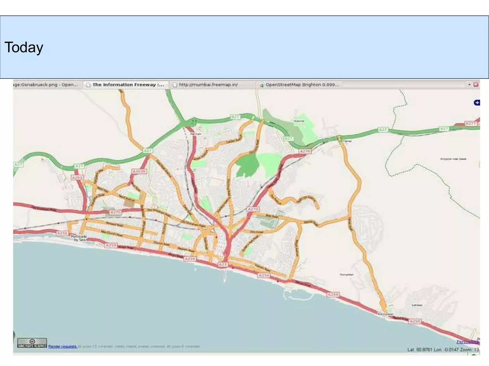
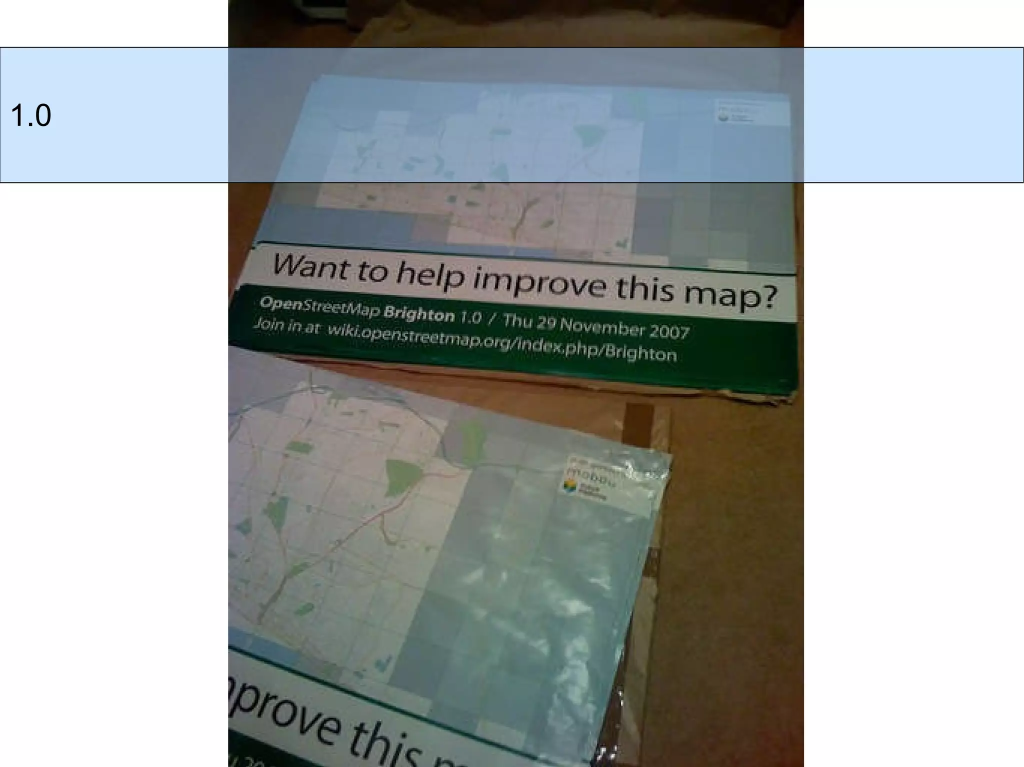
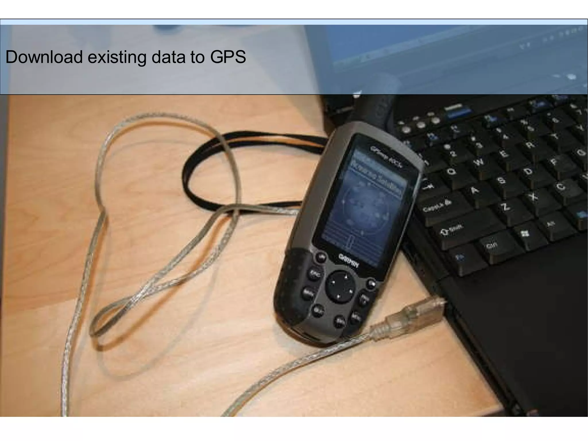
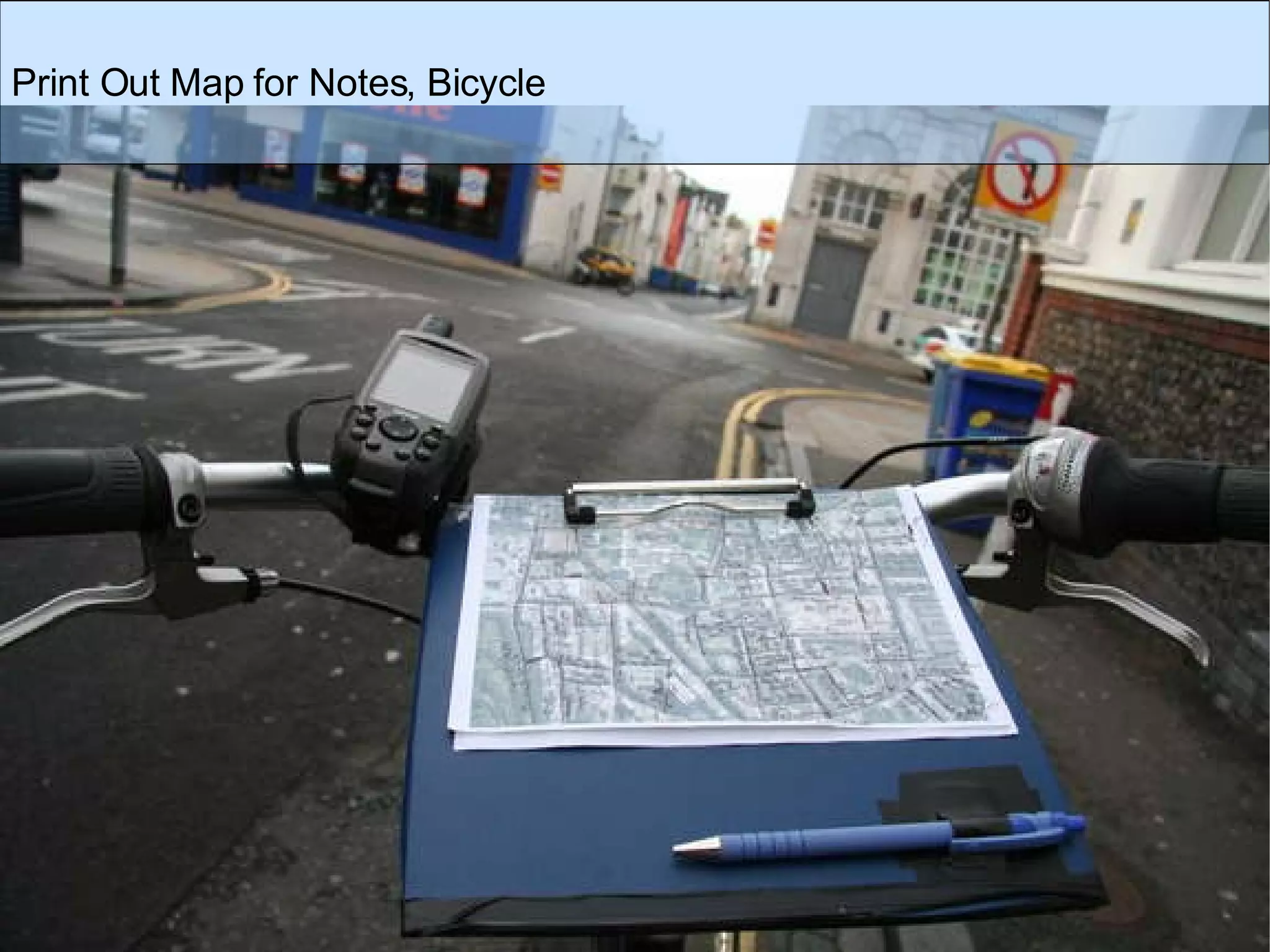
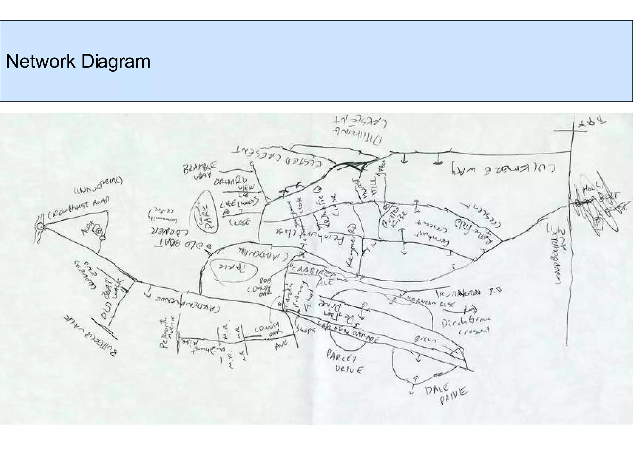
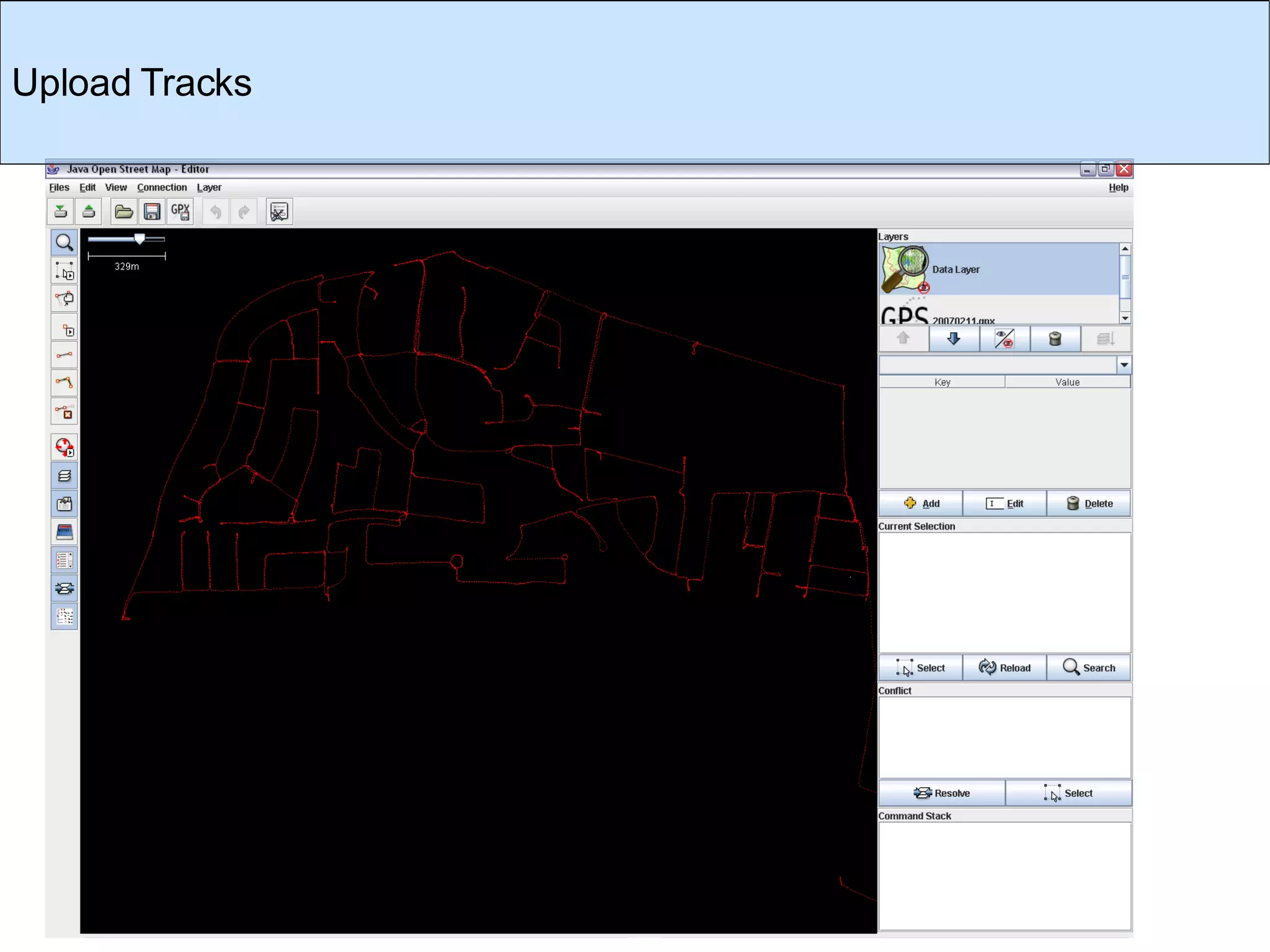
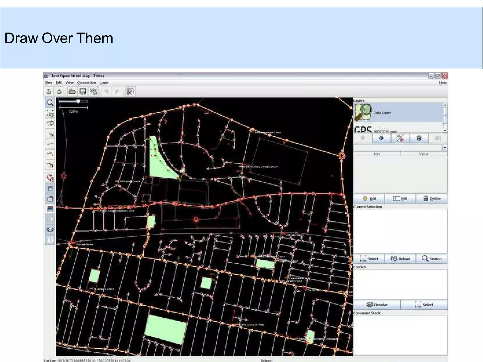
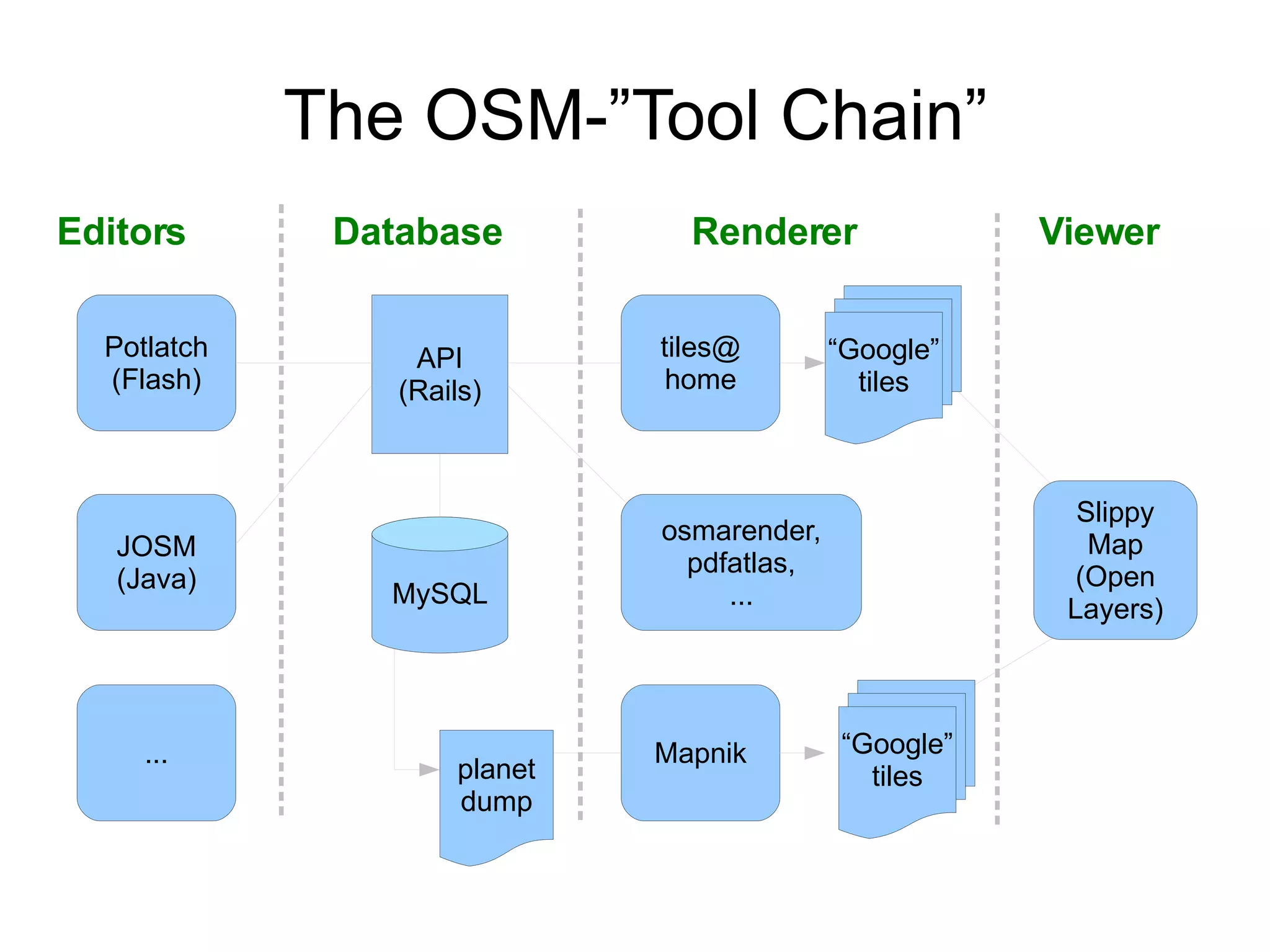
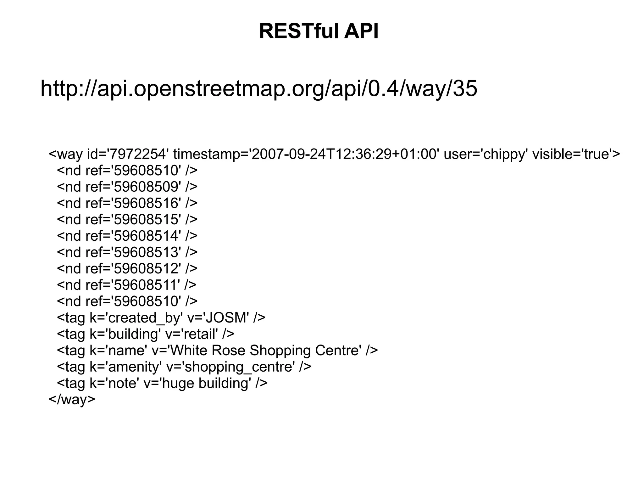
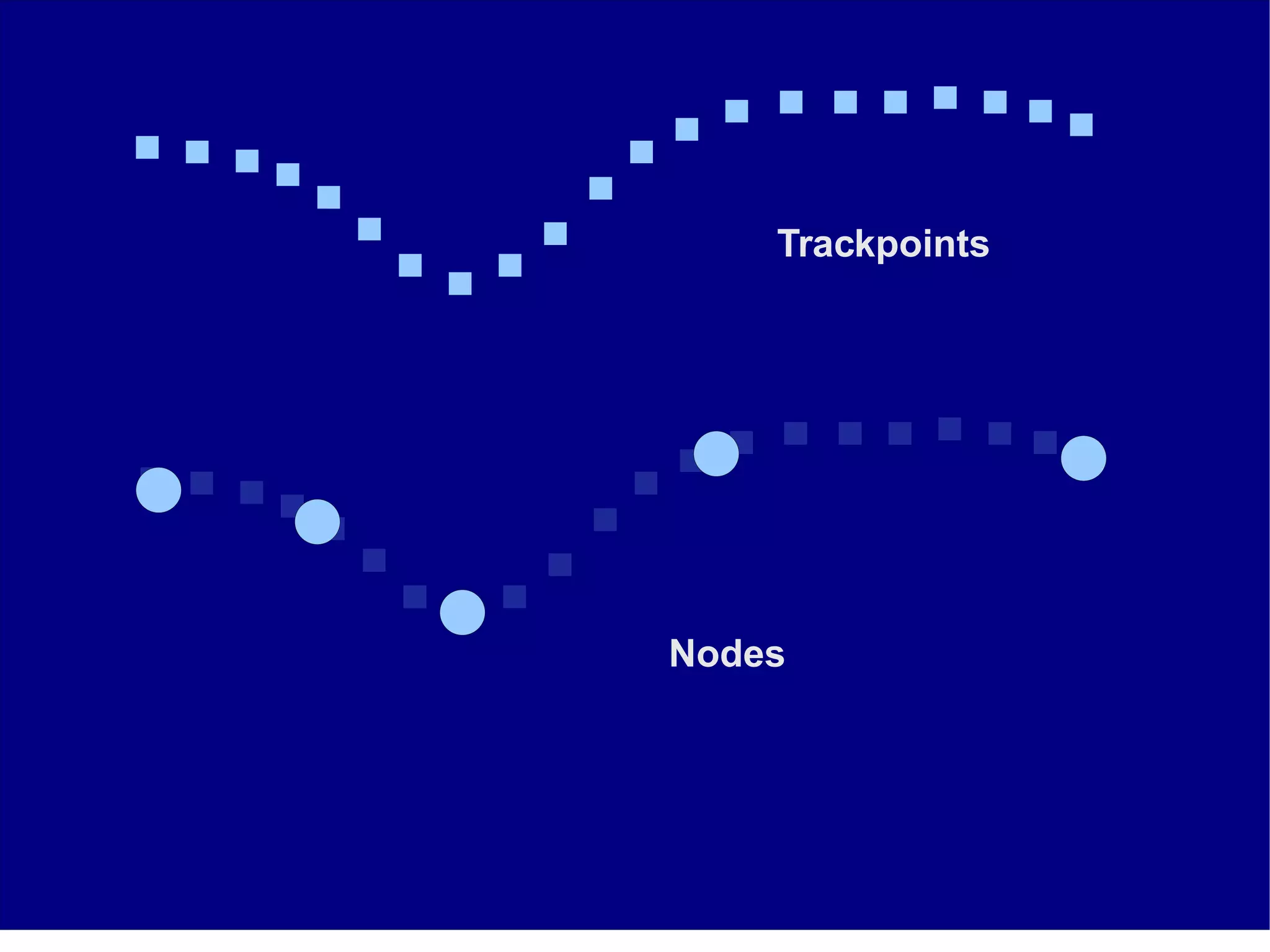
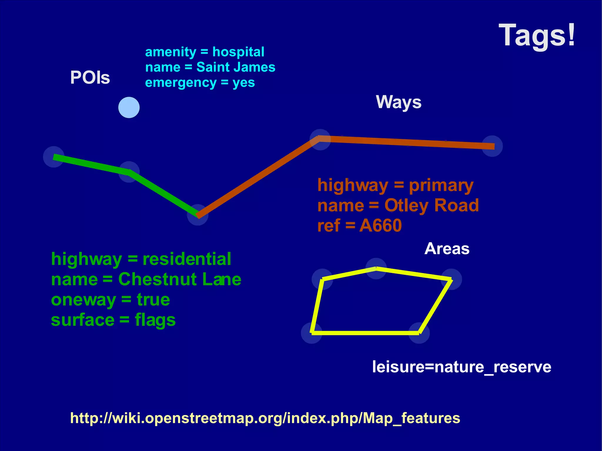
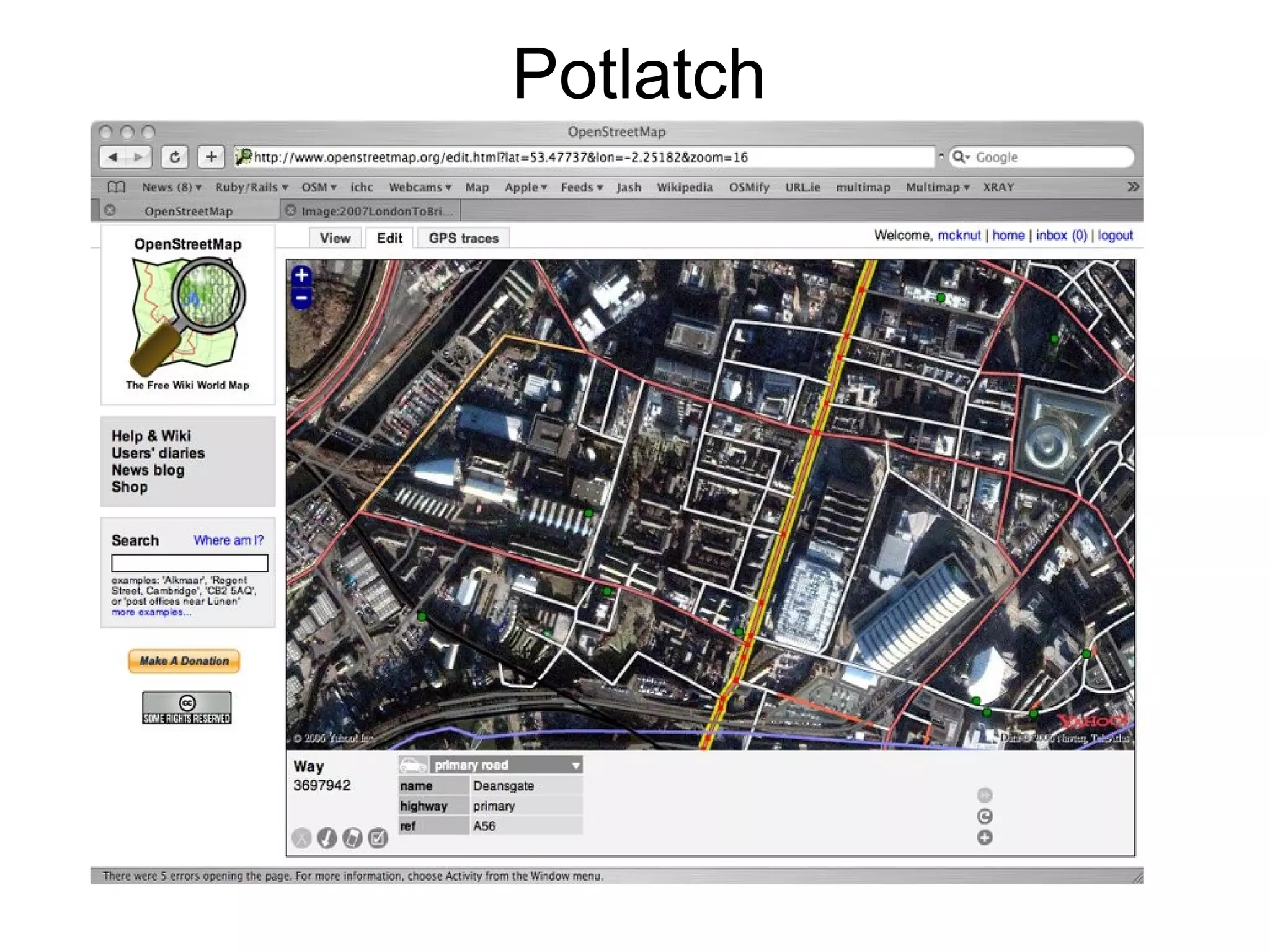
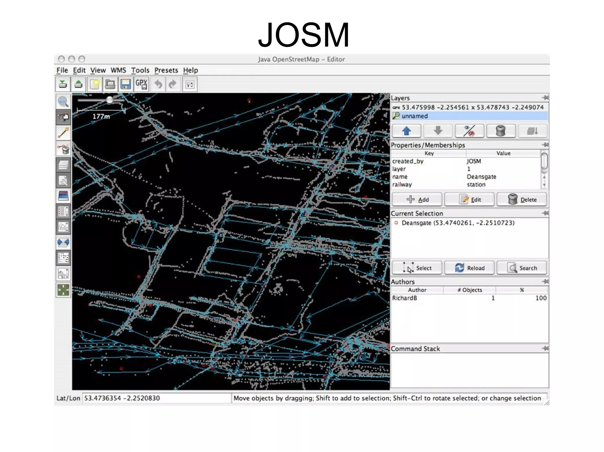
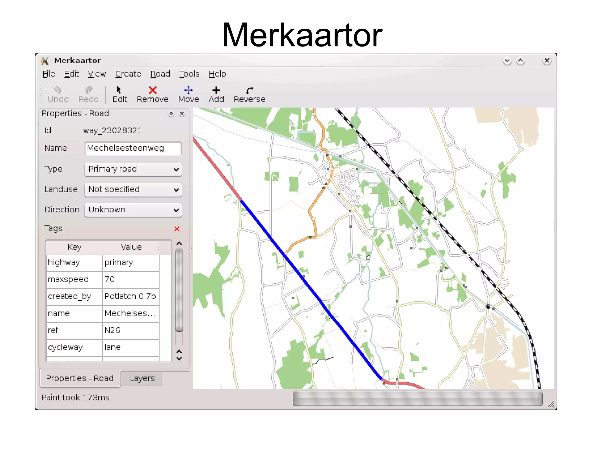
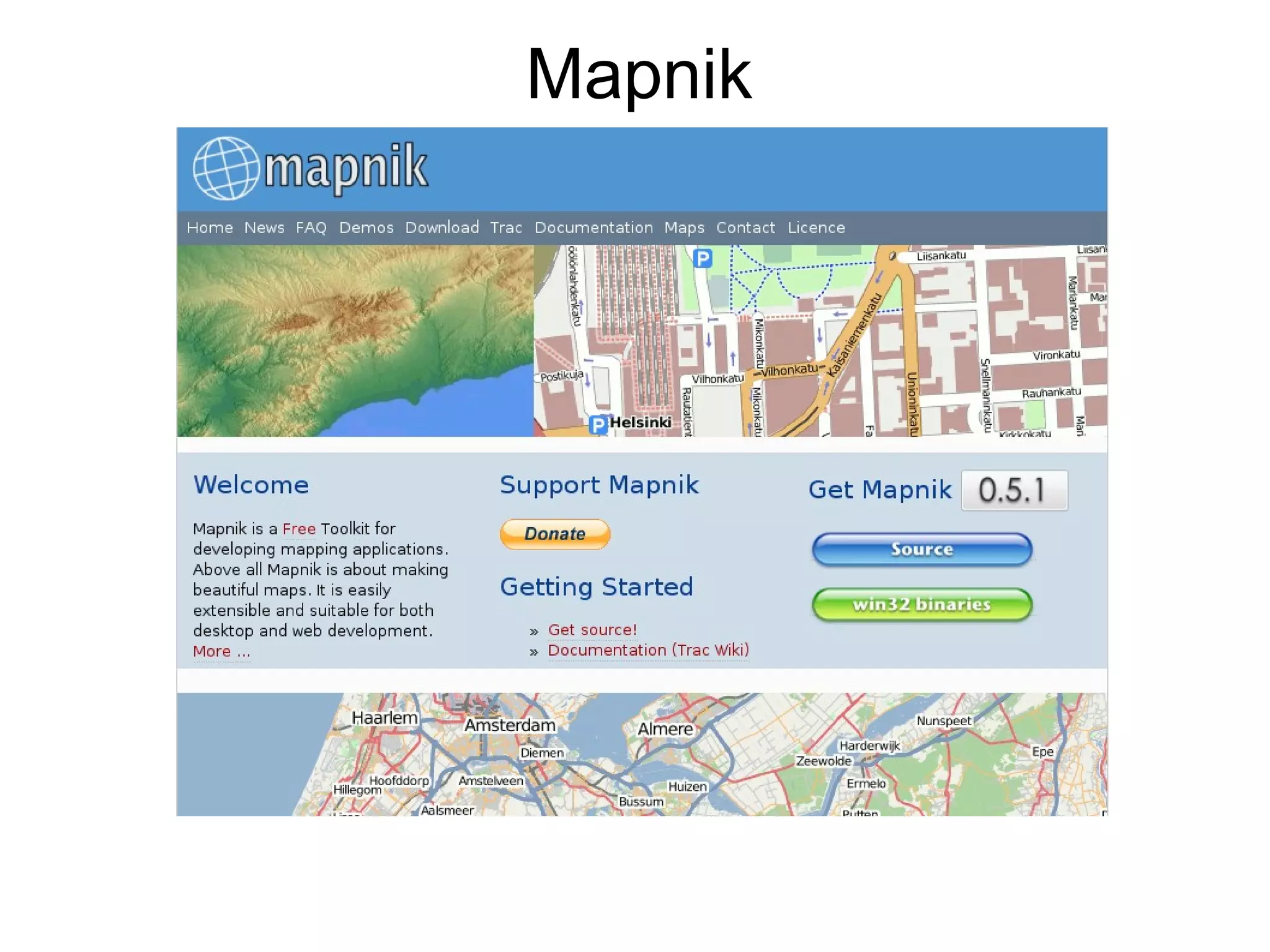
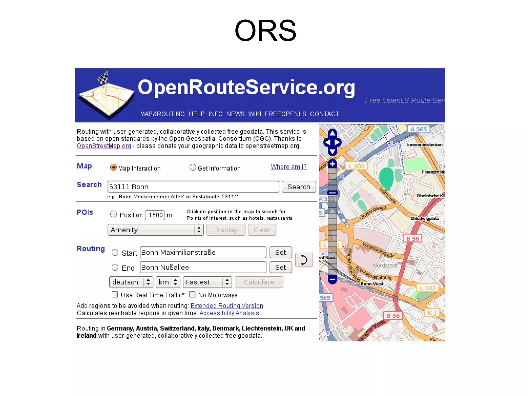
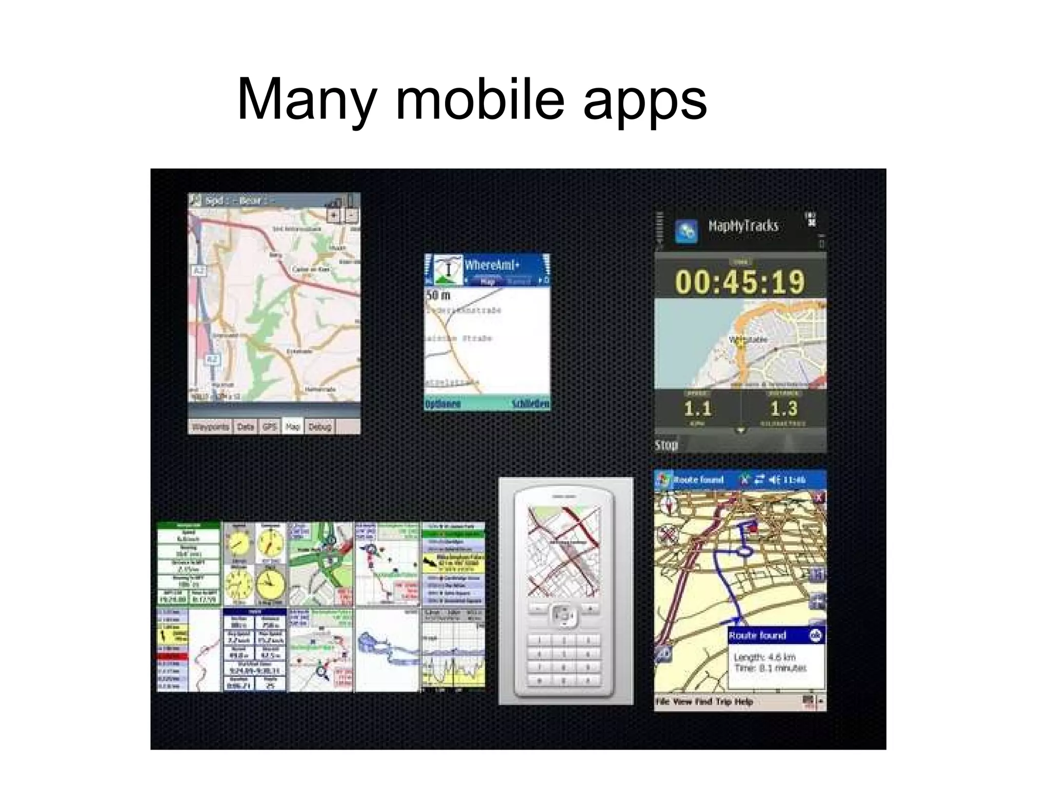
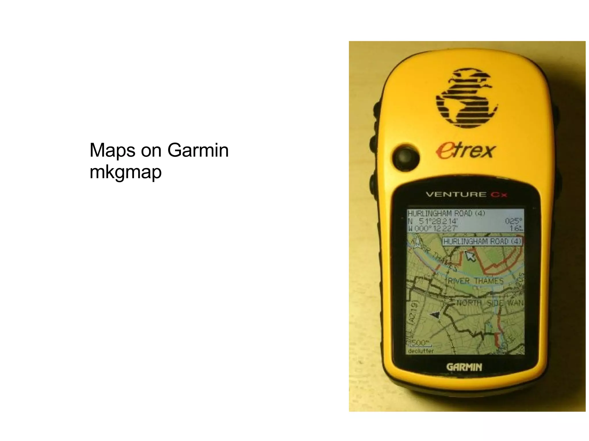
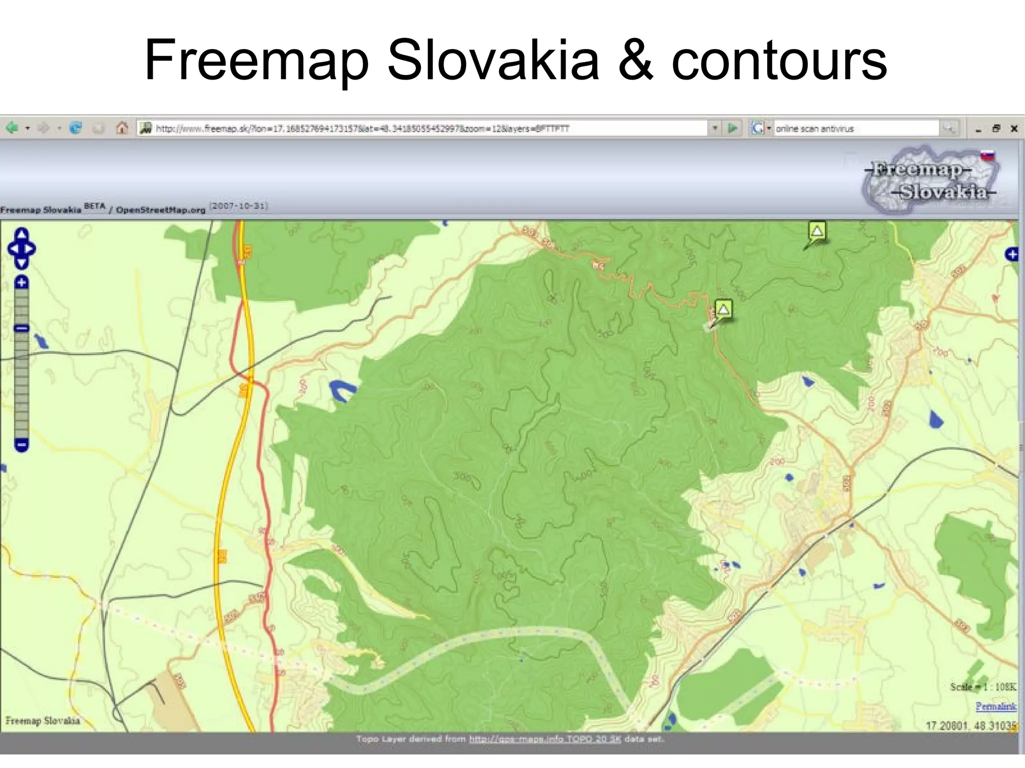
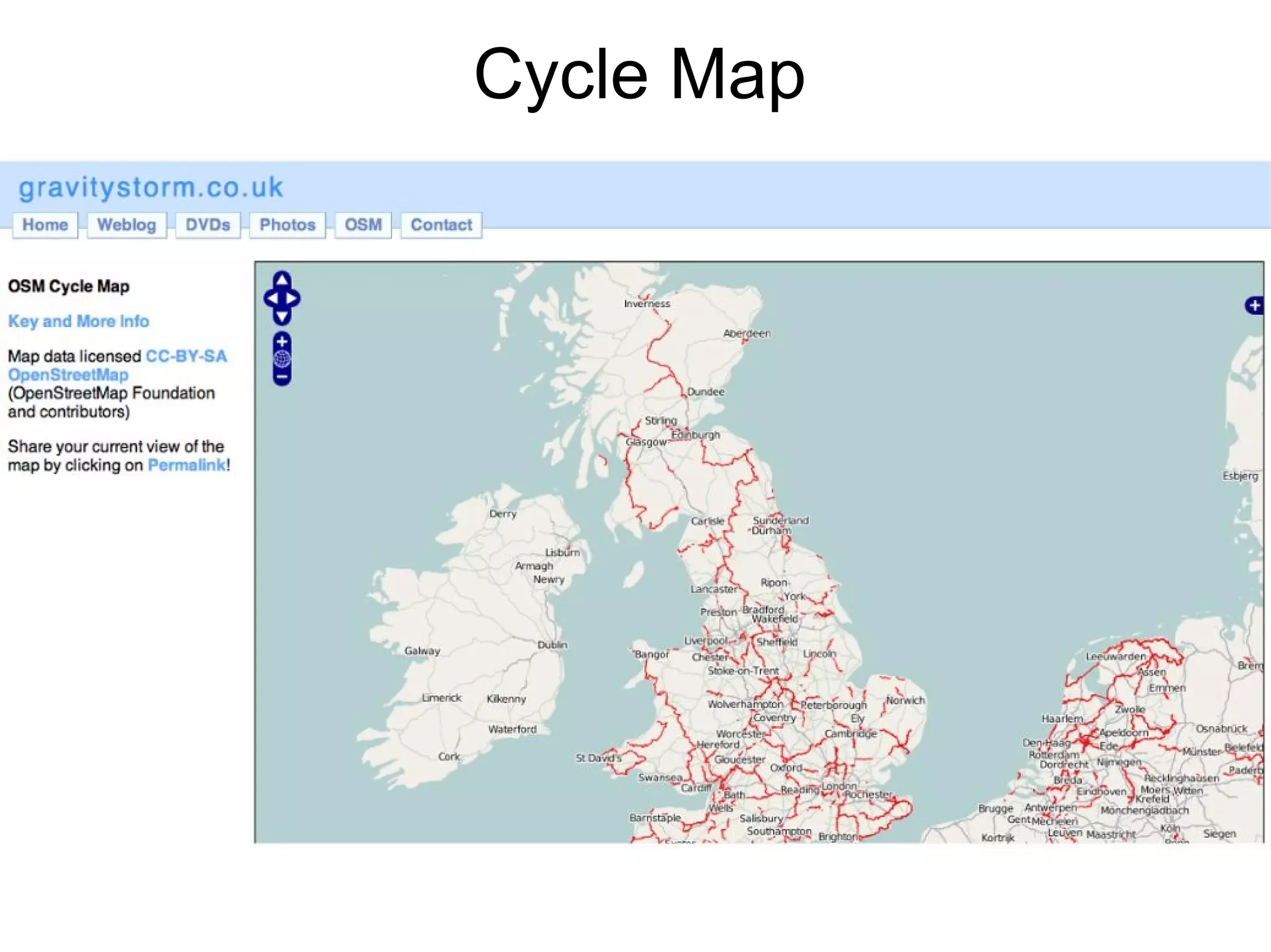
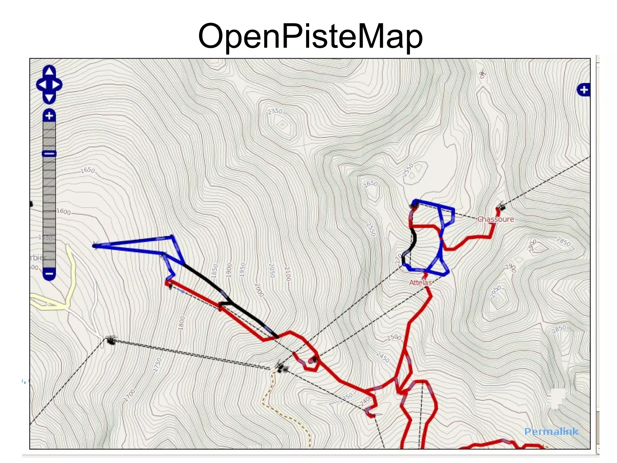
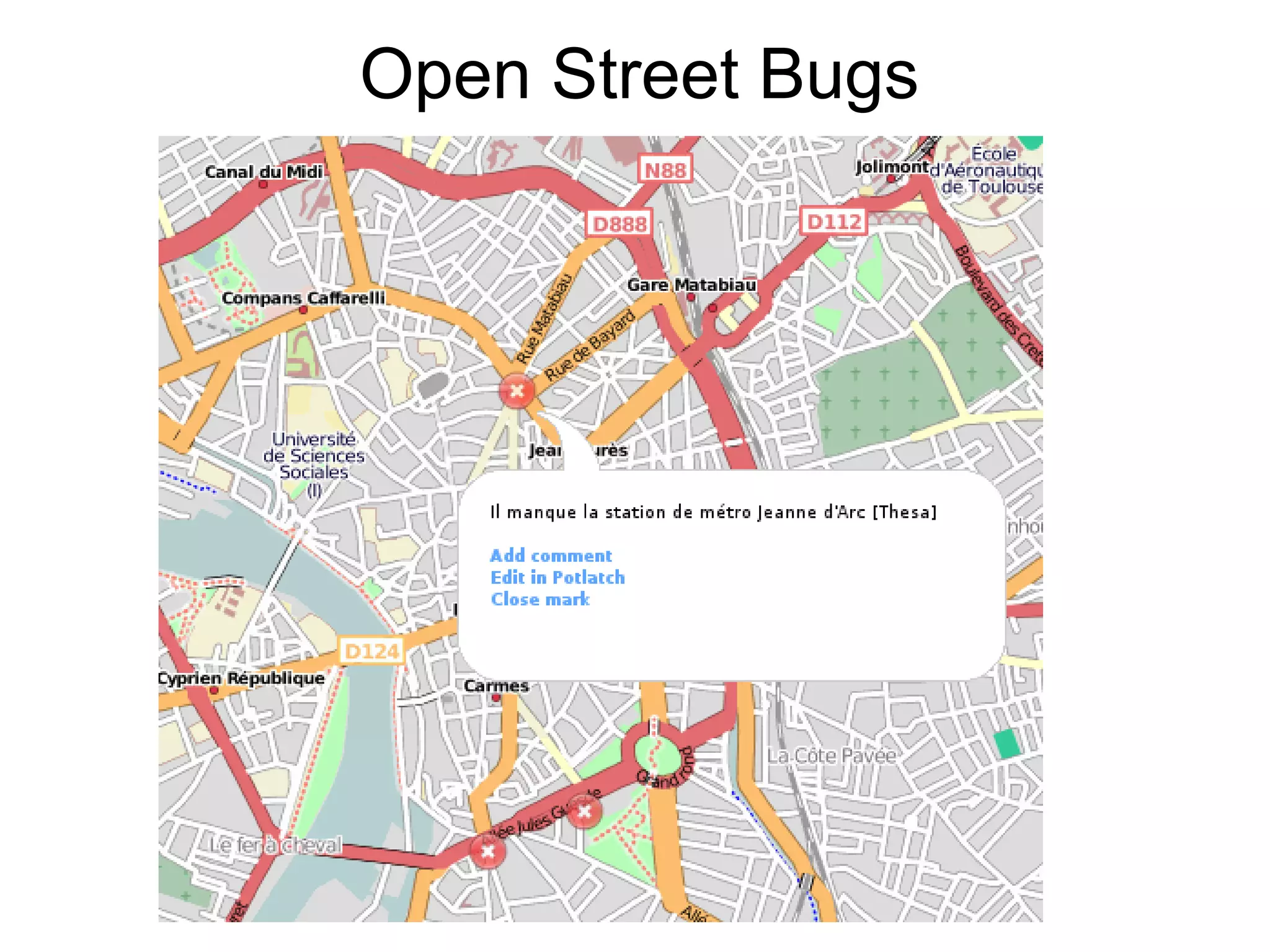
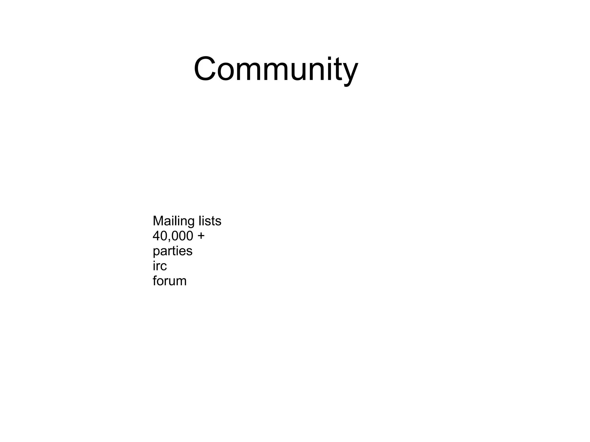
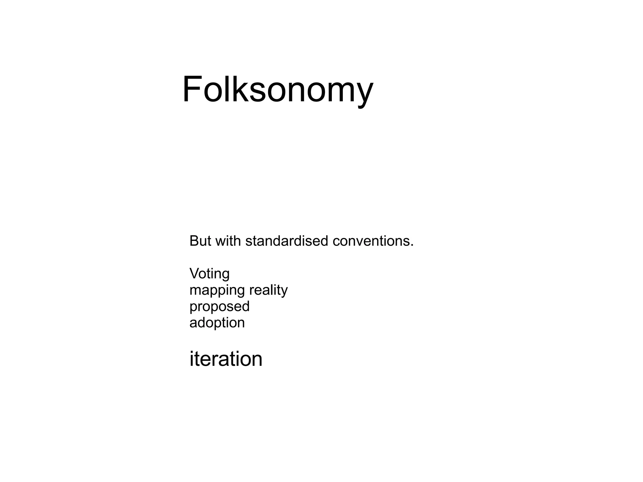
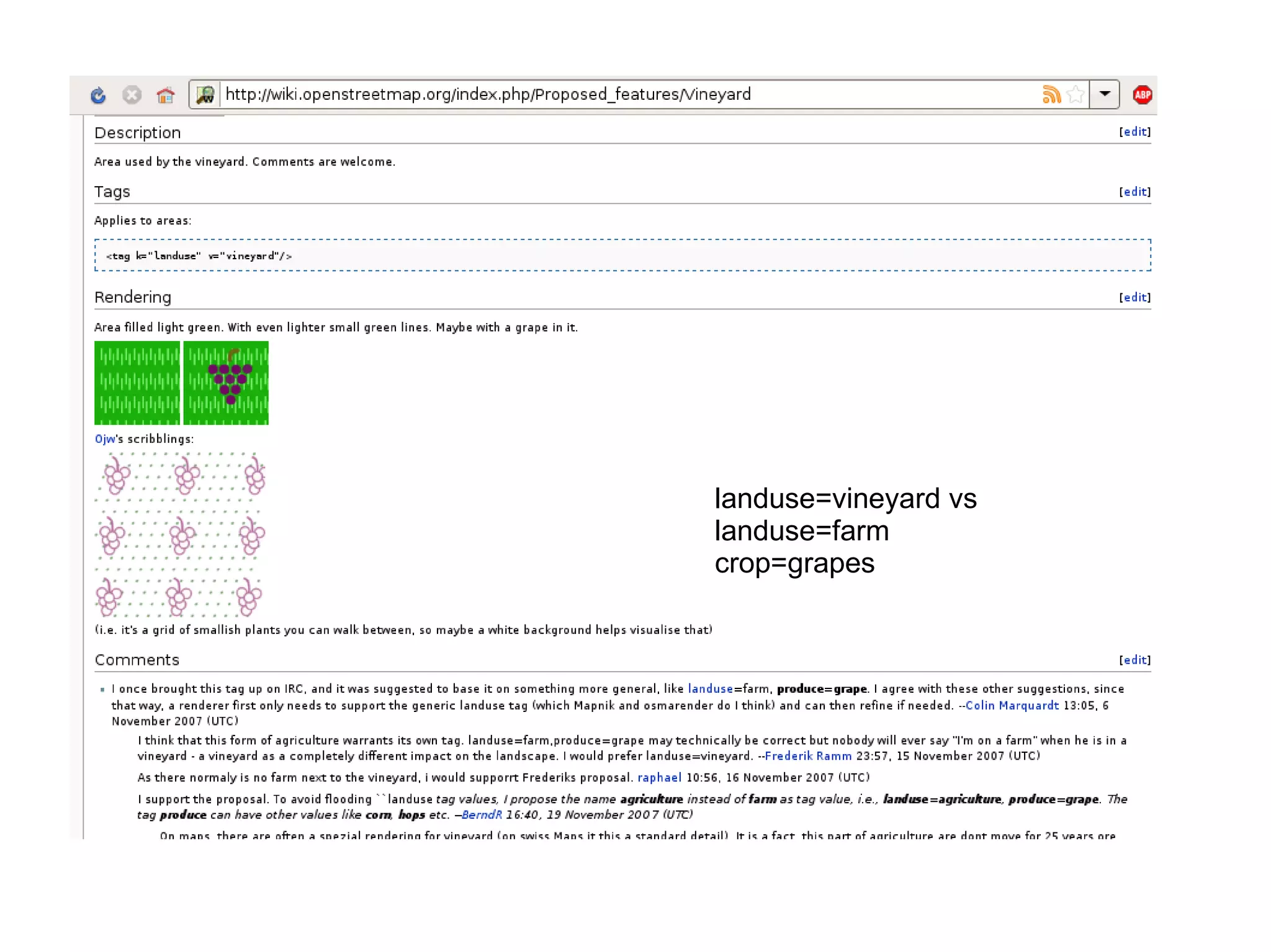
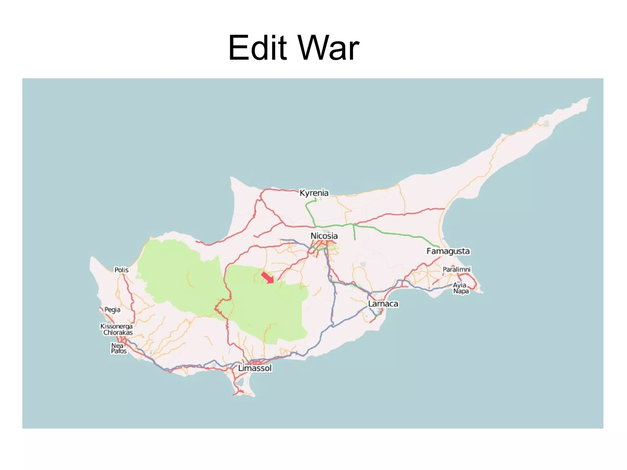
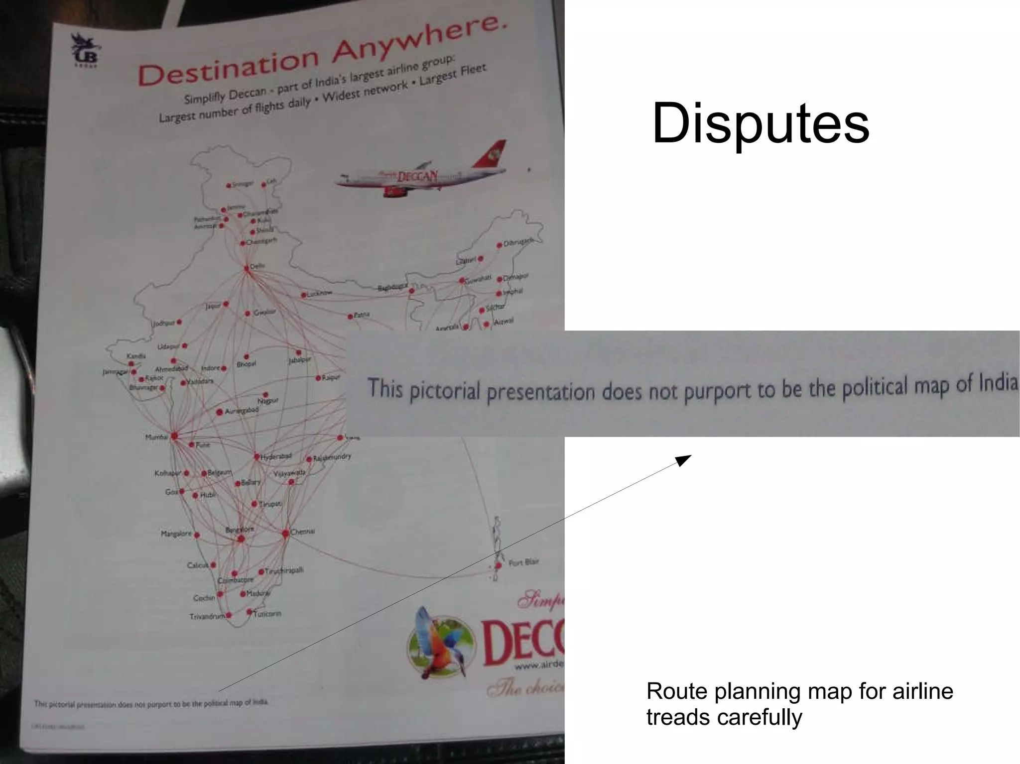
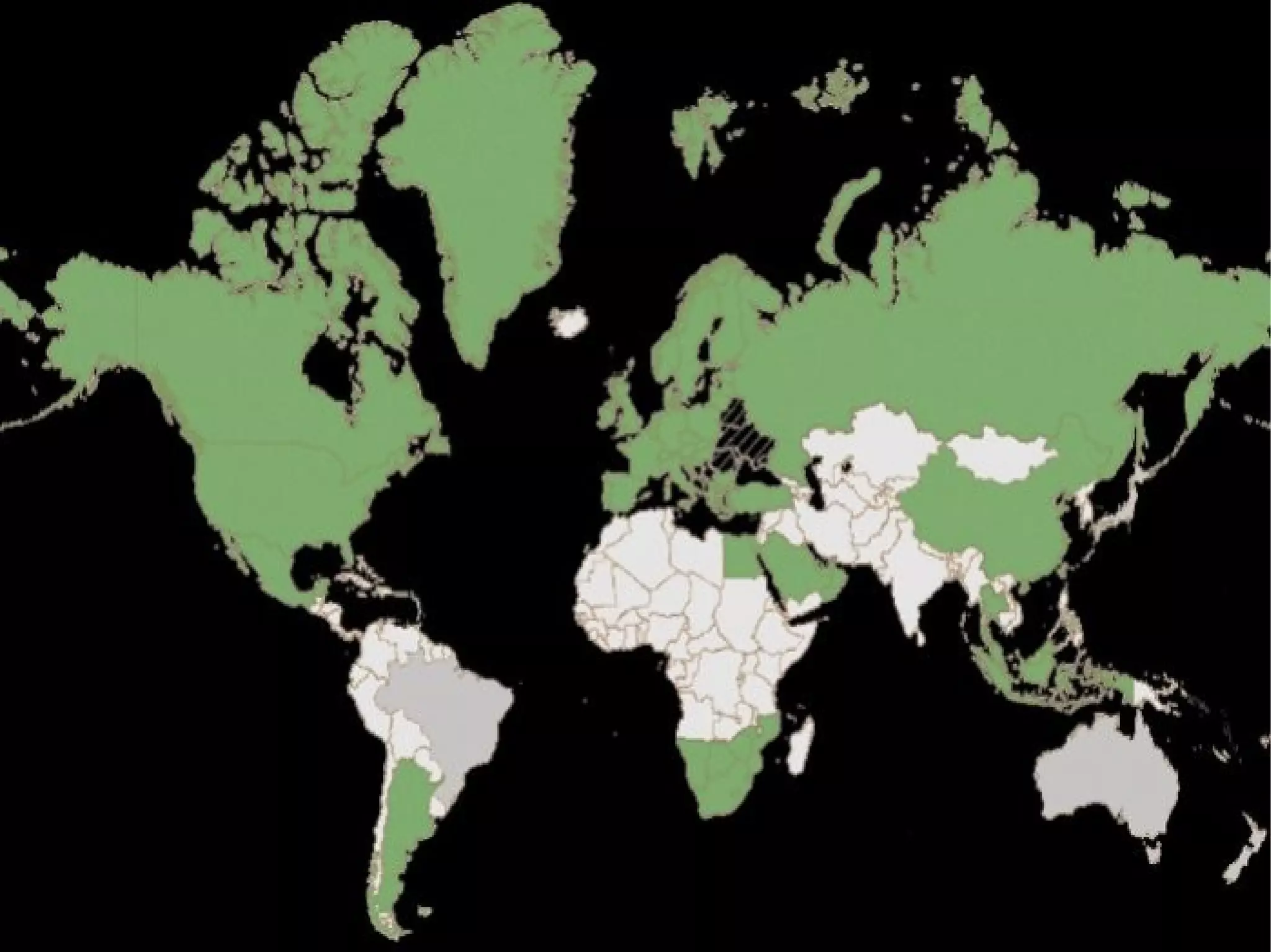
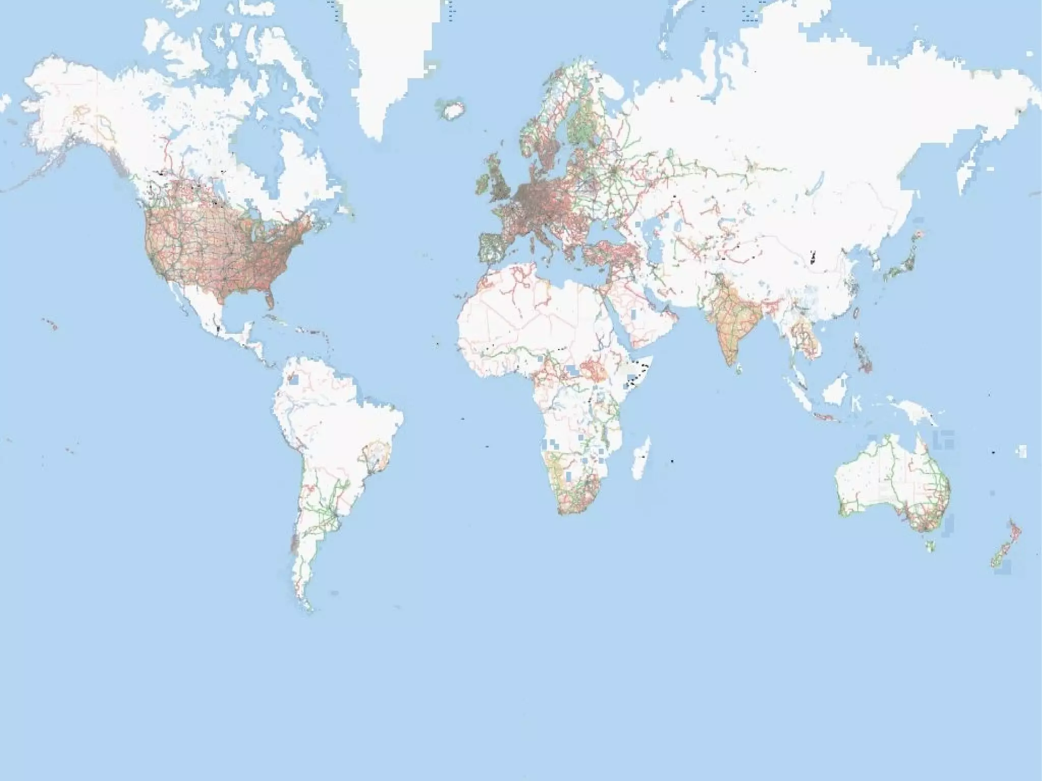
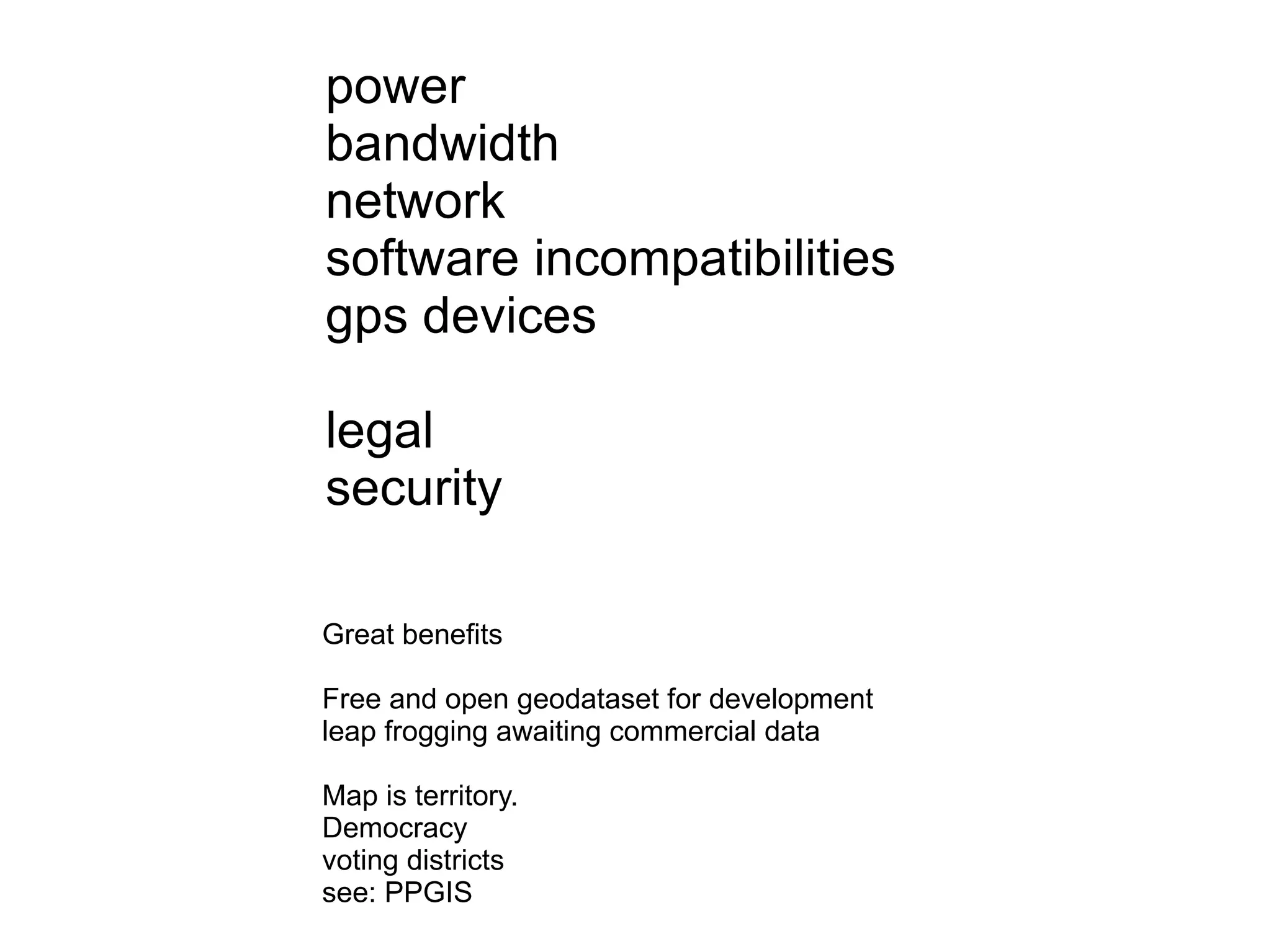
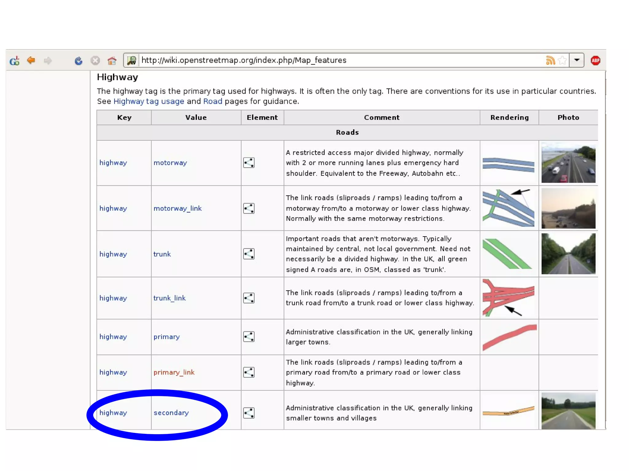
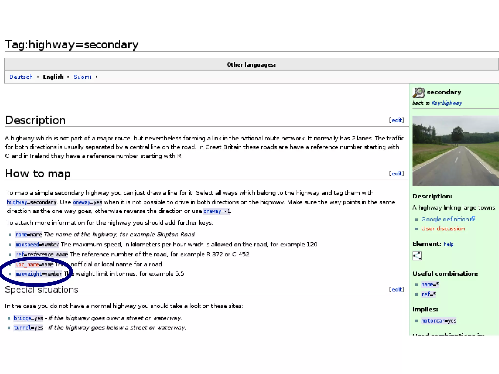
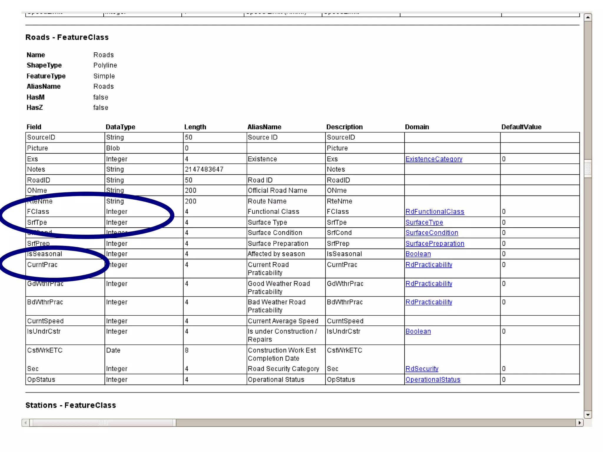
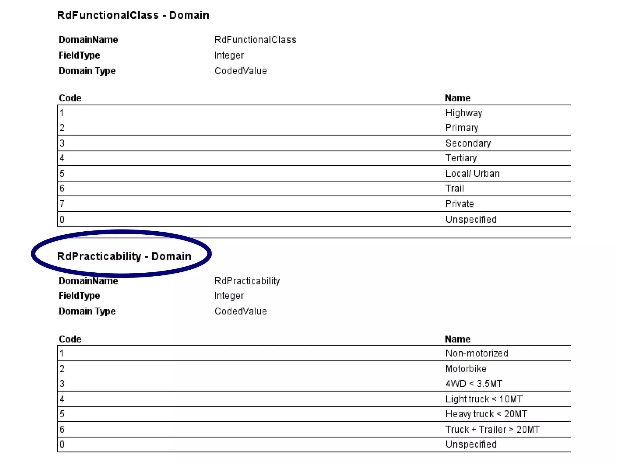
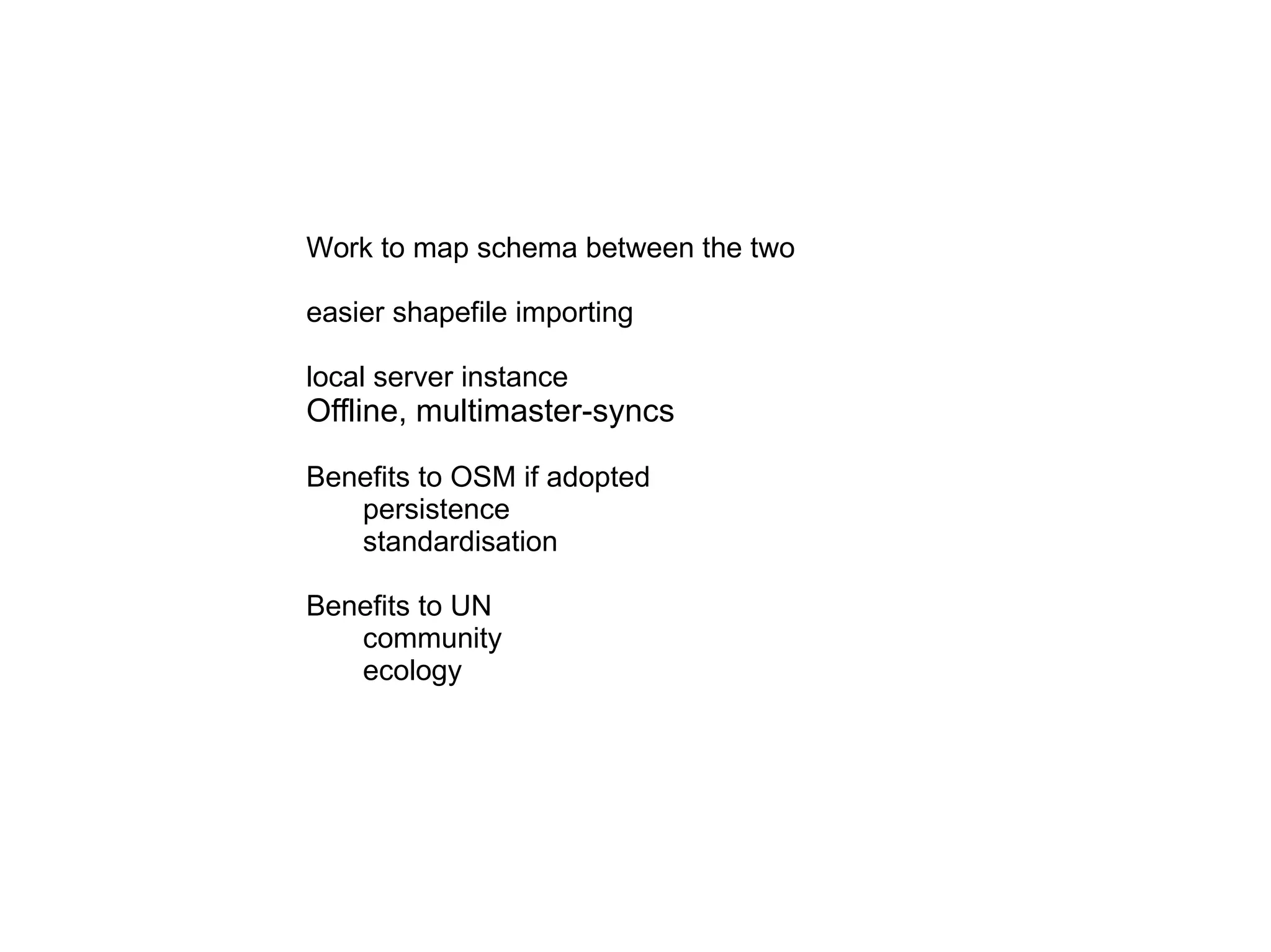
“ OpenStreetMap is a free editable map of the world made by people like you!”
About me Tim Waters Long time OpenStreetMap contributor & evangelist Leeds UK blog:  http://thinkwhere.wordpress.com [email_address] latest: http:wrp.geothings.net
OSM in a nutshell GPS + Wiki  = OSM
 
animation
Why on earth?
Mapping data is not free
Full of mistakes, car centred
Mistakes cannot be corrected
Cannot re use or reprint
Coverage economically determined
Not free as in freedom
Change happens inflexible
Katrina
From Times Atlas. Lake Chad


UK complete 1-2 years.
 
Yahoo allow use of imagery
OSM in Flickr.
cloudmade ito nestoria CadCorp Corporate users
Foundation Conferences
Taking a leaf. Tapping the crowd.
Map Maker from Google.
AND Map2.0
Donate data & free data
AND - netherlands
City of Merano
Tiger / Line
And more: Sudan from UN, Canada, New Zealand,  Falklands
Other Sources
Yahoo allow use of imagery
Landsat
Landsat etc http://www.openaerialmap.org/ UAV / cessnas / kites / satellites
 
 
Data provenance
Or, just D.I.Y!
Mapping Parties Galore!
Case Study:  Mikel in Brighton
Mapping Party, September 2006
OSM Brighton, December 2006
Summer 2007
Today Winter 2007
Today
1.0
His Process
Download existing data to GPS
Print Out Map for Notes, Bicycle
Network Diagram
Upload Tracks
Draw Over Them
Tech
The OSM-”Tool Chain” Database Renderer Viewer Editors API (Rails) Potlatch (Flash) JOSM (Java) ... Mapnik tiles@ home osmarender, pdfatlas, ... planet dump MySQL Slippy Map (Open Layers) “ Google” tiles “ Google” tiles
http://api.openstreetmap.org/api/0.4/way/35 <way id='7972254' timestamp='2007-09-24T12:36:29+01:00' user='chippy' visible='true'> <nd ref='59608510' /> <nd ref='59608509' /> <nd ref='59608516' /> <nd ref='59608515' /> <nd ref='59608514' /> <nd ref='59608513' /> <nd ref='59608512' /> <nd ref='59608511' /> <nd ref='59608510' /> <tag k='created_by' v='JOSM' /> <tag k='building' v='retail' /> <tag k='name' v='White Rose Shopping Centre' /> <tag k='amenity' v='shopping_centre' /> <tag k='note' v='huge building' /> </way> RESTful API
Trackpoints Nodes
Ways highway = residential name = Chestnut Lane oneway = true surface = flags highway = primary name = Otley Road ref = A660 Tags ! http://wiki.openstreetmap.org/index.php/Map_features amenity = hospital name = Saint James emergency = yes POIs Areas leisure=nature_reserve
simple data format tagging for metadata standard map tiles
healthy ecosystem  tools renderers editors routers applications
Potlatch
JOSM
Merkaartor
Mapnik
ORS
Many mobile apps
Maps on Garmin mkgmap
Freemap Slovakia & contours
Cycle Map
OpenPisteMap
Open Street Bugs
healthy ecosystem  tools renderers editors routers applications
Ecology System Iteration Gets better & stronger
Community Mailing lists 40,000 + parties irc forum
Folksonomy But with standardised conventions.  Voting mapping reality proposed adoption iteration
landuse=vineyard vs landuse=farm crop=grapes
Edit War
Disputes Route planning map for airline  treads carefully
OSM way Multiple representations of the world Data is not the map Localizable  History, Versioning
OSM in development India Africa
 
 
power bandwidth network software incompatibilities gps devices legal security Great benefits Free and open geodataset for development leap frogging awaiting commercial data Map is territory.  Democracy voting districts see: PPGIS
UNSDI & OSM http://wiki.openstreetmap.org/index.php/Map_features http://www.unjlc.org/tools/UNSDI-T/UNSDIT_V2.0_Light_Structure_HTML.html


Work to map schema between the two easier shapefile importing local server instance Offline, multimaster-syncs Benefits to OSM if adopted persistence standardisation Benefits to UN community ecology
Thanks! Tim Waters http://thinkwhere.wordpress.com [email_address]

GeOng presentation about OpenStreetMap