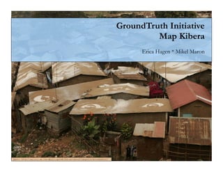
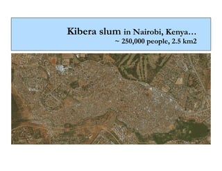
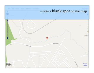
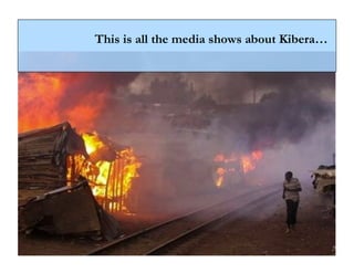
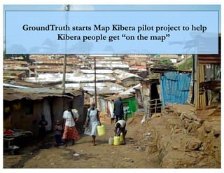
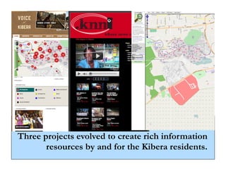
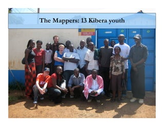
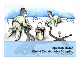
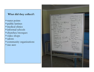
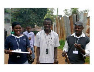
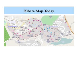
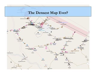
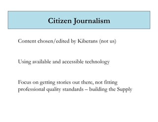
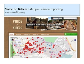
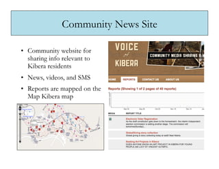
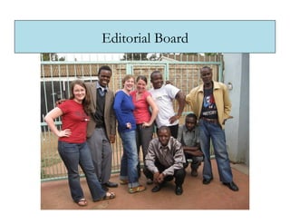
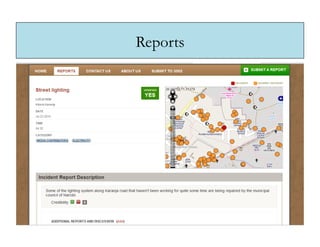
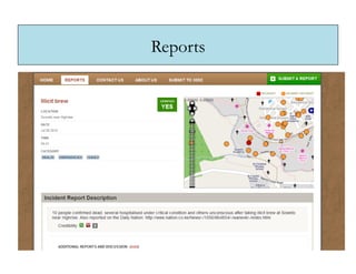
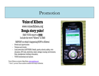
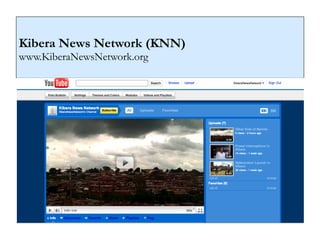
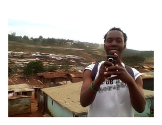
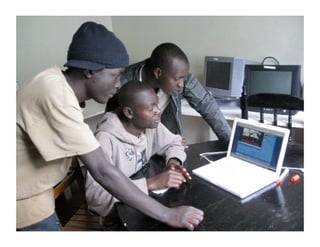
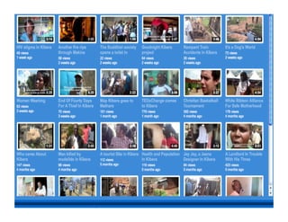
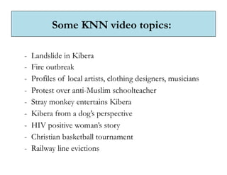
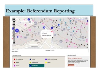
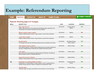
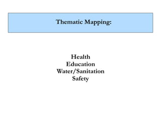
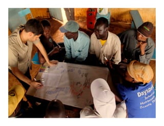
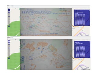
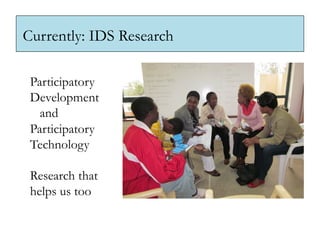
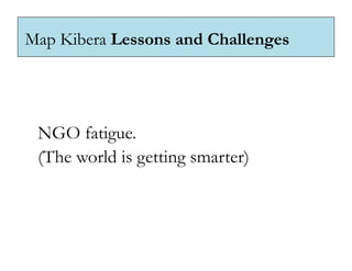
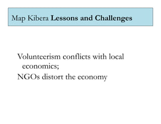
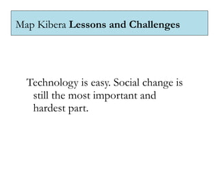
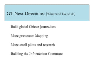
GroundTruth Initiative
                                                                                          Map Kibera
                                                                                       Erica Hagen * Mikel Maron


photo: http://gallery.me.com/dbullington#100816&view=null&bgcolor=black&sel=12
GroundTruth Initiative, LLC


  We help communities use digital media,
  mapping, and open data tools

  for greater influence and representation
   in development and democracy.
What we do:
Train in creative use of new technologies for data
collection and storytelling (mapping, video, mobile,
web)

Engage with specific geographic communities
in-depth

Support open, accessible information for action
Why we do it:

Local communities are the most reliable,
important knowledge-holders
for development and political engagement.

Participatory and open technologies and media
are key to amplifying voices
and increasing influence.
Why we are here:


We love doing this, and want to do more.

Maybe in collaboration with you.
Kibera slum in Nairobi, Kenya…
           ~ 250,000 people, 2.5 km2
…was a blank spot on the map
This is all the media shows about Kibera…
GroundTruth starts Map Kibera pilot project to help
        Kibera people get “on the map”
Screenshots of three
            projects? VoK, KNN,
            the Map?


Three projects evolved to create rich information
       resources by and for the Kibera residents.
The Mappers: 13 Kibera youth
    * The Mappers
OpenStreetMap
Global Collaborative Mapping
                 “like Wikipedia for Maps”
What did they collect?:

• water points
• public latrines
• medical clinics
• informal schools
• churches/mosques
• video shops
• salons
• community organizations
• tons more
PHOTO of the guys out with GPS
around neck
Kibera Map Today
The Densest Map Ever?
Citizen Journalism

Content chosen/edited by Kiberans (not us)


Using available and accessible technology


Focus on getting stories out there, not fitting
professional quality standards – building the Supply
Voice of Kibera: Mapped citizen reporting
www.voiceofkibera.org
Community News Site

•  Community website for
   sharing info relevant to
   Kibera residents
•  News, videos, and SMS
•  Reports are mapped on the
   Map Kibera map
Editorial Board
Reports
Reports
Promotion
Kibera News Network (KNN)
www.KiberaNewsNetwork.org
Need photo here of the guys
out on a shoot…
Some KNN video topics:

-  Landslide in Kibera
-  Fire outbreak
-  Profiles of local artists, clothing designers, musicians
-  Protest over anti-Muslim schoolteacher
-  Stray monkey entertains Kibera
-  Kibera from a dog’s perspective
-  HIV positive woman’s story
-  Christian basketball tournament
-  Railway line evictions
Example: Referendum Reporting
Thematic Mapping:


    Health
  Education
Water/Sanitation
     Safety
Map Kibera Outcomes


 Engaged and skilled young citizens.
 Strong slum-tech links.
 Information sharing platforms.

 Map Kibera Trust
Map Kibera Partnerships


 Institute for Development Studies
 PLAN Kenya
 Hivos/Omidyar
 UN Habitat Youth Fund
 Ushahidi
Onwards: Careful Replication vs Scaling Up
Currently: Map Mathare
Mathare is the second largest slum in Nairobi


Photo: Life in Abundance International, Flickr. http://www.flickr.com/photos/28477230@N04/
Mathare:

       Insert screenshot of Mathare Valley
       blog, and new map, ?
Currently: IDS Research

 Participatory
 Development
   and
 Participatory
 Technology

 Research that
 helps us too
Key Lessons:


 Community data collection risks being
  an extractive process.
Key Lessons:


  Participation and empowerment are
  still only buzzwords most of the time.

  (and therefore so is democracy…)
Key Lessons:


 Stay agile. Experiment small and adapt
 to every context.
 Artisanal Development.
Map Kibera Lessons and Challenges


 Donors favor silos, and duplication.
Map Kibera Lessons and Challenges


 NGO fatigue.
 (The world is getting smarter)
Map Kibera Lessons and Challenges


 Volunteerism conflicts with local
  economics;
 NGOs distort the economy
Map Kibera Lessons and Challenges


  Technology is easy. Social change is
   still the most important and
   hardest part.
GT Next Directions: Haiti?
From emergency mapping to sustained, comprehensive
 community information

               Need images here from Haiti projects,
               COSMHA and C-Haiti or whatever,
               Noula…
GT Next Directions: (What we’d like to do)

  Build global Citizen Journalism

  More grassroots Mapping

  More small pilots and research

  Building the Information Commons
GT Next Directions: (What we’d like to do)


  … budget   tracking, Yelp for international
  development, feedback and monitoring of
  projects, human rights online activism,
  strengthening the media…
Thanks!
contact@groundtruthinitiative.org
@ricaji, @mikel, @mapkibera

                          groundtruthinitiative.org
                          mapkibera.org
                          voiceofkibera.org
                          kiberanewsnetwork.org

GroundTruth Map Kibera East Coast Tour

  • 1.
    GroundTruth Initiative Map Kibera Erica Hagen * Mikel Maron photo: http://gallery.me.com/dbullington#100816&view=null&bgcolor=black&sel=12
  • 2.
    GroundTruth Initiative, LLC We help communities use digital media, mapping, and open data tools for greater influence and representation in development and democracy.
  • 3.
    What we do: Trainin creative use of new technologies for data collection and storytelling (mapping, video, mobile, web) Engage with specific geographic communities in-depth Support open, accessible information for action
  • 4.
    Why we doit: Local communities are the most reliable, important knowledge-holders for development and political engagement. Participatory and open technologies and media are key to amplifying voices and increasing influence.
  • 5.
    Why we arehere: We love doing this, and want to do more. Maybe in collaboration with you.
  • 6.
    Kibera slum inNairobi, Kenya… ~ 250,000 people, 2.5 km2
  • 7.
    …was a blankspot on the map
  • 8.
    This is allthe media shows about Kibera…
  • 9.
    GroundTruth starts MapKibera pilot project to help Kibera people get “on the map”
  • 10.
    Screenshots of three projects? VoK, KNN, the Map? Three projects evolved to create rich information resources by and for the Kibera residents.
  • 11.
    The Mappers: 13Kibera youth * The Mappers
  • 12.
    OpenStreetMap Global Collaborative Mapping “like Wikipedia for Maps”
  • 13.
    What did theycollect?: • water points • public latrines • medical clinics • informal schools • churches/mosques • video shops • salons • community organizations • tons more
  • 14.
    PHOTO of theguys out with GPS around neck
  • 15.
  • 16.
  • 17.
    Citizen Journalism Content chosen/editedby Kiberans (not us) Using available and accessible technology Focus on getting stories out there, not fitting professional quality standards – building the Supply
  • 18.
    Voice of Kibera:Mapped citizen reporting www.voiceofkibera.org
  • 19.
    Community News Site • Community website for sharing info relevant to Kibera residents •  News, videos, and SMS •  Reports are mapped on the Map Kibera map
  • 20.
  • 21.
  • 22.
  • 23.
  • 24.
    Kibera News Network(KNN) www.KiberaNewsNetwork.org
  • 25.
    Need photo hereof the guys out on a shoot…
  • 28.
    Some KNN videotopics: -  Landslide in Kibera -  Fire outbreak -  Profiles of local artists, clothing designers, musicians -  Protest over anti-Muslim schoolteacher -  Stray monkey entertains Kibera -  Kibera from a dog’s perspective -  HIV positive woman’s story -  Christian basketball tournament -  Railway line evictions
  • 29.
  • 30.
  • 32.
    Thematic Mapping: Health Education Water/Sanitation Safety
  • 36.
    Map Kibera Outcomes Engaged and skilled young citizens. Strong slum-tech links. Information sharing platforms. Map Kibera Trust
  • 37.
    Map Kibera Partnerships Institute for Development Studies PLAN Kenya Hivos/Omidyar UN Habitat Youth Fund Ushahidi
  • 38.
  • 39.
  • 40.
    Mathare is thesecond largest slum in Nairobi Photo: Life in Abundance International, Flickr. http://www.flickr.com/photos/28477230@N04/
  • 41.
    Mathare: Insert screenshot of Mathare Valley blog, and new map, ?
  • 44.
    Currently: IDS Research Participatory Development and Participatory Technology Research that helps us too
  • 45.
    Key Lessons: Communitydata collection risks being an extractive process.
  • 46.
    Key Lessons: Participation and empowerment are still only buzzwords most of the time. (and therefore so is democracy…)
  • 47.
    Key Lessons: Stayagile. Experiment small and adapt to every context. Artisanal Development.
  • 48.
    Map Kibera Lessonsand Challenges Donors favor silos, and duplication.
  • 49.
    Map Kibera Lessonsand Challenges NGO fatigue. (The world is getting smarter)
  • 50.
    Map Kibera Lessonsand Challenges Volunteerism conflicts with local economics; NGOs distort the economy
  • 51.
    Map Kibera Lessonsand Challenges Technology is easy. Social change is still the most important and hardest part.
  • 52.
    GT Next Directions:Haiti? From emergency mapping to sustained, comprehensive community information Need images here from Haiti projects, COSMHA and C-Haiti or whatever, Noula…
  • 53.
    GT Next Directions:(What we’d like to do) Build global Citizen Journalism More grassroots Mapping More small pilots and research Building the Information Commons
  • 54.
    GT Next Directions:(What we’d like to do) … budget tracking, Yelp for international development, feedback and monitoring of projects, human rights online activism, strengthening the media…
  • 55.
    Thanks! contact@groundtruthinitiative.org @ricaji, @mikel, @mapkibera groundtruthinitiative.org mapkibera.org voiceofkibera.org kiberanewsnetwork.org