Download to read offline
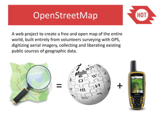
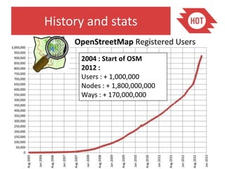
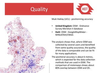

OpenStreetMap is a collaborative project to create a free editable map of the world. It began in 2004 and now has over 1 million users contributing data. The Humanitarian OpenStreetMap Team contributes mapping data for humanitarian and development contexts. OpenStreetMap data can be used for routing, downloaded for use in other projects, and edited in apps or through the website. Analysis has shown the positional accuracy of OpenStreetMap data is around 6 meters where there is significant contributor activity and quality assurance.


![Humanitarian OpenStreetMap Team [H.O.T.] Training for SBTF](https://cdn.slidesharecdn.com/ss_thumbnails/osmhotsbtf-130318160307-phpapp01-thumbnail.jpg?width=640&height=640&fit=bounds)


