Downloaded 26 times
![Better Mapping – the next level
OS OpenData
http://www.ordnancesurvey.co.uk/oswebsite/opendata/
LICENCE
You must:
• acknowledge the copyright and the source of the Data by including any attribution statement
specified
by the Data Provider. If no specific statement is provided please use the following:
Contains [insert name of Data Provider] data © Crown copyright and database right
• include the same acknowledgment requirement in any sub-licences of the Data that you grant, and a
requirement that any further sub-licences do the same;
• ensure that you do not use the Data in a way that suggests the Data Provider endorses you or your
use of the Data;
• ensure that you do not misrepresent the Data or its source.](https://image.slidesharecdn.com/bettermappingiisc-101130051111-phpapp01/75/Better-Mapping-II-Sourcing-good-data-4-2048.jpg)
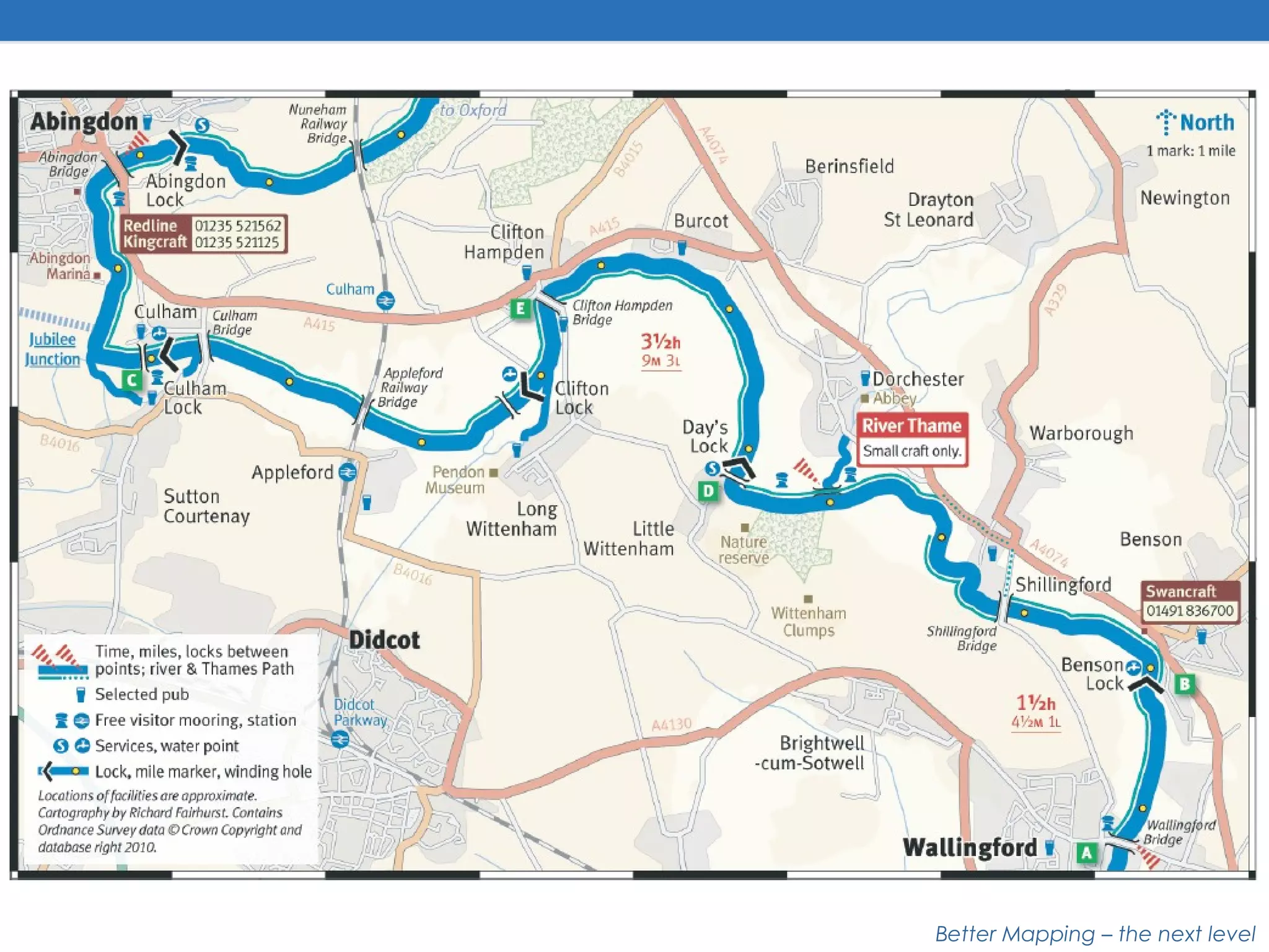
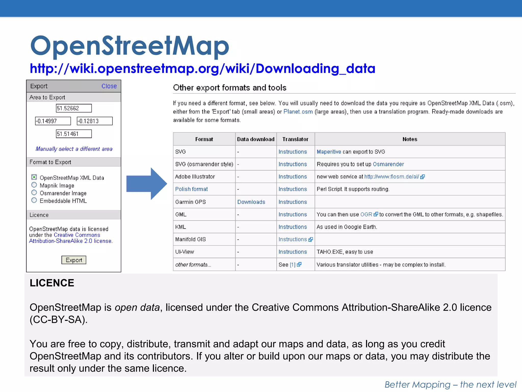
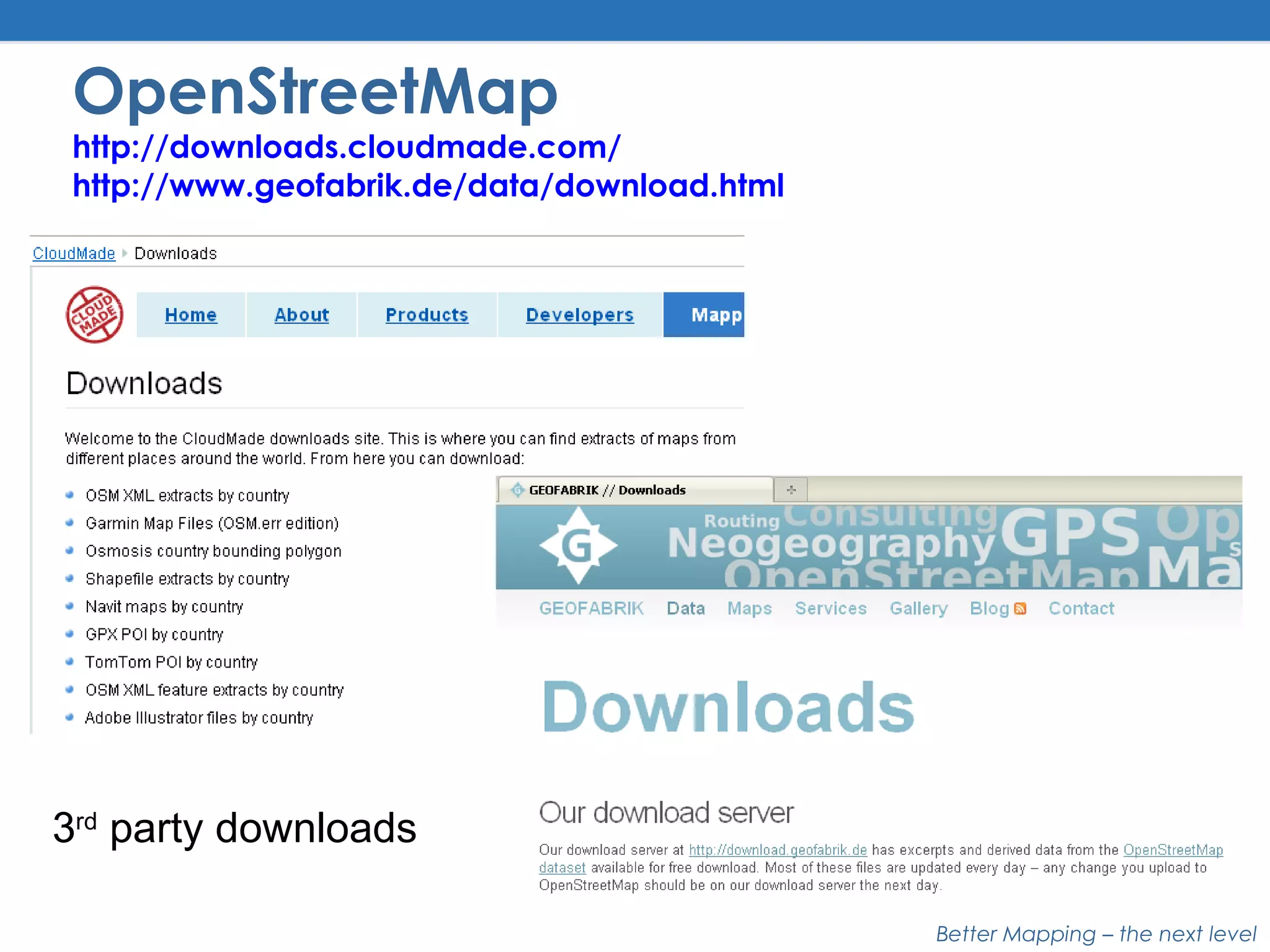
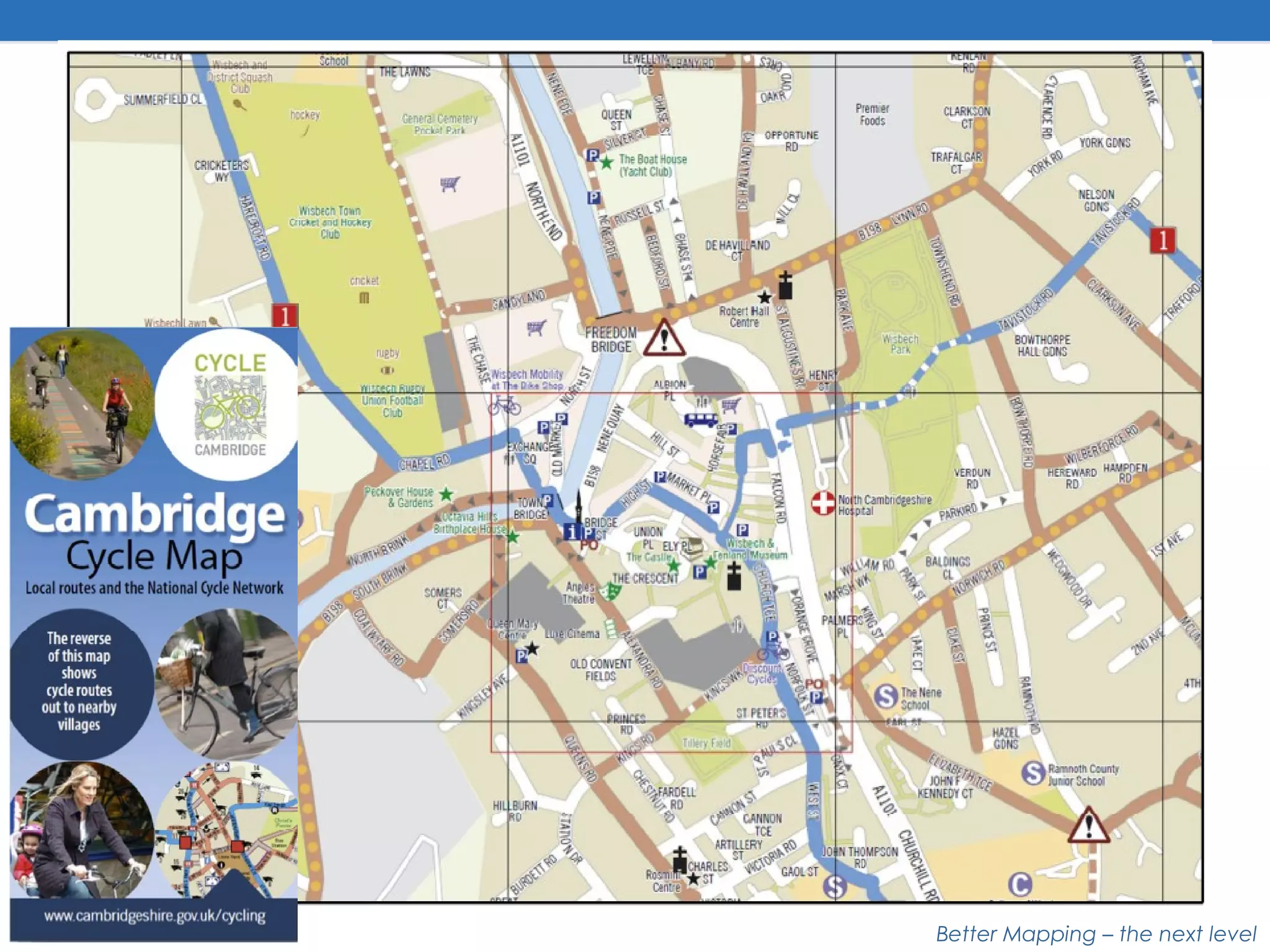
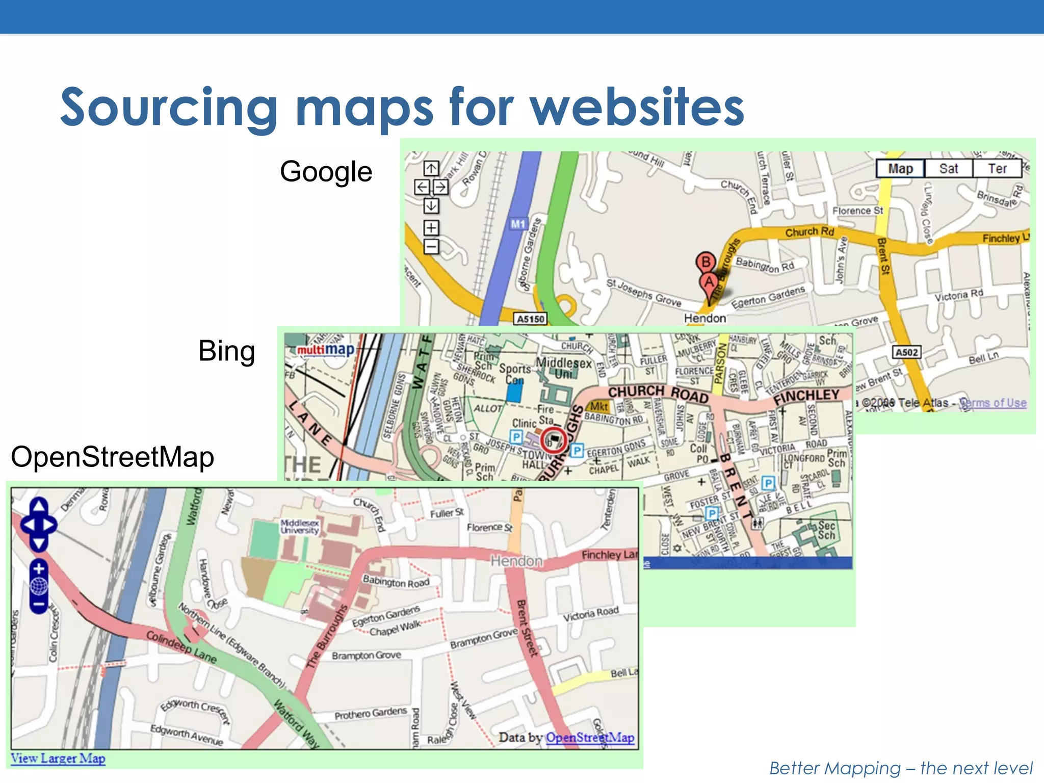
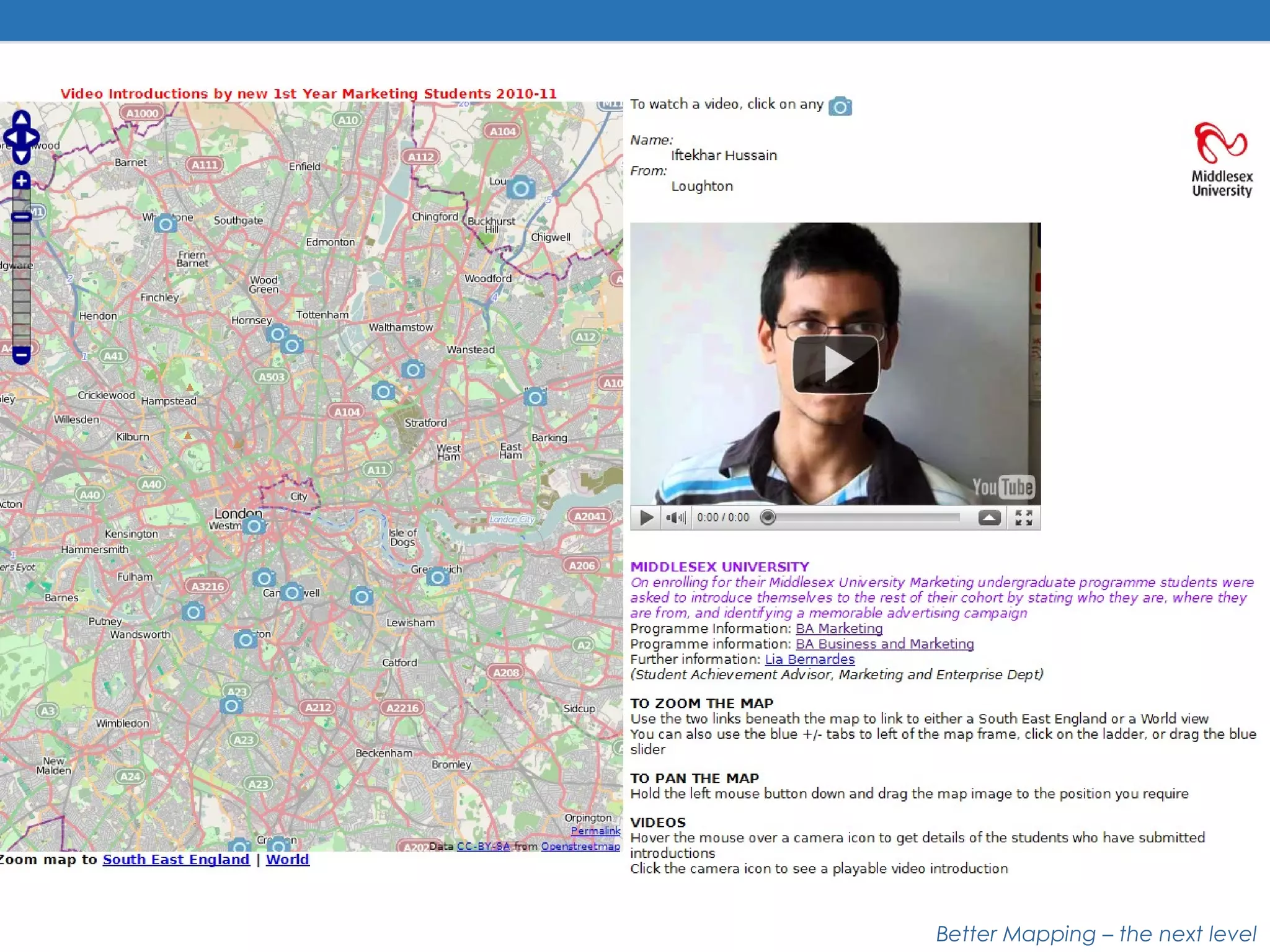


This document discusses various sources for map data and adding maps to websites. It outlines sources for commercial map data like Ordnance Survey and Navteq, as well as open data sources like OpenStreetMap, Natural Earth, and downloadable UK base maps. The document also discusses creating your own map data by tracing out-of-copyright maps or converting GPS tracks. Additional non-map data sources mentioned include patterns, icons, and tools for warping and rectifying scanned maps. The last section briefly discusses sourcing maps from Google, Bing, and OpenStreetMap for websites.


![Vibe Coding vs. Spec-Driven Development [Free Meetup]](https://cdn.slidesharecdn.com/ss_thumbnails/vibecodingvsspecdrivendevelopment-251209105622-43f455e7-thumbnail.jpg?width=640&height=640&fit=bounds)


