This document proposes integrating bus services with suburban train stations in Mira-Bhayandar, India. It analyzes the existing conditions at Mira Road and Bhayandar stations, including transportation modes used, passenger volumes, and issues. Key issues identified are lack of coordination between public transportation agencies, absence of bus terminals and shelters, uncertain bus schedules and routes, and inconvenient transfers between trains and buses. Solutions proposed include rationalizing bus routes and schedules, improving public information systems, developing bus terminals and shelters, and establishing a unified transportation management body. Concept plans are provided for proposed infrastructure upgrades at both stations. The goal is to improve mobility and accessibility through better integration of rail and bus services.
The FOBs and Subways in Pune, India are not used by pedestrians, either because they are not integrated with the pedestrian network or because they have repulsive design. In our proposal we tried to develop strategies that pedestrian have no other option, but to use it. This was possible only with a comprehensive urban design approach at a local level.
This presentation will give you an overview of Ahmedabad BRTS "JANMARG" Project. The slides were presented by me at Civil Engineering Department, L.D. College of Engineering
Development Plan and Environment: A Case of Ahmedabad. A Master Dissertation ...Rohit Nadkarni
This Study Intends to looks into the Development Plan and the development planning process of Ahmedabad and tries to understand the extent of environmental consideration in it. A Development plan envisages the entire town/urban area as a single unit and it is necessary to achieve overall
development of the town/urban area in an integrated and co-ordinated manner. Today Ahmedabad
is counted amongst the most polluted cities in India and this is mainly due to development planning
in Ahmedabad repetitively failing to incorporate environmental consideration and values in a
Development Plan. The other cases considered for the study like the London plan and the Delhi master Plan have managed to address most of their environmental issues in the Development Plan. London Plan is the most environmental sensitive Plan among the cases considered. Based on the lacuna identified in the present development planning process of Ahmedabad and by incorporating the lesson from the other Development Plans (London and Delhi), an attempt is made to evolve a framework and suggest changes in the present development planning process, in order to sensitize the entire development planning process towards environment.
REGIONAL PLAN: A CASE OF MUMBAI METROPOLITAN REGIONYash Shah
Regional planning deals with the efficient placement of land-use activities, infrastructure, and settlement growth across a larger area of land than an individual city or town. Regional planning is a sub-field of urban planning as it relates land use practices on a broader scale. It also includes formulating laws that will guide the efficient planning and management of such said regions.
Regions require various land uses; protection of farmland, cities, industrial space, transportation hubs and infrastructure, military bases, and wilderness. Regional planning is the science of efficient placement of infrastructure and zoning for the sustainable growth of a region. Advocates for regional planning such as new urbanist Peter Calthorpe, promote the approach because it can address region-wide environmental, social, and economic issues which may necessarily require a regional focus.
A ‘region’ in planning terms can be administrative or at least partially functional, and is likely to include a network of settlements and character areas. In most European countries, regional and national plans are ‘spatial’ directing certain levels of development to specific cities and towns in order to support and manage the region depending on specific needs, for example supporting or resisting polycentrism.
The Mumbai Metropolitan Planning Committee (MMPC) was formed under the provisions of the Maharashtra Metropolitan Planning Committee Act 1999 and has been entrusted with the task of preparing a Regional Plan for the Mumbai Metropolitan Area with help from MMRDA. Currently, the Regional Plan 1996 is in operation which was prepared by the Mumbai Metropolitan Region Development Authority (MMRDA) and sanctioned in 1999. The MMRDA was established under the MMRDA Act, 1974 and undertook the revision of the First regional plan prepared by the Regional Planning Board and sanctioned in 1973, under the provisions of the MR& TP Act, 1966.
Area Appreciation Studio - 2021 - SPAD M.PlanLakshman R
SEE THIS PPT IN SLIDESHOW MODE
About project
This project was an individual studio project named Area Appreciaton.
The main objective was to learn how to look and evaluate an area from a planners perspective.
So we were asked to select an area of about 1 Sqkm near our place of stay and appreciate several aspects related to spatial planning, quality of life etc.
I have selected Shakarpur and a part of Laxmi Nagar. Had a very hectic time but it was all fun and worth it!
India is a developing country. As the population grows rapidly, the development of cities is imminent. Urbanisation as an outcome of this development is being addressed here. Two case studies of medium towns are done underlining the factors of growth determining the structure of development. The objective is to learn from these experiences and make generalisations that could be helpful for the future development of many other similar towns and for developing a framework for balanced urban development in India.
This presentation covers the Urban Planning stages of Bhubaneswar, one of India's first modern cities along with Jamshedpur and Chandigarh. This city, the current capital of the coastal state of Odisha, was planned the German architect and urban planner, Otto Konigsberger, who also happens to be the author of 'Manual of Tropical Housing and Building.'
1.6 Town planning India pre & post independenceSachin PatiL
Necessity scope principles of Town Planning,
Present status of town planning in India,
Contribution of town planners in modern era,
Sir Patrick Geddes,
Sir Ebenezer Howard,
Clarence stein,
Sir Patrick Abercrombie,
Le Corbusier,
Crocodile is a platform and app to help with the admin and audit for schools who want to set up walking buses and make it simple and safe for parents to book their child onto a bus or train.
What would it take to get you out of your car? Usability for public transport. Delivered 13 November 2008 for World Usability Day, UTS, Sydney, Australia
My TEFL resources. See my resources webpage at http://www.globalcitizen.co.uk/inforesources/teflresources/resources.html
Download to enjoy the full audio/animation.
This selection of my favourite English lesson resources is adapted specifically for other Hong Kong primary children. All have an informal, fun-based approach and are original designs courtesy of yours truly.
Some Powerpoints cover several lessons and include accompanying printable worksheets and games - most can be adapted for older or younger pupils.
Please contact regarding any errors or copyright claims.
this this only for flight booking, not for taxi , bus or train. and all the contact details you will found in this document is totally wrong. so please don't try to contact with that details.
Pragmatic SOA - Beschränken auf das Wesentliche1&1
SOA ist mittlerweile ein weit bekanntes Paradigma. Leider bleibt es oftmals zu abstrakt, um greifbar zu sein, oder es wird auf einzelne Technologien reduziert. Darüber geraten leicht die eigentlichen Ziele für den Einsatz einer SOA aus dem Blickfeld. Diese Session stellt eine pragmatische Herangehensweise bei Aufbau und Einführung einer SOA vor und geht dazu auf Theorie und Praxis ein.
Para introduzir vocabulário e melhor assimilá-lo, nada melhor do que imagens! É com esse intuito que esta apresentação fora elaborada: para fazer com que os alunos entronizassem os vocábulos novos por meio de associação com as imagens.
For more information, see http://reliefline.ca
Do not include any personal information as all posted material on this site is considered to be part of a public record as defined by section 27 of the Municipal Freedom of Information and Protection of Privacy Act.
We reserve the right to remove inappropriate comments. Please see Terms of Use for City of Toronto Social Media Sites at http://www.toronto.ca/e-updates/termsofuse.htm.
Provide overview of the P3 concept, origins and benefits.
Introduce the Route 3 Express Toll Lane study
Describe study process, next steps and interest in Long Range Transportation Plan
For more information, see http://reliefline.ca
Do not include any personal information as all posted material on this site is considered to be part of a public record as defined by section 27 of the Municipal Freedom of Information and Protection of Privacy Act.
We reserve the right to remove inappropriate comments. Please see Terms of Use for City of Toronto Social Media Sites at http://www.toronto.ca/e-updates/termsofuse.htm.
IJRET : International Journal of Research in Engineering and Technology is an international peer reviewed, online journal published by eSAT Publishing House for the enhancement of research in various disciplines of Engineering and Technology. The aim and scope of the journal is to provide an academic medium and an important reference for the advancement and dissemination of research results that support high-level learning, teaching and research in the fields of Engineering and Technology. We bring together Scientists, Academician, Field Engineers, Scholars and Students of related fields of Engineering and Technology
Necessity of integrated transport system to namma metro at byapanahalli – a s...eSAT Journals
Abstract
Mass Rapid Transit is one of the major Transportation system proposed in metropolitan city like Bangalore in order to be beneficial
in reducing various traffic problems and result in reduction of Travel time etc. The efficiency of this system can be increased by
attracting more number of Trip makers by a suitable Integrated Transport System. Feeder system is one of these techniques proposed
for Namma Metro in Bangalore which includes Feeder bus (Minibus) operating throughout the radial areas of Metro stations. The
present study includes the necessity of these buses as par with Public Transport Buses currently operating in these areas with respect
to the willingness of commuters, Frequency and Travel Time.
VTA North County Open House Presentation April 2014SCVTA
More info: http://bit.ly/1lEOxm9. This presentation provides an overview of VTA's active and planned projects in the North County, presented at an April 9, 2014 open house in Mountain View. The projects covered include the Light Rail Efficiency Program, El Camino Real Bus Rapid Transit, Silicon Valley Express Lanes, and a study to improve bus service in the area. All the projects are located in or affect Mountain View, Palo Alto, Sunnyvale and surrounding communities.
As Europe's leading economic powerhouse and the fourth-largest hashtag#economy globally, Germany stands at the forefront of innovation and industrial might. Renowned for its precision engineering and high-tech sectors, Germany's economic structure is heavily supported by a robust service industry, accounting for approximately 68% of its GDP. This economic clout and strategic geopolitical stance position Germany as a focal point in the global cyber threat landscape.
In the face of escalating global tensions, particularly those emanating from geopolitical disputes with nations like hashtag#Russia and hashtag#China, hashtag#Germany has witnessed a significant uptick in targeted cyber operations. Our analysis indicates a marked increase in hashtag#cyberattack sophistication aimed at critical infrastructure and key industrial sectors. These attacks range from ransomware campaigns to hashtag#AdvancedPersistentThreats (hashtag#APTs), threatening national security and business integrity.
🔑 Key findings include:
🔍 Increased frequency and complexity of cyber threats.
🔍 Escalation of state-sponsored and criminally motivated cyber operations.
🔍 Active dark web exchanges of malicious tools and tactics.
Our comprehensive report delves into these challenges, using a blend of open-source and proprietary data collection techniques. By monitoring activity on critical networks and analyzing attack patterns, our team provides a detailed overview of the threats facing German entities.
This report aims to equip stakeholders across public and private sectors with the knowledge to enhance their defensive strategies, reduce exposure to cyber risks, and reinforce Germany's resilience against cyber threats.
Levelwise PageRank with Loop-Based Dead End Handling Strategy : SHORT REPORT ...Subhajit Sahu
Abstract — Levelwise PageRank is an alternative method of PageRank computation which decomposes the input graph into a directed acyclic block-graph of strongly connected components, and processes them in topological order, one level at a time. This enables calculation for ranks in a distributed fashion without per-iteration communication, unlike the standard method where all vertices are processed in each iteration. It however comes with a precondition of the absence of dead ends in the input graph. Here, the native non-distributed performance of Levelwise PageRank was compared against Monolithic PageRank on a CPU as well as a GPU. To ensure a fair comparison, Monolithic PageRank was also performed on a graph where vertices were split by components. Results indicate that Levelwise PageRank is about as fast as Monolithic PageRank on the CPU, but quite a bit slower on the GPU. Slowdown on the GPU is likely caused by a large submission of small workloads, and expected to be non-issue when the computation is performed on massive graphs.
Techniques to optimize the pagerank algorithm usually fall in two categories. One is to try reducing the work per iteration, and the other is to try reducing the number of iterations. These goals are often at odds with one another. Skipping computation on vertices which have already converged has the potential to save iteration time. Skipping in-identical vertices, with the same in-links, helps reduce duplicate computations and thus could help reduce iteration time. Road networks often have chains which can be short-circuited before pagerank computation to improve performance. Final ranks of chain nodes can be easily calculated. This could reduce both the iteration time, and the number of iterations. If a graph has no dangling nodes, pagerank of each strongly connected component can be computed in topological order. This could help reduce the iteration time, no. of iterations, and also enable multi-iteration concurrency in pagerank computation. The combination of all of the above methods is the STICD algorithm. [sticd] For dynamic graphs, unchanged components whose ranks are unaffected can be skipped altogether.
Opendatabay - Open Data Marketplace.pptxOpendatabay
Opendatabay.com unlocks the power of data for everyone. Open Data Marketplace fosters a collaborative hub for data enthusiasts to explore, share, and contribute to a vast collection of datasets.
First ever open hub for data enthusiasts to collaborate and innovate. A platform to explore, share, and contribute to a vast collection of datasets. Through robust quality control and innovative technologies like blockchain verification, opendatabay ensures the authenticity and reliability of datasets, empowering users to make data-driven decisions with confidence. Leverage cutting-edge AI technologies to enhance the data exploration, analysis, and discovery experience.
From intelligent search and recommendations to automated data productisation and quotation, Opendatabay AI-driven features streamline the data workflow. Finding the data you need shouldn't be a complex. Opendatabay simplifies the data acquisition process with an intuitive interface and robust search tools. Effortlessly explore, discover, and access the data you need, allowing you to focus on extracting valuable insights. Opendatabay breaks new ground with a dedicated, AI-generated, synthetic datasets.
Leverage these privacy-preserving datasets for training and testing AI models without compromising sensitive information. Opendatabay prioritizes transparency by providing detailed metadata, provenance information, and usage guidelines for each dataset, ensuring users have a comprehensive understanding of the data they're working with. By leveraging a powerful combination of distributed ledger technology and rigorous third-party audits Opendatabay ensures the authenticity and reliability of every dataset. Security is at the core of Opendatabay. Marketplace implements stringent security measures, including encryption, access controls, and regular vulnerability assessments, to safeguard your data and protect your privacy.
Show drafts
volume_up
Empowering the Data Analytics Ecosystem: A Laser Focus on Value
The data analytics ecosystem thrives when every component functions at its peak, unlocking the true potential of data. Here's a laser focus on key areas for an empowered ecosystem:
1. Democratize Access, Not Data:
Granular Access Controls: Provide users with self-service tools tailored to their specific needs, preventing data overload and misuse.
Data Catalogs: Implement robust data catalogs for easy discovery and understanding of available data sources.
2. Foster Collaboration with Clear Roles:
Data Mesh Architecture: Break down data silos by creating a distributed data ownership model with clear ownership and responsibilities.
Collaborative Workspaces: Utilize interactive platforms where data scientists, analysts, and domain experts can work seamlessly together.
3. Leverage Advanced Analytics Strategically:
AI-powered Automation: Automate repetitive tasks like data cleaning and feature engineering, freeing up data talent for higher-level analysis.
Right-Tool Selection: Strategically choose the most effective advanced analytics techniques (e.g., AI, ML) based on specific business problems.
4. Prioritize Data Quality with Automation:
Automated Data Validation: Implement automated data quality checks to identify and rectify errors at the source, minimizing downstream issues.
Data Lineage Tracking: Track the flow of data throughout the ecosystem, ensuring transparency and facilitating root cause analysis for errors.
5. Cultivate a Data-Driven Mindset:
Metrics-Driven Performance Management: Align KPIs and performance metrics with data-driven insights to ensure actionable decision making.
Data Storytelling Workshops: Equip stakeholders with the skills to translate complex data findings into compelling narratives that drive action.
Benefits of a Precise Ecosystem:
Sharpened Focus: Precise access and clear roles ensure everyone works with the most relevant data, maximizing efficiency.
Actionable Insights: Strategic analytics and automated quality checks lead to more reliable and actionable data insights.
Continuous Improvement: Data-driven performance management fosters a culture of learning and continuous improvement.
Sustainable Growth: Empowered by data, organizations can make informed decisions to drive sustainable growth and innovation.
By focusing on these precise actions, organizations can create an empowered data analytics ecosystem that delivers real value by driving data-driven decisions and maximizing the return on their data investment.
Multi model integration of bus and train services mira bhayandar
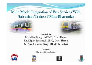
1. Multi Model Integration of Bus Services With
Sub-urban Trains of Mira-Bhayandar
Project by
Mr. Vilas Dhage, MBMC, Dist. Thane
Dr. Dipak Sawant, MBMC, Dist. Thane
Mr Sunil Kumar Garg, MRVC, Mumbai
Mentor
Ms. Manjiri Akalkotkar
2. Contents
Background
Project Scope
Project Limitations
Methodology – How you will do the project
Existing Condition and Issues
Proposed Solutions
Way Forward
2
4. City Profile
• Location : Near and at northern threshold of Greater Mumbai (MS)
• Area : 79 Sq Kms.
• Population : 8,14,615 (2011)
• Decadal growth : 57 %
• Density :
• No of Motorized vehicles : 1,24,891
(a) Cars/ Jeeps 26,227 (21%)
(b) Two Wheelers 72,436 (58%)
(c) Auto Rickshaws/Taxis 6,244 (5%)
(d) Other Commercial Vehicles: 19,982(16%)
(e) No. of PTAS (and vehicles) 6 (220)
9. Land Use Plan for Mira Bhayandar
9Mostly residential area, commute to greater Mumbai area
10. Agencies
Two important agencies
MRVC - A PSU of Ministry of Railways with
participation of Ministry of Railway and Govt. of
Maharashtra with equity in the ratio of 51:49. MRVC
implementing Rail Component of Mumbai Urban
Transport Project (MUTP).
MBMC - A local municipal body also running Bus
services in the area.
10
11. Overall Objective
• To develop specific actions in the form of short, medium and
long term transportation improvement proposals that will
achieve the transportation vision for the area.
• Long term and short term strategic planning to achieve desirable
mobility pattern for the city’s population in a sustainable and
cost effective manner.
• To make city to make the “engine of economic growth”
• To provide amenities and infrastructure for the convenience of
passengers and public transport vehicles.
• To take up measure of development for improvement of mobility
of people and make city livable.
12. Objective for the Project
To assess the existing condition at Railway stations and
plan safe, efficient & environmentally sustainable
means for multimodal integration of bus Services with
sub-urban trains of Mira-Bhainder.
To rationalize the bus services to sub-urban trains.
13. Background of city in context of project
• Existing Public Transport :-
• Sub-Urban Trains.
• MBMT, BEST, NMMT, TMT, MSRTC.
• Taxi & auto rickshaw.
• Road Network :- Well connected by road to National High Way.
(Thane, Mumbai & Gujrat)
• Rail Network :- Two railway stations
• Mira Road, Bhainder
• Suburban western local train service viz. Chuchgate to Virar. Two lakh
passengers board-alight everyday at above two stations (total 4 lakh)
15. MMR Existing Rail Route
15
Location map of Mira Road Station
Location map of Bhayandar Station
Connected two main stations –
Chrchgate –Virar Line
16. Mira Bhayandar Stations
Feeder service by multiple Public Transport
Authorities viz.
MBMT, MSRTC, BEST, TMT, UMT, KDMT, NMMT,
VVMT
Majority of people take bus to the stations
2nd most preferred way is to walk to station
3rd most preferred way is autorickshaw
Station area need improvement for seamless journey
16
17. Railway Station Characteristics of Mira Road
Mode of Transportation By people :-
Bus 30%
Auto 20%
2 /4 Wheeler 14%
By Walking 34%
Cycle 2%
No of
Passenger
Entered
No of
Passenger
exited
No of
Bus
Routs
Trip Of Buses
Per Day
Frequency
of Buses
per Hours
Mira Road 99,370 96,228 12 698 38
18. Railway Station Characteristics Of Bhaindar
Mode of Transportation By people :-
Bus 49%
Auto 10%
2 /4 Wheeler 14%
By Walking 27%
Cycle 1%
No of
Passenger
Entered
No of
Passenger
exited
No of
Bus
Routs
Trip Of Buses
Per Day
Frequency
of Buses
per Hours
Bhaindar 1,01,042 1,14,050 24 1032 57
19. Scope of Work
Delineate Station planning area for the Integration
of bus services with Sub-Urban Local trains
Existing condition analysis and demand – supply
gap analysis of transportation needs
Define Mobility Vision and Goals
Identification of policy measures and individual
projects
Preparation of a detailed plan involving
stakeholders consultation.
19
20. Methodology
• Define the scope & goals for the station area
integration
• Data collection & analysis (PTAs and Railways)
• Identification of issues, observations & conclusions
• Study on improvement / modification of existing
facilities
20
21. Methodology
• Identify Participation and involvement of all
Stakeholders, including that of NGOs & community
organizations.
• Assessment of impact on environment and social
aspect.
Preparation of Plans and Estimates.
21
22. Existing Problems
• Traffic Congestion at stations
• Issues related to the bus service at stations
• Lack of coordination among the PTAs;
• Absence of Bus Terminus & Shelters;
• Uncertainty of Bus Schedules and Routes and lack of
public information systems;
• Direct connection from railway exit/entrance to the bus
stops lacking
22
23. Existing Problems
• Transfer of passengers from one mode that i.e. From
Local train to Bus services is inconvenient and time
consuming.
• Exposure of users to inclement climate (rains, humid
and hot weather)
• Various activities in the station vicinity
• Hawkers
• Drop off by other vehicles
23
24. Approach
Travel pattern
origin and destination
Time of the day and mode choice
Land use pattern & bus routes
Mobility challenges
Street connectivity within MBMC
Institutional issues
Coordination of bus schedules among PTA
24
25. Integration of Transport
Infrastructure Integration
Institutional Integration
Operational Integration
Information Integration
26. Information Integration
Mobile enabled ITS facilities (M-Indicator) for
information regarding Rail & all STAs bus timings.
Display boards at Bus stops with ETA for different Bus
operators
Display boards at Terminals
27. Strategies
• Rationalization of bus service to stations
• Schedules, span of service and destination
• Integration Public information
• For railway and buses – time and route
• Station Area Traffic Improvement ,
• Seamless Accessibility with bus stops and
• Common fare collection mechanism
• Parking and drop off facilities
• Development of terminus, bus shelters
• Pedestrian pathways,
• Establishing Control/Management
• Funding by contribution of PTA and/or Government
Grants.
27
28. Strategy: Infrastructure Integration
Modernization of Mira Road & Bhainder stations by
MRVC
Beautification of Mira Road Station by MBMC
Common Bus Shelters for different Bus operators
Common Bus Terminals for different Bus operators
Designated Auto Rickshaw stands at Rly Stations
Designated parking spaces for two wheelers and four
wheelers
Bus Stops integrated with Skywalk entry/exit for
pedestrians
29. Strategy: Institutional Integration
UMMTA for MMR Region
Seamless ticketing for all STAs and trains in MMR
region
Planning coordination amogst different municipalities
and councils in MMR Region.
30. Data Collected – Other Agencies
1. Trespassing over Railway Track in Mumbai Suburban area
& remedial measures thereon By JJ School of Architecture,
Mumbai.
2. Mumbai Sub- urban Rail Passenger Surveys
and Analysis By Wilber Smith
3. Study on Station Area improvement of MIRA-Bhyandar
stations by Egis,
4. Comprehensive Mobility Plan (CMP) for Mira Bhayandar by
Urban Mass Transit Company Limited,
5. Short Term Traffic Improvement and Management Plan
for Mira Bhayandar by Urban Mass Transit Company Limited,
6. Field Visit
30
31. Data Collected
7. Data has been collected regarding future proposed
expenses road networking metro lines etc.
• Assessment of impact on environment and social aspect.
• Interaction with all Stakeholder, including that of NGOs &
community organization.
8. No of trains at both stations
9. Boarding and alighting data at both stations
10. Mode share at both stations
31
38. Peak hour mode shares for Mira Road & Bhayandar
Stations
38
39. Demand-Supply Analysis of Buses At Bhayandar & Mira Road Rly Station
39
Note : 1) Data Collection is Between 8.00 AM to 22.00 PM
2) Sitting Capacity of the Single Decker Bus is 49 to 51 with 20 to 21 standing
40. Railway map of the Bhayandar Station
40
Platforms : 6 Nos.
F.O.B. : 3 Nos.
Booking office : 16 nos.
Some Long distance Trains also halt at Bhayandar Station
41. Railway map of the Mira Road Station
41
Platforms : 4 Nos.
F.O.B. : 3 Nos.
Booking office : 13 nos.
46. General Findings
Improper Scheduling of the Buses,
Traffic Congestion due to high proportion of personal
mode, parking vehicle on road side, Lack of traffic
discipline etc.
Absence of Information systems for Buses at Railway
Station & vice-versa,
Noise & Air pollution
Various activities in the station vicinity
• Hawkers
• Drop off by other vehicles
47. Findings -Institutional
Multiplicity of agencies
Difficulty in coordinating the roles of central, state and
Local Government agencies
Individual objectives which are inconsistent with overall
development objectives
Difficulties encountered within individual transport
agencies
Functional responsibility unrelated to available
resources
47
48. Findings -Institutional
Delays in implementation or non implementation of
essential schemes
Lack of appropriate resources –
Rarely the transport planning/ execution/ operational
organizations are staffed with the professionals required to
accomplish the given objectives
Lack of shared goals & Objectives
48
49. Findings - Infrastructure
Lack of proper bus terminal with
basic facility like shelter,
toilet & water
Inadequate parking space, un-athorised parking,
Encroachment of circulating area near railway
station by hawkers
Lack of foot path leading to transit stops
Mixing of buses and private vehicles;
49
50. Findings Operations
• Transfer of passengers from one mode that i.e. From
Local train to Bus services is inconvenient and time
consuming
• Mismatch of bus schedule, frequency and demand of
passengers
• Exposure of users to inclement climate (rains, humid
and hot weather)
51. Short Term Solution
1. Improvement to circulating area near station by
shifting hawkers, unauthorized parking,
2. Proper lane provision for buses, autorikshaw etc.
3. Rescheduling of buses according to demand,
4. Common fare system for various mode,
5. Dedicated footpath, skywalk up to bus pick-up
point including proper Informatory sign boards,
6. Enforcing of Traffic discipline,
7. Display of information of various mode,
8. Set-up of unilateral body to monitor various
mode of transport,
51
52. Long Term Solution
Considering the growing population &
potential of the further development of land use,
1. Development of Modern Bus Terminal with basic
amenities,
2. Station area improvement by segregating traffic
on various mode at different level to seamless
access to railway station,
3. Multi-level parking facility for Private vehicles
for convenient inter-chainging,
4. Identifying the new route to promote public
transport,
5. Promotion to NMT
52
54. PLATFORM NO 2 & 3
PLATFORM NO 4
PLATFORM NO 1
ELEVATED WALKWAY
FOB3
FOB2
FOB1
RAILWAY
VACANT LAND
TF ROOM
SHANTI
OFFICE
RAILWA
Y
OFFICE
TOILET
BOOKIN
G
OFFICE
BOOKIN
G
OFFICE
PROPOSED
BASEMENT AREA FOR
PARKING
APPROX 10000 SQM
Perception Plan For Mira Road Station Area
54
56. Planning at Bhayandar Station
56
• FOB 3 is congested Need Widening / Additional FOB
• Escalators for the Convenience of the Old People.
V/C=0.82
V/C=0.92
57. Perception Plan for Bhayandar Station Area Improvement
Vehicular Movement
drop-off
pick-up
Bus stop
Terminal
58. Perception Plan for Bhayandar Station Area Improvement
TO BE DEMOLISHED
LAND IDENTIFIED
FOR STATION
IMPROVEMENT
59. Perception Plan for Bhayandar Station Area Improvement
11
22
3344
55
6677
88
99
10
11
22
33
44
55
66
77
88
99
10
PROPOSED DROP OFF AND PICK UP
PROPOSED BOOKING OFFICE AT FOB LEVEL
PROPOSED STATION BUILDING ON WEST SIDE
EXISTING FOB-2 JOINED
WITH PROPOSED STATION BUILDING
PROPOSED DROP OFF AND PICK UP
PROPOSED STATION BUILDING ON EAST SIDE
PROPOSED BOOKING OFFICE AT BOTH LVL
PROPOSED STAIRS AND ESCALATORS
PROPOSED LIFTS
RAILWAY PROPOSED FOB
60. Way Forward / Future Steps
• Analyzing existing transport / situation.
• Traveled demand assessment .
• Development of vision and goal, planning of medium
and long range measure along with cost estimated and
prioitization of project.
60
61. Discussion
Any project or New Idea comes into reality only
with the Fund Availability & Institutional Support at
local, State & Central level.
61