Downloaded 161 times
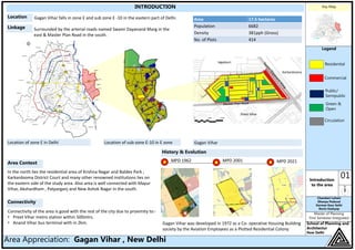
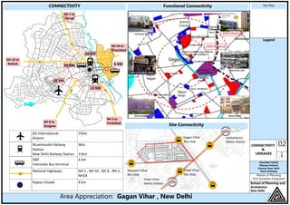
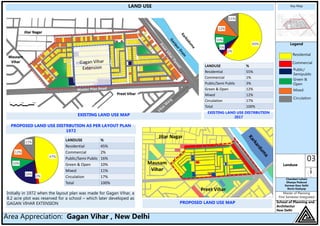
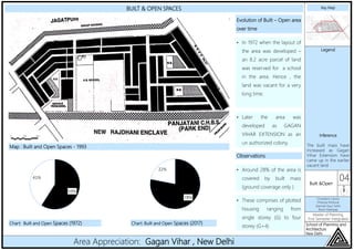
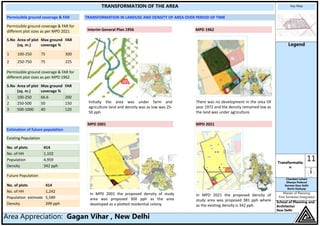

Gagan Vihar falls in zone E and sub zone E-10 in eastern Delhi. It was developed in 1972 as a plotted residential colony. The area is well connected to nearby areas via arterial roads and public transportation like the Preet Vihar metro station. Land use is primarily residential, comprising of plotted housing ranging from single to four stories. In recent years, there has been an increase in built-up area and building heights as plots redevelop to the maximum permissible FAR under the master plans. Basic physical and social infrastructure is available but requires improvements to fully meet growing demands.


