SlideShare a Scribd company logo
SACRED
STREAM
water
Understanding Hypoxia
Coral Bleaching
Olympic Hopeful
Rio's water woes
Working together for change
Underwater ghost towns
M I S S I O N: ISSUE 1 | Summer 2016
Expedition on Nepal’s Bagmati River
Who’s Minding the Planet?
32 Who’s Minding the Planet?
MISSION: WATER STAFFIN THIS ISSUE
Timothy A. Grooms
Director, YSI Marketing
Our Mission
I’d like to personally welcome you to the 1st
edition of Mission: Water, a magazine featuring the organizations and researchers
tackling the world’s most challenging water issues. Here we’ll highlight the latest trends in instrumentation and research applications,
while also offering additional educational resources on environmentally-focused matters.
Our goal is to help you stay informed about topics relevant to you. Our inaugural edition will cover articles ranging from monitoring
Nepal’s sacred rivers to examining coral bleaching events off the coast of Panama; research on fish diversity and nutrient recycling in
Africa’s Lake Tanganyika and much more!
At Xylem Analytics, we’re on a mission to solve water-related problems all around the world. As an industry leader in providing water
quality, flow and level monitoring instruments, we serve a wide range of customers that focus on surface water, ocean and coastal
environments. Our commitment is to provide you with accurate and reliable instruments to equip you with the best data possible.
Local Views
04 Water Blogged: Stories from the Web
06 Adventure Central: Water and Early Education
Surface Water
08 Sacred Stream: FlowTracker Helps Nepal Expedition
14 Exploring Lake Tanganyika
20 Flow for the Future: Three Gorges Dam
24 Marine Search and Rescue: Software Making a Difference
28 Wetlands in the High Desert
International Waters
32 Globally Integrated: Source Water Systems
36 Olympic Hopeful: Why Rio's Water Isn't Making the Cut
Ocean & Coastal Water
42 Coral Bleaching and Underwater Ghost Towns
48 Wendy Schmidt Ocean Health XPrize
50 On a New Kind of Hunt: The Impact of Community Science
Infographics
18 Californians Ready for Recycled Water
40 The Zika Virus: An Unhealthy Relationship with Water
56 Understanding Hypoxia
Inside Xylem
58 Developer Spotlight: Q&A with Chris Palassis
60 Xylem Watermark: What Does it Mean to 'Solve Water'?
62 Technical Tips from the Front Line
Steve Werblow
Staff Writer
Luke Giroux
Staff Writer
Tom Moeggenberg, YSI
Staff Writer
Jessica Clemmons, YSI
Staff Writer
Emily Jensen, YSI
Contributing Writer
Chris Iarossi, SonTek
Contributing Writer
Joel Heath, Arctic Eider Society
Contributing Writer
Dr. Yvonne Vadeboncoeur,
Wright State University
Contributing Writer
Inger Graves, Aanderaa
Contributing Writer
Judy Bragg, Hypack
Contributing Writer
Brittany Danek, Hypack
Contributing Writer
Rosa Maulini, YSI Systems
Contributing Writer
Brock Houston, YSI Systems
Contributing Writer
Raymond Mahar,
University of Dayton
Guest Writer
Carrie Parrish,
University of Dayton
Guest Writer
Patrick Higgins, YSI
Digital Marketing Manager
Brandon Smith
Executive Editor
Brandon.Smith@Xyleminc.com
Patrick Beatty
Creative Director
Patrick.Beatty@Xyleminc.com
Theresa McGeady
Copy Editor
Theresa.McGeady@Xyleminc.com
Copyright © 2016 Xylem Inc. All rights reserved. The publishers have made every effort to ensure the
accuracy of the information in this magazine. Questions or comments? Email us: info@ysi.com
Cover Photo: Bagmati River, Nepal
Source: Alexandra Lande
Editorial Staff:
Talk to us:
Magazine Contributors:
info@ysi.com
facebook.com/myYSI
YSI.com/blog linkedin.com/company/ysi
youtube.com/ysiinc twitter.com/YSIinc or @YSIinc
36 50
42
08 20
MISSION: WATER
HEADLINE
4 MISSION: WATER
WATER BLOGGED
Patrick Higgins, Digital Marketing Manager
Patrick.Higgins@Xyleminc.com
Water Blogged
Sharing in the love of water,
join us for more stories at:
YSI.com/blog
Estuary Research Project Highlights
Advantages of Continuous Monitoring
Researchers from the south coast of England have
established a small network of monitoring instruments in
Christchurch Harbour and associated rivers to study the
effects of weather events on water quality, and to better
understand the magnitude and spatial/temporal variation
of macronutrient fluxes - nitrogen (N), carbon (C) and
phosphorus (P).
The project, which is financed by a Natural Environment
Research Council grant, involved the installation of three
continuous monitoring stations; one in the harbor itself, a
second in the River Avon and a third in the
River Stour.
With over a year of data, project lead Professor Duncan
Purdie says: “We were fortunate with the storms that
took place over the winter of 2013/14, because we were
able to gather excellent high frequency data on nutrient
fluxes and water quality during severe weather, which
has dramatically improved our understanding of the
effect extreme river flows have on nutrient fluxes into the
estuary. The monitoring systems worked very well during
this period and we were particularly impressed with the
performance of the EXO2 sondes and the Storm loggers.”
Oregon’s Tualatin River:
America’s Early TMDL Case Study
The Tualatin River Watershed in northwestern Oregon was
one of the first TMDL-regulated watersheds in the United
States. Total Maximum Daily Load (TMDL) were set in 1987-88
following the resolution of a lawsuit based on the Clean Water
Act. As a result of this lawsuit, a consent decree was agreed
upon which included both a timetable for certain Oregon
actions and a requirement for EPA action if Oregon did
not comply.
Based on existing knowledge, TMDLs were set for the main
stem of the Tualatin River by the Oregon Department of
Environmental Quality (DEQ). Summer flow rates were
averaged for the tributaries and the main stem of the river so
that concentrations would not exceed 70 micrograms (0.07
milligrams) total phosphorus (TP)/L and 1 mg ammonia (total
of NH3
and NH4
+
)-N/L. Standards were in effect only during the
low-flow, warm season period, from approximately May 1st
through October 31st
, which covered the peak period of
algal growth.
Compliance was achieved by installing nitrification ponds at
the Water Resource Recovery Facilities (WRRF), which collect
wastewater and allow the ammonium-N to convert to nitrate.
It is important to note that since the Tualatin TMDL was
established, there has been increasing interest in monitoring
nitrate release from WRRFs around the country.
Water Quality Veteran Shares Memories
and Leaves 40 Year Legacy
At the end of 2015, Mr. Mike Lizotte formally retired from his
role as an Applications Engineer for YSI. Over the years he
has worked with diverse groups of professionals and students
on a plethora of projects – earning him a well-deserved
reputation as an expert in his field.
In this post Mike shares with us how he got his start, some
of his major contributions to the field of water quality
monitoring, and some parting advice to the professionals of
the future.
What Advice Would You Give to Up-and-Coming Water
Quality Professionals?
"A person in this field has to have patience – patience to
learn, and patience to not expect instant gratification. In the
early part of my career there were a lot of times I wanted to
quit – when I had to do a job I didn’t like. And yet, I learned
from that and it prepared me for new jobs down the road.
For some people, they are less willing to stick it out. Some of
that has to do with the fact that many folks have very large
education bills that need to be paid, rather than sticking
it out in a field they love they will jump from position-to-
position to climb the revenue ladder."
Get the full story: bit.ly/estuaryresearch Get the full story: bit.ly/OregonTMDL Get the full story: bit.ly/waterqualityveteran
Take automation to
the next level with
a VerticalProfiler®
system from YSI.
Don't Settle.
Measure Water Quality
Data throughout the
water column, not just at
a single depth.
Depth: 5m
Temp: 23°C
DO: 116% Sat
Chl a: 10.2 ug/L
Depth: 50m
Temp: 9°C
DO: 98.5% Sat
Chl a: 2.8 ug/L
Pontoon Profiler for
reservoirs, lakes
and estuaries.
For more on the
VerticalProfiler®
:
+1 (727) 565-2201
YSIsystems.com
Vertical
Profiling
MISSION: WATER 76 Who’s Minding the Planet?
RIVER STEWARDSRIVER STEWARDS
The students at Adventure Central are realizing everything the
river can offer. Groups explore the creek for macroinvertebrates,
and even engage in water testing with adult leader assistance.
They have taken ownership of the site, as the colloquial name
for the river has become “the beach.” Their imagination is
released during their time on the water. Kids are allowed to
explore, build, and swim to their hearts’ content.
It’s truly liberating.
Adventure Central holds programs all year long, including a
day camp in the summer. It is during this time the kids engage
with “river gods”, as Arnett calls them. These individuals are the
River Stewards, a University of Dayton student leadership group
that promotes civic engagement and service. Each summer, the
Stewards volunteer and bring kayaks for the kids to try. It's not a
secret - the kids love paddling around in the kayaks.
“I had a lot of fun kayaking. I was really good, except when I ran
into a lot of rocks,” says ten-year-old participant Jayla Fields.
There’s a definite uncertainty when kids hop into the kayaks.
Arnett describes the initial feeling as a “healthy fear.”
Kids embark on new experiences, overcome challenges, and
have fun. The River Stewards and Adventure Central Staff form
relationships of trust and support with the kids.
“The kids at Adventure Central taught me what it meant to be
a kid again. I was there to teach them about the importance of
their creek. Instead they showed me the importance of their
creek through their laughter and smiles we shared together,”
says River Steward, Boyd Newman-Caro.
Every day these kids go to school and hear the same lesson;
score this high, learn this formula, and spell this word correctly.
At Adventure Central, there is not one correct way to do things.
Failure is welcomed and seen as an opportunity to learn. The
outdoors and the river offer the necessary tools to enable
these kids as imaginative and innovative thinkers. Through their
activities the children learn leadership skills and teamwork. In
every aspect of environmental youth development, Adventure
Central is succeeding.
RAYMOND MAHAR
UD River Stewards
The American education system consistently receives
criticism aimed at early childhood development. The common
perspective is that our schools are simply not working. Children
are incapable of scoring well on standardized testing, ill
prepared to apply to college, and lack the 21st century skills to
function in our world today. Look at the statistics, and the future
seems truly daunting.
Let’s take a step back. Before we emphasize numbers and
formulas, what do we remember as the most crucial time
in our young lives? If you take a trip to Adventure Central at
Wesleyan MetroPark, they’ll tell you it was the experience of
play. Games of four square, tag, and kickball encapsulated our
summers as kids. The site is located in Dayton, Ohio and offers
an after school education program far different than any other
in the area. The education center’s mission is to promote youth
development and leadership skills using an environmental
foundation in a welcoming, safe, and fun setting. Youth spend
time connecting with nature to enable them as contributing
leaders for the future.
Wolf Creek, a major tributary of the Great Miami River, sits
in Adventure Central's backyard and is regarded as the most
beneficial resource the site utilizes. And the kids love it.
“Kids feel a natural connection to the river. They are drawn to
play in the river, and the relationships and confidence gained
from that are great,” says Center Director and Extension
Educator Nate Arnett.
Adventure Central students are mainly comprised of Dayton's
inner city youth. Most families come from low-income
households, several having little opportunity for such an
experience with the outdoors. When kids come here, they
explore the woods for the first time, learn about plant life, and
roast their very first marshmallow. Those initial experiences are
extremely powerful at such an impressionable age, and the river
exponentially adds to their fun at Adventure Central.
“When I was a kid, my mother told me not to go in the creek.
These kids are taught the same thing. Now it’s, please, jump
right in,” says Program Coordinator Angela Collie.
ADVENTURE CENTRAL
“When I was a kid, my mother told
me not to go in the creek. These
kids are taught the same thing.
Now it’s, please, jump right in.”
8 9Who’s Minding the Planet?MISSION: WATER
SURFACE WATERSURFACE WATER
SACRED
STREAMFLOWTRACKER HELPS NEPAL RIVER EXPEDITION
The Bagmati is both a sacred river and a city sewer, running
through Nepal’s capital city of Kathmandu before heading
into the mountains and over the Indian border. Since 2013,
thousands of volunteers have gathered along the Bagmati for
weekly river clean-ups on Saturday mornings, and the 100th
cleaning event on April 11, 2015 drew more than 100,000 locals
to the river’s banks.
The next day, a group of students and hydrologists embarked
on a 10-day, 160 km (100 mile) hike along the Bagmati from
Chovar—the point where the river leaves the Kathmandu
Valley—to the Indian border. Sampling every 5 km along the
route, where the landscape permitted, the UK-based Biosphere
Association and Kathmandu’s Nepal River Conservation Trust
made the first openly available survey of the downstream effects
of Kathmandu’s pollution in the Bagmati.
The expedition was a massive undertaking, both physically
and logistically.
“It was sort of the Nepalese river equivalent of going up one
of their mountains,” marvels Lee Pimble, European Hydrology
Manager for Xylem Analytics, who traveled to Nepal to train the
team on hydrometric sampling at the request of organizer Carol
Milner, founder of the Biosphere Association.
STEVE WERBLOW
SonTek European Hydrology Applications Manager, Lee Pimble,
conducts acoustics training for volunteer researchers working
for the Nepal River Conservation Trust.
“It was...the
Nepalese river
equivalent of going
up one of their
mountains.”
10 MISSION: WATER 11
SURFACE WATERSURFACE WATER
Fast Training
Pimble says he was concerned at first about training the
group to use the FlowTracker. The Nepal River Conservation
Trust team was comprised of a group of enthusiastic, young
hydrologists and ecologists. Some had masters degrees and field
experience. Others were undergraduate students, eager for
real-world experience and committed to working their way into
the conservation world. But most had been trained in Nepal, a
poor country where even the top government agencies were
measuring flow with outdated mechanical equipment.
“They had no knowledge of the acoustic instrument,” Pimble
says. “But they took to it. Considering they were novices with
the technology, they were very quick [to learn]. We spent half
a day ensuring that they understood hydrometric techniques.
Once they grasped that, we were probably an hour in the field
using the FlowTracker before I was comfortable saying, ‘go
ahead’ and they were on their way.”
	
Location, Location, Location
In fact, says Pimble, most of his two-day training session focused
on site selection, not equipment operation.
“The FlowTracker allows them to follow a very straightforward,
step-by-step procedure,” he notes. “If you follow the
FlowTracker, step-by-step, you will get good results. But if you
don’t choose a good sampling location, you won’t get a good
measurement, no matter what instrument you have.”
Local Heroes
Milner, who is based in the U.K. but has many friends in Nepal,
was touched by the impact of pollution in the Bagmati—
particularly on its impact on poor residents, who cannot afford
clean water but also can’t rely on the fouled river to supply
their needs.
	
In 2010, she asked a local when the trash in the river would be
removed, and was told that the monsoon would soon wash it to
India. That was the last straw.
“I wanted to give assistance to those already fighting to make a
change for the future,” Milner says.
Delving deeper into the challenges facing the Bagmati, Milner
found that water levels in the river were dropping precipitously.
Rock mining was altering the porosity of the substrate and
changing the flow of the water table. Draws for growing
communities, irrigation and industry decreased river flows, and
some studies indicated that recharge was decreasing.
	
Local hydrologists needed data on the river’s flow to create
a baseline along the river, explore changes in pollution and
fill in blanks in hydrological station readings that are vital to
understanding flood risk in the river’s basin.
Pimble points out that the FlowTracker allowed the Nepal
team to measure water where velocity and depth were well
below the thresholds of old, mechanical meter technology.
That permitted far greater breadth in site selection and the
opportunity to build a much more comprehensive picture of
conditions in the river.
	
“We went to the river and tried different scenarios,” Pimble
adds. “We looked at velocity distribution and how that affects
the measurement. We looked at debris in the channel. In the
UK, when we think of ‘debris,’ we think of vegetation. In Nepal,
it could easily be a dead goat or maybe pieces of a car. It could
be anything. By the third day, we worked at some interesting
sites. They practiced keeping themselves safe in the water, and
not so much on the use of the instrument.”
	
With Pimble’s training course and a few hours of experience
in the river, the group headed down the valley to begin their
expedition, toting the compact FlowTracker.
	
“They were walking the whole stretch,” says Pimble. “They
carried everything—the FlowTracker, the rod, the batteries,
their food, the water quality equipment. Everything.”
	
The physical challenges of operating on foot made the
FlowTracker’s reliability as vital as its portability.
	
“Because we were hiking in remote areas, it was difficult to
re-measure a site,” Milner points out. “It would have involved
hiking 10 or 20 km back to it, so the immediate feedback of the
system to look for potential errors was vital.”
Donated FlowTracker
In her native England, Milner approached Lee Pimble of Xylem
for help. She was hoping to borrow or buy a FlowTracker
handheld acoustic Doppler velocimeter (ADV). Built by SonTek,
a Xylem brand, the FlowTracker is a rugged, compact instrument
that would be ideal for the challenges ahead and would allow
the group to measure the velocity, direction and discharge—or
volume rate of water flow—in the river.
“We knew the expedition would be tough, walking remote
terrain, and wanted something that would be reliable,” Milner
explains. “Although we had a small budget, we contacted
SonTek, mostly for advice at first. Lee Pimble was extremely
helpful and engaged in our plight, and his advice was not based
on sales, but on actual river experience.”
Pimble requested permission from headquarters to lend an
instrument to Milner or find a demonstration model to sell her.
His pitch excited the product team, and Pimble was told SonTek
would donate a brand-new FlowTracker instead. At Milner’s
request, Pimble agreed to travel to Nepal to teach the Nepal
River Conservation Trust team how to use the instrument.
	
“This was the perfect opportunity to put our technology
to work, using science in a very practical way to help solve
environmental challenges,” explains SonTek product manager
Janice Landsfeld in San Diego, California. “We could put a
powerful tool in the hands of a really committed group of
people halfway around the world and help them in their efforts
to rescue their sacred river.”
Tragedy Strikes
As the Bagmati team began its hike back to Kathmandu the
ground shook from an earthquake that registered 7.8 on the
Richter Scale and devastated the capital and the surrounding
area. In a matter of moments, hundreds of thousands of people
were left homeless. The quake injured approximately 22,000
people and killed nearly 9,000, including friends and family of
some of the members of the hydrology team.
	
Pimble, back home in England, started calling his new friends
in Nepal to check on their safety, and immediately began
sending money to first-response groups. Meanwhile, Xylem
mounted a company-wide campaign through its foundation,
Xylem Watermark. Employees donated more than $25,000;
the company double-matched the gifts and added a corporate
contribution of its own, amassing a total donation of more than
$218,000 to Mercy Corps’ Nepal operations.
	
“The work we do is about more than projects and data,” says
Landsfeld. “It’s about the people we work with, the bonds
we create, and the passion we share for environmental
work. Xylem’s response to the earthquake in Nepal, through
the individual generosity of our colleagues like Lee and the
company’s contribution, reflects that personal concern
and connection.”
KATHMANDU, NEPAL - APRIL 29, 2015:
Patan Dubar Square which was severly
damaged after a major earthquake.
Photo: Shutterstock
Cremation ceremony along
the holy Bagmati River at
Pashupatinath temple.
Photo: De Visu
Milner...was touched by the
impact of pollution in the
Bagmati — particularly on its
impact on poor residents.
FlowTracker2®
MISSION: WATER12
SURFACE WATER
Future Goals
Using the lessons learned along the Bagmati, Milner is planning
a similar expedition along the Karnali River, a major tributary of
India’s famous Ganges.
	
The Karnali team will use the FlowTracker to measure discharge
of many tributaries to the river, Milner says, and is exploring
ways to use the instrument from a raft to measure flows in the
main stem. The FlowTracker is also at the heart of a program led
by a former member of the Bagmati team to train and inspire
Nepalese university students, giving them an exciting chance to
use top-shelf hydrology tools and techniques.
	
As Nepal engages in the long, difficult process of rebuilding
the nation in the wake of the devastating earthquake, Pimble
remains in touch with his colleagues in Nepal. He says he’s
confident the Nepal River Conservation Trust team will
persevere in its efforts to clean up the Bagmati with the calm,
grace and grit he observed when he visited on his
training mission.
	
“They’re going to carry on,” he says. “The earthquake put them
back, but they are still trying to do their work of restoring the
river. They’re that sort of people.”
Photo of the expedition team.
Courtesy NRCT
Expedition team members collect flow and discharge data at
cross sections along the Bagmati river. Courtesy NRCT
Find papers, videos and product specifications:
sontek.com/flowtracker2
• Proven SonTek ADV accuracy
• Intuitive, graphical and easy to use
• New features requested by
water professionals like you!
inquiry@sontek.com | +1 (858) 546-8327
DR CONGO
BURUNDI
TANZANIA
ZAMBIA
1514 MISSION: WATER Who’s Minding the Planet?
SURFACE WATERSURFACE WATER
The littoral (nearshore) ecosystem of
Lake Tanganyika is the freshwater analog
of a coral reef. The clear, shallow waters
at the lake’s edge are low in nutrients,
but the attached algae (periphyton
or microphytobenthos) are highly
productive and support the diverse
fish community.
Dr. Yvonne Vadeboncoeur (Department
of Biological Sciences, Wright State
University) and Dr. Peter McIntyre
(Center for Limnology, University of
Wisconsin) are studying the relationships
between fish abundance, periphyton
productivity and nutrient upwelling in
Lake Tanganyika. They are exploring
the key roles that grazing and nutrient
excretion by fish play in maintaining high
ecosystem production.
For years, lake ecologists have assumed
that phytoplankton, or algae in the water
column, are the main source of primary
production in lakes. However, evidence
is accumulating that in lakes of all sizes,
periphyton forms the energetic base
of littoral food webs. Furthermore, the
vast majority of fish species in lakes
feed in the littoral zone. In doing so,
the fish rely on periphyton for energy,
either through direct consumption, or by
consuming invertebrates that graze on
periphyton. In Lake Tanganyika and other
African Rift Valley lakes, the majority
of the fish species are grazers and
consume periphyton directly. Therefore,
periphyton productivity is critical
to understanding littoral ecosystem
dynamics. But quantification of the role
of periphyton in the lake ecosystem has
been hampered by logistical constraints
associated with measuring periphyton
productivity.
Chamber methods for measuring
phytoplankton productivity are well-
established and usually include the use
of 14
C to measure carbon uptake. In
contrast, benthic primary productivity
is not a routine measurement in lakes.
Initial methods also used 14
C, but it
became increasingly obvious that
benthic biofilms have high productivity
rates. The high photosynthesis rates
made bulk oxygen exchange methods
a viable alternative to tracer methods.
Lake
Tanganyika
Fish Diversity, Nutrient Recycling and
Periphyton Productivity in the Littoral Zone
Dr. YVONNE VADEBONCOEUR
Department of Biological Sciences,
Wright State University
RUMONGE, BURUNDI
People collecting water from Lake
Tanganyika in Rumonge
Photo: Giulio Napolitano
Lake Tanganyika in East Africa
is the second deepest lake in
the world reaching a maximum
depth of 1,470 m (4,820 feet)
and is also the second largest
lake by volume. The lake is
divided among the countries of
Burundi, Democratic Republic
of the Congo (DRC), Tanzania
and Zambia. Most of the lake’s
massive volume of water sits
in its dark depths, where a lack
of oxygen makes it impossible
for fish and other animals to
live. But swimming near the
well-lit shoreline is one of the
most diverse freshwater fish
communities in the world.
The lake supports nearly 275
fish species, many of which
are endemic and are popular
aquarium pets. In fact, nearly
98% of the Tanganyika cichlid
species are found nowhere else.
MISSION: WATER 1716
SURFACE WATER
WHEN THE ENVIRONMENT
DEMANDS IT
Periphyton on rocks or intact sediment
cores are easily isolated in chambers.
Large changes in oxygen in light and
dark chambers can be detected over
short incubation periods (15 minutes
to 2 hours). The tricky part is getting an
accurate oxygen measurement while, at
the same time, preventing exchange with
the atmosphere. Agitation of the sample
introduces error.
Stirring is not required to make accurate
measurements of oxygen with the YSI
ProODO, and the ProODO has increased
both the speed and repeatability
of the benthic primary productivity
measurements. Intact periphyton
communities are incubated in chambers,
either in situ or under lights in the lab.
Immediately before withdrawing a
water sample, the water is stirred in the
chamber with a built-in rotatable paddle
or the entire chamber is rotated to mix
the water.
No air is in the chamber, so this
procedure breaks down any oxygen
gradients in the chamber without
introducing air that would affect
the readings.
Water samples are then withdrawn using
a disposable, needle-less, 60 cc syringe.
The entire syringe is filled with water,
and extreme care is used to prevent the
introduction of any air into the syringe.
After the syringe is filled, a small rubber
cap is placed on its terminus.
After the diver returns to the surface, the
internal plunger of the syringe is carefully
removed, and replaced with the ProODO
optical-based dissolved oxygen sensor.
The stainless steel probe guard that
protects the optical sensor fits perfectly
inside the syringe, and it holds the sensor
in the center of the water sample.
In approximately 40 seconds, researchers
have an accurate oxygen measurement.
This technique is very fast and allows
for many more measurements than
previous methods. The ability to make a
high number of replicate measurements
addresses the common concern of high
spatial heterogeneity in periphyton
biofilms.
By measuring benthic primary
productivity and nutrient uptake in Lake
Tanganyika, researchers are beginning to
understand how this ecosystem supports
so many fish.
The fish persistently graze the
periphyton, and the water itself is
extremely nutrient poor. The biomass of
the periphyton is incredibly low, but data
from the measurements demonstrates
that the algae on the rocks are
incredibly productive.
How does such high productivity and
diversity persist in the face of apparent
extreme nutrient scarcity? It is believed
the answer lies in the grazing fish
themselves. Most of the nutrients in
the system are actually in the bodies of
the fish. By staying in the surface waters
and feeding on algae, the fish keep the
nutrients in the lighted waters where the
algae can use them. The fish continually
excrete small amounts of nutrients as
waste products, and this helps maintain
high algal productivity.
Ongoing lab and field experiments
are helping us to understand the
mechanisms underlying the high
ecosystem production and high fish
diversity in Lake Tanganyika.
The majority of Lake Tanganyika’s
fishes, like this Tropheus duboisi,
live along the lake’s well-lit
shoreline boasting one of the
world’s most diverse freshwater
communities.
East Africa and Lake
Tanganyika from Orbit
Photo: Anton Balazh & NASA
info@ysi.com | +1 (800) 765-4974
ProDSS
THE ULTIMATE
WATER QUALITY
Sampling &
Profiling System
YSI.com/ProDSS
WHEN THE ENVIRONMENT
DEMANDS IT
• Drop-rated, impact resistant
• Waterproof (IP67 rated)
• Laser-welded titanium sensors
• Rugged, military-spec connectors
• Back-lit display & keypad
• GPS (optional)
The ProDSS — built for the most
challenging field conditions:
1918
INFOGRAPHICINFOGRAPHIC
DROUGHT-WEARY
CALIFORNIANS ARE READY FOR
RECYCLED WATER*
Residents eager for long-term solutions to water scarcity
Californians are READY for recycled water. The state has the opportunity
to LEAD the US in accelerating the use and acceptance of recycled water.
of respondents SUPPORT
using recycled water as an
additional source of water.
SOMEWHAT
SUPPORTIVE
VERY
SUPPORTIVE
87%
of survey respondents
believe recycled water
should be used as a
long-term solution,
regardless of drought.
76%
is a key component in securing support
for recycled water across the state.EDUCATION
of California residents are
more willing to use recycled
water after learning about the
treatment process.
89%
Referring to reused water as “purified water” garners stronger
support for its use as an additional local water supply than
“recycled water” or “reclaimed water.”
LABELS MATTER:
PURIFIED
WATER
are willing to
use recycled
water in their
everyday lives.
83%
41%
SOMEWHAT
WILLING
VERY WILLING
42%
of Californians agree that the
drought has made them more supportive of
RECYCLED WATER.
89%
Californians believe that recycled water should be used as a
LONG-TERM SOLUTION
for a water-secure future – regardless of potential rainfall from El Niño.
NEARLY 90%
of Californians believe the state should continue to
invest in recycled water for drinking water even if
El Niño brings the expected rainfall.
Only 12% will be less concerned about
conserving water if El Niño brings
the expected rainfall.
12%
*These results are based on an online survey by research firm Edelman Intelligence of approximately 3,000 randomly selected
California voters from January 14-30, 2016. The survey was commissioned by Xylem Inc. and has +/-3.1 percent margin of error.
90%
87%
82%
RECYCLED
WATER
RECLAIMED
WATER
2120 Who’s Minding the Planet?MISSION: WATER
SURFACE WATERSURFACE WATER
Central China Floods, 1931
Davies, Richard
Millions Lost in Flood
In 1931, among the plains of
Southeastern China, the Yangtze River
water level peaked due to torrential
rains, flooding nearly 500 square miles
of the surrounding area. This historic,
devastating flood killed 3.7 million
people. Farm land and rice fields were
swamped, destroying a major food
source for citizens in surrounding
cities. As a result, many suffered from
starvation and disease.
The flood was
arguably the worst
natural disaster in
over a century.
Dam Proposed For Protection
Sun Yat-sen, founder of the Republic
of China, proposed a Dam in 1919 to
protect the river communities.
Though construction on the Dam was
not yet started, it became a controversial
topic among many. Environmentalists
cautioned that the Dam would take a
toll on the surrounding ecosystem and
provide future problems. Planning and
implementation of the project was
stopped by government officials during
the Chinese Civil War in 1947.
In years to follow, extensive flooding
continued to occur along the Yangtze
river, causing more death and costing
billions of dollars in damages.
In the 1980’s, the idea of the Dam
resurfaced. The Dam and reservoir
design would protect residents from
flood conditions, provide fresh water
for agricultural use, and be a source to
generate electricity without greenhouse
gas emissions. After much debate,
construction started in 1994 on what
is now known as the world’s largest
hydroelectric dam, spanning 1.4 miles
(2.3 kilometers) and 607 feet (185
meters) tall—The Three Gorges.
Flow for
the FutureChinese officials take action, through water level
data, with early warning and flood prevention.
EMILY JENSEN
The Three Gorges Dam, one of the world’s largest,
on the Yangtze River, Hubei Province, China.
Photo: SINITAR
2322 MISSION: WATER
SURFACE WATER
Facing Drought –
Nearly 100 Water
Monitoring Sites Installed
Years later, in 2011, the
environmentalists' nightmare came true.
Southern China was facing the worst
drought China had seen in 50 years.
The Dam faced criticism from
environmentalists, who blamed the
Dam for causing the drought by storing
water upstream for power generation.
Critics argued that the annual filling
of the Three Gorges Reservoir caused
plummeting water levels downstream,
resulting in two of China’s largest
freshwater lakes, Poyang and Dongting,
to diminish.
Regardless of the droughts cause,
Chinese officials took action—installing
nearly 100 water monitoring sites along
the Yangtze River.
Continuous, water quantity monitoring
sensors installed at these sites provide
important information to help manage
the drought, provide early warning for
future flooding, and assist in power
generation at the Dam. A H-3553T
bubbler from YSI, a Xylem brand was
installed to gather stage and flow
measurements that help officials
accurately monitor the water level of the
river, above and below the Dam.
Water Level Data is Vital
It is important to monitor the water
levels above and below the Dam for a
number of reasons—includng public
safety, environmental impact, and
generation of electricity.
“The sensors from the monitoring
sites provide key data to help the
Three Gorges Cascade Dispatch Center
and Changjiang Water Resources
Commission,” states Roger Zhou,
Xylem Analytics representative.
“The Changjiang Water Resources
Commission, can then build a regional
water flow model, which is used for
power generation estimation and to
calculate storage capacity of the Dam”.
The reservoir is said to be able to hold
water at a maximum height of 574
feet (175 meters). Officials analyze the
monitoring data to determine if they
need to discharge water to prevent
flooding upstream.
In addition to the risk of flooding
upstream, data is also used to prevent
downstream flooding.
“If the reservoir is filled, there is no room
to catch and hold water if there is a
flood,” explains YSI Water Level Division
Product Manager, Tim Jeppsen. “If a big
storm is coming they need to know if
there is capacity in the reservoir to hold
water so the area below the dam is
not flooded”.
Managing for Millions
The water level data is also used to
assist in the balancing act of providing
water both above and below the Dam.
Holding the water upstream, when it is
needed downstream can have a negative
environmental impact downstream—
causing drought conditions which
can in-turn affect farmers and water
transportation.
“The monitoring data also helps officials
to redirect the water to cities where
residents are experiencing shortages
downstream,” adds Jeppsen. “Managing
the water level data directly affects
the lives of citizens both upstream and
downstream from the Three
Gorges Dam”.
The sensors from the monitoring
sites provide key data to help...
build a regional water flow model.
N
EW
One of many
monitoring
stations built
along the
Yangtze.
An intelligent compact constant flow bubbler system developed to provide
long-term, accurate and repeatable water level readings for hydrologists and
water professionals. Used as a stand-alone system with internal data logging
or as a sensor that seamlessly integrates with any data logger.
*Shown with optional display.
Internal Data Logging
Wi-Fi Connection
Multiple Output Options
Intuitive Menu Configuration
AmazonBubbler
YSI.com/Amazon
MISSION: WATER24 Who’s Minding the Planet?
SURFACE WATER
Their duty to protect and serve local
communities isn’t limited to catching
the bad guys and putting out fires.
Not anymore. These days, their job
descriptions seem to extend for pages
on end; from investigating crimes to
providing first aid. Over the past several
years, “side-scan sonar technician” and
“hydrographic surveyor” have even been
added to this long list.
Since time is always crucial in search and
rescue operations, real-time sensors and
navigational charts have become critical
tools to find missing people or evidence
lost in marine environments.
Long gone are the days of relying solely
on teams of divers to sweep an area
during surveys. New technology is
improving the safety and efficiency of
these types of investigations.
In the past, marine searches by police or
fire departments would be conducted
by trained divers swimming in one of
several patterns (Ace, Parallel, Circular,
Linear, and Grid). The team would swim
along the bottom of a lake, river or
coastline, with guidance from partners
above water to ensure a thorough review
of an area. This tedious process could
take hours to fully explore even a
small space.
Nowadays, a combination of powerful
sonar systems and software platforms
help divers quickly discover their targets.
This technology provides real-time
images of a sea floor or lake bed, even
when darkness or murky waters would
otherwise affect a dive team’s visibility.
Search and rescue teams are now
exploring larger areas, in far less time.
Using a high frequency side-scan
sonar device along with a powerful
hydrographic survey package like
HYPACK® Marine Search, police and
firefighters can cover an area of 8,000
square meters in as quick as 5 minutes.
That’s larger than a football field!
How’s it work? Well, the software displays information
from navigational charts and helps guide the vessel, all
while coordinating data from a GPS and sonar system
to provide an image of the river, lake or ocean bed.
Compared to manual diver searches – agencies using
this tag team of hardware and software exponentially
increase the success of missions, all while keeping
their dive personnel out of harm’s way.
The Middletown, Connecticut Police and Fire
Departments were one of the first to receive a
HYPACK® Marine Search software package to support
their search and recovery activities.
Thus far, their departments have used the survey
package to search the bottom of the Connecticut
River in Hartford with the help of Jerry Knisley, a
HYPACK team member. Together they were
able to identify several vehicles along the west
bank of the River involved in an open criminal
investigation. During the search, the police
department found another suspicious object
that warranted further investigation.
All in all, an eventful trip!
Xylem is truly honored to help the community,
police, and fire departments improve their
marine operations.
HYPACK hopes to continue helping local police
and fire agencies all over the world to better
their search and recovery operations. For more
information on HYPACK® Marine Search, please
visit: hypack.com
Marine Search
and RescueHelping local police and fire agencies all over the world
to better their search and recovery operations.
JUDY BRAGG & BRITTANY DANEK
Police officers and firefighters have tough jobs.
HEADLINE HEADLINE
26 27Who’s Minding the Planet?MISSION: WATER
SURFACE WATER SURFACE WATER
With more than 10,000 users, HYPACK®
Software is one of the most widely used
hydrographic surveying packages in the
world. Whether you are collecting single
beam, side scan, magnetometer data,
or just positioning your vessel in an
engineering project, HYPACK® provides
the tools needed to complete your job.
HYSWEEP® is our Multibeam,
Backscatter, and Topographic Laser
Software. It is a powerful module
for multibeam and topographic laser
calibration, data collection, and 64 bit
processing. HYSWEEP® gives you the
tools needed to complete your task in a
system your surveyors can master.
DREDGEPACK® is designed to improve
your work efficiency. It will allow
the dredge operator to monitor and
record digging operations. Contractors
using DREDGEPACK® will benefit from
maximized precision and production,
reducing the risk of dredging errors.
DREDGEPACK® is designed to work with
cutter suction, hopper, bucket, and
excavator operations.
Located in Middletown, Connecticut, HYPACK is a
leading provider of hydrographic survey data acquisition,
processing, and visualization software. Used by government
agencies, universities, and consultants, HYPACK products
measure and map features in bodies of water in connection
with maritime navigation, marine construction, dredging,
offshore oil exploration, pipeline surveys, habitat
assessments and search & recovery efforts.
With more than 25 years of experience, HYPACK is
one of the most successful and leading providers of
hydrographic and dredging software worldwide!
hypack.com
Xylem Welcomes
Hypack to our
Analytics Family
About
Our Software
HYPACK®
Software
HYSWEEP®
Software
DREDGEPACK®
Software
Xylem Welcomes
Hypack to our
Analytics Family
About
Our SoftwareOur Software
HYSWEEP®
Software
HYPACK®
Software
DREDGEPACK®
SoftwareHYPACK®
Software
DREDGEPACK®
Software
HEADLINE HEADLINE
28 29Who’s Minding the Planet?MISSION: WATER
SURFACE WATERSURFACE WATER
Habitat Loss
Located in the heart of the middle Rio Grande region,
Albuquerque lost 85% of its wetland habitats due to the growth
of a city that is now home to over 70% of the population in New
Mexico. With the increasing amount of impervious surfaces
and the loss of natural infiltration of water into the ground,
stormwater is causing detrimental effects that can be observed
in the Mountain View neighborhood of Albuquerque, a part of
town in the South Valley. It is classified by the Environmental
Protection Agency (EPA) as an environmental justice area due to
contamination from factories and an adjacent Superfund site.
The loss of wetland habitat in this area has wreaked havoc on
species that rely on these areas to spawn. Several species of fish
that used to thrive in the Rio Grande are at risk of going extinct.
One such species is the Rio Grande Silvery Minnow, a small
herbivorous fish that used to be found as far north as Española,
New Mexico down to the Gulf of Mexico. Due to habitat loss
in the Rio Grande from various forms of development, the Rio
Grande Silvery Minnow can only be found in the middle Rio
Grande region today. Should these minnows go extinct, it could
disrupt the entire ecosystem along the Rio Grande because they
are a major food source for larger fish, who are also struggling
to survive in a river that often runs dry due to the amount of
water allocated for various development efforts.
Wetlands
High
Desert
The impacts of wetland
habitat loss and the
recovery effort in the
high desert of the
American Southwest.
CORRIE PARRISH
UD River Stewards
Valle de Oro
National Wildlife Refuge
However, the establishment of Valle de Oro National Wildlife
Refuge (NWR) is proving to be a major win for conservation
for the Rio Grande and its wetland habitats. Established
in 2012, Valle de Oro NWR is the first urban national
wildlife refuge in the Southwest. While its main mission is
conservation, Valle de Oro NWR also is a major advocate
for environmental education, encouraging environmental
stewardship and creating better access to open spaces
for underserved populations, like the Mountain View
neighborhood. Valle de Oro NWR stands for “Valley of Gold”
an epithet given to honor the legacy of the land which
previously was a dairy farm. In the fall, the fields and the
Cottonwood forest lining the property turn several shades of
gold as though it was nature’s way of saying this land is
truly valuable.
The view looking East from the West bluff of the Rio Grande
River at the Sandia mountains, Albuquerque, New Mexico.
Photo: Dave Stubblefield
The Endangered Southern Willow Flycather
Photo: D&D Photo Sudbury
Native American petroglyph featuring a bird,
Petroglyph National Monument, Albuquerque NM
Photo: Joseph Sohm
in the
3130
HEADLINESURFACE WATER
MISSION: WATER
Restoring the Balance
Although Valle de Oro NWR is still in its early stages of
development, there will be five seasonal wetlands on the
property. The wetlands will have sections of shallow and deep
areas to accommodate a wide diversity of plant and animal
wetland species. While the wetlands discourage larger birds
that are often found on the Refuge, such as Sandhill Cranes and
Canada Geese, the habitat that will be restored could bring back
several lesser seen birds, such as the endangered Southwestern
Willow Flycatcher.
In addition to the varying depths, the wetland habitat will also
mimic the historical footprint and natural path of the previous
saturated area. The wetlands in Valle de Oro NWR will curve in
and crisscross diagonally across the property until it reaches the
river. Both grey water sent to Valle de Oro NWR from the Water
Waste Authority and seasonal storm water will pass through
a grate to prevent any bigger pieces of debris or trash from
entering the wetlands. From there the water will go through the
series of wetlands to naturally be cleaned as it cycles through
various wetland plants until it reaches the retention ponds built
by the river; where it will then slowly dissipate back into the
river as clean water. In conjunction with other partners involved
in the development of the Refuge, seventy-three acres of water
are pledged to go back into the river for wildlife use. This will
ensure that the Rio Grande Silvery Minnow (and other fish)
have enough habitat in which to survive.
Young Stewards
Students visiting the Refuge have already begun to learn how
to conduct water quality tests on the Refuge. The students
will learn how the water impacts the plants and animals that
depend on the wetland habitat for survival and how they can
protect such habitat from being further destroyed in the area.
Trails are planned to be built leading to and around the Refuge
to encourage alternative transportation modes, such as biking.
The community will also have access to trails that will interlace
through the wetlands for learning opportunities and
wildlife viewing.
While development in the Mountain View Neighborhood has
historically had negative consequences for the surrounding
environment, due to the loss of surrounding wetland habitats,
the development of Valle de Oro NWR and its wetlands are
proving how valuable this part of the country is, especially when
water is looked at as though it were gold.
For more information about the Refuge and how you can help,
please visit: www.fws.gov/refuge/valle_de_oro/
Sandhill Cranes
Photo: Jose Armas
A New Generation
Photo: Genevieve Barret
Community Restoration
Photo: Mary Blake
Better Data, Better Decisions.
For more than 20 years we've been demonstrating how defensible data can change
your world. From autonomous HydroMet monitoring systems to hardware installation,
design, and maintenance we have solutions to fit every scale and budget.
Learn more online at: YSIsystems.com
Spatial Water Mapping
Open Channel FlowCustom Systems
Monitoring Networks
Support & Maintenance Data & Field Solutions
YSI
and SERVICES
INTEGRATED
SYSTEMS
The full spectrum
of water quality
solutions.
Speak with a systems expert
for your custom solution:
+1 (727) 565-2201 | systems@ysi.com
Formore on theVerticalProfiler:
+1 (727) 565-2201 | YSIsystems.com
MISSION: WATER 3332 Who’s Minding the Planet?
INTERNATIONAL WATERSINTERNATIONAL WATERS
Communities everywhere need access
to suitable drinking water, and reservoirs
throughout the U.S. help to serve that purpose.
Managing the quality and availability of this
basic yet essential resource is a challenge, and
invariably, costs are always a factor.
YSI Integrated Systems & Services supplied
a municipality in New York with a water
monitoring solution. The solution consisted of
seven Pontoon Vertical Profiling Systems (VPS)
equipped with EXO2 sondes. With the water
quality data provided by the automated systems
at specific depths, the customer can minimize
treatment and filtration costs by pulling water
from the optimal intake depth.
The data collected from these systems provides
information to reservoir operators and their
management systems that help determine the
daily usage based on capacities, models, and
weather. These remote systems are interfaced
to the local laboratory information management
system to help insure 1 billion gallons per day of
suitable drinking water reaches citizens.
As a result of the success this organization,
plans are underway to expand their monitoring
network to facilitate the delivery of clean water
to an ever growing population.
A significant portion of the Australian water supply
from reservoirs suffers from manganese issues.
Griffith University School of Engineering (Gold Coast,
Australia) and Scientific Services and Data Systems
(Seqwater in Brisbane, Australia), working with
data acquired from an automated water quality
monitoring station have developed a model that gives
7 days-notice for predicted Manganese (Mn) levels in
reservoirs. Even though the system does not measure
Mn itself, Edoardo Bertone (Ph.D. student), developed
a model that measures the variables that affect
Mn concentration.
This model allows the treatment staff to proactively
prepare in advance of predicted mangaese spikes.
Early warning allows operators to use the appropriate
dosing methodology, and can save the governing
body, or Council, up to $120,000 on labor that was
previously required for grab sampling.
Droughts can take a toll on the availability of water
to the inhabitants of any city, but near London’s
Heathrow Airport, a vertical profiling system has been
deployed on the Queen Mother Reservoir to help
decision makers make prompt money saving decisions
for their community.
Terry Bridgman, Field Scientist in the water quality
team at Thames Water tells us, “We have always
wanted a technology such as the Profiler because
knowledge of water quality throughout the entire
column helps to improve decisions on water
abstraction. Water can be drawn from different
depths and if we know the position of the best quality
water we can minimize water treatment costs.”
Reservoirs form an important step in the water supply
chain because, through sedimentation and natural
enhancement of biological quality, they represent a
low-cost method of water quality improvement.
YSI Integrated Systems & Services
St. Petersburg, Florida USA
Saving money by providing
actionable data
Getting creative with
the Vertical Profiler
Profiling the entire water
column helps to improve
decisions on water abstraction.
Xylem Analytics UK
Letchworth, Hertfordshire UK
Xylem Japan
Kawasaki City, Japan
Aanderaa
Data Instruments
Nesttun, Norway
Xylem Analytics China
Beijing, China
See next page for
more on YSI China
YSI Abu Dhabi
Co. Ltd.
Abu Dhabi, UAE
Xylem Analytics Australia Pty. Ltd.
Hemmant, QLD Australia
Globally Integrated: Source Water Systems
Xylem’s global presence provides localized integration, service, and support
to customers around the world. This global team of specialists offers proven
monitoring solutions customized to meet specific project requirements.
James Chen, Vertical Market Manager at
Xylem Analytics China, works with fellow
employees in setting up a reservoir buoy.
China's diverse ecosystems, public water reserves and
engineering projects offer a wide variety of
monitoring opportunities.
MISSION: WATER 3534 Who’s Minding the Planet?
INTERNATIONAL WATERSINTERNATIONAL WATERS
China: Dawning Insight
With its massive economy, massive population and massive water
management networks, China has huge needs for water quality data.
Bedeviled by devastating pollution and some of the worst floods in human history
(including a 1931 deluge that reportedly killed 3.7 million people and a 2007 flood that
ruined crops on nearly 30 million acres of farmland), China’s infrastructure agencies and
Ministry of Environmental Protection face epic challenges daily.
A historic lack of data has hampered their efforts. But when China’s president and
chairman of the Communist Party Hu Jintao called for greater scientific development on
water quality issues — including drinking water safety, pollution prevention and water
conservation — in 2007, China’s water quality measurement efforts shifted into high gear.
Today, government officials and nongovernment organizations (NGOs) are building
the nation’s body of knowledge on China’s water supplies.
RIO DE JANEIRO, BRAZIL -
Skyline view of Sugarloaf Mountain
and Guanabara Bay at sunrise.
Photo: lazyllama
HEADLINE HEADLINE
MISSION: WATER Who’s Minding the Planet? 3736
INTERNATIONAL WATERSINTERNATIONAL WATERS
Olympic Hopeful
WHY RIO’S WATER ISN’T
MAKING THE CUT
LUKE GIROUX
Every four years, since the late 19th century, athletes gather
together from around the globe to compete in the largest
sporting event in contemporary times, the Olympic Games.
This summer over 10,000 athletes, culminating years of
preparation and dogged determination, will go for the gold in
Rio de Janiero.
Of the 10,000 athletes competing in the 2016 summer games,
about 1,400 are engaged in outdoor water sports. Whether it’s
rowing, sailing, canoeing, triathlon, or distance swimming, five
out of the 42 summer Olympic sports will take place in bodies
of water in and around Rio.
When most of us think about Rio, we picture a tropical oasis
of beaches, water, surf, and sun. Visions of Copacabana beach
along the Atlantic Ocean, with suntanned natives and an
active night life, are typical visuals that come to mind. These
images are much different than the stark reality that awaits
the Olympians as they travel to Brazil this summer. Household
waste and raw sewage, and the infestation of the bacteria that
accompany them, have been the norm in the waters in the
shadow of Christ-the-Redeemer statue.
MISSION: WATER 3938 Who’s Minding the Planet?
HEADLINE HEADLINEINTERNATIONAL WATERSINTERNATIONAL WATERS
Many of Rio’s poorest residents
live in broken-down slums, tar-
paper shacks built on top of each
other, pressing up to the banks of
sewage-blackened rivers. Clumps
of waste float listlessly by, the
surface bubbles with escaping
gases, penetrating the air with a
sulfuric stench as it makes its way
into nearby Guanabara Bay. Not
exactly a tropical oasis, nor an
ideal setting for
world-class athletes.
Brazil is the world’s seventh-largest economy, but struggles
on the world stage when it comes to access to water and
sanitation. A fiscal crisis that shook Brazil in the 1980s largely
froze sewer investment in Rio for two decades, and it took
another decade for regulations divvying up responsibility for
those investments between the municipal, state, and
federal governments.
During that time Rio’s population experienced explosive growth
– from around 9 million in 1980 to 12 million today, and the
situation was compounded by poor city planning, political
infighting and economic instability.
Challenges of Olympic proportions
When the City of Rio pitched their Olympic plans for hosting the
2016 summer games to the International Olympic Committee
(IOC), their intent was to have the sailing competitions take
place in Guanabara Bay, rowing and canoeing in Rodrigo de
Freitas – the picturesque tidal lagoon in the heart of the city
– and the triathlon and swimming events off of Copacabana
Beach in the Atlantic Ocean.
The city’s plans, presented to the IOC a decade ago, also
acknowledged the water quality challenges that Rio faced.
And a significant part of the bid package promised to make
improvements to water infrastructure and to address water
quality concerns in the waters used for the competitions. The
plans called for, among other improvements, an 80% reduction
in sewage and waste in Guanabara Bay.
Fast forward 10 years and challenges still exist, with the pending
Olympic activities rapidly approaching. Images of massive
amounts of dead fish and household waste floating in Rodrigo
de Frietas and other Rio waterways are all over the internet, as
are numerous reports of athletes getting sick after training in
Olympic venues. Although there has been much speculation yet
no direct correlation of the illnesses to the polluted water, the
world community is asking questions about the improvements
that have been made, to ensure the health and wellbeing of
the 10,000 athletes – and the millions of spectators – that will
descend upon Rio in the coming months.
City and IOC authorities insist they are addressing water quality
issues at Olympic venues and beyond. Ongoing monitoring and
assessment of competition locations have taken place since the
bid was awarded to Rio in 2009, and certainly some progress
has been made. The state sewage company has built eight
new sewage pumping platforms in the lagoon, eliminated illicit
sewage dumping pipes that fed into it, and created a control
center to monitor potential dumping.
Sewage treatment stations have also increased their utilization
rates and advanced from primary treatment, mechanical
methods that separate waste from water, to secondary
treatment, which uses biological processes to further remove
organic matter. A fleet of two dozen eco-boats have been
methodically patrolling Rio waterways, scooping up floating
debris in their path, and will continue to do so even after the
games have come and gone.
The Brazilian government has spent more than $1 billion in
clean-up efforts, significantly less than expected, the economic
challenges of the recession curtailing additional plans. Because
of their efforts, however, the percentage of sewage that
still goes untreated in the metropolitan area has dropped
significantly since 2009 – from 83% to 50% – and is expected to
drop even further, to roughly 20% by the time the Olympic torch
is lit in August.
Global presence, global impact
To their credit, the IOC has a history of choosing cities and
countries to help effect change within those regions. The
2008 summer games were granted to Beijing, in the hopes of
opening China to the rest of the world. In 1988, the summer
games went to Seoul, to help usher in a civilian government at
a critical juncture in Korea’s history. The intention of the IOC in
choosing Rio, was to help expedite the advancement of Brazil as
a developing country.
If the IOC continues to choose global communities to help
effect change, which is certainly a noble objective and a primary
benefit of the games, then we’ll continue to see issues like
those we’ve seen in Rio. These issues exemplify the challenges
of an expanding society, struggling to maintain the regulated
constraints of growth, juxtaposed against the fundamental
infrastructure necessary to keep that society safe from disease
and environmental catastrophe.
Water quality and sanitation issues will continue to plague the
city of Rio, long after the Olympic flame burns out. But if the
coastal oasis continues to implement the sanitary and water
treatment improvements that were promised, they will keep the
Olympic spirit of Rio alive, and their residents, visitors and local
environment safe and healthy well into the 21st century.
Biggest Slum in South America,
Favela Rocinha, Rio de Janeiro
Photo: Dmitry Islentev
Fragile residential constructions
of Favela Vidigal in Rio de Janeiro.
Photo: Donatas Dabravolskas
ZIKA!The Zika Virus, Mosquitoes and Water:
An Unhealthy Relationship
The Aedes mosquito is
in every continent
except Antarctica.
The Zika virus has been found in:
• Africa
• Caribbean
• Central America
• Mexico
• Pacific Islands
• South America
• Southeast Asia
• United States
What is the Zika Virus?
The Zika Virus is a disease
related to dengue, yellow
fever, and the West Nile Virus.
It is spread by the bite of an
infected Aedes mosquito or
via sexual transmission.
Common Symptoms of
the Zika Virus
Symptoms are usually mild and
begin 3-7 days after being bitten.
• Fever
• Joint pain
• Muscle pain
• Rash
• Red eyes
• Birth defects
Water—Where
the Problem Begins.
Mosquitoes breed in standing
(stagnant) water found in:
• Containers
(flowerpots, cans, tires)
• Freshwater lakes
and ponds
• Freshwater swamps
and marshes
• Flooded areas
• Stormwater and waste-
water retention areas
Why Should We
be Worried?
Zika is linked to
microcephaly, the
development of unusually
small heads and brain
damage in newborns.
Zika is linked to
Guillain-Barré syndrome,
an autoimmune disease
caused by the body’s
immune system
mistakenly attacking the
nervous system.
Few in the Western
Hemisphere have an
immune defense against
the virus.
The World Health
Organization (WHO) has
declared Zika an
international public
health emergency.
30 countries have been
identified as travel threats
to pregnant women.
Water—Where the
Solution Starts.
Mosquito abatement starts
by keeping water clean.
• Empty, drain, or cover
anything that can hold water
• Eliminate standing water
in pots, buckets, barrels,
tires, yards, pools
• Ensure proper
drainage around homes
and businesses
• Clean bird baths regularly
• Repair outside leaks
• Chlorinate swimming pools
• Unclog rain gutters
and drains
• Aerate the water in your
fountains, ponds and lakes.
MISSION: WATER 4140
INFOGRAPHICINFOGRAPHIC
4342 Who’s Minding the Planet?MISSION: WATER
OCEAN & COASTAL WATERSOCEAN & COASTAL WATERS
CORAL
BLEACHING
In 2005, the U.S. lost half of
its coral reefs to a massive
bleaching event. Scientists
are determined to keep it
from happening again.
STEVE WERBLOW
Bustling, vibrant coral reefs have faded into pale underwater
ghost towns, threatening biodiversity around the world.
Over the past 30 years, massive bleaching events in the
Galapagos Islands, the Coral Triangle of the western
Pacific, and the Caribbean have alarmed scientists, who
worry about the ability of reef ecosystems to recover from
bleaching, especially in the face of increasingly warm El
Niño weather cycles.
Warm sea surface temperatures cause corals in the western
Pacific to begin to bleach. Bleaching occurs when symbiotic
algae, known as zooxanthellae, are expelled from coral tissue.
Photo: Acro Phuket
MISSION: WATER44 Who’s Minding the Planet? 45
OCEAN & COASTAL WATERSOCEAN & COASTAL WATERS
Coral reefs are massive colonies of tiny organisms living in a
delicate balance. Coral polyps are related to sea anemones and
jellyfish, with tentacles that wave in the water to capture and
draw in food. The polyps protect their soft bodies by building
cup-like exoskeletons around themselves. Billions of those
skeletons form the stony reefs that shelter not only the polyps,
but also thousands of species of fish, crustaceans and other sea
life—in fact, as many as 25 percent of marine species rely on
coral reefs for food or habitat.
	
Among the tiniest of those reef residents is a linchpin in the
ecosystem. Inside their fortress-like exoskeletons, corals host
zooxanthellae, microscopic algae that use carbon dioxide and
nutrients from waste products excreted by respiring coral to fuel
their photosynthesis. Through that process, the algae produce
sugars, fats and oxygen that help sustain the coral.
	
But if water temperatures climb too high, the algae exude toxic
products, causing the coral to expel the zooxanthellae and turn
ghostly white. Deprived of nutrition that had been provided by
the algae, the coral can die in weeks. Certain types of coral die
off more quickly than others, causing shifts in the ecological
balance of species.
	
At the Smithsonian Tropical Research Institute (STRI) in Bocas
del Toro, Panama, postdoctoral fellow Dr. Janina Seemann has
studied coral bleaching in the Caribbean and is at the forefront
of researching the ecological effects of human activities on coral
reefs. Her work is part of the MarineGEO (Marine Global Earth
Observatory), the Smithsonian’s detailed, long-term survey
of coastal water conditions and life forms around the world,
coordinated by Dr. Emmett Duffy.
Data is Critical
	
Water quality data is at the heart of the MarineGEO research
Seemann is conducting. She relies on a pair of EXO sondes
from YSI, a Xylem brand, to track a wide range of water quality
parameters. One EXO sonde gathers a continuous stream of
data from a platform in Panama’s Almirante Bay, providing a
running overview of seasonal changes in water temperature,
salinity, turbidity, pH, blooms of plankton or algae, and
other variables.
	
Seemann and her colleagues bring the other EXO sonde to a
variety of study locations every two weeks to measure depth,
dissolved oxygen, pH, chlorophyll and turbidity, shedding light
on water quality parameters that can impact the health of coral
and algae. Instrument sensitivity is important, she notes: for
instance, even slight changes in water pH can affect calcification
by the polyps.
	
Nutrient (using chlorophyll as an indicator), sediment (measured
as turbidity) and heavy metal levels in the bay are heavily
influenced by human activity. Seemann’s focus is studying the
effects of those human influences on the local reef community.
Indicator Parameters
	
Correlating water quality data with observations of the
environment helps Seemann explain changes in the reef.
	
“We plotted data for water temperature from last year to
this year,” she said in late 2015. “We detected a tremendous
increase in water temperature in September. Correlated to
this, there was a definite coral bleaching episode. The water
temperature gave us the reason why the coral was bleaching.”
	
Seemann points out that STRI’s portable EXO sonde allows
her to compare water quality in different environments—for
instance, taking measurements in connected mangrove fringes,
seagrass beds and coral reefs—on the same day, measuring
the water-cleansing effects of mangrove roots or seagrass for
coral reefs. Water quality measurements also allow her to
understand the value of adjacent terrestrial systems, such as
primary forests, in protecting reefs from pollution—particularly
sediment runoff.
	
That’s a key goal for Seemann. Deforestation and the cultivation
of banana farms have led to an intensive amount of nutrients,
sediments and pesticides traveling down the Changuinola River
to enter Almirante Bay. Nutrient plumes in the water column
can spur plankton blooms. That cloudy, enriched water may
provide more food for coral polyps, but simultaneously deprive
zooxanthellae of the light they need to photosynthesize. The
enriched, or eutrophic, conditions can also support other
organisms such as sponges and algae, which overgrow the
corals. It’s a set of trade-offs that must be understood to predict
the effects of human activity on the reef.
The water temperature
gave us the reason why
the coral was bleaching.
Dr. Seeman of MarineGEO
Photo: Dr. Janina Seemann
Water Sampling with an EXO2 SondePhoto:
Photo: Dr. Janina Seemann
Reef Monitoring with an EXO2 Sonde
Photo: Dr. Janina Seemann
4746 MISSION: WATER
OCEAN & COASTAL WATERS
Particulates
Algae
GasesBarnacles
Spreading the Word
	
Seemann is one of the first scientists engaged in the
Smithsonian’s Marine Global Earth Observatory (MarineGEO)
program. The global effort was launched in 2013; STRI joined
the program in 2015 under the leadership of Dr. Andrew Altieri.
Data from YSI sondes and other instruments at study sites
around the world is channeled through the Smithsonian’s web
servers to provide near-real-time data to scientists and other
interested people across the globe.
	
Streaming data from the field and making it accessible to a
wide range of users—from readers of peer-reviewed journals
to visitors to the MarineGEO Facebook site—MarineGEO data is
attracting a global audience.
	
“It starts with a normal person who’s interested in what’s
going on in the environment to an environmental NGO [non-
governmental organization] to a government policymaker,”
Seemann says. “We want to bring [the data] to the public
in all kinds of ways, to present it in a way that everyone can
understand it and the network can grow.”
	
At YSI, product manager Brandon Smith says Seemann’s work
with MarineGEO reflects the power of good data. “Water quality
data from anywhere in the world can be shared almost instantly,
integrated into analytical software, and become part of a stream
of information that teaches us about our environment around
the world,” Smith notes. “It’s an immensely powerful tool that
can help scientists, policymakers, local stakeholders—and,
ultimately, all of us—make better decisions that influence the
health of the planet.”
	
Seemann says coral reefs demand attention and care.
“If you lose corals, you lose biodiversity of other organisms—
fish, crustaceans, echinoderms,” she emphasizes. “Other
organisms live in exchange with the reef.”
Including us.
Coral Bleaching in the Caribbean
Photo: Dr. Janina Seemann
We want to bring it to
the public...in a way that
everyone can understand.
To learn more about the EXO monitoring platform,
visit EXOwater.com
+1 (800) 897-4151 | info@ysi.com
Start fighting back:
YSI.com/WipedCT
User
Upgradeable
Avoid
Stagnation
Lower
Maintenance
Safeguard
Your Data
Prevent
Fouling
TM
FIGHT FOULING
EXO Wiped Conductivity &
Temperature Sensor
In long-term monitoring, sensor fouling is public enemy number one.
Introducing the new EXO Wiped Conductivity & Temperature Sensor,
designed and engineered for compatibility with the EXO2 platform,
purpose-built to protect your conductivity data.
MISSION: WATER 4948
OCEAN & COASTAL WATERS
Oceans have been experiencing a
decrease in pH due to increasing
amounts of carbon dioxide (CO2
)
in the atmosphere.
Reliable and practical technology for
accurate long term monitoring of pH in
the ocean has been lacking for many
years. In the light of escalating ocean
acidification, it is of high importance
that this technology gap is filled. The
Wendy Schmidt Ocean Health XPrize
competition challenged teams of
engineers, scientists and innovators to
create pH sensor technology that will
affordably, accurately and efficiently
measure ocean chemistry. The $2 million
prize competition hoped to turn the tide
of ocean acidification.
Xylem entered the competition as
a joint project with members from
Aanderaa and YSI in a collaboration
across borders. The team brought
together innovative engineers with
experience commercializing sensors and
scientists from leading research institutes
comprised of individuals from two Xylem
businesses; Aanderaa Data Instruments
in Bergen, Norway and YSI in Yellow
Springs, Ohio.
“If the health of the world’s
oceans were to deteriorate
significantly, this would have
a massive impact on the
fisheries and aquaculture
industries all over the world
and of course would be a
catastrophe for the world’s
population.” - Peter Thomas
In addition, scientists from research
institutes in Norway and Sweden
participated. The team goal was to
develop a pH sensing solution that not
only offers the required performance
criteria under the full range of
environmental conditions but is also
easily manufacturable, reliable, intuitive
to use, and cost effective. In a relatively
short amount of time, they were able
to design and test a new optical sensor
utilizing optics behind a rugged sapphire
window in a titanium package capable of
deep ocean measurements at low power.
The competition gathered scientists
from around the world for extensive
laboratory and ocean testing, in depths
up to several thousand meters. After
months of trials, Xylem's design qualified
for the elite final round as one out of
only 5 teams. Even if the sensor did not
win first prize, it demonstrated how
collaborations can yield world class
solutions for monitoring the environment
in new and innovative ways.
Whether it is for wildlife in the oceans,
for global fisheries, or key species in the
food chain, monitoring pH will provide
critical information to help gain a better
understanding of this phenomenon and
how we might be able to combat it.
Wendy Schmidt Ocean Health XPRIZE
Video: https://youtu.be/VM5C5JloI0g
Deployable by one person, the i3XOEcoMapper®
has flexible options for water
quality monitoring, bottom mapping, and water current profiling. With forward
object avoidance, built in GPS, WiFi, continuous data streaming and up to 14 hours
of mission time at 2.5 knots the i3XOEcoMapper®
is ready for any challenge.
Easy and fast mission planning with
Vector Map software.
JU
N
E
A
rriving
in
Baseline Monitoring | Source Water Mapping | Event Response
Bottom Mapping | Oceanographic Research | Point and Non-Point Source
Theall new
i3XO EcoMapper®
AUV
For more on the
i3XOEcoMapper®
:
+1 (727) 565-2201
systems@ysi.com
My dream for the ocean is that we are able to take care of it,
stop acidification and to not pollute the ocean as we do today.
Jostein Hovdenes, Product Development Manager for Aandera
50 51Who’s Minding the Planet?MISSION: WATER
OCEAN & COASTAL WATERSOCEAN & COASTAL WATERS
The hunters recognized
the changes.
	
A shot seal would usually float, buoyed
by its blubber atop the dense salt water
of Canada’s Hudson Bay. Now the seals
were sinking below the surface before
the hunters could reach them. Polynyas,
the open patches of sea surrounded by
ice, were freezing over with brittle, clear
ice, often with little warning. Beluga
whales were being trapped beneath
the floes, cut off from their surfacing
holes. Arctic eiders, the diving ducks
whose down is a source of warmth and
commerce for the Inuit, were trapped on
the ice, dying like flies.
	
Joel Heath began traveling to the isolated
Belcher Islands of eastern Hudson Bay in
2002, when he arrived to begin his Ph.D.
research on how animals survive on
winter ice. Eiders, which stay in the area
all winter long and serve as an indicator
species for the health of the ecosystem,
quickly captured his attention. So did
the people who have been linked for
generations to the eiders.
	
“I became interested in the cultural
story,” says Heath. “That got me
interested in doing the documentary
People of a Feather. I went from the
more pure academic interest to concern
for the communities.”
What Heath saw concerned him deeply.
Hudson Bay water is typically about
as saline as seawater, with 30 parts
per thousand (ppt) salinity. However,
a massive plume of fresh water was
flowing beneath the ice, lowering the
salinity of the upper 25 meters of Bay
water to 25 to 26 ppt. The hunters
of Sanikiluaq and their neighbors in
the small communities ringing the
southeastern Hudson Bay had front
row seats to a massive ecological
disturbance—quite literally,
a sea change.
On a New
Kind of HuntInuit Hunters use CastAway CTD’s
to gather data beneath Hudson Bay ice.
STEVE WERBLOW & JOEL HEATH
In a dazzling example of citizen science,
Inuit hunters from five Hudson Bay
communities are gathering data on a
massive plume of fresh water that is
changing their environment.
MISSION: WATER 5352 Who’s Minding the Planet?
OCEAN & COASTAL WATERSOCEAN & COASTAL WATERS
Reversed Cycle
Heath’s first winter on the ice in 2002
coincided with a landmark agreement
between the Cree people of Quebec, the
federal government and the government
of Quebec that permitted the completion
of the second phase of the James Bay
Project. The massive hydroelectric
venture, begun in the 1970s, was
already one of the largest hydropower
systems in the world. By the end of
construction on Phase II, it would include
eight hydroelectric generating plants
and divert many of the rivers in eastern
Canada to drain through the mouths of
the Rupert River and the La Grande—just
off the Belcher Islands.
	
What’s more, the dam releases that drive
the hydroelectric turbines don’t follow
the ebb and flow of the region’s normal
hydrological cycle.
	
“Electrical demand is highest in the
winter,” Heath explains. “Usually we’d
have flooding, our highest flows, in the
spring. The hydrological cycle has been
reversed. Rivers have been re-routed,
and it all comes over to southeast
Hudson Bay.”	
	
Fresh water freezes at a higher
temperature than saltwater does. The ice
it forms is clear and brittle, which means
freshwater floes behave differently than
sea ice, interfering with normal flow
patterns. And fresh water freezes more
quickly than sea ice does, which is why
whales can find themselves caught in
the ice, as they did in 2013 when more
than 70 belugas were trapped under a
shrinking hole and mauled by
polar bears.
	
In 2011, Heath released People of
a Feather to raise awareness of the
challenges faced by the residents of
the Belcher Islands. That year, he also
established the Arctic Eider Society
as a foundation for fundraising and a
focal point to study the science and
community impact of the changing water.
Working with the local communities,
Environment Canada, University of
Manitoba and other stakeholders, he set
the course for a sweeping study of water
and ice across the region.
CastAways: Citizen Science
Heath began by enlisting members of
the community of Sanikiluaq to help
take samples of ice and water. In 2014,
he outfitted five small communities with
CastAway-CTDs from SonTek, a Xylem
brand, and trained a cadre of hunters
how to use them and upload their
data. CastAway-CTDs are softball-sized
instruments that measure conductivity—
which in turn indicates water’s salinity—
as well as temperature and depth.
The CastAway-CTD is extremely easy
to use—everything a user needs to
know about collecting data, viewing the
readings, and downloading files from
its onboard memory, fits on a single
sheet of paper. Users turn the units on,
lower them into the water on a line,
and steadily bring them back up. The
instrument takes readings every few
seconds, automatically logging data on
the water column.
	
“Training is pretty easy,” Heath says.
“People are pretty competent with
that kind of stuff, and it’s a pretty
straightforward interface. We spend a
day with the hunters on the ice, going to
different spots and trying them out. By
the end of the day, they’ve got it.”
	
Today, about two dozen hunters from
the Inuit communities of Sanikiluaq,
Kuujjuarapik, Umiujaq and Inukjuak
and the Cree village of Chisasibi prowl
the ice not just with rifles, but with
CastAways and sample jars. In the
winter of 2014-2015, the hunters and
several students working with the Arctic
Eider Society conducted more than 100
measurements. Heath’s goal for 2015-
2016 is to top that.
SonTek Donation
	
SonTek donated two of the CastAways
to the Arctic Eider Society to aid in the
group’s work. SonTek product manager
Isaac Jones says Heath and his team of
citizen scientists provide an inspiring
example of how stakeholders can
harness the power of data.
	
“Joel’s work with the communities of
the southeast Hudson Bay demonstrates
the power of local people to tap into
today’s mobile technology and bring
us all out onto the ice to understand
the phenomena they’re seeing in their
environment,” says Jones. “We’re proud
that the Arctic Eider Society selected
CastAway-CTDs for its important mission,
and glad to be able to contribute to its
efforts. The work of the hunters with our
CastAways doesn’t just represent some
of the most extreme deployments of the
technology—it reminds us how science
and tradition unite to help us understand
even the most challenging ecosystems.”
	
Throughout the winter, hunters pick up
their community CastAways as they head
out onto the ice.
“We’ve tried to set it up so we have
hunters in each community going out
in different directions on the ice once a
week,” Heath says. “We have up to two
trips per week [from each community].
We pay the hunters to be going out.
They can do their subsistence hunting,
too. Young people are also going out
with them to learn about traditional
knowledge and subsistence.”
Inuit hunters check data on a SonTek
CastAway-CTD on the ice in Hudson Bay.
Collecting interior Street View
imagery of an igloo in SanikiluaqOn the lookout for Polar Bears Arctic Eider Duck Arctic Fox
MISSION: WATER 5554
OCEAN & COASTAL WATERS
Science and Tradition
	
The traditional knowledge of local
hunters is an integral part of the Arctic
Eider Society’s approach to science.
Heath and students from the University
of Manitoba avidly study how hunters
read the ice for information on weather
and conditions, and how they track
wildlife through the winter.
	
They also ask hunters to interpret time-
lapse footage Heath shoots on the ice,
looking for insight into changes in the
freezing and break-up cycles of the floes.
Aerial photography provides landscape-
scale perspective on the ice and wildlife
populations. Video shot on the ice,
and below it, yield insight into feeding
patterns and energy requirements for
the eiders and other wildlife wintering in
the harsh—and changing—environment.
	
Measuring currents with acoustic
Doppler profilers allows Heath and
his team to chart water flow patterns.
Detailed water quality monitoring
measurements provide a more thorough
look into the sources of the fresh water
in the Bay, including dissolved oxygen,
dissolved organic matter and
other parameters.
Heath says analyzing the oxygen isotope
O18
in water and ice samples indicates
that the fresh water is not the product of
melting ice, but rather of inland water.
He hopes analysis of other isotopes
will someday allow scientists to track
individual water samples back to their
original river sources.
	
The product of space-age instruments
and age-old hunting routes is accessible
to researchers, policymakers and science
buffs online. Each of the hunters on the
data gathering team has a Facebook-style
profile on arcticeider.com.
Visitors to the site can click on sampling
locations for a look at each hunter’s
data or share pictures or charts on social
media. Teachers can tap into the Arctic
Eider Society’s educational curriculum
and stream time-lapse footage from the
ice into their classrooms. And visitors
can take a street-view virtual tour of the
ice using Google Maps, which conducted
the first-ever mapping of remote sea ice
in the community of Sanikiluaq in the
winter of 2014-2015.
Starting Here
	
Beyond the top-notch website and
award winning documentary film, Joel
Heath and the Arctic Eider Society are
working to bring together regulators
and stakeholders to focus on solutions
for one of Canada’s most overlooked
regions—a way to balance society’s
need for power and the effort to repair a
severely damaged ecosystem.
	
Heath is campaigning for a new approach
to energy management that could
store and distribute James Bay Project
power in step with the hydrologic cycle.
It’s a massive vision, and it will require
deep understanding of a complicated
ecosystem.
	
With the help of dedicated hunters and
five palm-sized CastAways, Heath is
working to literally turn the tide.
The product of space-age instruments and age-old hunting routes
is accessible online at arcticeider.com
Elders pointing out additions and edits
at a MapUp in Sanikiluaq
The CastAway-CTD is featured as part of a community driven research program to better
understand ice ecosystems, wildlife profiles, and sea ice features in the Hudson Bay area.
A new, online mapping platform is spearheaded by the Arctic Eider Society and includes
georeferenced site markers to log salinity, temperature and depth data for each location.
arcticeider.com/map
MODERN
CTD TECHNOLOGY
FOR THOSE WITH A PASSION FOR
COMMUNI TY
sontek.com/castaway
1960
1970
1980
1990
2000
Understanding
What causes hypoxia?
Coastal Hypoxia
and Eutrophication
Working Together
for Change
HYP XIAHypoxia is an environmental phenomenon where the concentration of dissolved oxygen in the water column decreases to a level that can no longer
support living aquatic organisms. The level is often considered to be 2 mg O2
per liter of water or lower.1
Hypoxic and anoxic (no oxygen) waters have
existed throughout geologic time, but their occurrence in shallow coastal and estuarine areas appears to be increasing as a result of human activities. 2
In 2015, scientists determined the Gulf of Mexico dead zone to be 6,474 square miles, which is an area about the size of
Connecticut and Rhode Island combined. 3
Major events leading to the formation of hypoxia in the Gulf of Mexico include:
In the past century, Hypoxia has become a global concern with
over 550 coastal areas identified as experiencing this issue. 4
Areas of anthropogenically-influenced
estuarine and coastal hypoxia.
n>
550
Only a small fraction of the 550-plus
hypoxia zones exhibited any signs
of improvement. 5
In the US, the US EPA leads a Hypoxia Task Force (HTF) with
representatives from the Department of Agriculture, Department of the
Interior, Department of Commerce, and the Army Corps of Engineers.
State Representatives from Arkansas, Illinois, Indiana, Iowa, Kentucky,
Louisiana, Minnesota, Mississippi, Missouri, Ohio, Wisconsin, and
Tennessee are also part of the solution, as is the National Tribal
Water Council.
The goal of the task force is to achieve a 20% reduction in nutrient
loading in the largest hypoxic zone in North America, the Mississippi
Delta by 2025. 6
This will require a large scale, coordinated effort to reduce nutrient
runoff throughout US water-bodies, setting monitoring requirements
and discharge limits for nitrogen and phosphorus that wash into rivers. 6
EPA USDA
DOI
NTWCUSDC
State
Agencies
Federal
Agencies
CoE
Number of dead zones has approximately
doubled each decade since the 1960’s. 5
Today, there is currently about 1,148,000 km2
of seabed covered by Oxygen Minimum
Zones (OMZs) (<0.5 ml of O2
/liter) 5
Runoff and nutrient
loading of the
Mississippi River. Nutrient-rich water from
the Mississippi River forms
a surface lens.
Phytoplankton growth
is fueled by nutrients.
Watershed
Sunlight
Bacteria consume oxygen
during decomposition in
the bottom layer of water.
Organisms that cannot
move away die off.
Mass anoxic areas
form Dead Zones.
Nutrient-enhanced
primary production,
or eutrophication.
Decomposition of
biomass by bacteria
on the ocean floor.
Stratification prevents
the return of oxygen.
SOURCES:
1
Vaquer-Sunyer and Duarte, 2008 2
Diaz and Rosenberg, 1995 3
NOAA
4
World Water Resources Institute 5
Diaz and Rosenberg, 2008 6
EPA.gov
4%
20%
1
2
3
4
Combined,
Dead Zones
cover 4x the
area of the
Great Lakes.
Hypoxia
Task Force
reduction in
nutrient loading
Goal:
Phytoplankton die and
sink to the bottom.
Organisms that are
able, flee deadly low
oxygen zones.
MISSION: WATER 5756 Who’s Minding the Planet?
INFOGRAPHICINFOGRAPHIC
HEADLINE HEADLINE
58
INSIDE XYLEMINSIDE XYLEM
MISSION: WATER Who’s Minding the Planet? 59
The standards used during a sensor
calibration are just as important as
the hardware. The manufacturers of
turbidity sensors will recommend which
solutions or standards are approved
for successful calibration and these
approved solutions are the only ones
that should be used.
In addition, some manufacturers, like
YSI, have turbidity solutions specifically
made for the instrumentation they
provide. Even though other solutions
may appear to be the same as the
manufacturer - specific varieties,
in fact, are not.
YSI recommends only two types of
turbidity solutions for a successful
calibration. The first is AMCO-AEPA
(turbidity standards prepared and
tested specifically for YSI turbidity
sensors) and the other is Formazin-
based standards (either self-prepared,
For questions regarding your
YSI instrumentation:
(IQ SensorNet, Pro Series,
Aquaculture, Lab instruments,
EXO or 6-Series Sondes)
Email: info@ysi.com
Call: +1 (937) 767-2762
YSI Integrated Systems support:
Email: support@ysisystems.com
Call: +1 (877) 392-9950
(US) and select option #5
WaterLOG support:
Email: support@waterlog.com
Call: +1 (937) 767-2772
SonTek support:
Email: support@sontek.com
Call: +1 (858) 546-8327
HYPACK support:
Email: help@hypack.com
Call: +1 (860) 635-1500
Aanderaa support:
Email: infousa@xyleminc.com
Call: +1 (937) 767-7241 x831
purchased with specific assigned values,
or purchased at high concentrations
and diluted).
Please note: Formazin standards will
settle so it is always necessary to follow
the turbidity standard manufacturer’s
recommendations when handling the
solution for proper suspension and
dilution techniques as well as using it
within the specified timeframe during
calibration. The AMCO standard does not
settle and is typically not recommended
for performing dilutions.
The key point is not all AMCO standards
are prepared or tested in a manner that
makes them conducive to calibrating all
types of turbidity sensors. The AMCO
turbidity standards for YSI turbidity
sensors should only be purchased
from YSI.
Other AMCO standards have not been
tested to YSI’s specifications and the
value of the turbidity standard printed on
the label of the standard does not reflect
what a YSI turbidity sensor will read
when placed in that standard.
As a final note on calibration standards,
deionized (DI) or distilled water is often
used for the zeroing portion of the
calibration and this is suggested to help
reduce cost. The precaution here is to
realize not all DI or distilled water is
created equal and cannot be assumed
to contain zero turbidity. DI water may
register up to 1 or 2 NTU (FNU).
Using DI or distilled water for calibration
and then taking measurements in
waters containing low turbidity may
exhibit slightly negative readings since
the water that is being measured may
actually contain less turbidity than the
zero standard that was used during
the calibration. For these applications
it is typically necessary to use certified
zero standards for calibration like those
previously mentioned.
YSI Tech Support in Ohio took over
17,000 support calls in 2015 and
answered them in less than a minute.
YSI Tech Support in Ohio answered nearly 4,000 emails
sent to our general email box from all over the globe in
2015. (This does not include emails sent to the individual
technicians email inbox.)
Get the full story: bit.ly/turbiditytips
Technical Tips Thoughts from the front
line of customer support.
TOM MOEGGENBERG
Which Turbidity
Calibration Solution
Should I Use?
GET ANSWERS:
Support Contact Information
Did you know?
Your YSI Technical Support Team | Yellow Springs, Ohio
Front Row: Tyler, Samantha, Myra, Curtis | Back Row: Matthew, Benjamin, Tom, Ryan
We recommend that YSI-certified
polymer-based standards are used
for best results with EXO, ProDSS and
6-Series Turbidity sensors.
60 MISSION: WATER Who’s Minding the Planet? 61
INSIDE XYLEMINSIDE XYLEM
Q: What’s your favorite part of your job?
A: The people. Well, is that too generic of an answer?
(Laughter) Honestly, working with brilliant and creative
people is the highlight of my day. Science and
engineering can be considered by some to be
very restricting work, but in reality it can be
very creative in terms of solving problems
from many different angles. Everyone in
my team brings a unique perspective
to the table and I learn something new
from them just about every day.
It also doesn’t hurt that I have the
freedom to come to work and play
around with new and exciting
technology that could eventually
change the world.
Q: How did you get your start in sensor research
and technology development?
A: Going back to when I was a kid – I took everything apart
to the dismay of my parents. (Laughter) It’s the age-old story
of people who end up becoming scientists or engineers.
When I was a little older, I just started building things. At first
it was go-karts, and then it ramped up into experiments with
superconductors.
The natural progression was a degree in physics. I have an
innate need to understand how things work, how they tick.
Physics affects everything and gives those who study it a whole
new outlook on the world.
Q: How did you make the transition from student
to industry?
A: I finished my graduate degree at Montana State University
and found an opportunity to work for Sony Electronics in their
R&D department. I was responsible for designing the optics for
big-screen TVs and enhancing picture quality for wide format
TVs. It was a great start to my career in engineering and
product development.
After a few years of work with Sony, I had a good friend from
graduate school contact me about returning to Montana to
work on designing lasers. The opportunity was too good to pass
on and allowed me to participate in and lead several projects
for NASA and the Department of Defense for remote sensing
and earth science related systems. You may be surprised,
but southwest Montana (USA) has the highest per capita
concentration of optics and photonics companies in the U.S.
Q: What ultimately led to you joining Xylem Analytics?
A: Montana is an absolutely beautiful place that’s almost like
an oasis in the world. You’re surrounded by nature. There’s just
vast open space and you can smell the pine trees as the wind
blows down from the mountains. Living there for so many years,
I gained an appreciation for the environment and I’m passionate
about protecting it.
Years ago, I was monitoring optics job boards on a whim and I
stumbled upon an opening for an optical engineer with YSI in
Ohio. It was a position that I felt was almost made for me and it
was also a lot closer to my family; a real win-win for me.
Q: What do you find most rewarding about your work?
A: There’s something special about taking an idea, making
a sketch, building a prototype, and testing if it works. Seeing
a sensor go from a concept on a whiteboard to reality is an
exciting experience and the most rewarding part of working
here. Not every idea will be successful, but you can’t find
success without flirting with failure.
Q: What words of advice do you have for those
interested in careers in sensor development?
A: Be a skeptic. Healthy skepticism is the only way to
be successful. It’s also not just about asking lots of
questions, but the right ones. Don’t be afraid
to ask “why not?” even if it ruffles feathers.
In general, product development is
all about building a good mix of
dreamers and realists.
I’m the former.
Also, do work you believe in. YSI
is an environmental company, so
it’s easy to see our cause and the
impact on the world around us.
Talk to and listen to people that use
your instruments, they’ll often spark
great ideas in you.
Developer
Spotlight
Chris Palassis is a lifelong engineer
with a specialty in optics and is
currently the Director of Sensor
Development at one of Xylem
Analytics’ largest R&D facilities.
His main role is to explore
new sensing technologies
and lay the groundwork
for future projects.
Experience: 8 Years with
YSI, a Xylem Brand
Alma Mater: Montana State
University-Bozeman,
University of Cincinnati
Chris Palassis
Director, Sensor Development
Not every idea will be
successful, but you can't
find success without
flirting with failure.
Photos:
Nikki Smiley Stargel Photography
Mission: Magazine, Issue #1 - The Magazine that Addresses Critical Water Issues

More Related Content

What's hot

Regime shfits montpellier
Regime shfits montpellierRegime shfits montpellier
Regime shfits montpellierJuan C. Rocha
 
Proceedings2015ElwhaNearshoreConsortiumworkshop
Proceedings2015ElwhaNearshoreConsortiumworkshopProceedings2015ElwhaNearshoreConsortiumworkshop
Proceedings2015ElwhaNearshoreConsortiumworkshopNathan Moore
 
Esa fort lauderdale
Esa fort lauderdaleEsa fort lauderdale
Esa fort lauderdale
Juan C. Rocha
 
NRRI_Magazine_Sustainability
NRRI_Magazine_SustainabilityNRRI_Magazine_Sustainability
NRRI_Magazine_SustainabilityMatthew Detjen
 
Is the water crises inevitable or is it a matter of governance and equity? Ex...
Is the water crises inevitable or is it a matter of governance and equity? Ex...Is the water crises inevitable or is it a matter of governance and equity? Ex...
Is the water crises inevitable or is it a matter of governance and equity? Ex...
UNESCO Venice Office
 
Arctic resilience assessment: exploring methods for scaling up
Arctic resilience assessment: exploring methods for scaling upArctic resilience assessment: exploring methods for scaling up
Arctic resilience assessment: exploring methods for scaling upJuan C. Rocha
 
Cascading Effects CCS2016
Cascading Effects CCS2016Cascading Effects CCS2016
Cascading Effects CCS2016
Juan C. Rocha
 
Project powerpoint
Project powerpoint Project powerpoint
Project powerpoint eldracherda
 
Project powerpoint
Project powerpointProject powerpoint
Project powerpointeldracherda
 
You and Your Students Are the Scientists: A Sampling of Citizen-Science Oppor...
You and Your Students Are the Scientists: A Sampling of Citizen-Science Oppor...You and Your Students Are the Scientists: A Sampling of Citizen-Science Oppor...
You and Your Students Are the Scientists: A Sampling of Citizen-Science Oppor...
Teaching the Hudson Valley
 
Conrad_Clark_McMains_Grant_Proposal-2
Conrad_Clark_McMains_Grant_Proposal-2Conrad_Clark_McMains_Grant_Proposal-2
Conrad_Clark_McMains_Grant_Proposal-2Dan Conrad
 
Final Draft Determining the effects of freshwater releases
Final Draft Determining the effects of freshwater releasesFinal Draft Determining the effects of freshwater releases
Final Draft Determining the effects of freshwater releasesJonathan Valentine
 
Quench! Faith Based Version
Quench! Faith Based VersionQuench! Faith Based Version
Quench! Faith Based Version
WaterStep
 
Water Supply Advisory Committee Open House Flyer
Water Supply Advisory Committee Open House FlyerWater Supply Advisory Committee Open House Flyer
Water Supply Advisory Committee Open House Flyer
Robert Singleton
 
August2012
August2012August2012
Licentiate: Regime shifts in the Anthropocene
Licentiate: Regime shifts in the AnthropoceneLicentiate: Regime shifts in the Anthropocene
Licentiate: Regime shifts in the Anthropocene
Juan C. Rocha
 
V4 prezi
V4 preziV4 prezi
V4 prezi
Leitold Péter
 
Moscicki_David_CV_20160823
Moscicki_David_CV_20160823Moscicki_David_CV_20160823
Moscicki_David_CV_20160823David Moscicki
 

What's hot (20)

Regime shfits montpellier
Regime shfits montpellierRegime shfits montpellier
Regime shfits montpellier
 
Proceedings2015ElwhaNearshoreConsortiumworkshop
Proceedings2015ElwhaNearshoreConsortiumworkshopProceedings2015ElwhaNearshoreConsortiumworkshop
Proceedings2015ElwhaNearshoreConsortiumworkshop
 
Esa fort lauderdale
Esa fort lauderdaleEsa fort lauderdale
Esa fort lauderdale
 
NRRI_Magazine_Sustainability
NRRI_Magazine_SustainabilityNRRI_Magazine_Sustainability
NRRI_Magazine_Sustainability
 
Is the water crises inevitable or is it a matter of governance and equity? Ex...
Is the water crises inevitable or is it a matter of governance and equity? Ex...Is the water crises inevitable or is it a matter of governance and equity? Ex...
Is the water crises inevitable or is it a matter of governance and equity? Ex...
 
Arctic resilience assessment: exploring methods for scaling up
Arctic resilience assessment: exploring methods for scaling upArctic resilience assessment: exploring methods for scaling up
Arctic resilience assessment: exploring methods for scaling up
 
Cascading Effects CCS2016
Cascading Effects CCS2016Cascading Effects CCS2016
Cascading Effects CCS2016
 
Project powerpoint
Project powerpoint Project powerpoint
Project powerpoint
 
Project powerpoint
Project powerpointProject powerpoint
Project powerpoint
 
PosterSutherland_Midwest
PosterSutherland_MidwestPosterSutherland_Midwest
PosterSutherland_Midwest
 
You and Your Students Are the Scientists: A Sampling of Citizen-Science Oppor...
You and Your Students Are the Scientists: A Sampling of Citizen-Science Oppor...You and Your Students Are the Scientists: A Sampling of Citizen-Science Oppor...
You and Your Students Are the Scientists: A Sampling of Citizen-Science Oppor...
 
AGould_CV_2016
AGould_CV_2016AGould_CV_2016
AGould_CV_2016
 
Conrad_Clark_McMains_Grant_Proposal-2
Conrad_Clark_McMains_Grant_Proposal-2Conrad_Clark_McMains_Grant_Proposal-2
Conrad_Clark_McMains_Grant_Proposal-2
 
Final Draft Determining the effects of freshwater releases
Final Draft Determining the effects of freshwater releasesFinal Draft Determining the effects of freshwater releases
Final Draft Determining the effects of freshwater releases
 
Quench! Faith Based Version
Quench! Faith Based VersionQuench! Faith Based Version
Quench! Faith Based Version
 
Water Supply Advisory Committee Open House Flyer
Water Supply Advisory Committee Open House FlyerWater Supply Advisory Committee Open House Flyer
Water Supply Advisory Committee Open House Flyer
 
August2012
August2012August2012
August2012
 
Licentiate: Regime shifts in the Anthropocene
Licentiate: Regime shifts in the AnthropoceneLicentiate: Regime shifts in the Anthropocene
Licentiate: Regime shifts in the Anthropocene
 
V4 prezi
V4 preziV4 prezi
V4 prezi
 
Moscicki_David_CV_20160823
Moscicki_David_CV_20160823Moscicki_David_CV_20160823
Moscicki_David_CV_20160823
 

Similar to Mission: Magazine, Issue #1 - The Magazine that Addresses Critical Water Issues

WSST presentation 2014 Final
WSST presentation 2014  FinalWSST presentation 2014  Final
WSST presentation 2014 Final
CindyByers
 
Water to tresure
Water to tresureWater to tresure
Water to tresure
Little Daisy
 
One Ocean - Auckland Launch and Discussion
One Ocean - Auckland Launch and DiscussionOne Ocean - Auckland Launch and Discussion
One Ocean - Auckland Launch and Discussion
McGuinness Institute
 
2011_Sanstrom_ClallamCountyStreamkeepers_WaterResourceManagement
2011_Sanstrom_ClallamCountyStreamkeepers_WaterResourceManagement2011_Sanstrom_ClallamCountyStreamkeepers_WaterResourceManagement
2011_Sanstrom_ClallamCountyStreamkeepers_WaterResourceManagementValli Sanstrom
 
InternshipPoster RachelS2
InternshipPoster RachelS2InternshipPoster RachelS2
InternshipPoster RachelS2Rachel Stroud
 
Mission: Magazine, Issue #3 - The Magazine that Addresses Critical Water Issues
Mission: Magazine, Issue #3 - The Magazine that Addresses Critical Water IssuesMission: Magazine, Issue #3 - The Magazine that Addresses Critical Water Issues
Mission: Magazine, Issue #3 - The Magazine that Addresses Critical Water Issues
Xylem Inc.
 
Kynan Witters Hicks, Global Perspectives Capstone, April 2014 -- Final Draft
Kynan Witters Hicks, Global Perspectives Capstone, April 2014 -- Final DraftKynan Witters Hicks, Global Perspectives Capstone, April 2014 -- Final Draft
Kynan Witters Hicks, Global Perspectives Capstone, April 2014 -- Final DraftKynan Witters-Hicks
 
Divein2
Divein2Divein2
Divein2
m_garrido
 
Issues, Challenges, and Cooperation in Transboundary Waters
Issues, Challenges, and Cooperation in Transboundary WatersIssues, Challenges, and Cooperation in Transboundary Waters
Issues, Challenges, and Cooperation in Transboundary Waters
Water, Land and Ecosystems (WLE)
 
Gga eco education program
Gga eco education programGga eco education program
Gga eco education program
Anthony DeCicco
 
Eleven cambodia2015 brief
Eleven cambodia2015 briefEleven cambodia2015 brief
Eleven cambodia2015 brief
Preston Liew
 
Frequency Analysis across the Drowning Prevention of Water Sportsindangerousw...
Frequency Analysis across the Drowning Prevention of Water Sportsindangerousw...Frequency Analysis across the Drowning Prevention of Water Sportsindangerousw...
Frequency Analysis across the Drowning Prevention of Water Sportsindangerousw...
IJERA Editor
 
WaterQualityReportCard1215152
WaterQualityReportCard1215152WaterQualityReportCard1215152
WaterQualityReportCard1215152Laura Kelm
 

Similar to Mission: Magazine, Issue #1 - The Magazine that Addresses Critical Water Issues (18)

WSST presentation 2014 Final
WSST presentation 2014  FinalWSST presentation 2014  Final
WSST presentation 2014 Final
 
Globemwee9700xp
Globemwee9700xpGlobemwee9700xp
Globemwee9700xp
 
Water to tresure
Water to tresureWater to tresure
Water to tresure
 
One Ocean - Auckland Launch and Discussion
One Ocean - Auckland Launch and DiscussionOne Ocean - Auckland Launch and Discussion
One Ocean - Auckland Launch and Discussion
 
2011_Sanstrom_ClallamCountyStreamkeepers_WaterResourceManagement
2011_Sanstrom_ClallamCountyStreamkeepers_WaterResourceManagement2011_Sanstrom_ClallamCountyStreamkeepers_WaterResourceManagement
2011_Sanstrom_ClallamCountyStreamkeepers_WaterResourceManagement
 
InternshipPoster RachelS2
InternshipPoster RachelS2InternshipPoster RachelS2
InternshipPoster RachelS2
 
Mission: Magazine, Issue #3 - The Magazine that Addresses Critical Water Issues
Mission: Magazine, Issue #3 - The Magazine that Addresses Critical Water IssuesMission: Magazine, Issue #3 - The Magazine that Addresses Critical Water Issues
Mission: Magazine, Issue #3 - The Magazine that Addresses Critical Water Issues
 
NA_Annual_Report_2013
NA_Annual_Report_2013NA_Annual_Report_2013
NA_Annual_Report_2013
 
Kynan Witters Hicks, Global Perspectives Capstone, April 2014 -- Final Draft
Kynan Witters Hicks, Global Perspectives Capstone, April 2014 -- Final DraftKynan Witters Hicks, Global Perspectives Capstone, April 2014 -- Final Draft
Kynan Witters Hicks, Global Perspectives Capstone, April 2014 -- Final Draft
 
Divein2
Divein2Divein2
Divein2
 
Issues, Challenges, and Cooperation in Transboundary Waters
Issues, Challenges, and Cooperation in Transboundary WatersIssues, Challenges, and Cooperation in Transboundary Waters
Issues, Challenges, and Cooperation in Transboundary Waters
 
Gga eco education program
Gga eco education programGga eco education program
Gga eco education program
 
Water Quality
Water QualityWater Quality
Water Quality
 
Eleven cambodia2015 brief
Eleven cambodia2015 briefEleven cambodia2015 brief
Eleven cambodia2015 brief
 
Frequency Analysis across the Drowning Prevention of Water Sportsindangerousw...
Frequency Analysis across the Drowning Prevention of Water Sportsindangerousw...Frequency Analysis across the Drowning Prevention of Water Sportsindangerousw...
Frequency Analysis across the Drowning Prevention of Water Sportsindangerousw...
 
WaterQualityReportCard1215152
WaterQualityReportCard1215152WaterQualityReportCard1215152
WaterQualityReportCard1215152
 
Ttt
TttTtt
Ttt
 
Tioman Lab Report Final
Tioman Lab Report FinalTioman Lab Report Final
Tioman Lab Report Final
 

More from Xylem Inc.

Nitrogen Determination Made Easy with DUMATHERM Combustion Analyzer
Nitrogen Determination Made Easy with DUMATHERM Combustion AnalyzerNitrogen Determination Made Easy with DUMATHERM Combustion Analyzer
Nitrogen Determination Made Easy with DUMATHERM Combustion Analyzer
Xylem Inc.
 
Wastewater strategies for Biological Nutrient Removal of Nitrogen
Wastewater strategies for Biological Nutrient Removal of NitrogenWastewater strategies for Biological Nutrient Removal of Nitrogen
Wastewater strategies for Biological Nutrient Removal of Nitrogen
Xylem Inc.
 
Mission: Magazine, Issue #6 - The Magazine that Addresses Critical Water Issues
Mission: Magazine, Issue #6 - The Magazine that Addresses Critical Water IssuesMission: Magazine, Issue #6 - The Magazine that Addresses Critical Water Issues
Mission: Magazine, Issue #6 - The Magazine that Addresses Critical Water Issues
Xylem Inc.
 
Mission: Magazine, Issue #5 - The Magazine that Addresses Critical Water Issues
Mission: Magazine, Issue #5 - The Magazine that Addresses Critical Water IssuesMission: Magazine, Issue #5 - The Magazine that Addresses Critical Water Issues
Mission: Magazine, Issue #5 - The Magazine that Addresses Critical Water Issues
Xylem Inc.
 
Phosphorus Removal Essentials in wastewater | YSI Webinar
Phosphorus Removal Essentials in wastewater | YSI WebinarPhosphorus Removal Essentials in wastewater | YSI Webinar
Phosphorus Removal Essentials in wastewater | YSI Webinar
Xylem Inc.
 
Orthophosphate Analyzer for Wastewater Monitoring | YSI IQ SensorNet Alyza
Orthophosphate Analyzer for Wastewater Monitoring | YSI IQ SensorNet AlyzaOrthophosphate Analyzer for Wastewater Monitoring | YSI IQ SensorNet Alyza
Orthophosphate Analyzer for Wastewater Monitoring | YSI IQ SensorNet Alyza
Xylem Inc.
 
Bringing GOES Transmitters Back to the Future | YSI Webinar
Bringing GOES Transmitters Back to the Future | YSI WebinarBringing GOES Transmitters Back to the Future | YSI Webinar
Bringing GOES Transmitters Back to the Future | YSI Webinar
Xylem Inc.
 
5 Tips for Better Water Quality Monitoring with ASVs
5 Tips for Better Water Quality Monitoring with ASVs5 Tips for Better Water Quality Monitoring with ASVs
5 Tips for Better Water Quality Monitoring with ASVs
Xylem Inc.
 
Are You Ready for Harmful Algal Bloom Season? | Preparing for HAB Monitoring
Are You Ready for Harmful Algal Bloom Season? | Preparing for HAB MonitoringAre You Ready for Harmful Algal Bloom Season? | Preparing for HAB Monitoring
Are You Ready for Harmful Algal Bloom Season? | Preparing for HAB Monitoring
Xylem Inc.
 
Monitoring for Harmful Algal Blooms | From Data to Decisions
Monitoring for Harmful Algal Blooms | From Data to DecisionsMonitoring for Harmful Algal Blooms | From Data to Decisions
Monitoring for Harmful Algal Blooms | From Data to Decisions
Xylem Inc.
 
How to Get the Best Data - Preventing Fouling of Online Wastewater Sensors
How to Get the Best Data - Preventing Fouling of Online Wastewater SensorsHow to Get the Best Data - Preventing Fouling of Online Wastewater Sensors
How to Get the Best Data - Preventing Fouling of Online Wastewater Sensors
Xylem Inc.
 
Continuous Monitoring of Harmful Algal Blooms | YSI
Continuous Monitoring of Harmful Algal Blooms | YSIContinuous Monitoring of Harmful Algal Blooms | YSI
Continuous Monitoring of Harmful Algal Blooms | YSI
Xylem Inc.
 
Improve Wastewater Treatment and Save Money with Process Monitoring | YSI IQ ...
Improve Wastewater Treatment and Save Money with Process Monitoring | YSI IQ ...Improve Wastewater Treatment and Save Money with Process Monitoring | YSI IQ ...
Improve Wastewater Treatment and Save Money with Process Monitoring | YSI IQ ...
Xylem Inc.
 
Aquaculture Facilities Benefit from Automated Monitoring & Control | YSI | We...
Aquaculture Facilities Benefit from Automated Monitoring & Control | YSI | We...Aquaculture Facilities Benefit from Automated Monitoring & Control | YSI | We...
Aquaculture Facilities Benefit from Automated Monitoring & Control | YSI | We...
Xylem Inc.
 
Meeting Nutrient Limits with Activated Sludge and Control Strategies | Wastew...
Meeting Nutrient Limits with Activated Sludge and Control Strategies | Wastew...Meeting Nutrient Limits with Activated Sludge and Control Strategies | Wastew...
Meeting Nutrient Limits with Activated Sludge and Control Strategies | Wastew...
Xylem Inc.
 
pH Measurement Principles and Best Measurement Practices | Webinar
pH Measurement Principles and Best Measurement Practices | WebinarpH Measurement Principles and Best Measurement Practices | Webinar
pH Measurement Principles and Best Measurement Practices | Webinar
Xylem Inc.
 
Case Study: Enhanced WWTP Performance & Reduced Operating Costs with Online M...
Case Study: Enhanced WWTP Performance & Reduced Operating Costs with Online M...Case Study: Enhanced WWTP Performance & Reduced Operating Costs with Online M...
Case Study: Enhanced WWTP Performance & Reduced Operating Costs with Online M...
Xylem Inc.
 
USABlueBook and YSI Webinar May 2015 | Water Quality Advancements
USABlueBook and YSI Webinar May 2015 | Water Quality AdvancementsUSABlueBook and YSI Webinar May 2015 | Water Quality Advancements
USABlueBook and YSI Webinar May 2015 | Water Quality Advancements
Xylem Inc.
 
YSI Activated Sludge - 3 Things You Need to Know to Improve Process Control
YSI Activated Sludge - 3 Things You Need to Know to Improve Process ControlYSI Activated Sludge - 3 Things You Need to Know to Improve Process Control
YSI Activated Sludge - 3 Things You Need to Know to Improve Process Control
Xylem Inc.
 
Centrate Sensor Analysis in Wastewater
Centrate Sensor Analysis in WastewaterCentrate Sensor Analysis in Wastewater
Centrate Sensor Analysis in Wastewater
Xylem Inc.
 

More from Xylem Inc. (20)

Nitrogen Determination Made Easy with DUMATHERM Combustion Analyzer
Nitrogen Determination Made Easy with DUMATHERM Combustion AnalyzerNitrogen Determination Made Easy with DUMATHERM Combustion Analyzer
Nitrogen Determination Made Easy with DUMATHERM Combustion Analyzer
 
Wastewater strategies for Biological Nutrient Removal of Nitrogen
Wastewater strategies for Biological Nutrient Removal of NitrogenWastewater strategies for Biological Nutrient Removal of Nitrogen
Wastewater strategies for Biological Nutrient Removal of Nitrogen
 
Mission: Magazine, Issue #6 - The Magazine that Addresses Critical Water Issues
Mission: Magazine, Issue #6 - The Magazine that Addresses Critical Water IssuesMission: Magazine, Issue #6 - The Magazine that Addresses Critical Water Issues
Mission: Magazine, Issue #6 - The Magazine that Addresses Critical Water Issues
 
Mission: Magazine, Issue #5 - The Magazine that Addresses Critical Water Issues
Mission: Magazine, Issue #5 - The Magazine that Addresses Critical Water IssuesMission: Magazine, Issue #5 - The Magazine that Addresses Critical Water Issues
Mission: Magazine, Issue #5 - The Magazine that Addresses Critical Water Issues
 
Phosphorus Removal Essentials in wastewater | YSI Webinar
Phosphorus Removal Essentials in wastewater | YSI WebinarPhosphorus Removal Essentials in wastewater | YSI Webinar
Phosphorus Removal Essentials in wastewater | YSI Webinar
 
Orthophosphate Analyzer for Wastewater Monitoring | YSI IQ SensorNet Alyza
Orthophosphate Analyzer for Wastewater Monitoring | YSI IQ SensorNet AlyzaOrthophosphate Analyzer for Wastewater Monitoring | YSI IQ SensorNet Alyza
Orthophosphate Analyzer for Wastewater Monitoring | YSI IQ SensorNet Alyza
 
Bringing GOES Transmitters Back to the Future | YSI Webinar
Bringing GOES Transmitters Back to the Future | YSI WebinarBringing GOES Transmitters Back to the Future | YSI Webinar
Bringing GOES Transmitters Back to the Future | YSI Webinar
 
5 Tips for Better Water Quality Monitoring with ASVs
5 Tips for Better Water Quality Monitoring with ASVs5 Tips for Better Water Quality Monitoring with ASVs
5 Tips for Better Water Quality Monitoring with ASVs
 
Are You Ready for Harmful Algal Bloom Season? | Preparing for HAB Monitoring
Are You Ready for Harmful Algal Bloom Season? | Preparing for HAB MonitoringAre You Ready for Harmful Algal Bloom Season? | Preparing for HAB Monitoring
Are You Ready for Harmful Algal Bloom Season? | Preparing for HAB Monitoring
 
Monitoring for Harmful Algal Blooms | From Data to Decisions
Monitoring for Harmful Algal Blooms | From Data to DecisionsMonitoring for Harmful Algal Blooms | From Data to Decisions
Monitoring for Harmful Algal Blooms | From Data to Decisions
 
How to Get the Best Data - Preventing Fouling of Online Wastewater Sensors
How to Get the Best Data - Preventing Fouling of Online Wastewater SensorsHow to Get the Best Data - Preventing Fouling of Online Wastewater Sensors
How to Get the Best Data - Preventing Fouling of Online Wastewater Sensors
 
Continuous Monitoring of Harmful Algal Blooms | YSI
Continuous Monitoring of Harmful Algal Blooms | YSIContinuous Monitoring of Harmful Algal Blooms | YSI
Continuous Monitoring of Harmful Algal Blooms | YSI
 
Improve Wastewater Treatment and Save Money with Process Monitoring | YSI IQ ...
Improve Wastewater Treatment and Save Money with Process Monitoring | YSI IQ ...Improve Wastewater Treatment and Save Money with Process Monitoring | YSI IQ ...
Improve Wastewater Treatment and Save Money with Process Monitoring | YSI IQ ...
 
Aquaculture Facilities Benefit from Automated Monitoring & Control | YSI | We...
Aquaculture Facilities Benefit from Automated Monitoring & Control | YSI | We...Aquaculture Facilities Benefit from Automated Monitoring & Control | YSI | We...
Aquaculture Facilities Benefit from Automated Monitoring & Control | YSI | We...
 
Meeting Nutrient Limits with Activated Sludge and Control Strategies | Wastew...
Meeting Nutrient Limits with Activated Sludge and Control Strategies | Wastew...Meeting Nutrient Limits with Activated Sludge and Control Strategies | Wastew...
Meeting Nutrient Limits with Activated Sludge and Control Strategies | Wastew...
 
pH Measurement Principles and Best Measurement Practices | Webinar
pH Measurement Principles and Best Measurement Practices | WebinarpH Measurement Principles and Best Measurement Practices | Webinar
pH Measurement Principles and Best Measurement Practices | Webinar
 
Case Study: Enhanced WWTP Performance & Reduced Operating Costs with Online M...
Case Study: Enhanced WWTP Performance & Reduced Operating Costs with Online M...Case Study: Enhanced WWTP Performance & Reduced Operating Costs with Online M...
Case Study: Enhanced WWTP Performance & Reduced Operating Costs with Online M...
 
USABlueBook and YSI Webinar May 2015 | Water Quality Advancements
USABlueBook and YSI Webinar May 2015 | Water Quality AdvancementsUSABlueBook and YSI Webinar May 2015 | Water Quality Advancements
USABlueBook and YSI Webinar May 2015 | Water Quality Advancements
 
YSI Activated Sludge - 3 Things You Need to Know to Improve Process Control
YSI Activated Sludge - 3 Things You Need to Know to Improve Process ControlYSI Activated Sludge - 3 Things You Need to Know to Improve Process Control
YSI Activated Sludge - 3 Things You Need to Know to Improve Process Control
 
Centrate Sensor Analysis in Wastewater
Centrate Sensor Analysis in WastewaterCentrate Sensor Analysis in Wastewater
Centrate Sensor Analysis in Wastewater
 

Recently uploaded

Daan Park Hydrangea flower season I like it
Daan Park Hydrangea flower season I like itDaan Park Hydrangea flower season I like it
Daan Park Hydrangea flower season I like it
a0966109726
 
AGRICULTURE Hydrophonic FERTILISER PPT.pptx
AGRICULTURE Hydrophonic FERTILISER PPT.pptxAGRICULTURE Hydrophonic FERTILISER PPT.pptx
AGRICULTURE Hydrophonic FERTILISER PPT.pptx
BanitaDsouza
 
Sustainable farming practices in India .pptx
Sustainable farming  practices in India .pptxSustainable farming  practices in India .pptx
Sustainable farming practices in India .pptx
chaitaliambole
 
Navigating the complex landscape of AI governance
Navigating the complex landscape of AI governanceNavigating the complex landscape of AI governance
Navigating the complex landscape of AI governance
Piermenotti Mauro
 
International+e-Commerce+Platform-www.cfye-commerce.shop
International+e-Commerce+Platform-www.cfye-commerce.shopInternational+e-Commerce+Platform-www.cfye-commerce.shop
International+e-Commerce+Platform-www.cfye-commerce.shop
laozhuseo02
 
Sustainable Rain water harvesting in india.ppt
Sustainable Rain water harvesting in india.pptSustainable Rain water harvesting in india.ppt
Sustainable Rain water harvesting in india.ppt
chaitaliambole
 
NRW Board Paper - DRAFT NRW Recreation Strategy
NRW Board Paper - DRAFT NRW Recreation StrategyNRW Board Paper - DRAFT NRW Recreation Strategy
NRW Board Paper - DRAFT NRW Recreation Strategy
Robin Grant
 
Q&A with the Experts: The Food Service Playbook
Q&A with the Experts: The Food Service PlaybookQ&A with the Experts: The Food Service Playbook
Q&A with the Experts: The Food Service Playbook
World Resources Institute (WRI)
 
Characterization and the Kinetics of drying at the drying oven and with micro...
Characterization and the Kinetics of drying at the drying oven and with micro...Characterization and the Kinetics of drying at the drying oven and with micro...
Characterization and the Kinetics of drying at the drying oven and with micro...
Open Access Research Paper
 
growbilliontrees.com-Trees for Granddaughter (1).pdf
growbilliontrees.com-Trees for Granddaughter (1).pdfgrowbilliontrees.com-Trees for Granddaughter (1).pdf
growbilliontrees.com-Trees for Granddaughter (1).pdf
yadavakashagra
 
Summary of the Climate and Energy Policy of Australia
Summary of the Climate and Energy Policy of AustraliaSummary of the Climate and Energy Policy of Australia
Summary of the Climate and Energy Policy of Australia
yasmindemoraes1
 
ppt on beauty of the nature by Palak.pptx
ppt on  beauty of the nature by Palak.pptxppt on  beauty of the nature by Palak.pptx
ppt on beauty of the nature by Palak.pptx
RaniJaiswal16
 
一比一原版(UMTC毕业证书)明尼苏达大学双城分校毕业证如何办理
一比一原版(UMTC毕业证书)明尼苏达大学双城分校毕业证如何办理一比一原版(UMTC毕业证书)明尼苏达大学双城分校毕业证如何办理
一比一原版(UMTC毕业证书)明尼苏达大学双城分校毕业证如何办理
zm9ajxup
 
How about Huawei mobile phone-www.cfye-commerce.shop
How about Huawei mobile phone-www.cfye-commerce.shopHow about Huawei mobile phone-www.cfye-commerce.shop
How about Huawei mobile phone-www.cfye-commerce.shop
laozhuseo02
 
Willie Nelson Net Worth: A Journey Through Music, Movies, and Business Ventures
Willie Nelson Net Worth: A Journey Through Music, Movies, and Business VenturesWillie Nelson Net Worth: A Journey Through Music, Movies, and Business Ventures
Willie Nelson Net Worth: A Journey Through Music, Movies, and Business Ventures
greendigital
 
Alert-driven Community-based Forest monitoring: A case of the Peruvian Amazon
Alert-driven Community-based Forest monitoring: A case of the Peruvian AmazonAlert-driven Community-based Forest monitoring: A case of the Peruvian Amazon
Alert-driven Community-based Forest monitoring: A case of the Peruvian Amazon
CIFOR-ICRAF
 
Celebrating World-environment-day-2024.pdf
Celebrating  World-environment-day-2024.pdfCelebrating  World-environment-day-2024.pdf
Celebrating World-environment-day-2024.pdf
rohankumarsinghrore1
 
UNDERSTANDING WHAT GREEN WASHING IS!.pdf
UNDERSTANDING WHAT GREEN WASHING IS!.pdfUNDERSTANDING WHAT GREEN WASHING IS!.pdf
UNDERSTANDING WHAT GREEN WASHING IS!.pdf
JulietMogola
 
Presentación Giulio Quaggiotto-Diálogo improbable .pptx.pdf
Presentación Giulio Quaggiotto-Diálogo improbable .pptx.pdfPresentación Giulio Quaggiotto-Diálogo improbable .pptx.pdf
Presentación Giulio Quaggiotto-Diálogo improbable .pptx.pdf
Innovation and Technology for Development Centre
 
"Understanding the Carbon Cycle: Processes, Human Impacts, and Strategies for...
"Understanding the Carbon Cycle: Processes, Human Impacts, and Strategies for..."Understanding the Carbon Cycle: Processes, Human Impacts, and Strategies for...
"Understanding the Carbon Cycle: Processes, Human Impacts, and Strategies for...
MMariSelvam4
 

Recently uploaded (20)

Daan Park Hydrangea flower season I like it
Daan Park Hydrangea flower season I like itDaan Park Hydrangea flower season I like it
Daan Park Hydrangea flower season I like it
 
AGRICULTURE Hydrophonic FERTILISER PPT.pptx
AGRICULTURE Hydrophonic FERTILISER PPT.pptxAGRICULTURE Hydrophonic FERTILISER PPT.pptx
AGRICULTURE Hydrophonic FERTILISER PPT.pptx
 
Sustainable farming practices in India .pptx
Sustainable farming  practices in India .pptxSustainable farming  practices in India .pptx
Sustainable farming practices in India .pptx
 
Navigating the complex landscape of AI governance
Navigating the complex landscape of AI governanceNavigating the complex landscape of AI governance
Navigating the complex landscape of AI governance
 
International+e-Commerce+Platform-www.cfye-commerce.shop
International+e-Commerce+Platform-www.cfye-commerce.shopInternational+e-Commerce+Platform-www.cfye-commerce.shop
International+e-Commerce+Platform-www.cfye-commerce.shop
 
Sustainable Rain water harvesting in india.ppt
Sustainable Rain water harvesting in india.pptSustainable Rain water harvesting in india.ppt
Sustainable Rain water harvesting in india.ppt
 
NRW Board Paper - DRAFT NRW Recreation Strategy
NRW Board Paper - DRAFT NRW Recreation StrategyNRW Board Paper - DRAFT NRW Recreation Strategy
NRW Board Paper - DRAFT NRW Recreation Strategy
 
Q&A with the Experts: The Food Service Playbook
Q&A with the Experts: The Food Service PlaybookQ&A with the Experts: The Food Service Playbook
Q&A with the Experts: The Food Service Playbook
 
Characterization and the Kinetics of drying at the drying oven and with micro...
Characterization and the Kinetics of drying at the drying oven and with micro...Characterization and the Kinetics of drying at the drying oven and with micro...
Characterization and the Kinetics of drying at the drying oven and with micro...
 
growbilliontrees.com-Trees for Granddaughter (1).pdf
growbilliontrees.com-Trees for Granddaughter (1).pdfgrowbilliontrees.com-Trees for Granddaughter (1).pdf
growbilliontrees.com-Trees for Granddaughter (1).pdf
 
Summary of the Climate and Energy Policy of Australia
Summary of the Climate and Energy Policy of AustraliaSummary of the Climate and Energy Policy of Australia
Summary of the Climate and Energy Policy of Australia
 
ppt on beauty of the nature by Palak.pptx
ppt on  beauty of the nature by Palak.pptxppt on  beauty of the nature by Palak.pptx
ppt on beauty of the nature by Palak.pptx
 
一比一原版(UMTC毕业证书)明尼苏达大学双城分校毕业证如何办理
一比一原版(UMTC毕业证书)明尼苏达大学双城分校毕业证如何办理一比一原版(UMTC毕业证书)明尼苏达大学双城分校毕业证如何办理
一比一原版(UMTC毕业证书)明尼苏达大学双城分校毕业证如何办理
 
How about Huawei mobile phone-www.cfye-commerce.shop
How about Huawei mobile phone-www.cfye-commerce.shopHow about Huawei mobile phone-www.cfye-commerce.shop
How about Huawei mobile phone-www.cfye-commerce.shop
 
Willie Nelson Net Worth: A Journey Through Music, Movies, and Business Ventures
Willie Nelson Net Worth: A Journey Through Music, Movies, and Business VenturesWillie Nelson Net Worth: A Journey Through Music, Movies, and Business Ventures
Willie Nelson Net Worth: A Journey Through Music, Movies, and Business Ventures
 
Alert-driven Community-based Forest monitoring: A case of the Peruvian Amazon
Alert-driven Community-based Forest monitoring: A case of the Peruvian AmazonAlert-driven Community-based Forest monitoring: A case of the Peruvian Amazon
Alert-driven Community-based Forest monitoring: A case of the Peruvian Amazon
 
Celebrating World-environment-day-2024.pdf
Celebrating  World-environment-day-2024.pdfCelebrating  World-environment-day-2024.pdf
Celebrating World-environment-day-2024.pdf
 
UNDERSTANDING WHAT GREEN WASHING IS!.pdf
UNDERSTANDING WHAT GREEN WASHING IS!.pdfUNDERSTANDING WHAT GREEN WASHING IS!.pdf
UNDERSTANDING WHAT GREEN WASHING IS!.pdf
 
Presentación Giulio Quaggiotto-Diálogo improbable .pptx.pdf
Presentación Giulio Quaggiotto-Diálogo improbable .pptx.pdfPresentación Giulio Quaggiotto-Diálogo improbable .pptx.pdf
Presentación Giulio Quaggiotto-Diálogo improbable .pptx.pdf
 
"Understanding the Carbon Cycle: Processes, Human Impacts, and Strategies for...
"Understanding the Carbon Cycle: Processes, Human Impacts, and Strategies for..."Understanding the Carbon Cycle: Processes, Human Impacts, and Strategies for...
"Understanding the Carbon Cycle: Processes, Human Impacts, and Strategies for...
 

Mission: Magazine, Issue #1 - The Magazine that Addresses Critical Water Issues

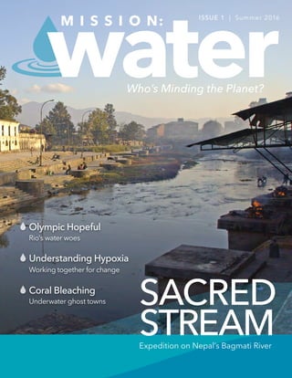
  • 1. SACRED STREAM water Understanding Hypoxia Coral Bleaching Olympic Hopeful Rio's water woes Working together for change Underwater ghost towns M I S S I O N: ISSUE 1 | Summer 2016 Expedition on Nepal’s Bagmati River Who’s Minding the Planet?
  • 2. 32 Who’s Minding the Planet? MISSION: WATER STAFFIN THIS ISSUE Timothy A. Grooms Director, YSI Marketing Our Mission I’d like to personally welcome you to the 1st edition of Mission: Water, a magazine featuring the organizations and researchers tackling the world’s most challenging water issues. Here we’ll highlight the latest trends in instrumentation and research applications, while also offering additional educational resources on environmentally-focused matters. Our goal is to help you stay informed about topics relevant to you. Our inaugural edition will cover articles ranging from monitoring Nepal’s sacred rivers to examining coral bleaching events off the coast of Panama; research on fish diversity and nutrient recycling in Africa’s Lake Tanganyika and much more! At Xylem Analytics, we’re on a mission to solve water-related problems all around the world. As an industry leader in providing water quality, flow and level monitoring instruments, we serve a wide range of customers that focus on surface water, ocean and coastal environments. Our commitment is to provide you with accurate and reliable instruments to equip you with the best data possible. Local Views 04 Water Blogged: Stories from the Web 06 Adventure Central: Water and Early Education Surface Water 08 Sacred Stream: FlowTracker Helps Nepal Expedition 14 Exploring Lake Tanganyika 20 Flow for the Future: Three Gorges Dam 24 Marine Search and Rescue: Software Making a Difference 28 Wetlands in the High Desert International Waters 32 Globally Integrated: Source Water Systems 36 Olympic Hopeful: Why Rio's Water Isn't Making the Cut Ocean & Coastal Water 42 Coral Bleaching and Underwater Ghost Towns 48 Wendy Schmidt Ocean Health XPrize 50 On a New Kind of Hunt: The Impact of Community Science Infographics 18 Californians Ready for Recycled Water 40 The Zika Virus: An Unhealthy Relationship with Water 56 Understanding Hypoxia Inside Xylem 58 Developer Spotlight: Q&A with Chris Palassis 60 Xylem Watermark: What Does it Mean to 'Solve Water'? 62 Technical Tips from the Front Line Steve Werblow Staff Writer Luke Giroux Staff Writer Tom Moeggenberg, YSI Staff Writer Jessica Clemmons, YSI Staff Writer Emily Jensen, YSI Contributing Writer Chris Iarossi, SonTek Contributing Writer Joel Heath, Arctic Eider Society Contributing Writer Dr. Yvonne Vadeboncoeur, Wright State University Contributing Writer Inger Graves, Aanderaa Contributing Writer Judy Bragg, Hypack Contributing Writer Brittany Danek, Hypack Contributing Writer Rosa Maulini, YSI Systems Contributing Writer Brock Houston, YSI Systems Contributing Writer Raymond Mahar, University of Dayton Guest Writer Carrie Parrish, University of Dayton Guest Writer Patrick Higgins, YSI Digital Marketing Manager Brandon Smith Executive Editor Brandon.Smith@Xyleminc.com Patrick Beatty Creative Director Patrick.Beatty@Xyleminc.com Theresa McGeady Copy Editor Theresa.McGeady@Xyleminc.com Copyright © 2016 Xylem Inc. All rights reserved. The publishers have made every effort to ensure the accuracy of the information in this magazine. Questions or comments? Email us: info@ysi.com Cover Photo: Bagmati River, Nepal Source: Alexandra Lande Editorial Staff: Talk to us: Magazine Contributors: info@ysi.com facebook.com/myYSI YSI.com/blog linkedin.com/company/ysi youtube.com/ysiinc twitter.com/YSIinc or @YSIinc 36 50 42 08 20 MISSION: WATER
  • 3. HEADLINE 4 MISSION: WATER WATER BLOGGED Patrick Higgins, Digital Marketing Manager Patrick.Higgins@Xyleminc.com Water Blogged Sharing in the love of water, join us for more stories at: YSI.com/blog Estuary Research Project Highlights Advantages of Continuous Monitoring Researchers from the south coast of England have established a small network of monitoring instruments in Christchurch Harbour and associated rivers to study the effects of weather events on water quality, and to better understand the magnitude and spatial/temporal variation of macronutrient fluxes - nitrogen (N), carbon (C) and phosphorus (P). The project, which is financed by a Natural Environment Research Council grant, involved the installation of three continuous monitoring stations; one in the harbor itself, a second in the River Avon and a third in the River Stour. With over a year of data, project lead Professor Duncan Purdie says: “We were fortunate with the storms that took place over the winter of 2013/14, because we were able to gather excellent high frequency data on nutrient fluxes and water quality during severe weather, which has dramatically improved our understanding of the effect extreme river flows have on nutrient fluxes into the estuary. The monitoring systems worked very well during this period and we were particularly impressed with the performance of the EXO2 sondes and the Storm loggers.” Oregon’s Tualatin River: America’s Early TMDL Case Study The Tualatin River Watershed in northwestern Oregon was one of the first TMDL-regulated watersheds in the United States. Total Maximum Daily Load (TMDL) were set in 1987-88 following the resolution of a lawsuit based on the Clean Water Act. As a result of this lawsuit, a consent decree was agreed upon which included both a timetable for certain Oregon actions and a requirement for EPA action if Oregon did not comply. Based on existing knowledge, TMDLs were set for the main stem of the Tualatin River by the Oregon Department of Environmental Quality (DEQ). Summer flow rates were averaged for the tributaries and the main stem of the river so that concentrations would not exceed 70 micrograms (0.07 milligrams) total phosphorus (TP)/L and 1 mg ammonia (total of NH3 and NH4 + )-N/L. Standards were in effect only during the low-flow, warm season period, from approximately May 1st through October 31st , which covered the peak period of algal growth. Compliance was achieved by installing nitrification ponds at the Water Resource Recovery Facilities (WRRF), which collect wastewater and allow the ammonium-N to convert to nitrate. It is important to note that since the Tualatin TMDL was established, there has been increasing interest in monitoring nitrate release from WRRFs around the country. Water Quality Veteran Shares Memories and Leaves 40 Year Legacy At the end of 2015, Mr. Mike Lizotte formally retired from his role as an Applications Engineer for YSI. Over the years he has worked with diverse groups of professionals and students on a plethora of projects – earning him a well-deserved reputation as an expert in his field. In this post Mike shares with us how he got his start, some of his major contributions to the field of water quality monitoring, and some parting advice to the professionals of the future. What Advice Would You Give to Up-and-Coming Water Quality Professionals? "A person in this field has to have patience – patience to learn, and patience to not expect instant gratification. In the early part of my career there were a lot of times I wanted to quit – when I had to do a job I didn’t like. And yet, I learned from that and it prepared me for new jobs down the road. For some people, they are less willing to stick it out. Some of that has to do with the fact that many folks have very large education bills that need to be paid, rather than sticking it out in a field they love they will jump from position-to- position to climb the revenue ladder." Get the full story: bit.ly/estuaryresearch Get the full story: bit.ly/OregonTMDL Get the full story: bit.ly/waterqualityveteran Take automation to the next level with a VerticalProfiler® system from YSI. Don't Settle. Measure Water Quality Data throughout the water column, not just at a single depth. Depth: 5m Temp: 23°C DO: 116% Sat Chl a: 10.2 ug/L Depth: 50m Temp: 9°C DO: 98.5% Sat Chl a: 2.8 ug/L Pontoon Profiler for reservoirs, lakes and estuaries. For more on the VerticalProfiler® : +1 (727) 565-2201 YSIsystems.com Vertical Profiling
  • 4. MISSION: WATER 76 Who’s Minding the Planet? RIVER STEWARDSRIVER STEWARDS The students at Adventure Central are realizing everything the river can offer. Groups explore the creek for macroinvertebrates, and even engage in water testing with adult leader assistance. They have taken ownership of the site, as the colloquial name for the river has become “the beach.” Their imagination is released during their time on the water. Kids are allowed to explore, build, and swim to their hearts’ content. It’s truly liberating. Adventure Central holds programs all year long, including a day camp in the summer. It is during this time the kids engage with “river gods”, as Arnett calls them. These individuals are the River Stewards, a University of Dayton student leadership group that promotes civic engagement and service. Each summer, the Stewards volunteer and bring kayaks for the kids to try. It's not a secret - the kids love paddling around in the kayaks. “I had a lot of fun kayaking. I was really good, except when I ran into a lot of rocks,” says ten-year-old participant Jayla Fields. There’s a definite uncertainty when kids hop into the kayaks. Arnett describes the initial feeling as a “healthy fear.” Kids embark on new experiences, overcome challenges, and have fun. The River Stewards and Adventure Central Staff form relationships of trust and support with the kids. “The kids at Adventure Central taught me what it meant to be a kid again. I was there to teach them about the importance of their creek. Instead they showed me the importance of their creek through their laughter and smiles we shared together,” says River Steward, Boyd Newman-Caro. Every day these kids go to school and hear the same lesson; score this high, learn this formula, and spell this word correctly. At Adventure Central, there is not one correct way to do things. Failure is welcomed and seen as an opportunity to learn. The outdoors and the river offer the necessary tools to enable these kids as imaginative and innovative thinkers. Through their activities the children learn leadership skills and teamwork. In every aspect of environmental youth development, Adventure Central is succeeding. RAYMOND MAHAR UD River Stewards The American education system consistently receives criticism aimed at early childhood development. The common perspective is that our schools are simply not working. Children are incapable of scoring well on standardized testing, ill prepared to apply to college, and lack the 21st century skills to function in our world today. Look at the statistics, and the future seems truly daunting. Let’s take a step back. Before we emphasize numbers and formulas, what do we remember as the most crucial time in our young lives? If you take a trip to Adventure Central at Wesleyan MetroPark, they’ll tell you it was the experience of play. Games of four square, tag, and kickball encapsulated our summers as kids. The site is located in Dayton, Ohio and offers an after school education program far different than any other in the area. The education center’s mission is to promote youth development and leadership skills using an environmental foundation in a welcoming, safe, and fun setting. Youth spend time connecting with nature to enable them as contributing leaders for the future. Wolf Creek, a major tributary of the Great Miami River, sits in Adventure Central's backyard and is regarded as the most beneficial resource the site utilizes. And the kids love it. “Kids feel a natural connection to the river. They are drawn to play in the river, and the relationships and confidence gained from that are great,” says Center Director and Extension Educator Nate Arnett. Adventure Central students are mainly comprised of Dayton's inner city youth. Most families come from low-income households, several having little opportunity for such an experience with the outdoors. When kids come here, they explore the woods for the first time, learn about plant life, and roast their very first marshmallow. Those initial experiences are extremely powerful at such an impressionable age, and the river exponentially adds to their fun at Adventure Central. “When I was a kid, my mother told me not to go in the creek. These kids are taught the same thing. Now it’s, please, jump right in,” says Program Coordinator Angela Collie. ADVENTURE CENTRAL “When I was a kid, my mother told me not to go in the creek. These kids are taught the same thing. Now it’s, please, jump right in.”
  • 5. 8 9Who’s Minding the Planet?MISSION: WATER SURFACE WATERSURFACE WATER SACRED STREAMFLOWTRACKER HELPS NEPAL RIVER EXPEDITION The Bagmati is both a sacred river and a city sewer, running through Nepal’s capital city of Kathmandu before heading into the mountains and over the Indian border. Since 2013, thousands of volunteers have gathered along the Bagmati for weekly river clean-ups on Saturday mornings, and the 100th cleaning event on April 11, 2015 drew more than 100,000 locals to the river’s banks. The next day, a group of students and hydrologists embarked on a 10-day, 160 km (100 mile) hike along the Bagmati from Chovar—the point where the river leaves the Kathmandu Valley—to the Indian border. Sampling every 5 km along the route, where the landscape permitted, the UK-based Biosphere Association and Kathmandu’s Nepal River Conservation Trust made the first openly available survey of the downstream effects of Kathmandu’s pollution in the Bagmati. The expedition was a massive undertaking, both physically and logistically. “It was sort of the Nepalese river equivalent of going up one of their mountains,” marvels Lee Pimble, European Hydrology Manager for Xylem Analytics, who traveled to Nepal to train the team on hydrometric sampling at the request of organizer Carol Milner, founder of the Biosphere Association. STEVE WERBLOW SonTek European Hydrology Applications Manager, Lee Pimble, conducts acoustics training for volunteer researchers working for the Nepal River Conservation Trust. “It was...the Nepalese river equivalent of going up one of their mountains.”
  • 6. 10 MISSION: WATER 11 SURFACE WATERSURFACE WATER Fast Training Pimble says he was concerned at first about training the group to use the FlowTracker. The Nepal River Conservation Trust team was comprised of a group of enthusiastic, young hydrologists and ecologists. Some had masters degrees and field experience. Others were undergraduate students, eager for real-world experience and committed to working their way into the conservation world. But most had been trained in Nepal, a poor country where even the top government agencies were measuring flow with outdated mechanical equipment. “They had no knowledge of the acoustic instrument,” Pimble says. “But they took to it. Considering they were novices with the technology, they were very quick [to learn]. We spent half a day ensuring that they understood hydrometric techniques. Once they grasped that, we were probably an hour in the field using the FlowTracker before I was comfortable saying, ‘go ahead’ and they were on their way.” Location, Location, Location In fact, says Pimble, most of his two-day training session focused on site selection, not equipment operation. “The FlowTracker allows them to follow a very straightforward, step-by-step procedure,” he notes. “If you follow the FlowTracker, step-by-step, you will get good results. But if you don’t choose a good sampling location, you won’t get a good measurement, no matter what instrument you have.” Local Heroes Milner, who is based in the U.K. but has many friends in Nepal, was touched by the impact of pollution in the Bagmati— particularly on its impact on poor residents, who cannot afford clean water but also can’t rely on the fouled river to supply their needs. In 2010, she asked a local when the trash in the river would be removed, and was told that the monsoon would soon wash it to India. That was the last straw. “I wanted to give assistance to those already fighting to make a change for the future,” Milner says. Delving deeper into the challenges facing the Bagmati, Milner found that water levels in the river were dropping precipitously. Rock mining was altering the porosity of the substrate and changing the flow of the water table. Draws for growing communities, irrigation and industry decreased river flows, and some studies indicated that recharge was decreasing. Local hydrologists needed data on the river’s flow to create a baseline along the river, explore changes in pollution and fill in blanks in hydrological station readings that are vital to understanding flood risk in the river’s basin. Pimble points out that the FlowTracker allowed the Nepal team to measure water where velocity and depth were well below the thresholds of old, mechanical meter technology. That permitted far greater breadth in site selection and the opportunity to build a much more comprehensive picture of conditions in the river. “We went to the river and tried different scenarios,” Pimble adds. “We looked at velocity distribution and how that affects the measurement. We looked at debris in the channel. In the UK, when we think of ‘debris,’ we think of vegetation. In Nepal, it could easily be a dead goat or maybe pieces of a car. It could be anything. By the third day, we worked at some interesting sites. They practiced keeping themselves safe in the water, and not so much on the use of the instrument.” With Pimble’s training course and a few hours of experience in the river, the group headed down the valley to begin their expedition, toting the compact FlowTracker. “They were walking the whole stretch,” says Pimble. “They carried everything—the FlowTracker, the rod, the batteries, their food, the water quality equipment. Everything.” The physical challenges of operating on foot made the FlowTracker’s reliability as vital as its portability. “Because we were hiking in remote areas, it was difficult to re-measure a site,” Milner points out. “It would have involved hiking 10 or 20 km back to it, so the immediate feedback of the system to look for potential errors was vital.” Donated FlowTracker In her native England, Milner approached Lee Pimble of Xylem for help. She was hoping to borrow or buy a FlowTracker handheld acoustic Doppler velocimeter (ADV). Built by SonTek, a Xylem brand, the FlowTracker is a rugged, compact instrument that would be ideal for the challenges ahead and would allow the group to measure the velocity, direction and discharge—or volume rate of water flow—in the river. “We knew the expedition would be tough, walking remote terrain, and wanted something that would be reliable,” Milner explains. “Although we had a small budget, we contacted SonTek, mostly for advice at first. Lee Pimble was extremely helpful and engaged in our plight, and his advice was not based on sales, but on actual river experience.” Pimble requested permission from headquarters to lend an instrument to Milner or find a demonstration model to sell her. His pitch excited the product team, and Pimble was told SonTek would donate a brand-new FlowTracker instead. At Milner’s request, Pimble agreed to travel to Nepal to teach the Nepal River Conservation Trust team how to use the instrument. “This was the perfect opportunity to put our technology to work, using science in a very practical way to help solve environmental challenges,” explains SonTek product manager Janice Landsfeld in San Diego, California. “We could put a powerful tool in the hands of a really committed group of people halfway around the world and help them in their efforts to rescue their sacred river.” Tragedy Strikes As the Bagmati team began its hike back to Kathmandu the ground shook from an earthquake that registered 7.8 on the Richter Scale and devastated the capital and the surrounding area. In a matter of moments, hundreds of thousands of people were left homeless. The quake injured approximately 22,000 people and killed nearly 9,000, including friends and family of some of the members of the hydrology team. Pimble, back home in England, started calling his new friends in Nepal to check on their safety, and immediately began sending money to first-response groups. Meanwhile, Xylem mounted a company-wide campaign through its foundation, Xylem Watermark. Employees donated more than $25,000; the company double-matched the gifts and added a corporate contribution of its own, amassing a total donation of more than $218,000 to Mercy Corps’ Nepal operations. “The work we do is about more than projects and data,” says Landsfeld. “It’s about the people we work with, the bonds we create, and the passion we share for environmental work. Xylem’s response to the earthquake in Nepal, through the individual generosity of our colleagues like Lee and the company’s contribution, reflects that personal concern and connection.” KATHMANDU, NEPAL - APRIL 29, 2015: Patan Dubar Square which was severly damaged after a major earthquake. Photo: Shutterstock Cremation ceremony along the holy Bagmati River at Pashupatinath temple. Photo: De Visu Milner...was touched by the impact of pollution in the Bagmati — particularly on its impact on poor residents.
  • 7. FlowTracker2® MISSION: WATER12 SURFACE WATER Future Goals Using the lessons learned along the Bagmati, Milner is planning a similar expedition along the Karnali River, a major tributary of India’s famous Ganges. The Karnali team will use the FlowTracker to measure discharge of many tributaries to the river, Milner says, and is exploring ways to use the instrument from a raft to measure flows in the main stem. The FlowTracker is also at the heart of a program led by a former member of the Bagmati team to train and inspire Nepalese university students, giving them an exciting chance to use top-shelf hydrology tools and techniques. As Nepal engages in the long, difficult process of rebuilding the nation in the wake of the devastating earthquake, Pimble remains in touch with his colleagues in Nepal. He says he’s confident the Nepal River Conservation Trust team will persevere in its efforts to clean up the Bagmati with the calm, grace and grit he observed when he visited on his training mission. “They’re going to carry on,” he says. “The earthquake put them back, but they are still trying to do their work of restoring the river. They’re that sort of people.” Photo of the expedition team. Courtesy NRCT Expedition team members collect flow and discharge data at cross sections along the Bagmati river. Courtesy NRCT Find papers, videos and product specifications: sontek.com/flowtracker2 • Proven SonTek ADV accuracy • Intuitive, graphical and easy to use • New features requested by water professionals like you! inquiry@sontek.com | +1 (858) 546-8327
  • 8. DR CONGO BURUNDI TANZANIA ZAMBIA 1514 MISSION: WATER Who’s Minding the Planet? SURFACE WATERSURFACE WATER The littoral (nearshore) ecosystem of Lake Tanganyika is the freshwater analog of a coral reef. The clear, shallow waters at the lake’s edge are low in nutrients, but the attached algae (periphyton or microphytobenthos) are highly productive and support the diverse fish community. Dr. Yvonne Vadeboncoeur (Department of Biological Sciences, Wright State University) and Dr. Peter McIntyre (Center for Limnology, University of Wisconsin) are studying the relationships between fish abundance, periphyton productivity and nutrient upwelling in Lake Tanganyika. They are exploring the key roles that grazing and nutrient excretion by fish play in maintaining high ecosystem production. For years, lake ecologists have assumed that phytoplankton, or algae in the water column, are the main source of primary production in lakes. However, evidence is accumulating that in lakes of all sizes, periphyton forms the energetic base of littoral food webs. Furthermore, the vast majority of fish species in lakes feed in the littoral zone. In doing so, the fish rely on periphyton for energy, either through direct consumption, or by consuming invertebrates that graze on periphyton. In Lake Tanganyika and other African Rift Valley lakes, the majority of the fish species are grazers and consume periphyton directly. Therefore, periphyton productivity is critical to understanding littoral ecosystem dynamics. But quantification of the role of periphyton in the lake ecosystem has been hampered by logistical constraints associated with measuring periphyton productivity. Chamber methods for measuring phytoplankton productivity are well- established and usually include the use of 14 C to measure carbon uptake. In contrast, benthic primary productivity is not a routine measurement in lakes. Initial methods also used 14 C, but it became increasingly obvious that benthic biofilms have high productivity rates. The high photosynthesis rates made bulk oxygen exchange methods a viable alternative to tracer methods. Lake Tanganyika Fish Diversity, Nutrient Recycling and Periphyton Productivity in the Littoral Zone Dr. YVONNE VADEBONCOEUR Department of Biological Sciences, Wright State University RUMONGE, BURUNDI People collecting water from Lake Tanganyika in Rumonge Photo: Giulio Napolitano Lake Tanganyika in East Africa is the second deepest lake in the world reaching a maximum depth of 1,470 m (4,820 feet) and is also the second largest lake by volume. The lake is divided among the countries of Burundi, Democratic Republic of the Congo (DRC), Tanzania and Zambia. Most of the lake’s massive volume of water sits in its dark depths, where a lack of oxygen makes it impossible for fish and other animals to live. But swimming near the well-lit shoreline is one of the most diverse freshwater fish communities in the world. The lake supports nearly 275 fish species, many of which are endemic and are popular aquarium pets. In fact, nearly 98% of the Tanganyika cichlid species are found nowhere else.
  • 9. MISSION: WATER 1716 SURFACE WATER WHEN THE ENVIRONMENT DEMANDS IT Periphyton on rocks or intact sediment cores are easily isolated in chambers. Large changes in oxygen in light and dark chambers can be detected over short incubation periods (15 minutes to 2 hours). The tricky part is getting an accurate oxygen measurement while, at the same time, preventing exchange with the atmosphere. Agitation of the sample introduces error. Stirring is not required to make accurate measurements of oxygen with the YSI ProODO, and the ProODO has increased both the speed and repeatability of the benthic primary productivity measurements. Intact periphyton communities are incubated in chambers, either in situ or under lights in the lab. Immediately before withdrawing a water sample, the water is stirred in the chamber with a built-in rotatable paddle or the entire chamber is rotated to mix the water. No air is in the chamber, so this procedure breaks down any oxygen gradients in the chamber without introducing air that would affect the readings. Water samples are then withdrawn using a disposable, needle-less, 60 cc syringe. The entire syringe is filled with water, and extreme care is used to prevent the introduction of any air into the syringe. After the syringe is filled, a small rubber cap is placed on its terminus. After the diver returns to the surface, the internal plunger of the syringe is carefully removed, and replaced with the ProODO optical-based dissolved oxygen sensor. The stainless steel probe guard that protects the optical sensor fits perfectly inside the syringe, and it holds the sensor in the center of the water sample. In approximately 40 seconds, researchers have an accurate oxygen measurement. This technique is very fast and allows for many more measurements than previous methods. The ability to make a high number of replicate measurements addresses the common concern of high spatial heterogeneity in periphyton biofilms. By measuring benthic primary productivity and nutrient uptake in Lake Tanganyika, researchers are beginning to understand how this ecosystem supports so many fish. The fish persistently graze the periphyton, and the water itself is extremely nutrient poor. The biomass of the periphyton is incredibly low, but data from the measurements demonstrates that the algae on the rocks are incredibly productive. How does such high productivity and diversity persist in the face of apparent extreme nutrient scarcity? It is believed the answer lies in the grazing fish themselves. Most of the nutrients in the system are actually in the bodies of the fish. By staying in the surface waters and feeding on algae, the fish keep the nutrients in the lighted waters where the algae can use them. The fish continually excrete small amounts of nutrients as waste products, and this helps maintain high algal productivity. Ongoing lab and field experiments are helping us to understand the mechanisms underlying the high ecosystem production and high fish diversity in Lake Tanganyika. The majority of Lake Tanganyika’s fishes, like this Tropheus duboisi, live along the lake’s well-lit shoreline boasting one of the world’s most diverse freshwater communities. East Africa and Lake Tanganyika from Orbit Photo: Anton Balazh & NASA info@ysi.com | +1 (800) 765-4974 ProDSS THE ULTIMATE WATER QUALITY Sampling & Profiling System YSI.com/ProDSS WHEN THE ENVIRONMENT DEMANDS IT • Drop-rated, impact resistant • Waterproof (IP67 rated) • Laser-welded titanium sensors • Rugged, military-spec connectors • Back-lit display & keypad • GPS (optional) The ProDSS — built for the most challenging field conditions:
  • 10. 1918 INFOGRAPHICINFOGRAPHIC DROUGHT-WEARY CALIFORNIANS ARE READY FOR RECYCLED WATER* Residents eager for long-term solutions to water scarcity Californians are READY for recycled water. The state has the opportunity to LEAD the US in accelerating the use and acceptance of recycled water. of respondents SUPPORT using recycled water as an additional source of water. SOMEWHAT SUPPORTIVE VERY SUPPORTIVE 87% of survey respondents believe recycled water should be used as a long-term solution, regardless of drought. 76% is a key component in securing support for recycled water across the state.EDUCATION of California residents are more willing to use recycled water after learning about the treatment process. 89% Referring to reused water as “purified water” garners stronger support for its use as an additional local water supply than “recycled water” or “reclaimed water.” LABELS MATTER: PURIFIED WATER are willing to use recycled water in their everyday lives. 83% 41% SOMEWHAT WILLING VERY WILLING 42% of Californians agree that the drought has made them more supportive of RECYCLED WATER. 89% Californians believe that recycled water should be used as a LONG-TERM SOLUTION for a water-secure future – regardless of potential rainfall from El Niño. NEARLY 90% of Californians believe the state should continue to invest in recycled water for drinking water even if El Niño brings the expected rainfall. Only 12% will be less concerned about conserving water if El Niño brings the expected rainfall. 12% *These results are based on an online survey by research firm Edelman Intelligence of approximately 3,000 randomly selected California voters from January 14-30, 2016. The survey was commissioned by Xylem Inc. and has +/-3.1 percent margin of error. 90% 87% 82% RECYCLED WATER RECLAIMED WATER
  • 11. 2120 Who’s Minding the Planet?MISSION: WATER SURFACE WATERSURFACE WATER Central China Floods, 1931 Davies, Richard Millions Lost in Flood In 1931, among the plains of Southeastern China, the Yangtze River water level peaked due to torrential rains, flooding nearly 500 square miles of the surrounding area. This historic, devastating flood killed 3.7 million people. Farm land and rice fields were swamped, destroying a major food source for citizens in surrounding cities. As a result, many suffered from starvation and disease. The flood was arguably the worst natural disaster in over a century. Dam Proposed For Protection Sun Yat-sen, founder of the Republic of China, proposed a Dam in 1919 to protect the river communities. Though construction on the Dam was not yet started, it became a controversial topic among many. Environmentalists cautioned that the Dam would take a toll on the surrounding ecosystem and provide future problems. Planning and implementation of the project was stopped by government officials during the Chinese Civil War in 1947. In years to follow, extensive flooding continued to occur along the Yangtze river, causing more death and costing billions of dollars in damages. In the 1980’s, the idea of the Dam resurfaced. The Dam and reservoir design would protect residents from flood conditions, provide fresh water for agricultural use, and be a source to generate electricity without greenhouse gas emissions. After much debate, construction started in 1994 on what is now known as the world’s largest hydroelectric dam, spanning 1.4 miles (2.3 kilometers) and 607 feet (185 meters) tall—The Three Gorges. Flow for the FutureChinese officials take action, through water level data, with early warning and flood prevention. EMILY JENSEN The Three Gorges Dam, one of the world’s largest, on the Yangtze River, Hubei Province, China. Photo: SINITAR
  • 12. 2322 MISSION: WATER SURFACE WATER Facing Drought – Nearly 100 Water Monitoring Sites Installed Years later, in 2011, the environmentalists' nightmare came true. Southern China was facing the worst drought China had seen in 50 years. The Dam faced criticism from environmentalists, who blamed the Dam for causing the drought by storing water upstream for power generation. Critics argued that the annual filling of the Three Gorges Reservoir caused plummeting water levels downstream, resulting in two of China’s largest freshwater lakes, Poyang and Dongting, to diminish. Regardless of the droughts cause, Chinese officials took action—installing nearly 100 water monitoring sites along the Yangtze River. Continuous, water quantity monitoring sensors installed at these sites provide important information to help manage the drought, provide early warning for future flooding, and assist in power generation at the Dam. A H-3553T bubbler from YSI, a Xylem brand was installed to gather stage and flow measurements that help officials accurately monitor the water level of the river, above and below the Dam. Water Level Data is Vital It is important to monitor the water levels above and below the Dam for a number of reasons—includng public safety, environmental impact, and generation of electricity. “The sensors from the monitoring sites provide key data to help the Three Gorges Cascade Dispatch Center and Changjiang Water Resources Commission,” states Roger Zhou, Xylem Analytics representative. “The Changjiang Water Resources Commission, can then build a regional water flow model, which is used for power generation estimation and to calculate storage capacity of the Dam”. The reservoir is said to be able to hold water at a maximum height of 574 feet (175 meters). Officials analyze the monitoring data to determine if they need to discharge water to prevent flooding upstream. In addition to the risk of flooding upstream, data is also used to prevent downstream flooding. “If the reservoir is filled, there is no room to catch and hold water if there is a flood,” explains YSI Water Level Division Product Manager, Tim Jeppsen. “If a big storm is coming they need to know if there is capacity in the reservoir to hold water so the area below the dam is not flooded”. Managing for Millions The water level data is also used to assist in the balancing act of providing water both above and below the Dam. Holding the water upstream, when it is needed downstream can have a negative environmental impact downstream— causing drought conditions which can in-turn affect farmers and water transportation. “The monitoring data also helps officials to redirect the water to cities where residents are experiencing shortages downstream,” adds Jeppsen. “Managing the water level data directly affects the lives of citizens both upstream and downstream from the Three Gorges Dam”. The sensors from the monitoring sites provide key data to help... build a regional water flow model. N EW One of many monitoring stations built along the Yangtze. An intelligent compact constant flow bubbler system developed to provide long-term, accurate and repeatable water level readings for hydrologists and water professionals. Used as a stand-alone system with internal data logging or as a sensor that seamlessly integrates with any data logger. *Shown with optional display. Internal Data Logging Wi-Fi Connection Multiple Output Options Intuitive Menu Configuration AmazonBubbler YSI.com/Amazon
  • 13. MISSION: WATER24 Who’s Minding the Planet? SURFACE WATER Their duty to protect and serve local communities isn’t limited to catching the bad guys and putting out fires. Not anymore. These days, their job descriptions seem to extend for pages on end; from investigating crimes to providing first aid. Over the past several years, “side-scan sonar technician” and “hydrographic surveyor” have even been added to this long list. Since time is always crucial in search and rescue operations, real-time sensors and navigational charts have become critical tools to find missing people or evidence lost in marine environments. Long gone are the days of relying solely on teams of divers to sweep an area during surveys. New technology is improving the safety and efficiency of these types of investigations. In the past, marine searches by police or fire departments would be conducted by trained divers swimming in one of several patterns (Ace, Parallel, Circular, Linear, and Grid). The team would swim along the bottom of a lake, river or coastline, with guidance from partners above water to ensure a thorough review of an area. This tedious process could take hours to fully explore even a small space. Nowadays, a combination of powerful sonar systems and software platforms help divers quickly discover their targets. This technology provides real-time images of a sea floor or lake bed, even when darkness or murky waters would otherwise affect a dive team’s visibility. Search and rescue teams are now exploring larger areas, in far less time. Using a high frequency side-scan sonar device along with a powerful hydrographic survey package like HYPACK® Marine Search, police and firefighters can cover an area of 8,000 square meters in as quick as 5 minutes. That’s larger than a football field! How’s it work? Well, the software displays information from navigational charts and helps guide the vessel, all while coordinating data from a GPS and sonar system to provide an image of the river, lake or ocean bed. Compared to manual diver searches – agencies using this tag team of hardware and software exponentially increase the success of missions, all while keeping their dive personnel out of harm’s way. The Middletown, Connecticut Police and Fire Departments were one of the first to receive a HYPACK® Marine Search software package to support their search and recovery activities. Thus far, their departments have used the survey package to search the bottom of the Connecticut River in Hartford with the help of Jerry Knisley, a HYPACK team member. Together they were able to identify several vehicles along the west bank of the River involved in an open criminal investigation. During the search, the police department found another suspicious object that warranted further investigation. All in all, an eventful trip! Xylem is truly honored to help the community, police, and fire departments improve their marine operations. HYPACK hopes to continue helping local police and fire agencies all over the world to better their search and recovery operations. For more information on HYPACK® Marine Search, please visit: hypack.com Marine Search and RescueHelping local police and fire agencies all over the world to better their search and recovery operations. JUDY BRAGG & BRITTANY DANEK Police officers and firefighters have tough jobs.
  • 14. HEADLINE HEADLINE 26 27Who’s Minding the Planet?MISSION: WATER SURFACE WATER SURFACE WATER With more than 10,000 users, HYPACK® Software is one of the most widely used hydrographic surveying packages in the world. Whether you are collecting single beam, side scan, magnetometer data, or just positioning your vessel in an engineering project, HYPACK® provides the tools needed to complete your job. HYSWEEP® is our Multibeam, Backscatter, and Topographic Laser Software. It is a powerful module for multibeam and topographic laser calibration, data collection, and 64 bit processing. HYSWEEP® gives you the tools needed to complete your task in a system your surveyors can master. DREDGEPACK® is designed to improve your work efficiency. It will allow the dredge operator to monitor and record digging operations. Contractors using DREDGEPACK® will benefit from maximized precision and production, reducing the risk of dredging errors. DREDGEPACK® is designed to work with cutter suction, hopper, bucket, and excavator operations. Located in Middletown, Connecticut, HYPACK is a leading provider of hydrographic survey data acquisition, processing, and visualization software. Used by government agencies, universities, and consultants, HYPACK products measure and map features in bodies of water in connection with maritime navigation, marine construction, dredging, offshore oil exploration, pipeline surveys, habitat assessments and search & recovery efforts. With more than 25 years of experience, HYPACK is one of the most successful and leading providers of hydrographic and dredging software worldwide! hypack.com Xylem Welcomes Hypack to our Analytics Family About Our Software HYPACK® Software HYSWEEP® Software DREDGEPACK® Software Xylem Welcomes Hypack to our Analytics Family About Our SoftwareOur Software HYSWEEP® Software HYPACK® Software DREDGEPACK® SoftwareHYPACK® Software DREDGEPACK® Software
  • 15. HEADLINE HEADLINE 28 29Who’s Minding the Planet?MISSION: WATER SURFACE WATERSURFACE WATER Habitat Loss Located in the heart of the middle Rio Grande region, Albuquerque lost 85% of its wetland habitats due to the growth of a city that is now home to over 70% of the population in New Mexico. With the increasing amount of impervious surfaces and the loss of natural infiltration of water into the ground, stormwater is causing detrimental effects that can be observed in the Mountain View neighborhood of Albuquerque, a part of town in the South Valley. It is classified by the Environmental Protection Agency (EPA) as an environmental justice area due to contamination from factories and an adjacent Superfund site. The loss of wetland habitat in this area has wreaked havoc on species that rely on these areas to spawn. Several species of fish that used to thrive in the Rio Grande are at risk of going extinct. One such species is the Rio Grande Silvery Minnow, a small herbivorous fish that used to be found as far north as Española, New Mexico down to the Gulf of Mexico. Due to habitat loss in the Rio Grande from various forms of development, the Rio Grande Silvery Minnow can only be found in the middle Rio Grande region today. Should these minnows go extinct, it could disrupt the entire ecosystem along the Rio Grande because they are a major food source for larger fish, who are also struggling to survive in a river that often runs dry due to the amount of water allocated for various development efforts. Wetlands High Desert The impacts of wetland habitat loss and the recovery effort in the high desert of the American Southwest. CORRIE PARRISH UD River Stewards Valle de Oro National Wildlife Refuge However, the establishment of Valle de Oro National Wildlife Refuge (NWR) is proving to be a major win for conservation for the Rio Grande and its wetland habitats. Established in 2012, Valle de Oro NWR is the first urban national wildlife refuge in the Southwest. While its main mission is conservation, Valle de Oro NWR also is a major advocate for environmental education, encouraging environmental stewardship and creating better access to open spaces for underserved populations, like the Mountain View neighborhood. Valle de Oro NWR stands for “Valley of Gold” an epithet given to honor the legacy of the land which previously was a dairy farm. In the fall, the fields and the Cottonwood forest lining the property turn several shades of gold as though it was nature’s way of saying this land is truly valuable. The view looking East from the West bluff of the Rio Grande River at the Sandia mountains, Albuquerque, New Mexico. Photo: Dave Stubblefield The Endangered Southern Willow Flycather Photo: D&D Photo Sudbury Native American petroglyph featuring a bird, Petroglyph National Monument, Albuquerque NM Photo: Joseph Sohm in the
  • 16. 3130 HEADLINESURFACE WATER MISSION: WATER Restoring the Balance Although Valle de Oro NWR is still in its early stages of development, there will be five seasonal wetlands on the property. The wetlands will have sections of shallow and deep areas to accommodate a wide diversity of plant and animal wetland species. While the wetlands discourage larger birds that are often found on the Refuge, such as Sandhill Cranes and Canada Geese, the habitat that will be restored could bring back several lesser seen birds, such as the endangered Southwestern Willow Flycatcher. In addition to the varying depths, the wetland habitat will also mimic the historical footprint and natural path of the previous saturated area. The wetlands in Valle de Oro NWR will curve in and crisscross diagonally across the property until it reaches the river. Both grey water sent to Valle de Oro NWR from the Water Waste Authority and seasonal storm water will pass through a grate to prevent any bigger pieces of debris or trash from entering the wetlands. From there the water will go through the series of wetlands to naturally be cleaned as it cycles through various wetland plants until it reaches the retention ponds built by the river; where it will then slowly dissipate back into the river as clean water. In conjunction with other partners involved in the development of the Refuge, seventy-three acres of water are pledged to go back into the river for wildlife use. This will ensure that the Rio Grande Silvery Minnow (and other fish) have enough habitat in which to survive. Young Stewards Students visiting the Refuge have already begun to learn how to conduct water quality tests on the Refuge. The students will learn how the water impacts the plants and animals that depend on the wetland habitat for survival and how they can protect such habitat from being further destroyed in the area. Trails are planned to be built leading to and around the Refuge to encourage alternative transportation modes, such as biking. The community will also have access to trails that will interlace through the wetlands for learning opportunities and wildlife viewing. While development in the Mountain View Neighborhood has historically had negative consequences for the surrounding environment, due to the loss of surrounding wetland habitats, the development of Valle de Oro NWR and its wetlands are proving how valuable this part of the country is, especially when water is looked at as though it were gold. For more information about the Refuge and how you can help, please visit: www.fws.gov/refuge/valle_de_oro/ Sandhill Cranes Photo: Jose Armas A New Generation Photo: Genevieve Barret Community Restoration Photo: Mary Blake Better Data, Better Decisions. For more than 20 years we've been demonstrating how defensible data can change your world. From autonomous HydroMet monitoring systems to hardware installation, design, and maintenance we have solutions to fit every scale and budget. Learn more online at: YSIsystems.com Spatial Water Mapping Open Channel FlowCustom Systems Monitoring Networks Support & Maintenance Data & Field Solutions YSI and SERVICES INTEGRATED SYSTEMS The full spectrum of water quality solutions. Speak with a systems expert for your custom solution: +1 (727) 565-2201 | systems@ysi.com
  • 17. Formore on theVerticalProfiler: +1 (727) 565-2201 | YSIsystems.com MISSION: WATER 3332 Who’s Minding the Planet? INTERNATIONAL WATERSINTERNATIONAL WATERS Communities everywhere need access to suitable drinking water, and reservoirs throughout the U.S. help to serve that purpose. Managing the quality and availability of this basic yet essential resource is a challenge, and invariably, costs are always a factor. YSI Integrated Systems & Services supplied a municipality in New York with a water monitoring solution. The solution consisted of seven Pontoon Vertical Profiling Systems (VPS) equipped with EXO2 sondes. With the water quality data provided by the automated systems at specific depths, the customer can minimize treatment and filtration costs by pulling water from the optimal intake depth. The data collected from these systems provides information to reservoir operators and their management systems that help determine the daily usage based on capacities, models, and weather. These remote systems are interfaced to the local laboratory information management system to help insure 1 billion gallons per day of suitable drinking water reaches citizens. As a result of the success this organization, plans are underway to expand their monitoring network to facilitate the delivery of clean water to an ever growing population. A significant portion of the Australian water supply from reservoirs suffers from manganese issues. Griffith University School of Engineering (Gold Coast, Australia) and Scientific Services and Data Systems (Seqwater in Brisbane, Australia), working with data acquired from an automated water quality monitoring station have developed a model that gives 7 days-notice for predicted Manganese (Mn) levels in reservoirs. Even though the system does not measure Mn itself, Edoardo Bertone (Ph.D. student), developed a model that measures the variables that affect Mn concentration. This model allows the treatment staff to proactively prepare in advance of predicted mangaese spikes. Early warning allows operators to use the appropriate dosing methodology, and can save the governing body, or Council, up to $120,000 on labor that was previously required for grab sampling. Droughts can take a toll on the availability of water to the inhabitants of any city, but near London’s Heathrow Airport, a vertical profiling system has been deployed on the Queen Mother Reservoir to help decision makers make prompt money saving decisions for their community. Terry Bridgman, Field Scientist in the water quality team at Thames Water tells us, “We have always wanted a technology such as the Profiler because knowledge of water quality throughout the entire column helps to improve decisions on water abstraction. Water can be drawn from different depths and if we know the position of the best quality water we can minimize water treatment costs.” Reservoirs form an important step in the water supply chain because, through sedimentation and natural enhancement of biological quality, they represent a low-cost method of water quality improvement. YSI Integrated Systems & Services St. Petersburg, Florida USA Saving money by providing actionable data Getting creative with the Vertical Profiler Profiling the entire water column helps to improve decisions on water abstraction. Xylem Analytics UK Letchworth, Hertfordshire UK Xylem Japan Kawasaki City, Japan Aanderaa Data Instruments Nesttun, Norway Xylem Analytics China Beijing, China See next page for more on YSI China YSI Abu Dhabi Co. Ltd. Abu Dhabi, UAE Xylem Analytics Australia Pty. Ltd. Hemmant, QLD Australia Globally Integrated: Source Water Systems Xylem’s global presence provides localized integration, service, and support to customers around the world. This global team of specialists offers proven monitoring solutions customized to meet specific project requirements.
  • 18. James Chen, Vertical Market Manager at Xylem Analytics China, works with fellow employees in setting up a reservoir buoy. China's diverse ecosystems, public water reserves and engineering projects offer a wide variety of monitoring opportunities. MISSION: WATER 3534 Who’s Minding the Planet? INTERNATIONAL WATERSINTERNATIONAL WATERS China: Dawning Insight With its massive economy, massive population and massive water management networks, China has huge needs for water quality data. Bedeviled by devastating pollution and some of the worst floods in human history (including a 1931 deluge that reportedly killed 3.7 million people and a 2007 flood that ruined crops on nearly 30 million acres of farmland), China’s infrastructure agencies and Ministry of Environmental Protection face epic challenges daily. A historic lack of data has hampered their efforts. But when China’s president and chairman of the Communist Party Hu Jintao called for greater scientific development on water quality issues — including drinking water safety, pollution prevention and water conservation — in 2007, China’s water quality measurement efforts shifted into high gear. Today, government officials and nongovernment organizations (NGOs) are building the nation’s body of knowledge on China’s water supplies.
  • 19. RIO DE JANEIRO, BRAZIL - Skyline view of Sugarloaf Mountain and Guanabara Bay at sunrise. Photo: lazyllama HEADLINE HEADLINE MISSION: WATER Who’s Minding the Planet? 3736 INTERNATIONAL WATERSINTERNATIONAL WATERS Olympic Hopeful WHY RIO’S WATER ISN’T MAKING THE CUT LUKE GIROUX Every four years, since the late 19th century, athletes gather together from around the globe to compete in the largest sporting event in contemporary times, the Olympic Games. This summer over 10,000 athletes, culminating years of preparation and dogged determination, will go for the gold in Rio de Janiero. Of the 10,000 athletes competing in the 2016 summer games, about 1,400 are engaged in outdoor water sports. Whether it’s rowing, sailing, canoeing, triathlon, or distance swimming, five out of the 42 summer Olympic sports will take place in bodies of water in and around Rio. When most of us think about Rio, we picture a tropical oasis of beaches, water, surf, and sun. Visions of Copacabana beach along the Atlantic Ocean, with suntanned natives and an active night life, are typical visuals that come to mind. These images are much different than the stark reality that awaits the Olympians as they travel to Brazil this summer. Household waste and raw sewage, and the infestation of the bacteria that accompany them, have been the norm in the waters in the shadow of Christ-the-Redeemer statue.
  • 20. MISSION: WATER 3938 Who’s Minding the Planet? HEADLINE HEADLINEINTERNATIONAL WATERSINTERNATIONAL WATERS Many of Rio’s poorest residents live in broken-down slums, tar- paper shacks built on top of each other, pressing up to the banks of sewage-blackened rivers. Clumps of waste float listlessly by, the surface bubbles with escaping gases, penetrating the air with a sulfuric stench as it makes its way into nearby Guanabara Bay. Not exactly a tropical oasis, nor an ideal setting for world-class athletes. Brazil is the world’s seventh-largest economy, but struggles on the world stage when it comes to access to water and sanitation. A fiscal crisis that shook Brazil in the 1980s largely froze sewer investment in Rio for two decades, and it took another decade for regulations divvying up responsibility for those investments between the municipal, state, and federal governments. During that time Rio’s population experienced explosive growth – from around 9 million in 1980 to 12 million today, and the situation was compounded by poor city planning, political infighting and economic instability. Challenges of Olympic proportions When the City of Rio pitched their Olympic plans for hosting the 2016 summer games to the International Olympic Committee (IOC), their intent was to have the sailing competitions take place in Guanabara Bay, rowing and canoeing in Rodrigo de Freitas – the picturesque tidal lagoon in the heart of the city – and the triathlon and swimming events off of Copacabana Beach in the Atlantic Ocean. The city’s plans, presented to the IOC a decade ago, also acknowledged the water quality challenges that Rio faced. And a significant part of the bid package promised to make improvements to water infrastructure and to address water quality concerns in the waters used for the competitions. The plans called for, among other improvements, an 80% reduction in sewage and waste in Guanabara Bay. Fast forward 10 years and challenges still exist, with the pending Olympic activities rapidly approaching. Images of massive amounts of dead fish and household waste floating in Rodrigo de Frietas and other Rio waterways are all over the internet, as are numerous reports of athletes getting sick after training in Olympic venues. Although there has been much speculation yet no direct correlation of the illnesses to the polluted water, the world community is asking questions about the improvements that have been made, to ensure the health and wellbeing of the 10,000 athletes – and the millions of spectators – that will descend upon Rio in the coming months. City and IOC authorities insist they are addressing water quality issues at Olympic venues and beyond. Ongoing monitoring and assessment of competition locations have taken place since the bid was awarded to Rio in 2009, and certainly some progress has been made. The state sewage company has built eight new sewage pumping platforms in the lagoon, eliminated illicit sewage dumping pipes that fed into it, and created a control center to monitor potential dumping. Sewage treatment stations have also increased their utilization rates and advanced from primary treatment, mechanical methods that separate waste from water, to secondary treatment, which uses biological processes to further remove organic matter. A fleet of two dozen eco-boats have been methodically patrolling Rio waterways, scooping up floating debris in their path, and will continue to do so even after the games have come and gone. The Brazilian government has spent more than $1 billion in clean-up efforts, significantly less than expected, the economic challenges of the recession curtailing additional plans. Because of their efforts, however, the percentage of sewage that still goes untreated in the metropolitan area has dropped significantly since 2009 – from 83% to 50% – and is expected to drop even further, to roughly 20% by the time the Olympic torch is lit in August. Global presence, global impact To their credit, the IOC has a history of choosing cities and countries to help effect change within those regions. The 2008 summer games were granted to Beijing, in the hopes of opening China to the rest of the world. In 1988, the summer games went to Seoul, to help usher in a civilian government at a critical juncture in Korea’s history. The intention of the IOC in choosing Rio, was to help expedite the advancement of Brazil as a developing country. If the IOC continues to choose global communities to help effect change, which is certainly a noble objective and a primary benefit of the games, then we’ll continue to see issues like those we’ve seen in Rio. These issues exemplify the challenges of an expanding society, struggling to maintain the regulated constraints of growth, juxtaposed against the fundamental infrastructure necessary to keep that society safe from disease and environmental catastrophe. Water quality and sanitation issues will continue to plague the city of Rio, long after the Olympic flame burns out. But if the coastal oasis continues to implement the sanitary and water treatment improvements that were promised, they will keep the Olympic spirit of Rio alive, and their residents, visitors and local environment safe and healthy well into the 21st century. Biggest Slum in South America, Favela Rocinha, Rio de Janeiro Photo: Dmitry Islentev Fragile residential constructions of Favela Vidigal in Rio de Janeiro. Photo: Donatas Dabravolskas
  • 21. ZIKA!The Zika Virus, Mosquitoes and Water: An Unhealthy Relationship The Aedes mosquito is in every continent except Antarctica. The Zika virus has been found in: • Africa • Caribbean • Central America • Mexico • Pacific Islands • South America • Southeast Asia • United States What is the Zika Virus? The Zika Virus is a disease related to dengue, yellow fever, and the West Nile Virus. It is spread by the bite of an infected Aedes mosquito or via sexual transmission. Common Symptoms of the Zika Virus Symptoms are usually mild and begin 3-7 days after being bitten. • Fever • Joint pain • Muscle pain • Rash • Red eyes • Birth defects Water—Where the Problem Begins. Mosquitoes breed in standing (stagnant) water found in: • Containers (flowerpots, cans, tires) • Freshwater lakes and ponds • Freshwater swamps and marshes • Flooded areas • Stormwater and waste- water retention areas Why Should We be Worried? Zika is linked to microcephaly, the development of unusually small heads and brain damage in newborns. Zika is linked to Guillain-Barré syndrome, an autoimmune disease caused by the body’s immune system mistakenly attacking the nervous system. Few in the Western Hemisphere have an immune defense against the virus. The World Health Organization (WHO) has declared Zika an international public health emergency. 30 countries have been identified as travel threats to pregnant women. Water—Where the Solution Starts. Mosquito abatement starts by keeping water clean. • Empty, drain, or cover anything that can hold water • Eliminate standing water in pots, buckets, barrels, tires, yards, pools • Ensure proper drainage around homes and businesses • Clean bird baths regularly • Repair outside leaks • Chlorinate swimming pools • Unclog rain gutters and drains • Aerate the water in your fountains, ponds and lakes. MISSION: WATER 4140 INFOGRAPHICINFOGRAPHIC
  • 22. 4342 Who’s Minding the Planet?MISSION: WATER OCEAN & COASTAL WATERSOCEAN & COASTAL WATERS CORAL BLEACHING In 2005, the U.S. lost half of its coral reefs to a massive bleaching event. Scientists are determined to keep it from happening again. STEVE WERBLOW Bustling, vibrant coral reefs have faded into pale underwater ghost towns, threatening biodiversity around the world. Over the past 30 years, massive bleaching events in the Galapagos Islands, the Coral Triangle of the western Pacific, and the Caribbean have alarmed scientists, who worry about the ability of reef ecosystems to recover from bleaching, especially in the face of increasingly warm El Niño weather cycles. Warm sea surface temperatures cause corals in the western Pacific to begin to bleach. Bleaching occurs when symbiotic algae, known as zooxanthellae, are expelled from coral tissue. Photo: Acro Phuket
  • 23. MISSION: WATER44 Who’s Minding the Planet? 45 OCEAN & COASTAL WATERSOCEAN & COASTAL WATERS Coral reefs are massive colonies of tiny organisms living in a delicate balance. Coral polyps are related to sea anemones and jellyfish, with tentacles that wave in the water to capture and draw in food. The polyps protect their soft bodies by building cup-like exoskeletons around themselves. Billions of those skeletons form the stony reefs that shelter not only the polyps, but also thousands of species of fish, crustaceans and other sea life—in fact, as many as 25 percent of marine species rely on coral reefs for food or habitat. Among the tiniest of those reef residents is a linchpin in the ecosystem. Inside their fortress-like exoskeletons, corals host zooxanthellae, microscopic algae that use carbon dioxide and nutrients from waste products excreted by respiring coral to fuel their photosynthesis. Through that process, the algae produce sugars, fats and oxygen that help sustain the coral. But if water temperatures climb too high, the algae exude toxic products, causing the coral to expel the zooxanthellae and turn ghostly white. Deprived of nutrition that had been provided by the algae, the coral can die in weeks. Certain types of coral die off more quickly than others, causing shifts in the ecological balance of species. At the Smithsonian Tropical Research Institute (STRI) in Bocas del Toro, Panama, postdoctoral fellow Dr. Janina Seemann has studied coral bleaching in the Caribbean and is at the forefront of researching the ecological effects of human activities on coral reefs. Her work is part of the MarineGEO (Marine Global Earth Observatory), the Smithsonian’s detailed, long-term survey of coastal water conditions and life forms around the world, coordinated by Dr. Emmett Duffy. Data is Critical Water quality data is at the heart of the MarineGEO research Seemann is conducting. She relies on a pair of EXO sondes from YSI, a Xylem brand, to track a wide range of water quality parameters. One EXO sonde gathers a continuous stream of data from a platform in Panama’s Almirante Bay, providing a running overview of seasonal changes in water temperature, salinity, turbidity, pH, blooms of plankton or algae, and other variables. Seemann and her colleagues bring the other EXO sonde to a variety of study locations every two weeks to measure depth, dissolved oxygen, pH, chlorophyll and turbidity, shedding light on water quality parameters that can impact the health of coral and algae. Instrument sensitivity is important, she notes: for instance, even slight changes in water pH can affect calcification by the polyps. Nutrient (using chlorophyll as an indicator), sediment (measured as turbidity) and heavy metal levels in the bay are heavily influenced by human activity. Seemann’s focus is studying the effects of those human influences on the local reef community. Indicator Parameters Correlating water quality data with observations of the environment helps Seemann explain changes in the reef. “We plotted data for water temperature from last year to this year,” she said in late 2015. “We detected a tremendous increase in water temperature in September. Correlated to this, there was a definite coral bleaching episode. The water temperature gave us the reason why the coral was bleaching.” Seemann points out that STRI’s portable EXO sonde allows her to compare water quality in different environments—for instance, taking measurements in connected mangrove fringes, seagrass beds and coral reefs—on the same day, measuring the water-cleansing effects of mangrove roots or seagrass for coral reefs. Water quality measurements also allow her to understand the value of adjacent terrestrial systems, such as primary forests, in protecting reefs from pollution—particularly sediment runoff. That’s a key goal for Seemann. Deforestation and the cultivation of banana farms have led to an intensive amount of nutrients, sediments and pesticides traveling down the Changuinola River to enter Almirante Bay. Nutrient plumes in the water column can spur plankton blooms. That cloudy, enriched water may provide more food for coral polyps, but simultaneously deprive zooxanthellae of the light they need to photosynthesize. The enriched, or eutrophic, conditions can also support other organisms such as sponges and algae, which overgrow the corals. It’s a set of trade-offs that must be understood to predict the effects of human activity on the reef. The water temperature gave us the reason why the coral was bleaching. Dr. Seeman of MarineGEO Photo: Dr. Janina Seemann Water Sampling with an EXO2 SondePhoto: Photo: Dr. Janina Seemann Reef Monitoring with an EXO2 Sonde Photo: Dr. Janina Seemann
  • 24. 4746 MISSION: WATER OCEAN & COASTAL WATERS Particulates Algae GasesBarnacles Spreading the Word Seemann is one of the first scientists engaged in the Smithsonian’s Marine Global Earth Observatory (MarineGEO) program. The global effort was launched in 2013; STRI joined the program in 2015 under the leadership of Dr. Andrew Altieri. Data from YSI sondes and other instruments at study sites around the world is channeled through the Smithsonian’s web servers to provide near-real-time data to scientists and other interested people across the globe. Streaming data from the field and making it accessible to a wide range of users—from readers of peer-reviewed journals to visitors to the MarineGEO Facebook site—MarineGEO data is attracting a global audience. “It starts with a normal person who’s interested in what’s going on in the environment to an environmental NGO [non- governmental organization] to a government policymaker,” Seemann says. “We want to bring [the data] to the public in all kinds of ways, to present it in a way that everyone can understand it and the network can grow.” At YSI, product manager Brandon Smith says Seemann’s work with MarineGEO reflects the power of good data. “Water quality data from anywhere in the world can be shared almost instantly, integrated into analytical software, and become part of a stream of information that teaches us about our environment around the world,” Smith notes. “It’s an immensely powerful tool that can help scientists, policymakers, local stakeholders—and, ultimately, all of us—make better decisions that influence the health of the planet.” Seemann says coral reefs demand attention and care. “If you lose corals, you lose biodiversity of other organisms— fish, crustaceans, echinoderms,” she emphasizes. “Other organisms live in exchange with the reef.” Including us. Coral Bleaching in the Caribbean Photo: Dr. Janina Seemann We want to bring it to the public...in a way that everyone can understand. To learn more about the EXO monitoring platform, visit EXOwater.com +1 (800) 897-4151 | info@ysi.com Start fighting back: YSI.com/WipedCT User Upgradeable Avoid Stagnation Lower Maintenance Safeguard Your Data Prevent Fouling TM FIGHT FOULING EXO Wiped Conductivity & Temperature Sensor In long-term monitoring, sensor fouling is public enemy number one. Introducing the new EXO Wiped Conductivity & Temperature Sensor, designed and engineered for compatibility with the EXO2 platform, purpose-built to protect your conductivity data.
  • 25. MISSION: WATER 4948 OCEAN & COASTAL WATERS Oceans have been experiencing a decrease in pH due to increasing amounts of carbon dioxide (CO2 ) in the atmosphere. Reliable and practical technology for accurate long term monitoring of pH in the ocean has been lacking for many years. In the light of escalating ocean acidification, it is of high importance that this technology gap is filled. The Wendy Schmidt Ocean Health XPrize competition challenged teams of engineers, scientists and innovators to create pH sensor technology that will affordably, accurately and efficiently measure ocean chemistry. The $2 million prize competition hoped to turn the tide of ocean acidification. Xylem entered the competition as a joint project with members from Aanderaa and YSI in a collaboration across borders. The team brought together innovative engineers with experience commercializing sensors and scientists from leading research institutes comprised of individuals from two Xylem businesses; Aanderaa Data Instruments in Bergen, Norway and YSI in Yellow Springs, Ohio. “If the health of the world’s oceans were to deteriorate significantly, this would have a massive impact on the fisheries and aquaculture industries all over the world and of course would be a catastrophe for the world’s population.” - Peter Thomas In addition, scientists from research institutes in Norway and Sweden participated. The team goal was to develop a pH sensing solution that not only offers the required performance criteria under the full range of environmental conditions but is also easily manufacturable, reliable, intuitive to use, and cost effective. In a relatively short amount of time, they were able to design and test a new optical sensor utilizing optics behind a rugged sapphire window in a titanium package capable of deep ocean measurements at low power. The competition gathered scientists from around the world for extensive laboratory and ocean testing, in depths up to several thousand meters. After months of trials, Xylem's design qualified for the elite final round as one out of only 5 teams. Even if the sensor did not win first prize, it demonstrated how collaborations can yield world class solutions for monitoring the environment in new and innovative ways. Whether it is for wildlife in the oceans, for global fisheries, or key species in the food chain, monitoring pH will provide critical information to help gain a better understanding of this phenomenon and how we might be able to combat it. Wendy Schmidt Ocean Health XPRIZE Video: https://youtu.be/VM5C5JloI0g Deployable by one person, the i3XOEcoMapper® has flexible options for water quality monitoring, bottom mapping, and water current profiling. With forward object avoidance, built in GPS, WiFi, continuous data streaming and up to 14 hours of mission time at 2.5 knots the i3XOEcoMapper® is ready for any challenge. Easy and fast mission planning with Vector Map software. JU N E A rriving in Baseline Monitoring | Source Water Mapping | Event Response Bottom Mapping | Oceanographic Research | Point and Non-Point Source Theall new i3XO EcoMapper® AUV For more on the i3XOEcoMapper® : +1 (727) 565-2201 systems@ysi.com My dream for the ocean is that we are able to take care of it, stop acidification and to not pollute the ocean as we do today. Jostein Hovdenes, Product Development Manager for Aandera
  • 26. 50 51Who’s Minding the Planet?MISSION: WATER OCEAN & COASTAL WATERSOCEAN & COASTAL WATERS The hunters recognized the changes. A shot seal would usually float, buoyed by its blubber atop the dense salt water of Canada’s Hudson Bay. Now the seals were sinking below the surface before the hunters could reach them. Polynyas, the open patches of sea surrounded by ice, were freezing over with brittle, clear ice, often with little warning. Beluga whales were being trapped beneath the floes, cut off from their surfacing holes. Arctic eiders, the diving ducks whose down is a source of warmth and commerce for the Inuit, were trapped on the ice, dying like flies. Joel Heath began traveling to the isolated Belcher Islands of eastern Hudson Bay in 2002, when he arrived to begin his Ph.D. research on how animals survive on winter ice. Eiders, which stay in the area all winter long and serve as an indicator species for the health of the ecosystem, quickly captured his attention. So did the people who have been linked for generations to the eiders. “I became interested in the cultural story,” says Heath. “That got me interested in doing the documentary People of a Feather. I went from the more pure academic interest to concern for the communities.” What Heath saw concerned him deeply. Hudson Bay water is typically about as saline as seawater, with 30 parts per thousand (ppt) salinity. However, a massive plume of fresh water was flowing beneath the ice, lowering the salinity of the upper 25 meters of Bay water to 25 to 26 ppt. The hunters of Sanikiluaq and their neighbors in the small communities ringing the southeastern Hudson Bay had front row seats to a massive ecological disturbance—quite literally, a sea change. On a New Kind of HuntInuit Hunters use CastAway CTD’s to gather data beneath Hudson Bay ice. STEVE WERBLOW & JOEL HEATH In a dazzling example of citizen science, Inuit hunters from five Hudson Bay communities are gathering data on a massive plume of fresh water that is changing their environment.
  • 27. MISSION: WATER 5352 Who’s Minding the Planet? OCEAN & COASTAL WATERSOCEAN & COASTAL WATERS Reversed Cycle Heath’s first winter on the ice in 2002 coincided with a landmark agreement between the Cree people of Quebec, the federal government and the government of Quebec that permitted the completion of the second phase of the James Bay Project. The massive hydroelectric venture, begun in the 1970s, was already one of the largest hydropower systems in the world. By the end of construction on Phase II, it would include eight hydroelectric generating plants and divert many of the rivers in eastern Canada to drain through the mouths of the Rupert River and the La Grande—just off the Belcher Islands. What’s more, the dam releases that drive the hydroelectric turbines don’t follow the ebb and flow of the region’s normal hydrological cycle. “Electrical demand is highest in the winter,” Heath explains. “Usually we’d have flooding, our highest flows, in the spring. The hydrological cycle has been reversed. Rivers have been re-routed, and it all comes over to southeast Hudson Bay.” Fresh water freezes at a higher temperature than saltwater does. The ice it forms is clear and brittle, which means freshwater floes behave differently than sea ice, interfering with normal flow patterns. And fresh water freezes more quickly than sea ice does, which is why whales can find themselves caught in the ice, as they did in 2013 when more than 70 belugas were trapped under a shrinking hole and mauled by polar bears. In 2011, Heath released People of a Feather to raise awareness of the challenges faced by the residents of the Belcher Islands. That year, he also established the Arctic Eider Society as a foundation for fundraising and a focal point to study the science and community impact of the changing water. Working with the local communities, Environment Canada, University of Manitoba and other stakeholders, he set the course for a sweeping study of water and ice across the region. CastAways: Citizen Science Heath began by enlisting members of the community of Sanikiluaq to help take samples of ice and water. In 2014, he outfitted five small communities with CastAway-CTDs from SonTek, a Xylem brand, and trained a cadre of hunters how to use them and upload their data. CastAway-CTDs are softball-sized instruments that measure conductivity— which in turn indicates water’s salinity— as well as temperature and depth. The CastAway-CTD is extremely easy to use—everything a user needs to know about collecting data, viewing the readings, and downloading files from its onboard memory, fits on a single sheet of paper. Users turn the units on, lower them into the water on a line, and steadily bring them back up. The instrument takes readings every few seconds, automatically logging data on the water column. “Training is pretty easy,” Heath says. “People are pretty competent with that kind of stuff, and it’s a pretty straightforward interface. We spend a day with the hunters on the ice, going to different spots and trying them out. By the end of the day, they’ve got it.” Today, about two dozen hunters from the Inuit communities of Sanikiluaq, Kuujjuarapik, Umiujaq and Inukjuak and the Cree village of Chisasibi prowl the ice not just with rifles, but with CastAways and sample jars. In the winter of 2014-2015, the hunters and several students working with the Arctic Eider Society conducted more than 100 measurements. Heath’s goal for 2015- 2016 is to top that. SonTek Donation SonTek donated two of the CastAways to the Arctic Eider Society to aid in the group’s work. SonTek product manager Isaac Jones says Heath and his team of citizen scientists provide an inspiring example of how stakeholders can harness the power of data. “Joel’s work with the communities of the southeast Hudson Bay demonstrates the power of local people to tap into today’s mobile technology and bring us all out onto the ice to understand the phenomena they’re seeing in their environment,” says Jones. “We’re proud that the Arctic Eider Society selected CastAway-CTDs for its important mission, and glad to be able to contribute to its efforts. The work of the hunters with our CastAways doesn’t just represent some of the most extreme deployments of the technology—it reminds us how science and tradition unite to help us understand even the most challenging ecosystems.” Throughout the winter, hunters pick up their community CastAways as they head out onto the ice. “We’ve tried to set it up so we have hunters in each community going out in different directions on the ice once a week,” Heath says. “We have up to two trips per week [from each community]. We pay the hunters to be going out. They can do their subsistence hunting, too. Young people are also going out with them to learn about traditional knowledge and subsistence.” Inuit hunters check data on a SonTek CastAway-CTD on the ice in Hudson Bay. Collecting interior Street View imagery of an igloo in SanikiluaqOn the lookout for Polar Bears Arctic Eider Duck Arctic Fox
  • 28. MISSION: WATER 5554 OCEAN & COASTAL WATERS Science and Tradition The traditional knowledge of local hunters is an integral part of the Arctic Eider Society’s approach to science. Heath and students from the University of Manitoba avidly study how hunters read the ice for information on weather and conditions, and how they track wildlife through the winter. They also ask hunters to interpret time- lapse footage Heath shoots on the ice, looking for insight into changes in the freezing and break-up cycles of the floes. Aerial photography provides landscape- scale perspective on the ice and wildlife populations. Video shot on the ice, and below it, yield insight into feeding patterns and energy requirements for the eiders and other wildlife wintering in the harsh—and changing—environment. Measuring currents with acoustic Doppler profilers allows Heath and his team to chart water flow patterns. Detailed water quality monitoring measurements provide a more thorough look into the sources of the fresh water in the Bay, including dissolved oxygen, dissolved organic matter and other parameters. Heath says analyzing the oxygen isotope O18 in water and ice samples indicates that the fresh water is not the product of melting ice, but rather of inland water. He hopes analysis of other isotopes will someday allow scientists to track individual water samples back to their original river sources. The product of space-age instruments and age-old hunting routes is accessible to researchers, policymakers and science buffs online. Each of the hunters on the data gathering team has a Facebook-style profile on arcticeider.com. Visitors to the site can click on sampling locations for a look at each hunter’s data or share pictures or charts on social media. Teachers can tap into the Arctic Eider Society’s educational curriculum and stream time-lapse footage from the ice into their classrooms. And visitors can take a street-view virtual tour of the ice using Google Maps, which conducted the first-ever mapping of remote sea ice in the community of Sanikiluaq in the winter of 2014-2015. Starting Here Beyond the top-notch website and award winning documentary film, Joel Heath and the Arctic Eider Society are working to bring together regulators and stakeholders to focus on solutions for one of Canada’s most overlooked regions—a way to balance society’s need for power and the effort to repair a severely damaged ecosystem. Heath is campaigning for a new approach to energy management that could store and distribute James Bay Project power in step with the hydrologic cycle. It’s a massive vision, and it will require deep understanding of a complicated ecosystem. With the help of dedicated hunters and five palm-sized CastAways, Heath is working to literally turn the tide. The product of space-age instruments and age-old hunting routes is accessible online at arcticeider.com Elders pointing out additions and edits at a MapUp in Sanikiluaq The CastAway-CTD is featured as part of a community driven research program to better understand ice ecosystems, wildlife profiles, and sea ice features in the Hudson Bay area. A new, online mapping platform is spearheaded by the Arctic Eider Society and includes georeferenced site markers to log salinity, temperature and depth data for each location. arcticeider.com/map MODERN CTD TECHNOLOGY FOR THOSE WITH A PASSION FOR COMMUNI TY sontek.com/castaway
  • 29. 1960 1970 1980 1990 2000 Understanding What causes hypoxia? Coastal Hypoxia and Eutrophication Working Together for Change HYP XIAHypoxia is an environmental phenomenon where the concentration of dissolved oxygen in the water column decreases to a level that can no longer support living aquatic organisms. The level is often considered to be 2 mg O2 per liter of water or lower.1 Hypoxic and anoxic (no oxygen) waters have existed throughout geologic time, but their occurrence in shallow coastal and estuarine areas appears to be increasing as a result of human activities. 2 In 2015, scientists determined the Gulf of Mexico dead zone to be 6,474 square miles, which is an area about the size of Connecticut and Rhode Island combined. 3 Major events leading to the formation of hypoxia in the Gulf of Mexico include: In the past century, Hypoxia has become a global concern with over 550 coastal areas identified as experiencing this issue. 4 Areas of anthropogenically-influenced estuarine and coastal hypoxia. n> 550 Only a small fraction of the 550-plus hypoxia zones exhibited any signs of improvement. 5 In the US, the US EPA leads a Hypoxia Task Force (HTF) with representatives from the Department of Agriculture, Department of the Interior, Department of Commerce, and the Army Corps of Engineers. State Representatives from Arkansas, Illinois, Indiana, Iowa, Kentucky, Louisiana, Minnesota, Mississippi, Missouri, Ohio, Wisconsin, and Tennessee are also part of the solution, as is the National Tribal Water Council. The goal of the task force is to achieve a 20% reduction in nutrient loading in the largest hypoxic zone in North America, the Mississippi Delta by 2025. 6 This will require a large scale, coordinated effort to reduce nutrient runoff throughout US water-bodies, setting monitoring requirements and discharge limits for nitrogen and phosphorus that wash into rivers. 6 EPA USDA DOI NTWCUSDC State Agencies Federal Agencies CoE Number of dead zones has approximately doubled each decade since the 1960’s. 5 Today, there is currently about 1,148,000 km2 of seabed covered by Oxygen Minimum Zones (OMZs) (<0.5 ml of O2 /liter) 5 Runoff and nutrient loading of the Mississippi River. Nutrient-rich water from the Mississippi River forms a surface lens. Phytoplankton growth is fueled by nutrients. Watershed Sunlight Bacteria consume oxygen during decomposition in the bottom layer of water. Organisms that cannot move away die off. Mass anoxic areas form Dead Zones. Nutrient-enhanced primary production, or eutrophication. Decomposition of biomass by bacteria on the ocean floor. Stratification prevents the return of oxygen. SOURCES: 1 Vaquer-Sunyer and Duarte, 2008 2 Diaz and Rosenberg, 1995 3 NOAA 4 World Water Resources Institute 5 Diaz and Rosenberg, 2008 6 EPA.gov 4% 20% 1 2 3 4 Combined, Dead Zones cover 4x the area of the Great Lakes. Hypoxia Task Force reduction in nutrient loading Goal: Phytoplankton die and sink to the bottom. Organisms that are able, flee deadly low oxygen zones. MISSION: WATER 5756 Who’s Minding the Planet? INFOGRAPHICINFOGRAPHIC
  • 30. HEADLINE HEADLINE 58 INSIDE XYLEMINSIDE XYLEM MISSION: WATER Who’s Minding the Planet? 59 The standards used during a sensor calibration are just as important as the hardware. The manufacturers of turbidity sensors will recommend which solutions or standards are approved for successful calibration and these approved solutions are the only ones that should be used. In addition, some manufacturers, like YSI, have turbidity solutions specifically made for the instrumentation they provide. Even though other solutions may appear to be the same as the manufacturer - specific varieties, in fact, are not. YSI recommends only two types of turbidity solutions for a successful calibration. The first is AMCO-AEPA (turbidity standards prepared and tested specifically for YSI turbidity sensors) and the other is Formazin- based standards (either self-prepared, For questions regarding your YSI instrumentation: (IQ SensorNet, Pro Series, Aquaculture, Lab instruments, EXO or 6-Series Sondes) Email: info@ysi.com Call: +1 (937) 767-2762 YSI Integrated Systems support: Email: support@ysisystems.com Call: +1 (877) 392-9950 (US) and select option #5 WaterLOG support: Email: support@waterlog.com Call: +1 (937) 767-2772 SonTek support: Email: support@sontek.com Call: +1 (858) 546-8327 HYPACK support: Email: help@hypack.com Call: +1 (860) 635-1500 Aanderaa support: Email: infousa@xyleminc.com Call: +1 (937) 767-7241 x831 purchased with specific assigned values, or purchased at high concentrations and diluted). Please note: Formazin standards will settle so it is always necessary to follow the turbidity standard manufacturer’s recommendations when handling the solution for proper suspension and dilution techniques as well as using it within the specified timeframe during calibration. The AMCO standard does not settle and is typically not recommended for performing dilutions. The key point is not all AMCO standards are prepared or tested in a manner that makes them conducive to calibrating all types of turbidity sensors. The AMCO turbidity standards for YSI turbidity sensors should only be purchased from YSI. Other AMCO standards have not been tested to YSI’s specifications and the value of the turbidity standard printed on the label of the standard does not reflect what a YSI turbidity sensor will read when placed in that standard. As a final note on calibration standards, deionized (DI) or distilled water is often used for the zeroing portion of the calibration and this is suggested to help reduce cost. The precaution here is to realize not all DI or distilled water is created equal and cannot be assumed to contain zero turbidity. DI water may register up to 1 or 2 NTU (FNU). Using DI or distilled water for calibration and then taking measurements in waters containing low turbidity may exhibit slightly negative readings since the water that is being measured may actually contain less turbidity than the zero standard that was used during the calibration. For these applications it is typically necessary to use certified zero standards for calibration like those previously mentioned. YSI Tech Support in Ohio took over 17,000 support calls in 2015 and answered them in less than a minute. YSI Tech Support in Ohio answered nearly 4,000 emails sent to our general email box from all over the globe in 2015. (This does not include emails sent to the individual technicians email inbox.) Get the full story: bit.ly/turbiditytips Technical Tips Thoughts from the front line of customer support. TOM MOEGGENBERG Which Turbidity Calibration Solution Should I Use? GET ANSWERS: Support Contact Information Did you know? Your YSI Technical Support Team | Yellow Springs, Ohio Front Row: Tyler, Samantha, Myra, Curtis | Back Row: Matthew, Benjamin, Tom, Ryan We recommend that YSI-certified polymer-based standards are used for best results with EXO, ProDSS and 6-Series Turbidity sensors.
  • 31. 60 MISSION: WATER Who’s Minding the Planet? 61 INSIDE XYLEMINSIDE XYLEM Q: What’s your favorite part of your job? A: The people. Well, is that too generic of an answer? (Laughter) Honestly, working with brilliant and creative people is the highlight of my day. Science and engineering can be considered by some to be very restricting work, but in reality it can be very creative in terms of solving problems from many different angles. Everyone in my team brings a unique perspective to the table and I learn something new from them just about every day. It also doesn’t hurt that I have the freedom to come to work and play around with new and exciting technology that could eventually change the world. Q: How did you get your start in sensor research and technology development? A: Going back to when I was a kid – I took everything apart to the dismay of my parents. (Laughter) It’s the age-old story of people who end up becoming scientists or engineers. When I was a little older, I just started building things. At first it was go-karts, and then it ramped up into experiments with superconductors. The natural progression was a degree in physics. I have an innate need to understand how things work, how they tick. Physics affects everything and gives those who study it a whole new outlook on the world. Q: How did you make the transition from student to industry? A: I finished my graduate degree at Montana State University and found an opportunity to work for Sony Electronics in their R&D department. I was responsible for designing the optics for big-screen TVs and enhancing picture quality for wide format TVs. It was a great start to my career in engineering and product development. After a few years of work with Sony, I had a good friend from graduate school contact me about returning to Montana to work on designing lasers. The opportunity was too good to pass on and allowed me to participate in and lead several projects for NASA and the Department of Defense for remote sensing and earth science related systems. You may be surprised, but southwest Montana (USA) has the highest per capita concentration of optics and photonics companies in the U.S. Q: What ultimately led to you joining Xylem Analytics? A: Montana is an absolutely beautiful place that’s almost like an oasis in the world. You’re surrounded by nature. There’s just vast open space and you can smell the pine trees as the wind blows down from the mountains. Living there for so many years, I gained an appreciation for the environment and I’m passionate about protecting it. Years ago, I was monitoring optics job boards on a whim and I stumbled upon an opening for an optical engineer with YSI in Ohio. It was a position that I felt was almost made for me and it was also a lot closer to my family; a real win-win for me. Q: What do you find most rewarding about your work? A: There’s something special about taking an idea, making a sketch, building a prototype, and testing if it works. Seeing a sensor go from a concept on a whiteboard to reality is an exciting experience and the most rewarding part of working here. Not every idea will be successful, but you can’t find success without flirting with failure. Q: What words of advice do you have for those interested in careers in sensor development? A: Be a skeptic. Healthy skepticism is the only way to be successful. It’s also not just about asking lots of questions, but the right ones. Don’t be afraid to ask “why not?” even if it ruffles feathers. In general, product development is all about building a good mix of dreamers and realists. I’m the former. Also, do work you believe in. YSI is an environmental company, so it’s easy to see our cause and the impact on the world around us. Talk to and listen to people that use your instruments, they’ll often spark great ideas in you. Developer Spotlight Chris Palassis is a lifelong engineer with a specialty in optics and is currently the Director of Sensor Development at one of Xylem Analytics’ largest R&D facilities. His main role is to explore new sensing technologies and lay the groundwork for future projects. Experience: 8 Years with YSI, a Xylem Brand Alma Mater: Montana State University-Bozeman, University of Cincinnati Chris Palassis Director, Sensor Development Not every idea will be successful, but you can't find success without flirting with failure. Photos: Nikki Smiley Stargel Photography