SlideShare a Scribd company logo
1 of 35
Download to read offline
LIFE AFTER
HORIZON
Ecologists without Borders
Sustainable Development
Corvette Catastrophe
Studying Car-Swallowing Sinkholes
Waterkeepers at the Roof of the World
Coastal Terraforming in Lusail City, Qatar
Remediation Efforts on the Gulf Coast
ISSUE 2 | Winter 2016/17
32 Who’s Minding the Planet?
HEADLINEHEADLINEIN THIS ISSUE MISSION: WATER STAFF
Surface Water
04 Water Blogged: Stories from the Web
06 Lake Mead: Safeguarding Source Water
12 Challenging Colorado Mining Legacy
16 Waterkeepers at the Third Pole
24 Corvette Catastrophe: Studying Sinkholes
Gulf Coast Highlights
32 Life After Deepwater Horizon
36 Battling Wetland Loss in Coastal Louisiana
40 Gulf Coast Monitoring Solutions
42 Water Heroes: Interview with Renee Collini (DISL)
44 Steering Silver Springs’ Recovery
Ocean & Coastal Waters
54 Lusail City: Terraforming on the Global Stage
58 Drilling into the Abyss
Infographics
10 Lead – An Accumulating Problem
34 Horizon – Six Years Later
Xylem Spotlight
62 EARTH FORCE, Engaging the Next Generation
64 Renaissance Woman – Q&A with Jessica Clemmons
66 Technical Tips: Limitations with Measuring ORP
Copyright © 2016 Xylem Inc. All rights reserved.
The publishers have made every effort to ensure the
accuracy of the information in this magazine.
Cover Photo: Sunrise at Low Tide
Credit: Larry Brandt
16 58
44
24 32
MISSION: WATER
Timothy A. Grooms
Director of Marketing - Xylem Analytics, NA
In this Issue
Welcome to the 2nd
edition of MISSION: Water, a magazine featuring the organizations and researchers tackling the world’s
most challenging water issues. I’d like to give a special thanks to all the participants in our inaugural edition who helped
make the magazine’s launch such a success – and another thank you to the contributors telling their story in this issue.
I’m excited to see MISSION: Water feature stories from around the globe, with topics ranging from climate change in the
arctic to grassroots monitoring coalitions in the Himalayas. This edition also puts a spotlight on the work of environmental
professionals confronting the lingering effects from some of the world’s worst environmental disasters, including the
Deepwater Horizon spill and the Gold King Mine incident in Colorado.
We hope you enjoy the magazine, and let us know if you’re interested in joining us for the next issue!
Steve Werblow
Staff Writer
Luke Giroux
Staff Writer
Tom Moeggenberg, YSI
Staff Writer
Jessica Clemmons, Xylem
Staff Writer
Chris Iarossi, SonTek
Contributing Writer
Inger Graves, Aanderaa
Contributing Writer
Reidun Dalland, Aanderaa
Contributing Writer
Lisa Landry, Xylem Gulf Coast
Contributing Writer
Chris Cushman, YSI
Research Associate
Patrick Higgins, Xylem
Digital Marketing Manager
EARTH FORCE
Guest Writer
The Water Institute
of the Gulf
Guest Writers
Waterkeeper Alliance
Guest Writers
Brandon Smith
Executive Editor
Brandon.Smith@Xyleminc.com
Patrick Beatty
Creative Director
Patrick.Beatty@Xyleminc.com
Theresa McGeady
Content Director
Theresa.McGeady@Xyleminc.com
Emily Jensen
Associate Editor
Emily.Jensen@Xyleminc.com
Editorial Staff:
Talk to us:
Magazine Contributors:
MissionWater@Xyleminc.com
facebook.com/myYSI
YSI.com/blog linkedin.com/company/ysi
youtube.com/ysiinc twitter.com/YSIinc or @YSIinc
Share your story in our next edition!
Contact us at MissionWater@Xyleminc.com
HEADLINE
4
WATER BLOGGED
Find papers, videos
and product specifications:
sontek.com/flowtracker2
• Proven accuracy
• Easy to use
• New features
WADING DISCHARGE
MEASUREMENT
inquiry@sontek.com
+1 (858) 617-0584
Patrick Higgins, Digital Marketing Manager
Patrick.Higgins@Xyleminc.com
Water Blogged
Sharing in the love of water,
join us for more stories at:
YSI.com/blog
Sea Level Rise Research:
Clam Bayou Estuary
In Pinellas county, surrounded by Gulfport,
St. Petersburg, and Boca Ciega Bay, lies a 170-acre
estuary — Clam Bayou. Due to urban development
constructed prior to stormwater monitoring regulations,
the Clam Bayou habitat is now facing environmental
repercussions affecting water level and quality.
Monitoring sea level rise and water quality—with the
ability to accurately report water level data over low
current, continuous operation—is a key component in
managing the Clam Bayou resources, but it isn’t without
its challenges.
“A specific challenge we face with this site is the amount
of hard fouling that occurs,” explains Mike Lizotte.
“I knew that the bubbler would have the same
challenges, so… we came up with a method that is
protecting the orifice tube from fouling by installing an
anti-fouling protection pipe.”
The lessons learned from the site, have produced
numerous product enhancements that, in-turn, make
work easier and the data quality higher for researchers,
notes Lizotte.
The result of the latest Xylem brand technology paired
with monitoring efforts at the Clam Bayou site, will
provide greater understanding...
7 Tips to Fight Fouling and
Extend Sonde Deployments
The goal of every monitoring program is to gain a
better understanding of an environment. That deeper
understanding can lead to better water management
tactics or better decision making. Ultimately, to better
understand water – we simply need more data – and
the more the better.
Some organizations only have the resources to monitor
on a weekly basis with handheld water quality sampling
equipment, and while that is a great first step to collect
water quality data, a more robust monitoring schedule
of even daily sampling can shed light on events
occurring there.
Ultimately, however, we can’t be at the site 24/7, 365
days a year to maintain the high resolution data set we
need via handheld instrumentation. That’s why sondes
are critical to building a global water quality data set.
For those of you who are new to water quality
monitoring, a sonde (EXO) is a piece of instrumentation
that can autonomously record water quality data in-situ
for weeks or months at a time. This equipment can
be installed throughout a watershed to capture key
parameters on the health of a waterbody...
Real-Time Stormwater Monitoring
System for NPDES Compliance
After receiving a text via telemetry indicating a real-time
spike in ammonium and conductivity, field technicians
dropped what they were doing to track the potential
illicit discharge. Something unusual was going on near
one of the stormwater monitoring stations in the Reedy
Watershed. The team quickly mobilized and drove to
the station.
Using a portable water quality sonde from YSI, the team
began taking readings around the station, and then
continued to take readings as they hiked upstream in
search of changes in the water chemistry. First they
found a small pipe dumping water in the river; they
traced the pipe back to a small tributary. Finally, they
pinpointed the source to a small drainage ditch where a
sanitary sewer manhole was blocked and overflowing.
Just as they arrived on the scene, a citizen was calling in
to report the sewer problem.
The real-time alerts from the continuous monitoring
station had given the team fast insight into a suspicious
discharge and they reacted quickly to address it.
Recognizing the need for more data to meet permit
requirements, the county - a Phase 1 Municipal
Separate Storm Sewer System (MS4) permit holder
- transitioned from a grab sampling program to a
continuous monitoring program five years ago...
Get the full story: bit.ly/sealevelclambayou Get the full story: bit.ly/7foulingtips Get the full story: bit.ly/realtimestormwater
FlowTracker2®
MISSION: WATER 76 Who’s Minding the Planet?
SURFACE WATER SURFACE WATER
LAKE
MEAD
How are water quality
professionals safeguarding
a critical reservoir in
America's driest state?
Lake Mead, located approximately 25 miles (39 km)
southeast of Las Vegas, Nevada, is an impoundment of
the Colorado River and is one of the most intensely used
reservoirs in the western United States.
It provides water to the states of Arizona, Nevada, and
California, serving nearly 22 million people – including
1.8 million residents of Nevada and tourists. Not only
does it serve as a drinking water source, it also provides
recreational water activities (boating, fishing, and
swimming), water for industrial uses, and irrigation
water for farmland. It is crucial to maintain the quality
and level of this water to guarantee a reliable and safe
resource for its many uses.
Lake Mead, formed following the realization of Boulder
Dam (now called Hoover Dam) in 1935, was the largest
artificial lake in the world at the time of completion.
It is one of several reservoirs along the Colorado River;
however, due to increases in population and agricultural
operations in recent decades, this once-expansive lake
in the desert is becoming more compromised.
While inflow into Lake Mead is primarily from the
Colorado River, a small percent is also from rivers on the
northern side of the lake and from Las Vegas Wash on
the northwest side. Las Vegas Wash transports treated
municipal wastewater effluent, urban runoff, and
shallow groundwater seepage from the Las Vegas area
to Boulder Basin in Lake Mead. Wastewater effluent
flow rates have more than doubled in recent years,
prompting concern over potential effects to reservoir
water quality, especially since some of the water is
pumped to the municipal water treatment plant at
Saddle Island for distribution to residents.
Background Photo: Outfall from the Hoover Dam
flows into Lake Mead, just outside of the Las Vegas
area. Since its peak in 1983, the level of Lake Mead
has dropped considerably, leaving a white ring mark
around its shores. The level is expected to continue to
drop below historic lows amid the western drought.
Background photo: Kunal MehtaThe discolored 'ring' is a clear reminder of our water scarcity issues.
MISSION: WATER STAFF
MISSION: WATER8
SURFACE WATER
Monitoring the watershed and analyzing water quality data
are crucial steps to ensure Lake Mead is attaining the state’s
water quality standards. If parameters such as dissolved
oxygen or temperature fall outside of the specified ranges,
then the lake’s beneficial uses are adversely affected. These
uses include: propagation of aquatic life, including a warm
water fishery; recreation; irrigation and watering of livestock;
and municipal drinking water supply.
For example, as the level of the lake continues to drop due
to high volume usage and reduced inflow, the elevation of
the thermocline, a zone that separates a layer of cool water
from a layer of warm water, is also lowered. As a result, the
drinking water intakes, which are located at fixed elevations,
may be drawing in warmer lake water, which is associated
with poorer quality water. This may require increased efforts
to treat the drinking water, which would lead to higher
treatment costs.
Managing Data in a
Changing Environment
Near real-time monitoring can reveal a lot about water
quality. Population growth in Las Vegas has increased the flow
and volume of water through the Lake Mead region, leading
to flooding and allowing additional pollutants to enter the
lake. These pollutants include bacteria, oil, grease, pesticides,
sediment, nutrients (nitrogen and phosphorus), and heavy
metals, which affect the quality of water.
In recent years, researchers have even studied the effect of
pharmaceutical compounds on aquatic organisms in Lake
Mead and the Las Vegas Wash.
Efforts are currently underway to improve the region’s water.
Several organizations are working to reduce erosion and silt
in the Las Vegas Wash Channel, build wetlands to reduce
nutrient loading, perform environmental monitoring, and
promote public awareness about this important watershed.
“Lake Mead and water distribution in general in the
southwest play a key role in population growth, agriculture,
and politics. Preserving its quality and volume is critical to
the population and agriculture of this region,” notes Michael
Strobel, Ph.D., in the USGS publication Water in Nevada.
For historical water quality and
meteorological data from the Lake Mead
monitoring platforms, please visit:
nevada.usgs.gov/lmqw/index.htm
Better Data, Better Decisions.
For more than 20 years we've been demonstrating how defensible data can change
your world. From autonomous HydroMet monitoring systems to hardware installation,
design, and maintenance we have solutions to fit every scale and budget.
Learn more online at: YSI.com/systems
For more on the VerticalProfiler®
:
+1 (727) 474-8535 | systems@ysi.com
Take automation to the next
level with a VerticalProfiler®
system from YSI.
Don't Settle.
Measure Water Quality Data
throughout the water column,
not just at a single depth.
Depth: 5m
Temp: 23°C
DO: 116% Sat
Chl a: 10.2 ug/L
Depth: 50m
Temp: 9°C
DO: 98.5% Sat
Chl a: 2.8 ug/L
Pontoon Profiler for
reservoirs, lakes
and estuaries.
Additional profiler options:
Fixed-Position Buoy Profiler
Vertical Profiling
Preserving [Lake Mead's] quality and volume is critical to
the population and agriculture of this region...
The recreational area of Lake Mead shows the
same discoloration and lowering water line.
Photo: Songquan Deng
7pH
H C
By the
Numbers
98%
40%
to
60%
99% Health
Impacts
of Lead
Taking
Action
Get the
Lead Out
1976
1990
1994
10.5
mcg/dL
8,000
$395
million
13.7
3.2
Protect
Yourself
Focus on Flint
Flint, MI
Lead is a naturally occurring element found in the earth’s crust.(1)
It is one of the best-studied toxic substances, and shares a long
history with human civilization due to its desirable properties.
Some historians suggest that the Romans’ high exposure to lead in
wine urns, utensils, and aqueducts contributed to their empire’s
decline. Ironically, lead poisoning was then a disease of the
affluent; today, it is primarily an affliction of poorer communities.(2)
In children,
lead induces:
• behavior and
learning problems
• lower IQ and
hyperactivity
• hearing problems
• anemia(4)
In adults, lead
can induce:
• cardiovascular issues
• high blood pressure
• decreased kidney
function
• reproductive problems
(male and female) (4)
Drinking water
can make up
20% or more
of a person‘s
total exposure
to lead.(5)
For
infants it can be
40% to 60% if
used to mix their
formula.(5)
Lead can be
ingested from
lead paint, house
dust, soil, drinking
water and food.(6)
Extremely low doses
of lead can cause
neurobehavioral
deficits.(3)
Overall, 98% of
adults and 99% of
children affected
by lead live in low-
and middle-income
countries.(4)
It is
an ongoing issue
worldwide.
Lead exposure causes
674,000
deaths globally
per year.(1)
The U.S. EPA‘s goal
is zero lead in
drinking water.(4)
8,000 children were
exposed to lead
poisoning when the
city switched its water
source to the Flint
River to save money.(3)
The city switched
back to Detroit's
municipal water
system in Oct. 2015.(3)
The social cost is
$395 million.(3)
Lead is required to be at safe levels
when it leaves the treatment plant,
but it can be redissolved in
plumbing if water is not
properly treated.
Water is less corrosive when it is high
in calcium carbonate and has a pH
over 7. Cold water is also less
corrosive than warm water.(5)
If water
sits for a long time in lead pipes, the
resulting corrosion can add lead to
tap water.(7)
Take action if lead in drinking water
exceeds 15 ppb at the tap, which
can be determined at home with a
simple, inexpensive test.
Before using water from a
faucet that hasn’t run in at
least 6 hours, flush your
pipes by running your water
until it is as cold as it can get.(4)
The removal of lead from
gasoline in 1990 is one of
the public health triumphs
of the 20th century.
Between 1976 and 1994,
the mean blood lead
concentration in children
dropped by 10.5 mcg/dL;
the clear result of a
consistently applied
public health policy.(2)
(3)
(3)
Sources
1 https://www.epa.gov/
2 https://www.lead.org.au/
history_of_lead_poisoning_
in_the_world.htm
3 http://www.reuters.com/article/
us-michigan-water-idUSKCN10J26Q
4 https://www.epa.gov/
5 http://extension.psu.edu/
6 http://www.cdc.gov/
7 http://www.mwra.state.ma.us/
An
accumulating
problem
20%
MISSION: WATER 1110 Who’s Minding the Planet?
HEADLINEHEADLINE INFOGRAPHICINFOGRAPHIC
13Who’s Minding the Planet?MISSION: WATER12
SURFACE WATER SURFACE WATER
THE GOLD
KING MINE
Luke Giroux
Durango, Colorado - August 7, 2015,
Animas River one day after the Gold King Mine spill.
Photos: Barbara K Powers
Durango, Colorado - August 6, 2015,
Animas River early in the day, the same day the Gold King Mine
spill occurred in Silverton, Colorado, 50 miles north.
For many, Southwestern Colorado is known for its four-season
recreation activities such as rafting and kayaking on rivers
that flow out of world famous snow-packed ski areas. In the
high-country, hiking, backpacking, and mountain biking trails
extend off of old logging and mining roads, which are also
used by locals and visitors for four-wheeling. Fun mountain
towns like Durango, Silverton, and Pagosa Hot Springs have
enough entertainment and commerce between backcountry
trips to support locals and tourists alike. Even the many old
mines scattered throughout the region offer historic interest
in the early regional mining industry.
However interesting these old mines are as remnants of the
wild west and the early Rocky Mountain natural resource
extraction, many are also unsealed and remain as unresolved
water and land pollution sources. In the state of Colorado
alone, there are approximately 23,000 of these
abandoned mines.
For decades, state and federal agencies have worked to
remediate and close over 6,000 of these inactive mines, but
many thousands more remain open. A few older Colorado
mines are still active, but most are no longer producing.
Early mineral mining in the United States had rampant
interest and activity with little regulation that controlled the
excavations, resulting in such environmental effects as heavy
metal polluted rivers and streams, and open unsafe tunnels,
or adits (a horizontal access or drain tunnel).
The remnants of negligent mining practices aren’t the only
environmental offenders, as naturally occurring seepage from
the region’s mineral rich soils and geology also contributes
to the high contaminant waters. Colorado’s Gold King Mine
incident last year stands as a glaring reminder of these
original mining practices still left unresolved.
CHALLENGING COLORADO
MINING LEGACY
1514 Who’s Minding the Planet?MISSION: WATER
SURFACE WATER SURFACE WATER
There are about 400 of these abandoned mines in the greater
San Juan River watershed of southwestern Colorado, which
includes the Animas River watershed where the Gold King
Mine is located. This inactive gold and silver mine, located
northeast of Silverton, was established in 1887 and closed in
1922. Unfortunately, on August 5, 2015, the Environmental
Protection Agency (EPA) inspectors discovered just how
tenuous the conditions of these inactive mines are. While
conducting a mine inspection, a water reservoir above the
mine adit collapsed, releasing an estimated 11.3 million
liters of acid mine drainage and heavy metals-rich water into
nearby Cement Creek and the Animas River. The Animas feeds
the San Juan River, which flows through New Mexico and
ultimately into Lake Powell in Utah. The irony in this situation
is that EPA inspectors were on site to evaluate additional
remediation steps for the mine when the plugged water
reservoir broke through.
Though initial communication to EPA management and local
community officials was challenged by limited satellite and
cell phone capabilities, inspectors soon warned communities
and officials downstream. EPA management cautioned
restricted water use across the spectrum for fishing, drinking,
agriculture, and recreation purposes in Colorado, New
Mexico, Utah, the Ute Mountain Ute tribe, the Southern
Ute Tribe, and the Navajo Nation. Immediately down river,
Silverton’s public drinking water was not affected, but further
downstream, Durango closed its Animas River intakes before
the plume arrived. The EPA was able to supply drinking and
irrigation water to users in Colorado’s San Juan and La Plata
counties. In New Mexico, authorities recommended closing
water intakes along the Animas and San Juan rivers, and the
EPA provided irrigation and livestock water at eight regional
sites and delivered hay to Navajo and New Mexico ranchers.
EPA staff also quickly established numerous filtering and
treatment ponds just below the adit rupture site to reduce
toxic overflow from continuing downstream. Unfortunately,
the construction of these ponds happened after the initial
plume of contaminated water pushed through. But once they
were put in place, officials were able to effectively control
and treat whatever water was still flowing before it entered
the Animas River and beyond. The pond treatment included
lime to reduce acidity and raise pH, and sodium hydroxide
solution, which aided metals sedimentation within the ponds.
EPA staff further established monitoring and testing of the
contaminant plume during and after the incident. Though the
initial plume passed through and dissipated in about an hour,
residual contamination continued. River monitoring used pre-
spill contaminant levels as baseline determination, and within
weeks, river contaminant levels had returned to pre-spill
conditions, ultimately allowing the Animas River to re-open
for recreation purposes on August 14th, only nine days after
the incident. It is important to note, however, that these
monitored contaminant levels are complicated by historically
high baseline levels which are found in the watershed from
abandoned mines and naturally occurring sources not
connected to mining.
Surface water testing, which still continues in 2016, includes
the following parameters: salinity, turbidity, temperature, pH,
dissolved oxygen (DO), conductivity, and oxidation reduction
potential (ORP). During the weeks and months after the Gold
King Mine incident, the EPA supported the involved states and
downstream communities with substantial staff and funding
to handle clean up, agricultural needs, ongoing testing and
monitoring, and other issues resulting from the spill.
In addition to water testing for contaminants, the EPA
contracted with the Mountain Studies Institute (MSI)
out of Durango to assess the possible harm to benthic
macroinvertebrates (BMI) from the discharge. BMI, such
as immature and adult stages of invertebrate flies, beetles,
worms, and snails, occur in relatively small numbers in the
Animas watershed, and have historically contained high
concentrations of metals. MSI concluded, in part, that the
increase in copper, aluminum, and iron at some of the testing
sites did not significantly affect these BMI populations, and
must also be considered within the historic data of the region.
Colorado Parks and Wildlife also concluded that Animas River
fish populations, which are historically challenged by the
watershed’s water quality, were also not adversely affected by
the Gold King Mine release.
The Gold King Mine clean up effort has prompted the EPA
to add many other active and dormant mines in the region,
and throughout the U.S., to the National Priorities List, which
is supported by federal Superfund clean-up regulations
and parameters. This plan includes additional efforts for
inactive mine remediation to further reduce the possibility
of an incident of this type occurring again. Though very well
intentioned in this instance, and with similar issues among
all of these mines, it is also very difficult to anticipate every
variable in working with abandoned sites.
In 2016, the EPA’s clean-up contractors have continued their
stabilization efforts of the Gold King Mine adit and waste pile.
These efforts include operating the Gladstone Interim Water
Treatment Plant (IWTP) downstream, securing the adit and
waste pile at the incident site, and removing and disposing
solids from the treatment ponds.
Abandoned mines, established when regulations and
oversight were often minimal or non-existent, present many
challenges to modern attitudes and remediation efforts.
Federal and local agencies have been left “holding the bag”
of thousands of toxic water reservoirs and naturally occurring
drainages, a seemingly Herculean clean up task to resolve.
However, with this significant mishap at the Gold King
Mine, federal and local officials and communities have been
reminded of the tenuous nature of the situation, prompting
public and private cooperation and action to restore the
region’s need for clean and safe flowing waters.
Above: Treatment ponds close to the Gold King Mine.
Below: Water Monitoring in the Animas River with a
YSI handheld multiparameter meter.
Below: Lime is added to a settling pond to assist in the
pH adjustment of the water prior to discharge to Cement
Creek on August 14th, 2015.
Photos: Eric Vance / EPA
Source:
The Denver Post
Gold King Mine
LA PLATA
COUNTY
Animas
River
SILVERTON
HERMOSA
DURANGO
Cement
Creek
SAN JUAN
COUNTY
SAN JUAN
NATIONAL
FOREST
epa.gov/GoldKingMine
N
10:30 am, Wednesday
While using heavy machinery
to investigate pollutants,
11.3 million liters of waste-
water spills into Cement Creek.
12:34 pm, Wednesday
Spill approaches the town of
Silverton, where Cement Creek
flows into the Animas River.
5:30 am, Thursday
Spill travels towards
Bakers Bridge.
1:30 pm, Thursday
Water discoloration
begins near Glider Park.
8:00 pm, Thursday
Contaminated water
reaches Durango as
hundreds line the river
to watch.
5:00 am, Friday
Estimated time to reach
New Mexico state line.
Midnight, Wednesday
Approaches Tall Timbers
Depot on the Durango &
Silverton Railroad.
Panoramic view of confluence of the Zanskar
river from left and Indus rivers from right -
Leh, Ladakh, Jammu and Kashmir, India.
Photo: Candy Halls
Who’s Minding the Planet?MISSION: WATER 1716
SURFACE WATER SURFACE WATER
WATERKEEPERS®
at the Third PoleCo-written by
Sharon Khan, International Director
and Marc Yaggi, Executive Director
THE HIMALAYAN GLACIERS,
which stretch east from northern Afghanistan, Pakistan, and
India, through Nepal and Bhutan, and into the neighboring
Tibetan Plateau and China, are the source of fresh water for
nearly four billion people in Asia.
The melting of snow in the Arctic and Antarctic due to global
climate change is reported frequently, but the melting of the
Himalayas’ glaciers has gone largely unreported, even though
far more people are affected. The glaciers of the Himalayas
are, in fact, the "Third Pole.” They feed the giant rivers of Asia
that support half of the world’s population.
Three major rivers – the Indus, the Ganges and the
Brahmaputra – arise in the Himalayas and flow directly into
Pakistan, India and Bangladesh. The Yellow, Yangtze, Mekong,
Irrawaddy and Salween Rivers arise from the Tibetan Plateau
and flow directly into China before continuing into Myanmar,
Laos, Thailand, Cambodia, and Vietnam.
These rivers are the source of water for drinking, washing,
irrigation, fishing and industry, and have also been the source
of many local and international disputes about their quality
and flow from one community into another, within and
across borders. But 65 Waterkeepers and Affiliates in these
communities do not recognize borders when they apply their
passion and commitment to the health of river ecosystems.
In January 2016, Waterkeeper Alliance launched an initiative
to protect the Himalayan waters and its growing network
in India, Nepal, and Bhutan, and work with Waterkeepers
throughout the region – and across the globe –
to protect the “Third Pole.”
Water monitoring equipment training on the Zanskar River.
Credit: Waterkeeper Alliance
19Who’s Minding the Planet?MISSION: WATER18
SURFACE WATER SURFACE WATER
Ladakh, India
High up on “the sacred rooftop of the world,” on the Indus
River in the Ladakh region of India, Himalayan Glacier
Waterkeeper was founded in 2013 by His Holiness the 12th
Gyalwang Drukpa, head of the Drukpa lineage of Buddhism,
who has over 27 million followers around the world. He is
an award-winning humanitarian and environmentalist who
advocates respect for nature as one of the steps on the path
to enlightenment. He was the recipient of the 2010 United
Nations Millennium Development Goals Award for his cross-
border humanitarian work and India’s 2010 Green Hero
Award for his work in sustainable development.
The Indus and its tributaries, fed by glacial-melt waters,
sustain communities throughout Jammu and Kashmir, a
single state that contains Ladakh and that is a locus of dispute
involving India, Pakistan and China. The headwaters of the
Indus originate in the plateaus of Tibet and run through India
and Pakistan to the Arabian Sea near the port city of Karachi.
Along its way, its river-systems support temperate forests,
plains, arid countryside and countless communities.
The natural habitat and the way of life of Himalayans are
seriously affected by the forces of modernization and climate-
change. In Ladakh, although increased tourism and new roads
have facilitated distribution of goods, there is virtually no
awareness of the dangers of plastic litter in the wild.
There are no means of disposing of this waste, which is
migrating into the region’s rivers, its primary source of
drinking-water. In addition, the rapid melting of glaciers
caused by warmer weather is contributing to the drying up of
springs and rivers used for drinking-water.
Ladakh, at an altitude of 9,800 feet, also has been facing
extreme-weather, including rare and catastrophic flash floods,
made worse by rapid deforestation that has removed nature’s
flood-defense mechanisms. In August 2010, flash floods in
Ladakh damaged over 71 towns and villages, and claimed 225
lives. Floods in September 2014 killed more than 550 people
in the Kashmir region and devastated the lives and livelihoods
of survivors. These incidences, which are expected to become
more common, have been termed “Himalayan tsunamis.”
Less disturbing but also very significant is the threat of such
events to Ladakh’s spiritual and cultural heritage. Its nearly
1,000-year-old Hemis Monastery of the Drukpa Lineage
houses its largest collection of Buddhist relics, rare murals
and texts, many of which define the sacred and sophisticated
administration of traditional water rights.
In July 2016 the Waterkeeper Alliance held their first training
exercise in the former Buddhist kingdom of Ladakh, India,
where Himalayan Glacier Waterkeeper has been leading
communities, and especially young people, to protect the
region’s water resources. Himalayan Glacier Waterkeeper
currently includes 20 Waterkeeper Affiliates based at Drukpa
monasteries in streamside villages throughout Ladakh.
At the Druk Padma Karpo School our experts trained the
Himalayan Glacier Waterkeeper team and its 20 Affiliates on
the use of water-quality monitoring field equipment. Drukpa
nuns and students from the school were also trained on
how to test water quality using monitoring kits. With these
tools, Himalayan Glacier Waterkeeper's community is able
to monitor the baseline physical and chemical water-quality
conditions of their local waterways and advocate for the
protection of clean water.
By the end of our tour, we had tested water quality at
10 sites northwest and southeast of Leh.
To launch the Himalayan Glacier Waterkeepers’ water-
quality monitoring program, we chose equipment from YSI
to measure dissolved oxygen (DO), conductivity, and pH and
supplemented these instruments with other tools to measure
for nutrients, turbidity and E. coli.
Initial testing found the water quality of glacial streams to
be generally good (dissolved oxygen at levels supportive of
aquatic life, slightly alkaline, low conductivity, high clarity, no
excessive nutrients). For the Indus and the Zanskar Rivers,
both larger river systems, the main difference was low clarity
and highly turbid water resulting from excessive suspended
sediments in the water. Ongoing water-quality testing will
help to establish baseline characteristics of these waterways
and allow Waterkeepers to assess and address any changes
that may occur from pollution or climate change.
Do not dirty the sacred
rooftop of the world.
His Holiness the Gyalwang Drukpa
Pangong Lake, an endorheic lake in the Himalayas situated at a height of about 4,350 m (14,270 ft). Stewards without borders, the WATERKEEPER® ALLIANCE work beyond political lines to solve water issues. Credit: Rinchen Wacher
Credit:RinchenWacher
Punakha Dzong "the palace of great
happiness" is the administrative centre of
Punakha District in Punakha, Bhutan.
Photo: MC Noppadol
21Who’s Minding the Planet?MISSION: WATER20
SURFACE WATER SURFACE WATER
Bhutan
Bhutan is a small Himalayan kingdom east of Nepal, north of
India and southwest of China. It contains the least impacted
rivers in the Himalayan region. It is roughly 75 percent
forested, and its constitution requires that it remain at least
60 percent so. These conditions have allowed the country to
be one of the few in the world that acts as a carbon sink
that beneficially absorbs more carbon than it releases.
Prime Minister Tshering Tobgay promises that Bhutan will
remain carbon neutral – while it is in fact, carbon negative.
Bhutans strong conservation ethic was established by King
Jigme Singye Wangchuck, who reigned until 2006, and has
been carried forward by his son, King Jigme Khesar Namgyel
Wangchuck, the prime minister and the Buddhist leadership.
“Where we live,” the current king has declared, “must be
clean, safe, organized and beautiful, for national integrity,
national pride, and for our bright future. This too is
nation-building.”
Bhutan’s main economic generator is hydroelectricity, 75
percent of which is exported to India. But as climate-change
advances, more caution is required in dam building. A 2012
UN report on glacial-lake outburst-floods noted that the
country’s 677 glaciers and 2,794 glacial lakes had experienced
more than 21 glacial lake outburst floods in the last forty
years. It also identified another 25 glacial lakes as potentially
dangerous – ticking time bombs whose outbursts could have
devastating impacts on dams downstream.
Bhutan, long closed to the outside world, opened its doors to
tourism in 1974, and is now rapidly modernizing. As imports
of packaged foods and other commodities have increased, so
have littering and unsustainable practices such as dumping
and burning of waste, this includes the burning of plastics,
which releases toxic fumes. Waterways are becoming
polluted, especially in the capital city, Thimphu.
A recent letter to the editor of Kuensel, the national
newspaper, lamented the lack of proper controls of erosion
and sediment on road-construction projects. And, though
automobiles remain fairly scarce in Bhutan, their growing
number has brought more repair-shops, which discharge
waste-oil and other pollutants directly into the city’s
Olarongchu River, tributary of the Thim Chu.
Several acts and plans have been established to address
waste-management in Bhutan, including the National
Environmental Protection Act and the National Strategy and
Action Plan: Integrated Solid Waste Management in 2007,
the 2009 Waste Prevention and Management Act, and the
2014 National Integrated Solid Waste Management Strategy.
Unfortunately, implementation of these plans does not
appear to have reached beyond Thimphu yet.
The Ministry of Health, which administers parts of the 2011
Water Act, has begun to focus more on water quality. It
oversees a modest hospital-based aquatic laboratory, but it
severely lacks equipment and training for monitoring and
analyzing all the pollutants that are caused by
rapid development.
Nedup Tshering
A charismatic authority who inspires citizens and leaders
across the country, is the founder and executive director
of Clean Bhutan, an NGO with a mission to achieve
a “zero-waste Bhutan” by 2030. It was established in
February 2014 in celebration of the 60th birthday of
the previous king, who conceived the “Gross National
Happiness Index,” by which welfare is measured by
good health, environmental preservation, clean air,
clean water and other factors. Clean Bhutan advocates
behavioral change and awareness of its programs. In
September 2015, Clean Bhutan welcomed Thim Chu
Waterkeeper to Thimphu.
WATERKEEPER® ALLIANCE engages monks and citizens at the top of the world to make positive impacts. Credit: Waterkeeper Alliance
22 MISSION: WATER
SURFACE WATER
Credit:
Waterkeeper Alliance
info@ysi.com | +1 (888) 860-9465
YSI.com/ProDSS
• Drop-rated, impact resistant
• Waterproof (IP67 rated)
• Laser-welded titanium sensors
• Rugged, military-spec connectors
• Back-lit display & keypad
• GPS (optional)
The ProDSS — built for the most
challenging field conditions:
WHEN THE ENVIRONMENT
DEMANDS IT
WHEN THE ENVIRONMENT
DEMANDS IT
ProDSS
THE ULTIMATE
WATER QUALITY
Sampling &
Profiling System
Last November, Waterkeeper Alliance staff traveled to
Bhutan with a team of scientists from Stroud Water
Research Center of Avondale, Pennsylvania to conduct
physical, chemical and biological assessments of water
quality in three Bhutanese rivers, the Thim Chu, Paro Chu,
and Punakha Chu, and various streams. Working alongside
Thim Chu Waterkeeper and partners from the National
Environment Commission and the HydroMet Division of the
Ministry of Economic Affairs, they installed the country’s
first three real-time water-quality monitoring sensors.
Conclusion
Protecting the Himalayan glaciers and rivers and the
countless communities that depend on them is a colossal
challenge, but the Waterkeepers in the Himalayas are
optimistic. They are dedicated to strengthening community
efforts to monitor the quality of their waterways and inform
themselves to advocate for the abundance and purity of
freshwater that sustains billions of people.
About WATERKEEPER® ALLIANCE
Waterkeeper Alliance strengthens and grows a global
network of grassroots leaders protecting everyone’s
right to clean water.
We’re the largest and fastest growing nonprofit solely focused
on clean water. We preserve and protect water by connecting
local Waterkeeper organizations worldwide. Our goal is
drinkable, fishable and swimmable water everywhere.
Waterkeeper Alliance is a global movement uniting more
than 300 Waterkeeper Organizations and Affiliates on six
continents and focusing citizen advocacy on issues that
affect our waterways, from pollution to climate change.
Waterkeepers patrol and protect more than 2.4 million
square miles of rivers, streams and coastlines in the
Americas, Europe, Australia, Asia and Africa.
waterkeeper.org
facebook.com/waterkeeper
@waterkeeper
In February 2014, a 30-foot-deep sinkhole opened
up beneath the National Corvette Museum and
swallowed $1 million worth of classic Corvettes.
Photo: National Corvette Museum
25Who’s Minding the Planet?MISSION: WATER24
SURFACE WATER SURFACE WATER
CORVETTE
CATASTROPHE
A car-eating sinkhole opens
a window into Kentucky’s
subterranean caves
STEVE WERBLOW
At 5:38 a.m. the morning of February 12, 2014, security
cameras registered a strange movement at the National
Corvette Museum in Bowling Green, Kentucky. The
grainy footage shows a half-dozen candy-colored sports
cars appear to settle just slightly in the play between
spotlight and shadow. Then, under a muscular, orange
T-top, a panel of floor tiles drops away. And another.
For 30 long seconds, the car hangs on by its tail light
before more floor disappears and the car, along with the
white one parked in the next spot, disappear into the
earth. The footage is silent, but you can almost hear the
sound of a crash and breaking glass in your imagination.
By 5:39 a.m., eight classic ‘Vettes, worth a total of about
$1 million, were swallowed by a collapsing cave that left a
yawning hole, 12 by 18 meters across and 9 meters deep,
in the center of the museum’s atrium.
In geologic terms, it was just one more sinkhole among
hundreds in south central Kentucky’s Warren County. The
region sits atop karst, an eroded limestone formation
riddled with ever-expanding caves and channels. But
instead of becoming just another farm pond, weedy pit
or temporary road hazard, the National Corvette Museum
sinkhole became global news—and a prime opportunity
to learn and teach about the karst geography that Bowling
Green is built upon.
MISSION: WATER26 27Who’s Minding the Planet?
SURFACE WATER SURFACE WATER
Sinkhole Study
The day of the collapse, Jason Polk and a team
of his graduate students and colleagues found
themselves in the museum’s Skydome, peering
into the sinkhole. A WKU engineering student
piloted a drone into the hole, using a camera on
board to help spot buried Corvettes and look for
signs of an underground river that could have
caused the collapse.
Meanwhile, Polk and his team went to an old
sinkhole on the museum’s property—used as a
retention pond for drainage from the building
and parking lot—to look for more insight into
conditions that could explain the collapse and
perhaps warn of further problems.
Their key tool was an EXO multiparameter
water quality sonde from YSI, a Xylem brand.
Logging measurements of water turbidity
(TSS, or total suspended solids), specific
conductance, pH, temperature and level
every 10 minutes, the monitoring sonde
was Polk’s eyes and ears as he searched for
indications that the old pond and the new
sinkhole could be connected. He and his
team also monitored whether runoff from
the museum was making its way to the pond
or undermining other areas of the lot
or buildings.
While crews at the museum were drilling
foundation structures and filling the
sinkhole, turbidity and level were the key
parameters on Polk’s mind. A spike in
turbidity could indicate that sediment-
enriched drilling water was flowing from
the museum sinkhole into the pond, or
that other water was somehow making
the trip. That would have been fascinating.
It would have also raised a huge red
flag, indicating that a blowout or further
collapse could be imminent.
Throughout the rainy spring, level and
water quality readings in the pond
showed that gutter and parking lot
runoff indeed drained straight into the
retention pond, but no other sources of
water seemed to be flowing into
the depression. That was good news.
Common Geology
Most people don’t think much about karst landscapes, though
25 percent of the world’s population lives on top of them. In
fact, karst covers about 12 percent of the earth’s ice-free land
surface. But as much as the story of karst is written in stone,
the heart of the subject is water.
Karst aquifers provide 20 to 25 percent of mankind’s drinking
water. Because groundwater is connected directly to the
surface by sinkholes, caves and fissures in the rock and flows
quickly through subterranean rivers and tunnels, karst aquifers
are extremely vulnerable to pollution. And water—slightly
acidic and capable of dissolving limestone—continues to
carve new tunnels and enlarge existing caves that make karst
formations look like Emmenthaler cheese or bubble-riddled
pizza crust.
The unique and fragile nature of karst geography generally
comes to light when new sinkholes form in populated areas,
opening the earth in a scene straight from the Bible and
giving people on the surface a window into the porous
world below.
“Most of them are slow-forming subsidence sinkholes that
take thousands of years to form,” notes Jason Polk, associate
professor of geosciences at Western Kentucky University in
Bowling Green and a global authority on sinkholes. “There’s
not too much to worry about as far as cars or people. We
don’t have many reports of big, catastrophic sinkholes like
the Corvette Museum.
“At the National Corvette Museum, after the sinkhole
occurred, we could see that there was just a few feet of
distance between concrete and the roof of the cave,” Polk
adds. “The ceiling had migrated upward over hundreds of
years, thousands of years. Little by little, water continues
to move. Storms can undermine the system because rain
continues to erode away the ceiling. The weight of the
water as it’s sitting there, making the clayey soils and
overlying rock heavier, can be an issue.”
Heavy rains and deep freezes in February 2014 created
the perfect conditions to break the cave ceiling lying
just a few feet beneath the museum’s car collection,
Polk explains. The weathered rock was stretched to its
limit, spanning a cavern more than 12 meters wide. The
massive weight of water-laden soil and rock, frozen in
place, stressed it further. Then a thaw created a pulse
of meltwater, possibly eroding away the last millimeters
of structure that held up the roof. That’s when the first
Corvettes started dropping 9 meters to the floor of the
cave, along with 160 truckloads of limestone, soil
and debris. “It was a perfect storm,” Polk says.
It was a
perfect storm.
A geologist uses an EXO sonde to monitor
changes in water quality in a sinkhole
adjacent to the Corvette Museum.
Photo: Dr. Jason Polk
Above: Drone footage of the sinkhole.
Below: The heartbreaking aftermath.
Photos: National Corvette Museum
Educational Opportunity
As crews excavated the sinkhole in the National Corvette
Museum, rescued buried sports cars and filled in the massive
cave, visitors flocked to the museum to see not only the car
collection, but the sinkhole itself.
“When it first happened, it was so unbelievable people just
came to see the sinkhole,” says Katie Frassinelli, the museum’s
marketing and communications director. “It was in our best
interest to show people what had happened. People started
peering through the PlexiGlass window, watching them dig
those cars out.
“We had a 67-percent increase in tourism the year it
happened, and kept growing from there,” she adds.
With annual visitor numbers approaching 250,000 in 2014
and 2015, the National Corvette Museum has turned the
sinkhole disaster into a teaching moment. A new Corvette
Cave-In exhibit, inaugurated on the second anniversary of
the appearance of the sinkhole, includes interactive displays,
exhibits of the restored cars as well as the remaining wrecks
extracted from the debris, and detailed information on karst
geography and sinkholes. Visitors can peer into a manhole
cover to the bottom of an unfilled portion of the sinkhole.
There’s even a sculpted area that gives guests a sense of what
it’s like to be at the bottom of a sinkhole.
Frassinelli admits that the events of February 12, 2014 gave
her “a little bit of a panic attack.” But the museum survived,
and is thriving. General Motors volunteered to restore two of
the most valuable cars, including the one-millionth Corvette
to roll off the assembly line. And Bowling Green remains a
great place to live and work, she says. In fact, Bowling Green
residents talk about sinkholes like Los Angelenos describe
earthquakes or Miami residents discuss hurricanes.
“Sinkholes are really common here,” Frassinelli tells visitors.
“What is uncommon with us is that it was in a building, and
Corvettes fell into it. This is a safe place to work and live
and drive.”
After the ‘Vettes were exhumed,
WKU geologists studied the sinkhole.
Photo: Dr. Jason Polk
Visitors to the National Corvette Museum
peer into a still-open portion of the sinkhole.
Photo: National Corvette Museum
Photo: National
Corvette Museum
28 MISSION: WATER 29Who’s Minding the Planet?
SURFACE WATER SURFACE WATER
Better Than Ever
When the excavation was complete and the site deemed safe,
Polk—an accomplished caver—and some of his colleagues
went into the sinkhole. It was surprisingly dry, without the
underground river most geologists expected to see. It was
also surprisingly extensive, part of a cave system that was
more than 60 meters long, 12 meters wide and as deep as
27 meters beneath the surface. Mapping the cave gave Polk
a chance to ground-truth the observations he and his team
made with the EXO sonde at ground level.
“It gave us very different investigative techniques from
beginning to end,” he notes.
The National Corvette Museum spent about $5 million digging
out the Corvettes, restoring some (with the help of General
Motors), filling the sinkhole and rebuilding the Skydome floor.
Katie Frassinelli, marketing and communications manager for
the museum, says the repair project utilized 3,977 tons of
crushed limestone fill, and a grid system of concrete beams
connecting 72 micropiles to underpin the new floor. Those
micropiles are high-strength steel rods drilled deep into
the bedrock beneath the cave, each capable of holding up
150,000 pounds. The deepest micropile reaches 25 stories
beneath the museum.
The rescue of the Corvettes brought
attention to the mysteries of karst
formations beneath Bowling Green.
Photo: National Corvette Museum
30 MISSION: WATER
SURFACE WATER
Extensive System
Water quality monitoring at the museum site is
complete, but Polk and his team rely heavily on
continuous, long-term monitoring sondes to study
the water running through the karst formation
beneath Bowling Green. (He also studies Florida
karst formations and aquifers in Central America
and elsewhere.)
Polk uses his cellular telemetry systems to report on
key testing sites in near-real time. Rapid changes in
level and temperature can indicate the presence of
floodwater mixing with karst groundwater. Shifts in
specific conductance and turbidity can signal a wash
of pollutants from the surface. Monitoring data are
posted to a website and mobile app for easy access
by scientists, city officials and the public as part of
the Under Bowling Green educational initiative.
Through the underBGKY.org website, the Under
Bowling Green team educates residents about
the connections among houses and roads on the
surface, caves and sinkholes, and groundwater. Text
and illustrations emphasize the proper treatment of
caves and sinkholes to minimize pollution.
The scientists and policymakers behind Under
Bowling Green are also using the EXO2 data to
glean a better understanding of the dynamics of
stormwater, pollution and flooding in the system,
which is constantly subject to change as new caves
collapse or old sinkholes clog up.
“As water makes its way underground, [the karst] is
like a bathtub,” Polk explains. “The holes the water
goes into eventually become holding chambers.
There are many spring outlets, most of which
eventually feed into the Barren River, the hydrologic
border of the city. There are over 2,000 injection
wells in the city, draining down the surface water
and filling up the karst just as fast. They could plug
with sediment, or they could collapse some more, or
an injection well could flood.
“Every time we build, every time we change the
hydrology, every time we pave over a surface, these
are all potential risks,” he emphasizes.
{YOUR BLUEPRINT
for superior continuous
environmentalmonitoring
• Antifouling Wiper
• Turbidity • Depth
• Cyanobacteria
• Chlorophyll A
• pH + Redox • fDOM
• Optical D.O.
And the new Wiped
Conductivity and
Temperature Probe for
high fouling conditions.
[ Figure 1 ]
The EXO Smart Sensor Suite
[ Figure 2 ]
EXO Platform
with the new
Handheld LEARN MORE @
YSI.COM/EXO
For more on the EXO platform:
+1 (888) 726-3194 • YSI.com/EXO • info@ysi.com
underBGKY.org
@WKU
Releasing a dolphin back into the wild. Assessing the damage to
marine mammals was a key component of Gulf Coast remediation.
Photos: Audubon Nature Institute
Who’s Minding the Planet?32 33
GULF COAST HIGHLIGHTSGULF COAST HIGHLIGHTS
MISSION: WATER
LISA LANDRY
Gulf Coast Region
Applications Specialist
On Tuesday, April 20, 2010
the largest oil spill in history occurred when a
sudden explosion and subsequent fire occurred on
the Deepwater Horizon Platform, located 50 miles
southeast of Venice, Louisiana. Lisa Landry, Gulf
Coast Applications Specialist for Xylem Inc., was on
the ground the weekend after the explosion, serving
as an oiled wildlife transporter.
“When I first arrived, I couldn’t get over how the
quiet fishing community had transformed into
ground-zero, a bustling staging area for oil spill
response workers. It was as though the population of
Venice and the small surrounding communities had
more than quadrupled their population overnight,”
recalls Landry. Field crews worked extremely long
hours surveying impacted areas, and bringing oiled
wildlife ashore where they would be transported to
nearby facilities for examination and cleaning.
“It was organized chaos.”
Serving as a state biologist for the Louisiana
Department of Wildlife and Fisheries, Lisa was a
member of the Marine Mammal and Sea Turtle
Stranding Team. “We responded to reports of
stranded dolphins and sea turtles across the
Louisiana coast.”
If the animals were alive, they worked with the
Audubon Society to transport the animals to their
rehabilitation center, and those that were deceased
were collected for necropsy.
“Years after the Deepwater Horizon event, we were
still working alongside federal and state partners
to conduct marine mammal health assessments
in Barataria Bay to assess the impacts of the oil
spill on the local dolphin populations.” There were
extremely long days and Landry says she will never
forget the sights and smells she experienced working
alongside the stranding team.
At the end of her tenure with the state, Landry
served as a member of the multi-agency Restoration
Planning Team tasked with developing restoration
plans to offset the damages incurred from the
Deepwater Horizon Disaster. “It was a rewarding
job, and I truly learned a lot. Although I’ve since
transitioned to a new role with Xylem, I still feel
deeply invested in the future of the Gulf of Mexico,
and I am very excited about the restoration projects
taking place across the gulf coast.”
LIFE AFTER
Remediation Efforts on the Gulf Coast
Workers attempt to clean oil from the beach
area on June 23, 2010 in Pensacola Beach.
Photo:Cheryl Casey
It was
organized
chaos.
SIX YEARS LATER
MISSION: WATER 3534 Who’s Minding the Planet?
GULF COAST INFOGRAPHICGULF COAST INFOGRAPHIC
120
100
80
60
40
20
0
ClaimsFiled
(thousands)
Alabam
a
Florida
Louisiana
M
ississippi
Texas
O
ther
37 of 50 states have renewable energy standards or goals. 6
Increased number of students are insisting their universities
divest in fossil fuels 7
BP will spend an estimated $62 Billion on court fees, penalties,
claims, and clean up costs. 8
In addition, as part of the settlement, BP Exploration and
Production (BPXP) is providing $7.1 billion to the United States and the five Gulf states
over 15 years for natural resource damages.
TRANSFORMING A TRAGEDY
46%
Beaches 52%
Coastal
Wetlands
2%
Other
Economic and property damage
claims filed by state are reported
highest in Louisiana. 4
Today the highest percent of oiled
shoreline still affected are coastal
wetlands. 5
SOURCES:
1
NOAA
2
Oceana
3
Popularmechanics.com
4
Deepwater Horizon
Claims Center
5
National Geographic
6
NCSL 7
Associated Press
8
The Guardian
In April 2010, the oil rig, Deepwater Horizon, exploded
off the coast of Louisiana, killing 11 workers and dumping
an estimated 795 million liters of oil into the Gulf of Mexico.
Six years later, scientists are still totaling the damage.
311 Olympic-size swimming pools
could be filled 3
13,208 homes could have been
heated for one year 3
THE CRUDE PERSPECTIVE
3
Over 770 square
miles of sea floor
around the wellhead was
damaged by oil.
These deep water impacts
include damage to reefs,
where corals can be
hundreds of years old.1
5
4
Scientists reported oil along more than
1,300 miles of shoreline
spanning from Texas to Florida. 2
1 An estimated 102,400 birds
lost as a result of the spill and
disaster-response efforts.1
2
It is estimated that
2 to 5 trillion
larval fish
and
37 to 68 trillion
invertebrates
were killed in the
surface waters as a
result of floating oil
and mixing of that oil
into the upper water
column. 1
1,000 dolphins
stranded (95% stranded
dead) from Louisiana to
Alabama following the oil spill.1
An estimated 795 million liters of oil
leaked out into the Gulf of Mexico.
With the oil that leaked:
MISSION: WATER 3736 Who’s Minding the Planet?
HEADLINEHEADLINE GULF COAST HIGHLIGHTSGULF COAST HIGHLIGHTS
Aerial footage,
coastal Louisiana.
Photo: The Institute
Monitoring Site
Breton
Sound
Black
Bay
Mississippi
River
Barataria Basin
Lake
Salvador
When The Water Institute of the Gulf
(the Institute) was founded in 2011 in Baton Rouge, Louisiana,
it set out a mission to provide independent research and
technical expertise to ensure resilient coastal communities
and sustainable water systems worldwide.
Created through a collaborative effort involving the State
of Louisiana, Senator Mary Landrieu, and the Baton Rouge
Area Foundation (BRAF), the Institute connects academic,
public, and private research providers and conducts applied
research to serve communities and industry. In all endeavors,
the Institute’s goal is to increase understanding of natural
and human aspects of deltaic, coastal, and water systems;
to develop tools that apply knowledge to restore coasts and
ecosystems; and to reduce risk for people and infrastructure.
As stated by President and CEO Charles “Chip” Groat, Ph.D.,
the expertise knowledge base being built today at the
Institute is exportable. “Today, we are actively engaged in
projects in other locations in the U.S. and around the world,
including the Mekong River Delta and Latin America,” said Dr.
Groat. “This initial portfolio of work is critical and will serve as
a foundation for diverse future opportunities.”
However, located on the Mississippi River Delta, the Institute
has to look no further than its home state to confront the
harsh reality that wetlands are disappearing at an alarmingly
swift rate – a phenomenon occurring across the globe.
At the rate of a football field disappearing every hour, land
loss in Louisiana is more than a local concern, it is a national
dilemma. In addition to being called home by millions of
residents, Louisiana’s coast and wetlands greatly support
America’s energy industry and an interlaced port system that
carries over 25% percent of all US waterborne commerce, and
creates international business and trade opportunities.
The state’s wetlands house recreational and economically
important fisheries – blue crabs, shrimp, oysters, menhaden,
and more – comprising 25% of America’s seafood. Also, these
wetlands provide the critical benefits of physical protection
from storms and hurricanes. Unless restoration activities are
successfully planned and implemented, land loss will continue
to threaten, reduce, and eliminate these valuable assets and
the communities they support.
BATTLING
WETLAND LOSS
in Coastal Louisiana
To assist in restoration projects designed to restore and
sustain lands in the delta and along the coast, the Louisiana
Coastal Protection and Restoration Authority (CPRA) tasked
the Institute with developing and applying a basin-wide
integrated biophysical model. In order to create such a model,
one that links water, sediment, and nutrient dynamics of the
Mississippi River to complex processes of the estuary, an
advanced set of tools and technology was needed.
For example, the Institute used many YSI multiparameter
sondes in the estuaries of the Breton Sound and Barataria
basins to collect water quality data such as salinity,
temperature, turbidity, and oxygen.
This helped produce a calibrated and validated model capable
of simulating critical coastal processes and predicting the
effects on land change, vegetation, and nutrient dynamics
resulting from proposed sediment diversions – engineered
crevasses in the lower Mississippi River where riverine
sediment is discharged into the basins to help build land.
The model output findings were then used by CPRA to
understand how different sediment diversions and their
operations could slow down predicted wetland loss.
Breton Sound, June 2014.
Photo: The Institute
thewaterinstitute.org
For more information about the Institute’s research
capabilities and how they can benefit your organization:
MISSION: WATER 3938 Who’s Minding the Planet?
HEADLINEHEADLINE GULF COAST HIGHLIGHTSGULF COAST HIGHLIGHTS
“The YSI multiparameter sonde was essential in collecting
the varied hydrological data necessary for validating our
decision support tool,” said Melissa Baustian, Ph.D. co-
principal investigator for this work and a coastal ecologist
with the Institute. “The outputs of our integrated model
have already been used by CPRA to decide which coastal
restoration diversion projects they will pursue – that’s
huge for the future of rebuilding Louisiana’s coast.
The model continues to inform critical decisions on an
ongoing basis.”
Through a cross-disciplinary approach, the Institute
integrated links between data, models, and end users
to continuously deliver high quality information to help
sustain coastal Louisiana and its most valuable resources.
As with its projects involving YSIs, the organization works
to develop and apply tools that support effective and
transparent decision making and that ensure livable
communities and thriving economy and environment.
The Institute serves as the RESTORE Act Center of Excellence
for Louisiana and will soon join CPRA and the Louisiana
State University (LSU) Center for River Studies as the first
tenants of The Water Campus in Baton Rouge, fostering an
international destination for research, unprecedented views
of the Mississippi River, and a collaborative culture to better
understand and manage the complex relationship between
water, land, and people.
Governmental agencies, business, and industry interests can
thoughtfully plan for sustainable infrastructure, ecosystems,
economies, and emergency preparedness by leveraging the
Institute’s knowledge and capabilities, and the organization
welcomes opportunities to apply its expertise with new
partners to face new challenges.
Above: Leland Moss, research associate,
records data for NOAA from a YSI EXO
multiparameter sonde handheld.
Photos:
The Institute
Below: Cyndhia Ramatchandirane, research
associate, performing maintenance on a YSI
EXO sonde used for long-term monitoring.
The Water Campus
in Baton Rouge.
The YSI...sonde was essential in collecting the varied
hydrological data necessary for validating our decision...
Who’s Minding the Planet? 41MISSION: WATER40
GULF COAST HIGHLIGHTSGULF COAST HIGHLIGHTS
10 years experience with service,
repair and technical support for
water quality instrumentation.
Jason Bullock
Senior Repair Technician
Gulf Coast Solutions
Xylem's long history of technical support in the Gulf Coast region
has helped ecologists, fish farmers and businesses gain a better
understanding of water characteristics.
The Atchafalaya River Basin is used
heavily for shipping and industry, and
as a result the Great Swamp Forest
that surrounds the river has suffered.
To address this challenge head on, The
Nature Conservancy purchased 5,359
acres in the Bayou Sorrel region, and
has monitoring sites – equipped with
YSI EXO2 sondes – for water quality
monitoring. Data from the sites will
assist the team as they work to restore
habitats for fish and wildlife.
When Deepwater Horizon sank about
100 miles off the mouth of Mobile
Bay in 2010, Dr. Webb put his Jag
Ski – outfitted with a SonTek acoustic
Doppler Profiler (RiverSurveyor M9)
and a Portable Sea Keeper water
quality testing system – to work,
studying the movement of oil from
the spill in the rich fishery. Data
collected offer insight into the Mobile
Bay estuary, and the performance of
practices designed to repair the barrier
island at the mouth of the Bay.
Due to urban development prior to
stormwater monitoring regulations,
the Clam Bayou habitat is now facing
environmental repercussions affecting
water level and quality. To determine
the level of impact the Bayou faces,
the Coastal Ocean Monitoring and
Prediction System (COMPS) installed
a monitoring site to collect data. The
COMPS system was upgraded with
several Xylem brand instruments
to monitor the sea level rise with a
geodetic reference.
The Grand Bay National Estuarine
Research Reserve (NERR), is part
of the National Oceanic and
Atmospheric Administration’s (NOAA)
National Estuarine Research Reserve
System (NERRS). The NERR’s System-
wide Monitoring Program measures
short and long-term changes in
estuarine conditions. Continuous
water quality data are collected
at four long-term monitoring sites
throughout the reserve.
The mission of the Mobile Bay
National Estuary Program (MBNEP)
is to promote wise stewardship of
the water quality characteristics and
living resource base of the Mobile Bay
estuarine system. As a division of the
Dauphin Island Sea Lab, it monitors
water quality at eight stations
throughout the area with YSI sondes.
They work with a variety of agencies,
to implement their Comprehensive
Conservation Management
Plan (CCMP).
The City of Kissimmee developed a
stormwater, watershed monitoring
plan and contracted YSI’s Integrated
Systems & Services to design, supply,
and install 19 stations throughout
the city. Each station utilized YSI data
collection and telemetry systems,
YSI water quality sondes, level
sensors, rain gauges, and SonTek
flowmeters. The data help the city
to better understand the baseline
conditions entering, and within,
their boundaries.
CONTACT: Xylem Gulf Coast | gulfcoast@ysi.com | +1 225-239-4267 | +1 866-921-4550 (US) Leverage Xylem's 72 YEARS of combined experience in the Gulf with your next project!
MEET OUR
Gulf Coast
Atchafalaya Basin, LA
Mobile, Alabama St. Petersburg, Florida
Moss Point, Mississippi
Dauphin Island, Alabama Kissimmee, Florida
2
3
5
6
1 2
5 6
Lisa Landry
Applications Specialist
12 years field experience with
environmental agencies in the Gulf.
Restoration planning team member.
13 years of consulting experience
with flow instrumentation.
17 years field experience with
the USGS.
Kevin Labbe
Application Engineer
7 years field experience, and
served as Product Coordinator
for BP oil spill natural resources
damage assessment.
Mindy Joiner
Team Coordinator
13 years of consulting experience
with water level, flow and quality
instrumentation.
Kyle Waits
Gulf Coast Team Lead
3 4
TEAM1
YSI Integrated
Systems & Services
YSI Baton
Rouge Offices 4
Photo Credit:
Nature Conservancy
Photo Credit:
Dr. Bret Webb
Photo Credit:
Mike Lizotte
Photo Credit:
Grand Bay NERRS
Photo Credit:
Renee Collini
Photo Credit:
Kevin Simpson
mymobilebay.com
MISSION: WATER 4342 Who’s Minding the Planet?
As environmental
professionals, we
are sentinels.
GULF COAST HIGHLIGHTSGULF COAST HIGHLIGHTS
Renee
ColliniDauphin Island Sea Lab
Water Heroes Interview
Q. What are some of the challenges
currently facing DISL?
A. Like most organizations right now, I’d say our biggest
challenge is finding funds. Transitioning from grant to grant
often times puts a lot of stress on the team.
It’s becoming difficult to get the money necessary for even
basic ecosystem monitoring these days. It isn’t cheap to
gather baseline data, but it’s absolutely critical to understand
changes in our environment. You have to fight for every cent.
Aside from funding, it’s balancing the needs of stakeholders,
from restoration efforts to gulf-wide monitoring projects. Like
all monitoring organizations, we have limited resources to
go around. Everyone wants your time…for free. And while all
these opportunities are worthwhile investments of our time,
we have to prioritize. We can’t be everything to everyone, so
we try to support as many folks as we can.
Q. What tips or tricks can you share for
securing funding for monitoring efforts?
A. BE CREATIVE! As practitioners we inherently know the
primary audience that would benefit from our data and often
times we’ll target the same groups over and over again with
requests for funding. This is the starting line, not the finish
line. It’s not easy to break outside of our traditional sources,
but we’ve had success looking at public health agencies, tying
our water quality data to things like seafood safety. There are
lots of public health opportunities where we can all benefit.
Another recommendation is to thoroughly understand your
end users. You want to make sure you’re catching all the
opportunities available to you and that starts by learning
everything you can about the people using your data and
educational services. Whenever my team makes field visits,
we always introduce ourselves to the fishermen and tell them
what we do. Whenever we go to a community meeting, we
market our capabilities. Make use of every touch point to
convey your value because you never know who’ll line up to
support you next.
Q. The amount of effort required to collect a
continuous data set is often under appreciated.
How does your team pull it off?
A. You need dedicated people from top to bottom in an
organization – and even then you have to battle. You need
people who are driven to put in effort even in their spare time,
on weekends. You have to be willing to stay up all night to deal
with the problems that will inevitably arise, and you have to be
enthusiastic about field trips in rain or incredibly hot weather.
Maintaining a high quality data record is a never-ending job.
It requires a network of people to make it happen. Most folks
don’t often think about that when they’re looking at the graphs
and spreadsheets.
Q. Thanks for your time Renee!
Is there anything else you’d like to add?
A. Yes! I’d like to take this opportunity to thank all the marine
field technicians that have helped DISL get to this point.
I’d also like to highlight our brilliant data manager, Lei Hu,
who works her miracles to provide the general public with an
amazing view of our local waterways at www.mymobilebay.com
Lastly, I’d like to acknowledge Mike Dardeau! He built our
network from the ground up and gave myself and all the other
members of the team the opportunity to do this fun and
important work. (And my Mom! She strong-armed me into
taking a NSF research experience at DISL and it’s turned out to
be one of the best experiences of my life. Love you Mom!)
Q. Do you miss your days on the
front lines as a technician?
A. (Laughter) That’s a tough one! The transition was difficult
in some respects, but a breeze in others. The devil’s in the
details when it comes to collecting high quality data, so it
was challenging to pass the torch when I didn’t want to see
anything overlooked. It was also difficult to let go of being out
in the field day in and out. It’s just so beautiful out there…
at least when it’s not freezing!
But, I knew someone had to be a champion for our field
work and support funding efforts for the organization. I had
the experience to grasp both the importance of the data we
collect and what it takes to make it happen.
Q. Why are the data collected
by your team so important?
A. As an organization we continue to champion monitoring at
a bigger scale. Continuous data inform EVERYTHING!
Data help us make good policy decisions and also help us to
relate environmental change to the general public.
As environmental professionals, we are sentinels. We are the
people watching and observing the world on a daily basis, and
it’s our responsibility to understand ecosystem dynamics and
to educate the people around us. Data help us do this.
About Dauphin Island Sea Lab
Founded in 1971 by the Alabama State Legislature, Dauphin
Island Sea Lab (DISL) is the administrative home for Alabama’s
Marine Environmental Sciences Consortium. Located on
the eastern tip of Dauphin Island, a barrier island in the
northern Gulf of Mexico, the DISL is surrounded by Mobile
Bay, Mississippi Sound and the waters of the Gulf, making it a
perfect location to conduct marine science activities.
Q. Tell us a little about Dauphin Island Sea Lab
and your role within the organization.
A. Dauphin Island Sea Lab has been around since the early
70s, and in some rendition even before that. Our goal has
always been to gain a deep understanding of our region’s
marine and coastal environments, and to educate those in
our communities about the importance of environmental
stewardship and the impacts we all can have on our world.
In conjunction with research, education is a big mandate for
our team, and we have a number of initiatives that include
K-12 field programs, teacher-training, and public engagement.
One of our most popular programs is the BayMobile, DISL's
traveling classroom, which allows Sea Lab educators to bring
marine science lessons to schools all across the region.
My current role at the lab is to support our researchers with
access to real-time water quality data and observations.
It’s a program manager position that lets me take more
of a leadership role on the team and ensures the valuable
environmental data we’re collecting gets in the right hands.
Q. How long have you been with
Dauphin Island Sea Lab?
A. I’ve been with DISL for several years and worked in a
number of positions. I started out maintaining our network of
water quality monitoring sites, collecting the data. These days
I’m behind a desk, but I am doing equally important work
securing funding for our work at the lab.
Field work offers its fair
share of high adventure.
Photos: Yantzee Hintz
Katrina Cut Station,
one of many Gulf Coast
sites studied by Renee.
Renee's Role
Program Manager, Alabama Real-Time
Coastal Observing System (ARCOS)
Coordinator, Northern Gulf of Mexico
Sentinel Site Cooperative
Alma Mater
University of Texas at Dallas, B.S. Biology
University of South Alabama, M.S. Marine Science
SUNRISE - SILVER SPRINGS, FLORIDA.
Towing a SonTek HydroSurveyor for flow data.
Photo: SJRWMD
4544 Who’s Minding the Planet?MISSION: WATER
GULF COAST HIGHLIGHTSGULF COAST HIGHLIGHTS
VIEWSFlow data will help steer springs’ recovery
STEVE WERBLOW
Since the 1870s, the crystal clear waters of
Silver Springs have provided millions of visitors a
glimpse into primeval Florida, a world of buried
caverns, bubbling springs and cruising alligators,
manatees and long-nosed gar.
Florida’s oldest tourist attraction, Silver Springs
is one of the largest artesian springs
ever discovered.
But the once-pristine springs and the Silver
River that flows from them are threatened
by Florida’s growing population. Spring flows
have declined due to a combination of climate
change, surface drainage alterations and
groundwater pumping. High levels of nitrates
and other nutrients flow into the aquifer from
lawns, farms, septic systems, faulty sewers and
urban runoff—background concentrations of
nitrates in the river jumped 20-fold, from 0.05
mg/l to 1 mg/l, during a 50-year study.
Invasive plants, including hydrilla, have upset the
ecological balance of the plant community. And
algae, fueled by nutrient-enriched flows, coat
native eelgrass and floats on the water’s surface,
dulling the system’s sapphire glow.
Mitch Wainwright, hydrographer for the St. Johns
River Water Management District (SJRWMD) in
Palatka, Florida, grew up visiting Silver Springs.
Now he is collecting data that will help inform
restoration efforts for the springs.
“As a kid in the early ‘60s, I remember how clear
it was,” Wainwright says. “I’ve seen a difference
in my lifetime. It’s amazing.”
I remember how
clear it was...
CLEARER
Photo: SJRWMD
HEADLINE
47Who’s Minding the Planet?MISSION: WATER46
GULF COAST HIGHLIGHTSGULF COAST HIGHLIGHTS
Go with the flow
Wainwright’s exploration of the springs goes far beyond
childhood memories and casual observation. Over the past two
years, he has carefully measured velocity and flow quarterly
in a six-mile stretch of the Silver River, which connects Silver
Springs to the Ocklawaha River. Those measurements comprise
a database of flow and vegetation characteristics that will help
scientists understand the dynamics of the river and build a
model to predict its behavior.
One of the biggest challenges in collecting data, he says, is
the thick, submerged aquatic vegetation—some natural,
some invasive—that grows in the river and can alter water
movement.
“The vegetation can be a couple of inches to four or five feet
high,” Wainwright notes. “It changes by the season, but there
are times when it gets so thick you can’t paddle through it. It
can alter the velocity pattern and changes based on where the
velocity is in the channel.”
Several years ago, during an extremely hot summer, the river
surface was completely covered with vegetation. Wainwright
and his colleagues were not able to document whether the
thick mats of plants had dammed the river’s flow that season,
but the situation alerted them to the need for an in-depth
study of the physics and biology of the river.
The timing was perfect: the SJRWMD was launching a
comprehensive springs research effort with the University of
Florida, and the State of Florida initiated significant funding
to help implement restoration projects. Understanding the
vegetation dynamics would be a critical step.
“The aquatic vegetation is a very good indicator of water
quality,” Wainwright says. “Seasonal changes are important
due to the variation of sunlight and discharge patterns.”
Submerged aquatic vegetation does more than alter water
flow—it also interferes with Wainwright’s ability to measure
flow and velocity all the way to the bottom of the river.
“Basically, we’re getting a picture of the top of the canopy,”
he explains.
Comparing canopy depth data with true-bottom readings by
divers and surveyors along four lateral transects in the river,
analysts will be able to calculate the waxing and waning of
the submerged vegetation from season to season. GPS-
pinpointed permanent markers hammered into the riverbed
provide fixed references for river bottom reading sites, with
surveys providing bed angles and the slope of the bank.
They also guide the divers and kayak-paddling hydrographers
along the transect paths.
Mysterious Foundations
Silver Springs—a network of two dozen or more springs
in central Florida—bubble up through central Florida’s
Karst formations, limestone beds that have been carved
by acidic groundwater and rain into baroque networks
of caves, channels, domes and tunnels. Channels in
the matrix flow with underground rivers and provide
quick conduits between surface water and shallow
groundwater. As domes collapse and sinkholes form,
ancient paths are rerouted beneath the surface.
	
That makes flow studies incredibly complex, and makes
the once-pristine Silver Springs and Silver River system
highly sensitive to pollution.
	
“The Karst geology is a great transporter of water
from surrounding areas,” says Mitch Wainwright,
hydrographer for the St. Johns River Water
Management District. “The underground ‘rivers’
efficiently move water throughout the aquifer. Rainfall
is a constant contributor, but it also has the effect of
washing nutrients and other pollutants into the upper
Floridian aquifer.”
	
In fact, that effect can take place much more quickly
than scientists once assumed. Wainwright describes a
dye test in the aquifer near Silver Springs to track the
travel time of a marked sample of water through
the system.
	
“It’s really quite amazing—they were expecting it to
take six months, but it got there in two weeks,” he says.
“It can move a lot faster than we thought.”
In Central Florida, karst
limestone’s channels and
caves intimately link aquifers
and crystal-clear rivers. It’s a
natural wonderland—and an
ecosystem in peril.
Florida’s spring-fed rivers are home to a host of wildlife species, including alligators…
adding urgency and a bit of excitement to data collection.
Photo: SJRWMD
Using four RiverSurveyor M9s, Mitch Wainwright and the SJRWMD team mapped changes in underwater vegetation and river
flow every three months for two years, providing insight into the mysterious world of Florida’s spring-fed river systems.
Photo: SJRWMD
Mitch Wainwright of the St. John River Water Management District (SJRWMD) figures he paddled more than 200 to 300 miles
while measuring depth, flow and velocity of a six-mile reach of the Silver River in 2015 and 2016.
Photo: SJRWMD
Using SonTek's exclusive SmartPulseHD®,
multiple acoustic frequencies with precise
bandwidth control are used for continuous
shallow-to-deep discharge measurements.
4948 MISSION: WATER Who’s Minding the Planet?
GULF COAST HIGHLIGHTSGULF COAST HIGHLIGHTS
In total, Wainwright conducts 11 transects across the Silver
River every three months to profile flow, velocity and canopy
depth using RiverSurveyor M9 systems produced by SonTek,
a Xylem brand. The RiverSurveyor systems are equipped
with a hydroboard floating platform and a power and
communications module that includes an integrated
GPS system.
Wainwright and his team from the district also conduct 12
longitudinal transects every quarter, profiling flow, velocity,
direction and canopy depth along a six-mile reach. The district
uses four RiverSurveyors in the massive data-gathering effort.
Wainwright designed a lightweight PVC frame that attaches
to each RiverSurveyor’s hydroboard on one end and a kayak
on the other, which allows a hydrographer to steer the
instrument without interfering with how it floats.
User-Friendly Instruments
	
Wainwright says the RiverSurveyor M9—which uses nine
transducers and multiple acoustic frequencies to measure
flow and velocity at depths of a few centimeters to 40
meters—is ideally suited for the complex bathymetry and
dense aquatic forests that make the Silver River a challenging
place to profile.
“The RiverSurveyor has been extremely reliable during all
conditions,” he says. “I was especially amazed to see the
integrated GPS system pick up numerous satellites through
heavy tree canopies during the summer season.
With its multiple acoustic frequencies, the system will switch
from measuring in shallow water to deep water automatically,
and it autoconfigures in the field. Calibration takes five
minutes—it’s a simple self-test.
SonTek product manager, Isaac Jones, says Wainwright and
the SJRWMD team have tapped into the versatility and
performance features of the RiverSurveyor M9 in a cluttered,
complex environment.
“Mitch and his colleagues provide an amazingly detailed
look at the characteristics of the channel—dominated by
vegetation, logs and a maze of cypress tree roots—and their
impacts on flow through the river,” Jones says. “They have
harnessed the capabilities of the RiverSurveyor’s SmartPulse
system to automatically select the optimum frequency, ping
rate and processing techniques to provide valuable data as
the river’s depth and velocity change in a very challenging
application. Working in a heavily vegetated environment, they
rely heavily on the RiverSurveyor telemetry and GPS package."
“The tool works well, but nothing works perfectly in an
environment like this,” Jones adds. “Mitch and his team have
overcome many obstacles through hard work, creativity,
ingenuity and collaboration with other experts. The insight
they are providing on flow and detailed channel bottom
features will complement the growing understanding of water
quality parameters and pollution to provide a deep look into
this fascinating environment.”
MISSION: WATER50
GULF COAST HIGHLIGHTS
In four panels from SonTek Hydrosurveyor software, SJRWMD’s Silver
Lake team goes from survey line plan to path to detailed data.
Data Courtesy: SJRWMD
SJRWMD’s RiverSurveyor transects are complemented by SonTek
CastAway-CTD readings of conductivity, temperature and depth.
Greenland ice sheet and
supraglacial river study.
Photos and data provided by
Brandon Overstreet (University of
Wyoming) and Lincoln Pitcher (UCLA).
No Tagline or
Tape Measure Required
With RiverSurveyor Stationary Live,
automatically measure distance
between stations with DGPS or RTK
GPS equipped systems.
Manual Configuration
Now you can set blanking distance,
cell size and number of cells for
moving boat measurements.
Real-time QA/QC Warnings
Know when there could be a
problem before there is one.
Zipped Files
New and improved compression and
auto-decompression, providing faster
access to large amounts of data.
Sample Filter
Remove your random
velocity outliers with ease!
For videos, papers and testimonials:
+1 (858) 617-0584 • sontek.com/riversurveyor
inquiry@sontek.com
RiverSurveyor-M9
The award-winning RiverSurveyor-M9 just got better!
Data Visualization
The immense amount of data collected during the SJRWMD’s
quarterly transects was processed through WaterCube, which
combines data sets from multiple Acoustic Doppler Current
Profilers (ADCPs) and filters the data to yield highly accurate
visualizations of the Silver River. Wainwright and his team
capture details in cells as small as two centimeters in area
and velocity measurements accurate to 0.001 meters per
second, providing WaterCube with high-definition (HD) data
to create pin-sharp graphics.
	
“WaterCube processing has been a giant plus,” Wainwright
says. “They are able to screen out the questionable data
that is generated from situations like side lobe interference,
GPS multipath from dense tree canopy, and bottom-tracking
issues when dealing with subsurface aquatic vegetation. For
me to do that manually would take 10 years. And their 3-D
and cross-section velocity visualization helps us explore the
data set rapidly.”
Ultimately, SJRWMD’s Silver River flow data will form the
basis of a hydrodynamic model that will allow scientists to
predict the flow of water. That insight will be combined with
research currently being conducted by collaborators at the
University of Florida on water quality, ecology and aquifer
transport to provide a clearer view of the workings of the
mysterious, complex and compellingly beautiful world of
Florida’s spring-fed rivers.
Data from 12 longitudinal
and 11 latitudinal transects
of the Silver River yields high-
resolution data that helps
hydrographers visualize the
contours of the river as well
as flow velocity and direction
on a 6-mile reach.
Courtesy: WaterCube
sjrwmd.com
MISSION: WATER 5352 Who’s Minding the Planet?
PHOTO CONTESTPHOTO CONTEST
Garrett was the recipient of an
iPad Mini for his submission!
This year Xylem Analytics put out a call for your best environmental monitoring photos.
We were humbled to receive dozens of wonderful photos - and here are some of the best!
Send in your
monitoring photos:
MissionWater
@Xyleminc.com
Honorable Mentions
Photo Contest Winner
Garrett Steensland
Wallagoot Lake, an estuary on the southern NSW coast, Australia.
Jellyfish were prolific in the estuary during this monitoring round.
Photo: Andrew Roberts
Melissa using an EXO2 off the Island of Barbuda, Lesser Antilles.
This lagoon houses the largest colony of frigate birds in the world.
Photo: Dr. Nancy E. Todd, Manhattanville College
CROOKED CREEK NEAR KLAMATH FALLS, OREGON
RiverSurveyor M9 being used to quantify flow as part of
a statewide streamflow monitoring program done
by the Oregon Water Resources Department
that provides real-time data to the public.
Photo: Garrett Steensland
Norm Ponferrada monitoring water quality using a YSI Model 556
at Guadalupe Reservoir in California.
Photo: Norm Ponferrada
5554 Who’s Minding the Planet?MISSION: WATER
OCEAN & COASTAL WATERSOCEAN & COASTAL WATERS
However, the project also faces numerous water-related
issues, including the extensive dredging and disruption of the
surrounding marine ecosystems, as well as drinking water and
water treatment. Desalinization, a common practice in the
Arabian Gulf, can oftentimes adversely affect an increasingly
fragile marine environment. With this type of project, there is
no action without a repercussion.
Competing resources
Other than the minimal border it shares with Saudi Arabia,
Qatar is a peninsula, completely surrounded by the waters of
the Arabian Gulf. The government of Qatar has established a
Qatar Marine Zone (QMZ), which encompasses its entire 350
miles of coastline. Qatar marine life is notable for its active
though tenuous coral beds, dugong (a manatee relative)
and whale shark populations, as well as other marine life
and habitats. When it comes to modifying these coastal
areas (a key component of the Lusail City endeavor), marine
environments and ecosystems need to be continuously
monitored, in order to observe and address any changes that
take place as a result of human disruptions.
Fisheries have been stressed for many years in Qatari waters,
but traditional methods are allowed, as they are viewed as
sustainable for this ideally renewable resource. Oil drilling and
natural gas extraction, the latter of which Qatar is the world’s
third largest producer, ultimately drive the development
economy here. On the strength of these varied and competing
resource environments, and major commercial and residential
developments, Qatar is continuing to establish itself as a
world economic player.
The Goal is Sustainable Development,
not just FIFA World Cup 2022.
Qatar Aims to Score on the
World Stage with Grand Project
LUKE GIROUX
Lusail City
Lusail stadium- a modern indoor
sports arena in Lusail.
Photo: Phillp Lange
Satellite imagery detailing almost a decade of development.
Turbidity monitoring is an essential part of the Lusail project.
Photos: Lusail.com 2007
2009
2015
With an ever-expanding world population, civilization has been pushing the
envelope to develop locations for domestication and commerce on lands
previously considered undevelopable. The world has seen massive scale
development in the name of progress countless times before. As a species,
in many ways it is what we do.
It is possibly no surprise that these developments often have dubious
construction and sustainability track records, and there are countless
examples around the globe, where we have stepped over a line or lines
of what is acceptable, all in the name of progress. Add the numerous
repercussions of warming marine environments to this mix, and massive
construction and development projects in increasingly sensitive natural
environments become a questionable endeavor.
New development, similar challenges
One of the newest and most ambitious locations being developed is in
Qatar, on the Arabian Gulf, a place where civilization is stretched to its limits,
due to the existing hot and arid climate. Qatar’s new coastal development
project, Lusail City – just north of the capital city of Doha – is a new city
being built along the coast, with a planned population of 450,000. With the
aggressive goal of hosting the FIFA World Cup in 2022, construction of new
waterways, land transportation and infrastructure systems, and residential,
commercial, and entertainment areas are in an enormous all-out effort.
MISSION: WATER56
OCEAN & COASTAL WATERS
Better Data, Better Decisions.
For more than 20 years we've been demonstrating how defensible data can change
your world. From autonomous HydroMet monitoring systems to hardware installation,
design, and maintenance we have solutions to fit every scale and budget.
Learn more online at: YSI.com/systems
Speak with a systems expert
for your custom solution:
+1 (727) 474-8535 | systems@ysi.com
YSI
and SERVICES
INTEGRATED
SYSTEMS
The full spectrum
of water quality
solutions.
Spatial Water Mapping
Open Channel FlowCustom Systems
Monitoring Networks
Support & Maintenance Data & Field Solutions
Smart and Sustainable
The Lusail City development project,
which intends to be a new “smart” city
of over 450,000 residents, is requiring
massive coastal changes, the norm
in the Gulf region’s new super cities
and commercial developments. The
coastal modifications will entail marine
and earthworks changes in the realm
of dredging and excavation of nearly
one billion cubic feet of gulf bottom,
reclamation and land filling of over 700
million cubic feet, and creation of 6.2
miles of block walls, 13 miles of rock
revetments, and 2.5 miles of 19 new
beaches. It’s a feat that is enormous and
stunning from any perspective.
The Qatari government and its construction partners, to
minimize environmental impact of the Lusail project as
much as possible, took it upon themselves to adopt the
Global Sustainability Assessment System (GSAS) and the
internationally recognized LEED (Leadership in Energy and
Environmental Design) standards for green and sustainable
building development for Lusail City – a positive step on the
world stage of supersized projects.
To adhere to the oversight requirements, and as part of the
coastal dredging for new waterways, marinas, and island
development, 50 monitoring stations including 8 anchored
buoys are monitoring and reporting dredging impacts
in real-time. These stations and buoys constantly monitor
water conditions, as high sediment concentrations can lead to
reduction in DO, negatively affecting marine life.
Additional water quality data such
as pH, temperature, and turbidity
is collected and uploaded to the
Environmental Agency in Doha.
Dredging contractor Al Jaber
Engineering and agency personnel
review and assess the data, and feed
back to dredging equipment operators
to adjust progress and direction as
needed. It is a feedback loop that
ensures the sustainable viability of the
project, and a critical step to minimize
the impact on the fragile marine
ecosystems in the QMZ.
The Gold Standard
As civilization marches on, the practice
of utilizing once-marginal land and locations to support
ever-burgeoning populations will continue at the same pace.
Given this trend, establishing and following progressive
and sustainable development procedures – to monitor the
impact as it's taking place and making corrective adjustments
accordingly before proceeding – should be the new paradigm
for contractors and developers. Lusail City is being billed as
the high-tech smart city of the future. It seems to be very
appropriate, then, that Qatar is taking steps to make the
construction and development of Lusail equally smart and
sustainable. Qatar should be proud of their progressive
monitoring and development practices for Lusail, as they
exemplify a significant step in the right direction for this type
of development on the world stage – perhaps even the gold
standard by which all future construction and development
projects should hope to emulate.
A series of monitoring systems commissioned
by the Environmental Agency in Doha.
Photos: Hassan Al Salem
Mission: Magazine, Issue #2 - The Magazine that Addresses Critical Water Issues

More Related Content

What's hot

Innovations for floodproof ecocities: technology, design and governance
Innovations for floodproof ecocities: technology, design and governanceInnovations for floodproof ecocities: technology, design and governance
Innovations for floodproof ecocities: technology, design and governanceRutger De Graaf-van Dinther
 
Cascading Effects CCS2016
Cascading Effects CCS2016Cascading Effects CCS2016
Cascading Effects CCS2016Juan C. Rocha
 
REACH High-Level Symposium Presentations
REACH High-Level Symposium PresentationsREACH High-Level Symposium Presentations
REACH High-Level Symposium PresentationsREACH_Programme
 
ANDREWS S 2015 Water Risk publ RISI Dec 2015 SA
ANDREWS S 2015 Water Risk publ RISI Dec 2015 SAANDREWS S 2015 Water Risk publ RISI Dec 2015 SA
ANDREWS S 2015 Water Risk publ RISI Dec 2015 SAStuart Andrews
 
Regime shfits montpellier
Regime shfits montpellierRegime shfits montpellier
Regime shfits montpellierJuan C. Rocha
 
Oregon greywater siting_presentation_05_13
Oregon greywater siting_presentation_05_13Oregon greywater siting_presentation_05_13
Oregon greywater siting_presentation_05_13Oregon State University
 
Catching the Rain: A Great Lakes Resource Guide
Catching the Rain: A Great Lakes Resource GuideCatching the Rain: A Great Lakes Resource Guide
Catching the Rain: A Great Lakes Resource GuideSotirakou964
 
Text mining Montpellier
Text mining MontpellierText mining Montpellier
Text mining MontpellierJuan C. Rocha
 
IRJET- Study of Pollution of Water Collected from Different Places of Saryu R...
IRJET- Study of Pollution of Water Collected from Different Places of Saryu R...IRJET- Study of Pollution of Water Collected from Different Places of Saryu R...
IRJET- Study of Pollution of Water Collected from Different Places of Saryu R...IRJET Journal
 
Proposal Presentation
Proposal PresentationProposal Presentation
Proposal Presentationbtdubos
 

What's hot (15)

Inaugural Lecture BlueRevolution
Inaugural Lecture BlueRevolutionInaugural Lecture BlueRevolution
Inaugural Lecture BlueRevolution
 
Innovations for floodproof ecocities: technology, design and governance
Innovations for floodproof ecocities: technology, design and governanceInnovations for floodproof ecocities: technology, design and governance
Innovations for floodproof ecocities: technology, design and governance
 
Cascading Effects CCS2016
Cascading Effects CCS2016Cascading Effects CCS2016
Cascading Effects CCS2016
 
Confluence 14: Autumn 2011
Confluence 14: Autumn 2011Confluence 14: Autumn 2011
Confluence 14: Autumn 2011
 
REACH High-Level Symposium Presentations
REACH High-Level Symposium PresentationsREACH High-Level Symposium Presentations
REACH High-Level Symposium Presentations
 
Water security issues after the mega earthquakes of 2015: Scarcity of safe dr...
Water security issues after the mega earthquakes of 2015: Scarcity of safe dr...Water security issues after the mega earthquakes of 2015: Scarcity of safe dr...
Water security issues after the mega earthquakes of 2015: Scarcity of safe dr...
 
ANDREWS S 2015 Water Risk publ RISI Dec 2015 SA
ANDREWS S 2015 Water Risk publ RISI Dec 2015 SAANDREWS S 2015 Water Risk publ RISI Dec 2015 SA
ANDREWS S 2015 Water Risk publ RISI Dec 2015 SA
 
Regime shfits montpellier
Regime shfits montpellierRegime shfits montpellier
Regime shfits montpellier
 
Flood Study
Flood StudyFlood Study
Flood Study
 
Oregon greywater siting_presentation_05_13
Oregon greywater siting_presentation_05_13Oregon greywater siting_presentation_05_13
Oregon greywater siting_presentation_05_13
 
Catching the Rain: A Great Lakes Resource Guide
Catching the Rain: A Great Lakes Resource GuideCatching the Rain: A Great Lakes Resource Guide
Catching the Rain: A Great Lakes Resource Guide
 
Text mining Montpellier
Text mining MontpellierText mining Montpellier
Text mining Montpellier
 
IRJET- Study of Pollution of Water Collected from Different Places of Saryu R...
IRJET- Study of Pollution of Water Collected from Different Places of Saryu R...IRJET- Study of Pollution of Water Collected from Different Places of Saryu R...
IRJET- Study of Pollution of Water Collected from Different Places of Saryu R...
 
Esa fort lauderdale
Esa fort lauderdaleEsa fort lauderdale
Esa fort lauderdale
 
Proposal Presentation
Proposal PresentationProposal Presentation
Proposal Presentation
 

Similar to Mission: Magazine, Issue #2 - The Magazine that Addresses Critical Water Issues

DSD-INT 2015 - unique delft3 d applications in the usa- edwin elias
DSD-INT 2015 - unique delft3 d applications in the usa- edwin eliasDSD-INT 2015 - unique delft3 d applications in the usa- edwin elias
DSD-INT 2015 - unique delft3 d applications in the usa- edwin eliasDeltares
 
Water Quality Management
Water Quality ManagementWater Quality Management
Water Quality ManagementRochelle Schear
 
IEEE SusTech Global Future of Water Presentation 11/14/17
IEEE SusTech Global Future of Water Presentation 11/14/17IEEE SusTech Global Future of Water Presentation 11/14/17
IEEE SusTech Global Future of Water Presentation 11/14/17Mark Goldstein
 
WaterUsageArticleFinal
WaterUsageArticleFinalWaterUsageArticleFinal
WaterUsageArticleFinalTrevor Warren
 
Improving water resilience from diagnosis to delivery - WWWeek2019
Improving water resilience from diagnosis to delivery - WWWeek2019Improving water resilience from diagnosis to delivery - WWWeek2019
Improving water resilience from diagnosis to delivery - WWWeek2019The Resilience Shift
 
Mission: Magazine, Issue #3 - The Magazine that Addresses Critical Water Issues
Mission: Magazine, Issue #3 - The Magazine that Addresses Critical Water IssuesMission: Magazine, Issue #3 - The Magazine that Addresses Critical Water Issues
Mission: Magazine, Issue #3 - The Magazine that Addresses Critical Water IssuesXylem Inc.
 
_SCWD_FactSheet_051716
_SCWD_FactSheet_051716_SCWD_FactSheet_051716
_SCWD_FactSheet_051716Sonja Morgan
 
Water Wise: Residential Landscape and Irrigation Guide for Western Colorado
Water Wise: Residential Landscape and Irrigation Guide for Western ColoradoWater Wise: Residential Landscape and Irrigation Guide for Western Colorado
Water Wise: Residential Landscape and Irrigation Guide for Western ColoradoKaila694m
 
Regional Water Issues and Solutions 110729
Regional Water Issues and Solutions 110729Regional Water Issues and Solutions 110729
Regional Water Issues and Solutions 110729markshively
 
Converting Turfgrass To Xeriscape In Southern Nevada: Evaluating the Water Sm...
Converting Turfgrass To Xeriscape In Southern Nevada: Evaluating the Water Sm...Converting Turfgrass To Xeriscape In Southern Nevada: Evaluating the Water Sm...
Converting Turfgrass To Xeriscape In Southern Nevada: Evaluating the Water Sm...Eric851q
 
Research Leading To Marina Design
Research Leading To Marina DesignResearch Leading To Marina Design
Research Leading To Marina Designsnwstud11
 
Dealing with Mother Nature's attitude problem - v.19
Dealing with Mother Nature's attitude problem - v.19Dealing with Mother Nature's attitude problem - v.19
Dealing with Mother Nature's attitude problem - v.19Brian Gongol
 
Selected IBM Research projects around "Water"
Selected IBM Research projects around "Water"Selected IBM Research projects around "Water"
Selected IBM Research projects around "Water"Pietro Leo
 
Water Supply Advisory Committee Open House Flyer
Water Supply Advisory Committee Open House FlyerWater Supply Advisory Committee Open House Flyer
Water Supply Advisory Committee Open House FlyerRobert Singleton
 

Similar to Mission: Magazine, Issue #2 - The Magazine that Addresses Critical Water Issues (20)

DSD-INT 2015 - unique delft3 d applications in the usa- edwin elias
DSD-INT 2015 - unique delft3 d applications in the usa- edwin eliasDSD-INT 2015 - unique delft3 d applications in the usa- edwin elias
DSD-INT 2015 - unique delft3 d applications in the usa- edwin elias
 
Water Quality Management
Water Quality ManagementWater Quality Management
Water Quality Management
 
IEEE SusTech Global Future of Water Presentation 11/14/17
IEEE SusTech Global Future of Water Presentation 11/14/17IEEE SusTech Global Future of Water Presentation 11/14/17
IEEE SusTech Global Future of Water Presentation 11/14/17
 
Essay On Water Supply System
Essay On Water Supply SystemEssay On Water Supply System
Essay On Water Supply System
 
WaterUsageArticleFinal
WaterUsageArticleFinalWaterUsageArticleFinal
WaterUsageArticleFinal
 
Improving water resilience from diagnosis to delivery - WWWeek2019
Improving water resilience from diagnosis to delivery - WWWeek2019Improving water resilience from diagnosis to delivery - WWWeek2019
Improving water resilience from diagnosis to delivery - WWWeek2019
 
Catching the Rain - A Great Lakes Resource Guide
Catching the Rain - A Great Lakes Resource GuideCatching the Rain - A Great Lakes Resource Guide
Catching the Rain - A Great Lakes Resource Guide
 
Mission: Magazine, Issue #3 - The Magazine that Addresses Critical Water Issues
Mission: Magazine, Issue #3 - The Magazine that Addresses Critical Water IssuesMission: Magazine, Issue #3 - The Magazine that Addresses Critical Water Issues
Mission: Magazine, Issue #3 - The Magazine that Addresses Critical Water Issues
 
_SCWD_FactSheet_051716
_SCWD_FactSheet_051716_SCWD_FactSheet_051716
_SCWD_FactSheet_051716
 
Water Wise: Residential Landscape and Irrigation Guide for Western Colorado
Water Wise: Residential Landscape and Irrigation Guide for Western ColoradoWater Wise: Residential Landscape and Irrigation Guide for Western Colorado
Water Wise: Residential Landscape and Irrigation Guide for Western Colorado
 
Regional Water Issues and Solutions 110729
Regional Water Issues and Solutions 110729Regional Water Issues and Solutions 110729
Regional Water Issues and Solutions 110729
 
Dodson 2011 09-26
Dodson 2011 09-26Dodson 2011 09-26
Dodson 2011 09-26
 
Water to tresure
Water to tresureWater to tresure
Water to tresure
 
Converting Turfgrass To Xeriscape In Southern Nevada: Evaluating the Water Sm...
Converting Turfgrass To Xeriscape In Southern Nevada: Evaluating the Water Sm...Converting Turfgrass To Xeriscape In Southern Nevada: Evaluating the Water Sm...
Converting Turfgrass To Xeriscape In Southern Nevada: Evaluating the Water Sm...
 
Merri Creek Case Study
Merri Creek Case StudyMerri Creek Case Study
Merri Creek Case Study
 
Korteling 7558
Korteling 7558Korteling 7558
Korteling 7558
 
Research Leading To Marina Design
Research Leading To Marina DesignResearch Leading To Marina Design
Research Leading To Marina Design
 
Dealing with Mother Nature's attitude problem - v.19
Dealing with Mother Nature's attitude problem - v.19Dealing with Mother Nature's attitude problem - v.19
Dealing with Mother Nature's attitude problem - v.19
 
Selected IBM Research projects around "Water"
Selected IBM Research projects around "Water"Selected IBM Research projects around "Water"
Selected IBM Research projects around "Water"
 
Water Supply Advisory Committee Open House Flyer
Water Supply Advisory Committee Open House FlyerWater Supply Advisory Committee Open House Flyer
Water Supply Advisory Committee Open House Flyer
 

More from Xylem Inc.

Nitrogen Determination Made Easy with DUMATHERM Combustion Analyzer
Nitrogen Determination Made Easy with DUMATHERM Combustion AnalyzerNitrogen Determination Made Easy with DUMATHERM Combustion Analyzer
Nitrogen Determination Made Easy with DUMATHERM Combustion AnalyzerXylem Inc.
 
Wastewater strategies for Biological Nutrient Removal of Nitrogen
Wastewater strategies for Biological Nutrient Removal of NitrogenWastewater strategies for Biological Nutrient Removal of Nitrogen
Wastewater strategies for Biological Nutrient Removal of NitrogenXylem Inc.
 
Phosphorus Removal Essentials in wastewater | YSI Webinar
Phosphorus Removal Essentials in wastewater | YSI WebinarPhosphorus Removal Essentials in wastewater | YSI Webinar
Phosphorus Removal Essentials in wastewater | YSI WebinarXylem Inc.
 
Orthophosphate Analyzer for Wastewater Monitoring | YSI IQ SensorNet Alyza
Orthophosphate Analyzer for Wastewater Monitoring | YSI IQ SensorNet AlyzaOrthophosphate Analyzer for Wastewater Monitoring | YSI IQ SensorNet Alyza
Orthophosphate Analyzer for Wastewater Monitoring | YSI IQ SensorNet AlyzaXylem Inc.
 
Bringing GOES Transmitters Back to the Future | YSI Webinar
Bringing GOES Transmitters Back to the Future | YSI WebinarBringing GOES Transmitters Back to the Future | YSI Webinar
Bringing GOES Transmitters Back to the Future | YSI WebinarXylem Inc.
 
5 Tips for Better Water Quality Monitoring with ASVs
5 Tips for Better Water Quality Monitoring with ASVs5 Tips for Better Water Quality Monitoring with ASVs
5 Tips for Better Water Quality Monitoring with ASVsXylem Inc.
 
Are You Ready for Harmful Algal Bloom Season? | Preparing for HAB Monitoring
Are You Ready for Harmful Algal Bloom Season? | Preparing for HAB MonitoringAre You Ready for Harmful Algal Bloom Season? | Preparing for HAB Monitoring
Are You Ready for Harmful Algal Bloom Season? | Preparing for HAB MonitoringXylem Inc.
 
Monitoring for Harmful Algal Blooms | From Data to Decisions
Monitoring for Harmful Algal Blooms | From Data to DecisionsMonitoring for Harmful Algal Blooms | From Data to Decisions
Monitoring for Harmful Algal Blooms | From Data to DecisionsXylem Inc.
 
How to Get the Best Data - Preventing Fouling of Online Wastewater Sensors
How to Get the Best Data - Preventing Fouling of Online Wastewater SensorsHow to Get the Best Data - Preventing Fouling of Online Wastewater Sensors
How to Get the Best Data - Preventing Fouling of Online Wastewater SensorsXylem Inc.
 
Continuous Monitoring of Harmful Algal Blooms | YSI
Continuous Monitoring of Harmful Algal Blooms | YSIContinuous Monitoring of Harmful Algal Blooms | YSI
Continuous Monitoring of Harmful Algal Blooms | YSIXylem Inc.
 
Improve Wastewater Treatment and Save Money with Process Monitoring | YSI IQ ...
Improve Wastewater Treatment and Save Money with Process Monitoring | YSI IQ ...Improve Wastewater Treatment and Save Money with Process Monitoring | YSI IQ ...
Improve Wastewater Treatment and Save Money with Process Monitoring | YSI IQ ...Xylem Inc.
 
Aquaculture Facilities Benefit from Automated Monitoring & Control | YSI | We...
Aquaculture Facilities Benefit from Automated Monitoring & Control | YSI | We...Aquaculture Facilities Benefit from Automated Monitoring & Control | YSI | We...
Aquaculture Facilities Benefit from Automated Monitoring & Control | YSI | We...Xylem Inc.
 
Meeting Nutrient Limits with Activated Sludge and Control Strategies | Wastew...
Meeting Nutrient Limits with Activated Sludge and Control Strategies | Wastew...Meeting Nutrient Limits with Activated Sludge and Control Strategies | Wastew...
Meeting Nutrient Limits with Activated Sludge and Control Strategies | Wastew...Xylem Inc.
 
pH Measurement Principles and Best Measurement Practices | Webinar
pH Measurement Principles and Best Measurement Practices | WebinarpH Measurement Principles and Best Measurement Practices | Webinar
pH Measurement Principles and Best Measurement Practices | WebinarXylem Inc.
 
Case Study: Enhanced WWTP Performance & Reduced Operating Costs with Online M...
Case Study: Enhanced WWTP Performance & Reduced Operating Costs with Online M...Case Study: Enhanced WWTP Performance & Reduced Operating Costs with Online M...
Case Study: Enhanced WWTP Performance & Reduced Operating Costs with Online M...Xylem Inc.
 
USABlueBook and YSI Webinar May 2015 | Water Quality Advancements
USABlueBook and YSI Webinar May 2015 | Water Quality AdvancementsUSABlueBook and YSI Webinar May 2015 | Water Quality Advancements
USABlueBook and YSI Webinar May 2015 | Water Quality AdvancementsXylem Inc.
 
YSI Activated Sludge - 3 Things You Need to Know to Improve Process Control
YSI Activated Sludge - 3 Things You Need to Know to Improve Process ControlYSI Activated Sludge - 3 Things You Need to Know to Improve Process Control
YSI Activated Sludge - 3 Things You Need to Know to Improve Process ControlXylem Inc.
 
Centrate Sensor Analysis in Wastewater
Centrate Sensor Analysis in WastewaterCentrate Sensor Analysis in Wastewater
Centrate Sensor Analysis in WastewaterXylem Inc.
 
Five Costly Mistakes with Water Quality Sondes Webinar Deck | YSI | EXO
Five Costly Mistakes with Water Quality Sondes Webinar Deck | YSI | EXOFive Costly Mistakes with Water Quality Sondes Webinar Deck | YSI | EXO
Five Costly Mistakes with Water Quality Sondes Webinar Deck | YSI | EXOXylem Inc.
 
Biological Nutrient Removal Applications for Monitoring ORP | YSI
Biological Nutrient Removal Applications for Monitoring ORP | YSIBiological Nutrient Removal Applications for Monitoring ORP | YSI
Biological Nutrient Removal Applications for Monitoring ORP | YSIXylem Inc.
 

More from Xylem Inc. (20)

Nitrogen Determination Made Easy with DUMATHERM Combustion Analyzer
Nitrogen Determination Made Easy with DUMATHERM Combustion AnalyzerNitrogen Determination Made Easy with DUMATHERM Combustion Analyzer
Nitrogen Determination Made Easy with DUMATHERM Combustion Analyzer
 
Wastewater strategies for Biological Nutrient Removal of Nitrogen
Wastewater strategies for Biological Nutrient Removal of NitrogenWastewater strategies for Biological Nutrient Removal of Nitrogen
Wastewater strategies for Biological Nutrient Removal of Nitrogen
 
Phosphorus Removal Essentials in wastewater | YSI Webinar
Phosphorus Removal Essentials in wastewater | YSI WebinarPhosphorus Removal Essentials in wastewater | YSI Webinar
Phosphorus Removal Essentials in wastewater | YSI Webinar
 
Orthophosphate Analyzer for Wastewater Monitoring | YSI IQ SensorNet Alyza
Orthophosphate Analyzer for Wastewater Monitoring | YSI IQ SensorNet AlyzaOrthophosphate Analyzer for Wastewater Monitoring | YSI IQ SensorNet Alyza
Orthophosphate Analyzer for Wastewater Monitoring | YSI IQ SensorNet Alyza
 
Bringing GOES Transmitters Back to the Future | YSI Webinar
Bringing GOES Transmitters Back to the Future | YSI WebinarBringing GOES Transmitters Back to the Future | YSI Webinar
Bringing GOES Transmitters Back to the Future | YSI Webinar
 
5 Tips for Better Water Quality Monitoring with ASVs
5 Tips for Better Water Quality Monitoring with ASVs5 Tips for Better Water Quality Monitoring with ASVs
5 Tips for Better Water Quality Monitoring with ASVs
 
Are You Ready for Harmful Algal Bloom Season? | Preparing for HAB Monitoring
Are You Ready for Harmful Algal Bloom Season? | Preparing for HAB MonitoringAre You Ready for Harmful Algal Bloom Season? | Preparing for HAB Monitoring
Are You Ready for Harmful Algal Bloom Season? | Preparing for HAB Monitoring
 
Monitoring for Harmful Algal Blooms | From Data to Decisions
Monitoring for Harmful Algal Blooms | From Data to DecisionsMonitoring for Harmful Algal Blooms | From Data to Decisions
Monitoring for Harmful Algal Blooms | From Data to Decisions
 
How to Get the Best Data - Preventing Fouling of Online Wastewater Sensors
How to Get the Best Data - Preventing Fouling of Online Wastewater SensorsHow to Get the Best Data - Preventing Fouling of Online Wastewater Sensors
How to Get the Best Data - Preventing Fouling of Online Wastewater Sensors
 
Continuous Monitoring of Harmful Algal Blooms | YSI
Continuous Monitoring of Harmful Algal Blooms | YSIContinuous Monitoring of Harmful Algal Blooms | YSI
Continuous Monitoring of Harmful Algal Blooms | YSI
 
Improve Wastewater Treatment and Save Money with Process Monitoring | YSI IQ ...
Improve Wastewater Treatment and Save Money with Process Monitoring | YSI IQ ...Improve Wastewater Treatment and Save Money with Process Monitoring | YSI IQ ...
Improve Wastewater Treatment and Save Money with Process Monitoring | YSI IQ ...
 
Aquaculture Facilities Benefit from Automated Monitoring & Control | YSI | We...
Aquaculture Facilities Benefit from Automated Monitoring & Control | YSI | We...Aquaculture Facilities Benefit from Automated Monitoring & Control | YSI | We...
Aquaculture Facilities Benefit from Automated Monitoring & Control | YSI | We...
 
Meeting Nutrient Limits with Activated Sludge and Control Strategies | Wastew...
Meeting Nutrient Limits with Activated Sludge and Control Strategies | Wastew...Meeting Nutrient Limits with Activated Sludge and Control Strategies | Wastew...
Meeting Nutrient Limits with Activated Sludge and Control Strategies | Wastew...
 
pH Measurement Principles and Best Measurement Practices | Webinar
pH Measurement Principles and Best Measurement Practices | WebinarpH Measurement Principles and Best Measurement Practices | Webinar
pH Measurement Principles and Best Measurement Practices | Webinar
 
Case Study: Enhanced WWTP Performance & Reduced Operating Costs with Online M...
Case Study: Enhanced WWTP Performance & Reduced Operating Costs with Online M...Case Study: Enhanced WWTP Performance & Reduced Operating Costs with Online M...
Case Study: Enhanced WWTP Performance & Reduced Operating Costs with Online M...
 
USABlueBook and YSI Webinar May 2015 | Water Quality Advancements
USABlueBook and YSI Webinar May 2015 | Water Quality AdvancementsUSABlueBook and YSI Webinar May 2015 | Water Quality Advancements
USABlueBook and YSI Webinar May 2015 | Water Quality Advancements
 
YSI Activated Sludge - 3 Things You Need to Know to Improve Process Control
YSI Activated Sludge - 3 Things You Need to Know to Improve Process ControlYSI Activated Sludge - 3 Things You Need to Know to Improve Process Control
YSI Activated Sludge - 3 Things You Need to Know to Improve Process Control
 
Centrate Sensor Analysis in Wastewater
Centrate Sensor Analysis in WastewaterCentrate Sensor Analysis in Wastewater
Centrate Sensor Analysis in Wastewater
 
Five Costly Mistakes with Water Quality Sondes Webinar Deck | YSI | EXO
Five Costly Mistakes with Water Quality Sondes Webinar Deck | YSI | EXOFive Costly Mistakes with Water Quality Sondes Webinar Deck | YSI | EXO
Five Costly Mistakes with Water Quality Sondes Webinar Deck | YSI | EXO
 
Biological Nutrient Removal Applications for Monitoring ORP | YSI
Biological Nutrient Removal Applications for Monitoring ORP | YSIBiological Nutrient Removal Applications for Monitoring ORP | YSI
Biological Nutrient Removal Applications for Monitoring ORP | YSI
 

Recently uploaded

Philippines-Native-Chicken.pptx file copy
Philippines-Native-Chicken.pptx file copyPhilippines-Native-Chicken.pptx file copy
Philippines-Native-Chicken.pptx file copyKristineRoseCorrales
 
Private Escorts Aliganj \ 9548273370 Indian Call Girls Service Lucknow ₹,9527
Private Escorts Aliganj \ 9548273370 Indian Call Girls Service Lucknow ₹,9527Private Escorts Aliganj \ 9548273370 Indian Call Girls Service Lucknow ₹,9527
Private Escorts Aliganj \ 9548273370 Indian Call Girls Service Lucknow ₹,9527nagunakhan
 
Spiders by Slidesgo - an introduction to arachnids
Spiders by Slidesgo - an introduction to arachnidsSpiders by Slidesgo - an introduction to arachnids
Spiders by Slidesgo - an introduction to arachnidsprasan26
 
Limnology and Wetland Management 2023 NaRM.pptx
Limnology and Wetland Management 2023 NaRM.pptxLimnology and Wetland Management 2023 NaRM.pptx
Limnology and Wetland Management 2023 NaRM.pptxTesfahunTesema
 
Poly-film-Prefab cover agricultural greenhouse-polyhouse structure.pptx
Poly-film-Prefab cover agricultural greenhouse-polyhouse structure.pptxPoly-film-Prefab cover agricultural greenhouse-polyhouse structure.pptx
Poly-film-Prefab cover agricultural greenhouse-polyhouse structure.pptxAgrodome projects LLP
 
办理学位证(KU证书)堪萨斯大学毕业证成绩单原版一比一
办理学位证(KU证书)堪萨斯大学毕业证成绩单原版一比一办理学位证(KU证书)堪萨斯大学毕业证成绩单原版一比一
办理学位证(KU证书)堪萨斯大学毕业证成绩单原版一比一F dds
 
5 Wondrous Places You Should Visit at Least Once in Your Lifetime (1).pdf
5 Wondrous Places You Should Visit at Least Once in Your Lifetime (1).pdf5 Wondrous Places You Should Visit at Least Once in Your Lifetime (1).pdf
5 Wondrous Places You Should Visit at Least Once in Your Lifetime (1).pdfsrivastavaakshat51
 
Dwarka Call Girls 9643097474 Phone Number 24x7 Best Services
Dwarka Call Girls 9643097474 Phone Number 24x7 Best ServicesDwarka Call Girls 9643097474 Phone Number 24x7 Best Services
Dwarka Call Girls 9643097474 Phone Number 24x7 Best Servicesnajka9823
 
Along the Lakefront, "Menacing Unknown"s
Along the Lakefront, "Menacing Unknown"sAlong the Lakefront, "Menacing Unknown"s
Along the Lakefront, "Menacing Unknown"syalehistoricalreview
 
Determination of antibacterial activity of various broad spectrum antibiotics...
Determination of antibacterial activity of various broad spectrum antibiotics...Determination of antibacterial activity of various broad spectrum antibiotics...
Determination of antibacterial activity of various broad spectrum antibiotics...Open Access Research Paper
 
Delivering nature-based solution outcomes by addressing policy, institutiona...
Delivering nature-based solution outcomes by addressing  policy, institutiona...Delivering nature-based solution outcomes by addressing  policy, institutiona...
Delivering nature-based solution outcomes by addressing policy, institutiona...CIFOR-ICRAF
 
885MTAMount DMU University Bachelor's Diploma in Education
885MTAMount DMU University Bachelor's Diploma in Education885MTAMount DMU University Bachelor's Diploma in Education
885MTAMount DMU University Bachelor's Diploma in Educationz xss
 
Call Girls Sarovar Portico Naraina Hotel, New Delhi 9873777170
Call Girls Sarovar Portico Naraina Hotel, New Delhi 9873777170Call Girls Sarovar Portico Naraina Hotel, New Delhi 9873777170
Call Girls Sarovar Portico Naraina Hotel, New Delhi 9873777170simranguptaxx69
 
Air pollution soli pollution water pollution noise pollution land pollution
Air pollution soli pollution water pollution noise pollution land pollutionAir pollution soli pollution water pollution noise pollution land pollution
Air pollution soli pollution water pollution noise pollution land pollutionrgxv72jrgc
 
Species composition, diversity and community structure of mangroves in Barang...
Species composition, diversity and community structure of mangroves in Barang...Species composition, diversity and community structure of mangroves in Barang...
Species composition, diversity and community structure of mangroves in Barang...Open Access Research Paper
 
Call Girls South Delhi Delhi reach out to us at ☎ 9711199012
Call Girls South Delhi Delhi reach out to us at ☎ 9711199012Call Girls South Delhi Delhi reach out to us at ☎ 9711199012
Call Girls South Delhi Delhi reach out to us at ☎ 9711199012sapnasaifi408
 
VIP Kolkata Call Girl Kalighat 👉 8250192130 Available With Room
VIP Kolkata Call Girl Kalighat 👉 8250192130  Available With RoomVIP Kolkata Call Girl Kalighat 👉 8250192130  Available With Room
VIP Kolkata Call Girl Kalighat 👉 8250192130 Available With Roomdivyansh0kumar0
 

Recently uploaded (20)

Philippines-Native-Chicken.pptx file copy
Philippines-Native-Chicken.pptx file copyPhilippines-Native-Chicken.pptx file copy
Philippines-Native-Chicken.pptx file copy
 
Private Escorts Aliganj \ 9548273370 Indian Call Girls Service Lucknow ₹,9527
Private Escorts Aliganj \ 9548273370 Indian Call Girls Service Lucknow ₹,9527Private Escorts Aliganj \ 9548273370 Indian Call Girls Service Lucknow ₹,9527
Private Escorts Aliganj \ 9548273370 Indian Call Girls Service Lucknow ₹,9527
 
Spiders by Slidesgo - an introduction to arachnids
Spiders by Slidesgo - an introduction to arachnidsSpiders by Slidesgo - an introduction to arachnids
Spiders by Slidesgo - an introduction to arachnids
 
Limnology and Wetland Management 2023 NaRM.pptx
Limnology and Wetland Management 2023 NaRM.pptxLimnology and Wetland Management 2023 NaRM.pptx
Limnology and Wetland Management 2023 NaRM.pptx
 
Poly-film-Prefab cover agricultural greenhouse-polyhouse structure.pptx
Poly-film-Prefab cover agricultural greenhouse-polyhouse structure.pptxPoly-film-Prefab cover agricultural greenhouse-polyhouse structure.pptx
Poly-film-Prefab cover agricultural greenhouse-polyhouse structure.pptx
 
Gandhi Nagar (Delhi) 9953330565 Escorts, Call Girls Services
Gandhi Nagar (Delhi) 9953330565 Escorts, Call Girls ServicesGandhi Nagar (Delhi) 9953330565 Escorts, Call Girls Services
Gandhi Nagar (Delhi) 9953330565 Escorts, Call Girls Services
 
办理学位证(KU证书)堪萨斯大学毕业证成绩单原版一比一
办理学位证(KU证书)堪萨斯大学毕业证成绩单原版一比一办理学位证(KU证书)堪萨斯大学毕业证成绩单原版一比一
办理学位证(KU证书)堪萨斯大学毕业证成绩单原版一比一
 
5 Wondrous Places You Should Visit at Least Once in Your Lifetime (1).pdf
5 Wondrous Places You Should Visit at Least Once in Your Lifetime (1).pdf5 Wondrous Places You Should Visit at Least Once in Your Lifetime (1).pdf
5 Wondrous Places You Should Visit at Least Once in Your Lifetime (1).pdf
 
Hot Sexy call girls in Nehru Place, 🔝 9953056974 🔝 escort Service
Hot Sexy call girls in Nehru Place, 🔝 9953056974 🔝 escort ServiceHot Sexy call girls in Nehru Place, 🔝 9953056974 🔝 escort Service
Hot Sexy call girls in Nehru Place, 🔝 9953056974 🔝 escort Service
 
Dwarka Call Girls 9643097474 Phone Number 24x7 Best Services
Dwarka Call Girls 9643097474 Phone Number 24x7 Best ServicesDwarka Call Girls 9643097474 Phone Number 24x7 Best Services
Dwarka Call Girls 9643097474 Phone Number 24x7 Best Services
 
Along the Lakefront, "Menacing Unknown"s
Along the Lakefront, "Menacing Unknown"sAlong the Lakefront, "Menacing Unknown"s
Along the Lakefront, "Menacing Unknown"s
 
Determination of antibacterial activity of various broad spectrum antibiotics...
Determination of antibacterial activity of various broad spectrum antibiotics...Determination of antibacterial activity of various broad spectrum antibiotics...
Determination of antibacterial activity of various broad spectrum antibiotics...
 
Model Call Girl in Rajiv Chowk Delhi reach out to us at 🔝9953056974🔝
Model Call Girl in Rajiv Chowk Delhi reach out to us at 🔝9953056974🔝Model Call Girl in Rajiv Chowk Delhi reach out to us at 🔝9953056974🔝
Model Call Girl in Rajiv Chowk Delhi reach out to us at 🔝9953056974🔝
 
Delivering nature-based solution outcomes by addressing policy, institutiona...
Delivering nature-based solution outcomes by addressing  policy, institutiona...Delivering nature-based solution outcomes by addressing  policy, institutiona...
Delivering nature-based solution outcomes by addressing policy, institutiona...
 
885MTAMount DMU University Bachelor's Diploma in Education
885MTAMount DMU University Bachelor's Diploma in Education885MTAMount DMU University Bachelor's Diploma in Education
885MTAMount DMU University Bachelor's Diploma in Education
 
Call Girls Sarovar Portico Naraina Hotel, New Delhi 9873777170
Call Girls Sarovar Portico Naraina Hotel, New Delhi 9873777170Call Girls Sarovar Portico Naraina Hotel, New Delhi 9873777170
Call Girls Sarovar Portico Naraina Hotel, New Delhi 9873777170
 
Air pollution soli pollution water pollution noise pollution land pollution
Air pollution soli pollution water pollution noise pollution land pollutionAir pollution soli pollution water pollution noise pollution land pollution
Air pollution soli pollution water pollution noise pollution land pollution
 
Species composition, diversity and community structure of mangroves in Barang...
Species composition, diversity and community structure of mangroves in Barang...Species composition, diversity and community structure of mangroves in Barang...
Species composition, diversity and community structure of mangroves in Barang...
 
Call Girls South Delhi Delhi reach out to us at ☎ 9711199012
Call Girls South Delhi Delhi reach out to us at ☎ 9711199012Call Girls South Delhi Delhi reach out to us at ☎ 9711199012
Call Girls South Delhi Delhi reach out to us at ☎ 9711199012
 
VIP Kolkata Call Girl Kalighat 👉 8250192130 Available With Room
VIP Kolkata Call Girl Kalighat 👉 8250192130  Available With RoomVIP Kolkata Call Girl Kalighat 👉 8250192130  Available With Room
VIP Kolkata Call Girl Kalighat 👉 8250192130 Available With Room
 

Mission: Magazine, Issue #2 - The Magazine that Addresses Critical Water Issues

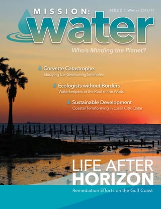
  • 1. LIFE AFTER HORIZON Ecologists without Borders Sustainable Development Corvette Catastrophe Studying Car-Swallowing Sinkholes Waterkeepers at the Roof of the World Coastal Terraforming in Lusail City, Qatar Remediation Efforts on the Gulf Coast ISSUE 2 | Winter 2016/17
  • 2. 32 Who’s Minding the Planet? HEADLINEHEADLINEIN THIS ISSUE MISSION: WATER STAFF Surface Water 04 Water Blogged: Stories from the Web 06 Lake Mead: Safeguarding Source Water 12 Challenging Colorado Mining Legacy 16 Waterkeepers at the Third Pole 24 Corvette Catastrophe: Studying Sinkholes Gulf Coast Highlights 32 Life After Deepwater Horizon 36 Battling Wetland Loss in Coastal Louisiana 40 Gulf Coast Monitoring Solutions 42 Water Heroes: Interview with Renee Collini (DISL) 44 Steering Silver Springs’ Recovery Ocean & Coastal Waters 54 Lusail City: Terraforming on the Global Stage 58 Drilling into the Abyss Infographics 10 Lead – An Accumulating Problem 34 Horizon – Six Years Later Xylem Spotlight 62 EARTH FORCE, Engaging the Next Generation 64 Renaissance Woman – Q&A with Jessica Clemmons 66 Technical Tips: Limitations with Measuring ORP Copyright © 2016 Xylem Inc. All rights reserved. The publishers have made every effort to ensure the accuracy of the information in this magazine. Cover Photo: Sunrise at Low Tide Credit: Larry Brandt 16 58 44 24 32 MISSION: WATER Timothy A. Grooms Director of Marketing - Xylem Analytics, NA In this Issue Welcome to the 2nd edition of MISSION: Water, a magazine featuring the organizations and researchers tackling the world’s most challenging water issues. I’d like to give a special thanks to all the participants in our inaugural edition who helped make the magazine’s launch such a success – and another thank you to the contributors telling their story in this issue. I’m excited to see MISSION: Water feature stories from around the globe, with topics ranging from climate change in the arctic to grassroots monitoring coalitions in the Himalayas. This edition also puts a spotlight on the work of environmental professionals confronting the lingering effects from some of the world’s worst environmental disasters, including the Deepwater Horizon spill and the Gold King Mine incident in Colorado. We hope you enjoy the magazine, and let us know if you’re interested in joining us for the next issue! Steve Werblow Staff Writer Luke Giroux Staff Writer Tom Moeggenberg, YSI Staff Writer Jessica Clemmons, Xylem Staff Writer Chris Iarossi, SonTek Contributing Writer Inger Graves, Aanderaa Contributing Writer Reidun Dalland, Aanderaa Contributing Writer Lisa Landry, Xylem Gulf Coast Contributing Writer Chris Cushman, YSI Research Associate Patrick Higgins, Xylem Digital Marketing Manager EARTH FORCE Guest Writer The Water Institute of the Gulf Guest Writers Waterkeeper Alliance Guest Writers Brandon Smith Executive Editor Brandon.Smith@Xyleminc.com Patrick Beatty Creative Director Patrick.Beatty@Xyleminc.com Theresa McGeady Content Director Theresa.McGeady@Xyleminc.com Emily Jensen Associate Editor Emily.Jensen@Xyleminc.com Editorial Staff: Talk to us: Magazine Contributors: MissionWater@Xyleminc.com facebook.com/myYSI YSI.com/blog linkedin.com/company/ysi youtube.com/ysiinc twitter.com/YSIinc or @YSIinc Share your story in our next edition! Contact us at MissionWater@Xyleminc.com
  • 3. HEADLINE 4 WATER BLOGGED Find papers, videos and product specifications: sontek.com/flowtracker2 • Proven accuracy • Easy to use • New features WADING DISCHARGE MEASUREMENT inquiry@sontek.com +1 (858) 617-0584 Patrick Higgins, Digital Marketing Manager Patrick.Higgins@Xyleminc.com Water Blogged Sharing in the love of water, join us for more stories at: YSI.com/blog Sea Level Rise Research: Clam Bayou Estuary In Pinellas county, surrounded by Gulfport, St. Petersburg, and Boca Ciega Bay, lies a 170-acre estuary — Clam Bayou. Due to urban development constructed prior to stormwater monitoring regulations, the Clam Bayou habitat is now facing environmental repercussions affecting water level and quality. Monitoring sea level rise and water quality—with the ability to accurately report water level data over low current, continuous operation—is a key component in managing the Clam Bayou resources, but it isn’t without its challenges. “A specific challenge we face with this site is the amount of hard fouling that occurs,” explains Mike Lizotte. “I knew that the bubbler would have the same challenges, so… we came up with a method that is protecting the orifice tube from fouling by installing an anti-fouling protection pipe.” The lessons learned from the site, have produced numerous product enhancements that, in-turn, make work easier and the data quality higher for researchers, notes Lizotte. The result of the latest Xylem brand technology paired with monitoring efforts at the Clam Bayou site, will provide greater understanding... 7 Tips to Fight Fouling and Extend Sonde Deployments The goal of every monitoring program is to gain a better understanding of an environment. That deeper understanding can lead to better water management tactics or better decision making. Ultimately, to better understand water – we simply need more data – and the more the better. Some organizations only have the resources to monitor on a weekly basis with handheld water quality sampling equipment, and while that is a great first step to collect water quality data, a more robust monitoring schedule of even daily sampling can shed light on events occurring there. Ultimately, however, we can’t be at the site 24/7, 365 days a year to maintain the high resolution data set we need via handheld instrumentation. That’s why sondes are critical to building a global water quality data set. For those of you who are new to water quality monitoring, a sonde (EXO) is a piece of instrumentation that can autonomously record water quality data in-situ for weeks or months at a time. This equipment can be installed throughout a watershed to capture key parameters on the health of a waterbody... Real-Time Stormwater Monitoring System for NPDES Compliance After receiving a text via telemetry indicating a real-time spike in ammonium and conductivity, field technicians dropped what they were doing to track the potential illicit discharge. Something unusual was going on near one of the stormwater monitoring stations in the Reedy Watershed. The team quickly mobilized and drove to the station. Using a portable water quality sonde from YSI, the team began taking readings around the station, and then continued to take readings as they hiked upstream in search of changes in the water chemistry. First they found a small pipe dumping water in the river; they traced the pipe back to a small tributary. Finally, they pinpointed the source to a small drainage ditch where a sanitary sewer manhole was blocked and overflowing. Just as they arrived on the scene, a citizen was calling in to report the sewer problem. The real-time alerts from the continuous monitoring station had given the team fast insight into a suspicious discharge and they reacted quickly to address it. Recognizing the need for more data to meet permit requirements, the county - a Phase 1 Municipal Separate Storm Sewer System (MS4) permit holder - transitioned from a grab sampling program to a continuous monitoring program five years ago... Get the full story: bit.ly/sealevelclambayou Get the full story: bit.ly/7foulingtips Get the full story: bit.ly/realtimestormwater FlowTracker2®
  • 4. MISSION: WATER 76 Who’s Minding the Planet? SURFACE WATER SURFACE WATER LAKE MEAD How are water quality professionals safeguarding a critical reservoir in America's driest state? Lake Mead, located approximately 25 miles (39 km) southeast of Las Vegas, Nevada, is an impoundment of the Colorado River and is one of the most intensely used reservoirs in the western United States. It provides water to the states of Arizona, Nevada, and California, serving nearly 22 million people – including 1.8 million residents of Nevada and tourists. Not only does it serve as a drinking water source, it also provides recreational water activities (boating, fishing, and swimming), water for industrial uses, and irrigation water for farmland. It is crucial to maintain the quality and level of this water to guarantee a reliable and safe resource for its many uses. Lake Mead, formed following the realization of Boulder Dam (now called Hoover Dam) in 1935, was the largest artificial lake in the world at the time of completion. It is one of several reservoirs along the Colorado River; however, due to increases in population and agricultural operations in recent decades, this once-expansive lake in the desert is becoming more compromised. While inflow into Lake Mead is primarily from the Colorado River, a small percent is also from rivers on the northern side of the lake and from Las Vegas Wash on the northwest side. Las Vegas Wash transports treated municipal wastewater effluent, urban runoff, and shallow groundwater seepage from the Las Vegas area to Boulder Basin in Lake Mead. Wastewater effluent flow rates have more than doubled in recent years, prompting concern over potential effects to reservoir water quality, especially since some of the water is pumped to the municipal water treatment plant at Saddle Island for distribution to residents. Background Photo: Outfall from the Hoover Dam flows into Lake Mead, just outside of the Las Vegas area. Since its peak in 1983, the level of Lake Mead has dropped considerably, leaving a white ring mark around its shores. The level is expected to continue to drop below historic lows amid the western drought. Background photo: Kunal MehtaThe discolored 'ring' is a clear reminder of our water scarcity issues. MISSION: WATER STAFF
  • 5. MISSION: WATER8 SURFACE WATER Monitoring the watershed and analyzing water quality data are crucial steps to ensure Lake Mead is attaining the state’s water quality standards. If parameters such as dissolved oxygen or temperature fall outside of the specified ranges, then the lake’s beneficial uses are adversely affected. These uses include: propagation of aquatic life, including a warm water fishery; recreation; irrigation and watering of livestock; and municipal drinking water supply. For example, as the level of the lake continues to drop due to high volume usage and reduced inflow, the elevation of the thermocline, a zone that separates a layer of cool water from a layer of warm water, is also lowered. As a result, the drinking water intakes, which are located at fixed elevations, may be drawing in warmer lake water, which is associated with poorer quality water. This may require increased efforts to treat the drinking water, which would lead to higher treatment costs. Managing Data in a Changing Environment Near real-time monitoring can reveal a lot about water quality. Population growth in Las Vegas has increased the flow and volume of water through the Lake Mead region, leading to flooding and allowing additional pollutants to enter the lake. These pollutants include bacteria, oil, grease, pesticides, sediment, nutrients (nitrogen and phosphorus), and heavy metals, which affect the quality of water. In recent years, researchers have even studied the effect of pharmaceutical compounds on aquatic organisms in Lake Mead and the Las Vegas Wash. Efforts are currently underway to improve the region’s water. Several organizations are working to reduce erosion and silt in the Las Vegas Wash Channel, build wetlands to reduce nutrient loading, perform environmental monitoring, and promote public awareness about this important watershed. “Lake Mead and water distribution in general in the southwest play a key role in population growth, agriculture, and politics. Preserving its quality and volume is critical to the population and agriculture of this region,” notes Michael Strobel, Ph.D., in the USGS publication Water in Nevada. For historical water quality and meteorological data from the Lake Mead monitoring platforms, please visit: nevada.usgs.gov/lmqw/index.htm Better Data, Better Decisions. For more than 20 years we've been demonstrating how defensible data can change your world. From autonomous HydroMet monitoring systems to hardware installation, design, and maintenance we have solutions to fit every scale and budget. Learn more online at: YSI.com/systems For more on the VerticalProfiler® : +1 (727) 474-8535 | systems@ysi.com Take automation to the next level with a VerticalProfiler® system from YSI. Don't Settle. Measure Water Quality Data throughout the water column, not just at a single depth. Depth: 5m Temp: 23°C DO: 116% Sat Chl a: 10.2 ug/L Depth: 50m Temp: 9°C DO: 98.5% Sat Chl a: 2.8 ug/L Pontoon Profiler for reservoirs, lakes and estuaries. Additional profiler options: Fixed-Position Buoy Profiler Vertical Profiling Preserving [Lake Mead's] quality and volume is critical to the population and agriculture of this region... The recreational area of Lake Mead shows the same discoloration and lowering water line. Photo: Songquan Deng
  • 6. 7pH H C By the Numbers 98% 40% to 60% 99% Health Impacts of Lead Taking Action Get the Lead Out 1976 1990 1994 10.5 mcg/dL 8,000 $395 million 13.7 3.2 Protect Yourself Focus on Flint Flint, MI Lead is a naturally occurring element found in the earth’s crust.(1) It is one of the best-studied toxic substances, and shares a long history with human civilization due to its desirable properties. Some historians suggest that the Romans’ high exposure to lead in wine urns, utensils, and aqueducts contributed to their empire’s decline. Ironically, lead poisoning was then a disease of the affluent; today, it is primarily an affliction of poorer communities.(2) In children, lead induces: • behavior and learning problems • lower IQ and hyperactivity • hearing problems • anemia(4) In adults, lead can induce: • cardiovascular issues • high blood pressure • decreased kidney function • reproductive problems (male and female) (4) Drinking water can make up 20% or more of a person‘s total exposure to lead.(5) For infants it can be 40% to 60% if used to mix their formula.(5) Lead can be ingested from lead paint, house dust, soil, drinking water and food.(6) Extremely low doses of lead can cause neurobehavioral deficits.(3) Overall, 98% of adults and 99% of children affected by lead live in low- and middle-income countries.(4) It is an ongoing issue worldwide. Lead exposure causes 674,000 deaths globally per year.(1) The U.S. EPA‘s goal is zero lead in drinking water.(4) 8,000 children were exposed to lead poisoning when the city switched its water source to the Flint River to save money.(3) The city switched back to Detroit's municipal water system in Oct. 2015.(3) The social cost is $395 million.(3) Lead is required to be at safe levels when it leaves the treatment plant, but it can be redissolved in plumbing if water is not properly treated. Water is less corrosive when it is high in calcium carbonate and has a pH over 7. Cold water is also less corrosive than warm water.(5) If water sits for a long time in lead pipes, the resulting corrosion can add lead to tap water.(7) Take action if lead in drinking water exceeds 15 ppb at the tap, which can be determined at home with a simple, inexpensive test. Before using water from a faucet that hasn’t run in at least 6 hours, flush your pipes by running your water until it is as cold as it can get.(4) The removal of lead from gasoline in 1990 is one of the public health triumphs of the 20th century. Between 1976 and 1994, the mean blood lead concentration in children dropped by 10.5 mcg/dL; the clear result of a consistently applied public health policy.(2) (3) (3) Sources 1 https://www.epa.gov/ 2 https://www.lead.org.au/ history_of_lead_poisoning_ in_the_world.htm 3 http://www.reuters.com/article/ us-michigan-water-idUSKCN10J26Q 4 https://www.epa.gov/ 5 http://extension.psu.edu/ 6 http://www.cdc.gov/ 7 http://www.mwra.state.ma.us/ An accumulating problem 20% 7pH H C By the Numbers 98% 40% to 60% 99% Health Impacts of Lead Taking Action Get the Lead Out 1976 1990 1994 10.5 mcg/dL 8,000 $395 million 13.7 3.2 Protect Yourself Focus on Flint Flint, MI Lead is a naturally occurring element found in the earth’s crust.(1) It is one of the best-studied toxic substances, and shares a long history with human civilization due to its desirable properties. Some historians suggest that the Romans’ high exposure to lead in wine urns, utensils, and aqueducts contributed to their empire’s decline. Ironically, lead poisoning was then a disease of the affluent; today, it is primarily an affliction of poorer communities.(2) In children, lead induces: • behavior and learning problems • lower IQ and hyperactivity • hearing problems • anemia(4) In adults, lead can induce: • cardiovascular issues • high blood pressure • decreased kidney function • reproductive problems (male and female) (4) Drinking water can make up 20% or more of a person‘s total exposure to lead.(5) For infants it can be 40% to 60% if used to mix their formula.(5) Lead can be ingested from lead paint, house dust, soil, drinking water and food.(6) Extremely low doses of lead can cause neurobehavioral deficits.(3) Overall, 98% of adults and 99% of children affected by lead live in low- and middle-income countries.(4) It is an ongoing issue worldwide. Lead exposure causes 674,000 deaths globally per year.(1) The U.S. EPA‘s goal is zero lead in drinking water.(4) 8,000 children were exposed to lead poisoning when the city switched its water source to the Flint River to save money.(3) The city switched back to Detroit's municipal water system in Oct. 2015.(3) The social cost is $395 million.(3) Lead is required to be at safe levels when it leaves the treatment plant, but it can be redissolved in plumbing if water is not properly treated. Water is less corrosive when it is high in calcium carbonate and has a pH over 7. Cold water is also less corrosive than warm water.(5) If water sits for a long time in lead pipes, the resulting corrosion can add lead to tap water.(7) Take action if lead in drinking water exceeds 15 ppb at the tap, which can be determined at home with a simple, inexpensive test. Before using water from a faucet that hasn’t run in at least 6 hours, flush your pipes by running your water until it is as cold as it can get.(4) The removal of lead from gasoline in 1990 is one of the public health triumphs of the 20th century. Between 1976 and 1994, the mean blood lead concentration in children dropped by 10.5 mcg/dL; the clear result of a consistently applied public health policy.(2) (3) (3) Sources 1 https://www.epa.gov/ 2 https://www.lead.org.au/ history_of_lead_poisoning_ in_the_world.htm 3 http://www.reuters.com/article/ us-michigan-water-idUSKCN10J26Q 4 https://www.epa.gov/ 5 http://extension.psu.edu/ 6 http://www.cdc.gov/ 7 http://www.mwra.state.ma.us/ An accumulating problem 20% MISSION: WATER 1110 Who’s Minding the Planet? HEADLINEHEADLINE INFOGRAPHICINFOGRAPHIC
  • 7. 13Who’s Minding the Planet?MISSION: WATER12 SURFACE WATER SURFACE WATER THE GOLD KING MINE Luke Giroux Durango, Colorado - August 7, 2015, Animas River one day after the Gold King Mine spill. Photos: Barbara K Powers Durango, Colorado - August 6, 2015, Animas River early in the day, the same day the Gold King Mine spill occurred in Silverton, Colorado, 50 miles north. For many, Southwestern Colorado is known for its four-season recreation activities such as rafting and kayaking on rivers that flow out of world famous snow-packed ski areas. In the high-country, hiking, backpacking, and mountain biking trails extend off of old logging and mining roads, which are also used by locals and visitors for four-wheeling. Fun mountain towns like Durango, Silverton, and Pagosa Hot Springs have enough entertainment and commerce between backcountry trips to support locals and tourists alike. Even the many old mines scattered throughout the region offer historic interest in the early regional mining industry. However interesting these old mines are as remnants of the wild west and the early Rocky Mountain natural resource extraction, many are also unsealed and remain as unresolved water and land pollution sources. In the state of Colorado alone, there are approximately 23,000 of these abandoned mines. For decades, state and federal agencies have worked to remediate and close over 6,000 of these inactive mines, but many thousands more remain open. A few older Colorado mines are still active, but most are no longer producing. Early mineral mining in the United States had rampant interest and activity with little regulation that controlled the excavations, resulting in such environmental effects as heavy metal polluted rivers and streams, and open unsafe tunnels, or adits (a horizontal access or drain tunnel). The remnants of negligent mining practices aren’t the only environmental offenders, as naturally occurring seepage from the region’s mineral rich soils and geology also contributes to the high contaminant waters. Colorado’s Gold King Mine incident last year stands as a glaring reminder of these original mining practices still left unresolved. CHALLENGING COLORADO MINING LEGACY
  • 8. 1514 Who’s Minding the Planet?MISSION: WATER SURFACE WATER SURFACE WATER There are about 400 of these abandoned mines in the greater San Juan River watershed of southwestern Colorado, which includes the Animas River watershed where the Gold King Mine is located. This inactive gold and silver mine, located northeast of Silverton, was established in 1887 and closed in 1922. Unfortunately, on August 5, 2015, the Environmental Protection Agency (EPA) inspectors discovered just how tenuous the conditions of these inactive mines are. While conducting a mine inspection, a water reservoir above the mine adit collapsed, releasing an estimated 11.3 million liters of acid mine drainage and heavy metals-rich water into nearby Cement Creek and the Animas River. The Animas feeds the San Juan River, which flows through New Mexico and ultimately into Lake Powell in Utah. The irony in this situation is that EPA inspectors were on site to evaluate additional remediation steps for the mine when the plugged water reservoir broke through. Though initial communication to EPA management and local community officials was challenged by limited satellite and cell phone capabilities, inspectors soon warned communities and officials downstream. EPA management cautioned restricted water use across the spectrum for fishing, drinking, agriculture, and recreation purposes in Colorado, New Mexico, Utah, the Ute Mountain Ute tribe, the Southern Ute Tribe, and the Navajo Nation. Immediately down river, Silverton’s public drinking water was not affected, but further downstream, Durango closed its Animas River intakes before the plume arrived. The EPA was able to supply drinking and irrigation water to users in Colorado’s San Juan and La Plata counties. In New Mexico, authorities recommended closing water intakes along the Animas and San Juan rivers, and the EPA provided irrigation and livestock water at eight regional sites and delivered hay to Navajo and New Mexico ranchers. EPA staff also quickly established numerous filtering and treatment ponds just below the adit rupture site to reduce toxic overflow from continuing downstream. Unfortunately, the construction of these ponds happened after the initial plume of contaminated water pushed through. But once they were put in place, officials were able to effectively control and treat whatever water was still flowing before it entered the Animas River and beyond. The pond treatment included lime to reduce acidity and raise pH, and sodium hydroxide solution, which aided metals sedimentation within the ponds. EPA staff further established monitoring and testing of the contaminant plume during and after the incident. Though the initial plume passed through and dissipated in about an hour, residual contamination continued. River monitoring used pre- spill contaminant levels as baseline determination, and within weeks, river contaminant levels had returned to pre-spill conditions, ultimately allowing the Animas River to re-open for recreation purposes on August 14th, only nine days after the incident. It is important to note, however, that these monitored contaminant levels are complicated by historically high baseline levels which are found in the watershed from abandoned mines and naturally occurring sources not connected to mining. Surface water testing, which still continues in 2016, includes the following parameters: salinity, turbidity, temperature, pH, dissolved oxygen (DO), conductivity, and oxidation reduction potential (ORP). During the weeks and months after the Gold King Mine incident, the EPA supported the involved states and downstream communities with substantial staff and funding to handle clean up, agricultural needs, ongoing testing and monitoring, and other issues resulting from the spill. In addition to water testing for contaminants, the EPA contracted with the Mountain Studies Institute (MSI) out of Durango to assess the possible harm to benthic macroinvertebrates (BMI) from the discharge. BMI, such as immature and adult stages of invertebrate flies, beetles, worms, and snails, occur in relatively small numbers in the Animas watershed, and have historically contained high concentrations of metals. MSI concluded, in part, that the increase in copper, aluminum, and iron at some of the testing sites did not significantly affect these BMI populations, and must also be considered within the historic data of the region. Colorado Parks and Wildlife also concluded that Animas River fish populations, which are historically challenged by the watershed’s water quality, were also not adversely affected by the Gold King Mine release. The Gold King Mine clean up effort has prompted the EPA to add many other active and dormant mines in the region, and throughout the U.S., to the National Priorities List, which is supported by federal Superfund clean-up regulations and parameters. This plan includes additional efforts for inactive mine remediation to further reduce the possibility of an incident of this type occurring again. Though very well intentioned in this instance, and with similar issues among all of these mines, it is also very difficult to anticipate every variable in working with abandoned sites. In 2016, the EPA’s clean-up contractors have continued their stabilization efforts of the Gold King Mine adit and waste pile. These efforts include operating the Gladstone Interim Water Treatment Plant (IWTP) downstream, securing the adit and waste pile at the incident site, and removing and disposing solids from the treatment ponds. Abandoned mines, established when regulations and oversight were often minimal or non-existent, present many challenges to modern attitudes and remediation efforts. Federal and local agencies have been left “holding the bag” of thousands of toxic water reservoirs and naturally occurring drainages, a seemingly Herculean clean up task to resolve. However, with this significant mishap at the Gold King Mine, federal and local officials and communities have been reminded of the tenuous nature of the situation, prompting public and private cooperation and action to restore the region’s need for clean and safe flowing waters. Above: Treatment ponds close to the Gold King Mine. Below: Water Monitoring in the Animas River with a YSI handheld multiparameter meter. Below: Lime is added to a settling pond to assist in the pH adjustment of the water prior to discharge to Cement Creek on August 14th, 2015. Photos: Eric Vance / EPA Source: The Denver Post Gold King Mine LA PLATA COUNTY Animas River SILVERTON HERMOSA DURANGO Cement Creek SAN JUAN COUNTY SAN JUAN NATIONAL FOREST epa.gov/GoldKingMine N 10:30 am, Wednesday While using heavy machinery to investigate pollutants, 11.3 million liters of waste- water spills into Cement Creek. 12:34 pm, Wednesday Spill approaches the town of Silverton, where Cement Creek flows into the Animas River. 5:30 am, Thursday Spill travels towards Bakers Bridge. 1:30 pm, Thursday Water discoloration begins near Glider Park. 8:00 pm, Thursday Contaminated water reaches Durango as hundreds line the river to watch. 5:00 am, Friday Estimated time to reach New Mexico state line. Midnight, Wednesday Approaches Tall Timbers Depot on the Durango & Silverton Railroad.
  • 9. Panoramic view of confluence of the Zanskar river from left and Indus rivers from right - Leh, Ladakh, Jammu and Kashmir, India. Photo: Candy Halls Who’s Minding the Planet?MISSION: WATER 1716 SURFACE WATER SURFACE WATER WATERKEEPERS® at the Third PoleCo-written by Sharon Khan, International Director and Marc Yaggi, Executive Director THE HIMALAYAN GLACIERS, which stretch east from northern Afghanistan, Pakistan, and India, through Nepal and Bhutan, and into the neighboring Tibetan Plateau and China, are the source of fresh water for nearly four billion people in Asia. The melting of snow in the Arctic and Antarctic due to global climate change is reported frequently, but the melting of the Himalayas’ glaciers has gone largely unreported, even though far more people are affected. The glaciers of the Himalayas are, in fact, the "Third Pole.” They feed the giant rivers of Asia that support half of the world’s population. Three major rivers – the Indus, the Ganges and the Brahmaputra – arise in the Himalayas and flow directly into Pakistan, India and Bangladesh. The Yellow, Yangtze, Mekong, Irrawaddy and Salween Rivers arise from the Tibetan Plateau and flow directly into China before continuing into Myanmar, Laos, Thailand, Cambodia, and Vietnam. These rivers are the source of water for drinking, washing, irrigation, fishing and industry, and have also been the source of many local and international disputes about their quality and flow from one community into another, within and across borders. But 65 Waterkeepers and Affiliates in these communities do not recognize borders when they apply their passion and commitment to the health of river ecosystems. In January 2016, Waterkeeper Alliance launched an initiative to protect the Himalayan waters and its growing network in India, Nepal, and Bhutan, and work with Waterkeepers throughout the region – and across the globe – to protect the “Third Pole.” Water monitoring equipment training on the Zanskar River. Credit: Waterkeeper Alliance
  • 10. 19Who’s Minding the Planet?MISSION: WATER18 SURFACE WATER SURFACE WATER Ladakh, India High up on “the sacred rooftop of the world,” on the Indus River in the Ladakh region of India, Himalayan Glacier Waterkeeper was founded in 2013 by His Holiness the 12th Gyalwang Drukpa, head of the Drukpa lineage of Buddhism, who has over 27 million followers around the world. He is an award-winning humanitarian and environmentalist who advocates respect for nature as one of the steps on the path to enlightenment. He was the recipient of the 2010 United Nations Millennium Development Goals Award for his cross- border humanitarian work and India’s 2010 Green Hero Award for his work in sustainable development. The Indus and its tributaries, fed by glacial-melt waters, sustain communities throughout Jammu and Kashmir, a single state that contains Ladakh and that is a locus of dispute involving India, Pakistan and China. The headwaters of the Indus originate in the plateaus of Tibet and run through India and Pakistan to the Arabian Sea near the port city of Karachi. Along its way, its river-systems support temperate forests, plains, arid countryside and countless communities. The natural habitat and the way of life of Himalayans are seriously affected by the forces of modernization and climate- change. In Ladakh, although increased tourism and new roads have facilitated distribution of goods, there is virtually no awareness of the dangers of plastic litter in the wild. There are no means of disposing of this waste, which is migrating into the region’s rivers, its primary source of drinking-water. In addition, the rapid melting of glaciers caused by warmer weather is contributing to the drying up of springs and rivers used for drinking-water. Ladakh, at an altitude of 9,800 feet, also has been facing extreme-weather, including rare and catastrophic flash floods, made worse by rapid deforestation that has removed nature’s flood-defense mechanisms. In August 2010, flash floods in Ladakh damaged over 71 towns and villages, and claimed 225 lives. Floods in September 2014 killed more than 550 people in the Kashmir region and devastated the lives and livelihoods of survivors. These incidences, which are expected to become more common, have been termed “Himalayan tsunamis.” Less disturbing but also very significant is the threat of such events to Ladakh’s spiritual and cultural heritage. Its nearly 1,000-year-old Hemis Monastery of the Drukpa Lineage houses its largest collection of Buddhist relics, rare murals and texts, many of which define the sacred and sophisticated administration of traditional water rights. In July 2016 the Waterkeeper Alliance held their first training exercise in the former Buddhist kingdom of Ladakh, India, where Himalayan Glacier Waterkeeper has been leading communities, and especially young people, to protect the region’s water resources. Himalayan Glacier Waterkeeper currently includes 20 Waterkeeper Affiliates based at Drukpa monasteries in streamside villages throughout Ladakh. At the Druk Padma Karpo School our experts trained the Himalayan Glacier Waterkeeper team and its 20 Affiliates on the use of water-quality monitoring field equipment. Drukpa nuns and students from the school were also trained on how to test water quality using monitoring kits. With these tools, Himalayan Glacier Waterkeeper's community is able to monitor the baseline physical and chemical water-quality conditions of their local waterways and advocate for the protection of clean water. By the end of our tour, we had tested water quality at 10 sites northwest and southeast of Leh. To launch the Himalayan Glacier Waterkeepers’ water- quality monitoring program, we chose equipment from YSI to measure dissolved oxygen (DO), conductivity, and pH and supplemented these instruments with other tools to measure for nutrients, turbidity and E. coli. Initial testing found the water quality of glacial streams to be generally good (dissolved oxygen at levels supportive of aquatic life, slightly alkaline, low conductivity, high clarity, no excessive nutrients). For the Indus and the Zanskar Rivers, both larger river systems, the main difference was low clarity and highly turbid water resulting from excessive suspended sediments in the water. Ongoing water-quality testing will help to establish baseline characteristics of these waterways and allow Waterkeepers to assess and address any changes that may occur from pollution or climate change. Do not dirty the sacred rooftop of the world. His Holiness the Gyalwang Drukpa Pangong Lake, an endorheic lake in the Himalayas situated at a height of about 4,350 m (14,270 ft). Stewards without borders, the WATERKEEPER® ALLIANCE work beyond political lines to solve water issues. Credit: Rinchen Wacher Credit:RinchenWacher
  • 11. Punakha Dzong "the palace of great happiness" is the administrative centre of Punakha District in Punakha, Bhutan. Photo: MC Noppadol 21Who’s Minding the Planet?MISSION: WATER20 SURFACE WATER SURFACE WATER Bhutan Bhutan is a small Himalayan kingdom east of Nepal, north of India and southwest of China. It contains the least impacted rivers in the Himalayan region. It is roughly 75 percent forested, and its constitution requires that it remain at least 60 percent so. These conditions have allowed the country to be one of the few in the world that acts as a carbon sink that beneficially absorbs more carbon than it releases. Prime Minister Tshering Tobgay promises that Bhutan will remain carbon neutral – while it is in fact, carbon negative. Bhutans strong conservation ethic was established by King Jigme Singye Wangchuck, who reigned until 2006, and has been carried forward by his son, King Jigme Khesar Namgyel Wangchuck, the prime minister and the Buddhist leadership. “Where we live,” the current king has declared, “must be clean, safe, organized and beautiful, for national integrity, national pride, and for our bright future. This too is nation-building.” Bhutan’s main economic generator is hydroelectricity, 75 percent of which is exported to India. But as climate-change advances, more caution is required in dam building. A 2012 UN report on glacial-lake outburst-floods noted that the country’s 677 glaciers and 2,794 glacial lakes had experienced more than 21 glacial lake outburst floods in the last forty years. It also identified another 25 glacial lakes as potentially dangerous – ticking time bombs whose outbursts could have devastating impacts on dams downstream. Bhutan, long closed to the outside world, opened its doors to tourism in 1974, and is now rapidly modernizing. As imports of packaged foods and other commodities have increased, so have littering and unsustainable practices such as dumping and burning of waste, this includes the burning of plastics, which releases toxic fumes. Waterways are becoming polluted, especially in the capital city, Thimphu. A recent letter to the editor of Kuensel, the national newspaper, lamented the lack of proper controls of erosion and sediment on road-construction projects. And, though automobiles remain fairly scarce in Bhutan, their growing number has brought more repair-shops, which discharge waste-oil and other pollutants directly into the city’s Olarongchu River, tributary of the Thim Chu. Several acts and plans have been established to address waste-management in Bhutan, including the National Environmental Protection Act and the National Strategy and Action Plan: Integrated Solid Waste Management in 2007, the 2009 Waste Prevention and Management Act, and the 2014 National Integrated Solid Waste Management Strategy. Unfortunately, implementation of these plans does not appear to have reached beyond Thimphu yet. The Ministry of Health, which administers parts of the 2011 Water Act, has begun to focus more on water quality. It oversees a modest hospital-based aquatic laboratory, but it severely lacks equipment and training for monitoring and analyzing all the pollutants that are caused by rapid development. Nedup Tshering A charismatic authority who inspires citizens and leaders across the country, is the founder and executive director of Clean Bhutan, an NGO with a mission to achieve a “zero-waste Bhutan” by 2030. It was established in February 2014 in celebration of the 60th birthday of the previous king, who conceived the “Gross National Happiness Index,” by which welfare is measured by good health, environmental preservation, clean air, clean water and other factors. Clean Bhutan advocates behavioral change and awareness of its programs. In September 2015, Clean Bhutan welcomed Thim Chu Waterkeeper to Thimphu. WATERKEEPER® ALLIANCE engages monks and citizens at the top of the world to make positive impacts. Credit: Waterkeeper Alliance
  • 12. 22 MISSION: WATER SURFACE WATER Credit: Waterkeeper Alliance info@ysi.com | +1 (888) 860-9465 YSI.com/ProDSS • Drop-rated, impact resistant • Waterproof (IP67 rated) • Laser-welded titanium sensors • Rugged, military-spec connectors • Back-lit display & keypad • GPS (optional) The ProDSS — built for the most challenging field conditions: WHEN THE ENVIRONMENT DEMANDS IT WHEN THE ENVIRONMENT DEMANDS IT ProDSS THE ULTIMATE WATER QUALITY Sampling & Profiling System Last November, Waterkeeper Alliance staff traveled to Bhutan with a team of scientists from Stroud Water Research Center of Avondale, Pennsylvania to conduct physical, chemical and biological assessments of water quality in three Bhutanese rivers, the Thim Chu, Paro Chu, and Punakha Chu, and various streams. Working alongside Thim Chu Waterkeeper and partners from the National Environment Commission and the HydroMet Division of the Ministry of Economic Affairs, they installed the country’s first three real-time water-quality monitoring sensors. Conclusion Protecting the Himalayan glaciers and rivers and the countless communities that depend on them is a colossal challenge, but the Waterkeepers in the Himalayas are optimistic. They are dedicated to strengthening community efforts to monitor the quality of their waterways and inform themselves to advocate for the abundance and purity of freshwater that sustains billions of people. About WATERKEEPER® ALLIANCE Waterkeeper Alliance strengthens and grows a global network of grassroots leaders protecting everyone’s right to clean water. We’re the largest and fastest growing nonprofit solely focused on clean water. We preserve and protect water by connecting local Waterkeeper organizations worldwide. Our goal is drinkable, fishable and swimmable water everywhere. Waterkeeper Alliance is a global movement uniting more than 300 Waterkeeper Organizations and Affiliates on six continents and focusing citizen advocacy on issues that affect our waterways, from pollution to climate change. Waterkeepers patrol and protect more than 2.4 million square miles of rivers, streams and coastlines in the Americas, Europe, Australia, Asia and Africa. waterkeeper.org facebook.com/waterkeeper @waterkeeper
  • 13. In February 2014, a 30-foot-deep sinkhole opened up beneath the National Corvette Museum and swallowed $1 million worth of classic Corvettes. Photo: National Corvette Museum 25Who’s Minding the Planet?MISSION: WATER24 SURFACE WATER SURFACE WATER CORVETTE CATASTROPHE A car-eating sinkhole opens a window into Kentucky’s subterranean caves STEVE WERBLOW At 5:38 a.m. the morning of February 12, 2014, security cameras registered a strange movement at the National Corvette Museum in Bowling Green, Kentucky. The grainy footage shows a half-dozen candy-colored sports cars appear to settle just slightly in the play between spotlight and shadow. Then, under a muscular, orange T-top, a panel of floor tiles drops away. And another. For 30 long seconds, the car hangs on by its tail light before more floor disappears and the car, along with the white one parked in the next spot, disappear into the earth. The footage is silent, but you can almost hear the sound of a crash and breaking glass in your imagination. By 5:39 a.m., eight classic ‘Vettes, worth a total of about $1 million, were swallowed by a collapsing cave that left a yawning hole, 12 by 18 meters across and 9 meters deep, in the center of the museum’s atrium. In geologic terms, it was just one more sinkhole among hundreds in south central Kentucky’s Warren County. The region sits atop karst, an eroded limestone formation riddled with ever-expanding caves and channels. But instead of becoming just another farm pond, weedy pit or temporary road hazard, the National Corvette Museum sinkhole became global news—and a prime opportunity to learn and teach about the karst geography that Bowling Green is built upon.
  • 14. MISSION: WATER26 27Who’s Minding the Planet? SURFACE WATER SURFACE WATER Sinkhole Study The day of the collapse, Jason Polk and a team of his graduate students and colleagues found themselves in the museum’s Skydome, peering into the sinkhole. A WKU engineering student piloted a drone into the hole, using a camera on board to help spot buried Corvettes and look for signs of an underground river that could have caused the collapse. Meanwhile, Polk and his team went to an old sinkhole on the museum’s property—used as a retention pond for drainage from the building and parking lot—to look for more insight into conditions that could explain the collapse and perhaps warn of further problems. Their key tool was an EXO multiparameter water quality sonde from YSI, a Xylem brand. Logging measurements of water turbidity (TSS, or total suspended solids), specific conductance, pH, temperature and level every 10 minutes, the monitoring sonde was Polk’s eyes and ears as he searched for indications that the old pond and the new sinkhole could be connected. He and his team also monitored whether runoff from the museum was making its way to the pond or undermining other areas of the lot or buildings. While crews at the museum were drilling foundation structures and filling the sinkhole, turbidity and level were the key parameters on Polk’s mind. A spike in turbidity could indicate that sediment- enriched drilling water was flowing from the museum sinkhole into the pond, or that other water was somehow making the trip. That would have been fascinating. It would have also raised a huge red flag, indicating that a blowout or further collapse could be imminent. Throughout the rainy spring, level and water quality readings in the pond showed that gutter and parking lot runoff indeed drained straight into the retention pond, but no other sources of water seemed to be flowing into the depression. That was good news. Common Geology Most people don’t think much about karst landscapes, though 25 percent of the world’s population lives on top of them. In fact, karst covers about 12 percent of the earth’s ice-free land surface. But as much as the story of karst is written in stone, the heart of the subject is water. Karst aquifers provide 20 to 25 percent of mankind’s drinking water. Because groundwater is connected directly to the surface by sinkholes, caves and fissures in the rock and flows quickly through subterranean rivers and tunnels, karst aquifers are extremely vulnerable to pollution. And water—slightly acidic and capable of dissolving limestone—continues to carve new tunnels and enlarge existing caves that make karst formations look like Emmenthaler cheese or bubble-riddled pizza crust. The unique and fragile nature of karst geography generally comes to light when new sinkholes form in populated areas, opening the earth in a scene straight from the Bible and giving people on the surface a window into the porous world below. “Most of them are slow-forming subsidence sinkholes that take thousands of years to form,” notes Jason Polk, associate professor of geosciences at Western Kentucky University in Bowling Green and a global authority on sinkholes. “There’s not too much to worry about as far as cars or people. We don’t have many reports of big, catastrophic sinkholes like the Corvette Museum. “At the National Corvette Museum, after the sinkhole occurred, we could see that there was just a few feet of distance between concrete and the roof of the cave,” Polk adds. “The ceiling had migrated upward over hundreds of years, thousands of years. Little by little, water continues to move. Storms can undermine the system because rain continues to erode away the ceiling. The weight of the water as it’s sitting there, making the clayey soils and overlying rock heavier, can be an issue.” Heavy rains and deep freezes in February 2014 created the perfect conditions to break the cave ceiling lying just a few feet beneath the museum’s car collection, Polk explains. The weathered rock was stretched to its limit, spanning a cavern more than 12 meters wide. The massive weight of water-laden soil and rock, frozen in place, stressed it further. Then a thaw created a pulse of meltwater, possibly eroding away the last millimeters of structure that held up the roof. That’s when the first Corvettes started dropping 9 meters to the floor of the cave, along with 160 truckloads of limestone, soil and debris. “It was a perfect storm,” Polk says. It was a perfect storm. A geologist uses an EXO sonde to monitor changes in water quality in a sinkhole adjacent to the Corvette Museum. Photo: Dr. Jason Polk Above: Drone footage of the sinkhole. Below: The heartbreaking aftermath. Photos: National Corvette Museum
  • 15. Educational Opportunity As crews excavated the sinkhole in the National Corvette Museum, rescued buried sports cars and filled in the massive cave, visitors flocked to the museum to see not only the car collection, but the sinkhole itself. “When it first happened, it was so unbelievable people just came to see the sinkhole,” says Katie Frassinelli, the museum’s marketing and communications director. “It was in our best interest to show people what had happened. People started peering through the PlexiGlass window, watching them dig those cars out. “We had a 67-percent increase in tourism the year it happened, and kept growing from there,” she adds. With annual visitor numbers approaching 250,000 in 2014 and 2015, the National Corvette Museum has turned the sinkhole disaster into a teaching moment. A new Corvette Cave-In exhibit, inaugurated on the second anniversary of the appearance of the sinkhole, includes interactive displays, exhibits of the restored cars as well as the remaining wrecks extracted from the debris, and detailed information on karst geography and sinkholes. Visitors can peer into a manhole cover to the bottom of an unfilled portion of the sinkhole. There’s even a sculpted area that gives guests a sense of what it’s like to be at the bottom of a sinkhole. Frassinelli admits that the events of February 12, 2014 gave her “a little bit of a panic attack.” But the museum survived, and is thriving. General Motors volunteered to restore two of the most valuable cars, including the one-millionth Corvette to roll off the assembly line. And Bowling Green remains a great place to live and work, she says. In fact, Bowling Green residents talk about sinkholes like Los Angelenos describe earthquakes or Miami residents discuss hurricanes. “Sinkholes are really common here,” Frassinelli tells visitors. “What is uncommon with us is that it was in a building, and Corvettes fell into it. This is a safe place to work and live and drive.” After the ‘Vettes were exhumed, WKU geologists studied the sinkhole. Photo: Dr. Jason Polk Visitors to the National Corvette Museum peer into a still-open portion of the sinkhole. Photo: National Corvette Museum Photo: National Corvette Museum 28 MISSION: WATER 29Who’s Minding the Planet? SURFACE WATER SURFACE WATER Better Than Ever When the excavation was complete and the site deemed safe, Polk—an accomplished caver—and some of his colleagues went into the sinkhole. It was surprisingly dry, without the underground river most geologists expected to see. It was also surprisingly extensive, part of a cave system that was more than 60 meters long, 12 meters wide and as deep as 27 meters beneath the surface. Mapping the cave gave Polk a chance to ground-truth the observations he and his team made with the EXO sonde at ground level. “It gave us very different investigative techniques from beginning to end,” he notes. The National Corvette Museum spent about $5 million digging out the Corvettes, restoring some (with the help of General Motors), filling the sinkhole and rebuilding the Skydome floor. Katie Frassinelli, marketing and communications manager for the museum, says the repair project utilized 3,977 tons of crushed limestone fill, and a grid system of concrete beams connecting 72 micropiles to underpin the new floor. Those micropiles are high-strength steel rods drilled deep into the bedrock beneath the cave, each capable of holding up 150,000 pounds. The deepest micropile reaches 25 stories beneath the museum.
  • 16. The rescue of the Corvettes brought attention to the mysteries of karst formations beneath Bowling Green. Photo: National Corvette Museum 30 MISSION: WATER SURFACE WATER Extensive System Water quality monitoring at the museum site is complete, but Polk and his team rely heavily on continuous, long-term monitoring sondes to study the water running through the karst formation beneath Bowling Green. (He also studies Florida karst formations and aquifers in Central America and elsewhere.) Polk uses his cellular telemetry systems to report on key testing sites in near-real time. Rapid changes in level and temperature can indicate the presence of floodwater mixing with karst groundwater. Shifts in specific conductance and turbidity can signal a wash of pollutants from the surface. Monitoring data are posted to a website and mobile app for easy access by scientists, city officials and the public as part of the Under Bowling Green educational initiative. Through the underBGKY.org website, the Under Bowling Green team educates residents about the connections among houses and roads on the surface, caves and sinkholes, and groundwater. Text and illustrations emphasize the proper treatment of caves and sinkholes to minimize pollution. The scientists and policymakers behind Under Bowling Green are also using the EXO2 data to glean a better understanding of the dynamics of stormwater, pollution and flooding in the system, which is constantly subject to change as new caves collapse or old sinkholes clog up. “As water makes its way underground, [the karst] is like a bathtub,” Polk explains. “The holes the water goes into eventually become holding chambers. There are many spring outlets, most of which eventually feed into the Barren River, the hydrologic border of the city. There are over 2,000 injection wells in the city, draining down the surface water and filling up the karst just as fast. They could plug with sediment, or they could collapse some more, or an injection well could flood. “Every time we build, every time we change the hydrology, every time we pave over a surface, these are all potential risks,” he emphasizes. {YOUR BLUEPRINT for superior continuous environmentalmonitoring • Antifouling Wiper • Turbidity • Depth • Cyanobacteria • Chlorophyll A • pH + Redox • fDOM • Optical D.O. And the new Wiped Conductivity and Temperature Probe for high fouling conditions. [ Figure 1 ] The EXO Smart Sensor Suite [ Figure 2 ] EXO Platform with the new Handheld LEARN MORE @ YSI.COM/EXO For more on the EXO platform: +1 (888) 726-3194 • YSI.com/EXO • info@ysi.com underBGKY.org @WKU
  • 17. Releasing a dolphin back into the wild. Assessing the damage to marine mammals was a key component of Gulf Coast remediation. Photos: Audubon Nature Institute Who’s Minding the Planet?32 33 GULF COAST HIGHLIGHTSGULF COAST HIGHLIGHTS MISSION: WATER LISA LANDRY Gulf Coast Region Applications Specialist On Tuesday, April 20, 2010 the largest oil spill in history occurred when a sudden explosion and subsequent fire occurred on the Deepwater Horizon Platform, located 50 miles southeast of Venice, Louisiana. Lisa Landry, Gulf Coast Applications Specialist for Xylem Inc., was on the ground the weekend after the explosion, serving as an oiled wildlife transporter. “When I first arrived, I couldn’t get over how the quiet fishing community had transformed into ground-zero, a bustling staging area for oil spill response workers. It was as though the population of Venice and the small surrounding communities had more than quadrupled their population overnight,” recalls Landry. Field crews worked extremely long hours surveying impacted areas, and bringing oiled wildlife ashore where they would be transported to nearby facilities for examination and cleaning. “It was organized chaos.” Serving as a state biologist for the Louisiana Department of Wildlife and Fisheries, Lisa was a member of the Marine Mammal and Sea Turtle Stranding Team. “We responded to reports of stranded dolphins and sea turtles across the Louisiana coast.” If the animals were alive, they worked with the Audubon Society to transport the animals to their rehabilitation center, and those that were deceased were collected for necropsy. “Years after the Deepwater Horizon event, we were still working alongside federal and state partners to conduct marine mammal health assessments in Barataria Bay to assess the impacts of the oil spill on the local dolphin populations.” There were extremely long days and Landry says she will never forget the sights and smells she experienced working alongside the stranding team. At the end of her tenure with the state, Landry served as a member of the multi-agency Restoration Planning Team tasked with developing restoration plans to offset the damages incurred from the Deepwater Horizon Disaster. “It was a rewarding job, and I truly learned a lot. Although I’ve since transitioned to a new role with Xylem, I still feel deeply invested in the future of the Gulf of Mexico, and I am very excited about the restoration projects taking place across the gulf coast.” LIFE AFTER Remediation Efforts on the Gulf Coast Workers attempt to clean oil from the beach area on June 23, 2010 in Pensacola Beach. Photo:Cheryl Casey It was organized chaos.
  • 18. SIX YEARS LATER MISSION: WATER 3534 Who’s Minding the Planet? GULF COAST INFOGRAPHICGULF COAST INFOGRAPHIC 120 100 80 60 40 20 0 ClaimsFiled (thousands) Alabam a Florida Louisiana M ississippi Texas O ther 37 of 50 states have renewable energy standards or goals. 6 Increased number of students are insisting their universities divest in fossil fuels 7 BP will spend an estimated $62 Billion on court fees, penalties, claims, and clean up costs. 8 In addition, as part of the settlement, BP Exploration and Production (BPXP) is providing $7.1 billion to the United States and the five Gulf states over 15 years for natural resource damages. TRANSFORMING A TRAGEDY 46% Beaches 52% Coastal Wetlands 2% Other Economic and property damage claims filed by state are reported highest in Louisiana. 4 Today the highest percent of oiled shoreline still affected are coastal wetlands. 5 SOURCES: 1 NOAA 2 Oceana 3 Popularmechanics.com 4 Deepwater Horizon Claims Center 5 National Geographic 6 NCSL 7 Associated Press 8 The Guardian In April 2010, the oil rig, Deepwater Horizon, exploded off the coast of Louisiana, killing 11 workers and dumping an estimated 795 million liters of oil into the Gulf of Mexico. Six years later, scientists are still totaling the damage. 311 Olympic-size swimming pools could be filled 3 13,208 homes could have been heated for one year 3 THE CRUDE PERSPECTIVE 3 Over 770 square miles of sea floor around the wellhead was damaged by oil. These deep water impacts include damage to reefs, where corals can be hundreds of years old.1 5 4 Scientists reported oil along more than 1,300 miles of shoreline spanning from Texas to Florida. 2 1 An estimated 102,400 birds lost as a result of the spill and disaster-response efforts.1 2 It is estimated that 2 to 5 trillion larval fish and 37 to 68 trillion invertebrates were killed in the surface waters as a result of floating oil and mixing of that oil into the upper water column. 1 1,000 dolphins stranded (95% stranded dead) from Louisiana to Alabama following the oil spill.1 An estimated 795 million liters of oil leaked out into the Gulf of Mexico. With the oil that leaked:
  • 19. MISSION: WATER 3736 Who’s Minding the Planet? HEADLINEHEADLINE GULF COAST HIGHLIGHTSGULF COAST HIGHLIGHTS Aerial footage, coastal Louisiana. Photo: The Institute Monitoring Site Breton Sound Black Bay Mississippi River Barataria Basin Lake Salvador When The Water Institute of the Gulf (the Institute) was founded in 2011 in Baton Rouge, Louisiana, it set out a mission to provide independent research and technical expertise to ensure resilient coastal communities and sustainable water systems worldwide. Created through a collaborative effort involving the State of Louisiana, Senator Mary Landrieu, and the Baton Rouge Area Foundation (BRAF), the Institute connects academic, public, and private research providers and conducts applied research to serve communities and industry. In all endeavors, the Institute’s goal is to increase understanding of natural and human aspects of deltaic, coastal, and water systems; to develop tools that apply knowledge to restore coasts and ecosystems; and to reduce risk for people and infrastructure. As stated by President and CEO Charles “Chip” Groat, Ph.D., the expertise knowledge base being built today at the Institute is exportable. “Today, we are actively engaged in projects in other locations in the U.S. and around the world, including the Mekong River Delta and Latin America,” said Dr. Groat. “This initial portfolio of work is critical and will serve as a foundation for diverse future opportunities.” However, located on the Mississippi River Delta, the Institute has to look no further than its home state to confront the harsh reality that wetlands are disappearing at an alarmingly swift rate – a phenomenon occurring across the globe. At the rate of a football field disappearing every hour, land loss in Louisiana is more than a local concern, it is a national dilemma. In addition to being called home by millions of residents, Louisiana’s coast and wetlands greatly support America’s energy industry and an interlaced port system that carries over 25% percent of all US waterborne commerce, and creates international business and trade opportunities. The state’s wetlands house recreational and economically important fisheries – blue crabs, shrimp, oysters, menhaden, and more – comprising 25% of America’s seafood. Also, these wetlands provide the critical benefits of physical protection from storms and hurricanes. Unless restoration activities are successfully planned and implemented, land loss will continue to threaten, reduce, and eliminate these valuable assets and the communities they support. BATTLING WETLAND LOSS in Coastal Louisiana To assist in restoration projects designed to restore and sustain lands in the delta and along the coast, the Louisiana Coastal Protection and Restoration Authority (CPRA) tasked the Institute with developing and applying a basin-wide integrated biophysical model. In order to create such a model, one that links water, sediment, and nutrient dynamics of the Mississippi River to complex processes of the estuary, an advanced set of tools and technology was needed. For example, the Institute used many YSI multiparameter sondes in the estuaries of the Breton Sound and Barataria basins to collect water quality data such as salinity, temperature, turbidity, and oxygen. This helped produce a calibrated and validated model capable of simulating critical coastal processes and predicting the effects on land change, vegetation, and nutrient dynamics resulting from proposed sediment diversions – engineered crevasses in the lower Mississippi River where riverine sediment is discharged into the basins to help build land. The model output findings were then used by CPRA to understand how different sediment diversions and their operations could slow down predicted wetland loss. Breton Sound, June 2014. Photo: The Institute
  • 20. thewaterinstitute.org For more information about the Institute’s research capabilities and how they can benefit your organization: MISSION: WATER 3938 Who’s Minding the Planet? HEADLINEHEADLINE GULF COAST HIGHLIGHTSGULF COAST HIGHLIGHTS “The YSI multiparameter sonde was essential in collecting the varied hydrological data necessary for validating our decision support tool,” said Melissa Baustian, Ph.D. co- principal investigator for this work and a coastal ecologist with the Institute. “The outputs of our integrated model have already been used by CPRA to decide which coastal restoration diversion projects they will pursue – that’s huge for the future of rebuilding Louisiana’s coast. The model continues to inform critical decisions on an ongoing basis.” Through a cross-disciplinary approach, the Institute integrated links between data, models, and end users to continuously deliver high quality information to help sustain coastal Louisiana and its most valuable resources. As with its projects involving YSIs, the organization works to develop and apply tools that support effective and transparent decision making and that ensure livable communities and thriving economy and environment. The Institute serves as the RESTORE Act Center of Excellence for Louisiana and will soon join CPRA and the Louisiana State University (LSU) Center for River Studies as the first tenants of The Water Campus in Baton Rouge, fostering an international destination for research, unprecedented views of the Mississippi River, and a collaborative culture to better understand and manage the complex relationship between water, land, and people. Governmental agencies, business, and industry interests can thoughtfully plan for sustainable infrastructure, ecosystems, economies, and emergency preparedness by leveraging the Institute’s knowledge and capabilities, and the organization welcomes opportunities to apply its expertise with new partners to face new challenges. Above: Leland Moss, research associate, records data for NOAA from a YSI EXO multiparameter sonde handheld. Photos: The Institute Below: Cyndhia Ramatchandirane, research associate, performing maintenance on a YSI EXO sonde used for long-term monitoring. The Water Campus in Baton Rouge. The YSI...sonde was essential in collecting the varied hydrological data necessary for validating our decision...
  • 21. Who’s Minding the Planet? 41MISSION: WATER40 GULF COAST HIGHLIGHTSGULF COAST HIGHLIGHTS 10 years experience with service, repair and technical support for water quality instrumentation. Jason Bullock Senior Repair Technician Gulf Coast Solutions Xylem's long history of technical support in the Gulf Coast region has helped ecologists, fish farmers and businesses gain a better understanding of water characteristics. The Atchafalaya River Basin is used heavily for shipping and industry, and as a result the Great Swamp Forest that surrounds the river has suffered. To address this challenge head on, The Nature Conservancy purchased 5,359 acres in the Bayou Sorrel region, and has monitoring sites – equipped with YSI EXO2 sondes – for water quality monitoring. Data from the sites will assist the team as they work to restore habitats for fish and wildlife. When Deepwater Horizon sank about 100 miles off the mouth of Mobile Bay in 2010, Dr. Webb put his Jag Ski – outfitted with a SonTek acoustic Doppler Profiler (RiverSurveyor M9) and a Portable Sea Keeper water quality testing system – to work, studying the movement of oil from the spill in the rich fishery. Data collected offer insight into the Mobile Bay estuary, and the performance of practices designed to repair the barrier island at the mouth of the Bay. Due to urban development prior to stormwater monitoring regulations, the Clam Bayou habitat is now facing environmental repercussions affecting water level and quality. To determine the level of impact the Bayou faces, the Coastal Ocean Monitoring and Prediction System (COMPS) installed a monitoring site to collect data. The COMPS system was upgraded with several Xylem brand instruments to monitor the sea level rise with a geodetic reference. The Grand Bay National Estuarine Research Reserve (NERR), is part of the National Oceanic and Atmospheric Administration’s (NOAA) National Estuarine Research Reserve System (NERRS). The NERR’s System- wide Monitoring Program measures short and long-term changes in estuarine conditions. Continuous water quality data are collected at four long-term monitoring sites throughout the reserve. The mission of the Mobile Bay National Estuary Program (MBNEP) is to promote wise stewardship of the water quality characteristics and living resource base of the Mobile Bay estuarine system. As a division of the Dauphin Island Sea Lab, it monitors water quality at eight stations throughout the area with YSI sondes. They work with a variety of agencies, to implement their Comprehensive Conservation Management Plan (CCMP). The City of Kissimmee developed a stormwater, watershed monitoring plan and contracted YSI’s Integrated Systems & Services to design, supply, and install 19 stations throughout the city. Each station utilized YSI data collection and telemetry systems, YSI water quality sondes, level sensors, rain gauges, and SonTek flowmeters. The data help the city to better understand the baseline conditions entering, and within, their boundaries. CONTACT: Xylem Gulf Coast | gulfcoast@ysi.com | +1 225-239-4267 | +1 866-921-4550 (US) Leverage Xylem's 72 YEARS of combined experience in the Gulf with your next project! MEET OUR Gulf Coast Atchafalaya Basin, LA Mobile, Alabama St. Petersburg, Florida Moss Point, Mississippi Dauphin Island, Alabama Kissimmee, Florida 2 3 5 6 1 2 5 6 Lisa Landry Applications Specialist 12 years field experience with environmental agencies in the Gulf. Restoration planning team member. 13 years of consulting experience with flow instrumentation. 17 years field experience with the USGS. Kevin Labbe Application Engineer 7 years field experience, and served as Product Coordinator for BP oil spill natural resources damage assessment. Mindy Joiner Team Coordinator 13 years of consulting experience with water level, flow and quality instrumentation. Kyle Waits Gulf Coast Team Lead 3 4 TEAM1 YSI Integrated Systems & Services YSI Baton Rouge Offices 4 Photo Credit: Nature Conservancy Photo Credit: Dr. Bret Webb Photo Credit: Mike Lizotte Photo Credit: Grand Bay NERRS Photo Credit: Renee Collini Photo Credit: Kevin Simpson
  • 22. mymobilebay.com MISSION: WATER 4342 Who’s Minding the Planet? As environmental professionals, we are sentinels. GULF COAST HIGHLIGHTSGULF COAST HIGHLIGHTS Renee ColliniDauphin Island Sea Lab Water Heroes Interview Q. What are some of the challenges currently facing DISL? A. Like most organizations right now, I’d say our biggest challenge is finding funds. Transitioning from grant to grant often times puts a lot of stress on the team. It’s becoming difficult to get the money necessary for even basic ecosystem monitoring these days. It isn’t cheap to gather baseline data, but it’s absolutely critical to understand changes in our environment. You have to fight for every cent. Aside from funding, it’s balancing the needs of stakeholders, from restoration efforts to gulf-wide monitoring projects. Like all monitoring organizations, we have limited resources to go around. Everyone wants your time…for free. And while all these opportunities are worthwhile investments of our time, we have to prioritize. We can’t be everything to everyone, so we try to support as many folks as we can. Q. What tips or tricks can you share for securing funding for monitoring efforts? A. BE CREATIVE! As practitioners we inherently know the primary audience that would benefit from our data and often times we’ll target the same groups over and over again with requests for funding. This is the starting line, not the finish line. It’s not easy to break outside of our traditional sources, but we’ve had success looking at public health agencies, tying our water quality data to things like seafood safety. There are lots of public health opportunities where we can all benefit. Another recommendation is to thoroughly understand your end users. You want to make sure you’re catching all the opportunities available to you and that starts by learning everything you can about the people using your data and educational services. Whenever my team makes field visits, we always introduce ourselves to the fishermen and tell them what we do. Whenever we go to a community meeting, we market our capabilities. Make use of every touch point to convey your value because you never know who’ll line up to support you next. Q. The amount of effort required to collect a continuous data set is often under appreciated. How does your team pull it off? A. You need dedicated people from top to bottom in an organization – and even then you have to battle. You need people who are driven to put in effort even in their spare time, on weekends. You have to be willing to stay up all night to deal with the problems that will inevitably arise, and you have to be enthusiastic about field trips in rain or incredibly hot weather. Maintaining a high quality data record is a never-ending job. It requires a network of people to make it happen. Most folks don’t often think about that when they’re looking at the graphs and spreadsheets. Q. Thanks for your time Renee! Is there anything else you’d like to add? A. Yes! I’d like to take this opportunity to thank all the marine field technicians that have helped DISL get to this point. I’d also like to highlight our brilliant data manager, Lei Hu, who works her miracles to provide the general public with an amazing view of our local waterways at www.mymobilebay.com Lastly, I’d like to acknowledge Mike Dardeau! He built our network from the ground up and gave myself and all the other members of the team the opportunity to do this fun and important work. (And my Mom! She strong-armed me into taking a NSF research experience at DISL and it’s turned out to be one of the best experiences of my life. Love you Mom!) Q. Do you miss your days on the front lines as a technician? A. (Laughter) That’s a tough one! The transition was difficult in some respects, but a breeze in others. The devil’s in the details when it comes to collecting high quality data, so it was challenging to pass the torch when I didn’t want to see anything overlooked. It was also difficult to let go of being out in the field day in and out. It’s just so beautiful out there… at least when it’s not freezing! But, I knew someone had to be a champion for our field work and support funding efforts for the organization. I had the experience to grasp both the importance of the data we collect and what it takes to make it happen. Q. Why are the data collected by your team so important? A. As an organization we continue to champion monitoring at a bigger scale. Continuous data inform EVERYTHING! Data help us make good policy decisions and also help us to relate environmental change to the general public. As environmental professionals, we are sentinels. We are the people watching and observing the world on a daily basis, and it’s our responsibility to understand ecosystem dynamics and to educate the people around us. Data help us do this. About Dauphin Island Sea Lab Founded in 1971 by the Alabama State Legislature, Dauphin Island Sea Lab (DISL) is the administrative home for Alabama’s Marine Environmental Sciences Consortium. Located on the eastern tip of Dauphin Island, a barrier island in the northern Gulf of Mexico, the DISL is surrounded by Mobile Bay, Mississippi Sound and the waters of the Gulf, making it a perfect location to conduct marine science activities. Q. Tell us a little about Dauphin Island Sea Lab and your role within the organization. A. Dauphin Island Sea Lab has been around since the early 70s, and in some rendition even before that. Our goal has always been to gain a deep understanding of our region’s marine and coastal environments, and to educate those in our communities about the importance of environmental stewardship and the impacts we all can have on our world. In conjunction with research, education is a big mandate for our team, and we have a number of initiatives that include K-12 field programs, teacher-training, and public engagement. One of our most popular programs is the BayMobile, DISL's traveling classroom, which allows Sea Lab educators to bring marine science lessons to schools all across the region. My current role at the lab is to support our researchers with access to real-time water quality data and observations. It’s a program manager position that lets me take more of a leadership role on the team and ensures the valuable environmental data we’re collecting gets in the right hands. Q. How long have you been with Dauphin Island Sea Lab? A. I’ve been with DISL for several years and worked in a number of positions. I started out maintaining our network of water quality monitoring sites, collecting the data. These days I’m behind a desk, but I am doing equally important work securing funding for our work at the lab. Field work offers its fair share of high adventure. Photos: Yantzee Hintz Katrina Cut Station, one of many Gulf Coast sites studied by Renee. Renee's Role Program Manager, Alabama Real-Time Coastal Observing System (ARCOS) Coordinator, Northern Gulf of Mexico Sentinel Site Cooperative Alma Mater University of Texas at Dallas, B.S. Biology University of South Alabama, M.S. Marine Science
  • 23. SUNRISE - SILVER SPRINGS, FLORIDA. Towing a SonTek HydroSurveyor for flow data. Photo: SJRWMD 4544 Who’s Minding the Planet?MISSION: WATER GULF COAST HIGHLIGHTSGULF COAST HIGHLIGHTS VIEWSFlow data will help steer springs’ recovery STEVE WERBLOW Since the 1870s, the crystal clear waters of Silver Springs have provided millions of visitors a glimpse into primeval Florida, a world of buried caverns, bubbling springs and cruising alligators, manatees and long-nosed gar. Florida’s oldest tourist attraction, Silver Springs is one of the largest artesian springs ever discovered. But the once-pristine springs and the Silver River that flows from them are threatened by Florida’s growing population. Spring flows have declined due to a combination of climate change, surface drainage alterations and groundwater pumping. High levels of nitrates and other nutrients flow into the aquifer from lawns, farms, septic systems, faulty sewers and urban runoff—background concentrations of nitrates in the river jumped 20-fold, from 0.05 mg/l to 1 mg/l, during a 50-year study. Invasive plants, including hydrilla, have upset the ecological balance of the plant community. And algae, fueled by nutrient-enriched flows, coat native eelgrass and floats on the water’s surface, dulling the system’s sapphire glow. Mitch Wainwright, hydrographer for the St. Johns River Water Management District (SJRWMD) in Palatka, Florida, grew up visiting Silver Springs. Now he is collecting data that will help inform restoration efforts for the springs. “As a kid in the early ‘60s, I remember how clear it was,” Wainwright says. “I’ve seen a difference in my lifetime. It’s amazing.” I remember how clear it was... CLEARER
  • 24. Photo: SJRWMD HEADLINE 47Who’s Minding the Planet?MISSION: WATER46 GULF COAST HIGHLIGHTSGULF COAST HIGHLIGHTS Go with the flow Wainwright’s exploration of the springs goes far beyond childhood memories and casual observation. Over the past two years, he has carefully measured velocity and flow quarterly in a six-mile stretch of the Silver River, which connects Silver Springs to the Ocklawaha River. Those measurements comprise a database of flow and vegetation characteristics that will help scientists understand the dynamics of the river and build a model to predict its behavior. One of the biggest challenges in collecting data, he says, is the thick, submerged aquatic vegetation—some natural, some invasive—that grows in the river and can alter water movement. “The vegetation can be a couple of inches to four or five feet high,” Wainwright notes. “It changes by the season, but there are times when it gets so thick you can’t paddle through it. It can alter the velocity pattern and changes based on where the velocity is in the channel.” Several years ago, during an extremely hot summer, the river surface was completely covered with vegetation. Wainwright and his colleagues were not able to document whether the thick mats of plants had dammed the river’s flow that season, but the situation alerted them to the need for an in-depth study of the physics and biology of the river. The timing was perfect: the SJRWMD was launching a comprehensive springs research effort with the University of Florida, and the State of Florida initiated significant funding to help implement restoration projects. Understanding the vegetation dynamics would be a critical step. “The aquatic vegetation is a very good indicator of water quality,” Wainwright says. “Seasonal changes are important due to the variation of sunlight and discharge patterns.” Submerged aquatic vegetation does more than alter water flow—it also interferes with Wainwright’s ability to measure flow and velocity all the way to the bottom of the river. “Basically, we’re getting a picture of the top of the canopy,” he explains. Comparing canopy depth data with true-bottom readings by divers and surveyors along four lateral transects in the river, analysts will be able to calculate the waxing and waning of the submerged vegetation from season to season. GPS- pinpointed permanent markers hammered into the riverbed provide fixed references for river bottom reading sites, with surveys providing bed angles and the slope of the bank. They also guide the divers and kayak-paddling hydrographers along the transect paths. Mysterious Foundations Silver Springs—a network of two dozen or more springs in central Florida—bubble up through central Florida’s Karst formations, limestone beds that have been carved by acidic groundwater and rain into baroque networks of caves, channels, domes and tunnels. Channels in the matrix flow with underground rivers and provide quick conduits between surface water and shallow groundwater. As domes collapse and sinkholes form, ancient paths are rerouted beneath the surface. That makes flow studies incredibly complex, and makes the once-pristine Silver Springs and Silver River system highly sensitive to pollution. “The Karst geology is a great transporter of water from surrounding areas,” says Mitch Wainwright, hydrographer for the St. Johns River Water Management District. “The underground ‘rivers’ efficiently move water throughout the aquifer. Rainfall is a constant contributor, but it also has the effect of washing nutrients and other pollutants into the upper Floridian aquifer.” In fact, that effect can take place much more quickly than scientists once assumed. Wainwright describes a dye test in the aquifer near Silver Springs to track the travel time of a marked sample of water through the system. “It’s really quite amazing—they were expecting it to take six months, but it got there in two weeks,” he says. “It can move a lot faster than we thought.” In Central Florida, karst limestone’s channels and caves intimately link aquifers and crystal-clear rivers. It’s a natural wonderland—and an ecosystem in peril.
  • 25. Florida’s spring-fed rivers are home to a host of wildlife species, including alligators… adding urgency and a bit of excitement to data collection. Photo: SJRWMD Using four RiverSurveyor M9s, Mitch Wainwright and the SJRWMD team mapped changes in underwater vegetation and river flow every three months for two years, providing insight into the mysterious world of Florida’s spring-fed river systems. Photo: SJRWMD Mitch Wainwright of the St. John River Water Management District (SJRWMD) figures he paddled more than 200 to 300 miles while measuring depth, flow and velocity of a six-mile reach of the Silver River in 2015 and 2016. Photo: SJRWMD Using SonTek's exclusive SmartPulseHD®, multiple acoustic frequencies with precise bandwidth control are used for continuous shallow-to-deep discharge measurements. 4948 MISSION: WATER Who’s Minding the Planet? GULF COAST HIGHLIGHTSGULF COAST HIGHLIGHTS In total, Wainwright conducts 11 transects across the Silver River every three months to profile flow, velocity and canopy depth using RiverSurveyor M9 systems produced by SonTek, a Xylem brand. The RiverSurveyor systems are equipped with a hydroboard floating platform and a power and communications module that includes an integrated GPS system. Wainwright and his team from the district also conduct 12 longitudinal transects every quarter, profiling flow, velocity, direction and canopy depth along a six-mile reach. The district uses four RiverSurveyors in the massive data-gathering effort. Wainwright designed a lightweight PVC frame that attaches to each RiverSurveyor’s hydroboard on one end and a kayak on the other, which allows a hydrographer to steer the instrument without interfering with how it floats. User-Friendly Instruments Wainwright says the RiverSurveyor M9—which uses nine transducers and multiple acoustic frequencies to measure flow and velocity at depths of a few centimeters to 40 meters—is ideally suited for the complex bathymetry and dense aquatic forests that make the Silver River a challenging place to profile. “The RiverSurveyor has been extremely reliable during all conditions,” he says. “I was especially amazed to see the integrated GPS system pick up numerous satellites through heavy tree canopies during the summer season. With its multiple acoustic frequencies, the system will switch from measuring in shallow water to deep water automatically, and it autoconfigures in the field. Calibration takes five minutes—it’s a simple self-test. SonTek product manager, Isaac Jones, says Wainwright and the SJRWMD team have tapped into the versatility and performance features of the RiverSurveyor M9 in a cluttered, complex environment. “Mitch and his colleagues provide an amazingly detailed look at the characteristics of the channel—dominated by vegetation, logs and a maze of cypress tree roots—and their impacts on flow through the river,” Jones says. “They have harnessed the capabilities of the RiverSurveyor’s SmartPulse system to automatically select the optimum frequency, ping rate and processing techniques to provide valuable data as the river’s depth and velocity change in a very challenging application. Working in a heavily vegetated environment, they rely heavily on the RiverSurveyor telemetry and GPS package." “The tool works well, but nothing works perfectly in an environment like this,” Jones adds. “Mitch and his team have overcome many obstacles through hard work, creativity, ingenuity and collaboration with other experts. The insight they are providing on flow and detailed channel bottom features will complement the growing understanding of water quality parameters and pollution to provide a deep look into this fascinating environment.”
  • 26. MISSION: WATER50 GULF COAST HIGHLIGHTS In four panels from SonTek Hydrosurveyor software, SJRWMD’s Silver Lake team goes from survey line plan to path to detailed data. Data Courtesy: SJRWMD SJRWMD’s RiverSurveyor transects are complemented by SonTek CastAway-CTD readings of conductivity, temperature and depth. Greenland ice sheet and supraglacial river study. Photos and data provided by Brandon Overstreet (University of Wyoming) and Lincoln Pitcher (UCLA). No Tagline or Tape Measure Required With RiverSurveyor Stationary Live, automatically measure distance between stations with DGPS or RTK GPS equipped systems. Manual Configuration Now you can set blanking distance, cell size and number of cells for moving boat measurements. Real-time QA/QC Warnings Know when there could be a problem before there is one. Zipped Files New and improved compression and auto-decompression, providing faster access to large amounts of data. Sample Filter Remove your random velocity outliers with ease! For videos, papers and testimonials: +1 (858) 617-0584 • sontek.com/riversurveyor inquiry@sontek.com RiverSurveyor-M9 The award-winning RiverSurveyor-M9 just got better! Data Visualization The immense amount of data collected during the SJRWMD’s quarterly transects was processed through WaterCube, which combines data sets from multiple Acoustic Doppler Current Profilers (ADCPs) and filters the data to yield highly accurate visualizations of the Silver River. Wainwright and his team capture details in cells as small as two centimeters in area and velocity measurements accurate to 0.001 meters per second, providing WaterCube with high-definition (HD) data to create pin-sharp graphics. “WaterCube processing has been a giant plus,” Wainwright says. “They are able to screen out the questionable data that is generated from situations like side lobe interference, GPS multipath from dense tree canopy, and bottom-tracking issues when dealing with subsurface aquatic vegetation. For me to do that manually would take 10 years. And their 3-D and cross-section velocity visualization helps us explore the data set rapidly.” Ultimately, SJRWMD’s Silver River flow data will form the basis of a hydrodynamic model that will allow scientists to predict the flow of water. That insight will be combined with research currently being conducted by collaborators at the University of Florida on water quality, ecology and aquifer transport to provide a clearer view of the workings of the mysterious, complex and compellingly beautiful world of Florida’s spring-fed rivers. Data from 12 longitudinal and 11 latitudinal transects of the Silver River yields high- resolution data that helps hydrographers visualize the contours of the river as well as flow velocity and direction on a 6-mile reach. Courtesy: WaterCube sjrwmd.com
  • 27. MISSION: WATER 5352 Who’s Minding the Planet? PHOTO CONTESTPHOTO CONTEST Garrett was the recipient of an iPad Mini for his submission! This year Xylem Analytics put out a call for your best environmental monitoring photos. We were humbled to receive dozens of wonderful photos - and here are some of the best! Send in your monitoring photos: MissionWater @Xyleminc.com Honorable Mentions Photo Contest Winner Garrett Steensland Wallagoot Lake, an estuary on the southern NSW coast, Australia. Jellyfish were prolific in the estuary during this monitoring round. Photo: Andrew Roberts Melissa using an EXO2 off the Island of Barbuda, Lesser Antilles. This lagoon houses the largest colony of frigate birds in the world. Photo: Dr. Nancy E. Todd, Manhattanville College CROOKED CREEK NEAR KLAMATH FALLS, OREGON RiverSurveyor M9 being used to quantify flow as part of a statewide streamflow monitoring program done by the Oregon Water Resources Department that provides real-time data to the public. Photo: Garrett Steensland Norm Ponferrada monitoring water quality using a YSI Model 556 at Guadalupe Reservoir in California. Photo: Norm Ponferrada
  • 28. 5554 Who’s Minding the Planet?MISSION: WATER OCEAN & COASTAL WATERSOCEAN & COASTAL WATERS However, the project also faces numerous water-related issues, including the extensive dredging and disruption of the surrounding marine ecosystems, as well as drinking water and water treatment. Desalinization, a common practice in the Arabian Gulf, can oftentimes adversely affect an increasingly fragile marine environment. With this type of project, there is no action without a repercussion. Competing resources Other than the minimal border it shares with Saudi Arabia, Qatar is a peninsula, completely surrounded by the waters of the Arabian Gulf. The government of Qatar has established a Qatar Marine Zone (QMZ), which encompasses its entire 350 miles of coastline. Qatar marine life is notable for its active though tenuous coral beds, dugong (a manatee relative) and whale shark populations, as well as other marine life and habitats. When it comes to modifying these coastal areas (a key component of the Lusail City endeavor), marine environments and ecosystems need to be continuously monitored, in order to observe and address any changes that take place as a result of human disruptions. Fisheries have been stressed for many years in Qatari waters, but traditional methods are allowed, as they are viewed as sustainable for this ideally renewable resource. Oil drilling and natural gas extraction, the latter of which Qatar is the world’s third largest producer, ultimately drive the development economy here. On the strength of these varied and competing resource environments, and major commercial and residential developments, Qatar is continuing to establish itself as a world economic player. The Goal is Sustainable Development, not just FIFA World Cup 2022. Qatar Aims to Score on the World Stage with Grand Project LUKE GIROUX Lusail City Lusail stadium- a modern indoor sports arena in Lusail. Photo: Phillp Lange Satellite imagery detailing almost a decade of development. Turbidity monitoring is an essential part of the Lusail project. Photos: Lusail.com 2007 2009 2015 With an ever-expanding world population, civilization has been pushing the envelope to develop locations for domestication and commerce on lands previously considered undevelopable. The world has seen massive scale development in the name of progress countless times before. As a species, in many ways it is what we do. It is possibly no surprise that these developments often have dubious construction and sustainability track records, and there are countless examples around the globe, where we have stepped over a line or lines of what is acceptable, all in the name of progress. Add the numerous repercussions of warming marine environments to this mix, and massive construction and development projects in increasingly sensitive natural environments become a questionable endeavor. New development, similar challenges One of the newest and most ambitious locations being developed is in Qatar, on the Arabian Gulf, a place where civilization is stretched to its limits, due to the existing hot and arid climate. Qatar’s new coastal development project, Lusail City – just north of the capital city of Doha – is a new city being built along the coast, with a planned population of 450,000. With the aggressive goal of hosting the FIFA World Cup in 2022, construction of new waterways, land transportation and infrastructure systems, and residential, commercial, and entertainment areas are in an enormous all-out effort.
  • 29. MISSION: WATER56 OCEAN & COASTAL WATERS Better Data, Better Decisions. For more than 20 years we've been demonstrating how defensible data can change your world. From autonomous HydroMet monitoring systems to hardware installation, design, and maintenance we have solutions to fit every scale and budget. Learn more online at: YSI.com/systems Speak with a systems expert for your custom solution: +1 (727) 474-8535 | systems@ysi.com YSI and SERVICES INTEGRATED SYSTEMS The full spectrum of water quality solutions. Spatial Water Mapping Open Channel FlowCustom Systems Monitoring Networks Support & Maintenance Data & Field Solutions Smart and Sustainable The Lusail City development project, which intends to be a new “smart” city of over 450,000 residents, is requiring massive coastal changes, the norm in the Gulf region’s new super cities and commercial developments. The coastal modifications will entail marine and earthworks changes in the realm of dredging and excavation of nearly one billion cubic feet of gulf bottom, reclamation and land filling of over 700 million cubic feet, and creation of 6.2 miles of block walls, 13 miles of rock revetments, and 2.5 miles of 19 new beaches. It’s a feat that is enormous and stunning from any perspective. The Qatari government and its construction partners, to minimize environmental impact of the Lusail project as much as possible, took it upon themselves to adopt the Global Sustainability Assessment System (GSAS) and the internationally recognized LEED (Leadership in Energy and Environmental Design) standards for green and sustainable building development for Lusail City – a positive step on the world stage of supersized projects. To adhere to the oversight requirements, and as part of the coastal dredging for new waterways, marinas, and island development, 50 monitoring stations including 8 anchored buoys are monitoring and reporting dredging impacts in real-time. These stations and buoys constantly monitor water conditions, as high sediment concentrations can lead to reduction in DO, negatively affecting marine life. Additional water quality data such as pH, temperature, and turbidity is collected and uploaded to the Environmental Agency in Doha. Dredging contractor Al Jaber Engineering and agency personnel review and assess the data, and feed back to dredging equipment operators to adjust progress and direction as needed. It is a feedback loop that ensures the sustainable viability of the project, and a critical step to minimize the impact on the fragile marine ecosystems in the QMZ. The Gold Standard As civilization marches on, the practice of utilizing once-marginal land and locations to support ever-burgeoning populations will continue at the same pace. Given this trend, establishing and following progressive and sustainable development procedures – to monitor the impact as it's taking place and making corrective adjustments accordingly before proceeding – should be the new paradigm for contractors and developers. Lusail City is being billed as the high-tech smart city of the future. It seems to be very appropriate, then, that Qatar is taking steps to make the construction and development of Lusail equally smart and sustainable. Qatar should be proud of their progressive monitoring and development practices for Lusail, as they exemplify a significant step in the right direction for this type of development on the world stage – perhaps even the gold standard by which all future construction and development projects should hope to emulate. A series of monitoring systems commissioned by the Environmental Agency in Doha. Photos: Hassan Al Salem