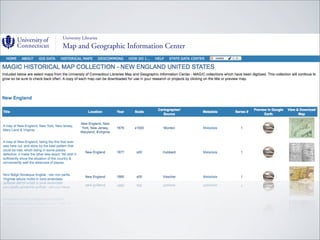
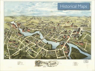
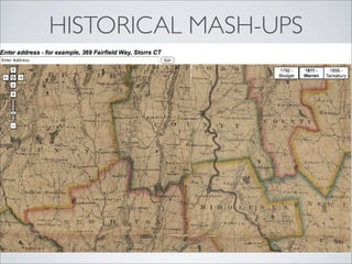
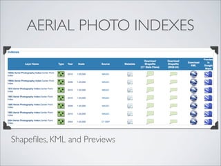
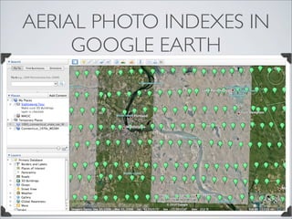
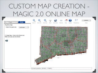
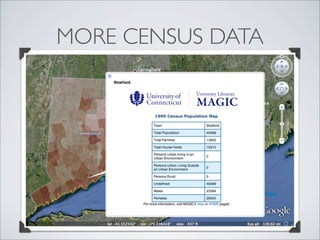
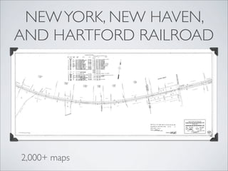
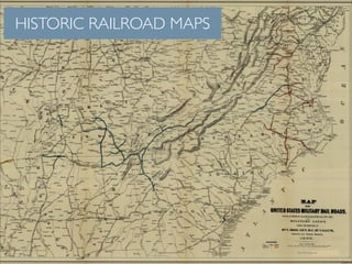
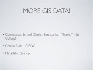
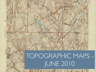
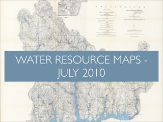
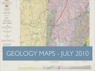
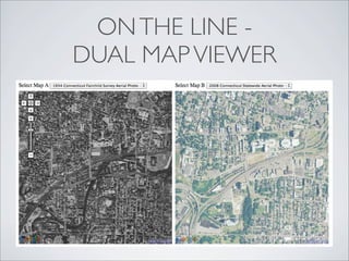
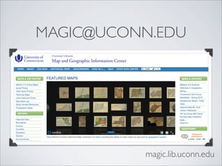
MAPS & GIS DATA FOR
21ST CENTURY RESEARCH
WHAT IS MAGIC?


• University
           of Connecticut Libraries Map and Geographic
 Information Center - MAGIC

• Collection   of over 200,000 print maps

• Providehistoric maps, aerial photos, topographic maps, and
 GIS data via the web at: magic.lib.uconn.edu
MAGIC’S MISSION...
To provide public access to GIS data, historical
maps and aerial photographs with a focus on
Connecticut and New England.
QUICK QUESTIONS


• What   do you use from MAGIC currently?


• What   would you like to see MAGIC offer in the future?
HISTORICAL MAPS
Historical Maps
MAGIC on Flickr
HISTORICAL MAP MASHUPS


• Historical   Maps overlaid on Google Maps interface

• 1934 Aerial    Photography

• USGS Topographic     Maps 1890s to present
HISTORICAL MASH-UPS
HISTORICAL AERIAL PHOTOS
AERIAL PHOTO INDEXES


Shapefiles, KML and Previews
AERIAL PHOTO INDEXES IN
     GOOGLE EARTH
WEB MAPPING SERVICE (WMS)
CUSTOM MAP CREATION -
 MAGIC 2.0 ONLINE MAP
GIS DATASETS
GIS DATASETS

• Provided in NAD 83 CT State Plane and WGS 1984
 projections as shapefiles

• KML   files - for use in Google Earth

• GIS   Dataset Previews - Using Google Maps

• FGDC    Metadata available
GIS DATA PREVIEWS


Preview in Google Maps
NEW CTSDC WEBSITE


With map friendly data (shapefiles & KML) coming soon!
AND COMING SOON...
MORE CENSUS DATA
NEW YORK, NEW HAVEN,
AND HARTFORD RAILROAD


2,000+ maps
HISTORIC RAILROAD MAPS
MORE GIS DATA!


• Connecticut   School District Boundaries - Thanks Trinity
 College!

• Census   Data - CtSDC

• Metadata   Cleanup
SUMMER @ MAGIC
RELEASE SCHEDULE
TOPOGRAPHIC MAPS -
    JUNE 2010
TOPOGRAPHIC MAPS -
    JUNE 2010
WATER RESOURCE MAPS -
      JULY 2010
GEOLOGY MAPS - JULY 2010
NEW YORK, NEW HAVEN, &
HARTFORD RAILROAD MAPS
       - JULY 2010
AERIAL PHOTOS -
 AUGUST 2010
HISTORICAL MAPS -
   AUGUST 2010
WHAT FORMATS?
FULL QUALITY TIFF IMAGES
GEOREFERENCED MAPS -
  WHEN AVAILABLE
EXCITED YET?
THERE’S MORE COMING!
MAP OF THE WEEK FEATURES


Outsidetheneatline.blogspot.com
SAMPLE “GEO” CLASSROOM
          ACTIVITIES


• Mash-ups   for classroom use

• Maps   & Dataset collections
IMPROVED MAP MASH-UPS

            Searchable

              Download Images

                    Multiple Years
MAGIC WORKSHOPS!

• Mash-ups   Basics & Advanced
 Features

• Making   Maps for Presentations

• Transforming   Data into Maps

• And   more!
HOW TO VIDEOS


• Videos   on how to create mash-ups

• Add   MAGIC data to your own research

• Creating   mash-ups from MAGIC’s data

• And   More!
PROJECTS IN DEVELOPMENT
NEH GRANT

• Collaboration   with Jack Dougherty of Trinity College

• Hartford Area   Maps and GIS data to be added to MAGIC

• More   Map Mash-ups

• $100,800   NEH Collaborative grant!

• Started   June 1, 2010
ON THE LINE -
DUAL MAP VIEWER
GIS SERVER


• Improved    quality for WMS images

• Streamline   internal workflow at MAGIC

• Increase   access to MAGIC historical maps and geospatial data
LET’S EXPLORE!
MAGIC@UCONN.EDU


          magic.lib.uconn.edu
SPECIAL THANKS TO
•   Jack Dougherty at Trinity College

•   CT DEP - Kevin O’Brien & Howie Sternberg

•   Bill Miller, Cary Lynch, Doug Sands, Jeff Dunn, Josh Strunk, Chelsea
    Leiper, Tia Hogan, Tom Barchant and the rest of the MAGIC crew!

•   Tony Molloy, Robert Swanson, Rick O’Toole, Dave Hicking, and
    Raul Potenciano from UConn Libraries IT

•   Undergraduate Education Team, Susanna Cowan, Scott Kennedy,
    Brinley Franklin and the entire UConn LIbraries Staff

•   And you!
QUESTIONS?

Map and GIS Data for 21st Century Research