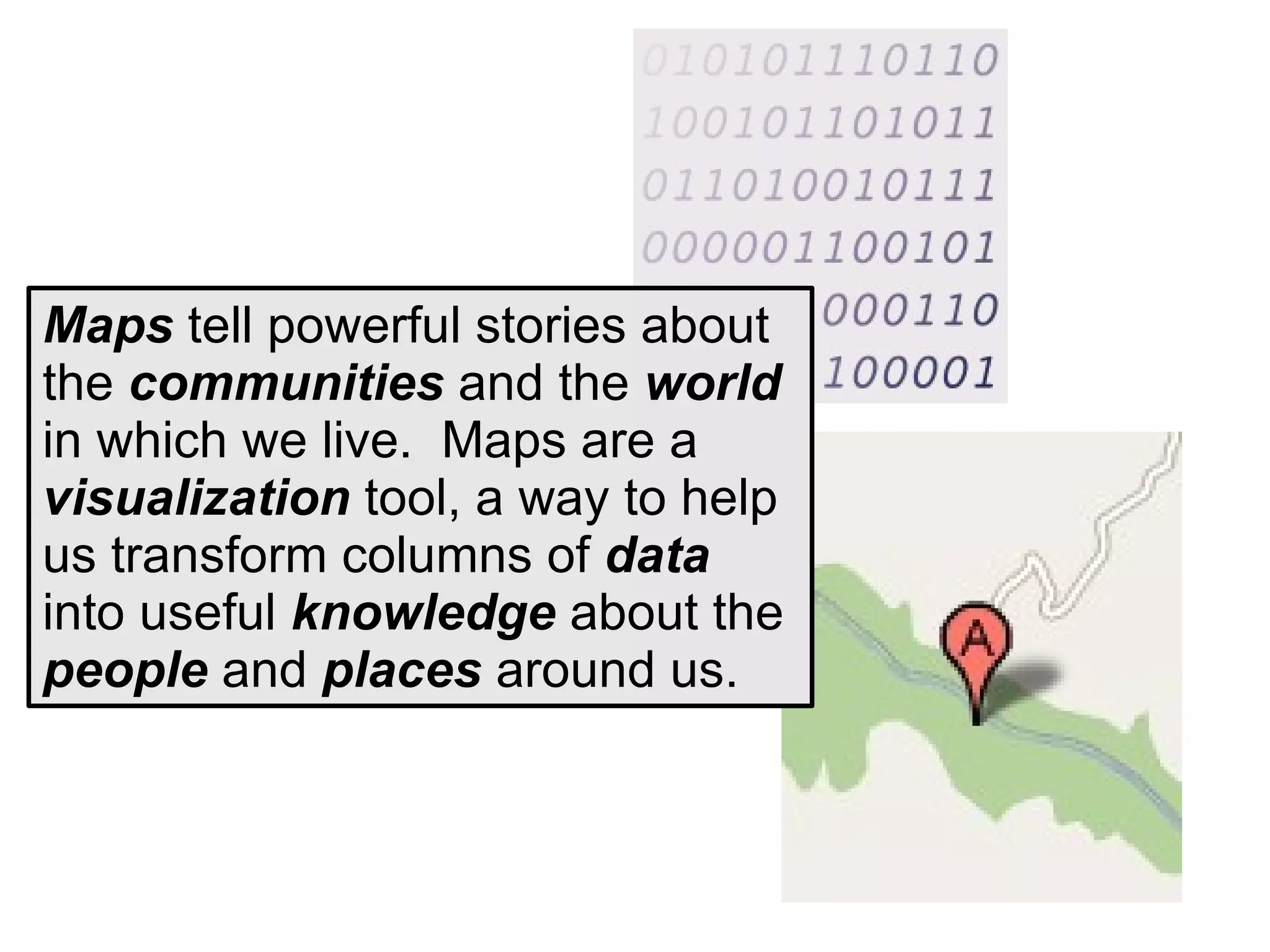
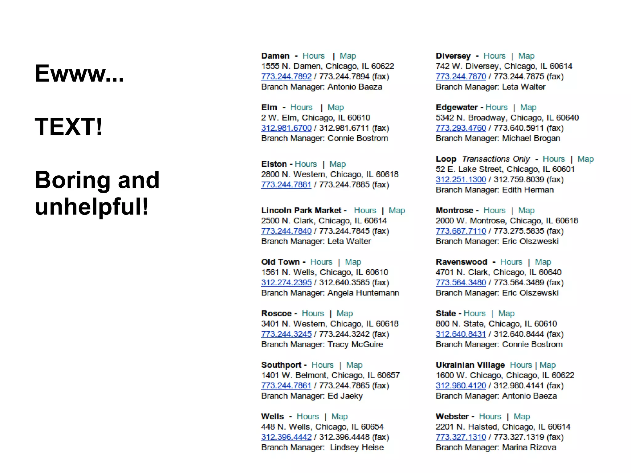
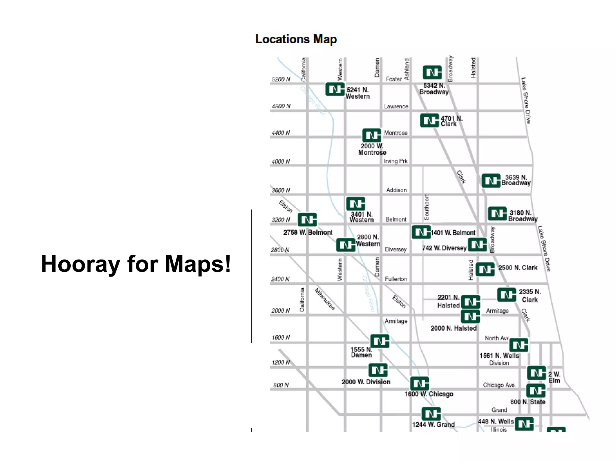
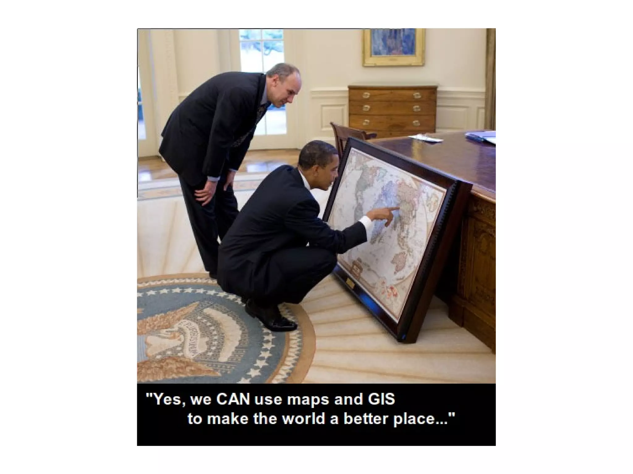
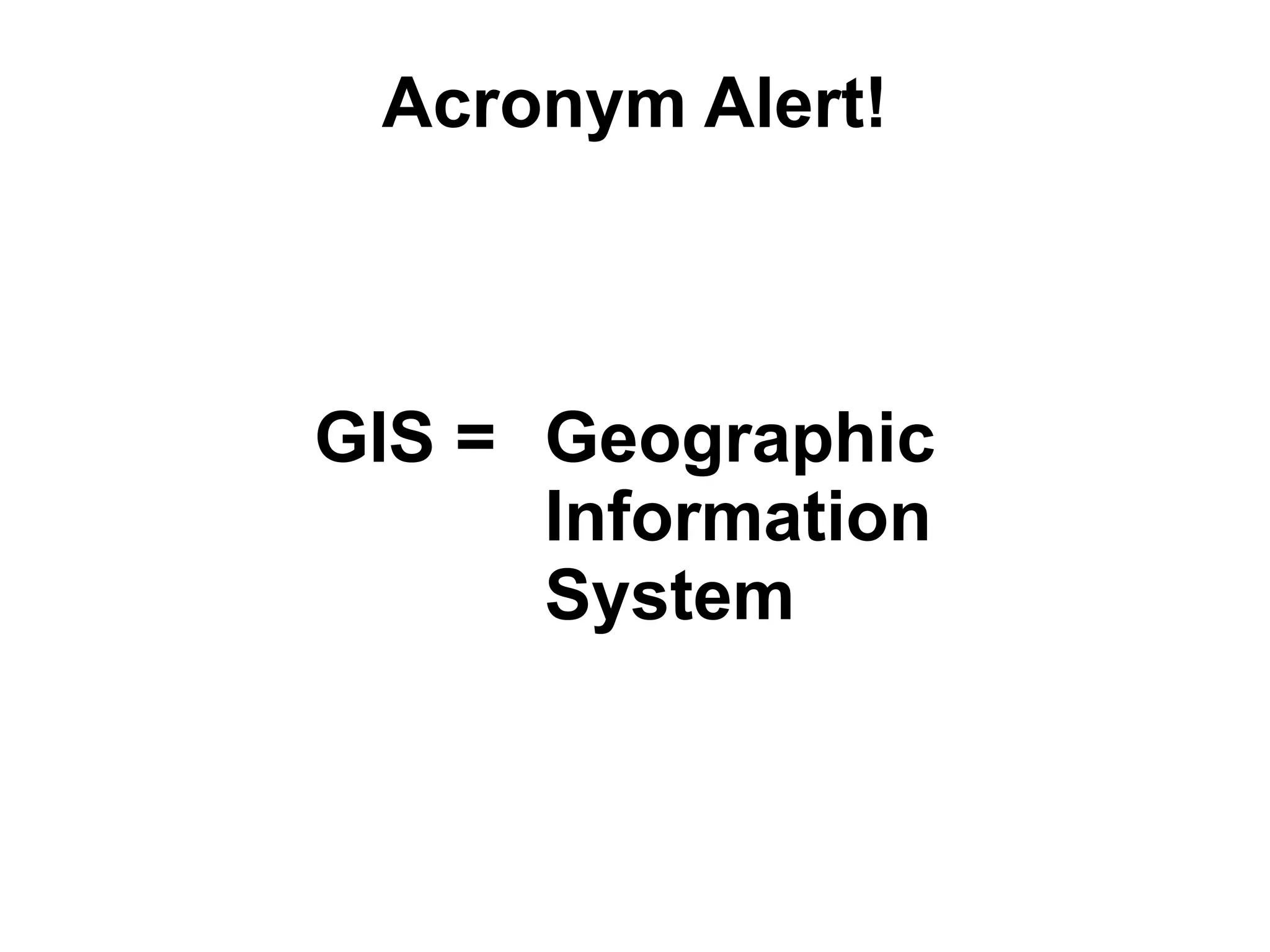
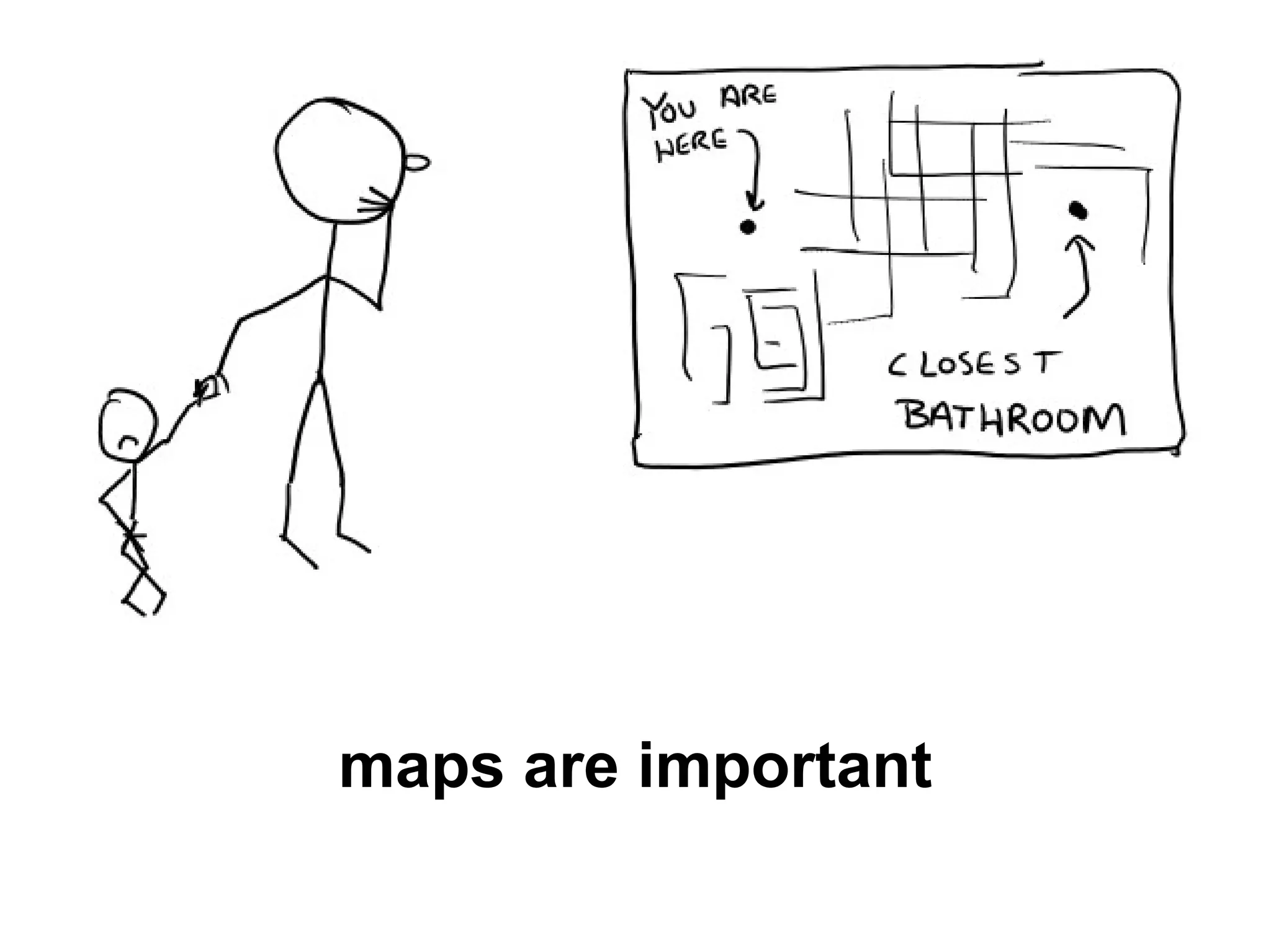
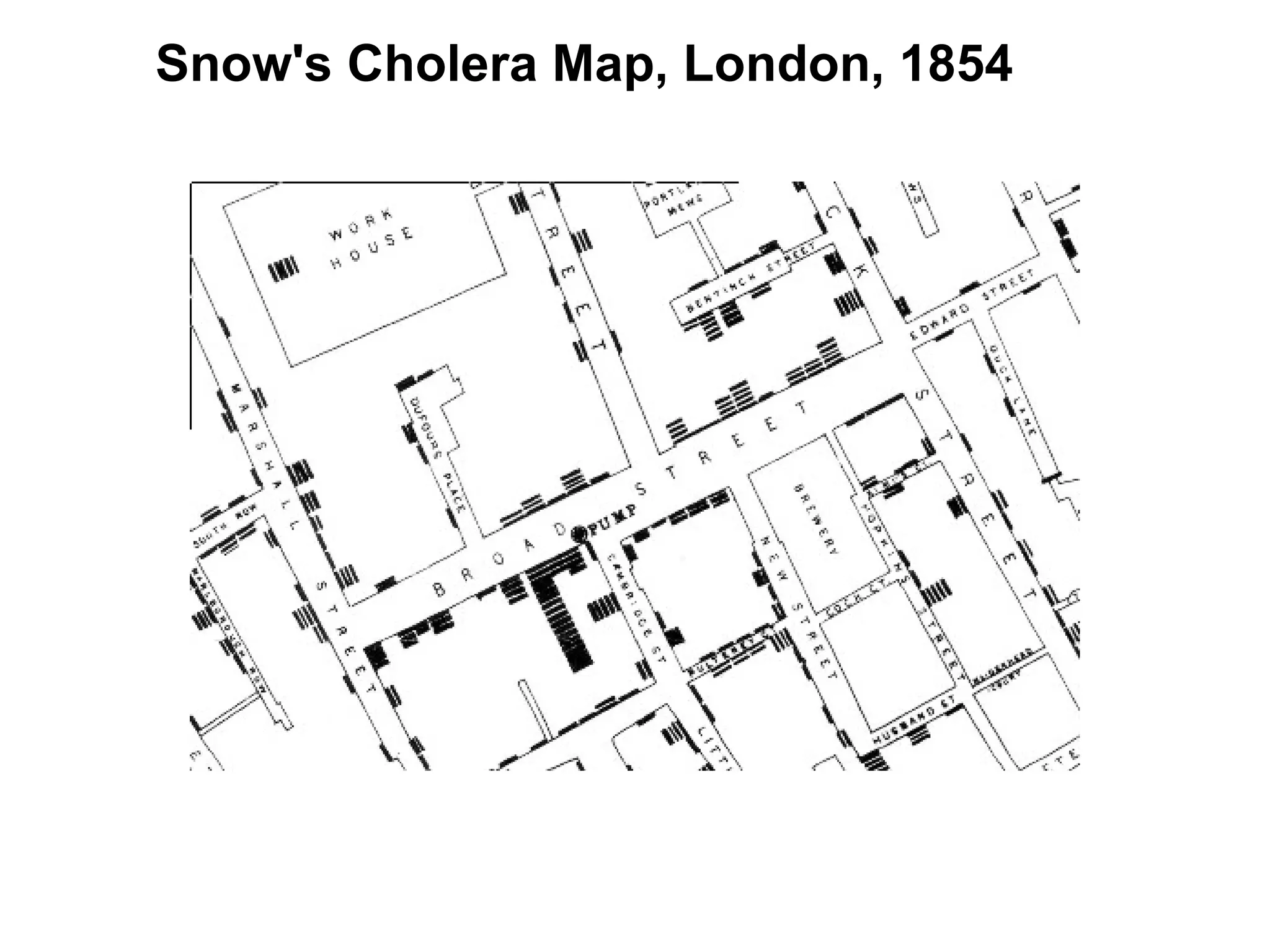
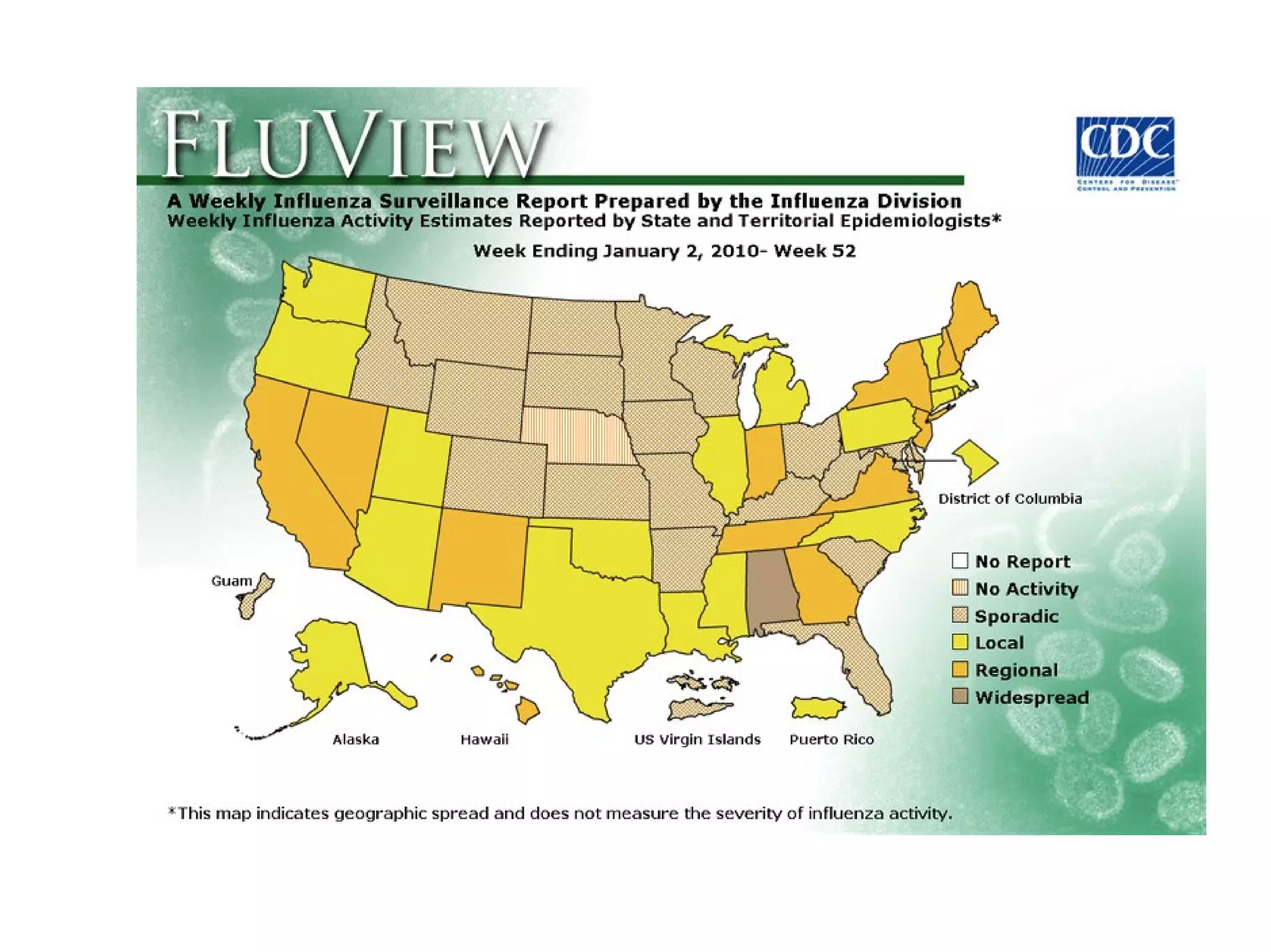
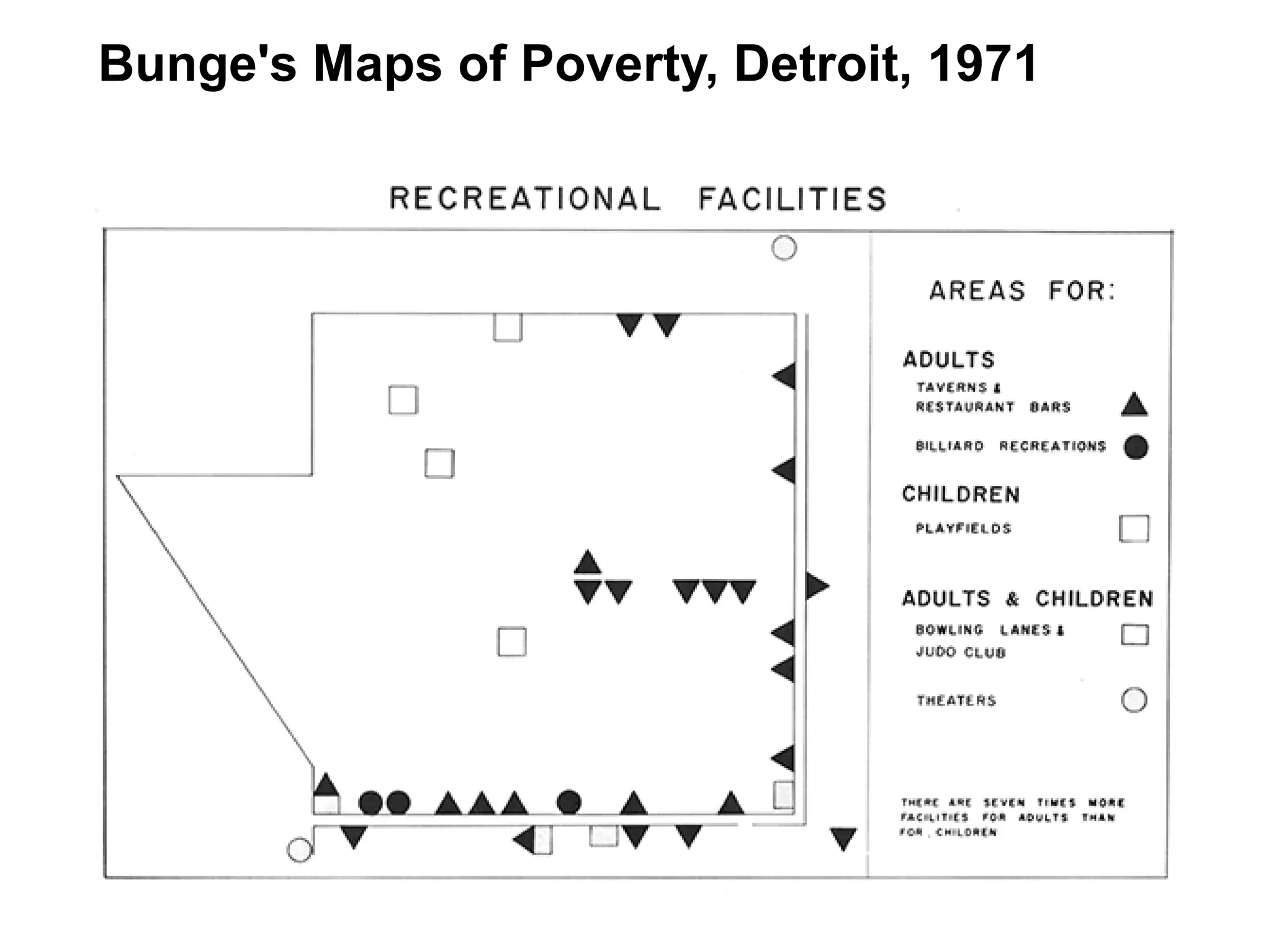
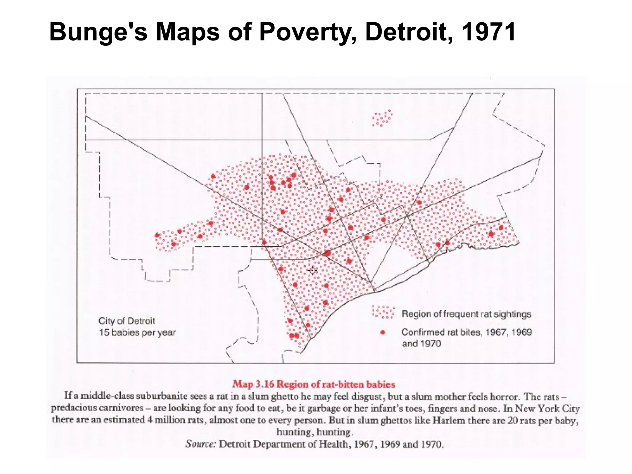
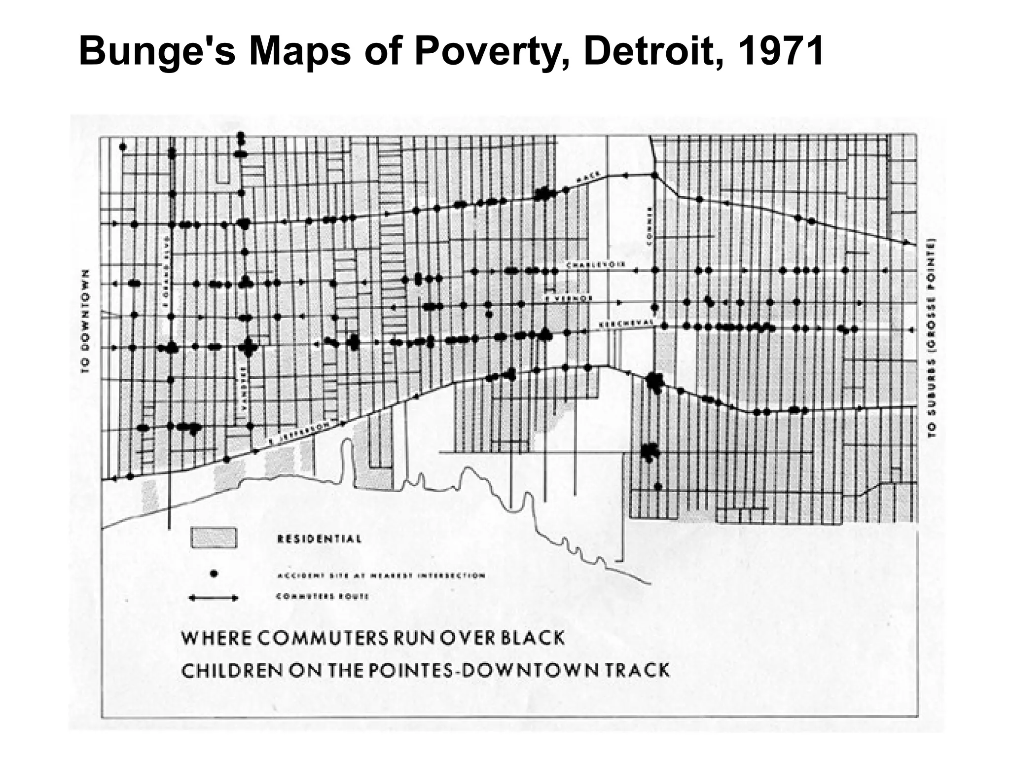
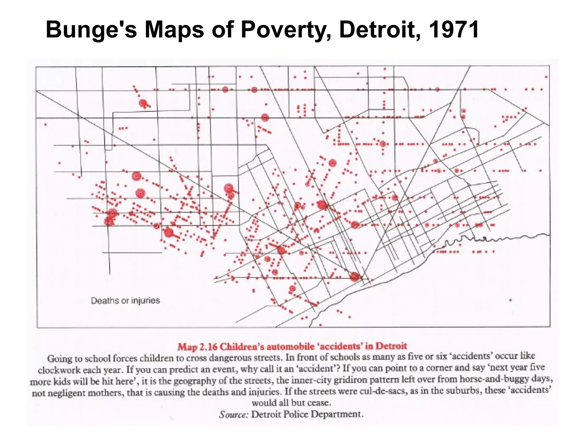
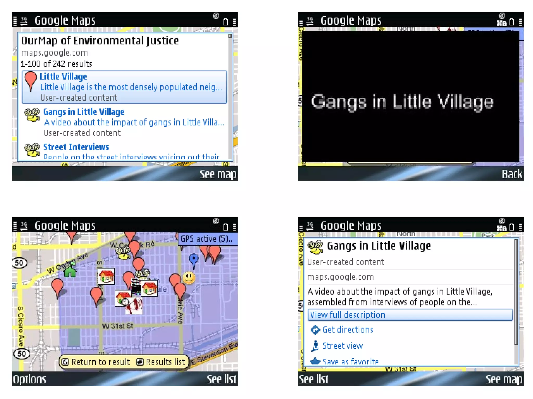
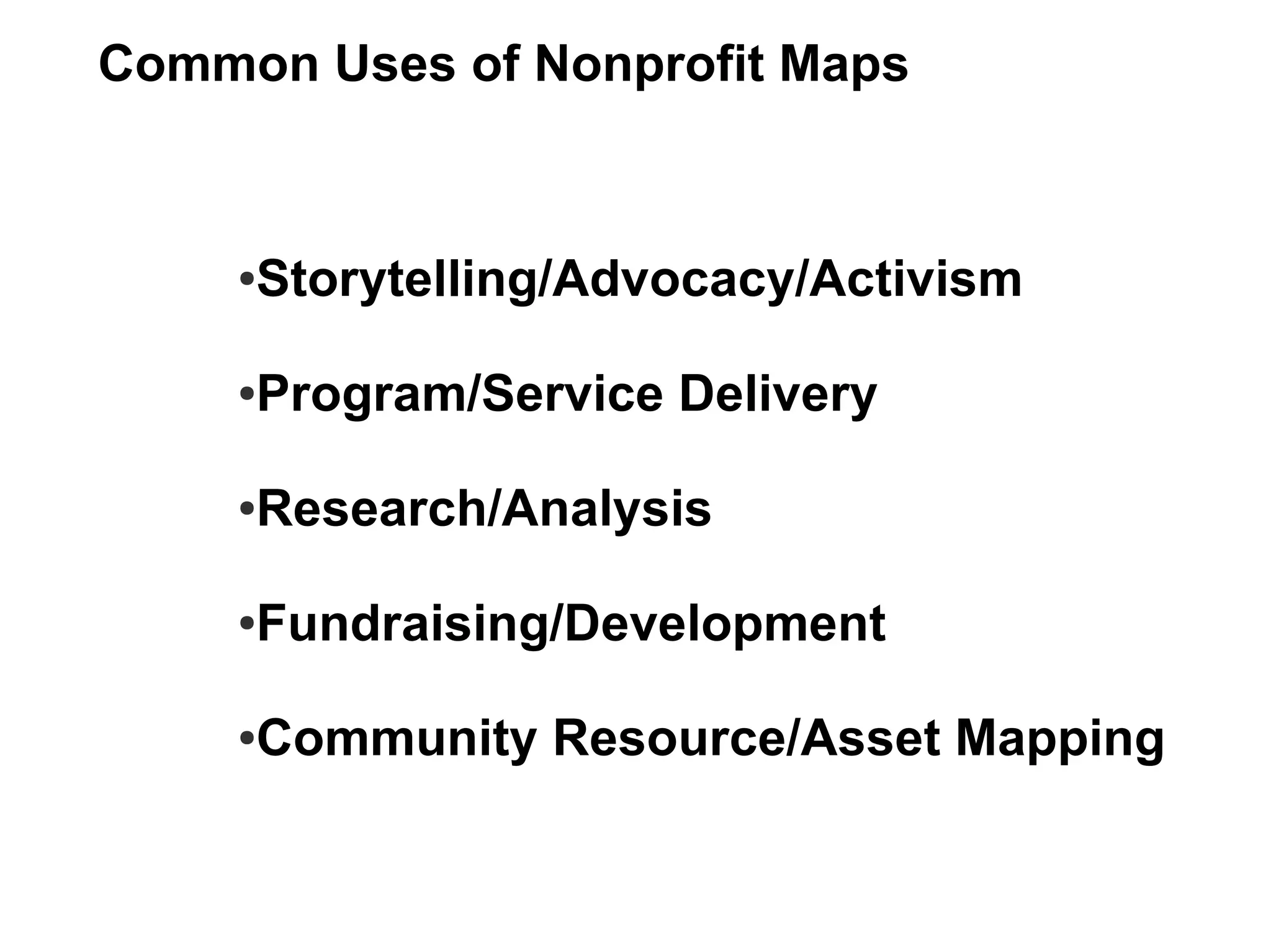
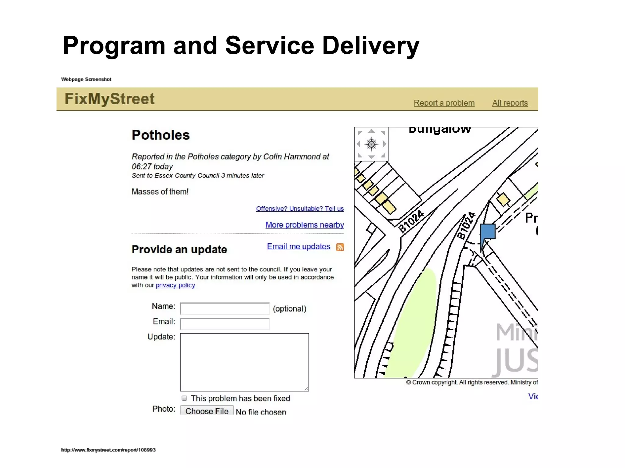
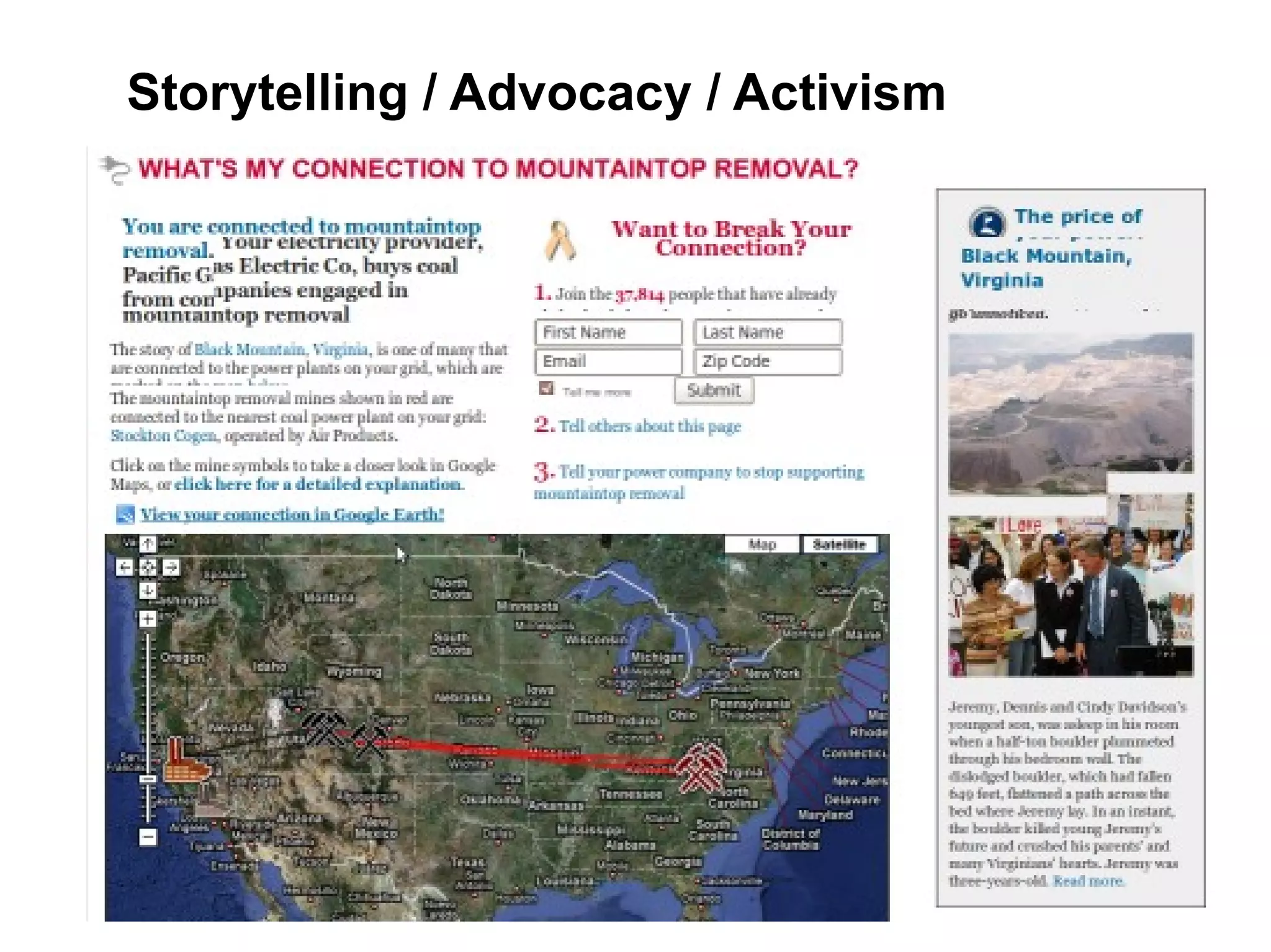
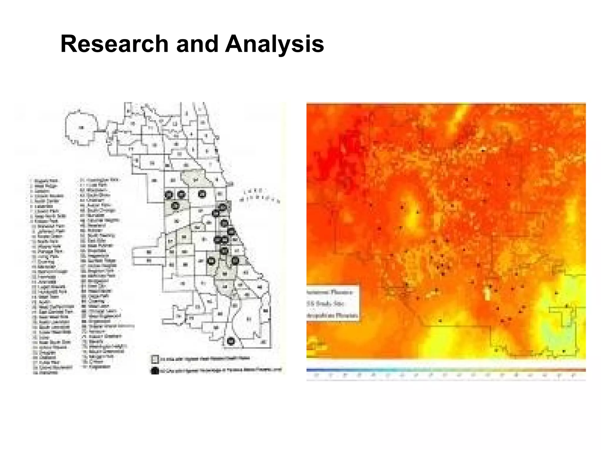
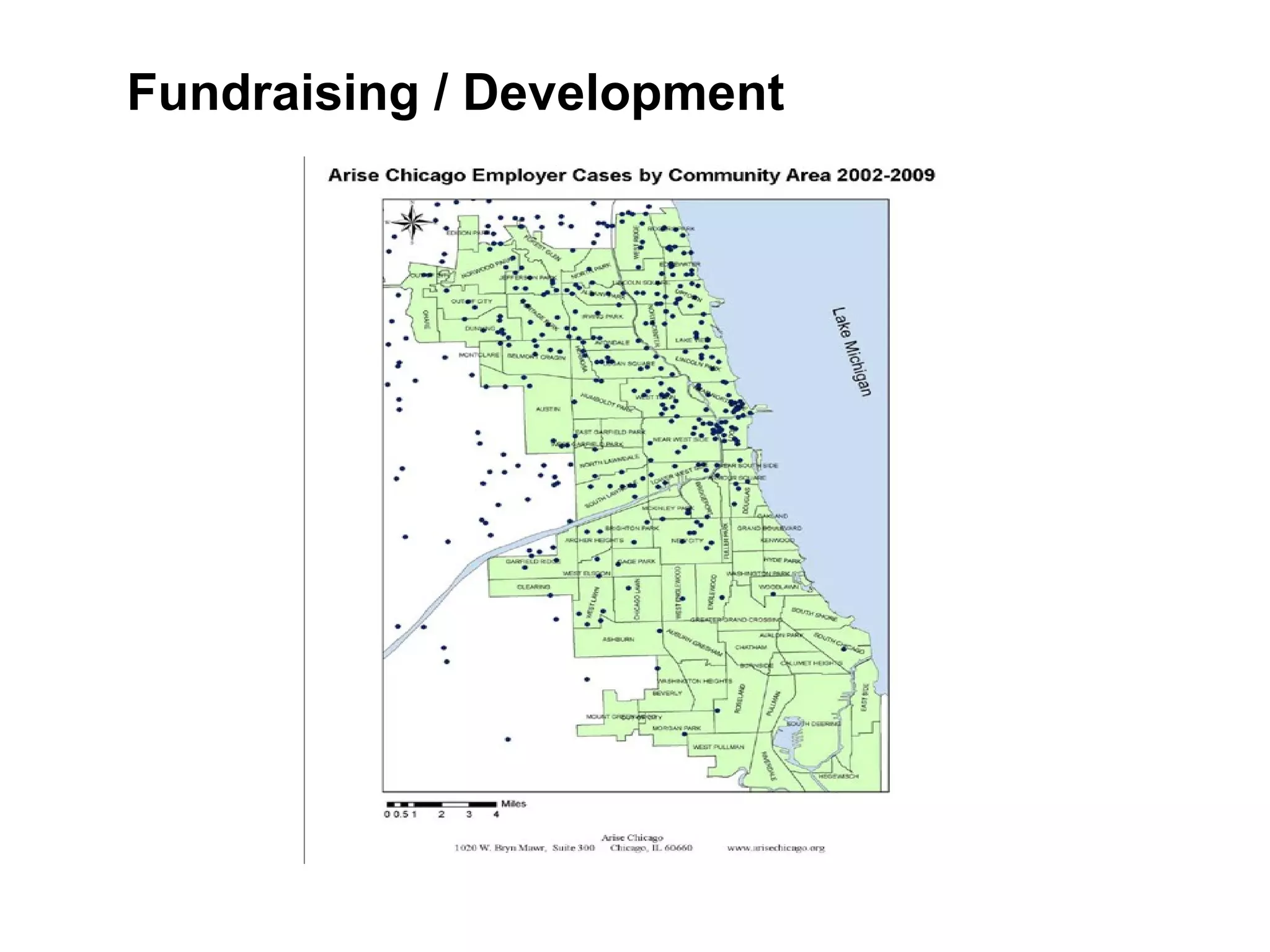
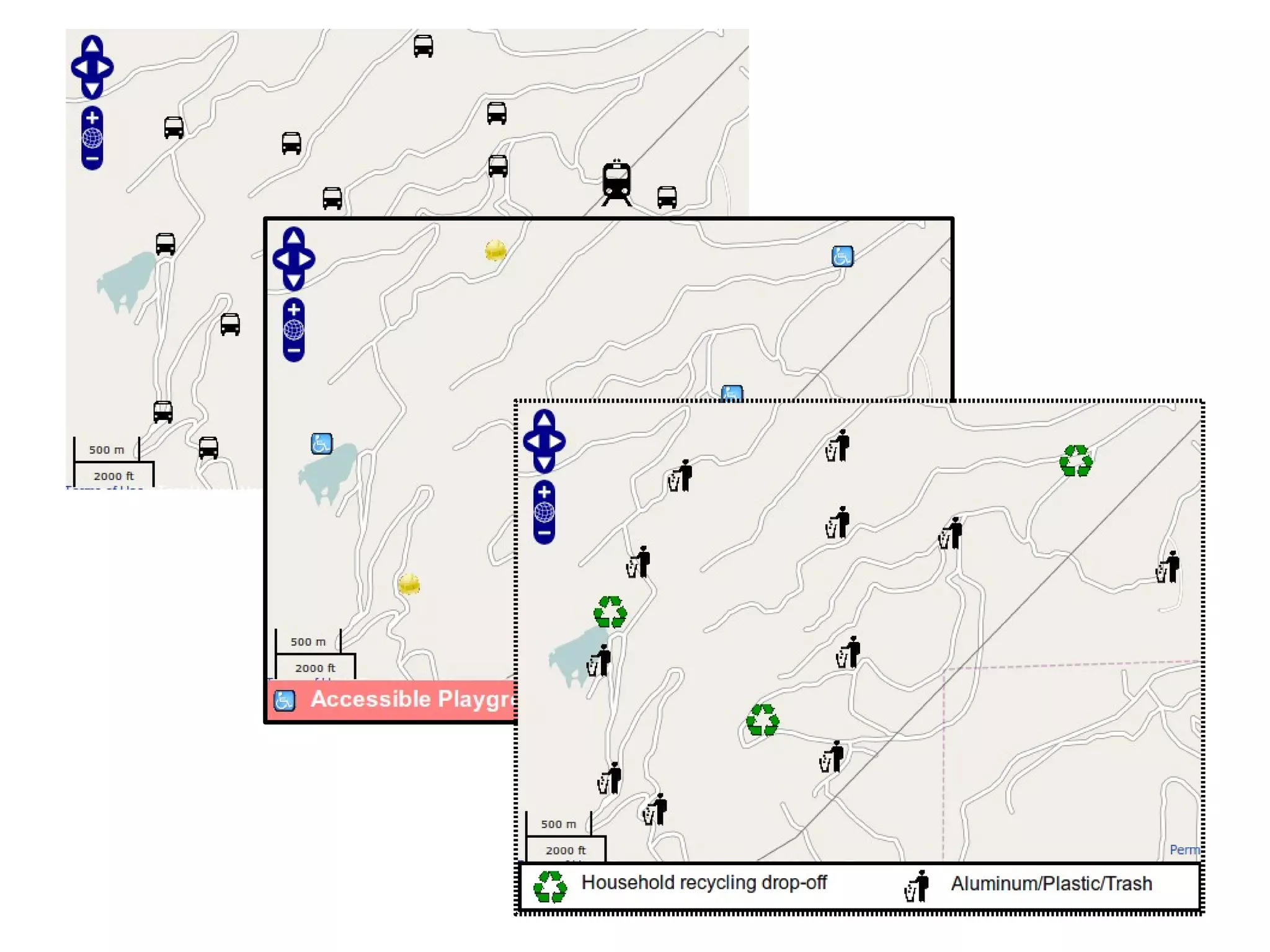
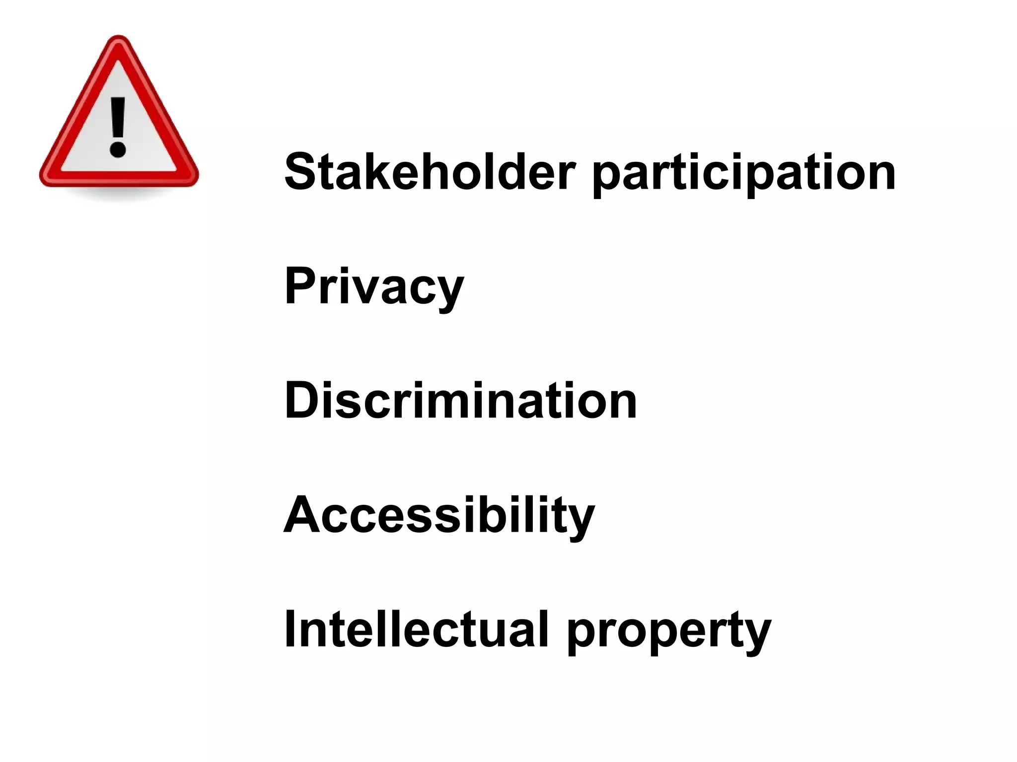
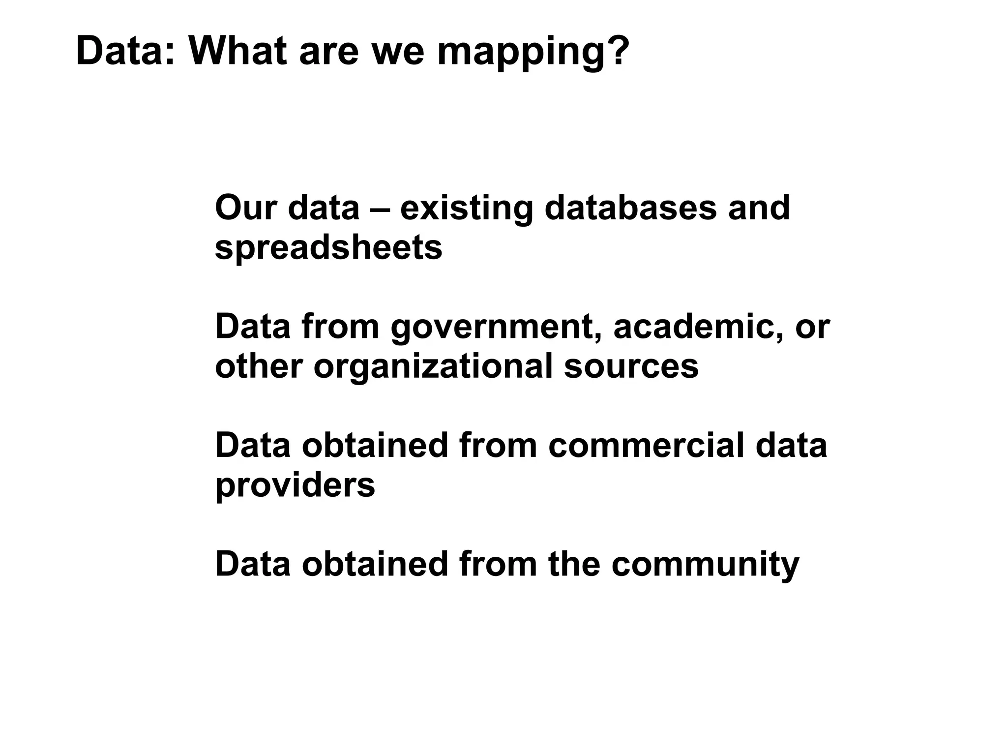
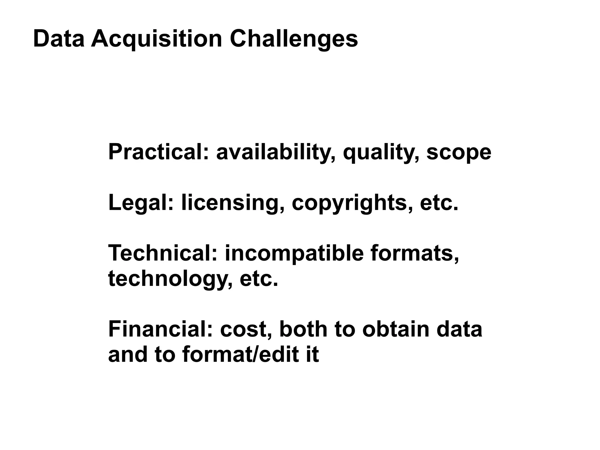
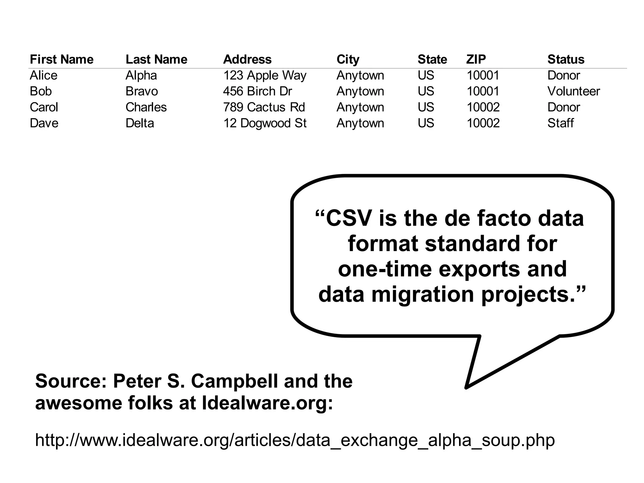
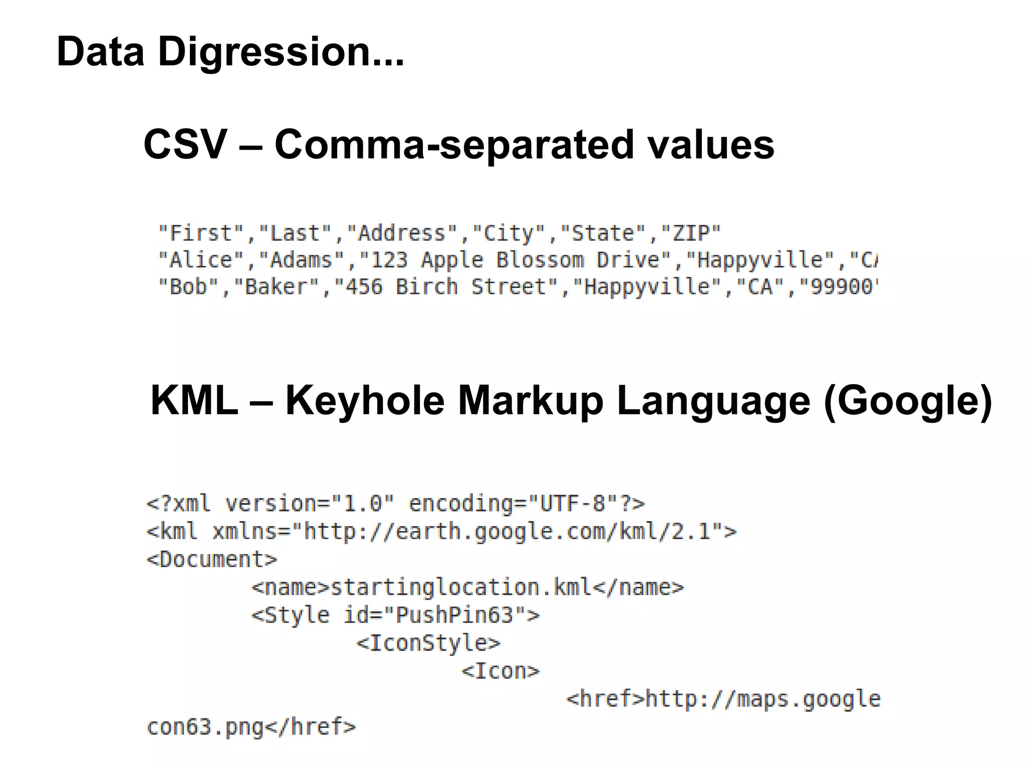
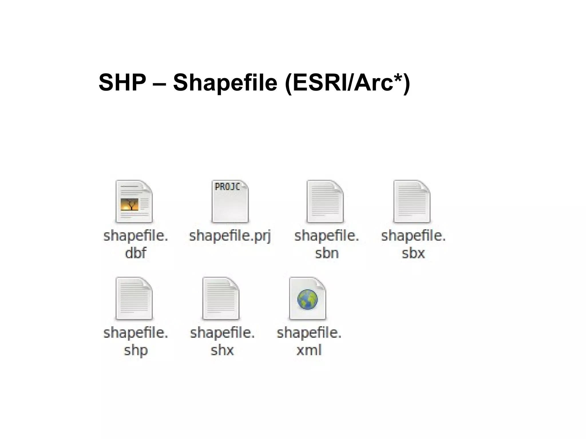
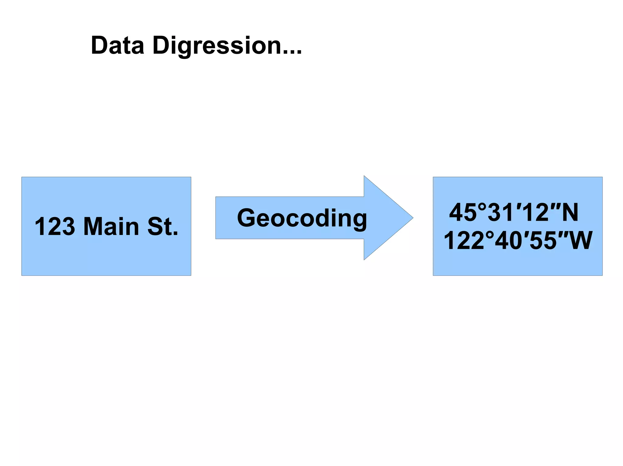
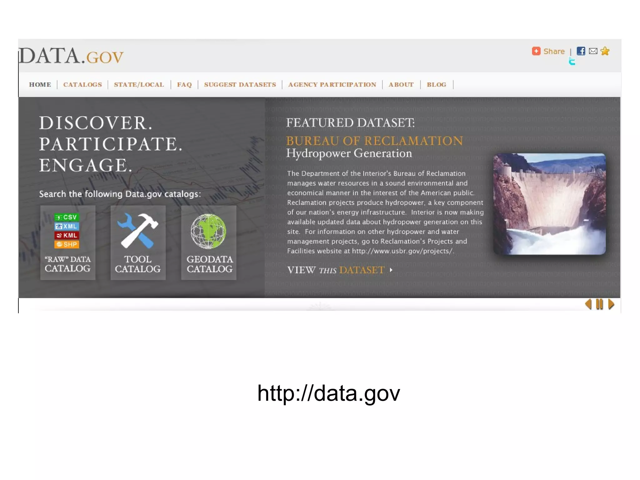
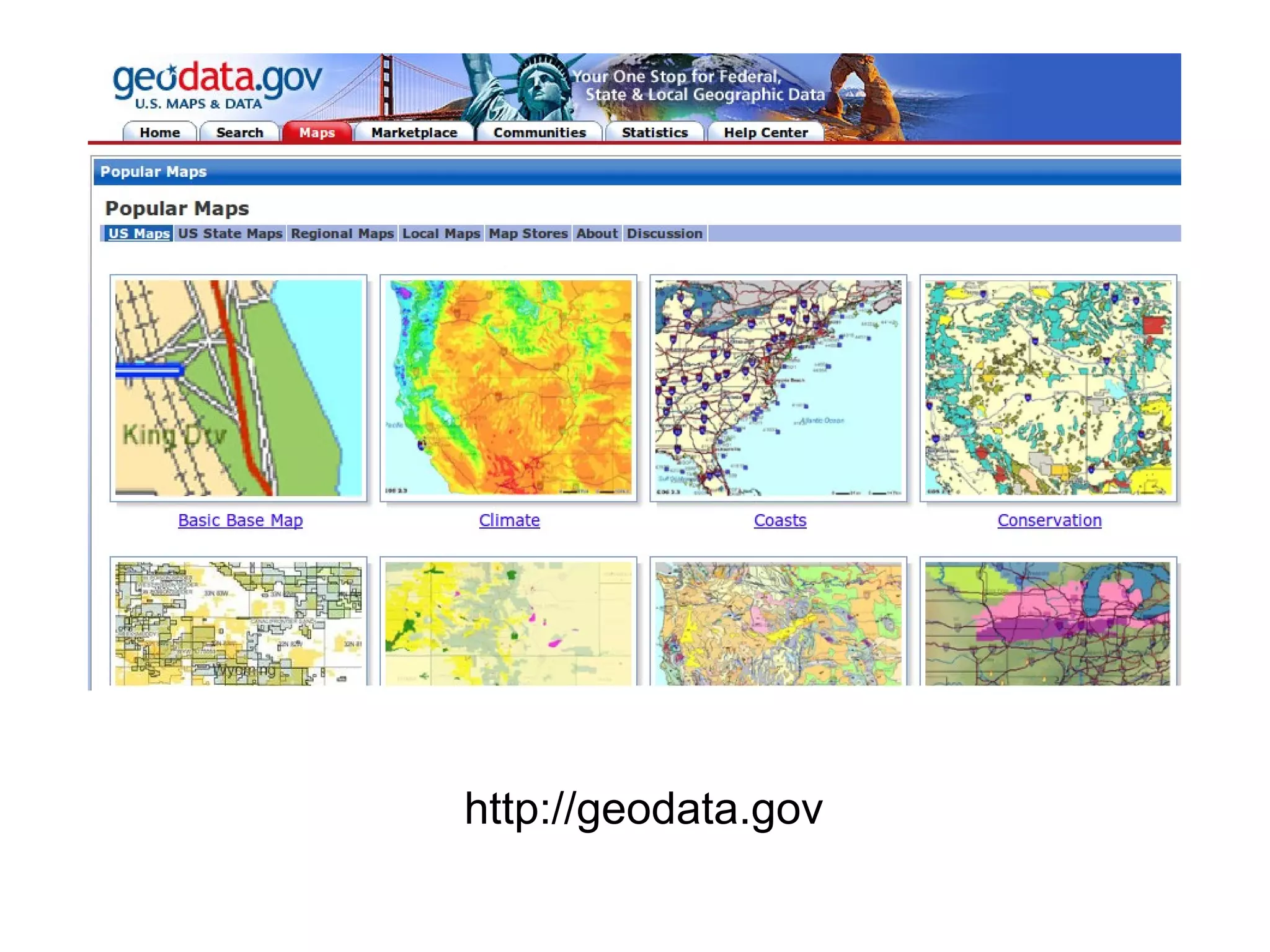
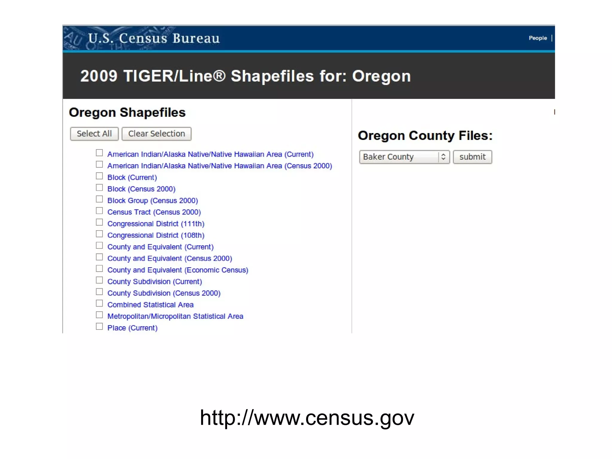
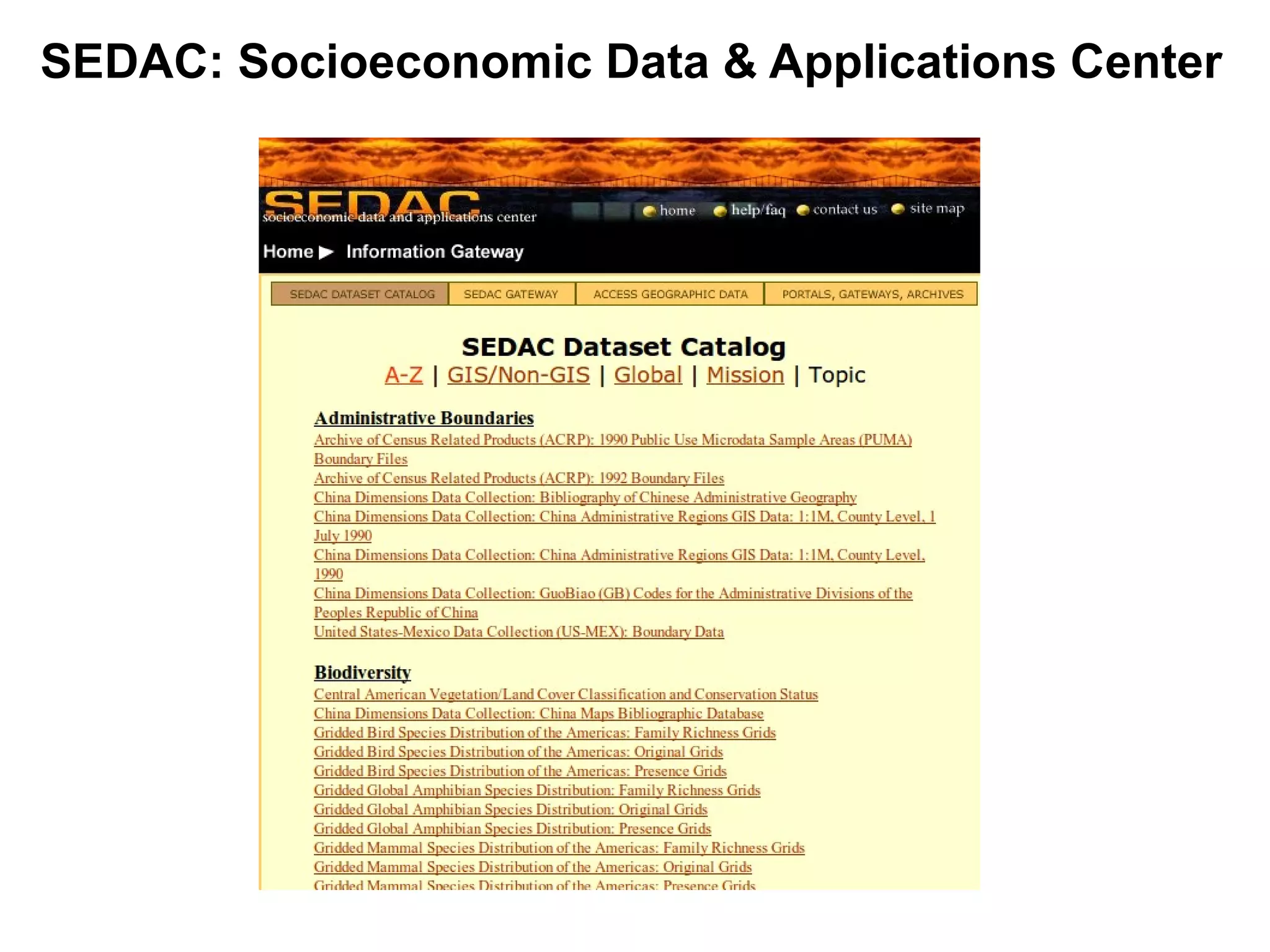
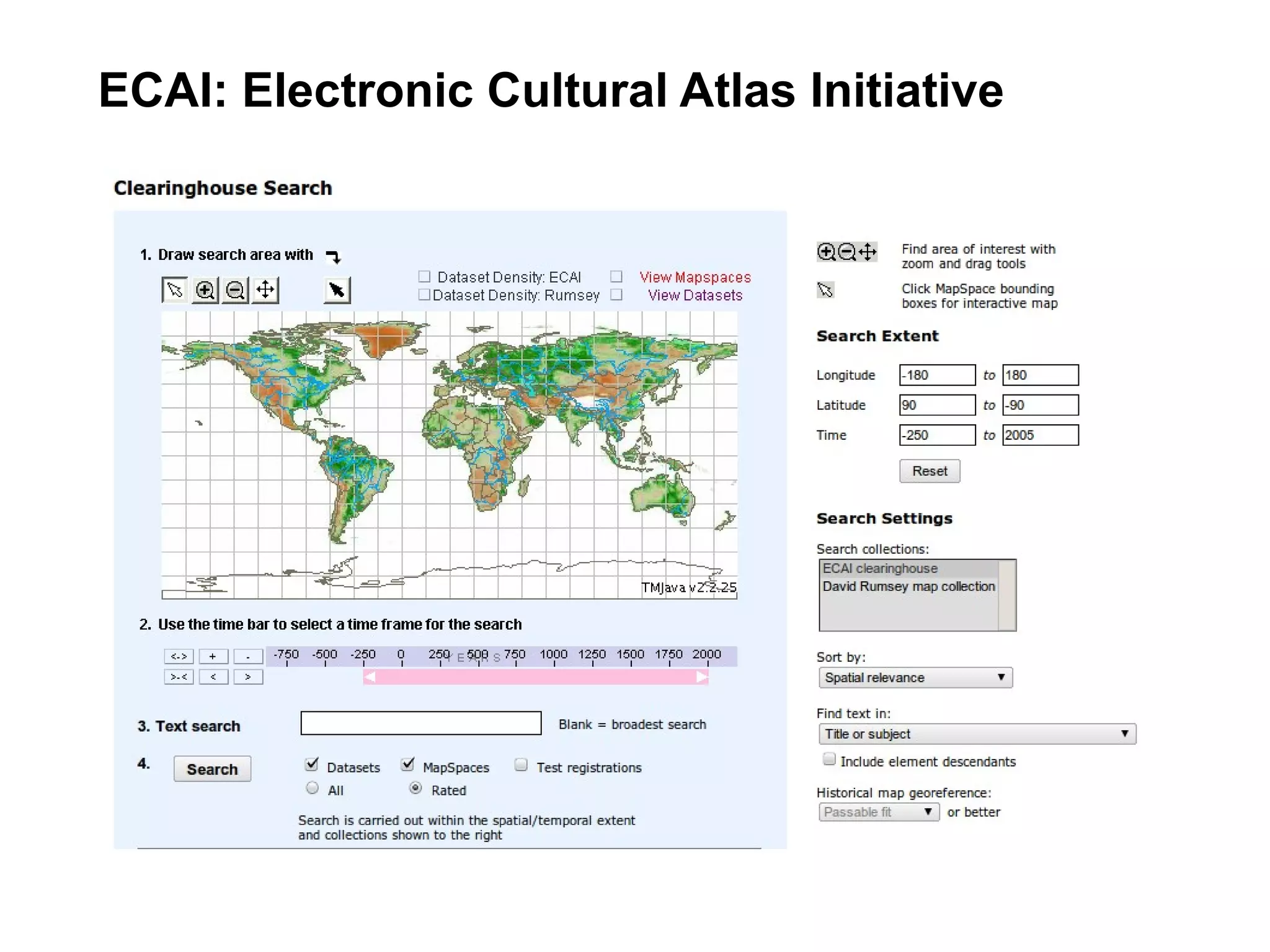
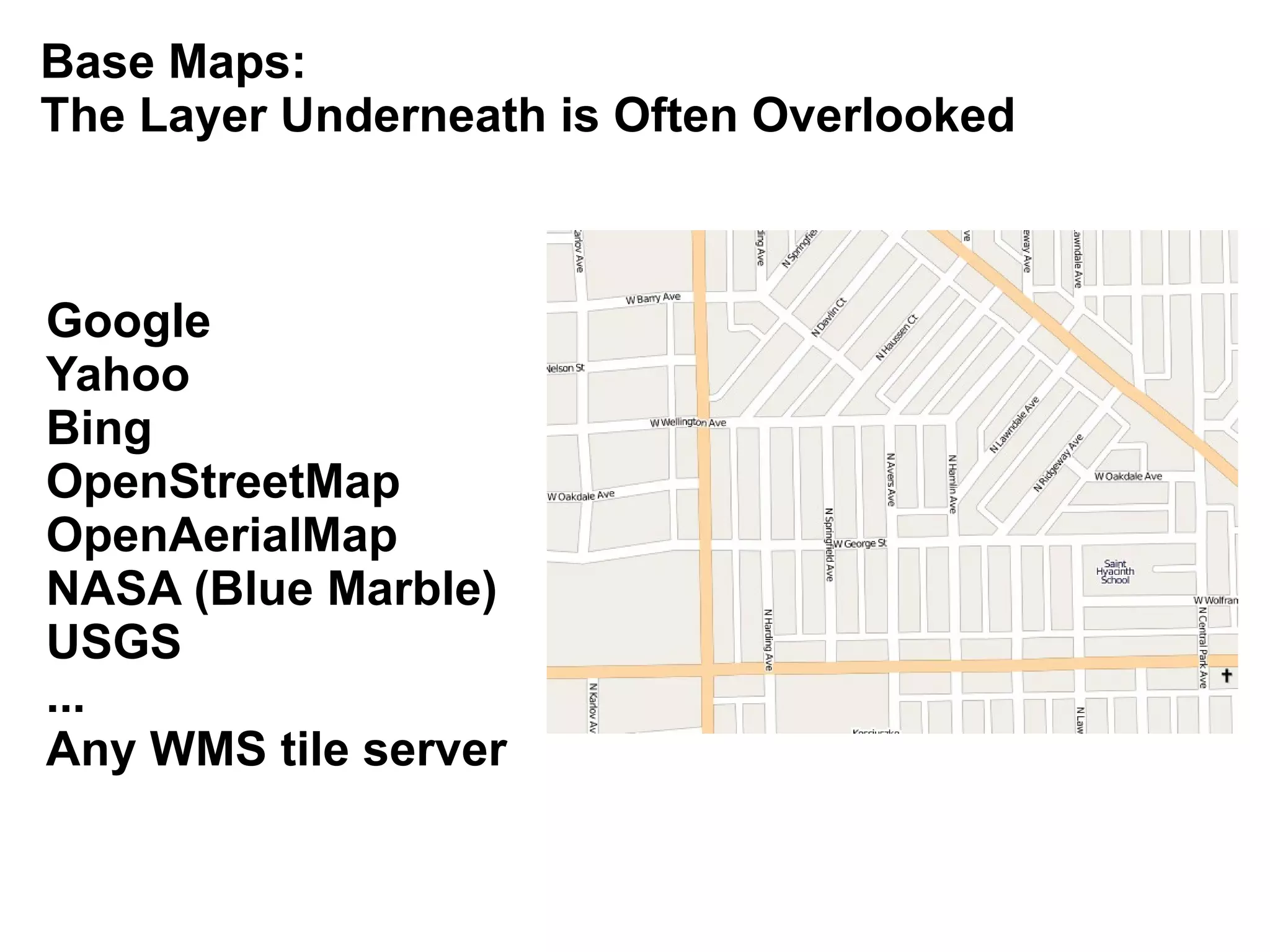
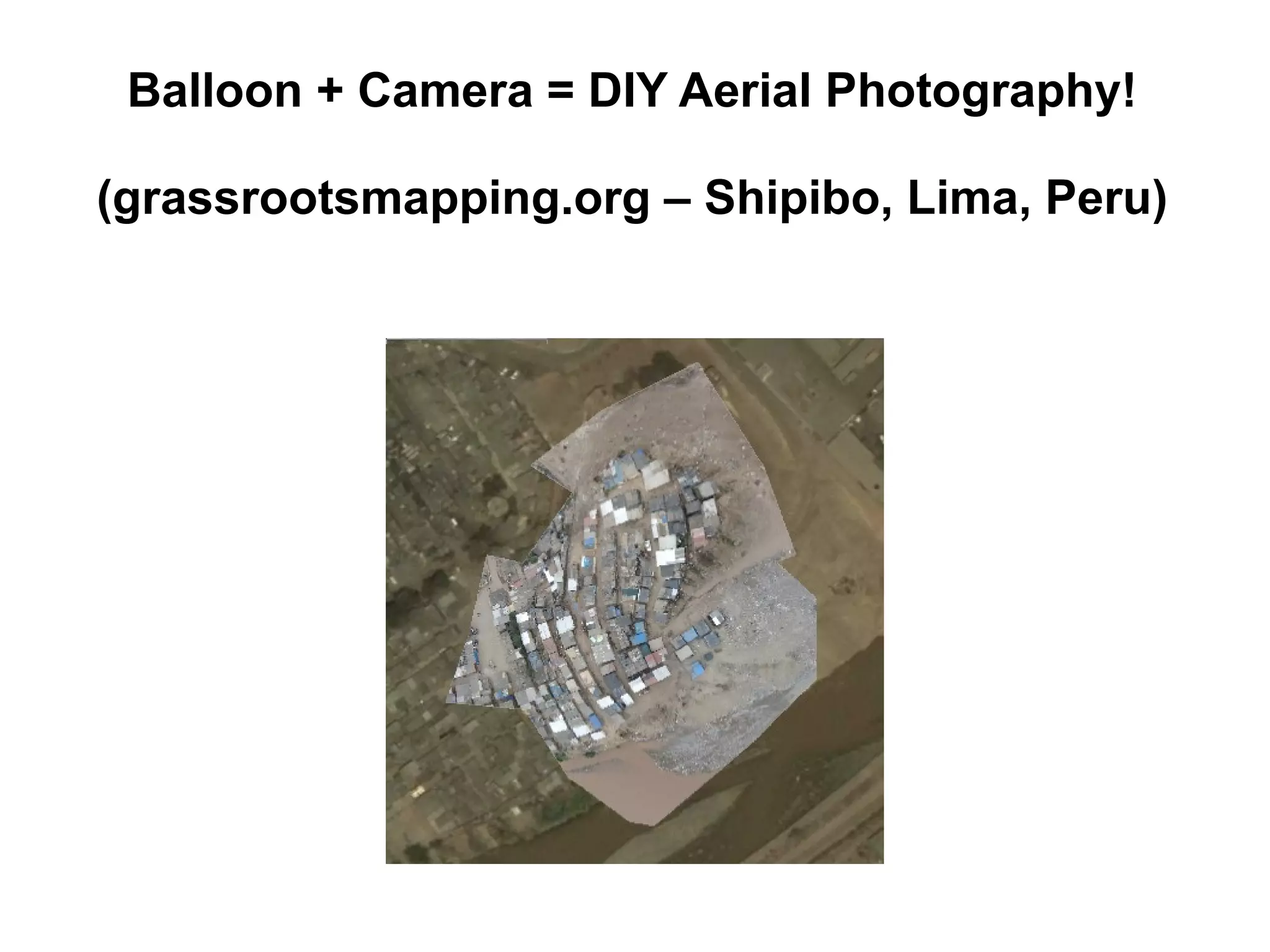
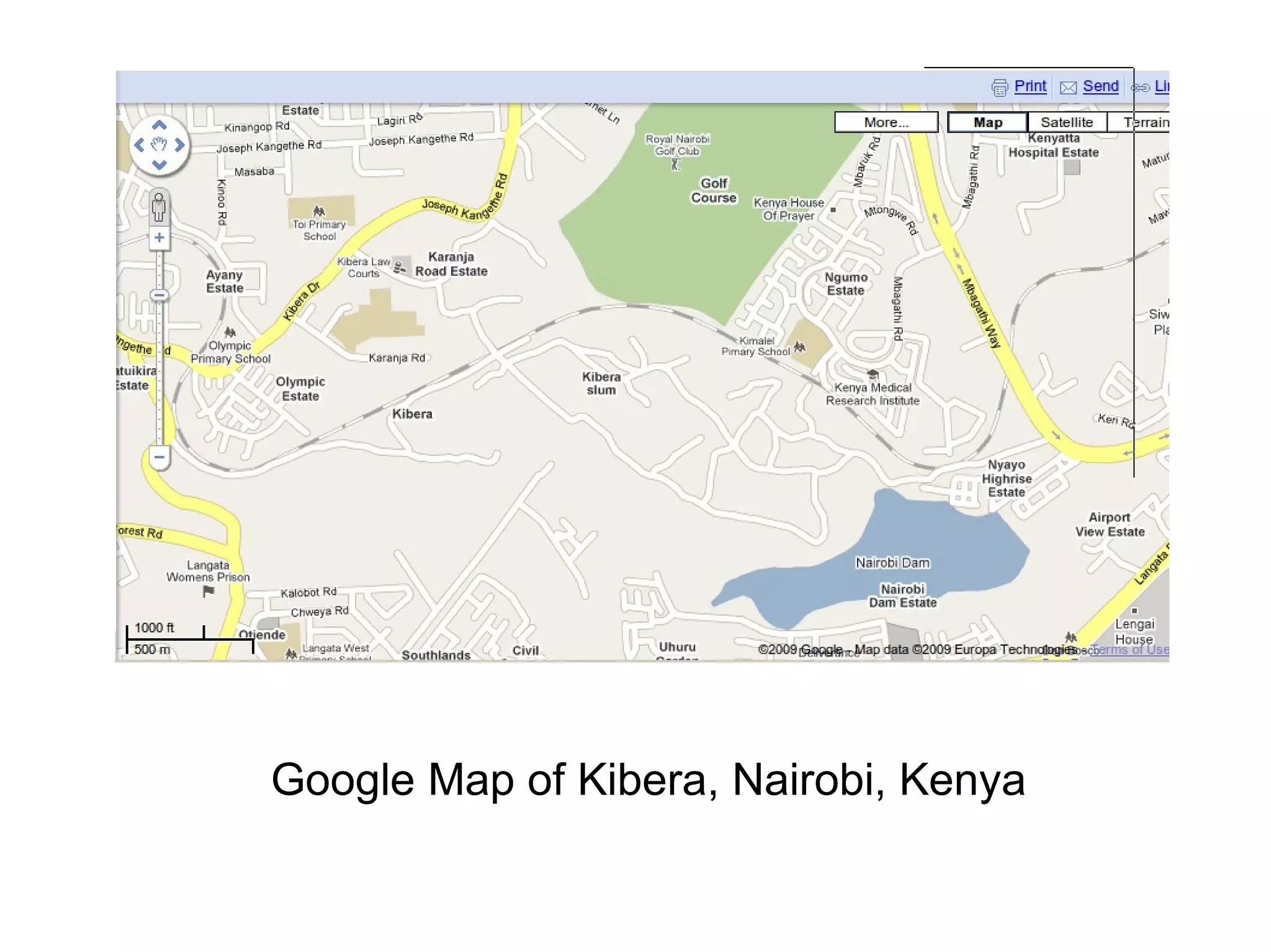
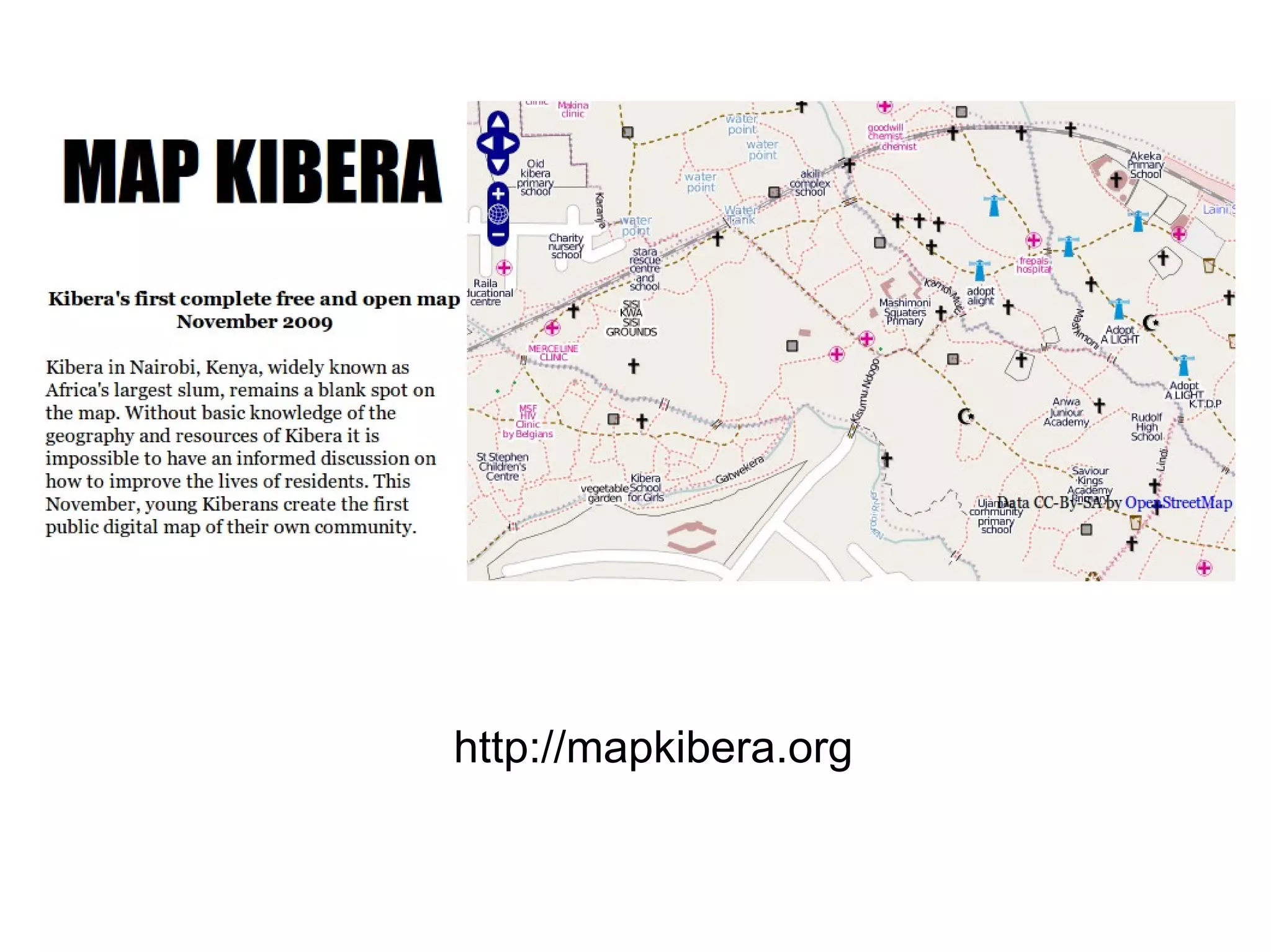
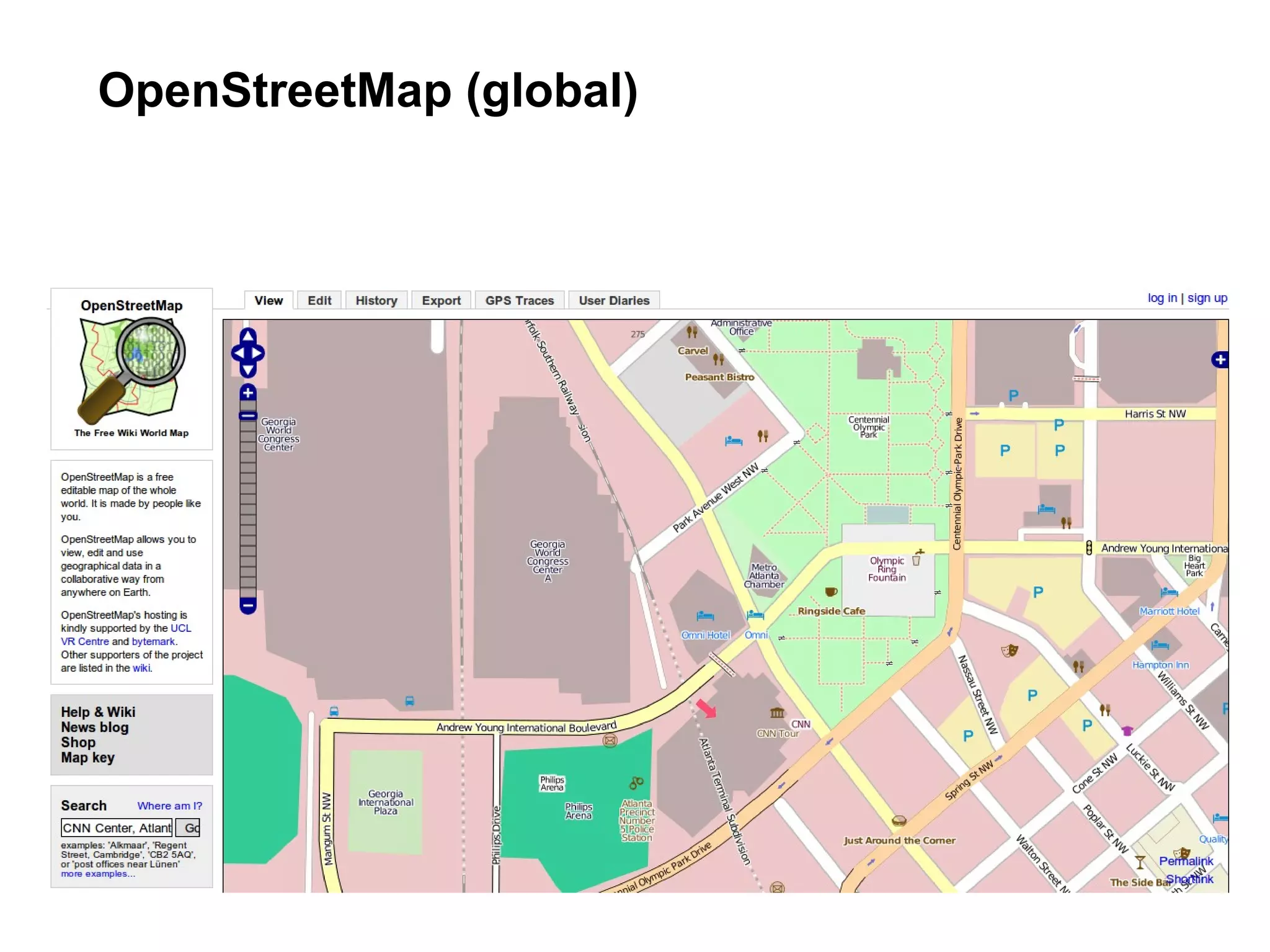
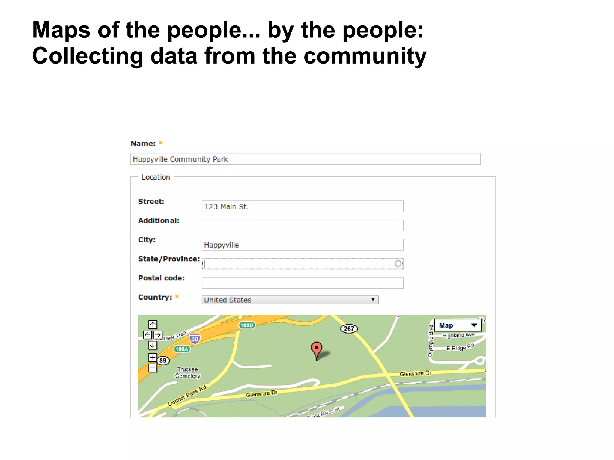
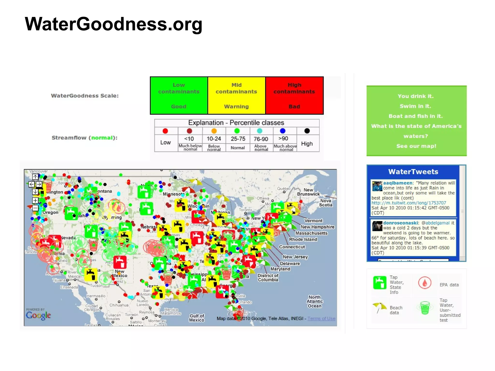
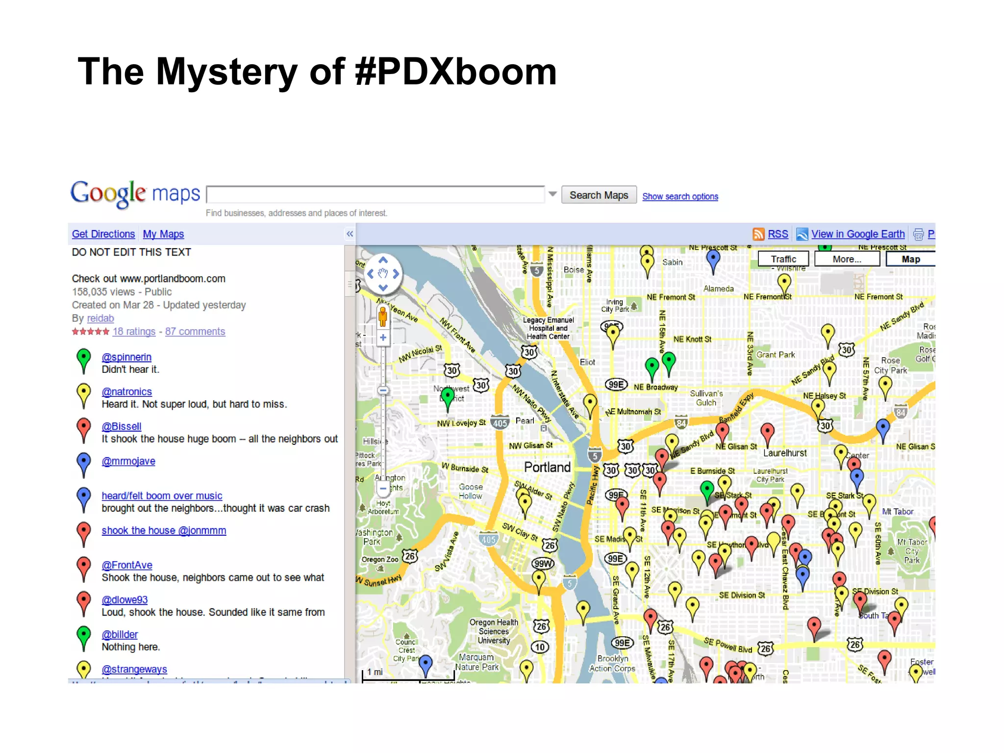
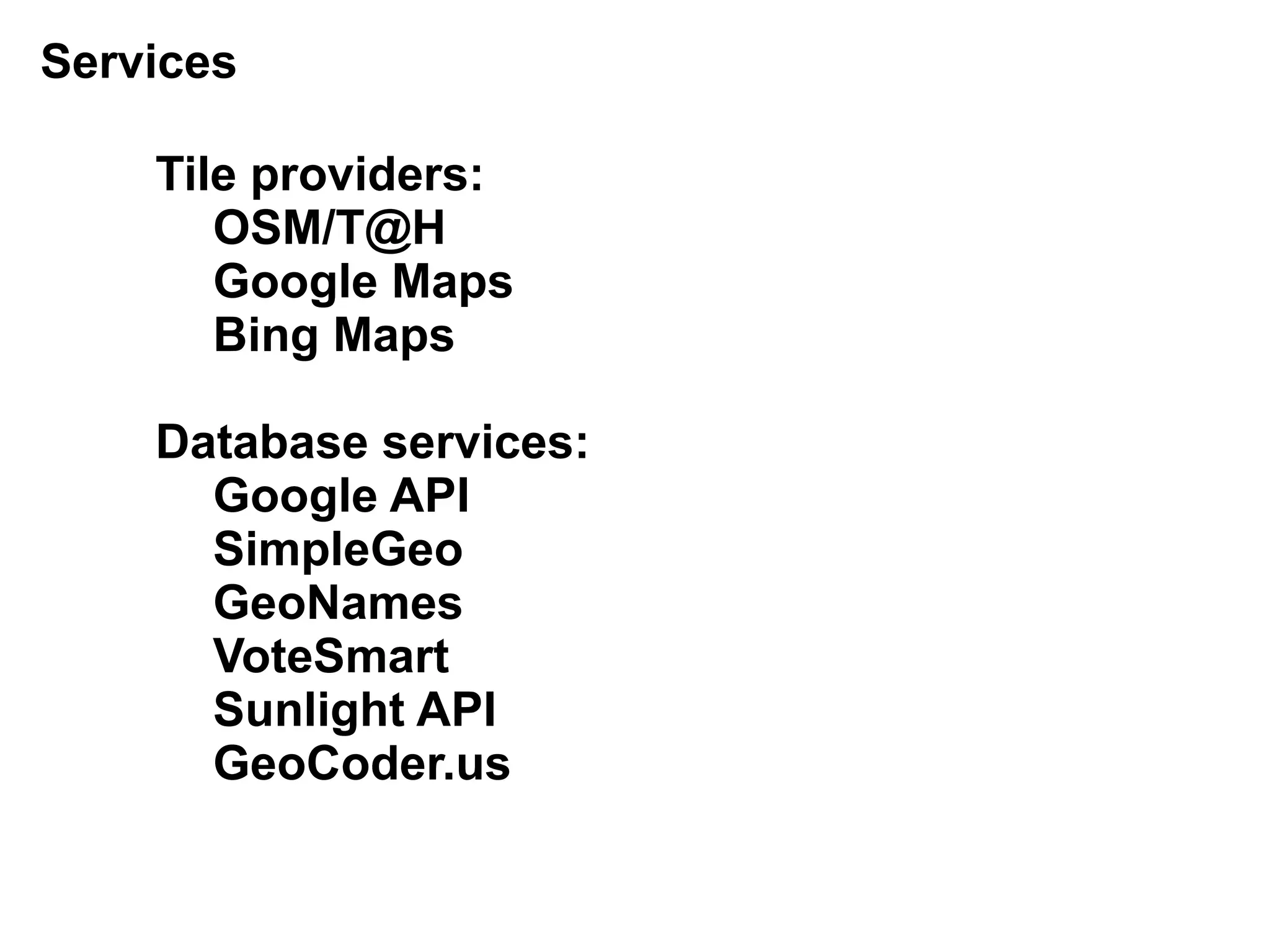
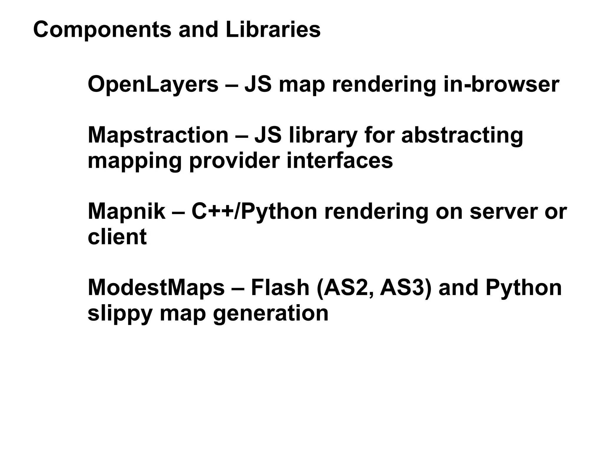
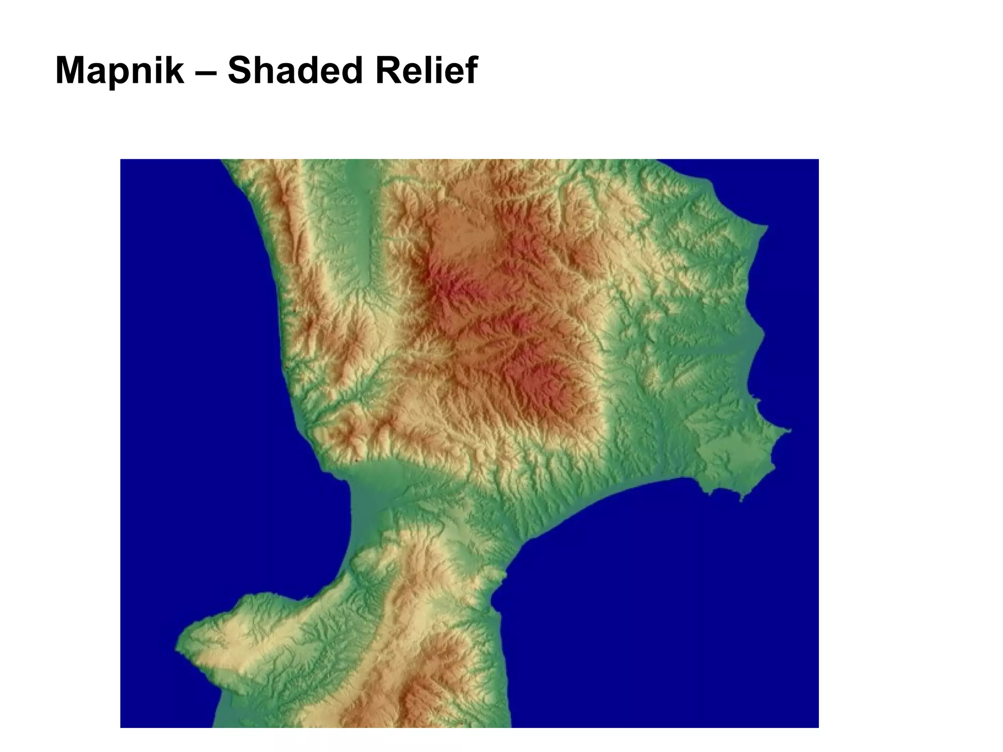
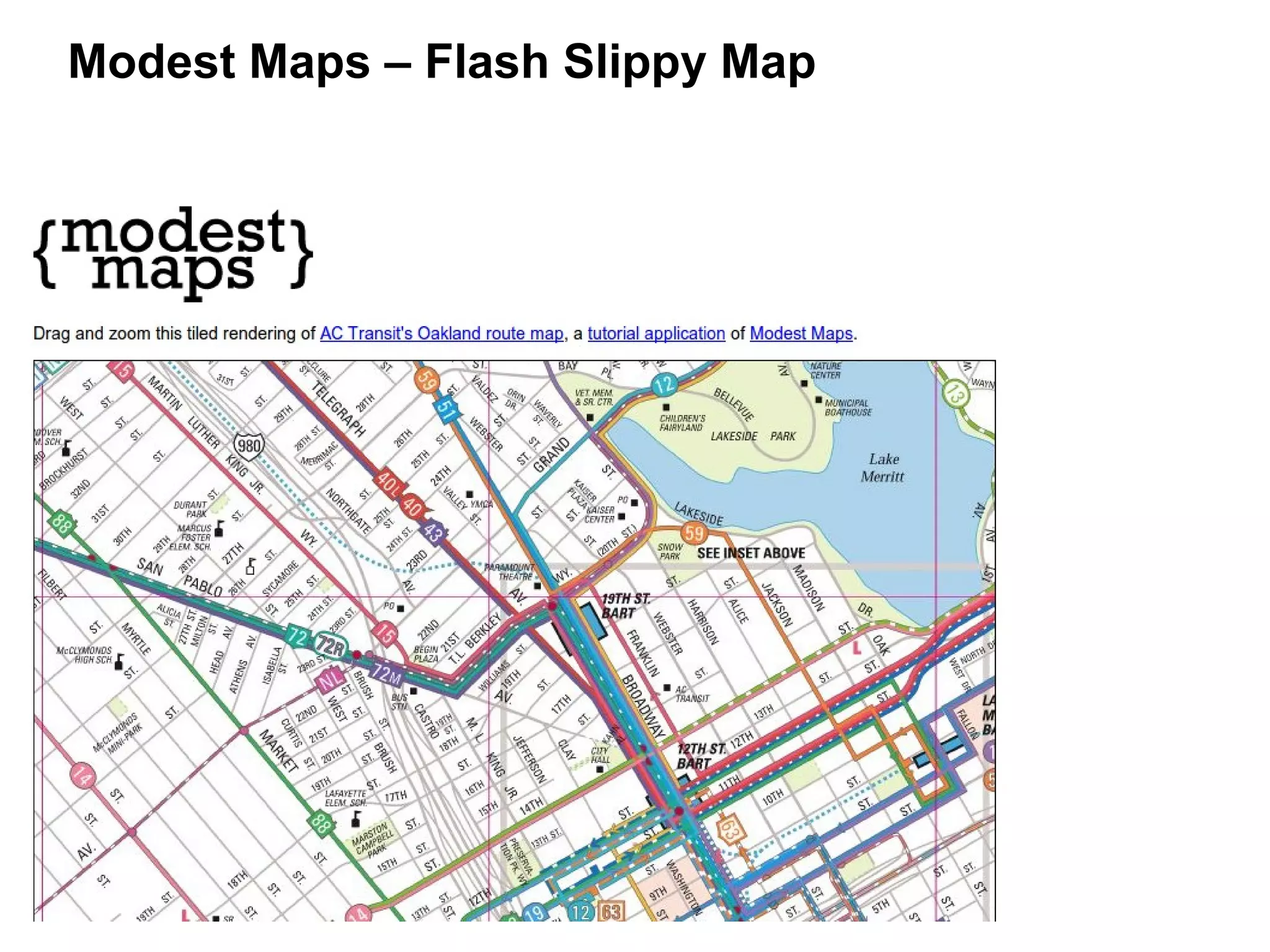
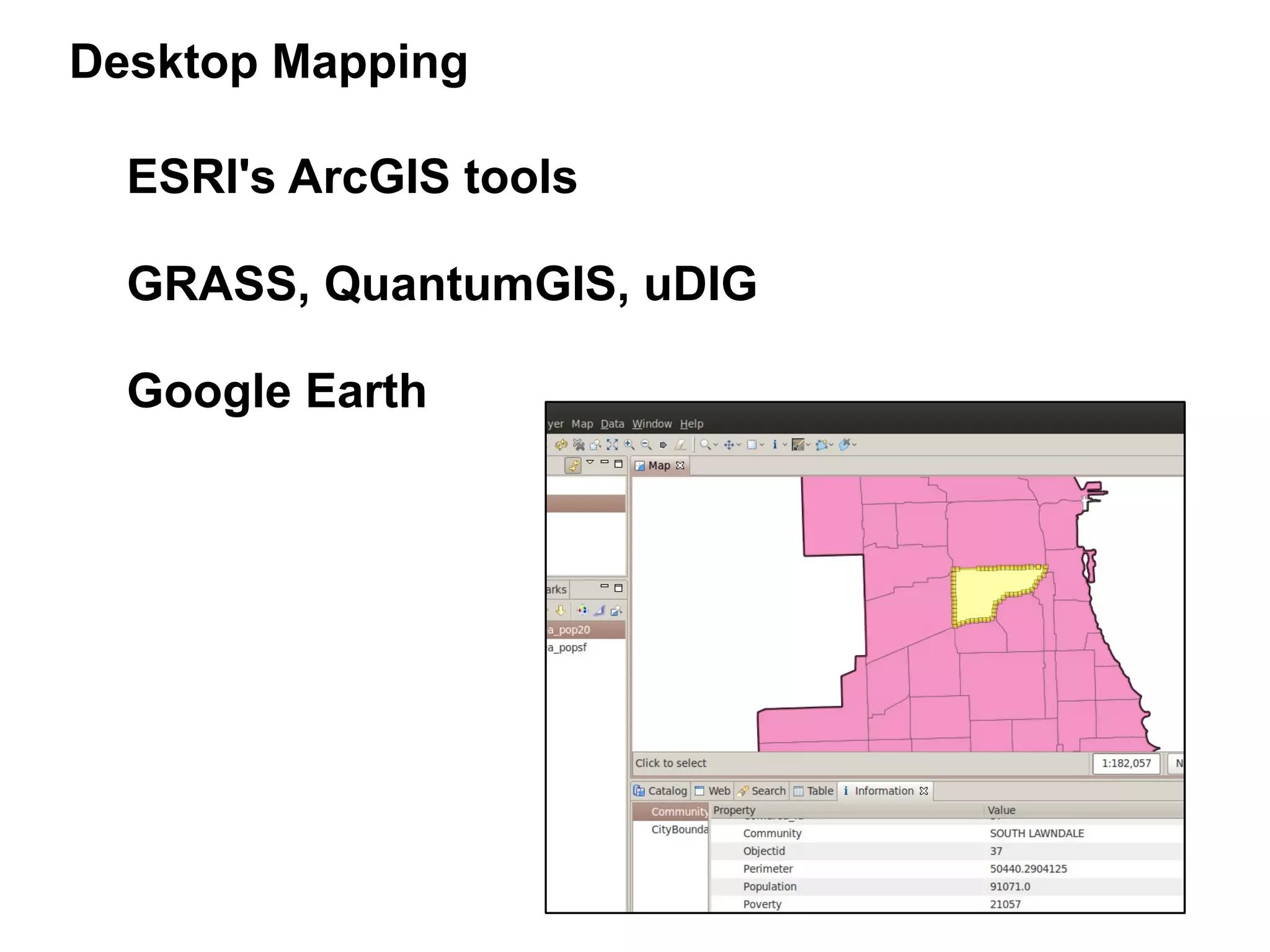
this is NOT your grandmother's
          online map!
 advancing your mission with GIS tools


          10 April 2010 – NTC'10


           33.7555 N // 84.3918 W
this IS an online map of your grandmother
Maps tell powerful stories about
the communities and the world
in which we live. Maps are a
visualization tool, a way to help
us transform columns of data
into useful knowledge about the
people and places around us.
Ewww...

TEXT!

Boring and
unhelpful!
Hooray for Maps!
Acronym Alert!


GIS = Geographic
      Information
      System
maps are important
“gerrymandering”
A Tale of Two Maps...
A brief history of mapping...
Snow's Cholera Map, London, 1854
Bunge's Maps of Poverty, Detroit, 1971
The old days...
counter-mapping
Geographic Information Systems
 ●formal
 ●analytical

 ●costly

 ●.gov, .com, .edu


                                 PARTICIPATORY!


               DATA AND TOOLS    MAPS FOR THE
               SHOULD BE FREE!     PEOPLE!


      BOTTOM UP!
     NOT TOP DOWN!   neogeography!
http://www.lvejo.org
Common Uses of Nonprofit Maps


     Storytelling/Advocacy/Activism
     ●


     Program/Service Delivery
     ●


     Research/Analysis
     ●


     Fundraising/Development
     ●


     Community Resource/Asset Mapping
     ●
Program and Service Delivery
Storytelling / Advocacy / Activism
Research and Analysis
Fundraising / Development
Kira Marchenese

Environmental Defense Fund
Purpose of map: Why?


Data: What? Where?


Tools: How?
Stakeholder participation

Privacy

Discrimination

Accessibility

Intellectual property
Data: What are we mapping?


      Our data – existing databases and
      spreadsheets

      Data from government, academic, or
      other organizational sources

      Data obtained from commercial data
      providers

      Data obtained from the community
Data Acquisition Challenges


      Practical: availability, quality, scope

      Legal: licensing, copyrights, etc.

      Technical: incompatible formats,
      technology, etc.

      Financial: cost, both to obtain data
      and to format/edit it
First Name   Last Name   Address           City      State   ZIP     Status
Alice        Alpha       123 Apple Way     Anytown   US      10001   Donor
Bob          Bravo       456 Birch Dr      Anytown   US      10001   Volunteer
Carol        Charles     789 Cactus Rd     Anytown   US      10002   Donor
Dave         Delta       12 Dogwood St     Anytown   US      10002   Staff


                                         “CSV is the de facto data
                                            format standard for
                                           one-time exports and
                                         data migration projects.”


Source: Peter S. Campbell and the
awesome folks at Idealware.org:
http://www.idealware.org/articles/data_exchange_alpha_soup.php
Data Digression...

    CSV – Comma-separated values


    KML – Keyhole Markup Language (Google)
SHP – Shapefile (ESRI/Arc*)
Data Digression...


                Geocoding   45°31′12″N
123 Main St.
                            122°40′55″W
http://data.gov
http://geodata.gov
http://www.census.gov
SEDAC: Socioeconomic Data & Applications Center
ECAI: Electronic Cultural Atlas Initiative
United States National Atlas
GeoBase.ca
GeoGratis – Natural Resources Canada
VisibleGovernment.ca
Data.gov.uk
Ordnance Survey - UK
Zillow.com Neighborhood Boundary Files
Base Maps:
The Layer Underneath is Often Overlooked


Google
Yahoo
Bing
OpenStreetMap
OpenAerialMap
NASA (Blue Marble)
USGS
...
Any WMS tile server
Balloon + Camera = DIY Aerial Photography!

(grassrootsmapping.org – Shipibo, Lima, Peru)
Google Map of Kibera, Nairobi, Kenya
http://mapkibera.org
OpenStreetMap (global)
Maps of the people... by the people:
Collecting data from the community
WaterGoodness.org
The Mystery of #PDXboom
David Kobia

Ushahidi
The Neogeographer's Toolbox:


           Asking the right question

           Picking the right tool

           Playing well with others
Selecting the right tool for the job

      Features vs. Requirements

      Simple vs. Sophisticated

      Proprietary vs. Free/open source

      Expensive vs. Free/low-cost

      Browser-based vs. Desktop-based

      Components vs. Integration
Quick 'n' Dirty Mapmaking
Getting started with web-based mapping


    Google Maps

    OpenStreetMap

    Google MyMaps

    GeoCommons Finder

    GeoCommons Maker

    Google Fusion Tables Mapping
GeoCommons Finder! and Maker!
GeoCommons Finder!
and Maker!
Geo-Content Management System
  (Drupal + Google Maps API)
Mixing and Mashing...


        API – Application Programming
               Interface

        Web Services

        GeoRSS, GeoXML, GeoJSON

        Location-based Services
            Twitter
            Foursquare, etc.
Warden's Facebook Data Crawl Results
Floating Sheep's “Beer Belly of the US”
Mapping Application Architecture
Services

    Tile providers:
       OSM/T@H
       Google Maps
       Bing Maps

    Database services:
      Google API
      SimpleGeo
      GeoNames
      VoteSmart
      Sunlight API
      GeoCoder.us
Components and Libraries

    OpenLayers – JS map rendering in-browser

    Mapstraction – JS library for abstracting
    mapping provider interfaces

    Mapnik – C++/Python rendering on server or
    client

    ModestMaps – Flash (AS2, AS3) and Python
    slippy map generation
Mapnik – Shaded Relief
Modest Maps – Flash Slippy Map
Desktop Mapping

  ESRI's ArcGIS tools

  GRASS, QuantumGIS, uDIG

  Google Earth
Tanya Keen

Google Earth Outreach
Evaluation Code: 244
      How Was this Session?
    Call In                           Text                      Online


Call 404.939.4909              Text 244 to 69866          Visit nten.org/ntc-eval
Enter Code 244                                               Enter Code 244

Session feedback powered by:


Tell Us and You Could Win a Free 2011 NTC Registration!

This is not your grandmother's online map: Advancing your mission with GIS tools