Mapping Connecticut History and Spatial Inequality with On The Line
•Download as PPTX, PDF•
1 like•1,236 views

This document summarizes a presentation about an interactive online map project called "On The Line" that chronicles Connecticut history and spatial inequality using GIS technology. The project has received NEH funding to create maps visualizing topics like neighborhood change over time, 1930s redlining maps, comparisons of political boundaries, and animated historical maps. It invites attendees to preview and provide feedback on its work-in-progress maps on the OnTheLine.trincoll.edu website.
Report
Share
Report
Share

Recommended
Mining user-generated geographic content: An interactive, crowdsourced approa...
This document summarizes a presentation about mining user-generated geographic content from social media to understand places. The key points are:
1) It describes a hybrid human-machine approach to analyzing Flickr photos to understand places in London, using clustering, classification and a crowdsourced validation interface.
2) The results show that iteratively adjusting the clustering parameters and retraining the classifier can improve classification performance.
3) Moving forward, the approach could be improved by incorporating more diverse geosocial data sources, advanced analysis techniques, and more local knowledge through crowdsourcing to better capture place semantics.
GIS On Demand Deck
This document summarizes a geographic information system (GIS) that provides 3D mapping services on demand. The GIS uses various data sources like drones, aerial imagery, and satellite images to create 3D models of buildings, roads, terrain and other landscape features with less manual work than traditional methods. It aims to offer these customized 3D mapping services faster and at a lower cost than other vendors. The startup is currently pre-alpha but plans scaled versions with more automation and capabilities over time to build an on-demand GIS platform.
Toronto City Planning and Open Data
I gave this presentation on Friday, November 21st in Hamilton, Ontario at an Open Data Jam organised by jointly by the City of Hamilton and Microsoft. The presentation details City Planning's efforts to expand its Open Data offerings.
Citizen apps
This document appears to be notes from a conference on mobile technologies for citizen science. It lists several projects and organizations that are using mobile apps and devices to collect field data for citizen science initiatives, including projects focused on parking, potholes, taxis, street signs, and more. The notes also list contact information for individuals from organizations like NASA, the City of Boston, and others working on related mobile technology projects.
Census 2010 and its impacts on libraries
Census 2010 and its impacts on librariesUniversity of Connecticut Libraries Map and Geographic Information Center - MAGIC
The document discusses the 2010 Census and its impact on libraries. It provides information from the 2010 Census for Connecticut, including that the total population grew 4.9% to 3,574,097. It also details the Connecticut State Data Center and MAGIC (Map and Geographic Information Center), which provide census and mapping data and resources.Finding Data from the US Census
Finding Data from the US CensusUniversity of Connecticut Libraries Map and Geographic Information Center - MAGIC
The Connecticut State Data Center located at the University of Connecticut Libraries provides assistance in locating and using US Census Bureau data for the state of Connecticut, serving as a liaison and providing public outreach. The CTSDC website is being relaunched to include 2010 and historical Census data for Connecticut at various geographic levels that can be accessed through interactive maps and downloadable files, along with population projections and information on upcoming Census data releases.Valenti Partners Project Management Solutions
Valenti Partners Project Management & Project Development Services
Mount Vernon Regional GIS Symposium for Historical Resources
The document announces a Regional GIS Symposium for Historical Resources to be held on February 19th, 2015 at Mount Vernon. It provides the schedule of presentations which will discuss topics such as using GIS to protect historic viewsheds, mapping racial segregation in Washington DC, reconstructing an historic road path, developing mobile applications for historic resource surveying, visualizing antebellum Richmond through 3D modeling, and building a historic building information model at Mount Vernon. RSVPs for the event are due by February 13th and should be sent to the listed Co-Chairs.
Archiving digital maps
This document discusses cataloging and preserving digital maps and geographic information system (GIS) data. It begins by explaining how born-digital maps are different from traditionally paper maps in that they are stored in databases and have dynamic, interactive features. It then provides examples of metadata standards and catalog records for maps, as well as citations for digital maps and datasets. Models for preserving and providing broader access to GIS data are presented, such as data clearinghouses and open data initiatives. The importance of archiving digital geospatial data and challenges involved are also addressed.
Mount Vernon Regional GIS Symposium for Historical Resources Agenda
The document announces a Regional GIS Symposium for Historical Resources to be held on February 19th, 2015 at Mount Vernon. It provides an agenda for the day including presentations on various topics such as protecting the James River viewshed using GIS and 3D visualizations, mapping segregation in Washington DC from 1900-1948 using GIS, reconstructing the original track of MD 178 using GIS, developing mobile applications for historic resource surveying, visualizing antebellum Richmond through 3D modeling, and building a historic building information model at Mount Vernon using BIM and integrating it with GIS.
Visualizing nyc
among the case studies I'm collecting here http://www.scoop.it/t/urbansensing on visualization of georeferenced data, this is a selection of the project based on the city of New York
GIS Services at Michigan State University Libraries: Interactions with the Wi...
GIS Services at Michigan State University Libraries: Interactions with the Wi...National Information Standards Organization (NISO)
This presentation was provided by Amanda Tickner of Michigan State University during the NISO virtual conference, The Computer Campus: Integrating Information Systems and Services, held on August 15, 2018.Roughmaps
This document discusses digital spatial history and mapping. It covers how maps are socially constructed and reflect tensions between objectivity and subjectivity. It also discusses how digital technologies have democratized mapping by allowing anyone to create and annotate maps. Different types of digital maps are described, including georectified maps that show changes over time by layering historical maps, thematic maps that visualize data statistics, bubble maps, chloropleth maps, aggregation maps, animated maps, and interactive maps. Examples of each type are provided.
Aerial photography digitization at MAGIC Overview
Aerial photography digitization at MAGIC OverviewUniversity of Connecticut Libraries Map and Geographic Information Center - MAGIC
Provides an overview of the workflows and considerations for digitizing aerial photography collections based on experience at MAGICConnecticut State Data Center Overview of T-Hub Collaboration
Connecticut State Data Center Overview of T-Hub CollaborationUniversity of Connecticut Libraries Map and Geographic Information Center - MAGIC
The Connecticut State Data Center is a collaboration between the University of Connecticut Libraries MAGIC, the Department of Geography, and the Office of Policy and Management. It is part of the national State Data Center Network and focuses on assisting users with census data and developing Connecticut-specific datasets and resources. The Data Center helps process and visualize census data to make it more accessible for mapping and analysis. It works with other groups like the t-Hub to identify and provide demographic data related to Title VI and develop GIS infrastructure for related analysis.Locating Census 2010 Data using the NEW American FactFinder
Locating Census 2010 Data using the NEW American FactFinderUniversity of Connecticut Libraries Map and Geographic Information Center - MAGIC
The document discusses the 2010 Census and how to locate data from it using the American FactFinder. It notes that the 2010 Census collected only short form data and that detailed social, economic, and housing data is now from the American Community Survey. It outlines the different data sets available from the 2010 Census, including redistricting data, demographic profiles, and summary files. It also provides an overview of census geography terms like census blocks, tracts, and counties.Finding Data Using the New American FactFinder
Finding Data Using the New American FactFinderUniversity of Connecticut Libraries Map and Geographic Information Center - MAGIC
The document provides an overview of the Connecticut State Data Center and MAGIC (Map and Geographic Information Center). It discusses the 2010 Census highlights for Connecticut, including population changes. It also introduces the new American FactFinder tool for exploring 2010 Census and American Community Survey data, with an outline of topics covered and a live demonstration. The presentation aims to help users locate and utilize key 2010 Census and demographic data resources.Making MAGIC with Your Data: Interactive Maps, Mash-ups, and Data Visualizati...
Making MAGIC with Your Data: Interactive Maps, Mash-ups, and Data Visualizati...University of Connecticut Libraries Map and Geographic Information Center - MAGIC
The document discusses tools for visualizing and mapping data, including Google Maps, Google Earth, Google Fusion Tables, and ArcGIS. It provides examples of using these tools to map census data, poverty rates, and neighborhood changes. The goal is to illustrate how interactive maps and data visualization can provide new insights into large and complex datasets that may be difficult to understand in spreadsheets or reports. The Connecticut State Data Center and MAGIC help users access and analyze census and other geographic data through these free, online mapping platforms.The numbers are in... 2010 Census for Connecticut
The numbers are in... 2010 Census for ConnecticutUniversity of Connecticut Libraries Map and Geographic Information Center - MAGIC
The document provides information from a presentation about the 2010 Census and demographic data for Connecticut. It notes that the total population of Connecticut according to the 2010 Census is 3,574,097. It also discusses the roles of the Connecticut State Data Center and MAGIC (Map and Geographic Information Center) in providing Census and mapping data and resources.Making MAGIC with Your Data: Methods for Visualizing Data using 2010 Census Data
Making MAGIC with Your Data: Methods for Visualizing Data using 2010 Census DataUniversity of Connecticut Libraries Map and Geographic Information Center - MAGIC
The document provides an overview of a presentation given by Michael Howser on visualizing 2010 Census data from Connecticut. It discusses the Connecticut State Data Center and MAGIC (Map and Geographic Information Center), which work together to provide Census data and maps. It then highlights key facts from the 2010 Census for Connecticut, including population changes and redistricting data releases. The presentation aims to demonstrate methods for visualizing Census data through tools like American FactFinder.Engaging Students with Interactive Web-Based Mapping
Engaging Students with Interactive Web-Based MappingUniversity of Connecticut Libraries Map and Geographic Information Center - MAGIC
This document discusses how interactive, web-based mapping can engage students in learning spatial concepts. It outlines examples of interactive maps created for the "On the Line" project that integrate historical data from multiple sources. The document also describes tools like Google Maps, Google Earth, Google Fusion Tables and ArcGIS.com that were used to create interactive maps for the project in a way that is platform-agnostic and does not require special plugins.Census 2010 and Connecticut
Census 2010 and ConnecticutUniversity of Connecticut Libraries Map and Geographic Information Center - MAGIC
The document discusses the 2010 Census and resources available through the Connecticut State Data Center and MAGIC (Map and Geographic Information Center). It provides an overview of the Connecticut State Data Center and MAGIC, their roles in disseminating census and map data, and the timeline and types of 2010 Census data to be released. Key information resources mentioned include the American FactFinder, customized data sets, and historical maps and aerial photography available through MAGIC.UConn Geospatial Coffeehouse - July 28, 2011
UConn Geospatial Coffeehouse - July 28, 2011University of Connecticut Libraries Map and Geographic Information Center - MAGIC
Presented on July 28, 2011 at the UConn Geospatial Coffeehouse in Storrs, CT. Includes an overview of announcements and resources presented at the 2011 ESRI International User Conference.On the Line: A Preview
On the Line: A PreviewUniversity of Connecticut Libraries Map and Geographic Information Center - MAGIC
Presented on October 30, 2010 at New England - Saint Lawrence Valley Geographical Society (NESTVAL) Conference in Storrs, CT.The 'where' in education
The 'where' in educationUniversity of Connecticut Libraries Map and Geographic Information Center - MAGIC
The document discusses integrating geographic information systems (GIS) into K-12 education curricula. It outlines common barriers to using GIS in schools and proposes interactive spatial activities and tools to help overcome these barriers. These include the Map of the Week, How in the World map mashups, and virtual tours that allow students to explore maps and spatial data in an intuitive way. The goal is to make geography more accessible across different subjects.Open source remote sensing
Open source remote sensingUniversity of Connecticut Libraries Map and Geographic Information Center - MAGIC
Bilko is an open source remote sensing software developed in 1987 that can be used to classify, filter, and analyze remote sensing imagery. It supports common file formats like GeoTIFF and comes with tutorials, lessons, and modules. While it cannot perform digital elevation modeling or support vector data, Bilko is freely available online and provides a cost-effective way to introduce users to remote sensing techniques. Potential applications include educational uses in Connecticut to inspire future workforces.Map and GIS Data for 21st Century Research
Map and GIS Data for 21st Century ResearchUniversity of Connecticut Libraries Map and Geographic Information Center - MAGIC
This document summarizes the resources and services provided by the University of Connecticut Libraries Map and Geographic Information Center (MAGIC). MAGIC provides over 200,000 print maps as well as historic maps, aerial photos, topographic maps, and GIS data via their website. Their mission is to provide public access to these resources with a focus on Connecticut and New England. The document outlines the various map and data formats available and previews upcoming additions to MAGIC's collections over the summer of 2010, including topographic maps, water resource maps, geology maps, and maps of the New York, New Haven & Hartford Railroad.About Scanning and Metadata Standards - NEMO 2010
About Scanning and Metadata Standards - NEMO 2010University of Connecticut Libraries Map and Geographic Information Center - MAGIC
Presented at the New England Map Organization conference on June 3, 2010 at the University of Southern Maine in Portland, Maine.Using Web Map Services for Historical Maps Mash-Ups
Using Web Map Services for Historical Maps Mash-UpsUniversity of Connecticut Libraries Map and Geographic Information Center - MAGIC
Presented at the 2009 Spring Northeast Arc User Group (NEArc) Meeting in Northampton, MA on May 12, 2009More Related Content
Similar to Mapping Connecticut History and Spatial Inequality with On The Line
Mount Vernon Regional GIS Symposium for Historical Resources
The document announces a Regional GIS Symposium for Historical Resources to be held on February 19th, 2015 at Mount Vernon. It provides the schedule of presentations which will discuss topics such as using GIS to protect historic viewsheds, mapping racial segregation in Washington DC, reconstructing an historic road path, developing mobile applications for historic resource surveying, visualizing antebellum Richmond through 3D modeling, and building a historic building information model at Mount Vernon. RSVPs for the event are due by February 13th and should be sent to the listed Co-Chairs.
Archiving digital maps
This document discusses cataloging and preserving digital maps and geographic information system (GIS) data. It begins by explaining how born-digital maps are different from traditionally paper maps in that they are stored in databases and have dynamic, interactive features. It then provides examples of metadata standards and catalog records for maps, as well as citations for digital maps and datasets. Models for preserving and providing broader access to GIS data are presented, such as data clearinghouses and open data initiatives. The importance of archiving digital geospatial data and challenges involved are also addressed.
Mount Vernon Regional GIS Symposium for Historical Resources Agenda
The document announces a Regional GIS Symposium for Historical Resources to be held on February 19th, 2015 at Mount Vernon. It provides an agenda for the day including presentations on various topics such as protecting the James River viewshed using GIS and 3D visualizations, mapping segregation in Washington DC from 1900-1948 using GIS, reconstructing the original track of MD 178 using GIS, developing mobile applications for historic resource surveying, visualizing antebellum Richmond through 3D modeling, and building a historic building information model at Mount Vernon using BIM and integrating it with GIS.
Visualizing nyc
among the case studies I'm collecting here http://www.scoop.it/t/urbansensing on visualization of georeferenced data, this is a selection of the project based on the city of New York
GIS Services at Michigan State University Libraries: Interactions with the Wi...
GIS Services at Michigan State University Libraries: Interactions with the Wi...National Information Standards Organization (NISO)
This presentation was provided by Amanda Tickner of Michigan State University during the NISO virtual conference, The Computer Campus: Integrating Information Systems and Services, held on August 15, 2018.Roughmaps
This document discusses digital spatial history and mapping. It covers how maps are socially constructed and reflect tensions between objectivity and subjectivity. It also discusses how digital technologies have democratized mapping by allowing anyone to create and annotate maps. Different types of digital maps are described, including georectified maps that show changes over time by layering historical maps, thematic maps that visualize data statistics, bubble maps, chloropleth maps, aggregation maps, animated maps, and interactive maps. Examples of each type are provided.
Similar to Mapping Connecticut History and Spatial Inequality with On The Line (6)
Mount Vernon Regional GIS Symposium for Historical Resources
Mount Vernon Regional GIS Symposium for Historical Resources
Mount Vernon Regional GIS Symposium for Historical Resources Agenda
Mount Vernon Regional GIS Symposium for Historical Resources Agenda
GIS Services at Michigan State University Libraries: Interactions with the Wi...
GIS Services at Michigan State University Libraries: Interactions with the Wi...
More from University of Connecticut Libraries Map and Geographic Information Center - MAGIC
Aerial photography digitization at MAGIC Overview
Aerial photography digitization at MAGIC OverviewUniversity of Connecticut Libraries Map and Geographic Information Center - MAGIC
Provides an overview of the workflows and considerations for digitizing aerial photography collections based on experience at MAGICConnecticut State Data Center Overview of T-Hub Collaboration
Connecticut State Data Center Overview of T-Hub CollaborationUniversity of Connecticut Libraries Map and Geographic Information Center - MAGIC
The Connecticut State Data Center is a collaboration between the University of Connecticut Libraries MAGIC, the Department of Geography, and the Office of Policy and Management. It is part of the national State Data Center Network and focuses on assisting users with census data and developing Connecticut-specific datasets and resources. The Data Center helps process and visualize census data to make it more accessible for mapping and analysis. It works with other groups like the t-Hub to identify and provide demographic data related to Title VI and develop GIS infrastructure for related analysis.Locating Census 2010 Data using the NEW American FactFinder
Locating Census 2010 Data using the NEW American FactFinderUniversity of Connecticut Libraries Map and Geographic Information Center - MAGIC
The document discusses the 2010 Census and how to locate data from it using the American FactFinder. It notes that the 2010 Census collected only short form data and that detailed social, economic, and housing data is now from the American Community Survey. It outlines the different data sets available from the 2010 Census, including redistricting data, demographic profiles, and summary files. It also provides an overview of census geography terms like census blocks, tracts, and counties.Finding Data Using the New American FactFinder
Finding Data Using the New American FactFinderUniversity of Connecticut Libraries Map and Geographic Information Center - MAGIC
The document provides an overview of the Connecticut State Data Center and MAGIC (Map and Geographic Information Center). It discusses the 2010 Census highlights for Connecticut, including population changes. It also introduces the new American FactFinder tool for exploring 2010 Census and American Community Survey data, with an outline of topics covered and a live demonstration. The presentation aims to help users locate and utilize key 2010 Census and demographic data resources.Making MAGIC with Your Data: Interactive Maps, Mash-ups, and Data Visualizati...
Making MAGIC with Your Data: Interactive Maps, Mash-ups, and Data Visualizati...University of Connecticut Libraries Map and Geographic Information Center - MAGIC
The document discusses tools for visualizing and mapping data, including Google Maps, Google Earth, Google Fusion Tables, and ArcGIS. It provides examples of using these tools to map census data, poverty rates, and neighborhood changes. The goal is to illustrate how interactive maps and data visualization can provide new insights into large and complex datasets that may be difficult to understand in spreadsheets or reports. The Connecticut State Data Center and MAGIC help users access and analyze census and other geographic data through these free, online mapping platforms.The numbers are in... 2010 Census for Connecticut
The numbers are in... 2010 Census for ConnecticutUniversity of Connecticut Libraries Map and Geographic Information Center - MAGIC
The document provides information from a presentation about the 2010 Census and demographic data for Connecticut. It notes that the total population of Connecticut according to the 2010 Census is 3,574,097. It also discusses the roles of the Connecticut State Data Center and MAGIC (Map and Geographic Information Center) in providing Census and mapping data and resources.Making MAGIC with Your Data: Methods for Visualizing Data using 2010 Census Data
Making MAGIC with Your Data: Methods for Visualizing Data using 2010 Census DataUniversity of Connecticut Libraries Map and Geographic Information Center - MAGIC
The document provides an overview of a presentation given by Michael Howser on visualizing 2010 Census data from Connecticut. It discusses the Connecticut State Data Center and MAGIC (Map and Geographic Information Center), which work together to provide Census data and maps. It then highlights key facts from the 2010 Census for Connecticut, including population changes and redistricting data releases. The presentation aims to demonstrate methods for visualizing Census data through tools like American FactFinder.Engaging Students with Interactive Web-Based Mapping
Engaging Students with Interactive Web-Based MappingUniversity of Connecticut Libraries Map and Geographic Information Center - MAGIC
This document discusses how interactive, web-based mapping can engage students in learning spatial concepts. It outlines examples of interactive maps created for the "On the Line" project that integrate historical data from multiple sources. The document also describes tools like Google Maps, Google Earth, Google Fusion Tables and ArcGIS.com that were used to create interactive maps for the project in a way that is platform-agnostic and does not require special plugins.Census 2010 and Connecticut
Census 2010 and ConnecticutUniversity of Connecticut Libraries Map and Geographic Information Center - MAGIC
The document discusses the 2010 Census and resources available through the Connecticut State Data Center and MAGIC (Map and Geographic Information Center). It provides an overview of the Connecticut State Data Center and MAGIC, their roles in disseminating census and map data, and the timeline and types of 2010 Census data to be released. Key information resources mentioned include the American FactFinder, customized data sets, and historical maps and aerial photography available through MAGIC.UConn Geospatial Coffeehouse - July 28, 2011
UConn Geospatial Coffeehouse - July 28, 2011University of Connecticut Libraries Map and Geographic Information Center - MAGIC
Presented on July 28, 2011 at the UConn Geospatial Coffeehouse in Storrs, CT. Includes an overview of announcements and resources presented at the 2011 ESRI International User Conference.On the Line: A Preview
On the Line: A PreviewUniversity of Connecticut Libraries Map and Geographic Information Center - MAGIC
Presented on October 30, 2010 at New England - Saint Lawrence Valley Geographical Society (NESTVAL) Conference in Storrs, CT.The 'where' in education
The 'where' in educationUniversity of Connecticut Libraries Map and Geographic Information Center - MAGIC
The document discusses integrating geographic information systems (GIS) into K-12 education curricula. It outlines common barriers to using GIS in schools and proposes interactive spatial activities and tools to help overcome these barriers. These include the Map of the Week, How in the World map mashups, and virtual tours that allow students to explore maps and spatial data in an intuitive way. The goal is to make geography more accessible across different subjects.Open source remote sensing
Open source remote sensingUniversity of Connecticut Libraries Map and Geographic Information Center - MAGIC
Bilko is an open source remote sensing software developed in 1987 that can be used to classify, filter, and analyze remote sensing imagery. It supports common file formats like GeoTIFF and comes with tutorials, lessons, and modules. While it cannot perform digital elevation modeling or support vector data, Bilko is freely available online and provides a cost-effective way to introduce users to remote sensing techniques. Potential applications include educational uses in Connecticut to inspire future workforces.Map and GIS Data for 21st Century Research
Map and GIS Data for 21st Century ResearchUniversity of Connecticut Libraries Map and Geographic Information Center - MAGIC
This document summarizes the resources and services provided by the University of Connecticut Libraries Map and Geographic Information Center (MAGIC). MAGIC provides over 200,000 print maps as well as historic maps, aerial photos, topographic maps, and GIS data via their website. Their mission is to provide public access to these resources with a focus on Connecticut and New England. The document outlines the various map and data formats available and previews upcoming additions to MAGIC's collections over the summer of 2010, including topographic maps, water resource maps, geology maps, and maps of the New York, New Haven & Hartford Railroad.About Scanning and Metadata Standards - NEMO 2010
About Scanning and Metadata Standards - NEMO 2010University of Connecticut Libraries Map and Geographic Information Center - MAGIC
Presented at the New England Map Organization conference on June 3, 2010 at the University of Southern Maine in Portland, Maine.Using Web Map Services for Historical Maps Mash-Ups
Using Web Map Services for Historical Maps Mash-UpsUniversity of Connecticut Libraries Map and Geographic Information Center - MAGIC
Presented at the 2009 Spring Northeast Arc User Group (NEArc) Meeting in Northampton, MA on May 12, 2009Future at MAGIC
The document provides an overview of the future plans and directions of the MAGIC (Map and Geographic Information Center) at the University of Connecticut Libraries. MAGIC aims to increase public access to historical maps, aerial photographs, and GIS data of Connecticut and New England through collaborative and user-driven efforts. Key points discussed include plans to add more topographic maps, water resource maps, geology maps, aerial photos, census data, and historical railroad maps over the next year. MAGIC also plans to offer downloadable and georeferenced content, improved map mashups, workshops and how-to videos to enable further scholarship using maps and geographic data.
Interactive Mapping for Education: Collaborations for Success
Interactive Mapping for Education: Collaborations for SuccessUniversity of Connecticut Libraries Map and Geographic Information Center - MAGIC
This document discusses how the MAGIC program is using GIS technology to enhance K-12 education. It outlines barriers to implementing GIS in classrooms and how MAGIC is helping address these barriers. MAGIC provides open-source GIS platforms, data, map mashups, and QR codes to teachers. A key partnership between MAGIC and Trinity College resulted in a $100,800 grant to create historical maps and datasets for public use.Reference Librarians Toolkit: Maps
Reference Librarians Toolkit: MapsUniversity of Connecticut Libraries Map and Geographic Information Center - MAGIC
Presentation from 2010 Connecticut Library Association (CLA) conference on April 20, 2010 in Uncasville, Connecticut.Scholars and Librarians Collaborating to Develop Online Collections from Mult...
Scholars and Librarians Collaborating to Develop Online Collections from Mult...University of Connecticut Libraries Map and Geographic Information Center - MAGIC
This document discusses strategies for librarians and scholars to collaboratively develop online collections from multiple perspectives. It emphasizes engaging with users by gathering feedback, surveying interests, and testing works in progress. Data from search terms, usage trends, and analytics can reveal what excites researchers and how to improve collections. The keys are talking to users, facilitating conversations rather than dominating them, and being willing to make mistakes.More from University of Connecticut Libraries Map and Geographic Information Center - MAGIC (20)
Connecticut State Data Center Overview of T-Hub Collaboration
Connecticut State Data Center Overview of T-Hub Collaboration
Locating Census 2010 Data using the NEW American FactFinder
Locating Census 2010 Data using the NEW American FactFinder
Making MAGIC with Your Data: Interactive Maps, Mash-ups, and Data Visualizati...
Making MAGIC with Your Data: Interactive Maps, Mash-ups, and Data Visualizati...
Making MAGIC with Your Data: Methods for Visualizing Data using 2010 Census Data
Making MAGIC with Your Data: Methods for Visualizing Data using 2010 Census Data
Engaging Students with Interactive Web-Based Mapping
Engaging Students with Interactive Web-Based Mapping
Using Web Map Services for Historical Maps Mash-Ups
Using Web Map Services for Historical Maps Mash-Ups
Interactive Mapping for Education: Collaborations for Success
Interactive Mapping for Education: Collaborations for Success
Scholars and Librarians Collaborating to Develop Online Collections from Mult...
Scholars and Librarians Collaborating to Develop Online Collections from Mult...
Mapping Connecticut History and Spatial Inequality with On The Line
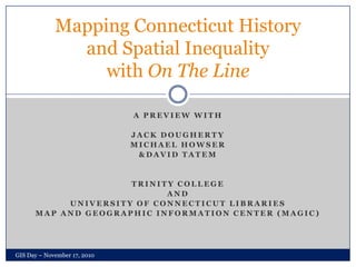
- 1. A Preview with Jack Dougherty Michael Howser & David Tatem Trinity College And University of Connecticut Libraries Map and Geographic Information Center (MAGIC) Mapping Connecticut History and Spatial Inequality with On The Line GIS Day – November 17, 2010
- 2. Collaboration on Interactive Map Design GIS Day – November 17, 2010 National Endowment for the Humanities grant ($100,800for 2010-11) Create free-access civil rights history web-book with interactive maps WordPress comment tool Cross browser, cross platform compatible Creative Commons License Preview & comment on our work-in-progress at OnTheLine.trincoll.edu
- 3. Neighborhood Change Compare 1934 to 2008 Aerial imagery Dual map viewer with linked zoom and pan CT address searching Showcases changes in neighborhoods due to interstate highway construction, suburban housing development GIS Day – November 17, 2010
- 4. HOLC “Redlining” Map 1937 Home Owners Loan Corporation (HOLC)map with neighborhood appraisals Dual map viewer Links from map to archival documents GIS Day – November 17, 2010
- 5. Relative Size Viewer Compare size of political boundaries in two areas at the same scale Highlight differences such as school district boundaries across US Linked zoom controls GIS Day – November 17, 2010
- 6. Animated Maps Visualize historical change over time with thematic map data Time slider controls animation based on year Zoom control GIS Day – November 17, 2010
- 7. More interactive maps to come GIS Day – November 17, 2010 Explore maps-in-progress as we develop them Post a comment, pose a question, share an idea No log-in required Visit us at OnTheLine.trincoll.edu Special thanks to: Thomas Bachant, George Bentley, Katie Campbell, Curtis Denton, Cary Lynch, Bill Miller, Benjamin Spaulding, Joshua Strunk and the UConn Libraries IT department!